


")


")


")
")


")


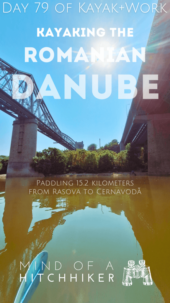
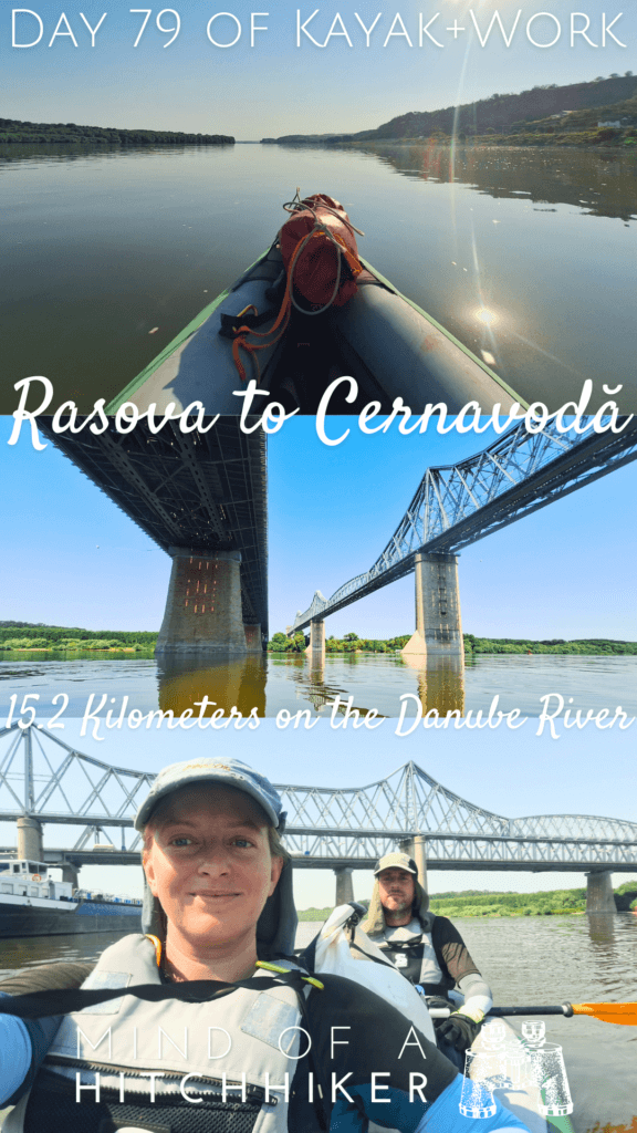
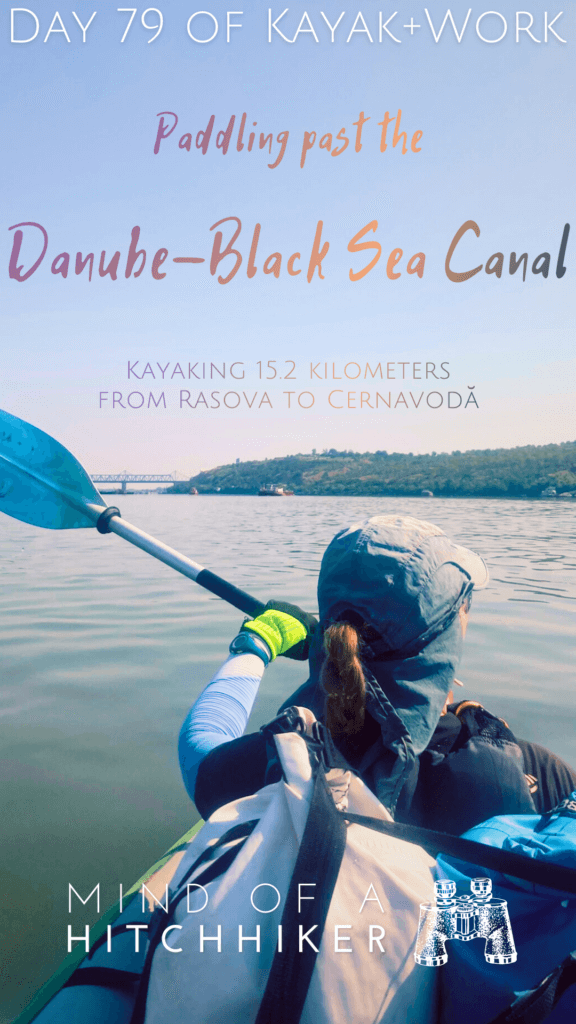
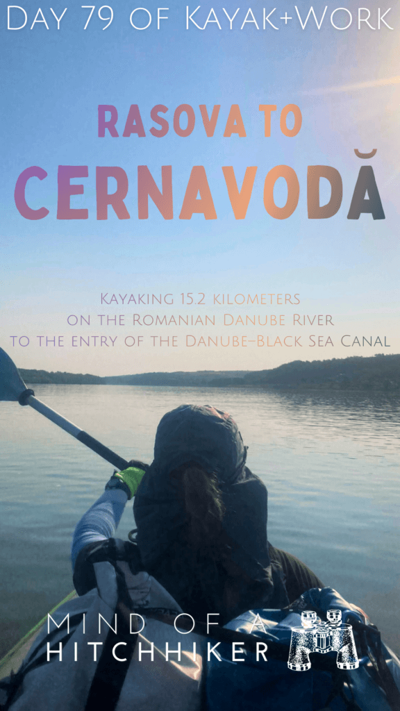
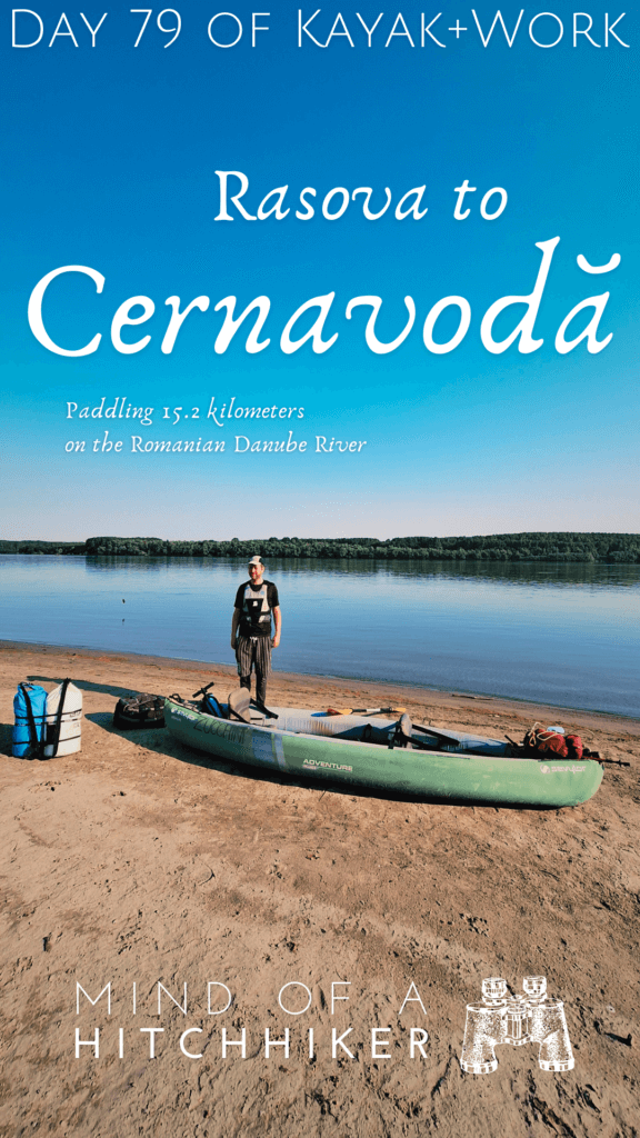
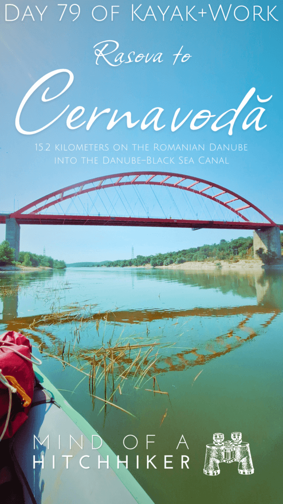
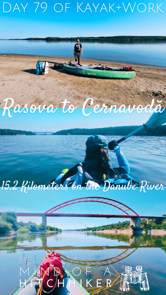
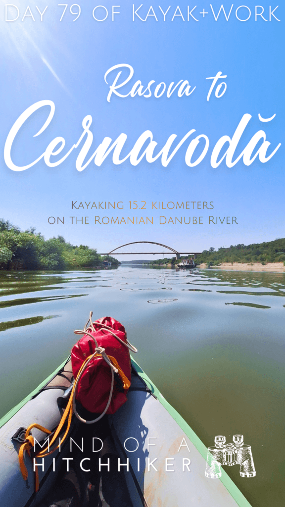
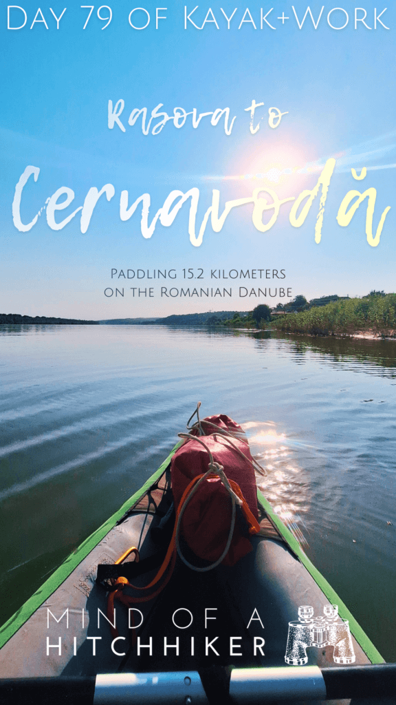
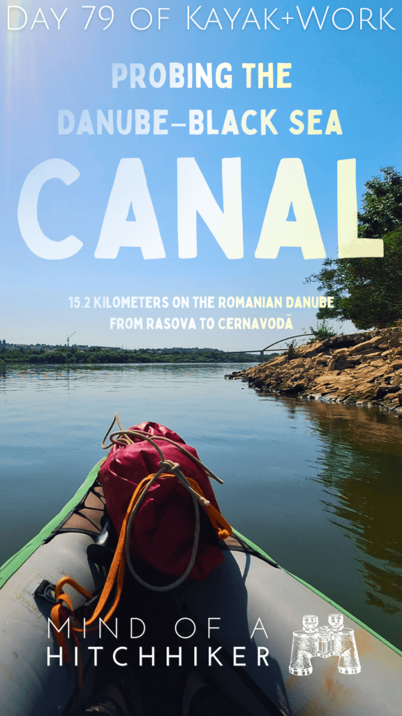
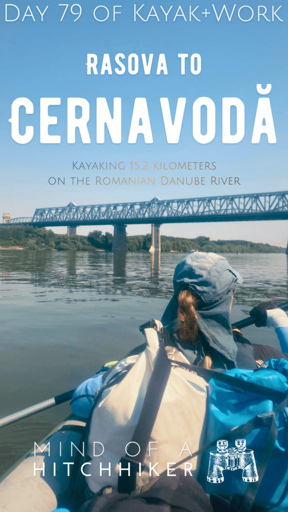
This happened on Friday the 12th of July, 2024. We had a short kayaking day from Rasova to Cernavodă. Cernavodă is where the third-to-last bridge crosses the Danube and where the Danube–Black Sea Canal splits off to Constanța at the Black Sea.
Want to travel the (entire) Danube River in an adventurous way? Join our Facebook group Danube River Source to Sea: Kayak / Canoe / Bike / Hike / Sail to find your community
Contents
- 1 Leaving Rasova for Cernavodă
- 2 Foal and Fowl
- 3 Ships and Ships and Barges
- 4 Paddling Under the Cernavodă Bridge + Anghel Saligny Bridge
- 5 Kayaking the Danube–Black Sea Canal (Just a Little)
- 6 Arriving in Cernavodă at St. Maria Bridge
- 7 Our Nuclear-Powered Stay in Cernavodă
- 8 Good read? Consider buying me a cup of tea!
- 9 Sharing this article helps my blog
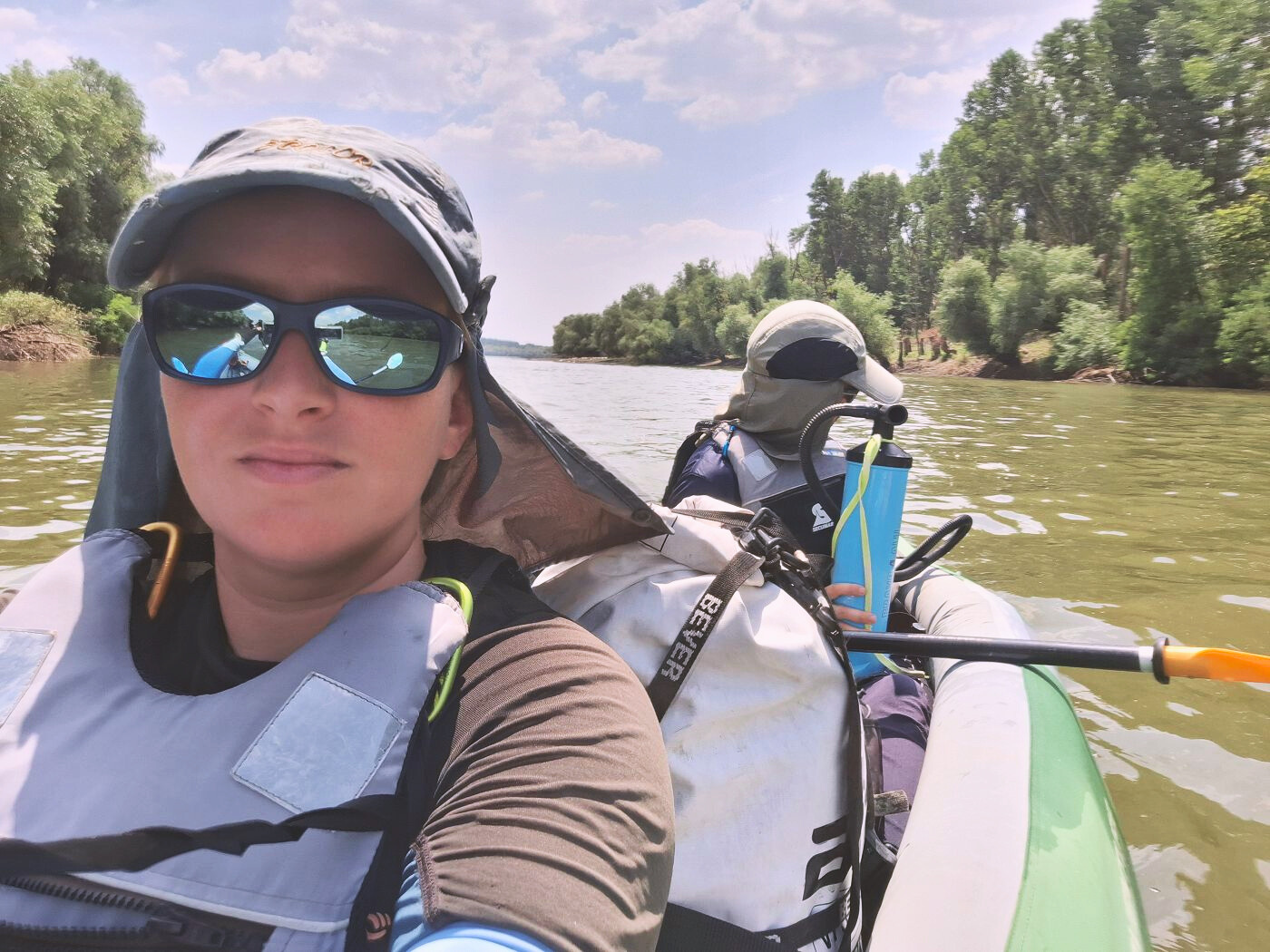
Jonas woke up before my alarm at 6:30. For a paddling day on the Danube, 6:30 is late to start out. But we only have roughly 15 kilometers to cover.
I got dressed and went to the bathroom to do my hair while Jonas prepared some coffee. Mimi was already out and about in the kitchen. Once I ready, I picked up my cup of coffee and went outside with some Whiskas to wish the cat I named ‘Socks’ a good morning. She’s very cuddly (if you have food) and is one of the softest cats I’ve petted recently.
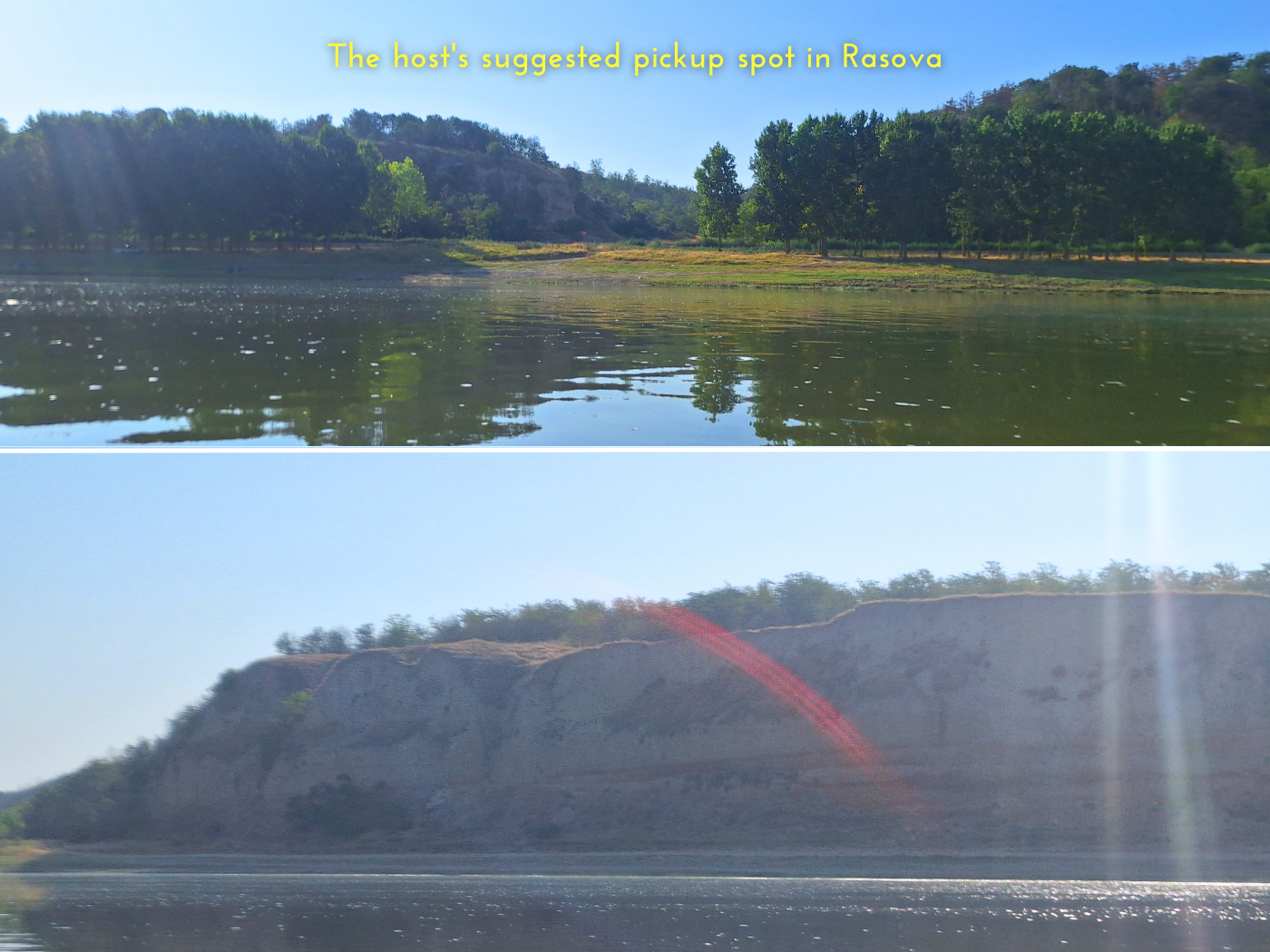
We both still smashed a banana for breakfast—more I can’t eat this early in the AM. The intent was to drive to the Danube at 7:30. But it was 7:45 before we’d petted the big old dog and Socks again, said our goodbyes, and taken a picture together. We drove off with Bernhard with our luggage in the rattling trailer. He almost took a right to the intended landing spot for last time, but Jonas caught it in time and said we wanted to return to our landing spot further upstream. The water looked nice and calm. We can do the extra two kilometers.
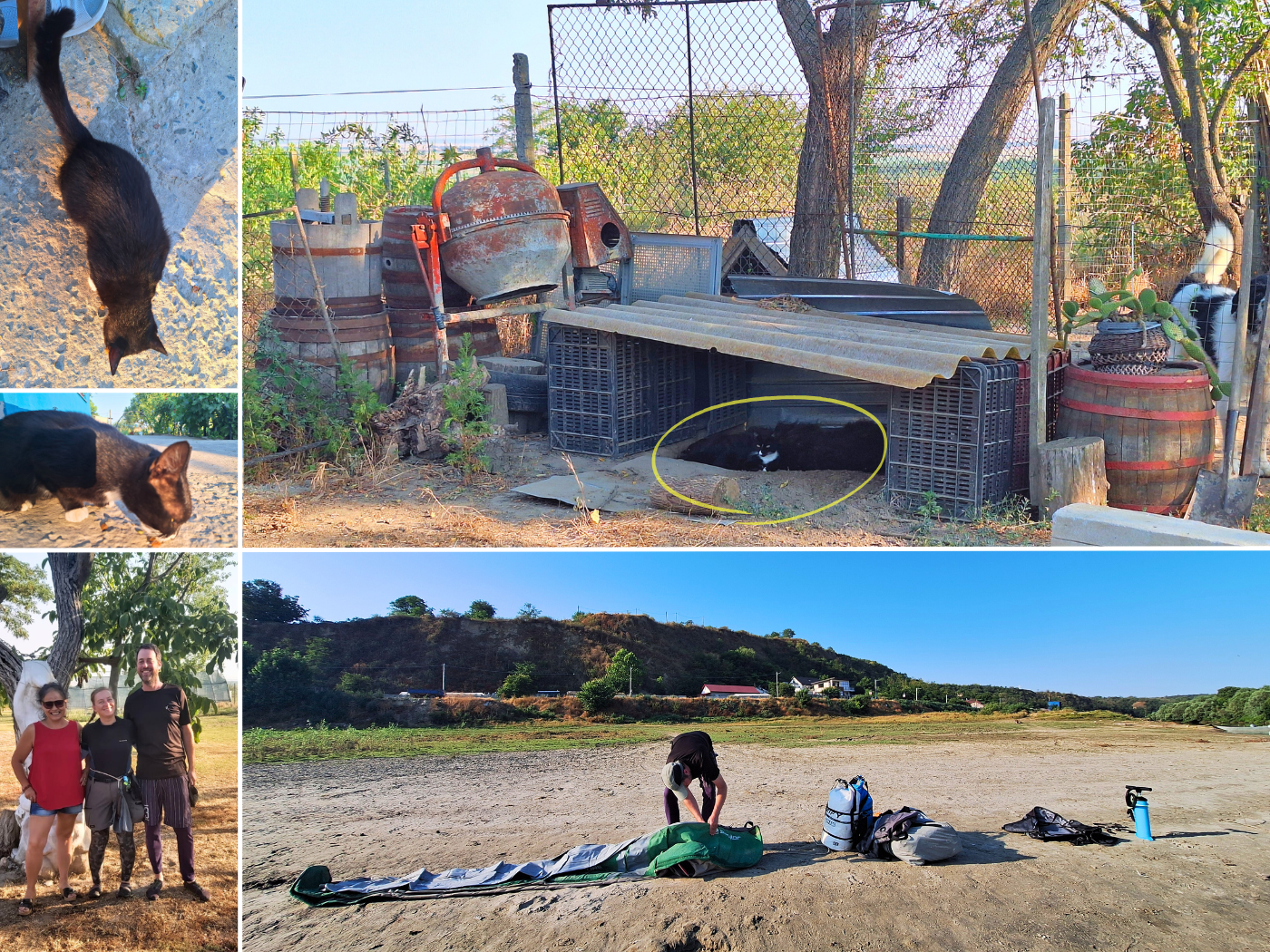
At the launch spot, we put all our luggage on the beach of Rasova and said goodbye. We felt very welcome at Bernhard and Mihaela’s homestay. We have an invitation to come back.
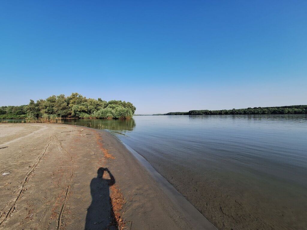
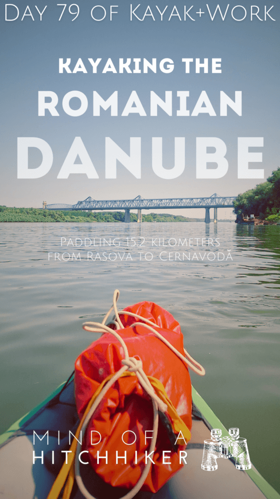
Jonas and I pumped up Zucchini. It was a very different beach from two days ago when it was so windy. Until we put our feet in the water while lifting Zucchini in, it had also been clear. We’d made it muddy once again.
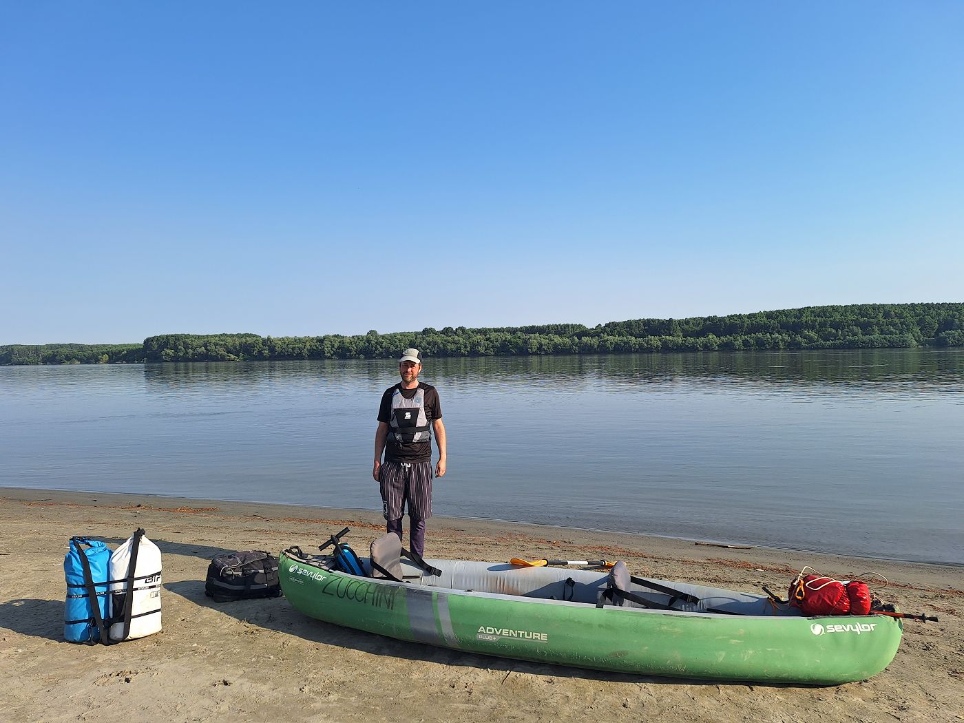
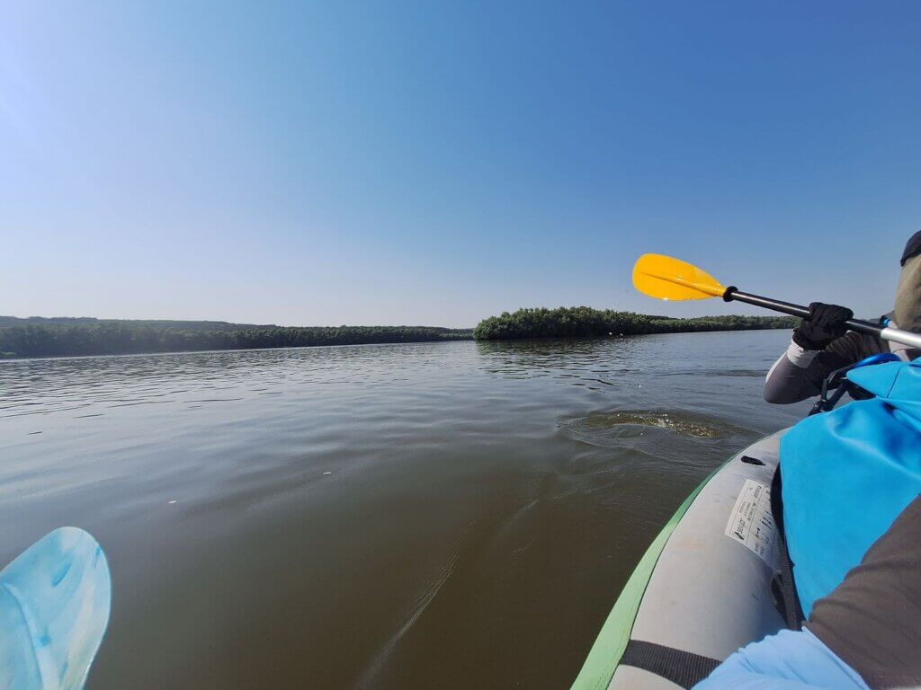
Jonas wanted to get started before the headwind would pick up. So he didn’t do some things better done on land like putting on his sun sleevies, grab his sunglasses, apply sunscreen to his exposed ankles, and put on gloves while floating downstream. After adjusting my seat, I was simply ready to paddle. So I propelled us downstream towards Cernavodă while Jonas was still doing stuff.
Starting time: 8:15.
Foal and Fowl
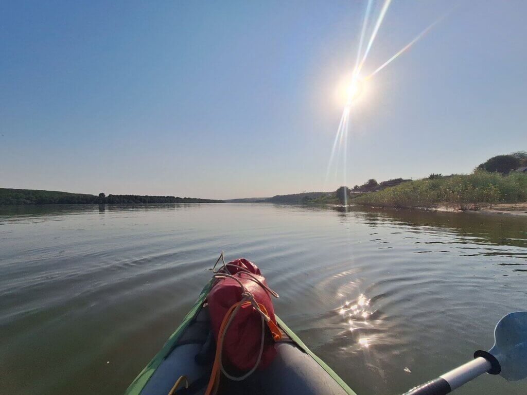
Though the forecast says the headwind will pick up at noon, we’re not in a hurry since this shouldn’t take longer than three hours. Ten minutes after we got started, we paddled beneath the bluff where Bernhard, Mihaela, and their five dogs and four cats live. It’s easy to recognize the property after watching the sunset from where the sculpture of a person with arms stretched above their heads.
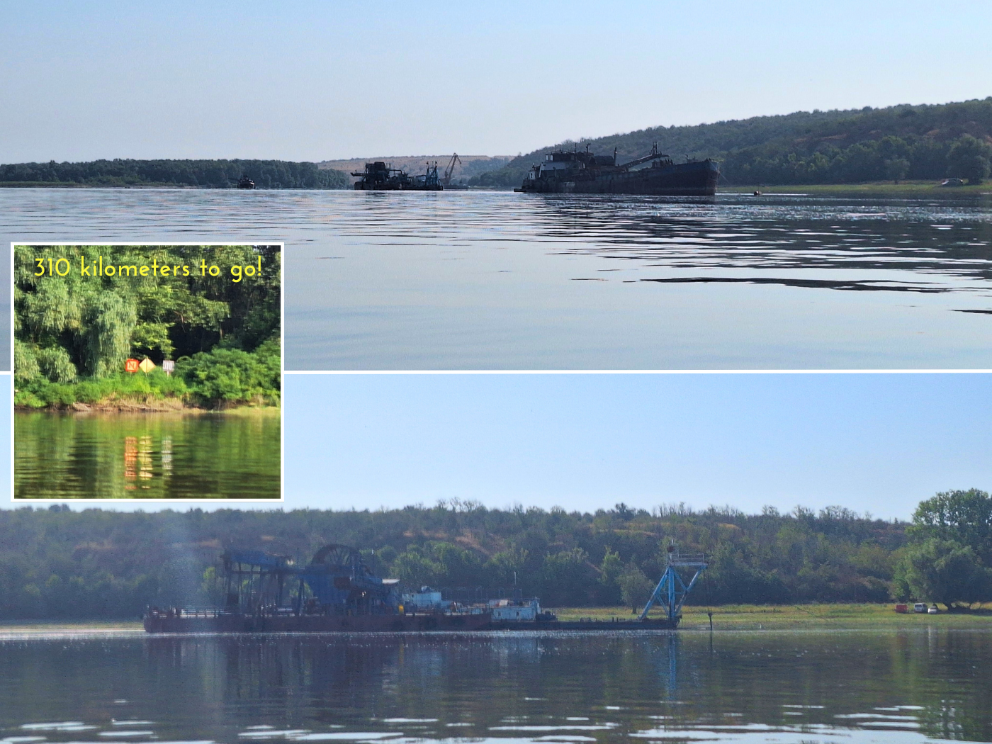
Soon, we spotted a kilometer sign: 312. We’ll go below 300 kilometers to the Black Sea today, but just barely. We also passed the landing spot (44.25475° N, 27.94981° E) we originally wanted to go to when we kayaked to Rasova. It looked nice to land as well. A good place for a car and a boat to meet. After that, tall loess cliffs.
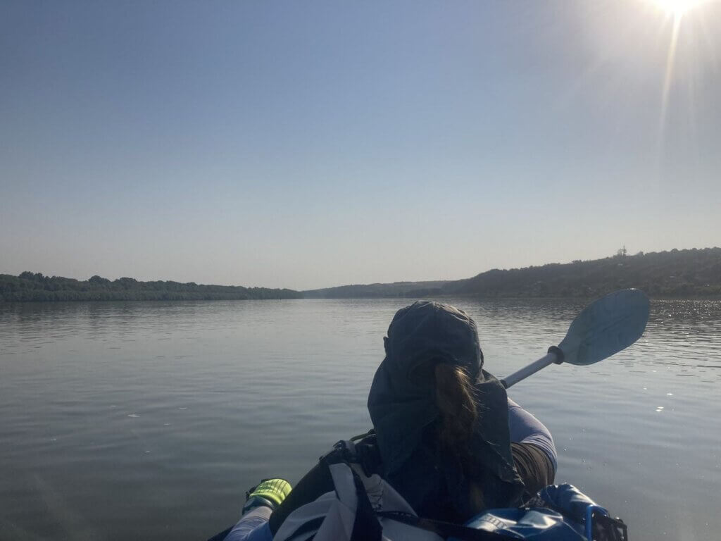
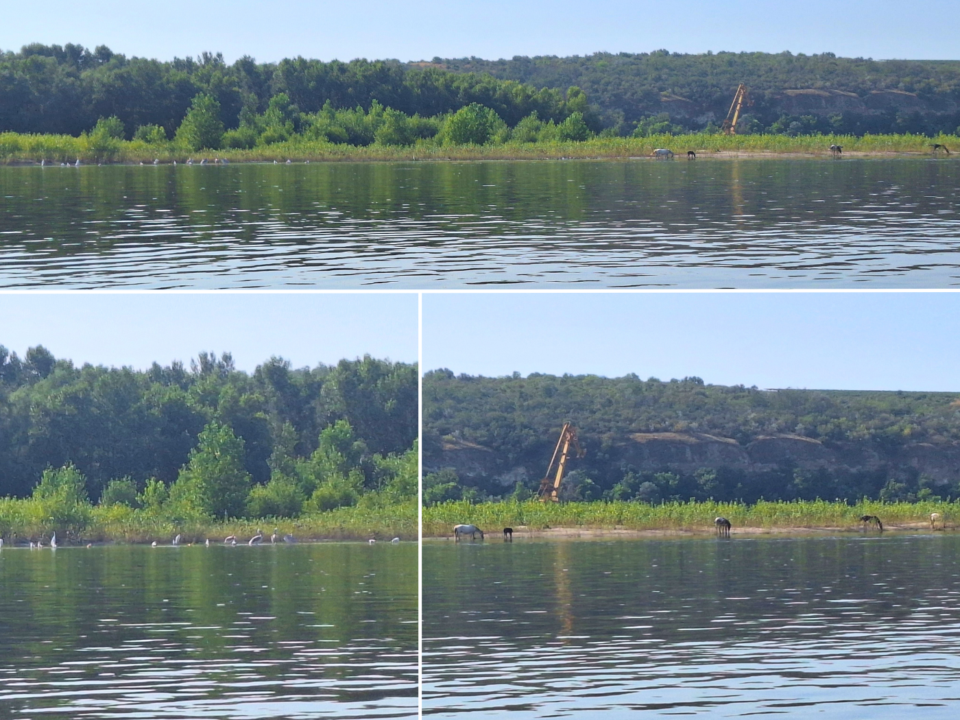
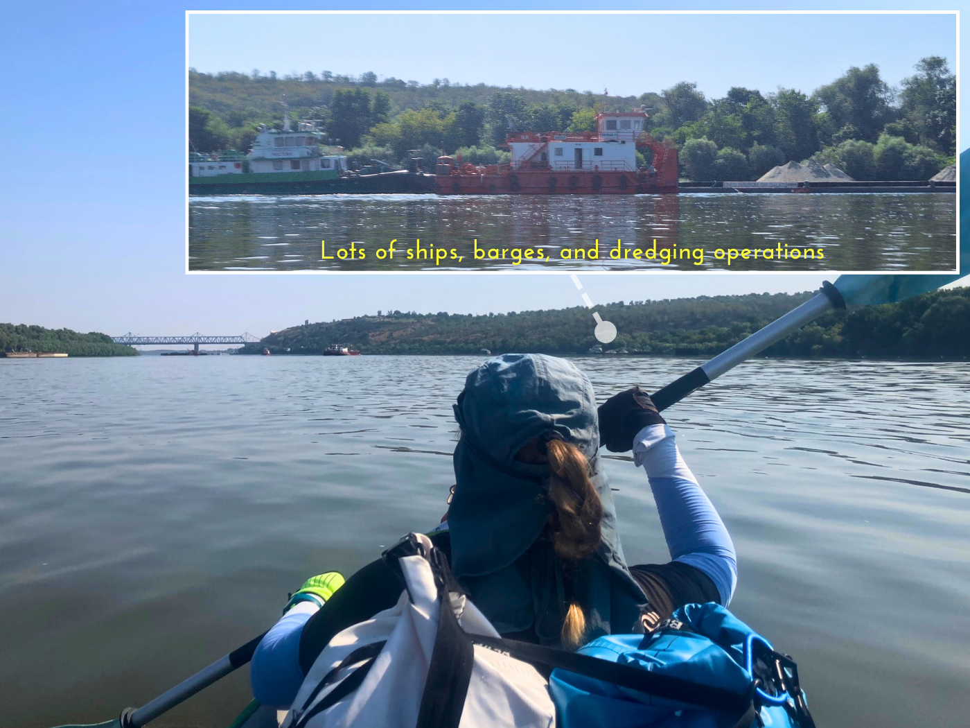
On the next stretch, we had the choice to go right of a river island outside of the shipping lane or stay to its left with the ships. We spotted a lot of dredging ships and excavators in the area of the island, so we chose to stay in the shipping lane. That turned out to be a good choice.
We first spotted some kind of mammals on the shores of that (unnamed?) river island. I thought cows at first, till I saw the distinctive whipping of long tail hair. There were at least 10 individuals, some of them bathing in the river. Jonas asked me if one of them was a baby horse. When its mom trotted out of the water, the foal followed. So small and cute!
A little further downstream in the same area, there was also a bird gathering. It took a few seconds to spot the odd beak angle. Pelicans! It’s the third time we see them. There were also some other birds that I could not ID from our location.
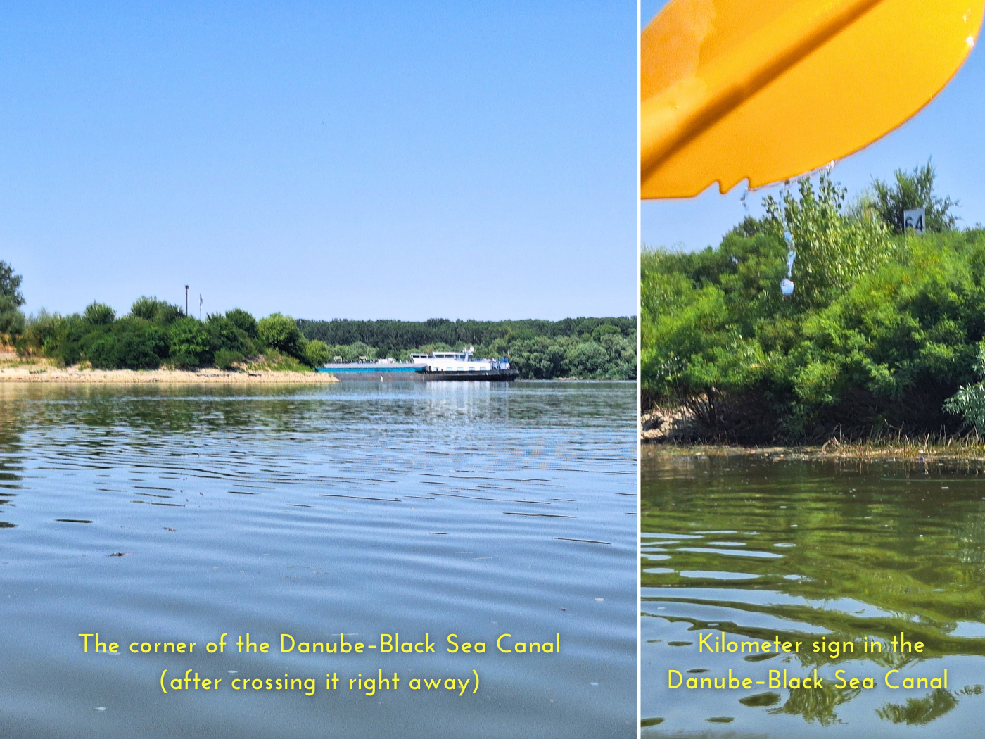
At 9:09, the first ship of the day overtook us from behind. It was a gas barge named Gama with a pushtow whose name I couldn’t read. Bulgarian flag. I wasn’t so satisfied with the progress we’d made over the first hour of kayaking, so I kept checking the map to a minimum and paddled with Jonas to the end of this elongated river island.
Jonas asked me how long the Danube–Black Sea Canal is, but I couldn’t answer that question as my map didn’t accept navigation through it. I gave the as-the-bird-flies distance: 56 kilometers. So it’s maybe 10 kilometers longer as it’s not a straight canal.
Ships and Ships and Barges
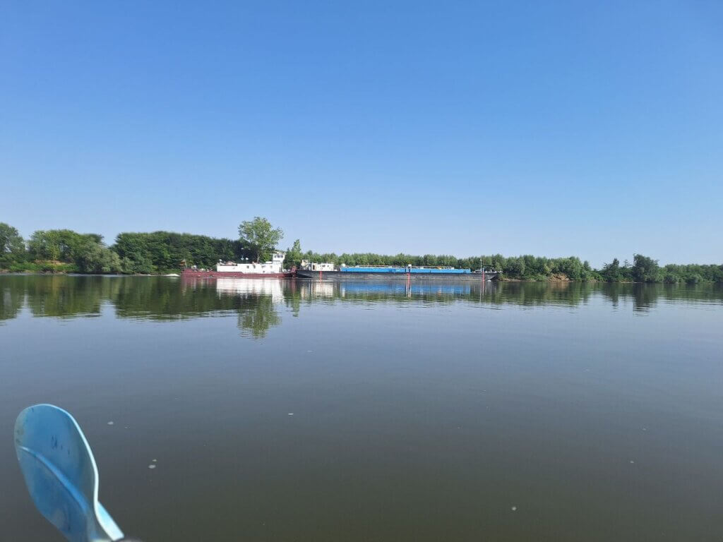
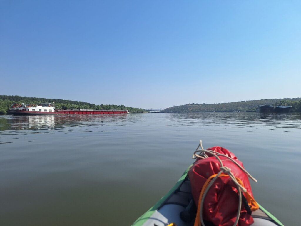
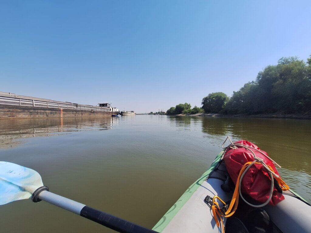
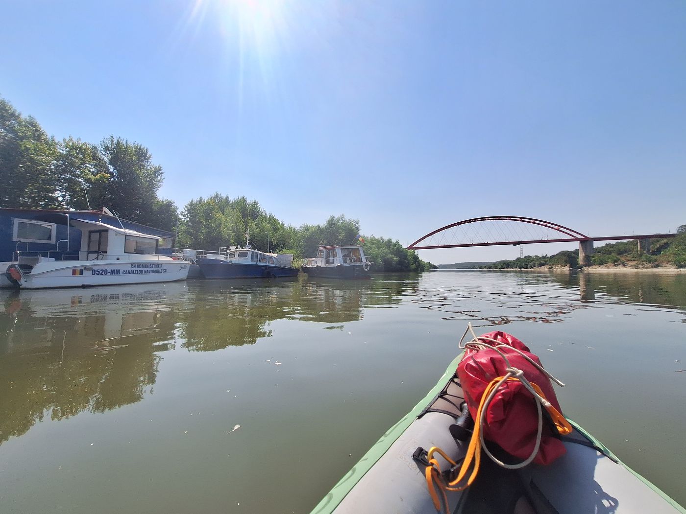
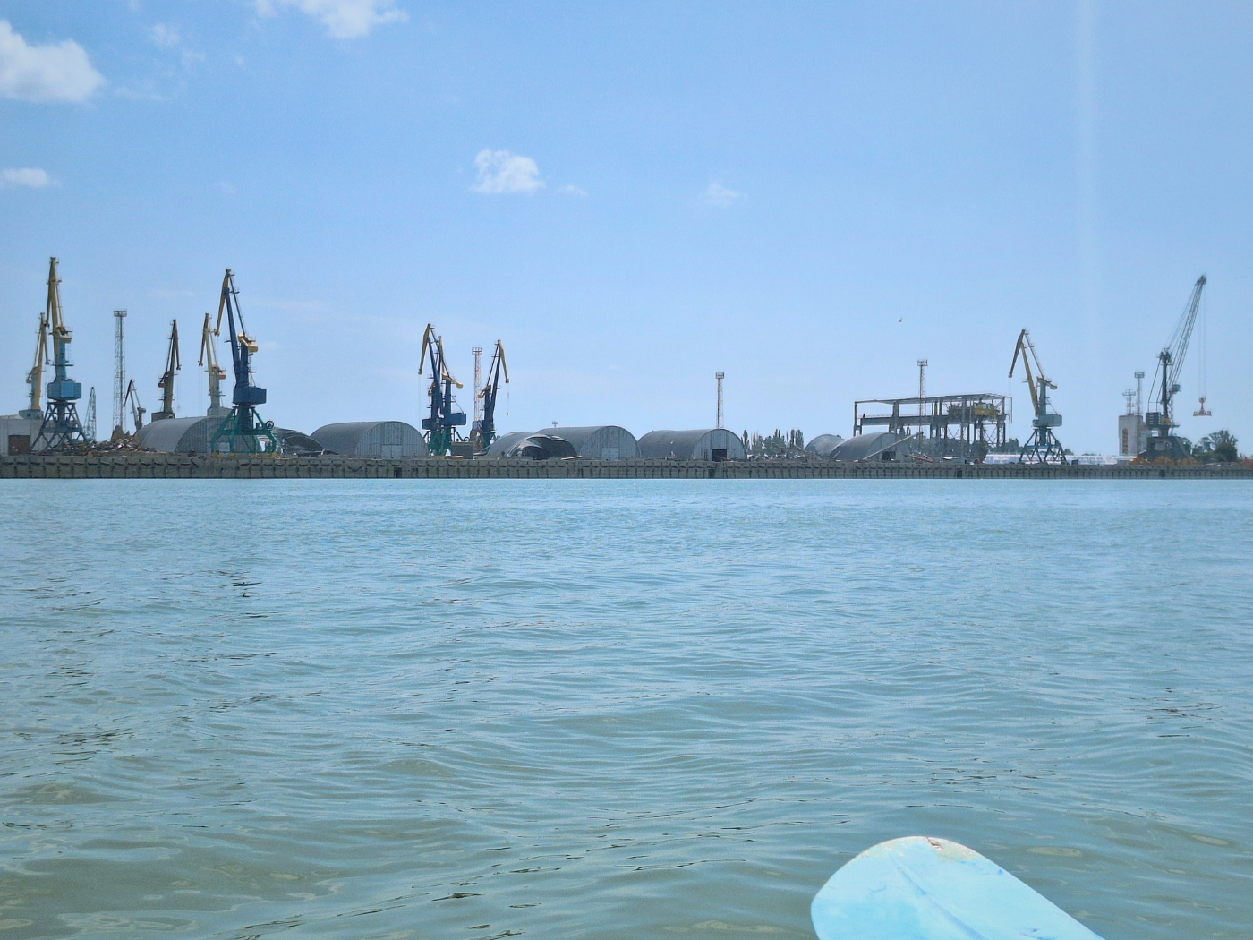
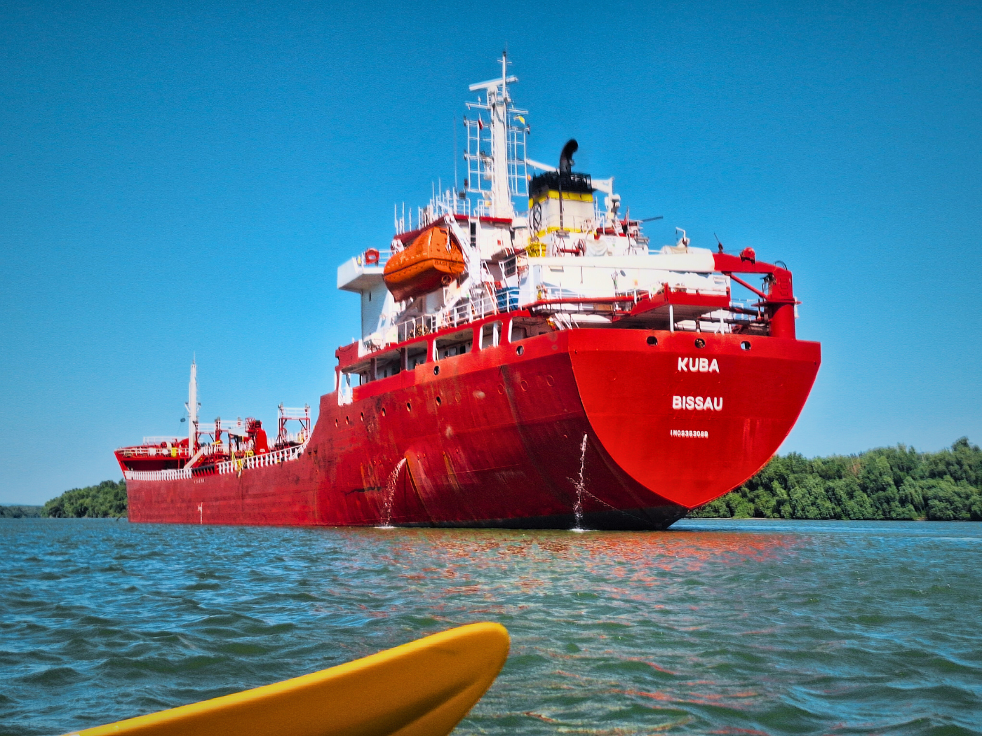
At 9:36, we were beyond the island and entering an anchorage zone. In front of us was a a bunch of barges tied together that I thought were moving for the longest time. A small red ship was coming to us from behind, aiming at us for a long time in anticipation to make the turn towards Cernavodă. The ships in front of us were stationary, we figured out quite late.
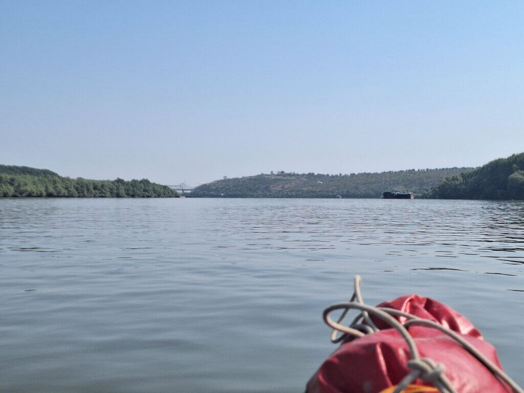
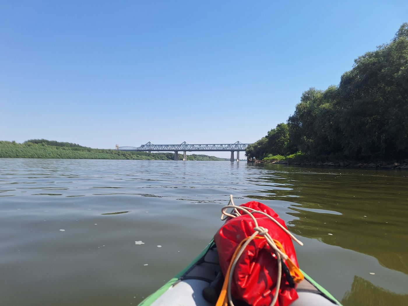
One pillar of one of the two bridges peeked above the treetops on the left side of the river. At 9:46, we saw the humble beginnings of the bridges across the Danube at Cernavodă. We were outside of the red buoy and therefore outside of the shipping lane when the red ship under Bulgarian flag overtook us.
A few minutes later, a pushtow without any barges traveled upstream. There were some barges and anchored ships with barges to our right now, so it was no surprise when they crossed our path. The wake a pushtow causes when it doesn’t have a load is quite impressive (and annoying). And their maneuverability when they’re unburdened is a bit terrifying as well. Thankfully, they saw us and we were out of each other’s ways in no time.
Though we couldn’t yet see which bridge is which, we did see the span in full with its traffic driving over them. There was an impressive number of trains crossing the Danube here as well on the busy stretch between inland capital city Bucharest and coastal fourth-biggest-city Constanța. Constanța is Romania’s most important port city on the Black Sea.
There was a dredging operation a little upstream of the bridge that I thought might cause the shipping lane to go to the right side. It normally passes on the left. But in the end, it was a lot less close to the bridge than I thought.
It was time to make one little break on land so we wouldn’t be under pressure when we arrive in Cernavodă. We found an okay landing spot that wasn’t muddy, thankfully, but had small stones. The embankment has probably been hardened in this area in anticipation of the bridges and the anchoring site. Though this five-minute break was necessary, it wasn’t very nice as the mosquitoes found us in no time and we paddled away slapping them dead. Jonas showed me the blood stain he had on one of his sleevies from a previous kayak day when he unalived a mosquito that had just bitten him. Deserved outcome.
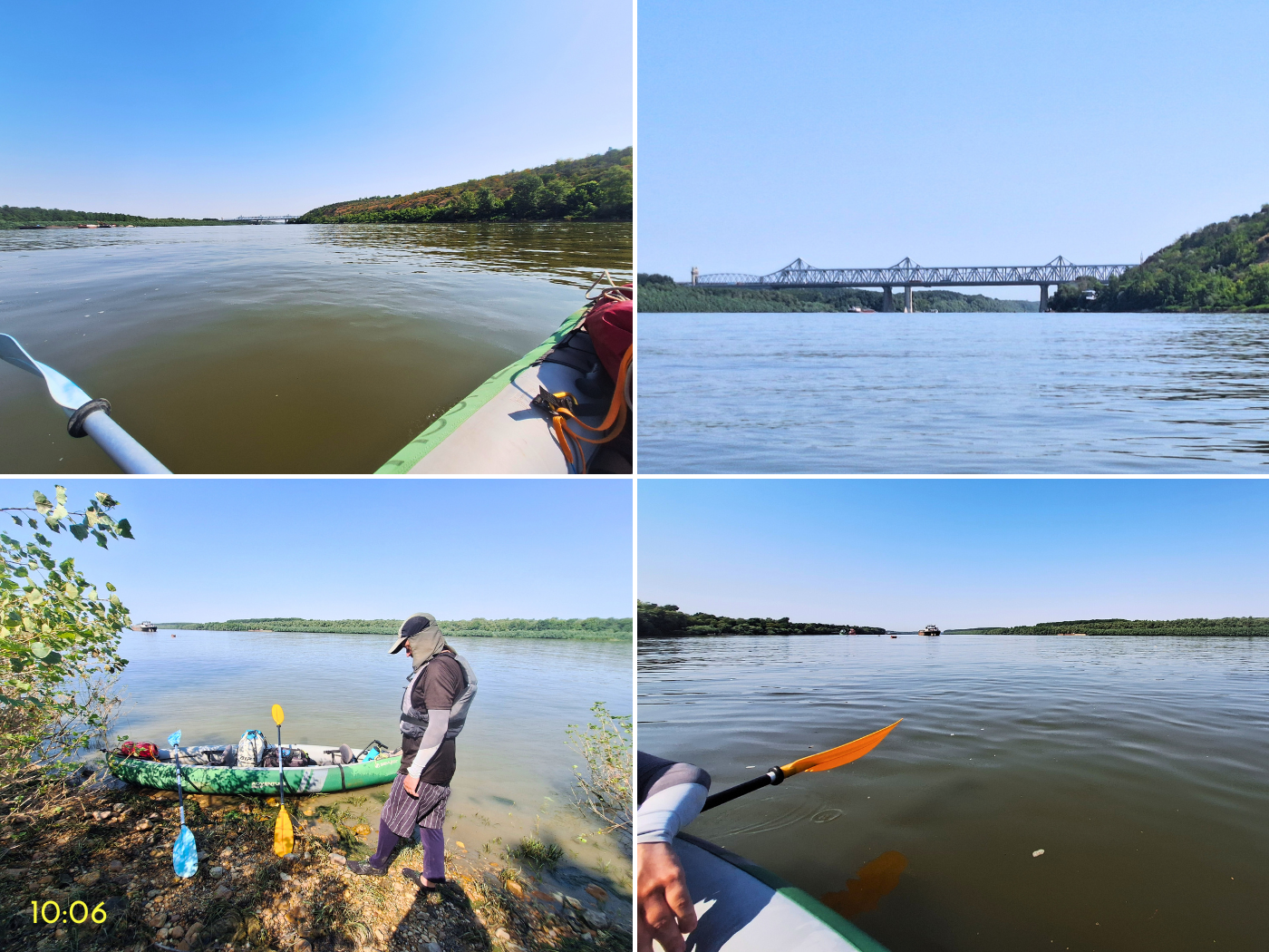
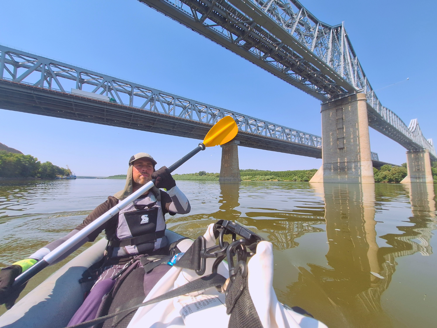
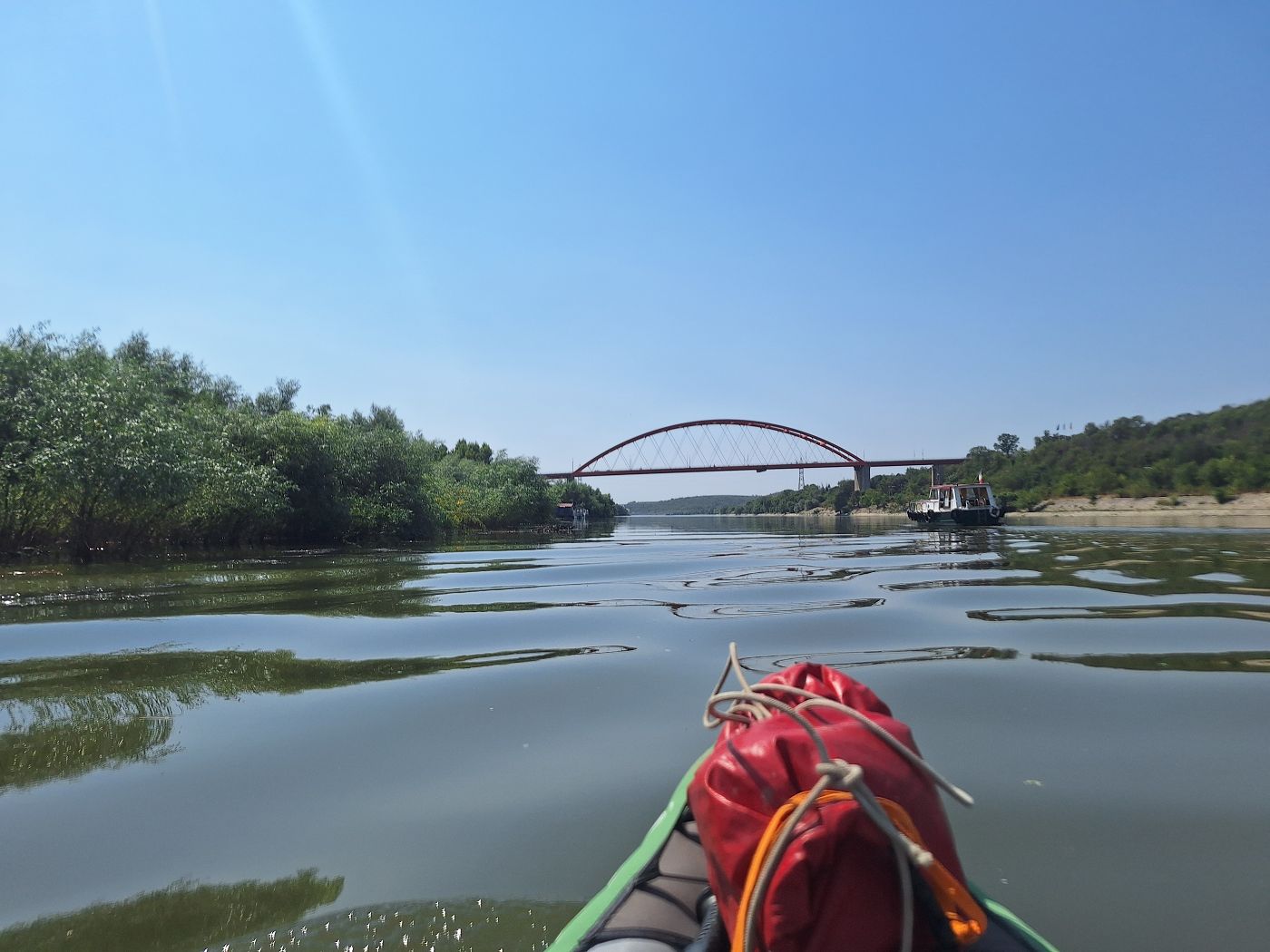
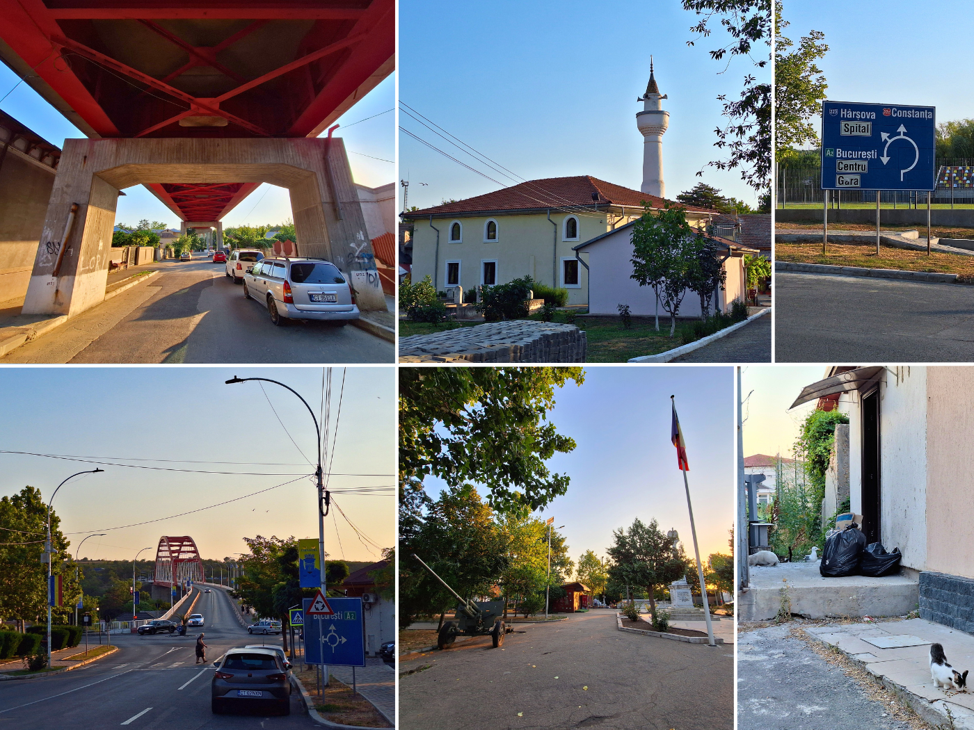
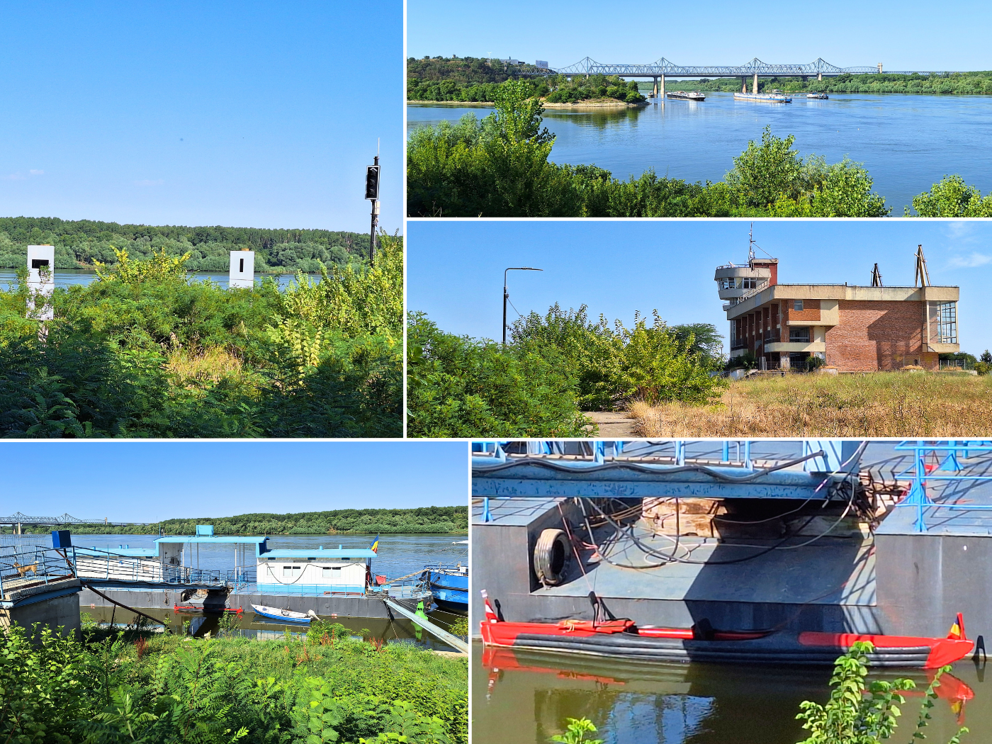
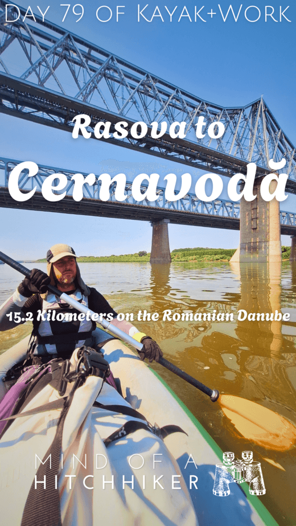
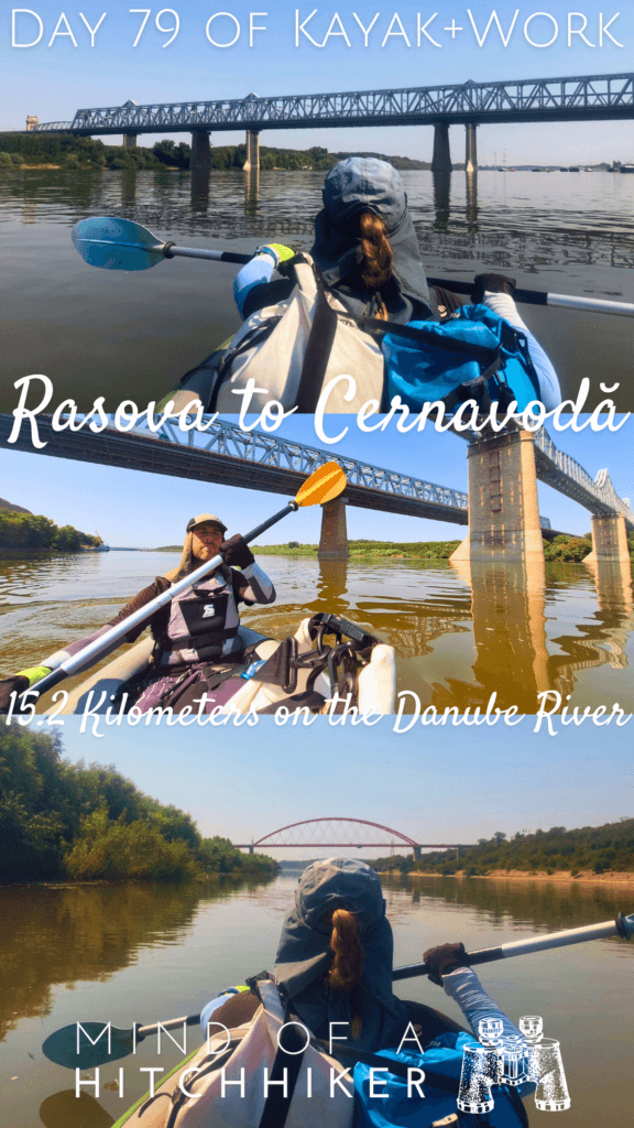
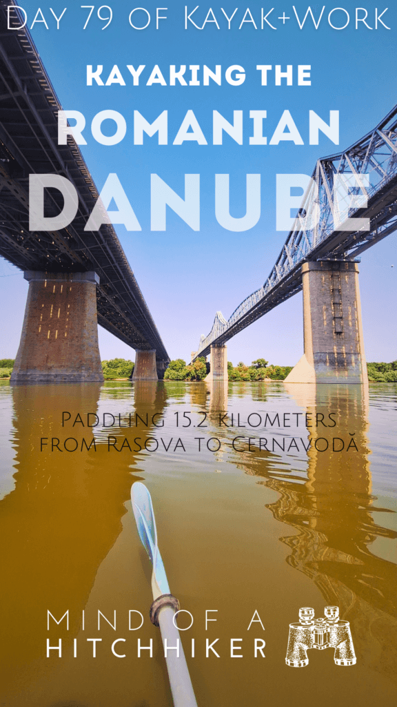
Our next challenge was to paddle under those two bridges – that I count as one due to shared location – which is the third-to-last bridge across the Danube before the delta. That’s kind of crazy.
At 10:18, we paddled past a bunch of river signs talking about anchoring here, the VHF channel to use, and the fact that there will be a lesser side branch on the river appearing on the right soon. That’s the Danube–Black Sea Canal.
Once we got close to the first bridge, we realized the anchorage site after the bridges is really crowded with ships. I recognized the red Bulgarian ship that had just overtaken us. It still had its radar antenna turning. That’s one of the ways we identify ships that are moving or about to move. All the others were stationary.
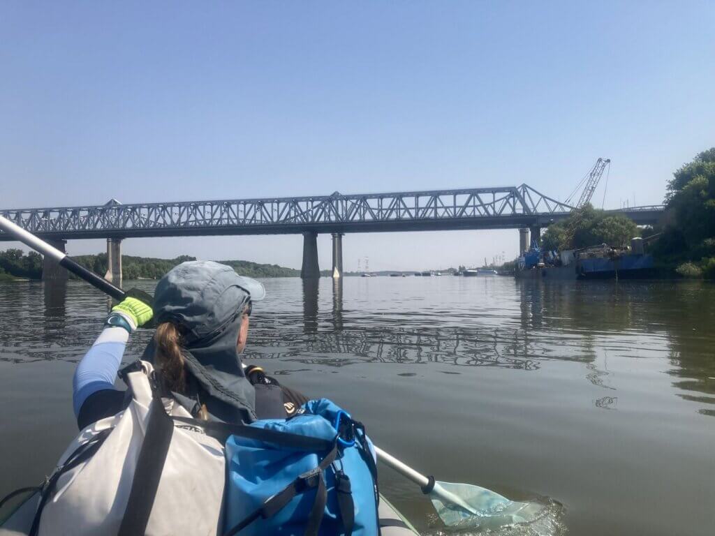
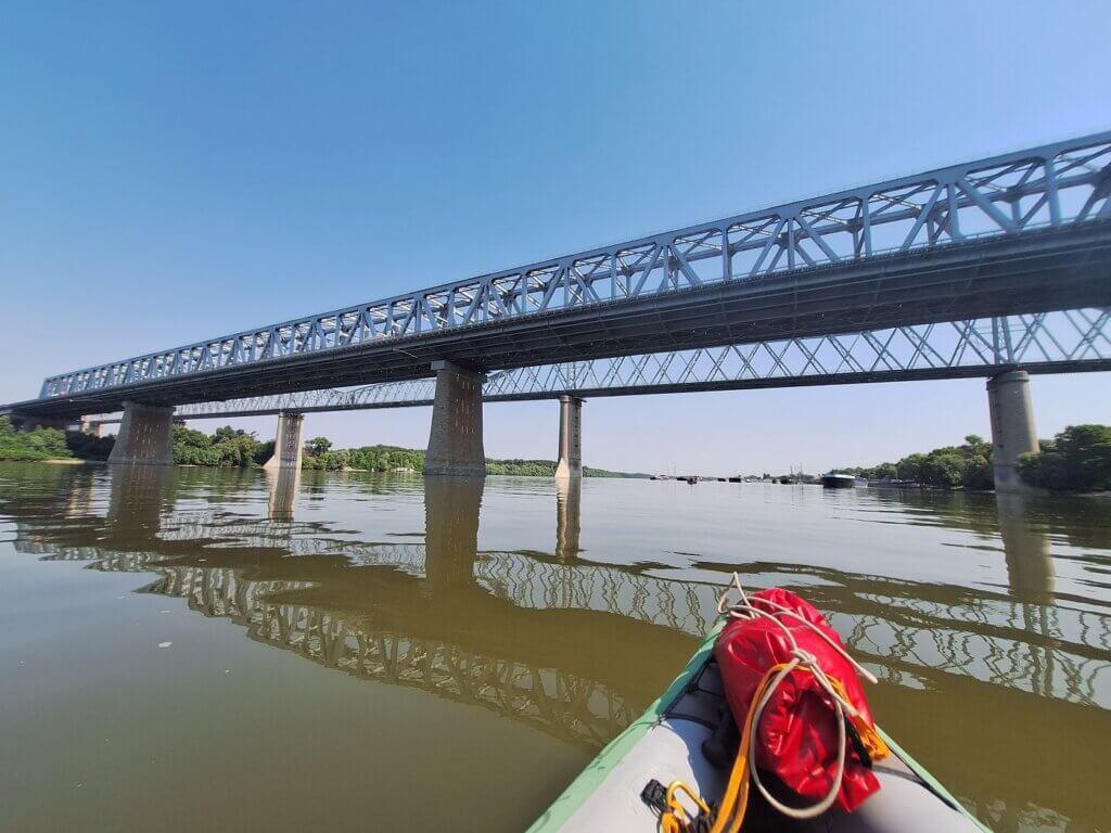
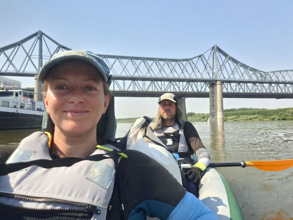
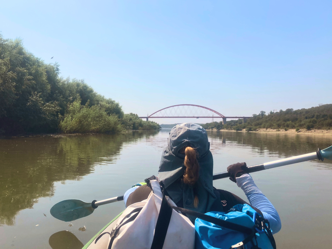
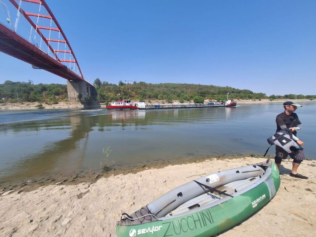
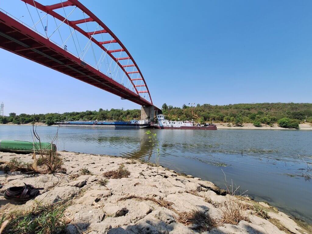
I took some photos and videos and asked Jonas to do the same while we paddled under the two bridges. This is actually the most insane bridge combo I’ve seen this year. Way cooler than Novi Sad. Of course, a man in a fishing boat was hanging out under the bridge as well. The fact that there’s another person in a small boat on the river gives us confidence to paddle between the big ships as well.
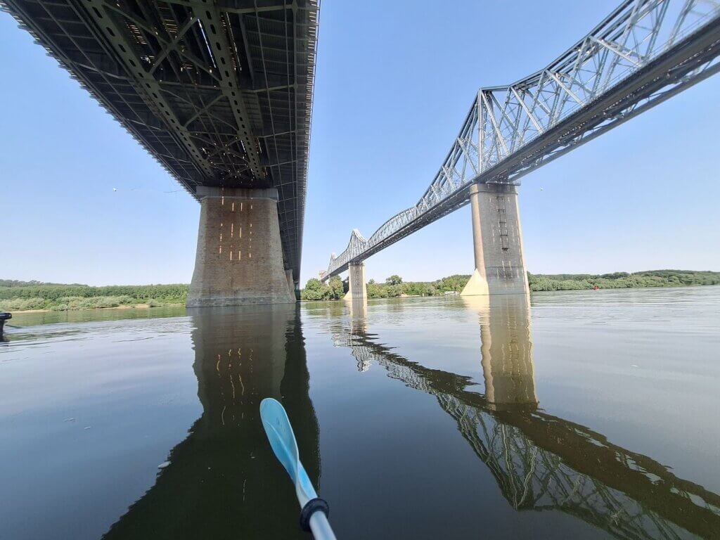
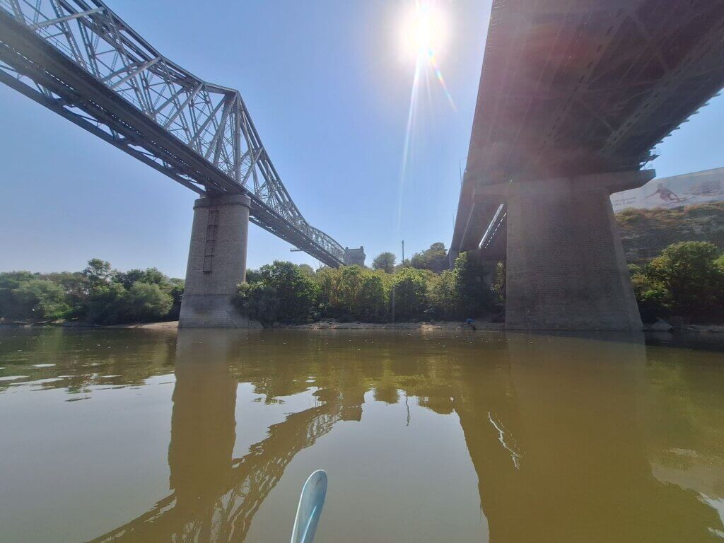
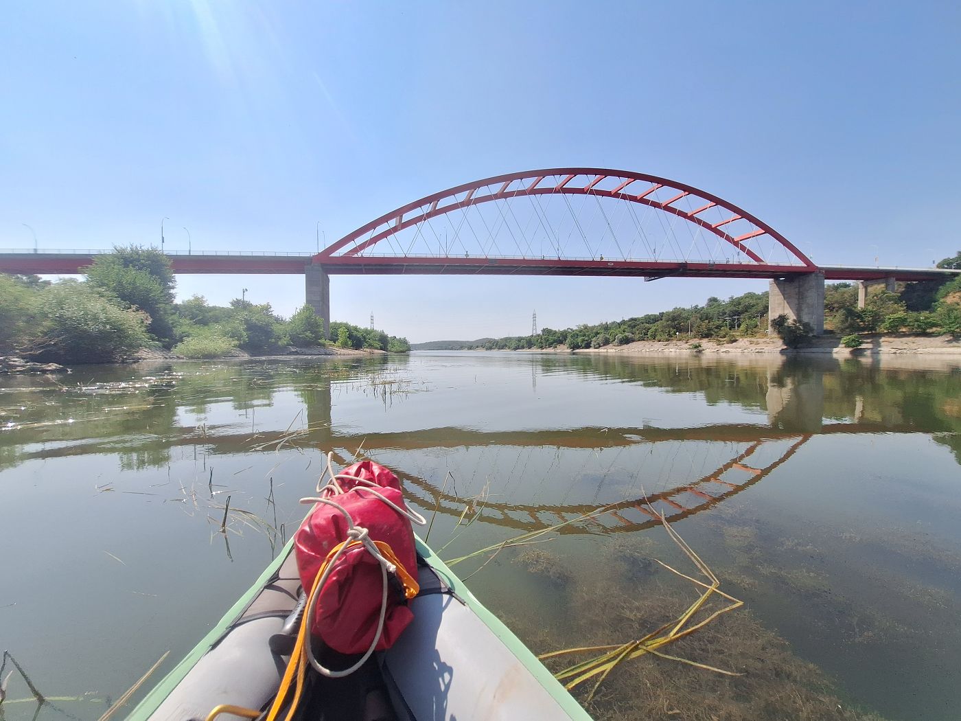
The first bridge is the Cernavodă Bridge, which opened in 1987. In the middle there are two electrified railroad tracks for cargo and passengers. To the sides, there are two two-lane toll highways that are part of the A2 from Bucharest to Constanța. It’s… modern, functional, forgettable.
The second bridge is the much older (and mostly decommissioned since 1987) Anghel Saligny Bridge, aka the King Carol I Bridge. This single-track rail bridge opened in 1895. It was the second or third-longest bridge in the world at that time at almost 4.1 kilometers if you add up both sections from abutment to abutment. It was the most downstream bridge on the Danube at the time, with the next bridge across the Danube being in Novi Sad (Serbia today) almost 1000 kilometers back upstream. That bridge, the Franz Joseph Bridge, was destroyed in WWII.
Both bridges span the entire Danube in this area from Fetești on the Borcea Branch to Cernavodă across the Ostrov/Old Danube Branch. They cross the gigantic (formerly-swampy) river island Balta Ialomiței that lies between the two branches. On this island, the newer bridge swaps sides with the old Anghel Saligny Bridge. So near the village of Fetești, the new bridge is further north, while near Cernavodă, the old Anghel Saligny Bridge is further north.
The Anghel Saligny Bridge has a wonderful design with those concrete bridge pillars and fancy cat-ear-shaped trusses that remind of another time. There’s a myth that the original superstructure for the bridge across the Danube designed by Gustave Eiffel was then moved to Saint-Louis, Senegal‘s Faidherbe Bridge across the Senegal River. Imagine going to the beach in Constanța or Mangalia by train like this. They just don’t build stuff like this anymore.

By own scan – Raymund Netzhammer, Aus Rumänien 1909, Public Domain, Link
Perhaps when we hopefully finish the trip to the Black Sea, we will return via the electrified rail bridge upstream to northwest Europe.
Beyond the bridges, I snapped some photos and videos of Jonas with the bridge. He wondered why I’m not too hot and sweaty for taking photos. I said I am absolutely too hot and my face is moist, but I really liked these two bridges. He turned around and saw how cool it looked with the sun illuminating the other side and agreed. Jonas made a little vlog as well while I kept Zucchini in check as we approached the other ships.
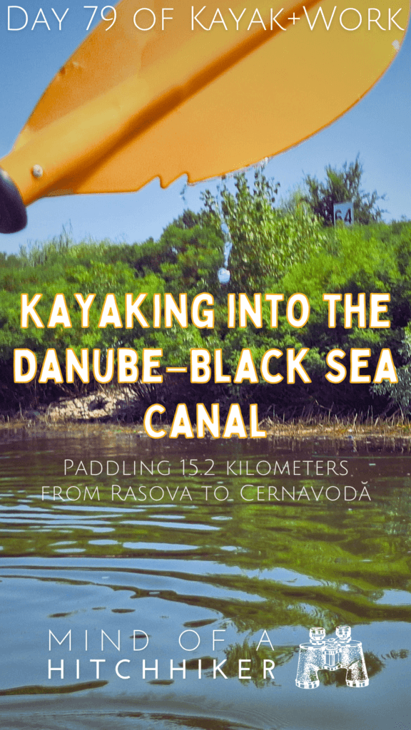
Kayaking the Danube–Black Sea Canal (Just a Little)
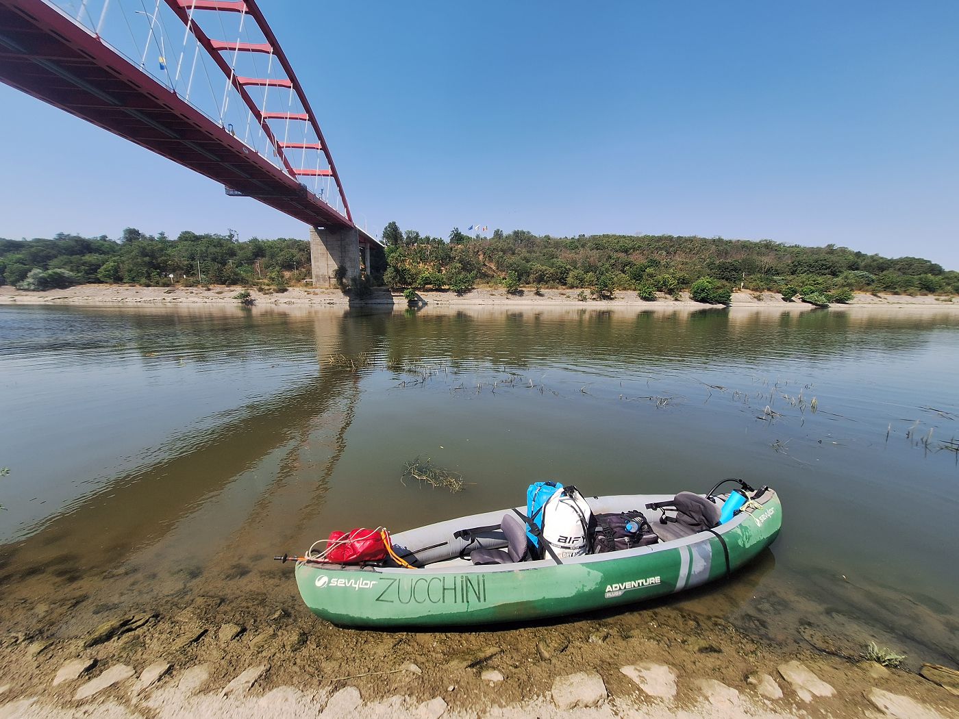
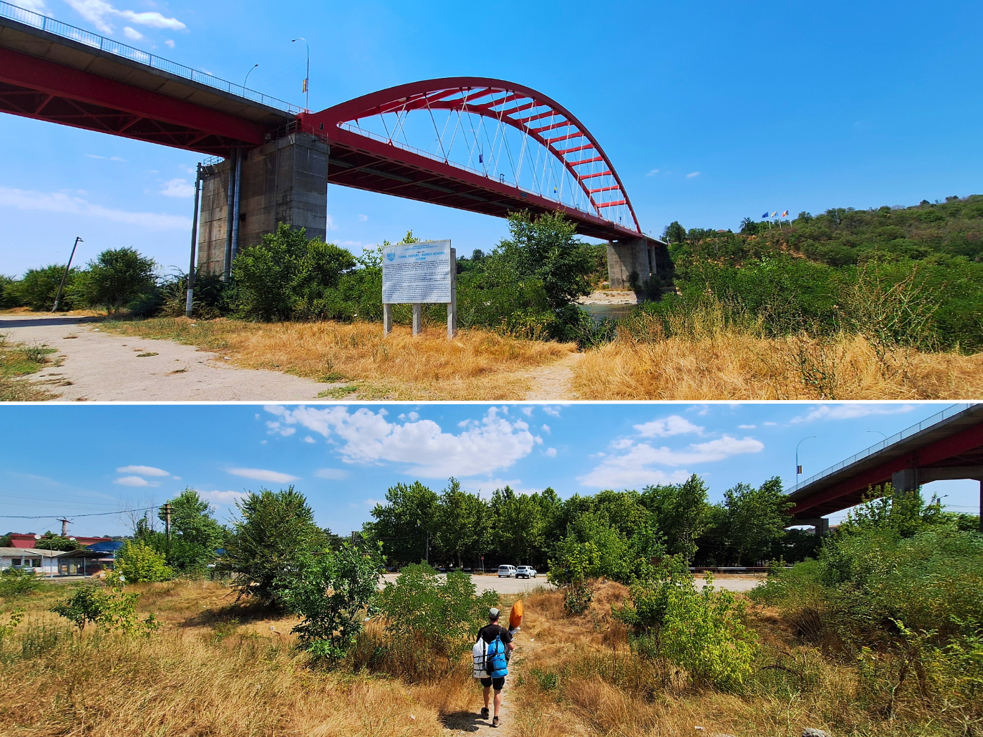
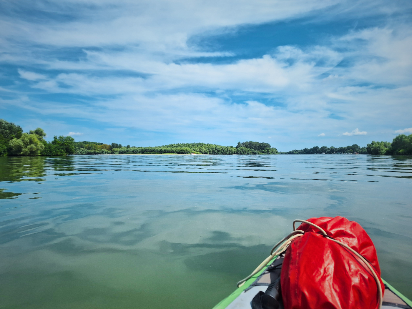
At 10:34, we paddled past the last anchored ship and approached the sharp corner that is the start of the Danube–Black Sea Canal. There was a small motor vessel coming upstream. Water police? Wrong type of boat. We crossed the canal to the left side, which is the side of the town of Cernavodă. We wanted to land somewhere in that area, at the latest under the Saint Maria Bridge that crosses the canal.
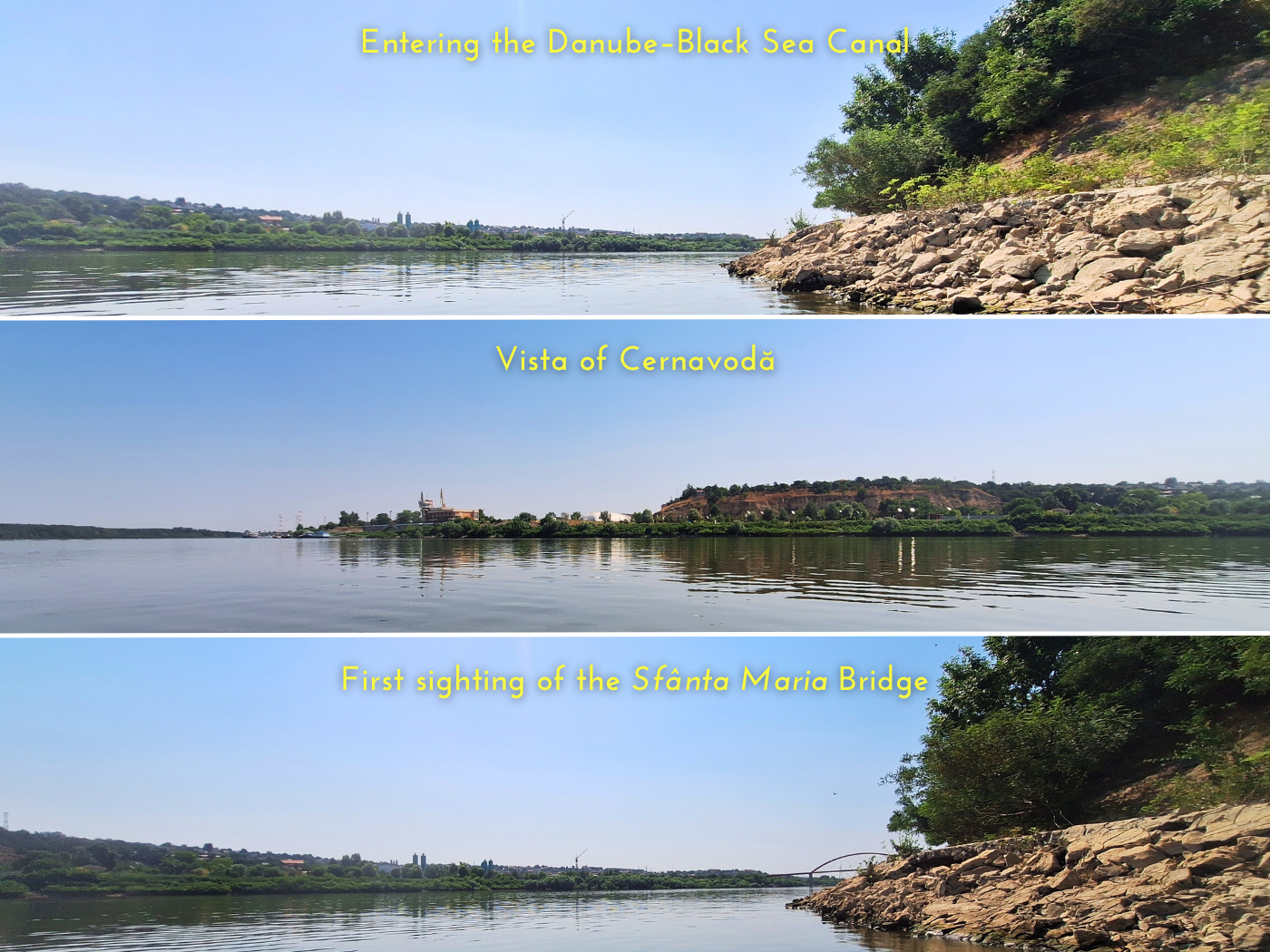
Once across, the current picked up. For now, this is okay. But when we continue kayaking to Hârșova, we might want to pick a different entry spot into the Danube so we don’t have to paddle against the current first thing in the morning on a day that will be over 45 kilometers.
Jonas spotted a sign in the bushes that read 64. That’s the length of the Danube–Black Sea Canal! Very cool. Much shorter than 299 kilometers. But even if it’s allowed to kayak in the Danube–Black Sea Canal (which it isn’t), it won’t be fun and it’s supposedly very dirty. I wonder if cruise ships take it?
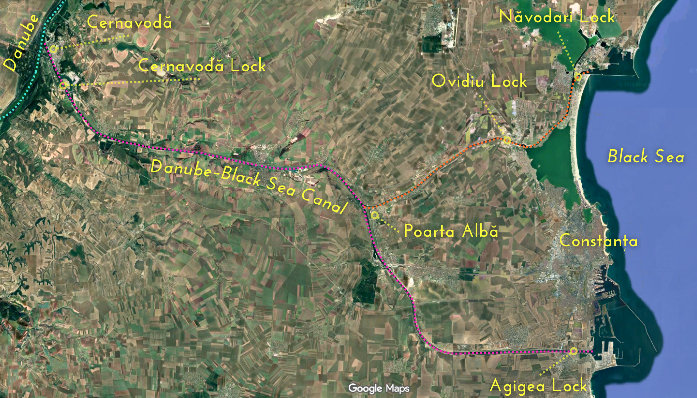
As for the history of the Danube–Black Sea Canal, the keywords are forced labor. Plans to build this canal had already been around since Romania annexed the Dobruja region in the late 19th century. It shortens the connection to the Black Sea by about 400 kilometers.
Construction began in 1949 during the communist times of Romania under Gheorghe Gheorghiu-Dej, pushed for by Stalin. Prisoner camps sprung up along the canal route. The Soviet Union ‘helped’ Romania by giving them old equipment used to build the Volga–Don Canal before. But most of it was constructed by hand at this time, slowly shoveling and pickaxing away at the mountains. Prisoners starved while doing back-breaking labor, were tortured or executed. The regime saw it as a way to get rid of the bourgeoisie. At least 10.000 people died, while some estimates go into six digits, giving it the nickname Canalul Morții (Canal of Death). Construction was halted in 1953.
In 1973 under Nicoleau Ceaușescu, construction was continued with new machinery. The southern arm of the canal was opened in 1984 and the northern arm in 1987. This bifurcation in the canal is at the village of Poarta Albă well before the city of Constanța, where there’s a monument to the victims of the canal. There are four locks in the canal: Cernavodă, Agigea (south), Ovidiu (north), and Năvodari (north).
Here’s an old-timey video from the inauguration:
We continued paddling very slowly. Jonas was convinced there was an earlier exit close to our hotel. I knew the walk from under the St. Maria Bridge to the hotel was just 400 meters. Not much to optimize, in my opinion.
At 10:44, the motor vessel we’d seen before on the Danube overtook us. Jonas was convinced it was Romanian water police and wanted to see our papers. Cernavodă is, in fact, our next port of call on our crew manifest. But Romanian water police are so slow with processing our tiny little kayak, so I hope no one bothers us.
The man on the boat wasn’t police and he simply waved at us. He moored his boat at a floating pontoon with more motor vessels a bit further downstream. Perhaps getting out here was possible and the compromise Jonas was hoping for. Upstream of the pontoon didn’t work because the ropes hung too low in the water. We paddled around the man on the motorboat and tried landing downstream of the pontoon, but there was a rope floating in the water.
The man started talking to us in Romanian. We asked him if this landing spot leads to Cernavodă town. He first said Da da, but when we proceeded to attempt to land there, he said something like “No, don’t land here, go to the police” while pointing upstream. I told him that we don’t need to go there and said “Chiciu” and “Călărași”. He didn’t hear me. Jonas repeated the same, but butchered Călărași beyond recognition. I’m aware where the Cernavodă water police is at because of the Via Donau document (page 131). But we’ll maybe see them on the way out of Cernavodă. And we certainly don’t need to see them.
The landing spot was terrible and this otherwise friendly fella was not going to stop trying to tell us to paddle one kilometer upstream to see the police, so we decided to paddle away and go further downstream.
It’s just a couple of hundred more meters until the Podul Sfânta Maria. I was sure of my research. And then we spotted a fisherman sitting on the hardened embankment beneath the bridge. He got there on foot, which means we can get out of there on foot.
We landed in Cernavodă at 10:55. It’s so nice and early.
We washed Zucchini’s bottom air chamber in the canal waters to get the buildup of mud off. It was a big improvement, but not as clean as I’d hoped. Zucchini went into the sun while Jonas and I retreated into the shadow to eat a rather melted protein bar after the fact. Jonas bravely ate 1.5 mango-papaya-curry-cheese sandwiches that I deemed too old to eat. Let’s hope he won’t get sick.
One ship traveled upstream on the Danube–Black Sea Canal. The wake was minimal and didn’t threaten to make our boat wet again. Some 15 minutes later, a familiar ship entered the canal: the barge’s name is Gama and the ship’s name is Madara and it flies the Bulgarian flag. Funny that the first ship that passed us today is here again. Apparently, checking in with the Cernavodă water police takes several hours.
The fisherman came by while we were ready to pack up to offer us some snack? I had no idea what it was. Perhaps it was fish bait. No idea. He used the word baidarka to describe our boat. That’s not Romanian, that’s russian. I tried to keep things friendly without inviting him to touch our boat or something like that. But I really didn’t want a snack and neither did Jonas, so we tried to reject him in a kind way. He walked back to his fishing spot. I tried to say bye to him when we walked away fully packed, but he didn’t hear me.
The walk to the Hotel Imperio was quite short. The lobby had strong air-conditioning, which was very welcome as it took them forever to get us our room keys. We’d asked for an earlier check-in when booking this place the day before. Perhaps they were stalling because the room wasn’t ready (Jonas’ theory).
Once we’d settled in and showered, I started catching up with writing about today to Cernavodă and the previous two kayak days to Ostrov and Rasova. I’m very much behind. It was 12:57 when I started and I’m still full of energy. Jonas suggested we should always paddle only 15 kilometers—joking, not joking. I told him then we’ll have to do another 20 paddle days to make it to the Black Sea instead of, I don’t know, six to eight more.
“Oh.”
This is how we spent our time in Cernavodă:
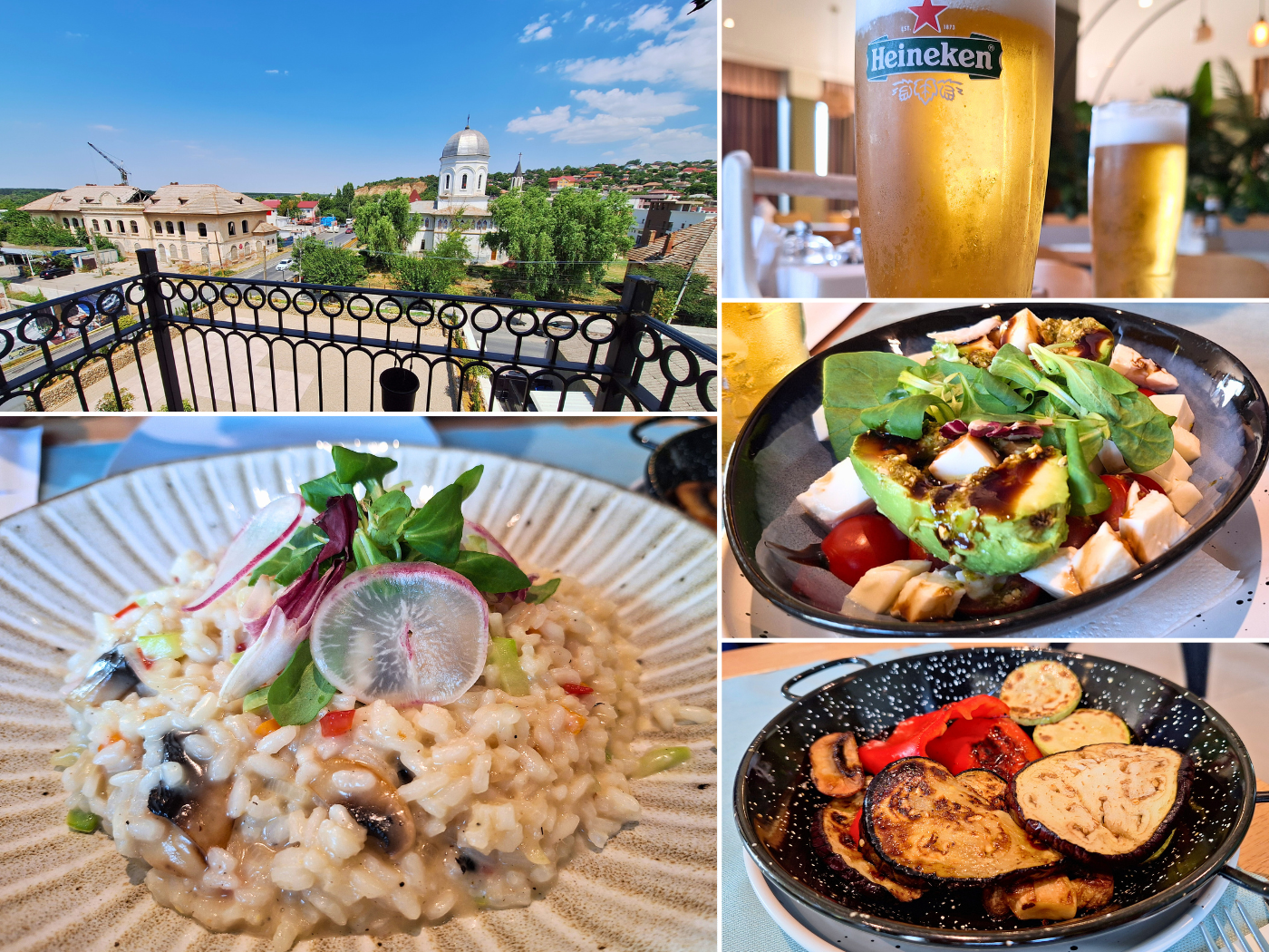
Friday: after writing, I took a nap. For dinner, we decided to go to the hotel restaurant instead of the Turkish restaurant nearby. It was okay.
Afterward, we walked around Cernavodă to see if there’s a shop nearby. We walked past a couple of good candidates, but they were all either hardware stores or didn’t exist. So we ended up walking to Carrefour. Cernavodă is a bit dodgy. Lots of guys walking and shouting to their mates across the street. Ew, brother.
Once we’d bought new supplies at Carrefour, we fed some cats on the way home. The ratio was about 3 dogs per 1 cat. I didn’t see signs of a TNR project for either species.
Back at the hotel, we had a feeling something was going on tonight. Perhaps a party on the rooftop lounge. That’s probably why the room comes with earplugs. Damn, we’re right below that. We watched two episodes of The Asunta Case and did a lot of Spanish on Duolingo before crawling into bed for the night.
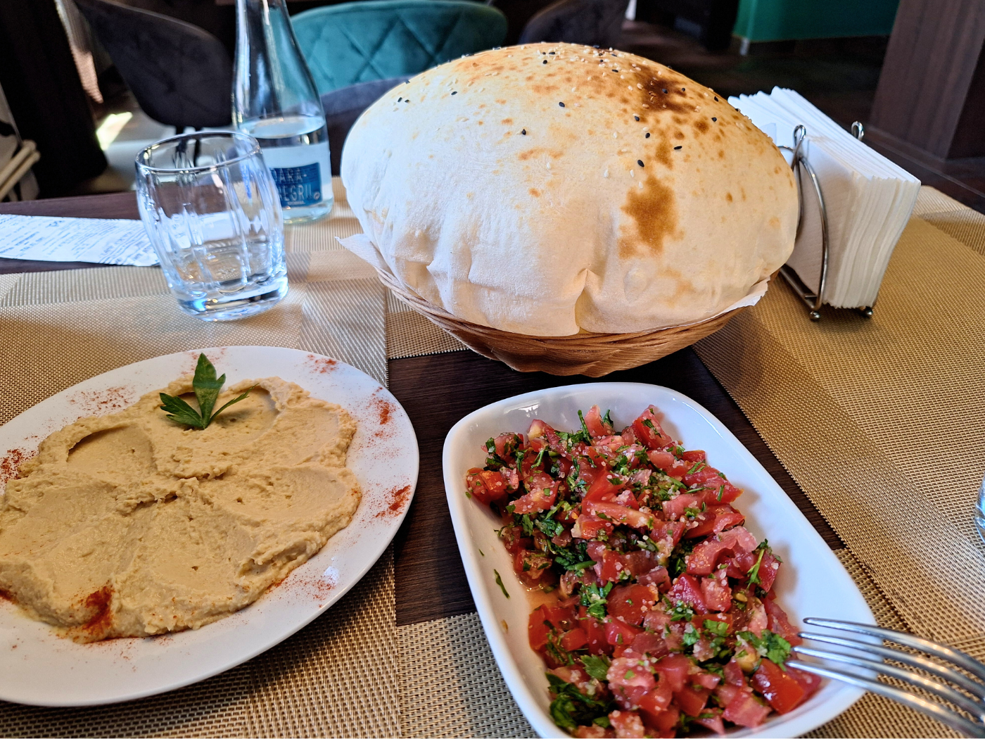
Saturday: we worked… went to a Turkish restaurant called Saray Cernavodă for some amazing bread, hummus, and salad. Afterwards, we stopped at a supermarket to buy some goodies to eat dinner in our hotel room. Later, we booked our stay in Hârșova and watched The Asunta Case. And that’s it.
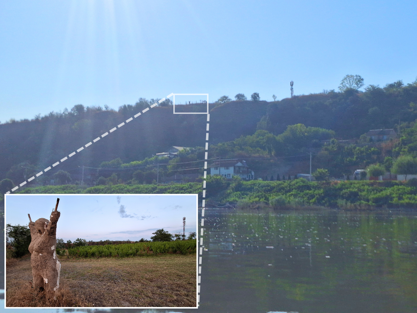
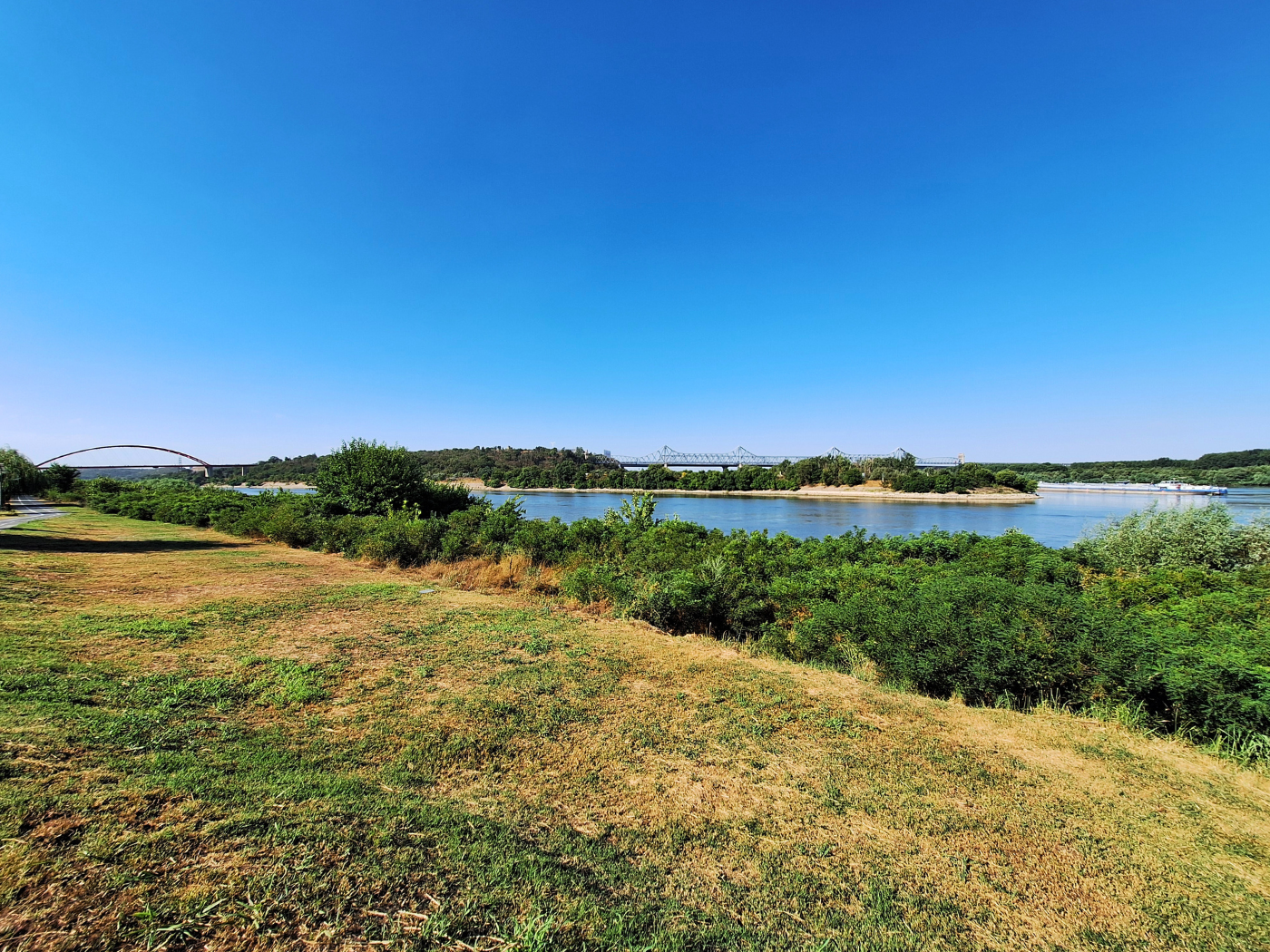
Sunday: in the morning, we walked to the port of Cernavodă to see if there’s a better launch spot, to check out the Danube–Black Sea Canal, and to see the Port Authority of Cernavodă. But first, some churches and viewpoints of the canal to Constanța and the Black Sea.
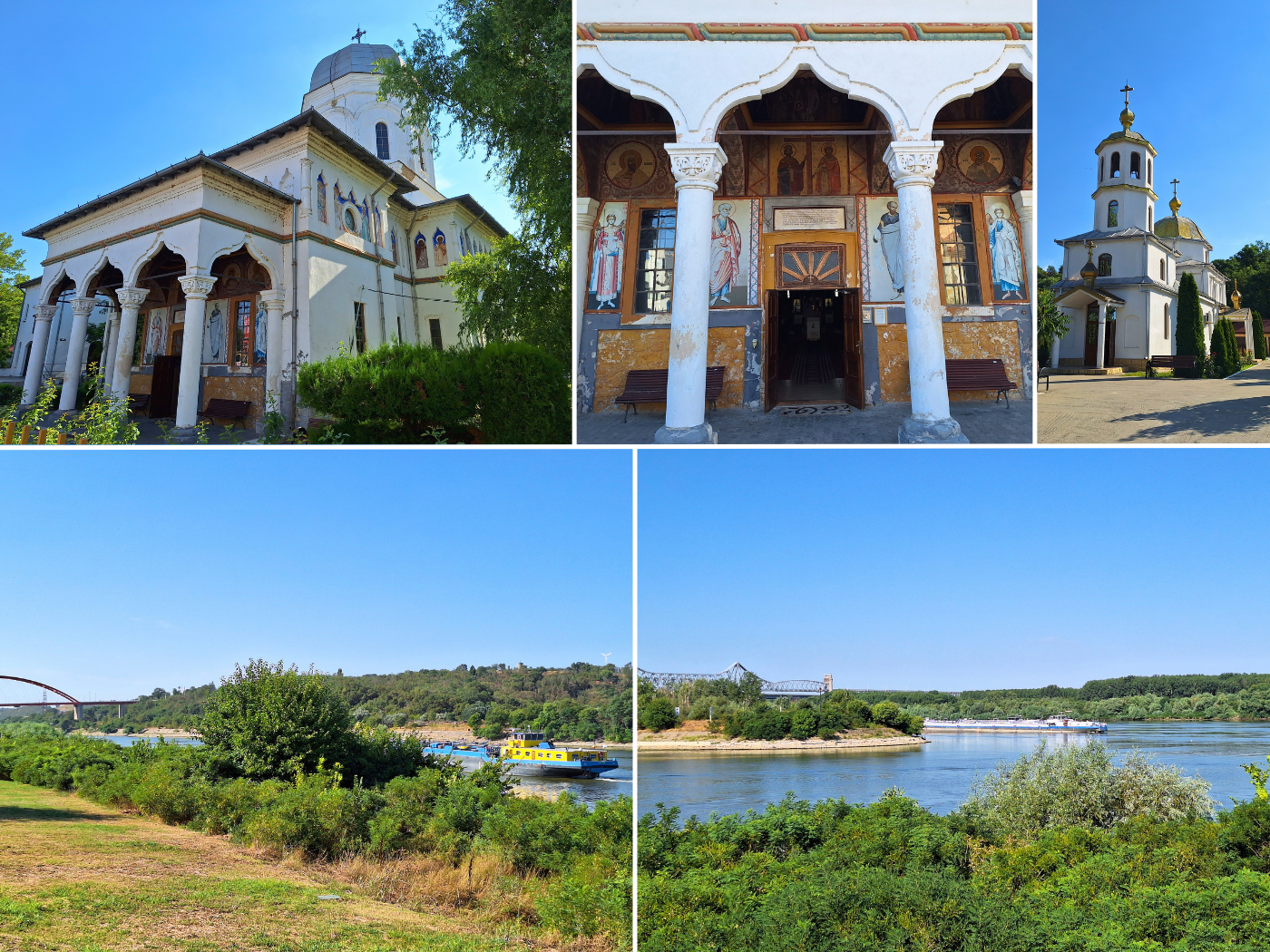
The visit to Cernavodă Port Authority was worth it, not because we needed to show our paperwork, but we saw a familiar boat: the kayak from the Austrians we met in Chiciu! There was no sign of the guys, nor of their outrigger engine system. Have they parked their boat here and returned to Austria because of work? We will never know, unless they join my Facebook group and reveal themselves these fellas.
On the walk back, we checked for a different launch spot, but we came up empty. There was only one promising spot, but it was too steep and annoying. So we’ll return to our arrival spot in the Danube–Black Sea Canal under the bridge. But we did meet a cute big tabby boy cat. Back at the hotel, we bought ourselves into their breakfast buffet, which was excellent and featured quality blue cheese.
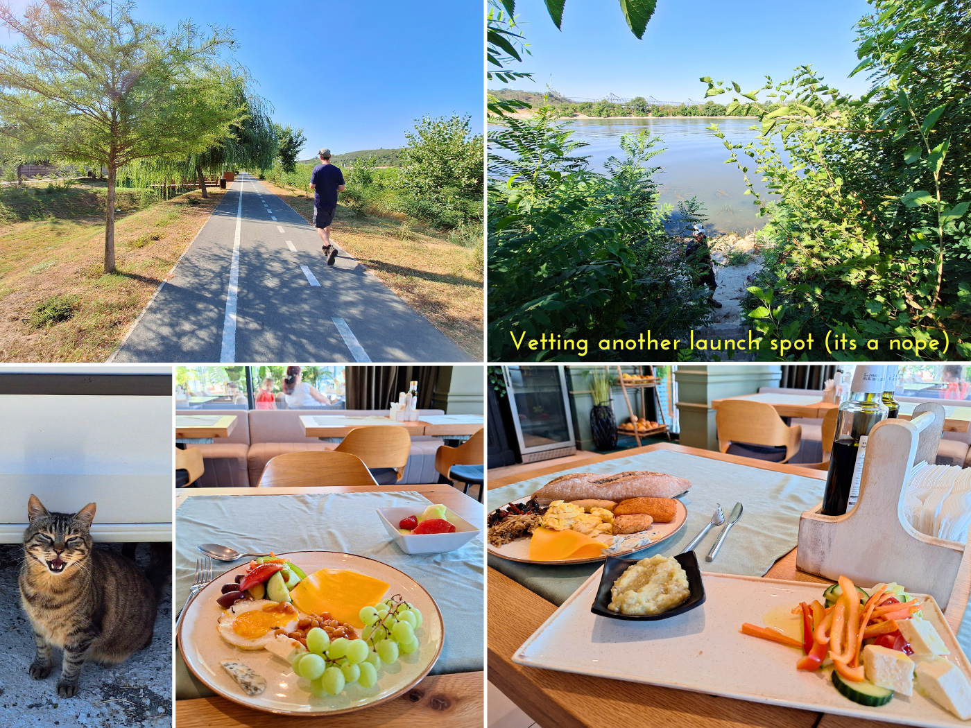
After breakfast, I wrote a lot as I had to catch up with the three kayaking days since Silistra. Working in the afternoon was interrupted with some incessant scrolling, since there had been a Trump assassination attempt the night before. In the evening, we ate dinner at the hotel restaurant and over ordered for road food, finished watching our TV show, and packed for kayaking the following day.
Good read? Consider buying me a cup of tea!

Donate via PayPal
Sharing this article helps my blog


Similar posts:
 Kayak Trip Day 80: Cernavodă to Hârșova – Third Leak + Swimming Cows
 Kayak Trip Day 83: Galați to Isaccea – Bombed Grain Silos in Reni, Kayaking the Ukrainian–Romanian Border Danube
 Kayak Trip Day 81: Hârșova to Brăila! – An Unexpected 70-Kilometer Day in the Vâlciu Branch
 Kayak Trip Day 84: Isaccea to Tulcea – Entering the Danube Delta, the End is Near
 Kayak Trip Day 85: Tulcea to Murighiol – Sulina, Speedboats, and Shortcuts