
")


")


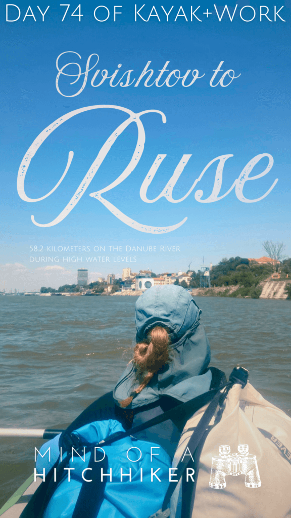
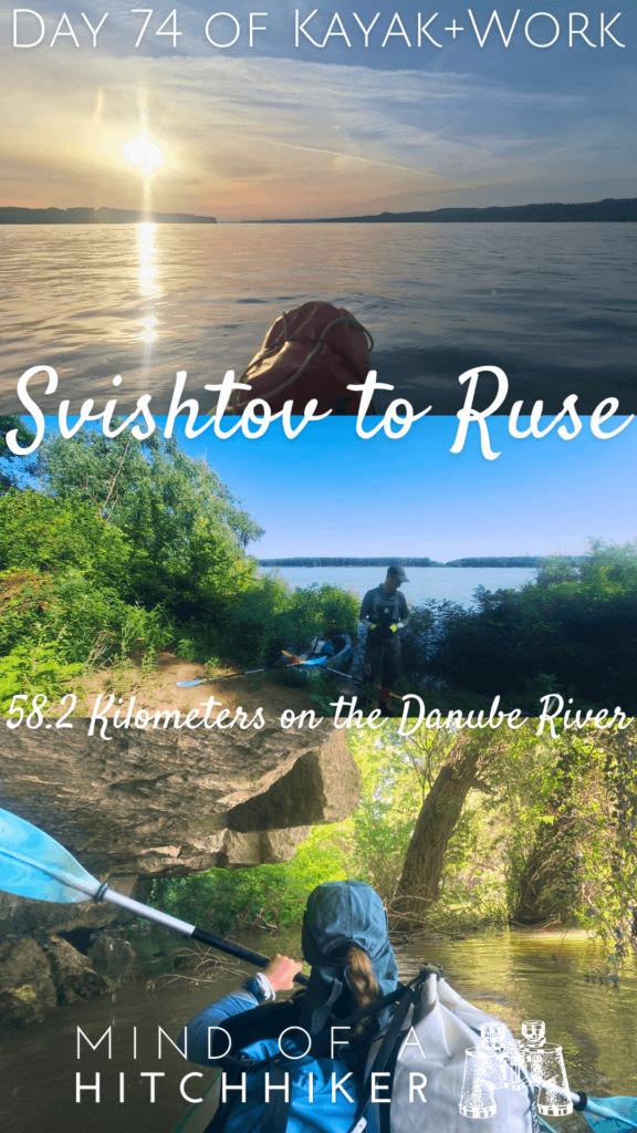
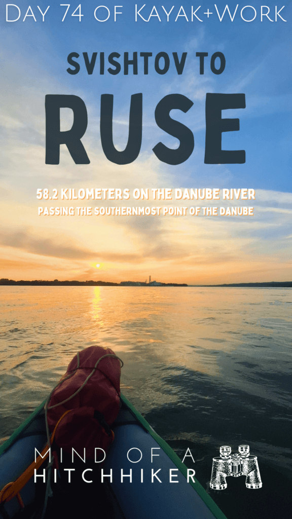
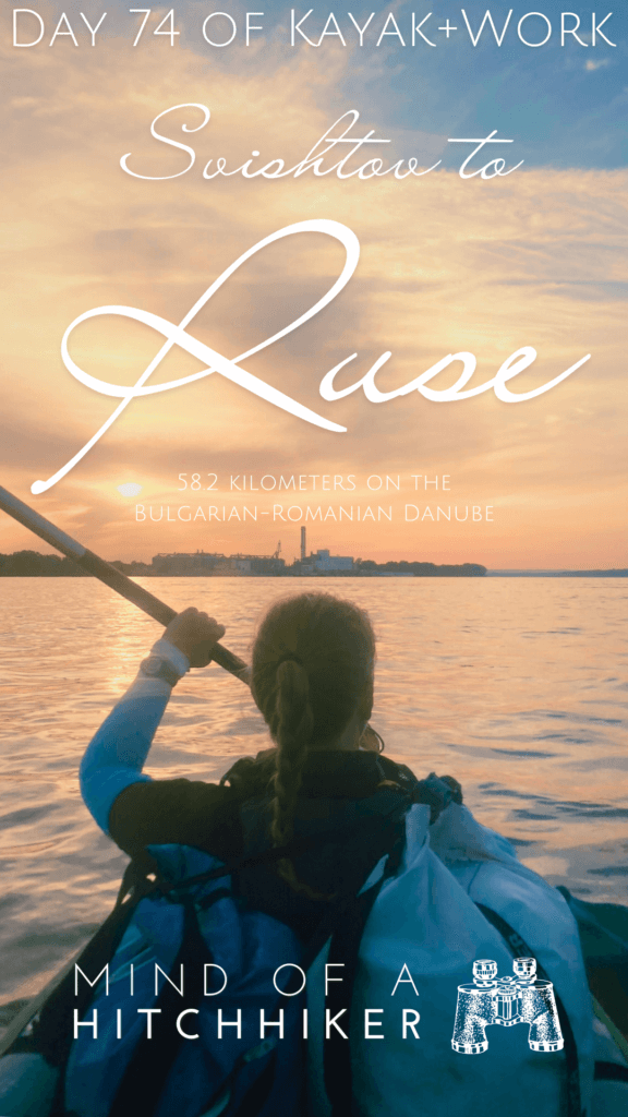
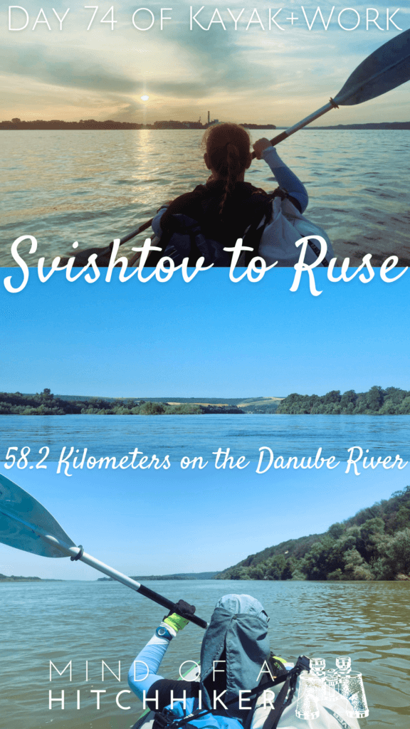
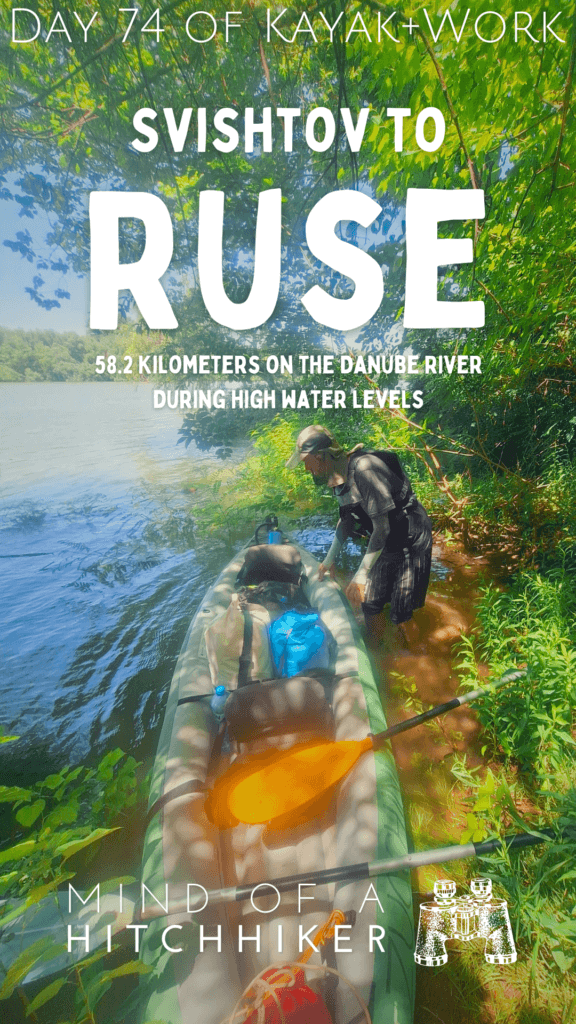
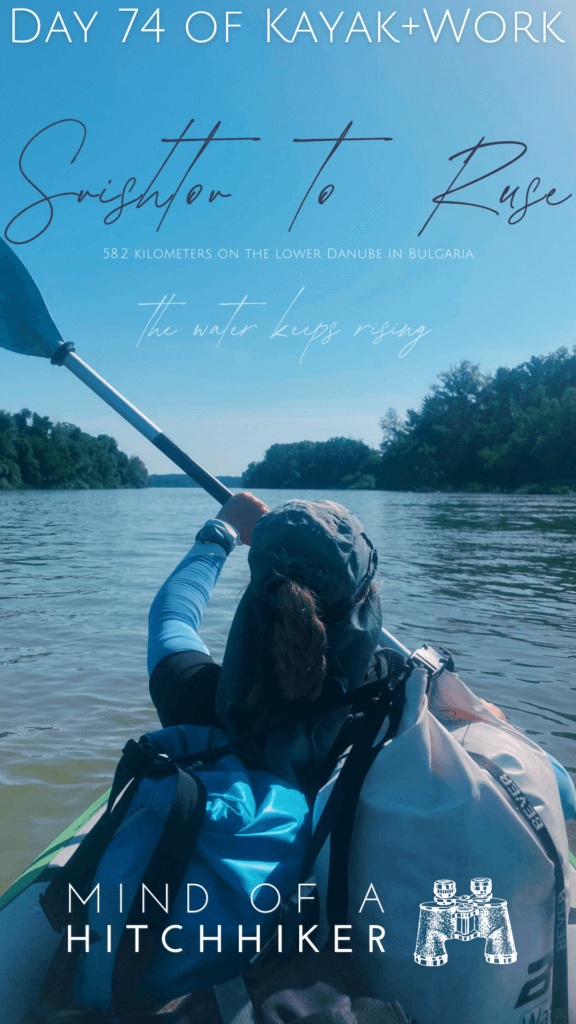
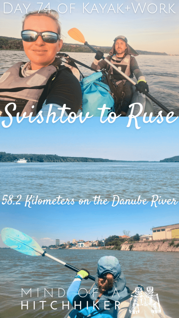
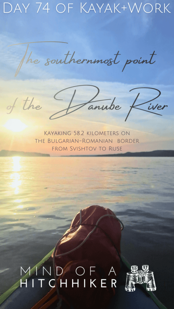
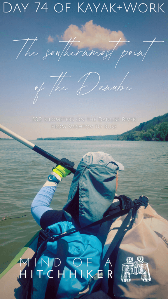
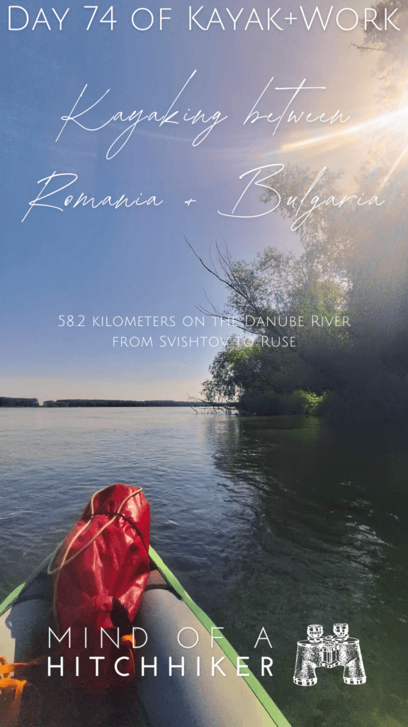
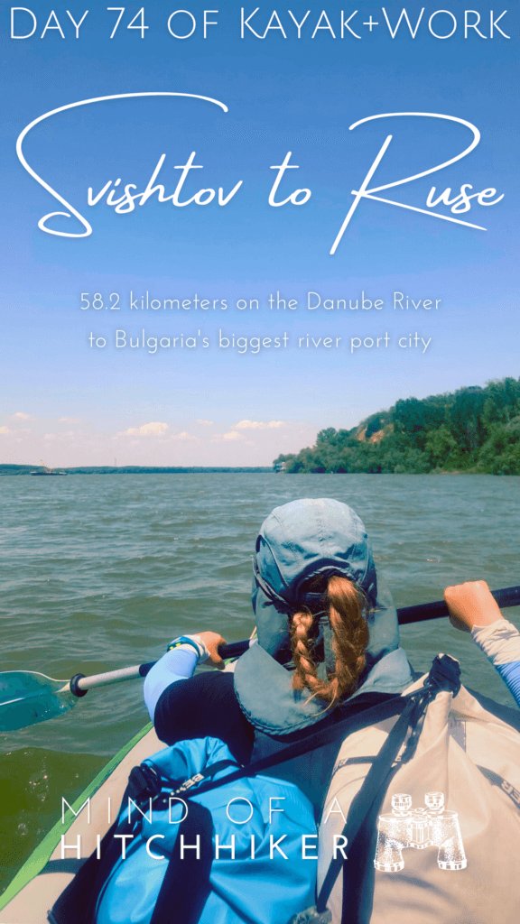
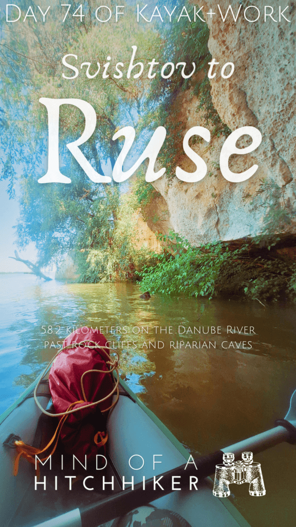
This paddle day happened on Monday the 24th of June, 2024. We kayaked from Svishtov to Ruse in northern Bulgaria. Nearby Svishtov is the southernmost point of the Danube River. In Bulgaria’s fifth-largest city Ruse, we’ll take more than a week to recover from all the paddling.
Want to travel the (entire) Danube River in an adventurous way? Join our Facebook group Danube River Source to Sea: Kayak / Canoe / Bike / Hike / Sail to find your community
Contents
- 1 Departing Svishtov for Ruse
- 2 Southernmost Point of the Danube + Vardim Island
- 3 Headwind + Batin Island
- 4 Dikili Tash Significant Rock
- 5 Cliffs, Caves, and Islands Before Ruse
- 6 Arriving in Ruse
- 7 Ten Days of Rest in Ruse
- 8 Helpful article? Consider buying me a craft beer!
- 9 Feel free to share this post with your buddies
Departing Svishtov for Ruse
I felt like I’d slept pretty well when my alarm went off at 4:38. Getting dressed was a bit more of a hassle than anticipated, but I was almost ready when Jonas’ alarm went off at 5:00 and it was his turn to occupy the bathroom. I just had to slap on some sunscreen and finish packing while he was getting ready.
By 5:30, we were out of the room and struggling to fit all of us and our luggage in the elevator. Downstairs, the door to reception was locked and – as expected – no one was there. Jonas hung the room key on a door handle and we left this place. So far, I’ve noticed that Bulgarian hotels are really good at making a first impression, and then rather quickly drop the ball. We left the building and began the long walk down the hill to the Danube.
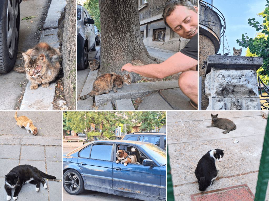
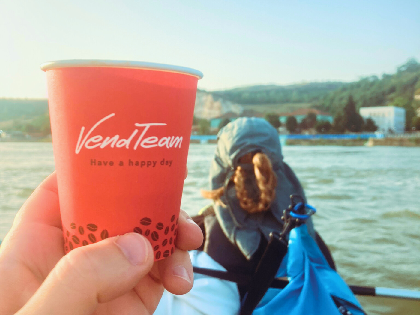
On the way, we passed some people who were out very early. A woman crossed the street from her house to go to the nearest coffee vending machine. We shortly thought about doing the same, but it’s still a long walk to be carrying a liquid in an open container. We also encountered the first cats at morning cat hour, but one was busy hunting a rodent and the others were too scared.
The same dogs on a chain barked at us as we made the final approach. The black cat that we’d met when we arrived in Svishtov was also present. But we look so intimidating with our big luggage. It’s not very cat-friendly.
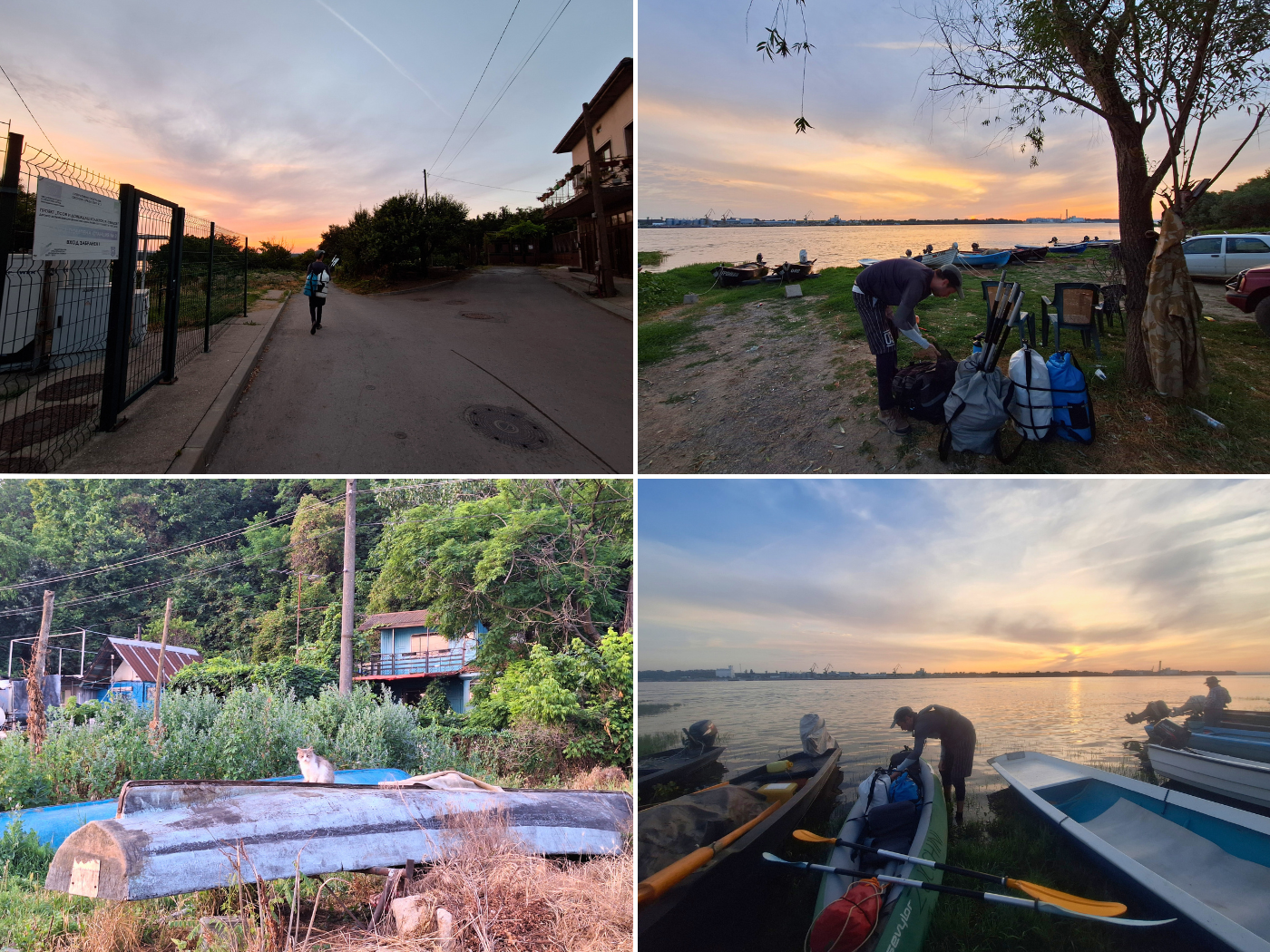
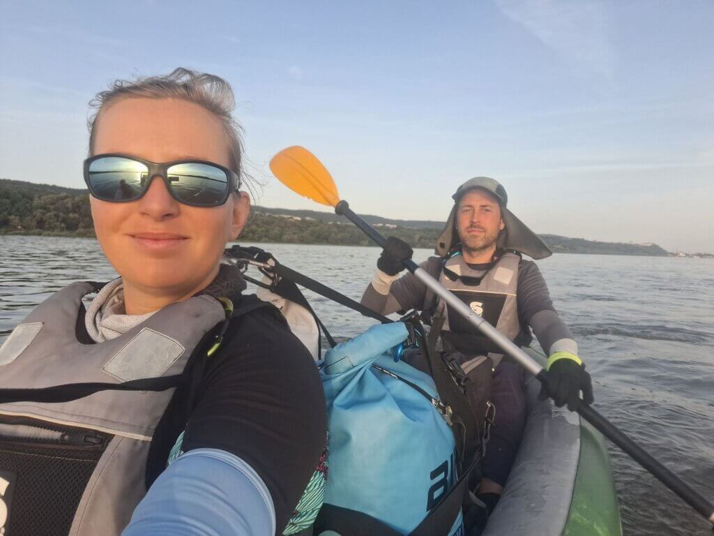
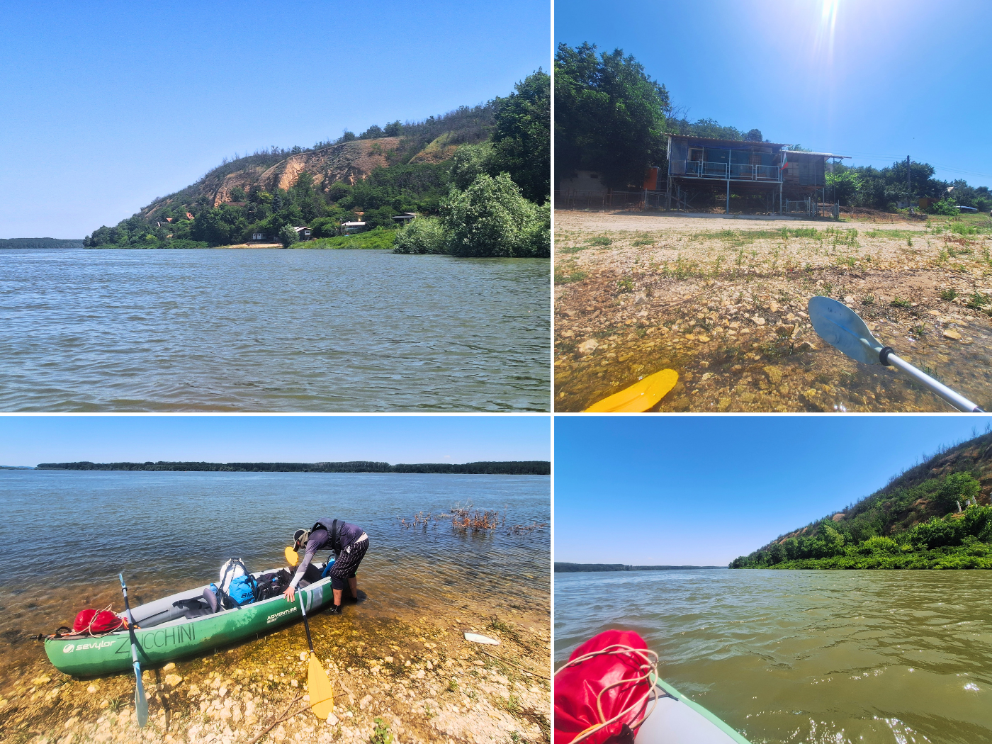
At the fisherman’s port of Svishtov, we weren’t the only ones. A man and his dog were getting ready to motor out onto the water, and two other guys were still prepping the boat. Another man arrived with just a fishing rod and began fishing from the shore as we inflated Zucchini.
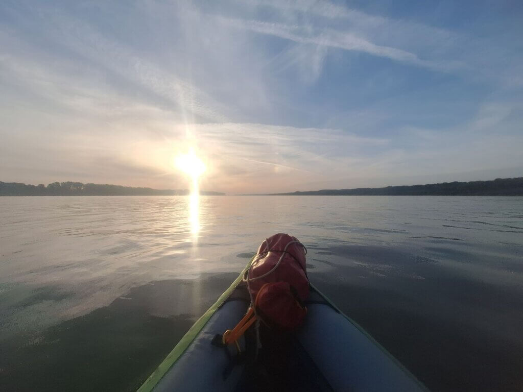
The sun rose above Zimnicea in Romania, followed by the mosquitoes and other bugs. One flew directly into my eye and might still be stuck there, embalmed in my lacrimal fluid, today. One day, I hope we’ll get up early enough to set sail before sunrise, so we may be out on the water before they awaken.
A few more cats came out, who were all too shy. Time to get going to Ruse. As we put Zucchini in the water, the man with the fishing rod asked us where we’re from, guessing “Ungariya? Avstriya? Rumuniya?” I answered his question with “Holandiya” and “Germaniya”. He wished us a pleasant trip.
Starting time: 6:14.
Southernmost Point of the Danube + Vardim Island
Jonas made his first short vlog while I was paddling outward and into the current. The headwind was immediately noticeable, though it wasn’t wavy. No ships, to my surprise. It was so busy in the Svishtov-Zimnicea area when we arrived.

Our first big deal of the day was paddling past the southernmost point of the Danube at 6:37. A major turnaround point!
On the main arm of the Danube, it’s near the Monument Park (Парк Паметниците) of Svishtov. That’s also where the TID camps. The monument at the mouth of the Tekir Dere River we could see from the Danube was the tall arch dedicated to the liberation of Bulgaria in 1877 during the russo-Turkish war, of which Svishtov was the first town to be liberated.
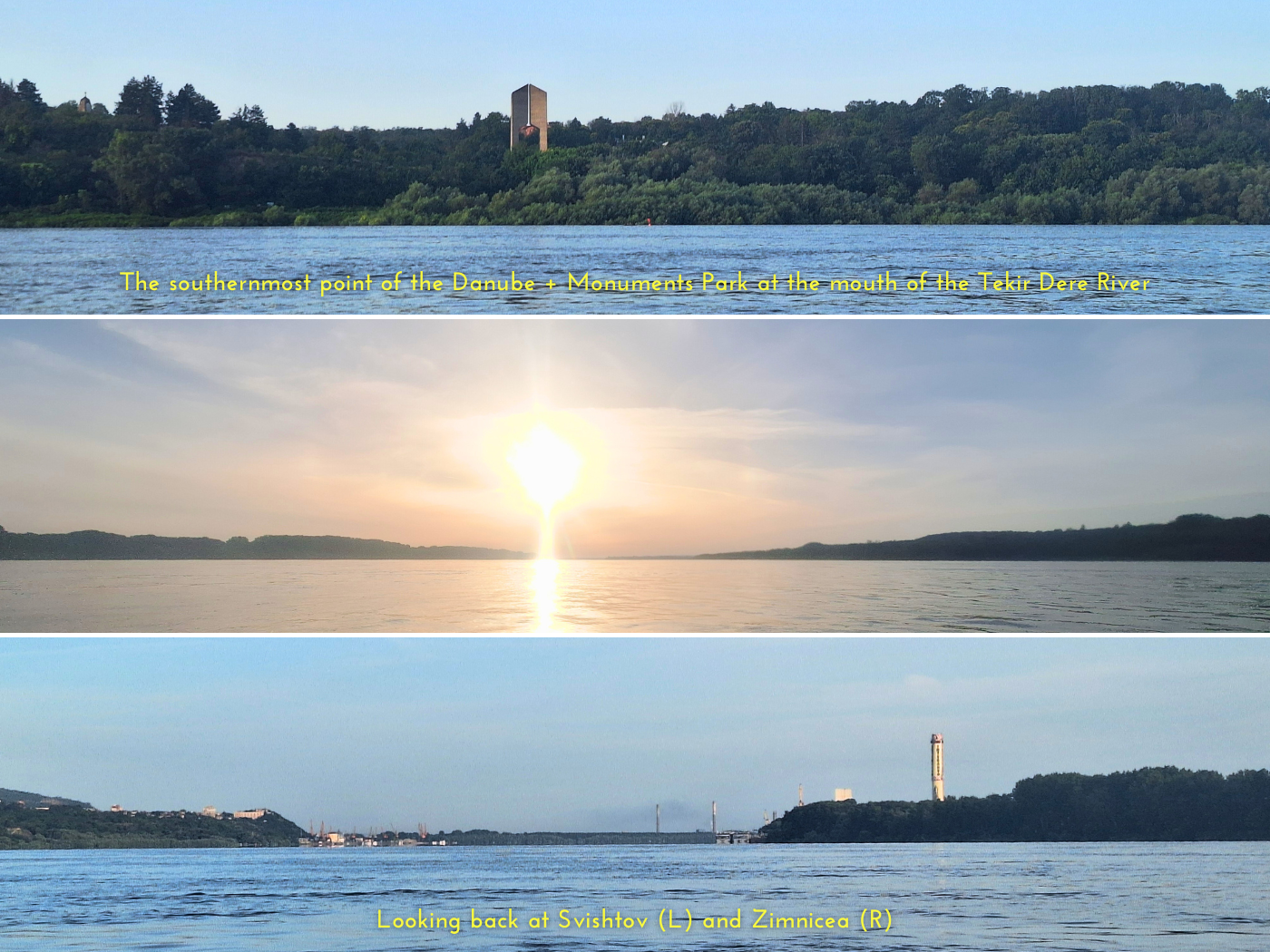
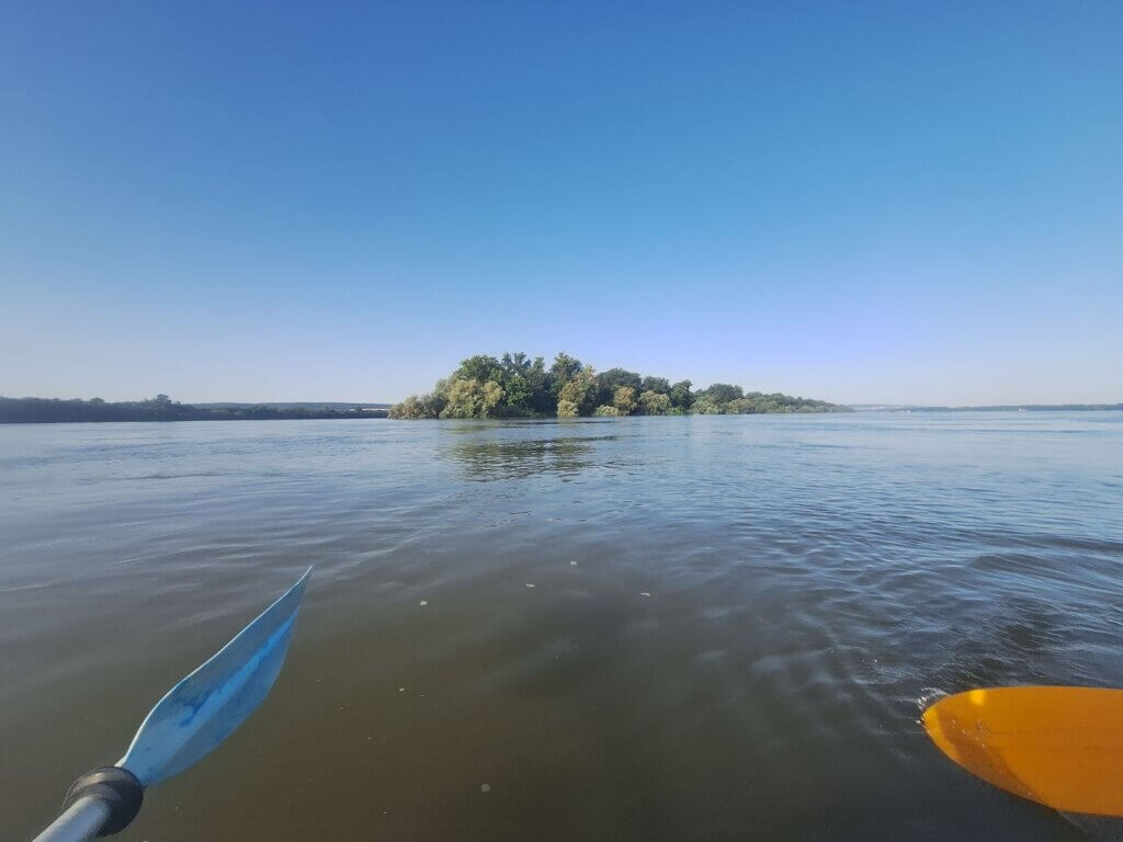
In reality, the southernmost point of the Danube is on a side branch around Vardim Island here (43.612745132898006, 25.477420624861324). Though I offered Jonas the option to paddle the 1.2 kilometers extra to be ~300 meters more south on this trip, he didn’t want to do it and would rather stay in the main. I’m not sure if it would have been worth it, as it seems like the side arm at the village of Vardim also has some industrial nonsense going on, besides being the launch spot of birdwatching kayaking trips to Vardim Island, which is a protected habitat.
On the opposite end, this reminded me of our time kayaking in Regensburg, which is the northernmost point of the Danube. I see that I wrote “We finally passed the northernmost bend in the Danube in Regensburg…” (emphasis mine) which in hindsight seems a bit dramatic; that was day 16 of the Danube kayak trip. We’re now at day 74. There’s 58 days and more than 1800 kilometers between them. I thought getting from Donaueschingen to Regensburg took a long time. That was just a warmup.
Sometimes it feels that this trip is “bite off more than I can chew” territory. But every single kayak day, I do check-in with myself and ask if doing this makes me happy. And almost all days, the answer is a resounding yes.
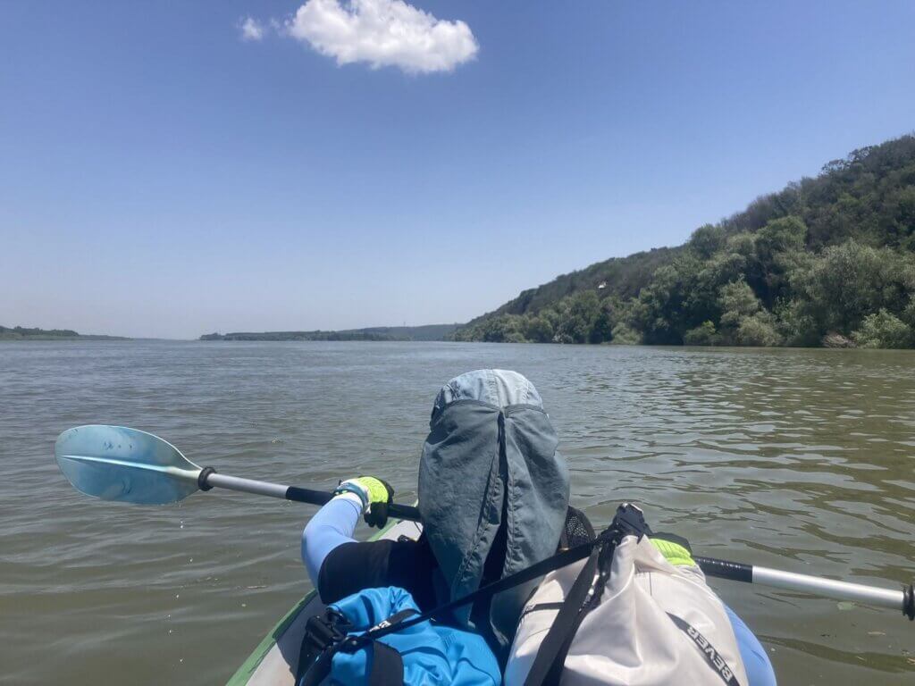
Jonas made another short video and we began our slight change in direction. From now on, we’ll paddle mostly northeast.
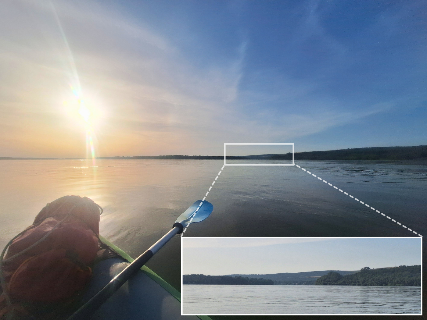
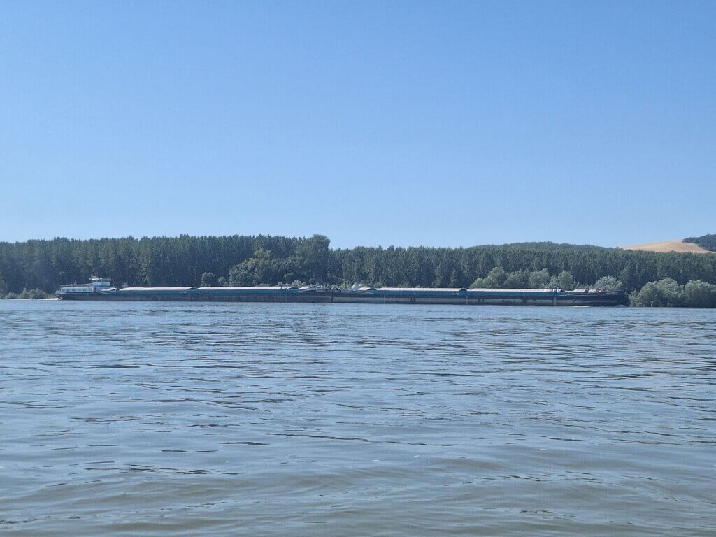
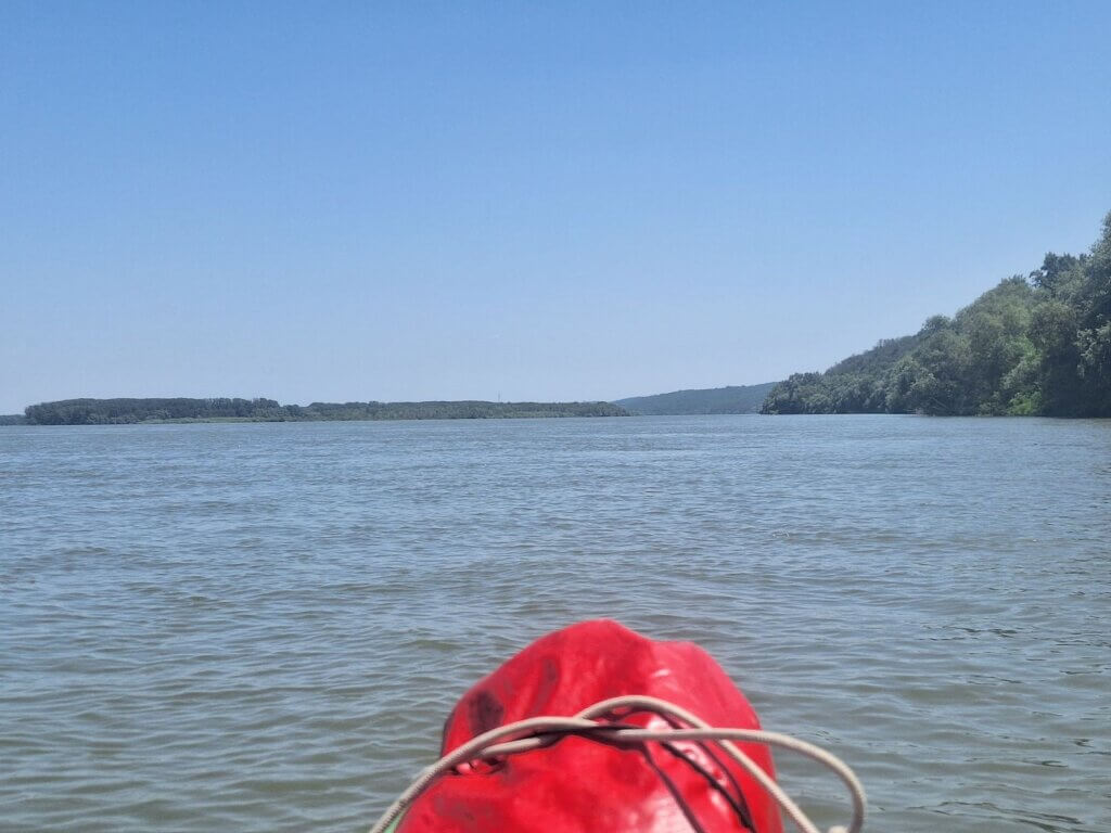
At 7:00, we were at the fork around Vardim Island. The current didn’t drag us into the southernmost arm. To our left across the river were some cargo ships that were just getting their day started. They were going upstream at such a slow pace. This is what the Vardim Branch looks like if you are skipping it like us:
At the end of Vardim Island was a dredging ship. As we got closer, we could see that there’s an entire caravan on it. It looked kind of funny.

At 7:48, we could see into the other end of the southernmost arm. With that curiosity satisfied, it was time to try to get ahead of today’s kayaking journey to hopefully beat when the headwind is scheduled to pick up.
Headwind + Batin Island
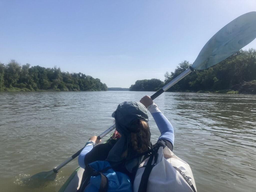
We tried to shortcut the left bend a little by going closer to the Romanian side, but it didn’t work out. The headwind picked up strongly and there were some waves. We were two hours in when we were beyond Gâsca Island in Romania. I checked how much we’d paddled: about 16.5 kilometers. So we’re still going relatively strong at above 8km/h. Good to know.
I missed the river mouth of the Yantra River, which is the third-longest river that flows only through Bulgaria. It interests me because it also flows through Veliko Tarnovo in a way that reminds me of the way the Aare flows through Bern. At least, that’s the vibe I’m getting from the map. I haven’t been to Veliko Tarnovo (yet), which was the capital of the Second Bulgarian Empire.
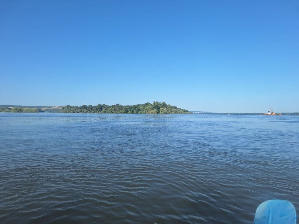
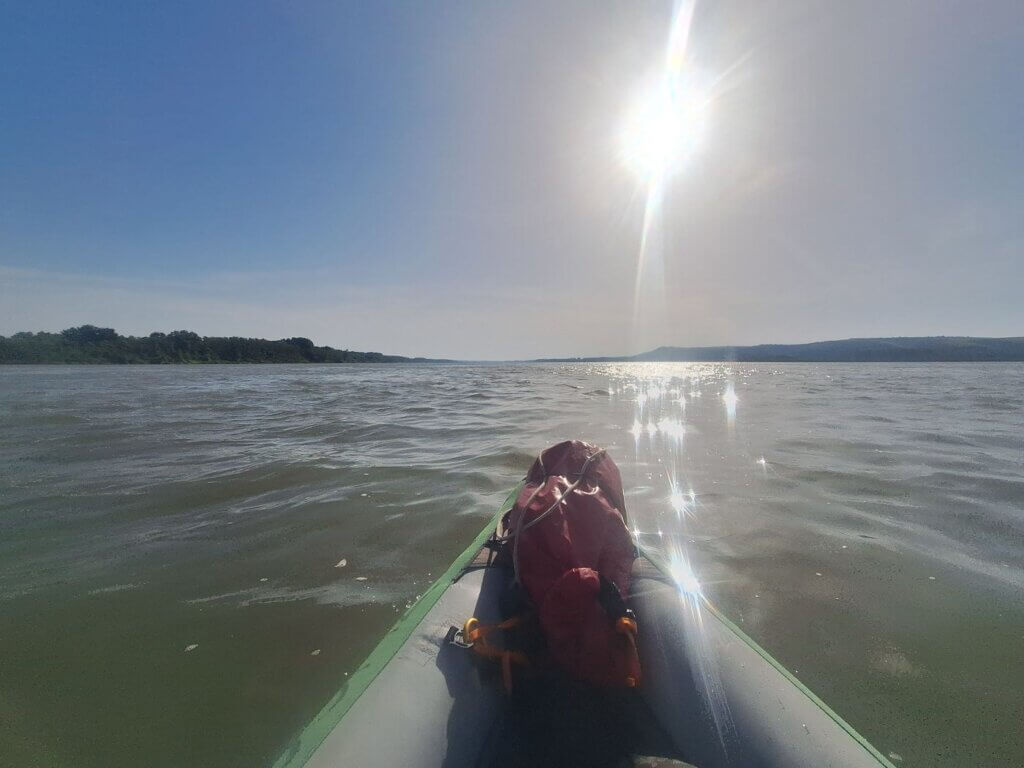
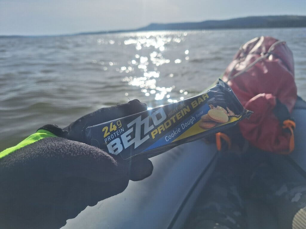
When we spotted Batin Island, we decided to slowly cross back to the Bulgarian side. Jonas gave me my morning protein bar, which was the biggest protein bar we’ve had to date. Supposedly, it was cookie dough flavor, but it didn’t taste like that at all. Also, it was just too big for our morning appetite and quite crumbly, which is hell for keeping the kayak clean. A disappointment. Behind Batin Island is a 160-meter tall hill with the invisible ruins of a fortress (Антична крепост “Градъта”) that was a pleasant point to orientate.
When approaching the head of Batin Island, we were still in the shipping lane. Jonas looked on the map and suggested we’d try to paddle between Batin Island and Deutschov Island (Дойчов остров). As we worked to paddle between the two islands, we noticed the current really didn’t want us to take that route. But we were too close now and I thought I saw a landing spot on Batin Island not far from us. So we both wasted quite some energy to still pass through the narrow channel. And the landing spot didn’t pay off as it wasn’t landable.
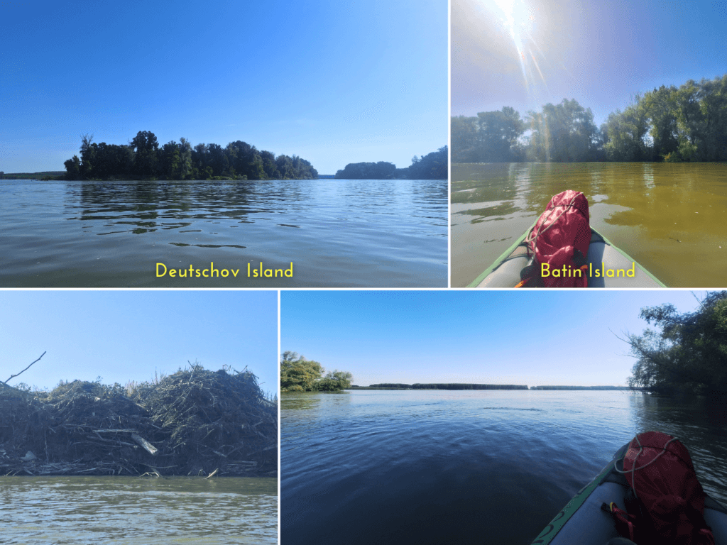
Batin Island is a little interesting. On my map, it shows roads, but no permanent ferry connection between them. It’s apparently mostly farm land, but also has a luxury hunting lodge.
Once past the protected Deutschov Island, we kept looking for landing spots on Batin. I promised myself not to complain about the lack of landing spots, which we only need 2 – 4 times per kayaking day. The high waters and strong currents benefit us more than ample landing spots ever could.
I eventually spotted something on Batin. We had to plow through some small bushes, but it revealed a nice sandy beach. Our break lasted from 9:51 till 10:02.
By 10:32, we were at the tail end of Batin Island and could focus our efforts on getting to Dikili Tash.
Dikili Tash Significant Rock
I had trouble keeping awake. I thought I’d slept well, what is this? Jonas was feeling similar, so I tried to start a conversation with him to keep awake. It worked well enough for the 10 kilometers between our landing spot in Batin and our next landing spot at Dikili Tash beach, down the cliffs from a Bulgarian village called Mechka.

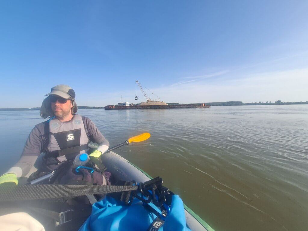
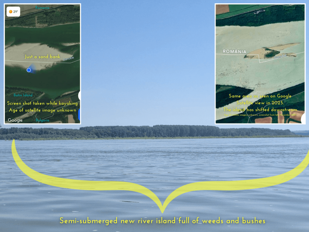
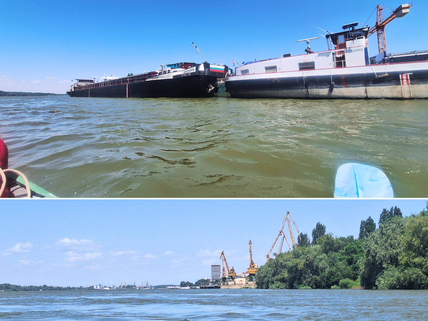
We wanted to slowly cross over to the right of the river, but a cargo ship named Anaconda was coming upstream. The next day, I looked up where it came from (Cernavodă) and where it was now (between Kozludoy and Lom). There was also an unmapped river island that was mostly grass and bushes in real life. On satellite view, it was just sand, so it’s been a few years since the satellite image was taken and today when its pioneer species are trying to become permanent residents.
Once the cargo ship had gone, we paddled into the middle of the shipping lane. We were quite comfortable there until I asked Jonas if there was any traffic and he said a small boat was lurking behind us. It took them forever to get to our position. It was a medium-sized motor vessel, comfortable enough to live in permanently, but neither a ‘super yacht’ nor built for speed and douchebaggery. Something you’d see on the canals in the Netherlands, frankly. Actually quite intriguing to see something like that here, and definitely the first of its kind I’ve seen in 2024, or even on the entire Danube.

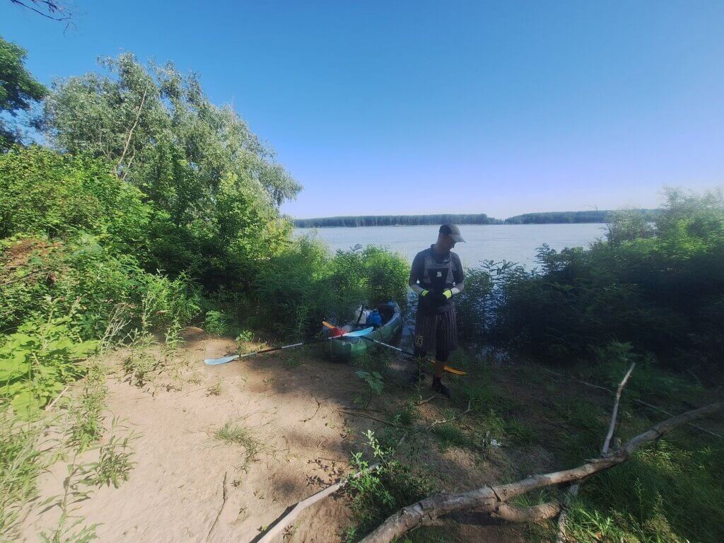
Meanwhile, we’d moved out of the way to the right, because a tourist attraction was nearby and I wanted to land there and check it out. Giving Zucchini a squeeze, we also knew it was time to let some air out.
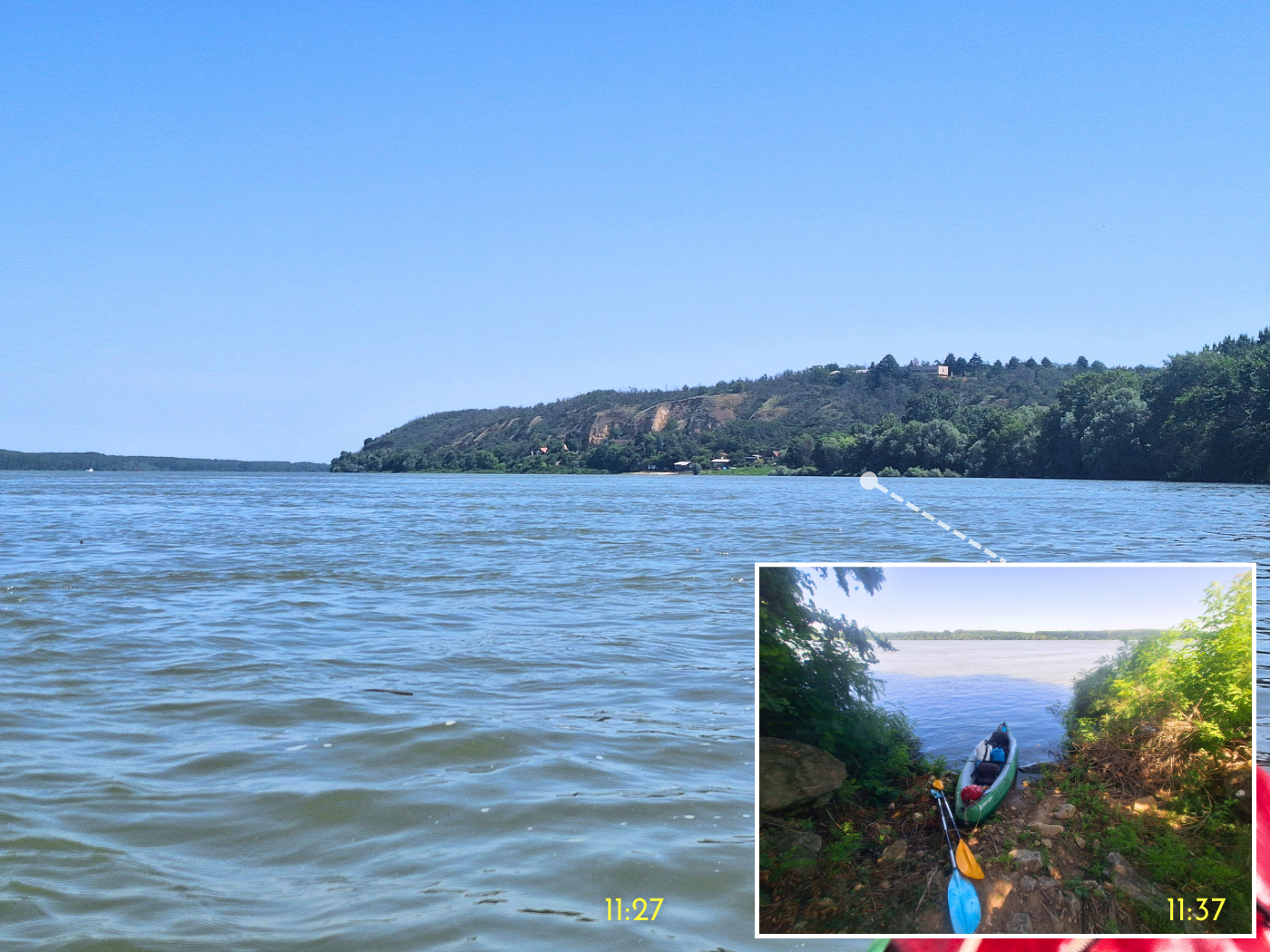
I navigated by GPS to get close to the first ‘remarkable stone’ mapped on OSM. There was a landing spot some 50 meters away from it, but there was a small caravan nearby. Well, if nobody’s home, they won’t care. And if they are home, it will only be about 10 minutes. We landed at 11:36.
Jonas walked up first and came back saying “I found the significant stone”. The whole remarkable stone/significant rock has been a bit of a running gag between us whenever something is mapped as such on OSM (more often than you think). This one is mapped as natural phenomenon “Dikili tash” (Дикили таш).
I went up as well and walked around the geomorphological feature that’s apparently 12 meters tall. It does have a funny shape. I was also looking around to see if this campsite area has a restaurant, or perhaps just a coffee machine where we can get a mean cup for 50 Lev. Dikili Taš or Dikilitaş, means upright stone in Turkish, and this is not the only one in Bulgaria (I’ve found three sites also named Dikili tash). There are various legends attached to it, including one about Krali Marko where he lifts the stone on his little finger, and one where it was used by the Romans as either a watch tower or a part of a Danube-crossing bridge.
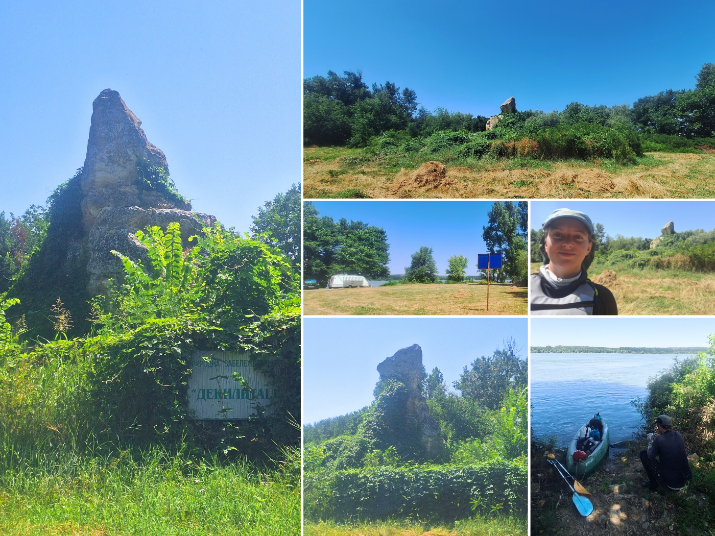
The entire area is surrounded by a fence, presumably to stop people from climbing it. Inside the fence it’s completely overgrown with stuff. There’s also another significant rock nearby that has no name as far as I know.
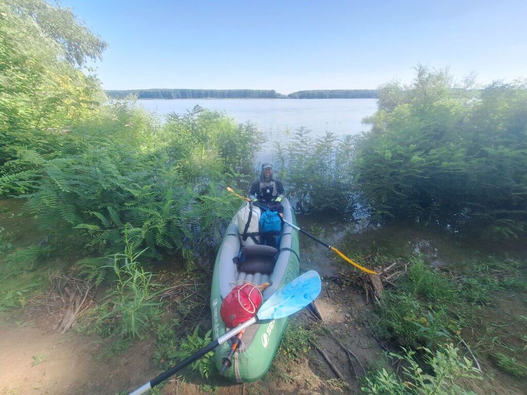
I returned to Jonas and suggested to eat a sandwich. Our daily snake-sighting happened here as it arrived seemingly out of nowhere. The one-meter noodle just ssssslipped away to some trees. Jonas said it’s better to eat in the boat. He hadn’t found the opportunity to let some air out of our boat and he suggested we’d do that at the beachy landing spot a few hundred meters downstream.
When we landed further downstream, there was a dog under a stilt house/caravan contraption. He had an ear tag that implies that he’s a street dog and sterilized. I was afraid he’d come to us at first, but he didn’t and we could let the air out in peace. I suggested to Jonas to switch places in the kayak, but he didn’t want to.
Before noon, we continued paddling.
Cliffs, Caves, and Islands Before Ruse
The current felt quite good in this immediate area beyond the TID camp site at Dikili Tash. I was paddling while Jonas grabbed his cheesy bread thing and ate it. A few minutes later, it was my turn to eat a Perlenka (Пърленка). It was oily, rather dry, and there wasn’t enough cheese to make me happy. It was almost impossible to get through it, and I gave the last bites to Jonas, who tolerated it better. So sad that not a single decent shop was open in Svishtov the day before.

These next kilometers were a long slow turn to the right, past a small Bulgarian port with fairly fancy holiday homes. The accumulation of bad food and little visual stimulation made me rather sleepy. And when I was fighting the sleepiness really hard and discussed things with Jonas like the mark we should aim for and agree on, it made me a little crabby. And this headwind was picking up.
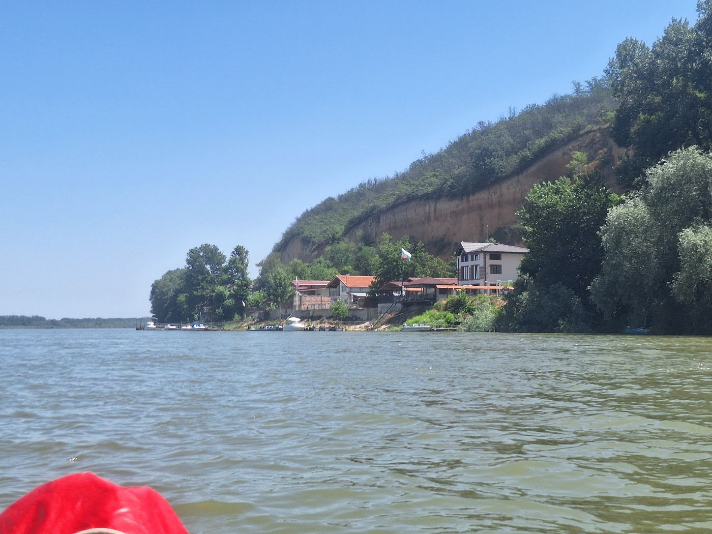
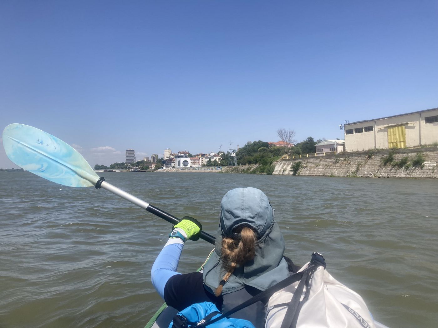
We were well over halfway by now, but still quite far from Ruse. But then I saw a tall needle in the distance, Ruse TV Tower! Unfortunately, the observation deck has been closed for visitors since 2010. But still, the end of our trip and our nine-day rushing journey from Vidin to Ruse is coming to an end.
 I promise Ruse TV tower is in this picture (12:19)
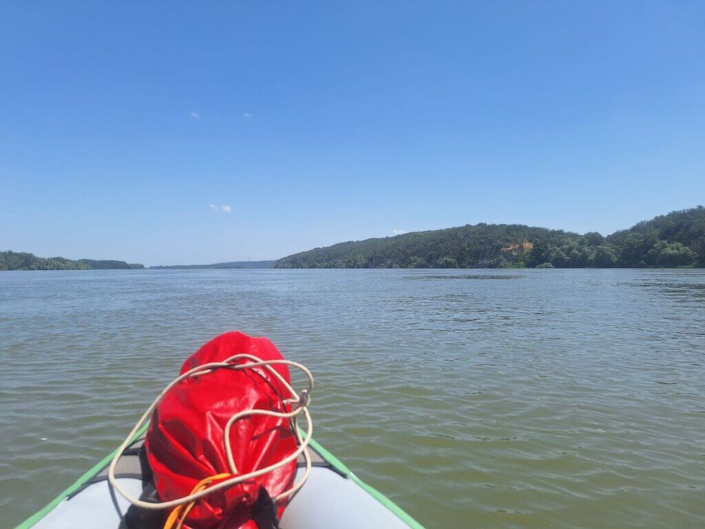 Ruse TV tower again and some cliffs. Ostrovul Cama to our left (12:54)
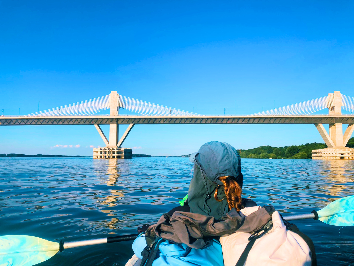
We passed around the Romanian island of Cama on the right, though the shipping lane passes it on the left. This implies that the thalweg used to decide on the border between Romania and Bulgaria used to pass on the right. It appears to have silted up and now the shipping lane passes between Romania and a Romanian island. I wanted to pass on the right so we don’t have to deal with ships. The water is deep enough right now and Ostrovul Cama isn’t as big as satellite view implies at the moment. We paddled past this Romanian island and saw a red buoy to guide the shipping lane around several Romanian and Bulgarian Danube islands.

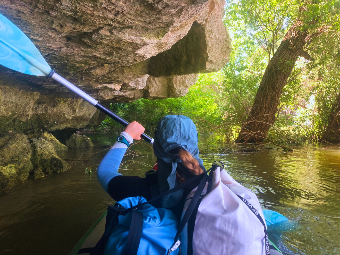
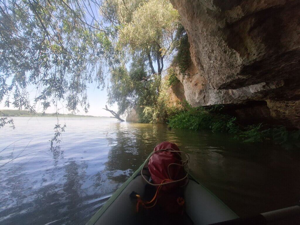
Cliffs appeared to our right, which I hadn’t expected. Some of it at the water’s edge also looked like cave entrances. Intriguing!
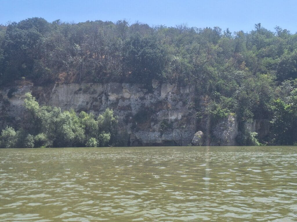

Jonas asked me if I wanted to visit a cave and I didn’t hesitate. We paddled closer to shore and found the cliff edge covered by drowned trees. I found an entrance and soon we were inside a little shelf cave. Jonas didn’t expect this to be big enough to house us, but it was.
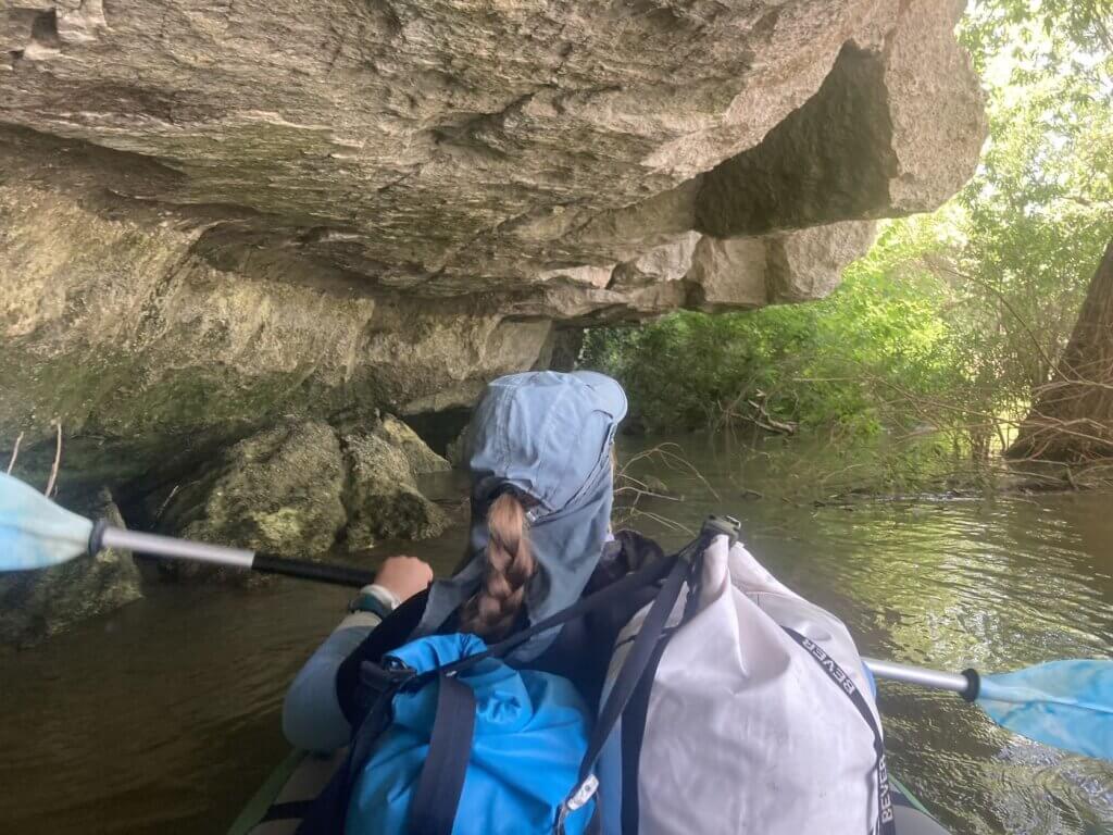
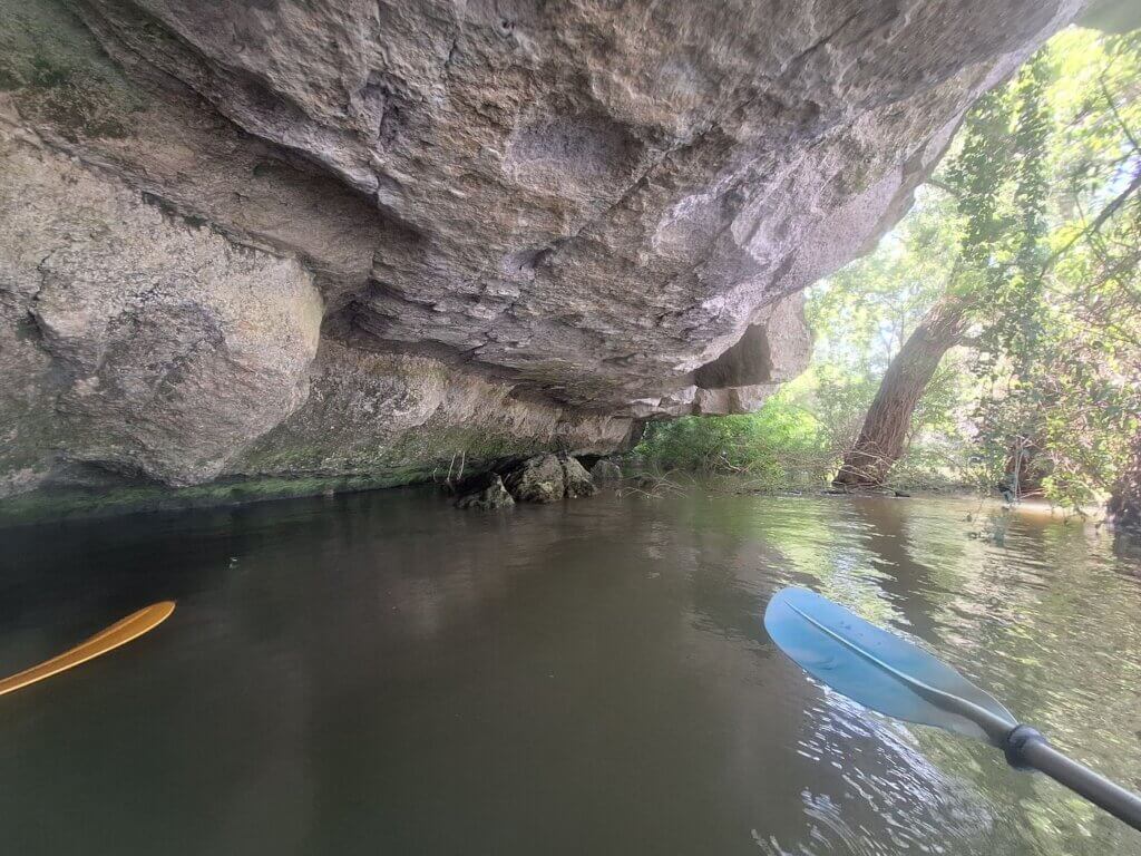

We spent a good 10 minutes there chilling in the shadow and taking photos before we continued paddling to Ruse.

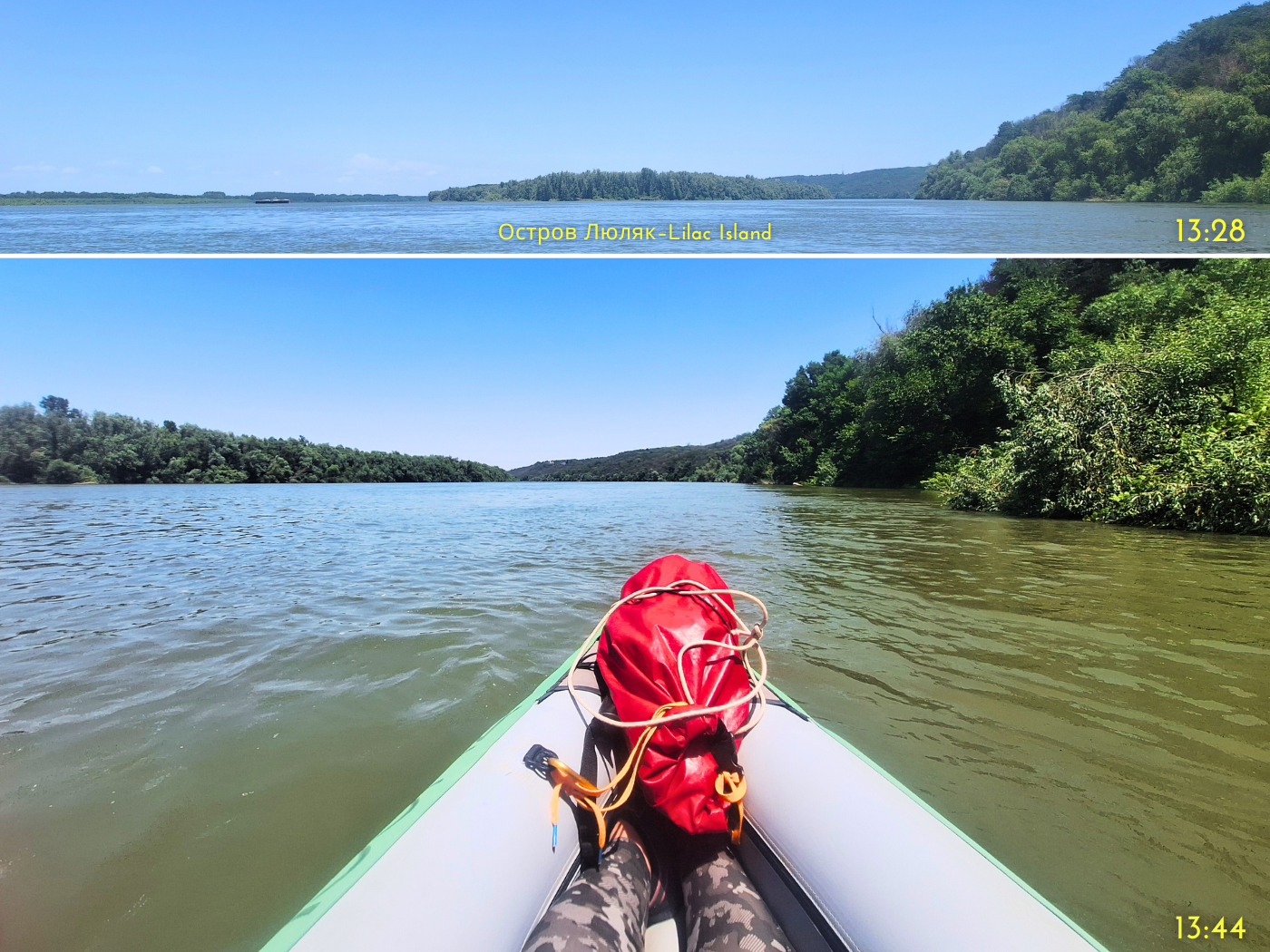
Next up, we paddled past the red buoy while a ship was coming upstream. It was nice to be fully outside of the shipping lane. The ship and us went our separate ways around the next island, the Bulgarian island called Lyulyak (Люляк), meaning Lilac.
In this otherwise calm channel, the headwind was very much focused. We paddled close to the mainland shore in search of a landing spot to pee since we were now less than 10 kilometers away from Ruse. But with the continuous cliffs and high water levels, there wasn’t anything to choose from. I know I’ll regret writing this, but I miss the beachiness of lower water levels sometimes. It was very frustrating that we couldn’t enjoy this natural area because of our call of nature.
After half an hour of paddling and looking, we found something that barely worked. It wasn’t sandy, but muddy, so we made Zucchini quite dirty when hopping back into the boat.

Arriving in Ruse
It was now 14:05 and we were ready for the final push to Ruse. It’s crazy to think back about the last nine days, how we had a rhythm of basically a kayak day, followed by a resting day, followed by a kayak day… The repetition worked like a positive feedback loop; our intense kayaking days made us want to rest and write, and our rest and writing days spent mostly indoors made us want to go back and paddle more. There was no time for highs and lows like the intense low we’d felt the day after we went through Iron Gate I lock and the intense high we’d felt while doing it. Because we had no immediate need to process those feelings since we had many rest days afterward.
Each day has motivated us and the conditions have been sublime. Part of me wonders if it’s a mistake to spend 10 days in Ruse, but we do need a new kayak sail and we also really need rest. In the end, this rhythm is not sustainable. And I do feel a little sad that we haven’t seen much in all these lesser-visited towns in Bulgaria. But I also can’t wait for hotel life to be over and enjoy the comforts of an Airbnb.
Pros and Cons.
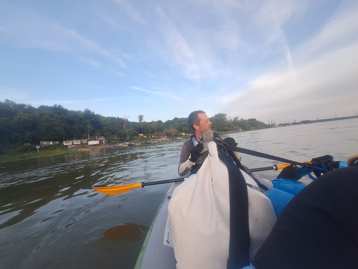
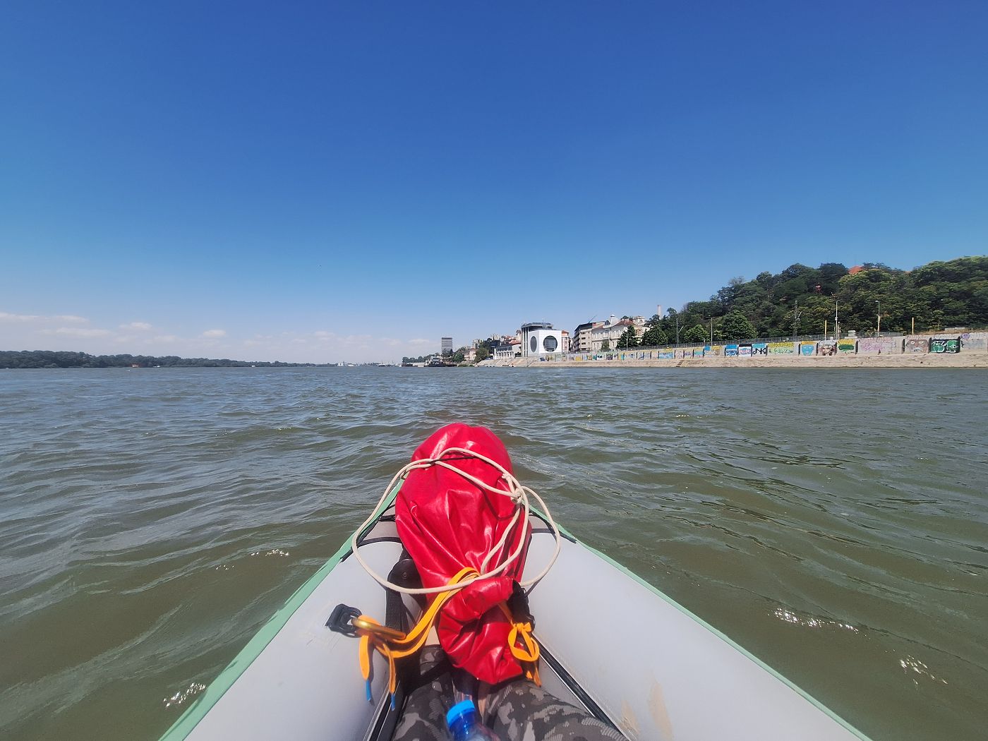
Slowly, signs of civilization started to appear to our right. An abandoned factory, followed by some fishing houses and a slipway. And then we spotted the cranes and silos of the port of Giurgiu in Romania across the river. We still had to paddle around a slight right bend and get beyond Lilac Island. We saw ships departing upstream, including a cruise ship. It was barely visible because of the disturbed water ahead of us.
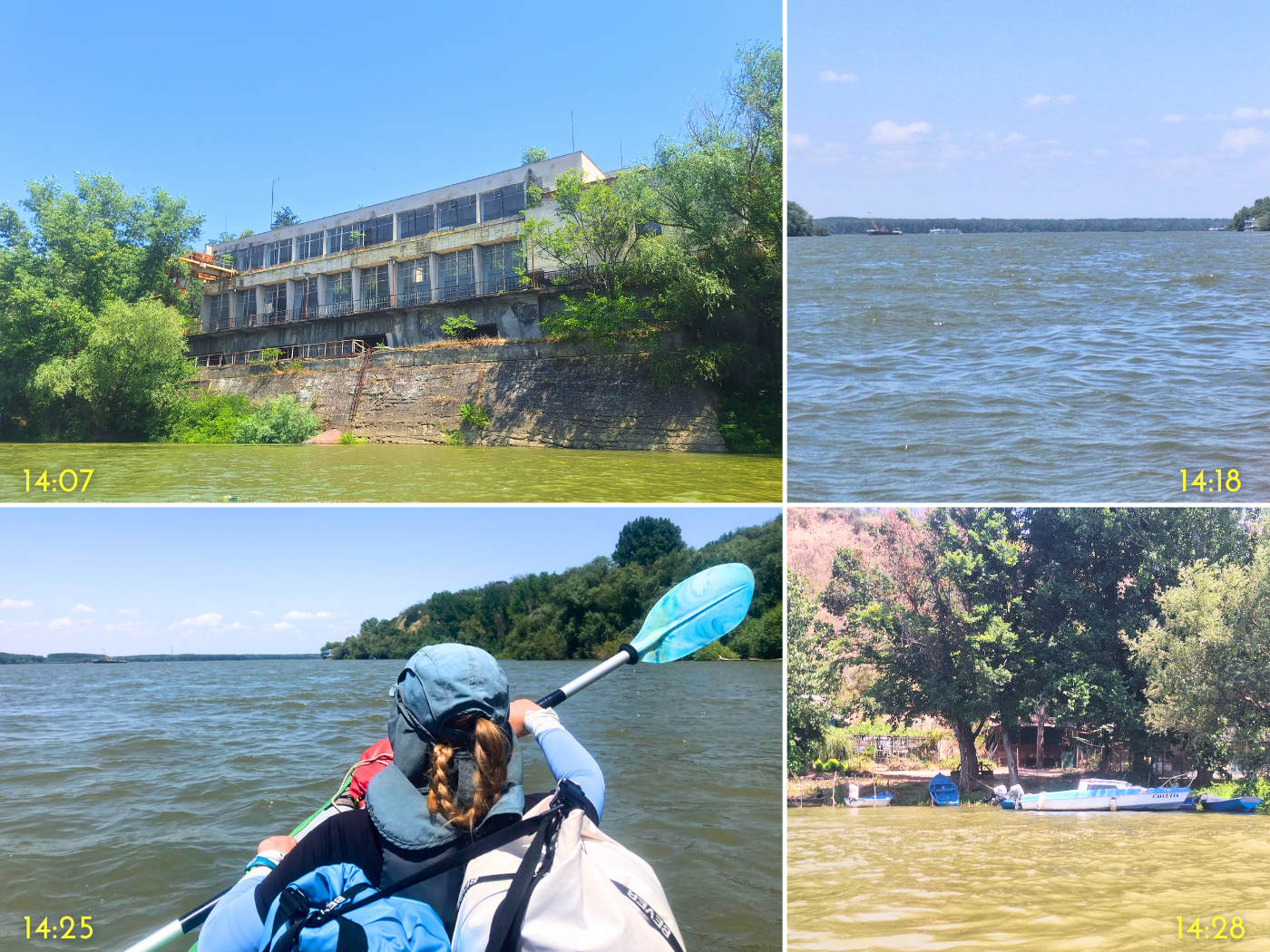
We paddled beyond the safety of the island channel and faced a strong headwind. The waves would actually splash up and make me wet. But the current was still strong—as long as we weren’t sideways, we’d make a speed of 3.5 kilometers per hour. But this wasn’t fun and we paddled closer to shore to be out of the high waves as much as possible.
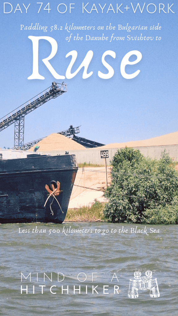
There was a port facility ahead of us with anchored barges to the left and mountains of sand on the shore. One ship moored at the shore was called “Inert 9”. That means it’s not gonna move, thankfully. I almost missed it in the heat of the moment, but behind some bushes at Inert 9, I spotted a kilometer sign.
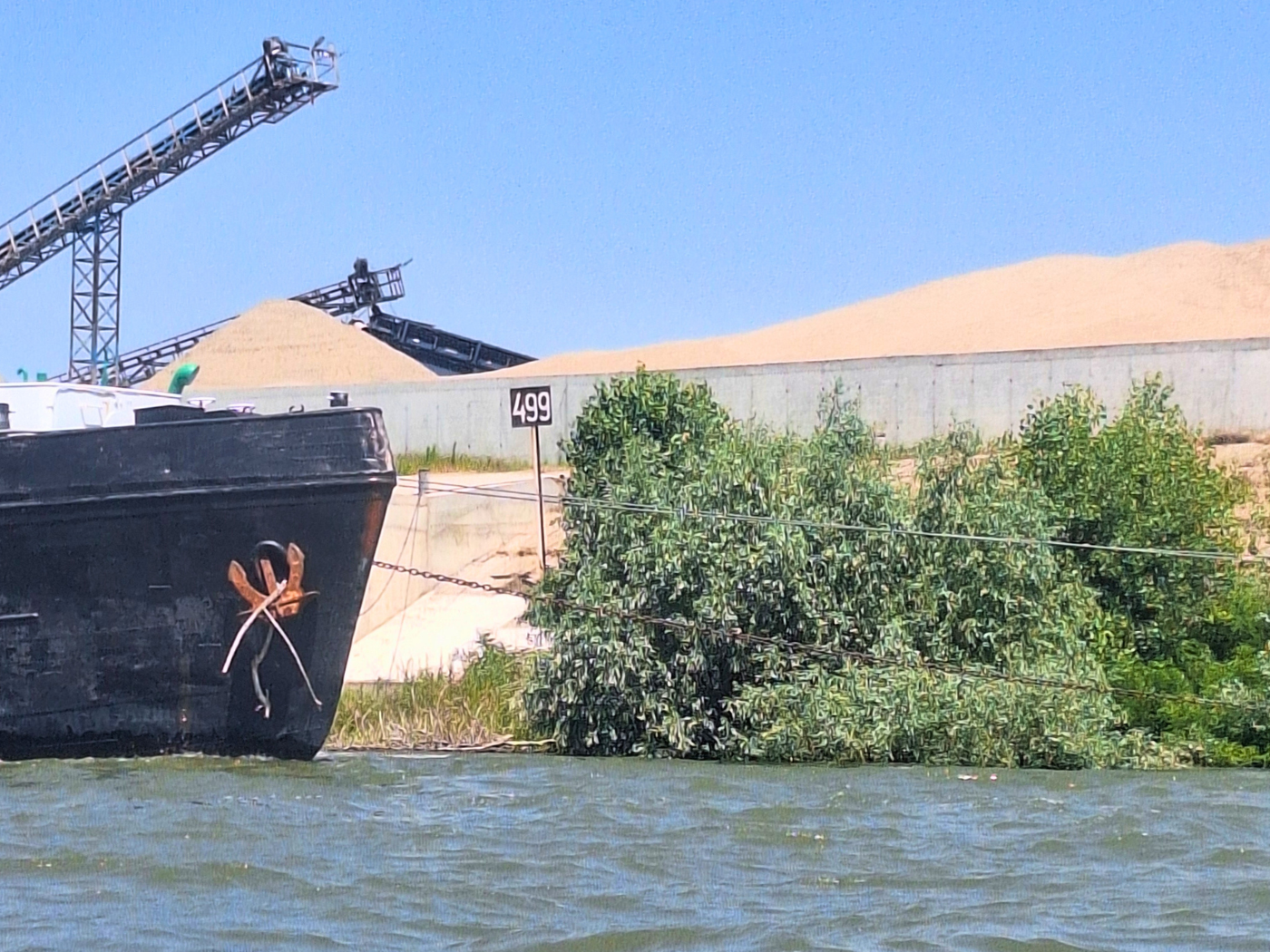
499
I was feeling lots of feelings. We are under 500 kilometers, Holy Shit.
But we had to keep the focus most of the time. That’s why I missed the confluence of the Rusenski Lom, which is the last ‘major’ right-hand tributary of the Danube. The wind and waves here were quite scary, though they weren’t as high as on the day from Belgrade to Grocka na Dunavu, or the day from Ram to Golubac. Perhaps I’ve grown unaccustomed to bouncing up and down over the waves and hitting them at awkward angles. And the yelling, christ, the yelling. We can’t hear each other otherwise.
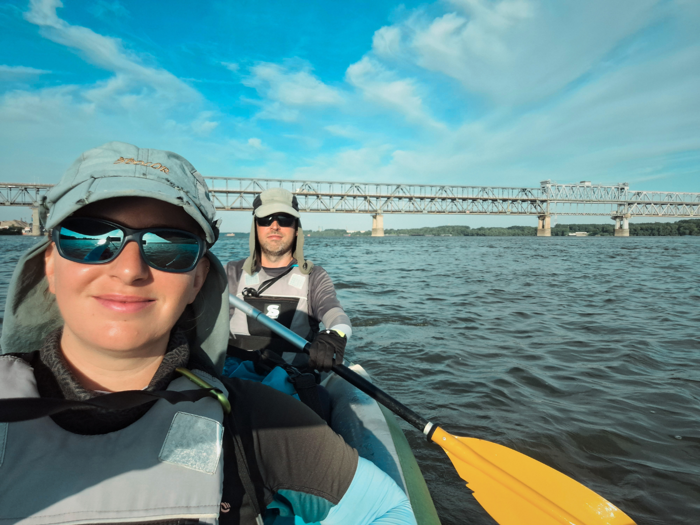
We passed some more berthed ships from Rubiships shipping company and others before we spotted the cranes of Ruse and the town. Part of me expected to see the rail and road bridge between Giurgiu and Ruse from here, but I couldn’t see it. It’s still very far away. Perhaps the water in the air blocked it. Or I just wasn’t paying attention.
It still took a long time to get to town, and I was very unsure of our landing spot. The TID GPX mapper has a stop in town, but I don’t think it’s landable at these high water levels. So I suggested Jonas we should land at the yacht club of Ruse, which is in the protected port. Walking from there to our self-check-in Airbnb is about the same distance as from his later landing spot.
But the yacht club didn’t look too inviting. Also, another alternative had popped up: Rechna Gara, the river port of Ruse, not to be confused with the Rechna Gara of Vidin. It also has a restaurant!
Jonas’ landing spot would require us to paddle out onto the more wind-affected area of the river to go around some moored landing ships and then quickly go behind them and land at some stairs. But I hadn’t done enough research into this and didn’t expect the conditions to be this scary. It was too late for research and time to land.
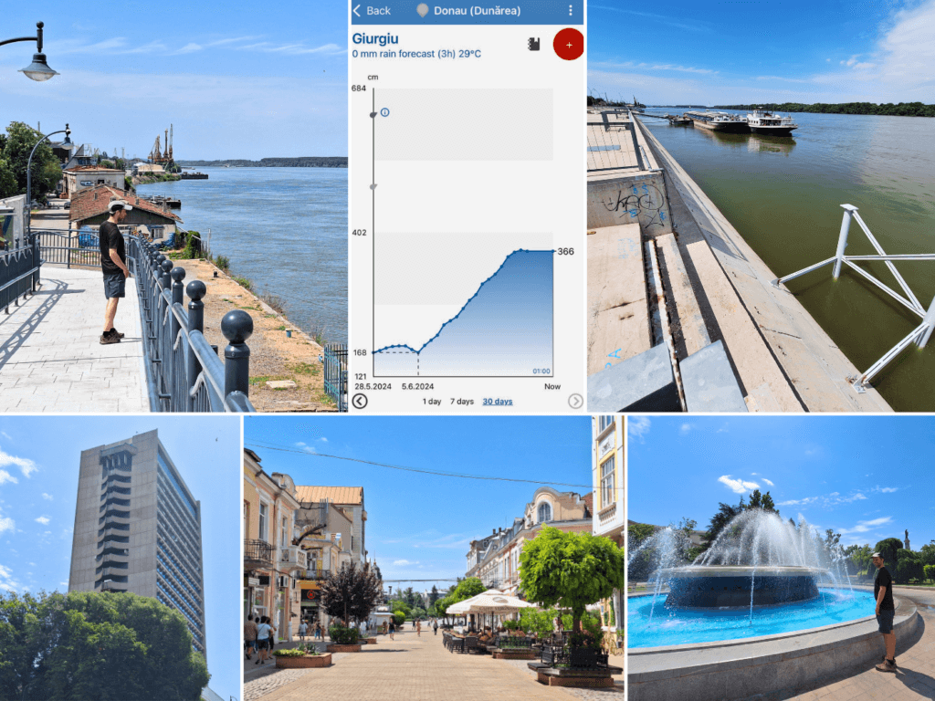
Eventually, we settled on some stairs that led out of the water at the old embankment instead of the shiny new embankment. We landed in Ruse at 15:18.
Though it looks a little decrepit, it was actually a pretty good arrival spot: wide stairs, shadow of a building to sit in, and sunshine for drying the boat. But there was of course some broken glass and rusty nails. Still, we managed to relax here and pack everything up before we walked to our Airbnb.

Now it’s time for rest. Next month we’ll paddle to Tutrakan and Silistra, the last towns on the Bulgarian Danube.
Ten Days of Rest in Ruse
This is how we spent our time in Ruse:
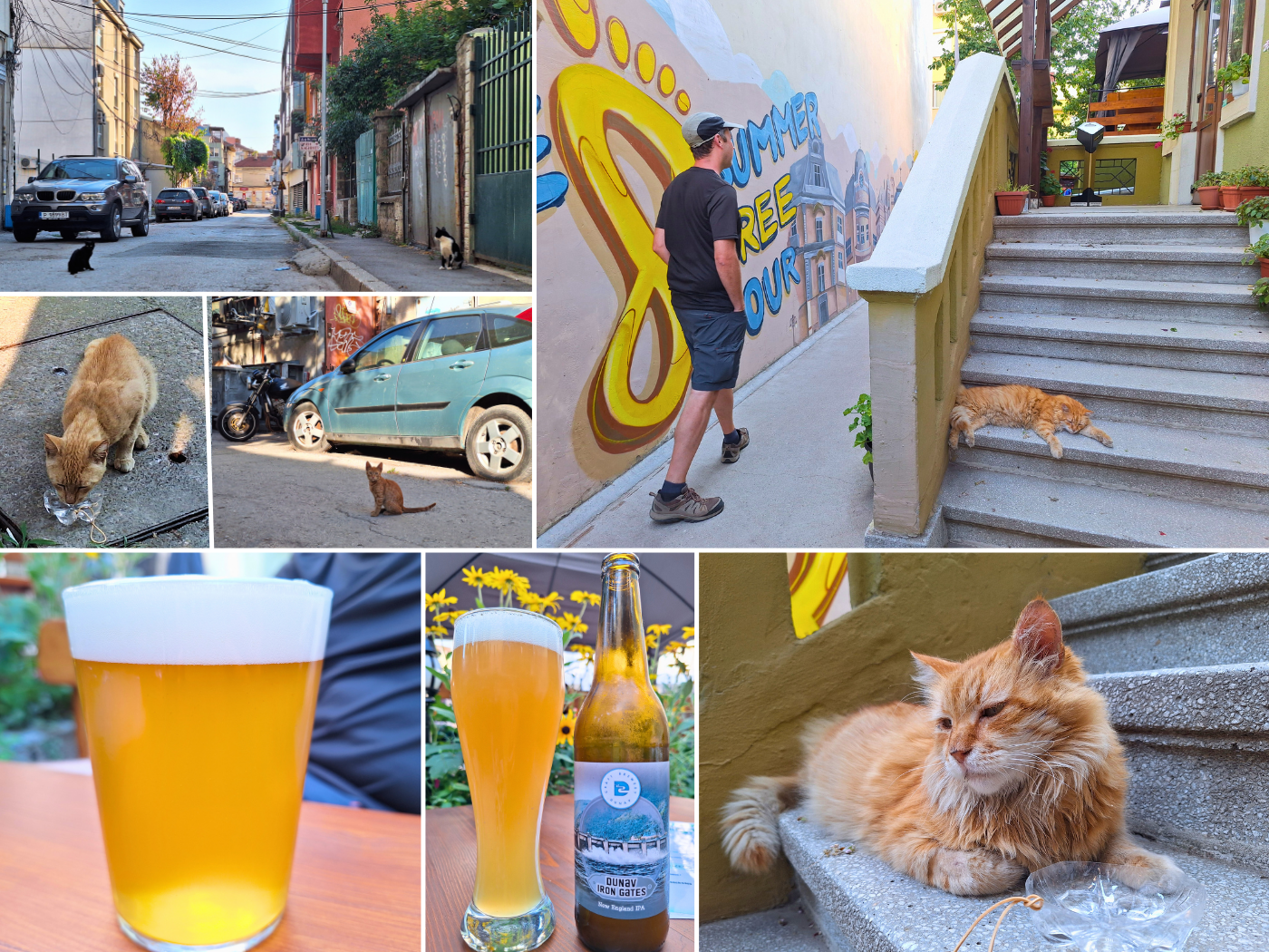
Monday: after arriving at the Airbnb and checking in, we showered, did laundry, and ordered food in. We also walked to a nearby convenience store called Vimon where we bought some beer and sparkling water. There was one big tomcat we met on the way that we intend to befriend, and our neighbor from across the hall also has a cat. We watched 1.5 episodes of Dexter when Jonas was beginning to fall asleep. So we called it a night and had some of that amazing post-kayaking sleep.
Tuesday: the feeling of being down crept in. After nine days of kayak-rest-kayak-rest rhythm, we now had nothing on the schedule. There’s no need to find a lunch and dinner spot, no need to make sandwiches for the next kayak day, and no need to pack up again in the evening. My arms and shoulders hurt a little. I think yesterday while kayaking was the fittest my kayaking arms will ever be. It’s all downhill from here as my body decays on its slow march towards death.
But we both tried to fight the emotional down after yesterday’s high with work. I needed to write about day 74 before I could do fun things like drink local craft beer. Jonas ordered (middling) food for us for lunch. I knew if I had to go out to eat for lunch, I probably wouldn’t finish writing today. That’s my carrot-and-stick tactic. I could easily put off writing this till the end of these 10 days in Ruse. But I’m trying not to.
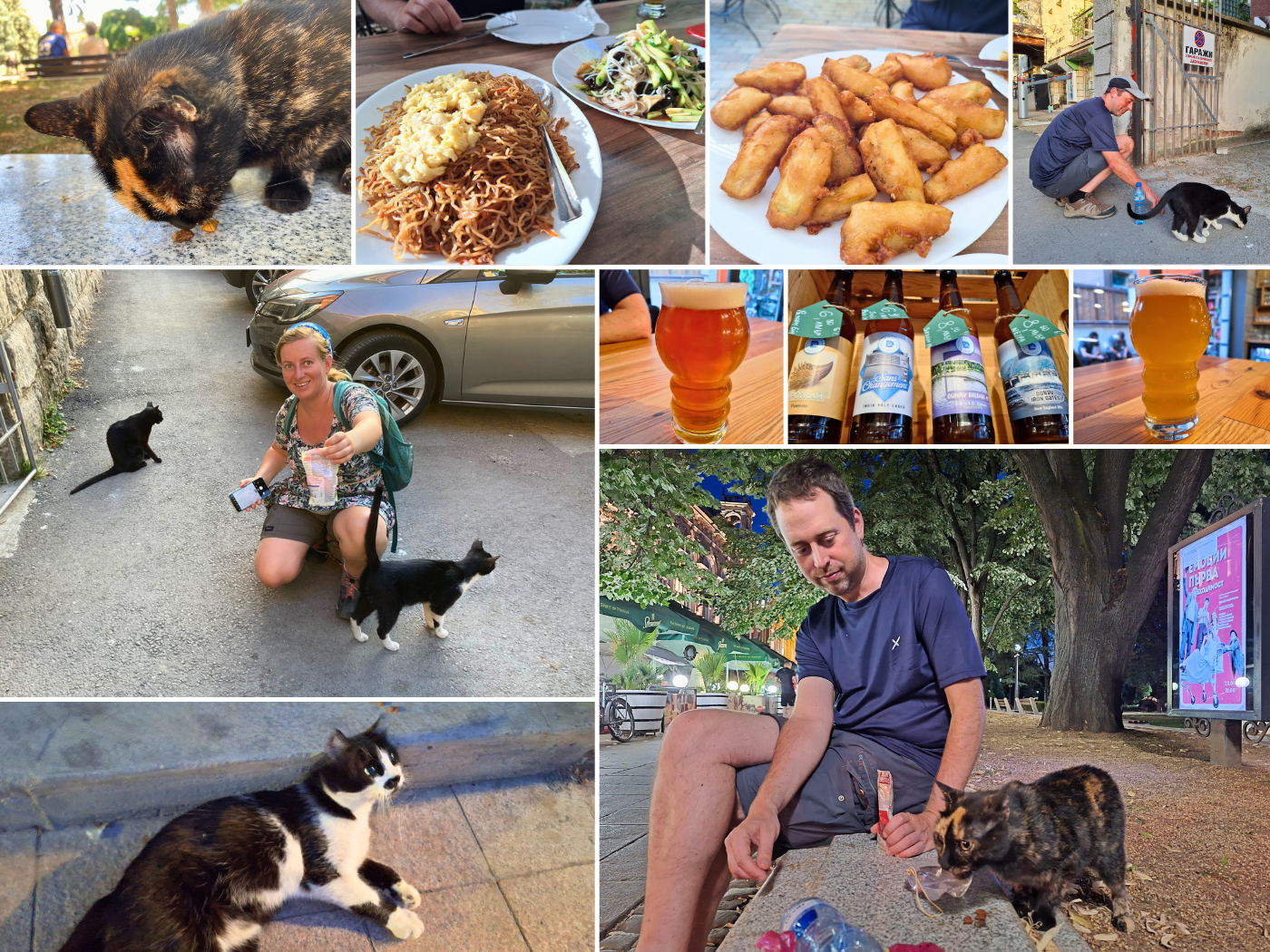
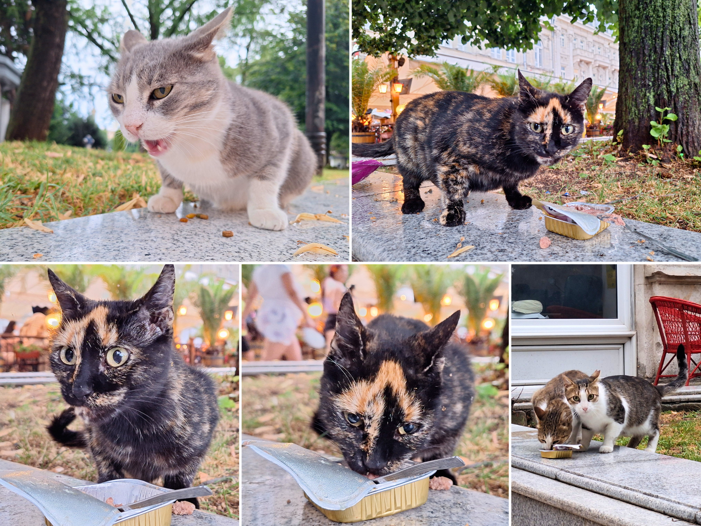
After finishing this, we went to Chinese restaurant Bambuk, which was quite nice and return-worthy. There are shy cats that are animal-protein motivated.
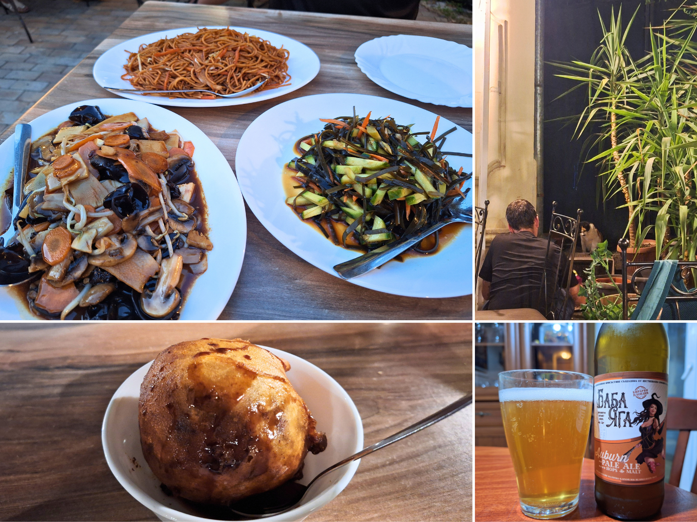
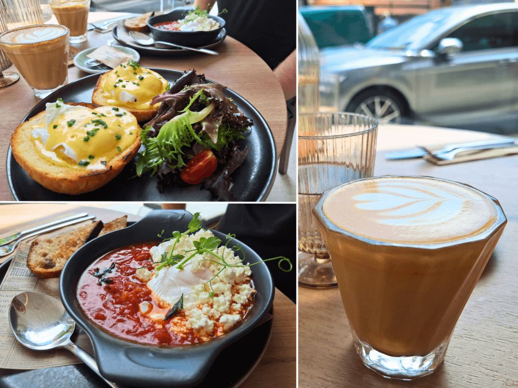
Wednesday: for breakfast/lunch, we went to the nearby Happy restaurant, which has a very big menu with lots of veggie options, including vegetarian sushi. There we also met the least-shy tortie in the world, who was happy to drink our water and receive pets. Afterwards, we went to Billa to do the shopping. The Billa in Ruse has a wonderful delicatessen section with a guy who speaks good English and will recognize you the next time you come. I recommend the spinach-cheese patties he sells.

At home, I tried to finish as many of these kayaking articles as possible, with mixed results.
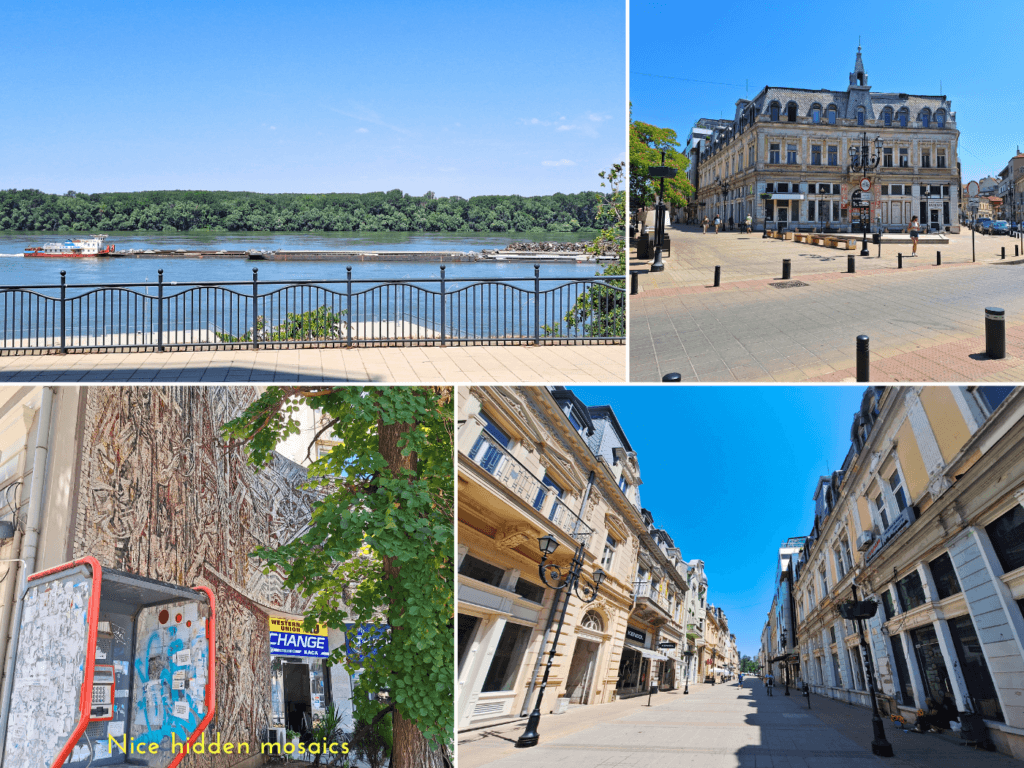
Thursday: we went to Sapiens Specialty Coffee for the first time, which is a great place for egg-lovers like us. We had a vegetarianized eggs Benedict (i.e. no bacon/salmon) and a shakshouka. Afterwards, we walked along the Danube to see 1) if we’d made a mistake getting out of the river as early as we did and 2) check if there would be a better launch spot for when we leave Ruse for Tutrakan. The end result is that we used the best possible exit/entry spot in Ruse for inflatable kayaks, as everything downstream was worse.
In the afternoon, we heard that our Amazon packages might arrive soon. Though Jonas kept an eye on it and asked our Airbnb host for the correct doorbell for the delivery person to ring, we still missed it. Luckily, there was a card with a place where we could pick up our goodies the following day. It’s very surprising how quick this delivery was.
Friday: we first picked up our two Amazon packages two blocks away from our apartment. Yay, we have a new kayak sail! The blue kayak sail era has begun, following the short-lived red kayak sail and the green one that broke on the way to Calafat. We also have new waterproof phone cases – the old ones had gotten scratched up – and Jonas got a new paddle shirt.
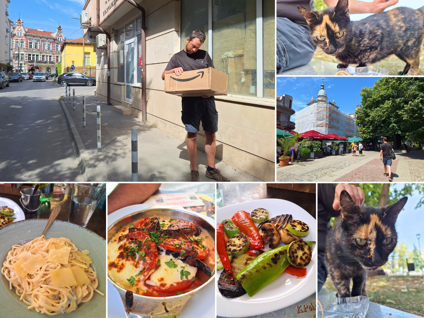
After dropping the items off, we went to King Breakfast for sort of breakfast, which was great, though we ended up ordering things like four cheese pasta, grilled veggies, and eggplant parmigiana. It’s some of the politest service we’ve ever had. Afterwards, we went to visit our favorite tortoiseshell cat, who was again very thirsty.
Saturday: we returned to Sapiens, this time for eggs Panagyurishte and avocado toast. Again, this was wonderful. And we added Panagyurski-style eggs to our list of dishes to try to make ourselves. We returned home via some mosaics and fun streets. At home, we worked and played the Ivaylo campaign of Age of Empires II. I contemplated going to the Round Church in Veliki Preslav, which is the wonder of the Bulgarian civilization in AoE2. It’s very remote and I researched the options of hitchhiking, public transport, and even rental cars. None of it works in a convenient way from Ruse and all the rental cars in Bulgaria were booked out till the end of July for some reason.
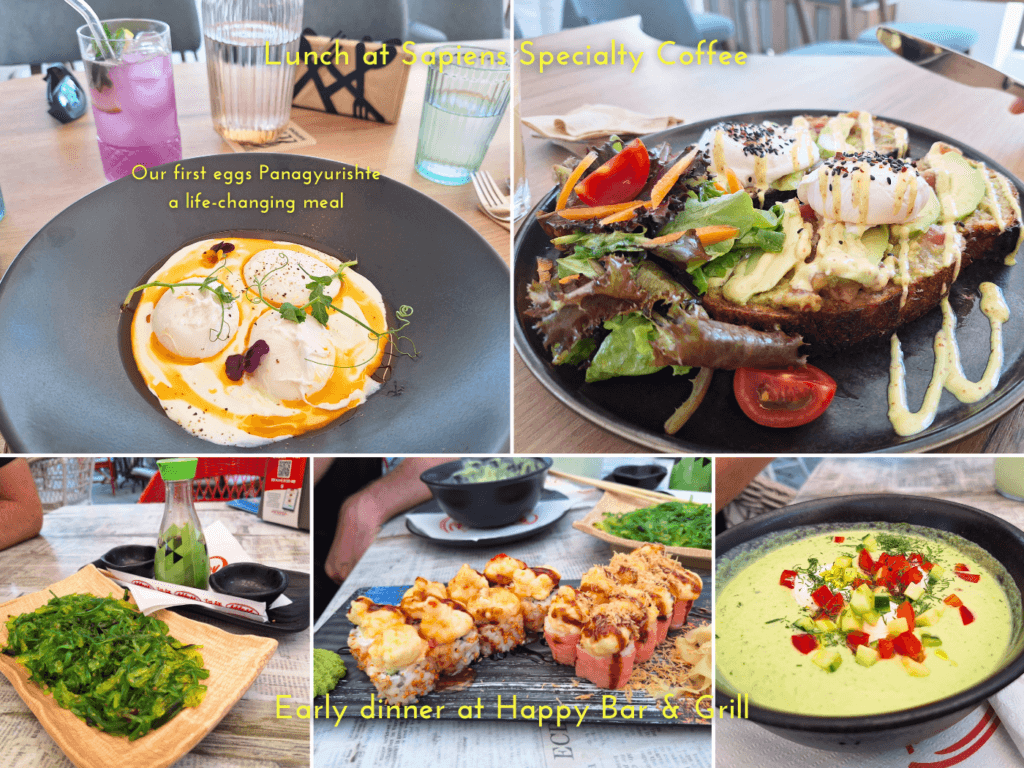
In the evening, we went to Happy once again for avocado tarator summer soup and vegetarian sushi. Afterwards, we went to Biraria Tangra for some draft craft beer.
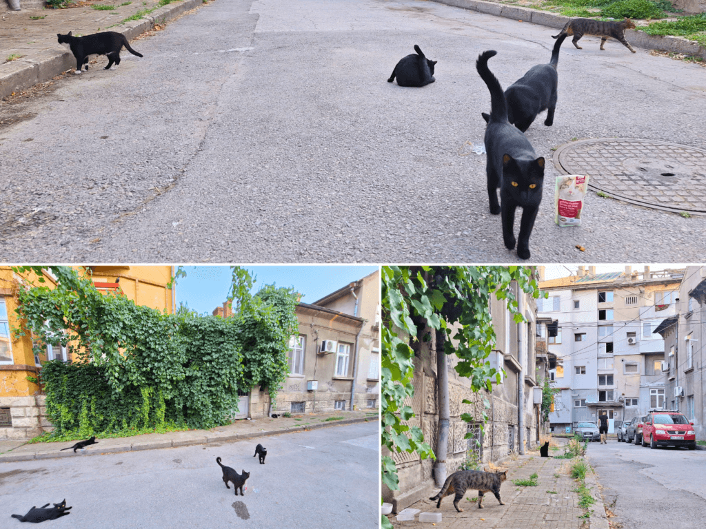
We met and fed and watered a lot of cats on the way. Some of them looked very hurt, with a missing eyeball and a completely open wound. Close to home, we also met a big group of voids who were all very hungry and eager. A few minutes later, a volunteer came to feed the cats in this part of Ruse. There’s certainly hope.
Sunday: we had mezze lunch at home and worked. I was still thinking about visiting that wonder, but opted not to because I’d have to do it alone and would be under severe time pressure to make it back to Ruse before kayaking on to Tutrakan on Thursday. Not a good combo. I also unpacked the new kayak sail for the first time. The blue version is a little weirder than the green version from 2019. So many carabiners. And now we know to hold on to these little metal pipes to hopefully fix breaks before they appear. I hope this kayak sail will last us to the Black Sea.

Speaking of lasting to the Black Sea (and beyond), I had imagined this year’s kayak trip down the Danube to be as good for our relationship as it had been in 2019. Jonas and I were really close after that first leg from Donaueschingen to Mohács. Since these trials we’ve withstood then and since (COVID), getting married to him has been on my mind. When we met in 2015 and got together, we talked about this. Back then, it wasn’t something either of us strived for. Back then I though, what would be the point? We have similar passports. Almost nine years on and in the opening chapter of World War III, I feel different about it. I want us to be inseparable for what’s to come.
I had kind of planned to go out by myself in Ruse and buy him a gift of gold here in town to give to him when we reach the Black Sea in Sfântu Gheorghe—which is a goal that’s finally coming into view. I had imagined several different scenarios. Ruse has been the last target on the Danube kayak trip part II to go get that gift and carry it further.
But something has changed. I’m drained, tired, worried. And it’s not the physical challenge that’s doing that to me. Jonas has been a less-than kayak partner this year. Ever since the failed kayaking day to Golubac in Serbia, he has thrown obstacle after hurdle at me in every single way. Whatever I ask, the first answer is “No.” from him. Doesn’t matter what it is I’m asking. But we end up doing the thing I suggested 99% of the time anyway, but only after I’ve given him a six-thousand word essay about why it’s important to buy a new hummus. It stresses me out so much that (publishing) these blog posts are getting nowhere as I need to lie down after something like that with my hand pressing down on my chest as my heart is beating so damn fast. It kills my joy, dulls my spark.
And it’s exhausting me to the point that I couldn’t figure out how to get Veliki Preslav to visit the wonder of the Bulgarians, which I had lowkey planned for a while as well. And I had ten fucking days in Ruse to make the trip. And after roughly nine years of being together, traveling together, I’m not sure if I can hack a solo trip to there by myself. I have become insecure as fuck.
And he threatened to quit the Danube kayak trip many times. Quitting is not an option for me. These blog posts are kind of my life’s work. I’ve already started looking into piloting Zucchini by myself (hence my suggestion to switch places while kayaking from Svishtov to Ruse) or finding another person to replace him for the grand finale. I’m generally having a great time despite (or because of?) doing a tough thing. I would be having an even better time without the constant moping (at best) and the presumed sabotage and subterfuge (at worst) from my partner in adventure. I’m not a good-vibes-only cheerleader who demands smiles positive thinking and shit. When something sucks, just acknowledge it and move on. And don’t take it out on each other.
Jonas has started to put a lot less effort into our relationship. He often prioritizes video games or doomscrolling over doing something together. He used to diligently read my blog, that’s been about our life together since many years. He used to love to help me with perfecting articles and just going down memory lane on my blog. Now he doesn’t even help me fix up the things that inevitably break with web development, which is something only he can do. So I can write this bit of TMI with you, scrupulous reader, and stick it in this blog post without ever having to worry he’s going to come across it. He could delete these paragraphs with ease, since he holds more power over this blog than I do.
It’s a shame, really. I haven’t put in less effort into this relationship. I have been consistent in my words, actions, and life goals. And I have communicated those to him; I am a motherfucking open book.
However, Jonas keeps loving me. Always in words, sometimes in deeds. When we hold hands, he rubs over my ring finger until it borderline hurts. I am reading things into that. He gives good and meaningful hugs. And he says we are “in a marriage-like [sic] relationship” and reaffirms he wants to be with me constantly. So it should be only a minor life change. But I can’t read him. Will he propose to me any day now? Will we grow old as boyfriend-girlfriend? Has he been wanting to restart or re-evaluate this conversation?
There are things in our relationship that have been 100% agreed upon: yes travel and no kids. He left someone before because she wanted to stop traveling and have kids. Those life goals were incompatible and contradictory to his, so they broke up. For us, I don’t think no marriage was ever set in stone. We used to make fun of this movie trope where people have been together for a while, then one of them proposes, and the other says no to marriage, but not to the person, but they always immediately go their separate ways. “Why would they need to break up?” is something he’d say, and I’d agree. Today? I’m not so sure if that’s stranger than fiction.
So… all of this is going not how I imagined it in 2019. I have lost my spark. I feel utterly powerless. I resent my situation. And so, I’m not pursuing what I’ve been thinking about since all this optimism about our future I’ve felt since we finished the Dutch Coastal Hike and kayaked bits of the Agger, Ljubljanica, and Sava rivers. Somewhere between there and here, something snapped. And I don’t know how to fix it…
…and is it even my job to fix everything?
In the evening, we ate again at restaurant Bambuk, where we heard they would be closed for a week. Damn. The sweet calico cat made an appearance again. Afterwards, we went to Za razBIRAchi craft beer bar, which was a great experience. We intend to go back there for food and drinks.
Monday: I had quite a productive day, which came at the cost of enjoying the outside world. We had lunch at restaurant Hacienda, which was nice but the server kind of led me into speaking russian. She might have been from Central Asia, in which case it would be understandable she didn’t know neither Bulgarian nor English, but I still felt a little tricked into paying lip service to Mordor.
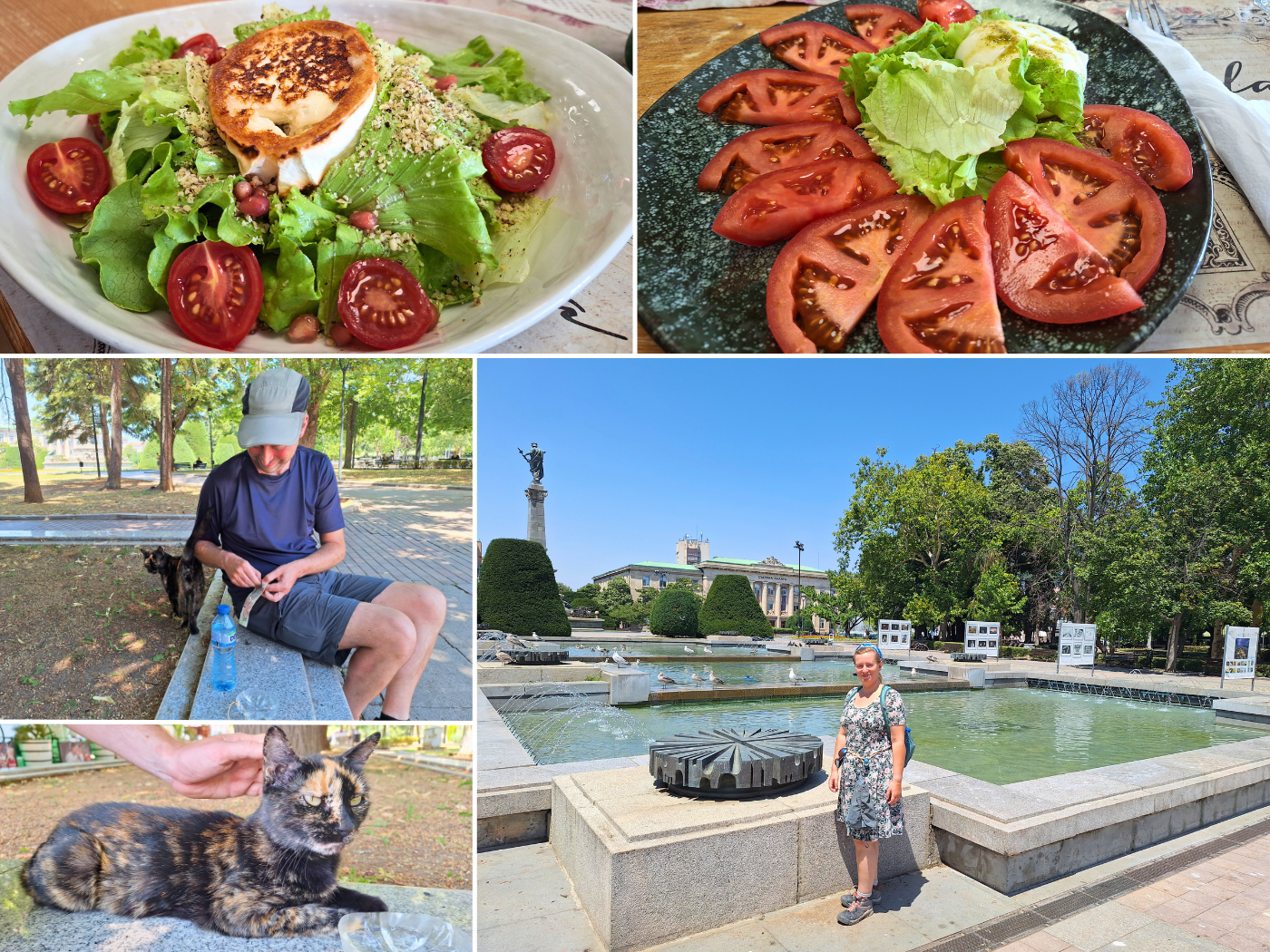
Afterwards, we walked past the central square again to say hi to our sweet little tortoiseshell cat. She’s so reliably there. I love her.
Tuesday: today, rain was predicted. But not for a while. The weather has been heating up quite a bit. You can smell in the air it’s about to break. For lunch, we returned to Happy Bar & Grill, where we had tried basically all vegetarian dishes. So we now knew the good stuff and reordered only those things. Going there meant feeding the sweet tortie and any other visitors. We treated them to wet food as well as dry kibbles.
In the evening, we returned to RazBIRAchi for some craft beer and excellent pub food. Yes, once again we had a burrata salad in Bulgaria. I tried a few beers from the local Dunav Craft Brewery. They have a NEIPA, which is currently my favorite style of beer. But another interesting one they have is a Session IPA called Dunav Bridge #3 with an image of the pontoon bridge to Belene Island. The name comes from a hypothetical third bridge across the Danube between Bulgaria and Romania. The newest one is between Vidin and Calafat, and the first one is here between Ruse and Giurgiu.
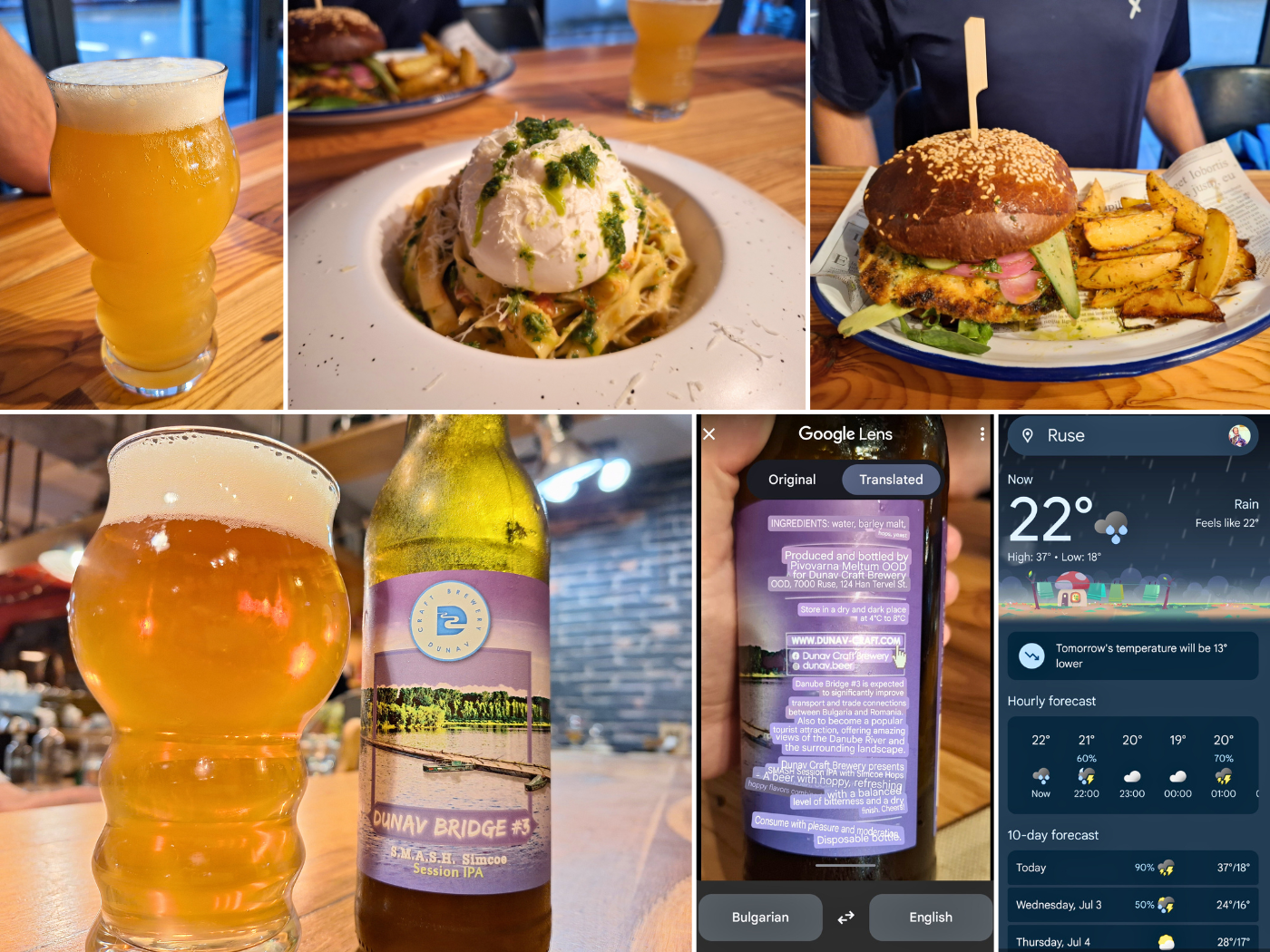
Romania is in charge of deciding what and where for this third Danube bridge. One option is a second bridge between Ruse and Giurgiu, which I think is dumb and a strategic mistake from a NATO defense perspective, considering we have maybe five more years till we’re at war. There are several options west and east of Ruse. Both countries have expressed a desire to improve the connection between Sofia and Bucharest. I think it should cross the Danube between Nikopol and Turnu Măgurele. Why? Drawing a line between the two capitals, that’s where the shortest route crosses the Danube. It would replace a ferry. And lastly, if they’re looking to make a road-rail bridge, there are rail connections (close to) both Nikopol as well as Turnu Măgurele on both ends. Nikopol was economically depressing, and this would mean a revival. I say cheers to that!
On the way home, we got caught in the heavy rain that had been announced. I loved it. Jonas didn’t. I was in no hurry to get home.
Wednesday: on our last day, we returned to Sapiens Specialty Coffee for one last time. After coffee, we tried the olive craft beer from Spain. It was good. Then it was time to scout our launch spot. It’s not far from this café. After that, we still need to go shopping to buy more protein bars for tomorrow’s kayaking journey. We didn’t revisit Tortie, who I will miss dearly.
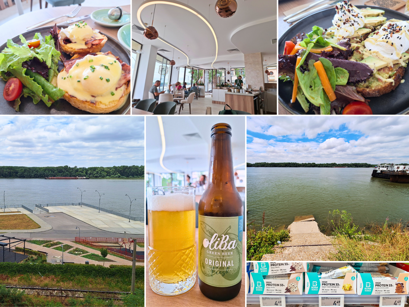
As I feared, the water levels had gone down quite much. When we landed here nine days ago, there were just stairs out of the water. Now the Danube has receded by over one meter and even more concrete became visible. It’s still usable as a launch spot, but kayaking to Tutrakan will probably be much tougher since the current will help us less.
Did we… fuck up?
Helpful article? Consider buying me a craft beer!


Similar posts:
 Kayak Trip Day 75: Ruse to Tutrakan – New Kayak Sail + 1000 Kilometers Paddled
 Kayak Trip Day 73: Nikopol to Svishtov – Headwind to Belene Island + Attempted Side Quest
 Kayak Trip Day 68: Iron Gate II Dam to
 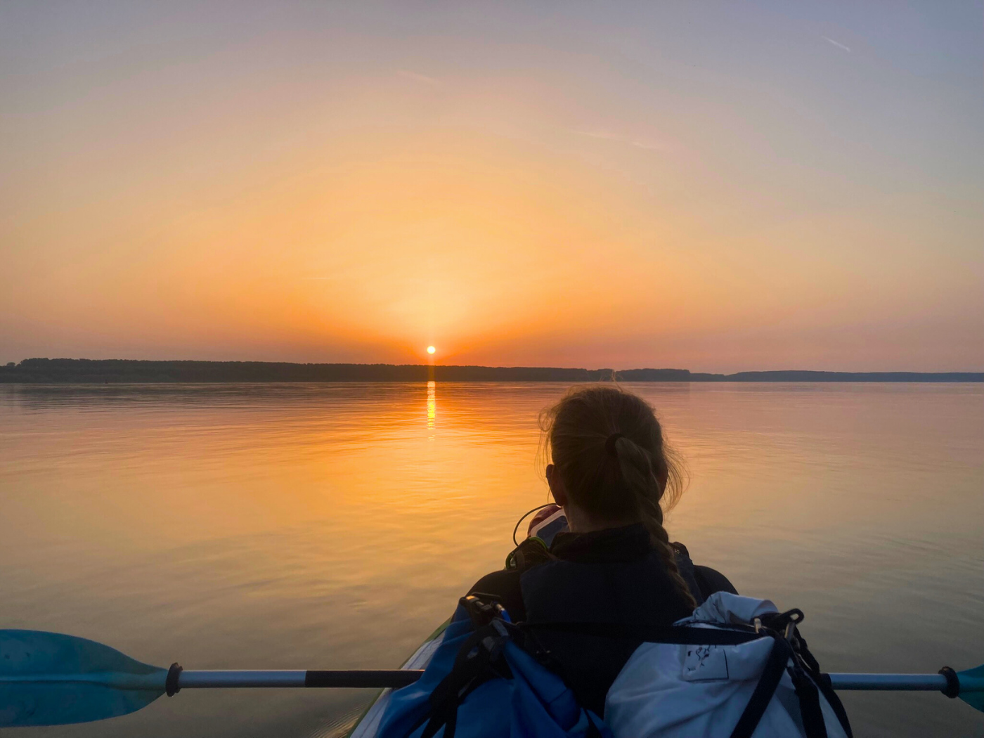 Kayak Trip Day 72: Oryahovo to Nikopol – Summer Solstice + 80 Kilometers
 Kayak Trip Day 36: Čunovo to the Danube Floodplains – Freecamping