")


")

")


")

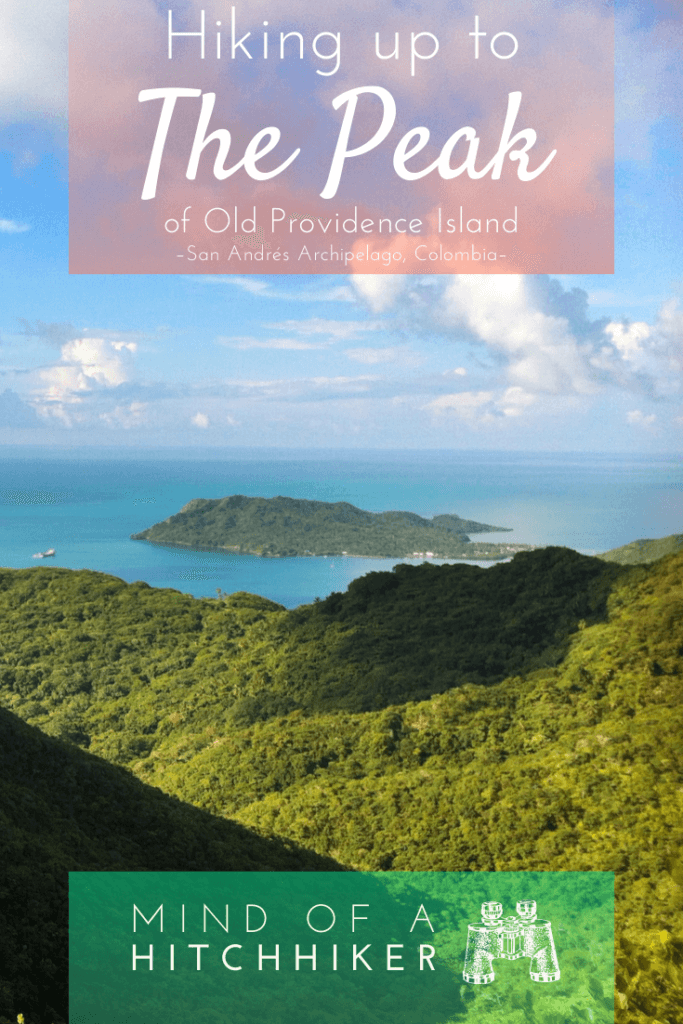
We did this hike on Tuesday, October 31st, 2017. Jonas and I traveled around the San Andrés Archipelago for two weeks after extending our Colombian visa in Santa Marta. This Caribbean archipelago comprises three islands (San Andrés, Providencia, and Santa Catalina) which are part of Colombia. We stayed on Isla de Providencia (Old Providence Island) for one week and did this hike to the peak.
Preparations to Ascend The Peak
Having had enough of the crabs and the sea for a day, we wanted to explore the inland of the island and hike up the highest point. According to the internet, it’s 360 meters above sea level. It was yet another typically hot day in Providence. We took quite some water with us in my day bag for this hike, along with sunscreen, our cameras, and some snacks.
But first, we squeezed in a couple of hours of work. It’s a small island with short distances… right? The map says it’s only 3 kilometers from the trailhead to the peak. We can make it an afternoon hike. (Click here to sea the location on OpenStreetMaps and here to see the location on Google Maps)
The main trail to The Peak goes from the south end of the ring road to the center of the island. After that, the map informs us that there’s a smaller-looking trail that goes down a cliff westward. It passes a freshwater reservoir and then ends up in the town Fresh Water at Fresh Water Bay. I’m hoping we can hike it without backtracking and then take a motorbike taxi back to our Posada Sunrise View.
The Normal Route to The Peak
We took a motorbike taxi to the secondary trailhead east of Bottom House. Even though I’ve been squeezed in hard between the driver and Jonas a couple of times now, this isn’t really something I can get used to.
After a short walk through a small town, we leave the inhabited zone. A sign informs us that we’re entering the sendero interpretativo to The Peak. The next sign repeats our whereabouts bilingually:
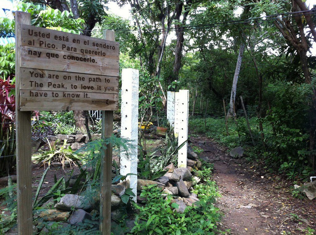
“You are on the path to The Peak. To love it you have to know it.”
Sounds promising!
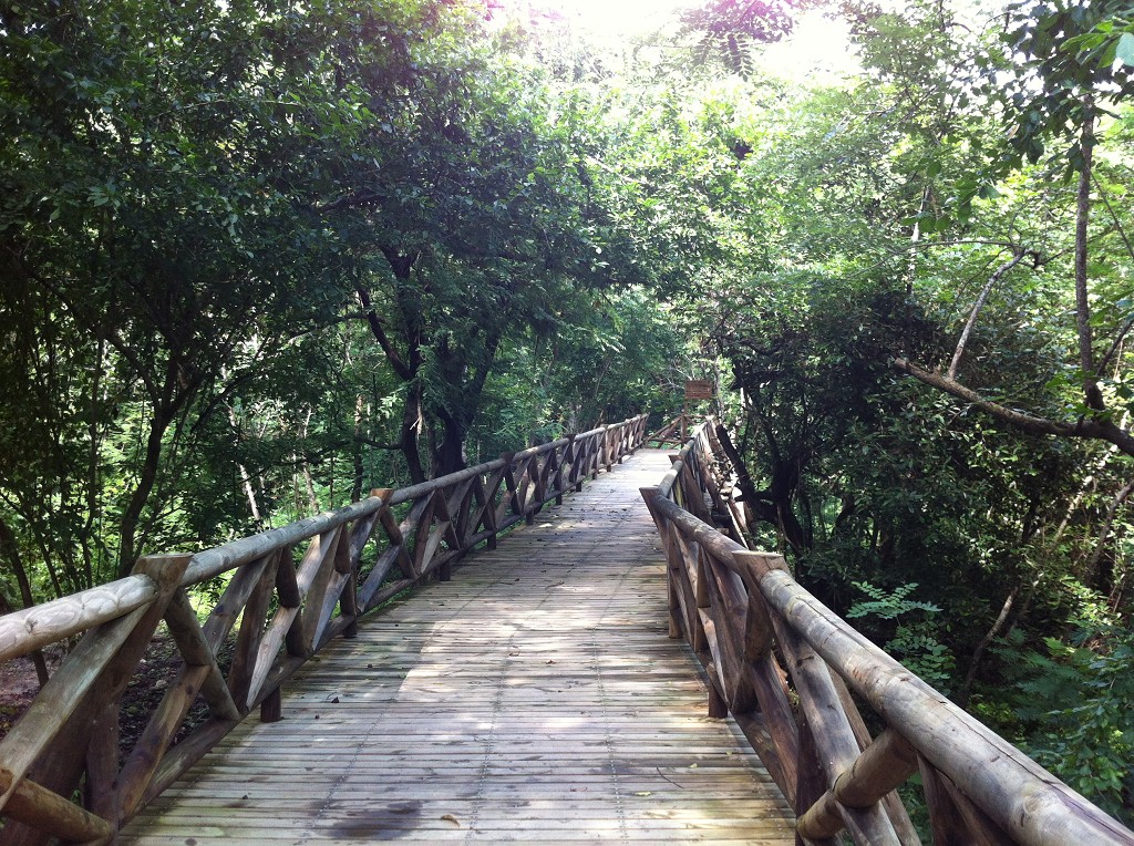
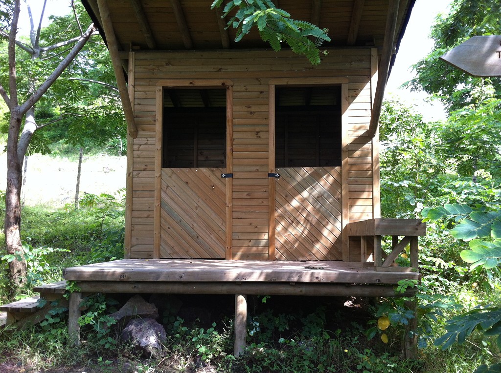
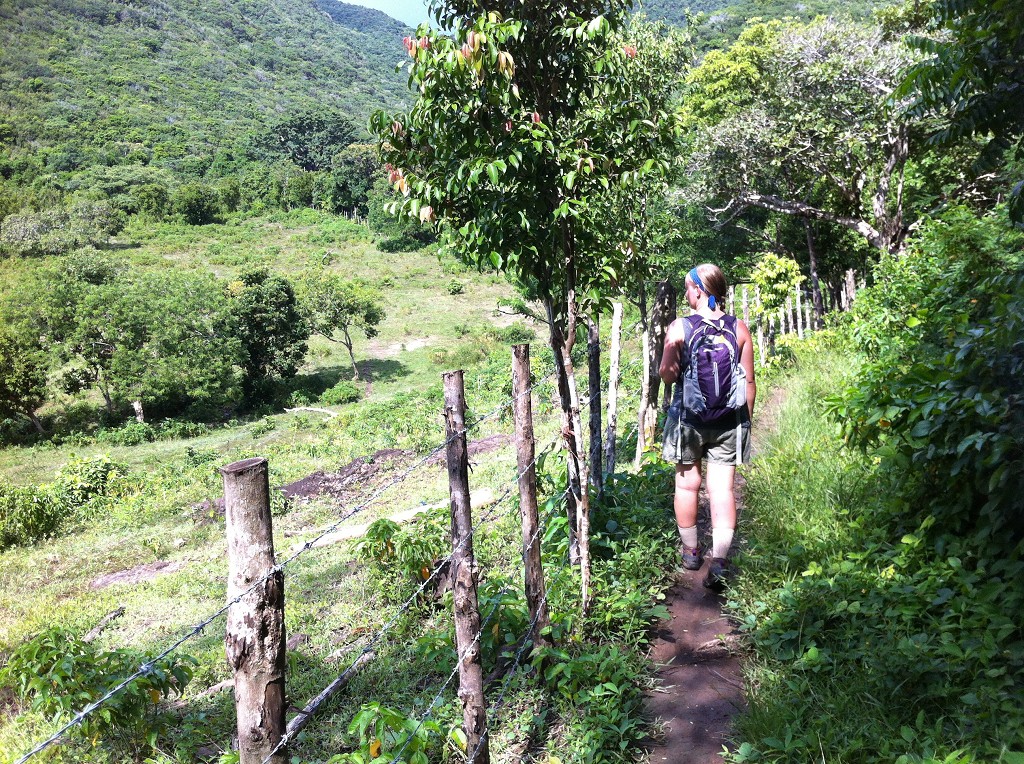
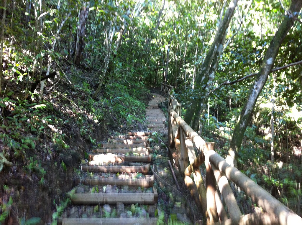
Both wooden signs appear to be brand new. Actually, the whole trail thus far looks brand new; a wooden boardwalk wide enough for a wheelchair to pass guides us over the moist forest ground in comfort. That disability friendliness soon stops again at the first stairs back down to the forest ground. It’s 2.5 kilometers to the summit, another fresh sign informs us. A little wooden shelter appears for hikers to go hide in. It’s really cool that they’ve made these investments to keep hikers safe.
El Campo
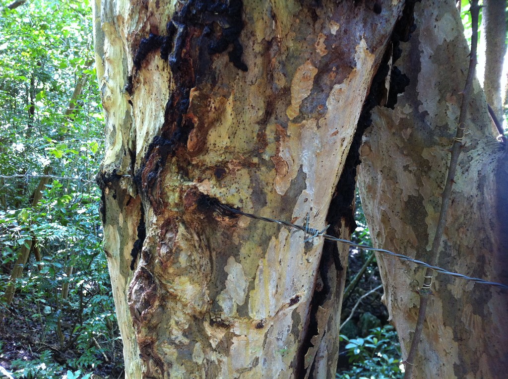
We enter a small area of farmland. Our trail is separated from it by means of a barbed-wire fence. There isn’t much space to work with around here between the needs of the farmland, the trail, and the forest. This part of the trail seems older, as the trees have swallowed some of the barbed wire that leaned against them.
After some countryside vibes, we reenter the forest. The thick canopy allows for mushrooms to grow on the bark of decaying trees. I didn’t think I’d be blessed with some mushroom sightings on this hike.

The highly-developed trail starts up once again with a magnificent construction of wooden stairs. There’s another wooden sign informing us to stay on the trail to enjoy nature. It already warns that at the peak, we shouldn’t get too close to the edge because of the possibility of rockfall.
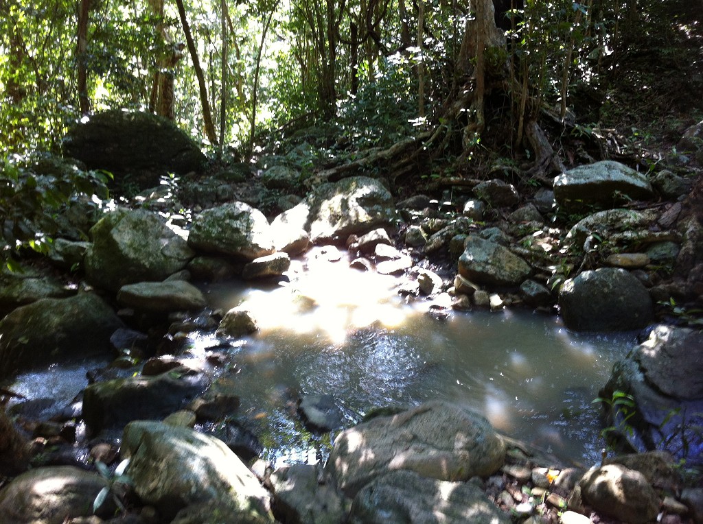
The climb begins in relative comfort. There’s a mountain spring trickling down a rockier surface parallel to the stairs that lead all the way up. The surroundings are quiet and we haven’t met anyone on the trail.
The Peak
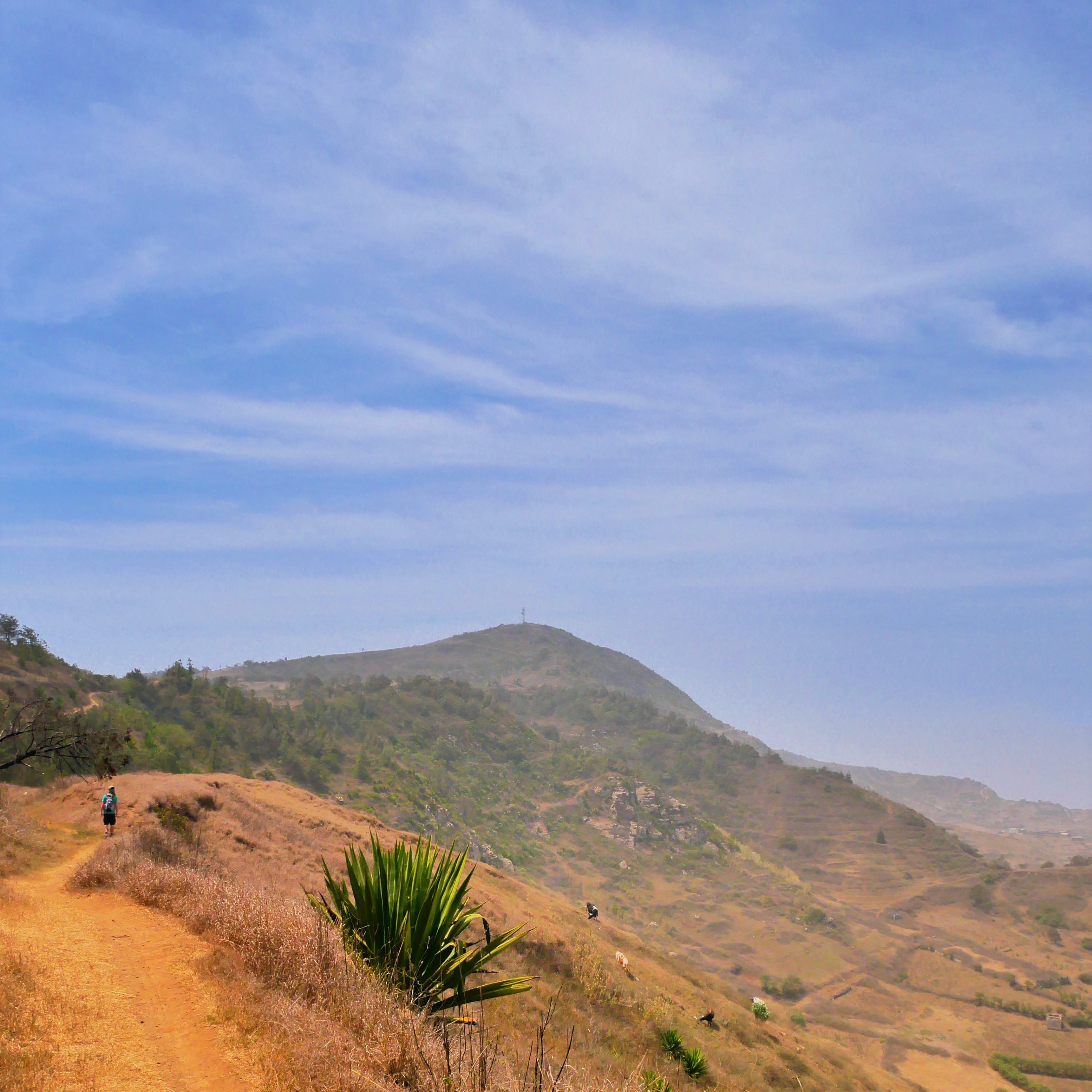
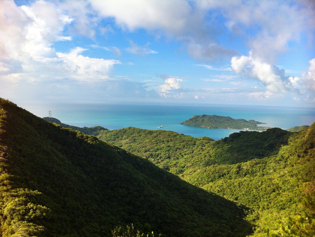
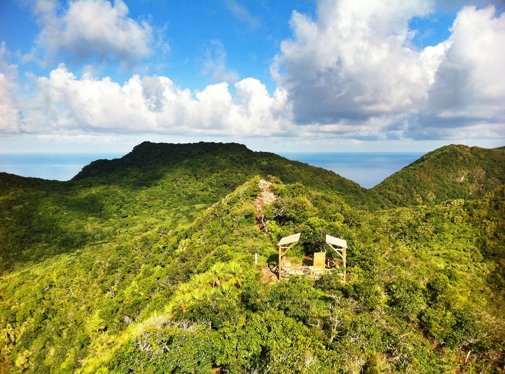
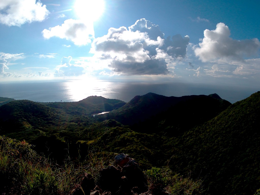
Towards the summit, the trees thin out until we’re mostly exposed to the sunshine. The wooden stairs end. We’re walking on a mountain ridge and the ground has become rocky instead of mushy. The lush trees traded places for spiky shrubs. There are green peaks all around us, but only one of these is the highest and accessible from this trail.
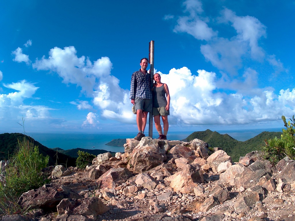
Right before the peak is a little gazebo for hikers to rest at with a bit of shadow. We walk straight to the peak to enjoy the views over Old Providence island/Providencia. It’s very wow.
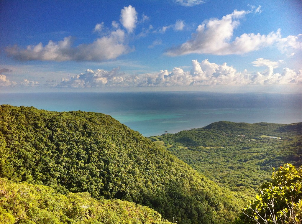
From The Peak, you can see the mar de los siete colores fringed by the green mountains you just walked up. We discuss if we can actually discern the seven different shades of the Caribbean Sea, but we only agree on five distinct ones – perhaps two more when shot in HDR.
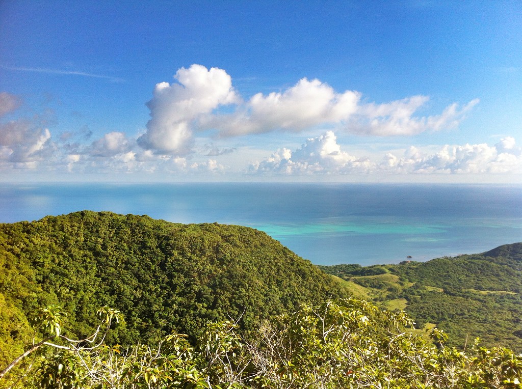
To the north, we see Santa Catalina and its bridge to Providencia. To the south and southeast, there’s an unmapped rock in the water, the antennas of the military base and the freshwater reservoir. The mountains themselves already cast long shadows over the valleys in between them. We see a fade of the waves crashing on the reefs surrounding pretty Old Providence. What an incredible place.
No Backtracking
We first snack and rehydrate a little at the gazebo. The sun is quickly lowering in the sky and we have to make a decision on which way to go quick: do we go back the way we came, or do we hike down the other side?
We don’t know what’s on the other side. We do know that the hike up here wasn’t that challenging and quite leisurely. I was definitely up for something more, but we first had to find out what that something more was. We decided to at the very least check out the alternate route down the mountain. There weren’t any signs encouraging us to continue down a different path, so we used my GPS map to find the trailhead down.
I found a rope attached to a stump and some earth scraped by hiking boots. I looked over the edge and saw that that must be it. We checked the offline map once again and measured that it would be 2.7 kilometers down this way with quite a steep descent. The map also only showed this particular edge as a cliff’s edge, so if after this it would smoothen out, that would be fine.
So we ignored the red flags and used the rope to get down.
A Sunset Scramble
But the scramble didn’t stop there. There were more ropes to be used on our way down. And ropes attached to ropes to descend slopes of -34%. Once the ropes stopped, the steepness didn’t for quite some time. Soon we were in the darkness of the forest once again.
The trail was less well-defined, though still well-marked for some stretch. It seemed as if they still had to finish this part of the trail but were still in the process of fundraising or getting the materials and labor in the right place at the right time. I was confident they’d build a similar boardwalk as on the other side, given enough time and money.
When it finally flattened out, the trail became vaguer. We traveled parallel to something that would surely be a fast cascading river had it rained recently. I hoped it wouldn’t rain. We had to cross the stony riverbed a gazillion times.
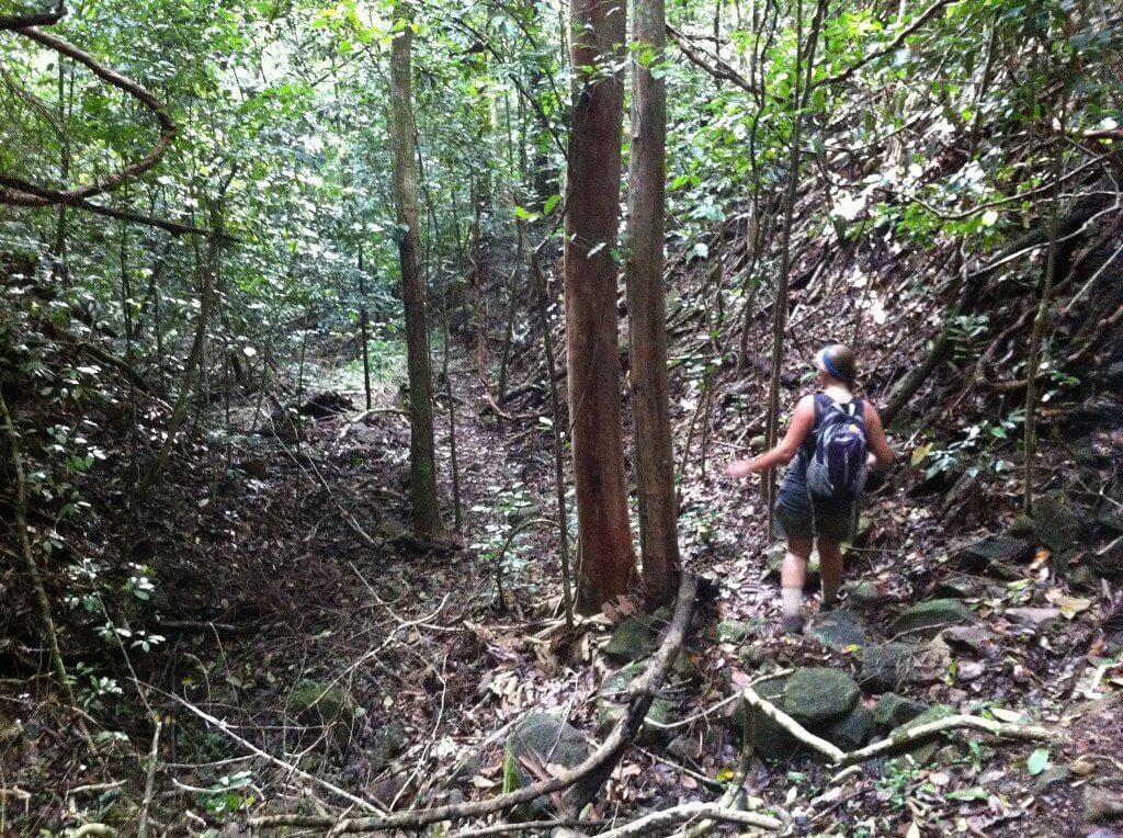
Jonas lost his optimism, but also knew that going back wasn’t really an option anymore. So we hiked through the forest at a steady but slow pace, climbed over boulders, and tried to not get lost. GPS helped partially, but it felt like we weren’t making any progress.
Once we were down in the forest, things got nicer, but the GPS signal bounced all over the place. The darkness fell and we were getting a bit concerned. I had a flashlight in my backpack for these situations, but more for those emergencies. Using it now would escalate things to an emergency.
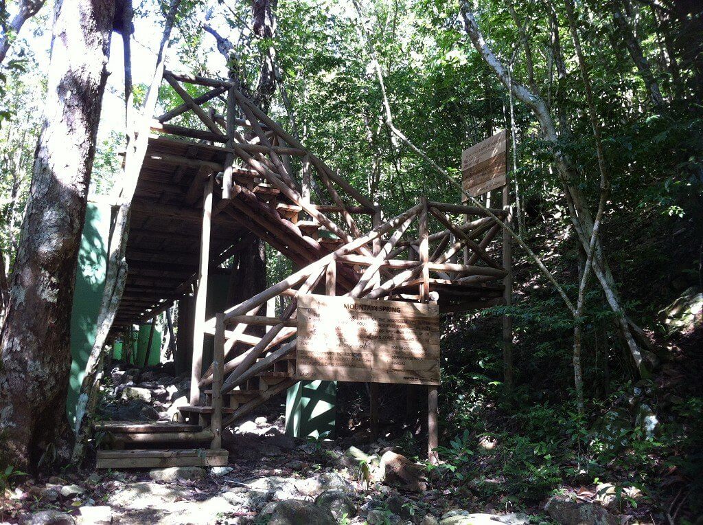
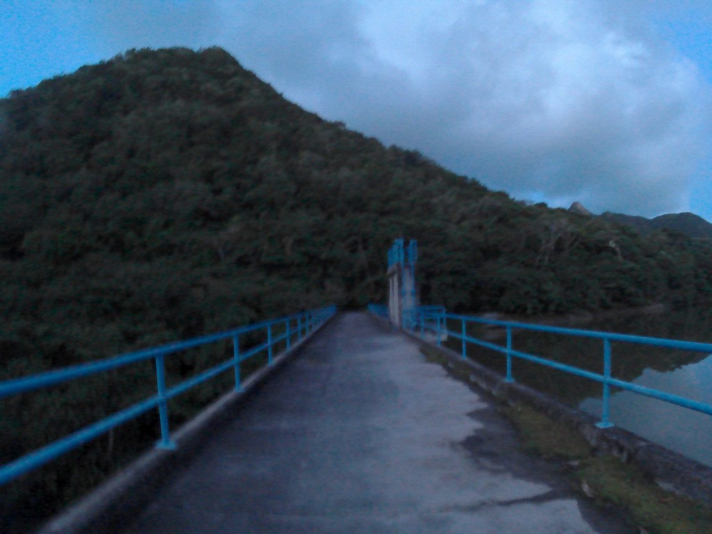
La Represa
The last light died out when we were – according to our GPS – only 200 meters away from the freshwater reservoir. But we lost the trail and had to sometimes retrace our steps to find a better way to get down. Then I saw a banana tree.
The banana tree led to more banana trees and clearing between the trees. We’d left the influence of the boulder-heavy riverbed and entered some kind of farmland once again. After trying different ways, we found a path that led to a barbed-wire fence and a small trail. That trail eventually led to the reservoir (represa).
But the trail passes the reservoir on the right-hand side, and we were on some trail on the left. We decided to roll with it nonetheless since it seemed to continue with some confidence.
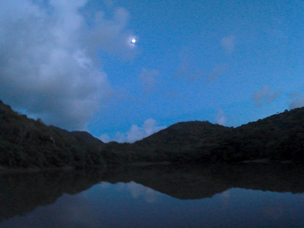
We walked next to the reservoir until we hit the actual dam. That’s where the developed areas began again. There was a small concrete road over the dam. I decided to still walk a little onto the bridge. We looked over the water and saw an incredible moonrise reflected in the water we’d totally missed inside the forest. We relaxed a bit now that we knew we’d make it back.
Fresh Water Bay
The last 700 meters were over a paved driveable road. We passed several buildings in the darkness and eventually arrived at the main ring road in Fresh Water town. There was some event going on, but we didn’t have much energy left to pay attention to. Jonas felt like that the downhill scramble from The Peak was definitely too much and quite unenjoyable. He just wanted to return to our guest house ASAP.
We got a motorbike taxi and hopped on in the darkness. Squeezed between them, we’re having a nice chat with the driver. We drove via the south end past the military base on the winding road. Once driving up on that hill, the motorbike made a weird sound. The guy flipped a switch and the engine reverted to its usual sound.
“I switched to the reserves,” he said. We’re thinking shit, we’re not getting back tonight with this guy.
“But don’t worry man, my reserve takes me two times around the island!”
Feel Free to Share or Link to this Article!