If you’re only here for an overview of the hike and preparation tips, click here.
Months ago I heard for the first time of the Quilotoa Caldera, a collapsed volcano in Ecuador with a crater lake in the middle. The pictures looked incredible and I wanted to visit. A few sprees on Wikipedia and my map app later, I knew I wanted to hike the rim of the caldera. Besides hitchhiking, I also enjoy hiking without the hitching part.
I hitchhiked from the town of Baños de Agua Santa – a cool destination in its own right – in one day to Zumbahua, a town close to Quilotoa. Upon arrival at the roundabout in Latacunga, I already had had two hitches. When I was leaving the Panamerican Highway I already started to notice the touristy pull this place has.
An already crowded pickup stopped and told me to hop in to go to Quilotoa. I hopped into the back. Within seconds of driving off, we took a side road and started dropping off passengers. This is when I noticed something was wrong. After dropping everyone off, Osvaldo invited me to sit in the front. We looped back to the Panamericana and the roundabout where he had picked me up from. I asked him what his job was, and he answered with taxi driver. Fuck. I told him I wanted to get out in that case, as I’m hitchhiking. He still tried to get $2 from me for the effort of wasting 20 minutes of my time. I told him next time he sees a gringo with a thumb out, it means he should pass unless he wants to take them for free.
I had to walk back 2 kilometers to my originally intended hitchhiking spot. This time I would only lift my thumb for truck drivers – the only people who won’t ask for money, guaranteed. After 5 minutes of getting shouted at by buses going to Quilotoa, a tiny truck left the roundabout in my direction. It stopped! The driver named Anthony was on his way to La Maná, about twice the distance of my destination, Zumbahua. He was a very nice and talkative guy and had lived in Madrid, Spain, for a while. He knew things worked quite differently in Europe. That’s why he understood that at the ‘ripe’ age of 25, I’m still not married and still don’t have kids. He was very proud of his four.
The road was very long and very curvy. I thought about the taxi ride, and how much Osvaldo would have charged to bring me 70 kilometers to Quilotoa. It was cloudy and rainy, and I was happy to be inside the nice truck. Anthony’s cargo was chicken food, which can’t get wet. He apologized for not having music in the truck. He told me that he’d been robbed at knife-point a few weeks earlier.
We arrived in Zumbahua around 16:00. It was terribly cold outside. I decided to stay in town for the night and go to Quilotoa the day after instead. The next day I went out quite late – I really needed the sleep – to finish the final leg. I hiked down through Zumbahua’s center the next day. Every car driving in any direction beeped at me, to indicate they were willing to take me to Quilotoa, for a price. Some slowed down next to me and rolled down their window to talk to me directly. I’m really averse to giving pushy people business, so I kept walking toward the end of town. After some time waiting for a car to take me for free, I realized this wasn’t going to happen here. Too damn touristy. When the rain rolled in, I decided to take one of the paid pickups for $2.50.
Before going there I had read a source saying there wouldn’t be any internet at the lake. It was to my surprise that nearly all businesses in the little village of Quilotoa advertised WiFi on their windows. I asked around for prices in three hostels before deciding. Chukirawa charged $16 per night for the dorm, which includes breakfast and dinner. Not cheap, but neither unexpected. After dropping my stuff I walked to the crater’s lookout. My jaw dropped. I was awestruck. JFC that’s some incredible view!
It was too late in the day to do the hike around the crater’s rim, so I walked around town to find information about the hike and other activities. Walking around town was already a bit tiring. The air is thin and I knew it wasn’t going to be an easy task for someone like me. I can hike 20 kilometers in an afternoon with my backpack and guitar on a flat area without complaining. Ask me to hike 5 kilometers in a mountainous area without any luggage and it will take me all day – and I won’t be able to walk the next day. Perhaps it has something to do with growing up in a flat country below sea level. By the way, having been a smoker for 4 years of my life hasn’t been helpful either.
The Hike
I got up at 7:00 the next day. Breakfast starts at 7:30 and the trail would ‘open’ at 7:00 for the early birds that skip their breakfasts. People had said it would take 4 – 5 hours and was about 10 kilometers (6 miles) in distance. I had charged my tablet and my map app had the details of the trail on it. My day pack had all the essentials of food, water, a hat and sun cream. Ready to roll.
It was very cold outside when I hit the trail at 8:15, and I was glad I still hadn’t tossed my warm, woolly winter hat. I decided to go clockwise around the lake. The path started out nice and wide. This is the actively-used part by the inhabitants of Quilotoa. I encountered a man going to his farm on the slope of the caldera. Later I crossed paths with a young boy carrying some heavy-ass bucket filled with other farm stuff. He walked over the skinny and muddy trail like it was no big deal. Unlike me, who was already in heavy-breathing in thin air mode.
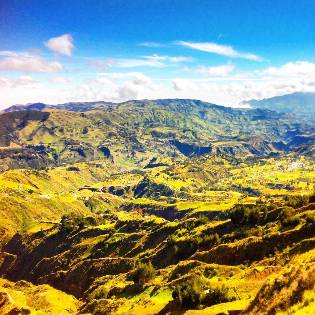
Before I started the hike, I’ve received a warning about the many ups and downs this hike would provide. Only a week earlier I had hiked down a rather shitty trail in Baños de Agua Santa that had left me temporarily incapacitated. It seemed like the Quilotoa track was also in use by horses. Some of the areas were carved out deep by their hooves. It was hard tough to get through at times. I feared for my next-day legs, while simultaneously enjoying the perfect landscapes around me.
Then, of course, I had to do something rather stupid…
A fork in the road appeared. I checked my GPS map to see which one I should take, but couldn’t get a signal in a decent time. So I made a guess. I chose the silly route going down the crater. By the time I realized my mistake it was too late to hike all of that back up again. I continued the lower trail until it vanished in front of my eyes. Shit. Then I saw a continuation of another trail even lower, nearly at lake-level. It required me to hike straight down over a really steep area that was partly slippery gravel, partly grassy and mossy slopes.
Reaching this area was no easy task. And neither would it get any easier. A nearly straight wall stood in front of me. Granted, it looked as if someone had begun to hew out some shape of stairs, but never completed the task. A brief moment in time, I’d practiced wall-climbing before, but never in nature and never without a rope. At that moment, I had already decided that I’d turn back to Quilotoa once this trail would reconnect to the main route. I was fully aware that no one would come and help me if I cracked open my skull on a rock. Imagine the headlines. “Stupid gringa takes silly route on a volcano, pays with her life.” Or: “Thought Dutch people were tall? Short-legged Holandesa fails to crawl out of crater to safety.”
Hands and feet. The careful placement of both. Test if hand grips are solid material or loose rubble. Lean on foot without commitment until certain that the step is not slippery as fuck. Move up and repeat this sequence until human feels base level of safety. Perhaps it’s best not to look down. Last steps to go. Don’t lose your shit under any circumstance. (No one will hear you scream.) Focus and breathe. Christ, I’m tense, but I’m there now.
In the end, the wall turned out to be not too technical, but it truly did me a frighten. Upon the continuation of the trail, things started to look better quickly. The path was first at a steep wall about half a step wide, then widened till I could walk up-straight without the prospect of imminent death at one misstep. The trail reconnected to the ‘normal route’. There was a little refuge on a sandy bit of crater rim. I had only wasted about one hour more than necessary to arrive at this point.
I was at merely one-quarter of the way. The next parts didn’t look too challenging, so I decided to stick to the plan and not return, defeated and disappointed. I’d rather be the slow person than the one who gives up. This close to the equator there’s at least one guarantee: the sun won’t set until it’s 18:00.
Continuing the Hike
I couldn’t have chosen a better day to do this; it was sunny, warm and everything looked better than one can imagine. The flatter parts were lined with flowers and bushes. Purple lupines wherever you looked. Little yellow and orange flowers with short stems because of the abrasive winds. Pink flower cones that contrasted well with the lake’s various shades of emerald. Steep edges on both sides of me. A patchwork of green fields to the left.
I followed the trail over rocky edges and flowery fields with the occasional horse, mule or donkey staring at me. One time I passed a shepherd with his herd. We nodded to say hi. It doesn’t seem like a bad job to me. Binging on fresh air, sunshine, and silence. He seemed happier than the peasants preparing the fertile slopes for the next crops.
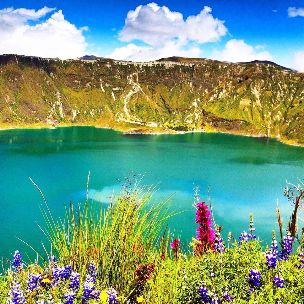
That’s when I covered quite some distance. Within a reasonable time, I was well beyond halfway. The town is on the other side of the lake. I see a few kayaks on the blue fabric. A good time for a lunch break of chocolate and water; my needs are simple. It’s amazing how far you can see on a clear day. The peak of the Cotopaxi volcano was still visible, though clouds were rolling in. The twin peaks of Ilinizas to the northeast felt nearby. My chocolate was ice cold in the bag but melted quickly in the bright sun. It reminded me to reapply sun cream.
On the tall bits, you could see other people on the trail. A group headed towards me from the back. I was sure they’d overtake me within the next 30 minutes. A Polish couple walked towards me from the other side and I asked them how long it took them to come this far and at what time they started. “We arrived by bus at 10:30 and immediately started hiking.” They’d been at it for less than two hours and were still looking energetic. I knew better than to compare. They asked me to take a photo of them before they continued counterclockwise.
I started the main ascent to the tallest point on the hike. A group of fit young men overtook me. They were tall and had legs to match. One of their steps was more than double one of mine. I took regular breaks on the flatter bits. I could see the summit and the little shelter that was there. Little by little I got closer to that milestone. I could already see the gym boys having a break on the summit.
By the time I arrived, there was only this German couple from my hostel that was slightly faster. I had another chocolate and water break for about 10 minutes. Another couple in regular clothes and a young woman doing it solo from the other direction arrived during that time. It was 13:40 and the sign informed me this peak is Monte Juyende and is 3930 meters above sea level. Everyone wanted a picture with the sign and the lake. The summit was small and the edges steep. I didn’t want to stand there to take photos, so I just offered to be out of the way for their pictures.
From outside the crater the clouds rolled in. It was a spectacular and terrifying sight. First, a bit of cloud dripped over the edge of the crater on the lower part I just came from. Once over the edge the fluff descended into the crater making the blue disappear. Then the clouds tipped over the higher parts of the crater. My sight diminished and I got scared of the altitude. I couldn’t see either side of the rim anymore, only a few meters in front of me. It was 13:45 and time to go.
Time to Descend
The way down wasn’t as expected. It was still a bunch of ups and downs and the path was very steep at times. The loose rubble made it difficult to descend in a controlled manner. The rubber of my boots was gritting the soft rock and sand underneath. My legs got tired quickly, so I did a significant distance on my tush, leaving me with a dusty posterior. This was not the time nor the place to concern one’s self with future laundry.
At the bottom of the steepest part, a little hut marked a stopover. A little girl ran a shop from a little shelter, with three dogs standing around looking hopeful. I wanted a cold and sugary drink, but unfortunately, she didn’t have change for $5. To continue walking I had to get past three angry-faced llamas that had parked themselves in the middle of the path. I was just standing there staring at the llama staring back at me with the girl behind me wondering why I’m not leaving. Eventually, the main obstructionist llama got up and moved a few meters when I slipped past them and escaped spitting and other clichés.
A mild drizzle started. I was disappointed, but not surprised. I put my tech in the waterproof bag I carry around and walked on. The trail became flatter and easier, but I felt like I was losing control over my legs. My knees ached and made funny sounds when bending them deeply. I heard voices in the distance, giggling and with no signs of exhaustion.
Minutes later I arrived at the viewpoint near the Shalala hostel, which marks the beginning of the end. This is where a huge investment happened; the wooden and glass construction built over the lake looks brand new. There’s again a little girl selling basic snacks and drinks, but again she doesn’t have change. A large group of Dutch people is taking photos at the lookout, but it’s darn cloudy. I speak to them in our common language and ask them how the last two kilometers of trail are.
“Whoa that’s strange!” one dude says. “I don’t expect people to speak Dutch out of nowhere.” A woman of the group answers me that they didn’t do the hike, but are on a day tour and hiked Cotopaxi volcano that morning. It seems like they’re students and on a group trip; perhaps they’re one of those mixed sororities/fraternities or student organizations that organize faraway trips for their members. Their local Ecuadorian guide provides me with answers. She said the path was in a good condition from here onward. It’s 15:00 and the wind is picking up.
The last kilometers of the trail were indeed more doable – if only I could enjoy them as much as the first few. The trail got wider and wider. In my mind, I was busy planning to drink a canelazo later that evening, or even a cold beer. I passed under the wires of an electricity pole and knew these were the last bits. Then a barking dog ran up to me, seemingly ready to charge. I picked up a rock to tell it to back off. From the last viewpoint, it was a short stroll into town and into my ‘favorite’ lowkey canelazo or hot chocolate place.
I was very much done for the day – and quite proud of myself.
Down to the Lake
The next day I took things easy. When I got up I was worried it would hurt too much to walk, but it turned out quite fine. I’d massaged my legs in the shower after I’d gotten back to the hostel the night before. (I think that’s what saved me.)
Today I’d hike down the trail to the bottom of the lake and treat myself by going it back up by horse. The people from the information office told me it would be 45 minutes down, 1.5 hours up by walking and $10 to go up by horse. And going down by horse? “No es posible...” Alrighty!?
I’m not sure if it was the day or the fact that most people just do this trail, but it was crowded. The path started out very promising but soon turned into a steep and sandy slope with the occasional rock and steamy pile of horse shit. There were kids everywhere, and they were crying. Old people halfway down looked sorry. 100% of people going up was suffering visibly. I’ve seen at least five people slip and fall – without major injury.
A large group of middle-aged German tourists walked down slowly, talking and laughing, armed with Nordic walking poles. I tried to overtake the group when they stopped for a shoelace tying break – nearly losing an eye – but then they started walking again. This dance happened a couple of times until one lady fell with her superior hiking equipment and the whole group came to a proper stop. I slipped by, only to have my photos ruined by them at the bottom.
After doing the circle hike the previous day, I must admit it didn’t really impress me; it was just annoying as hell. There was one swing that was out of order, kayaks for rent and many people trying to sell you things like plátano maduro con queso (grilled ripe plantain with cheese) and more random items. I wanted to go for a swim, but I had forgotten my towel. The water was a little warmer than the air. Also, it was truly crowded.
Find You a Luis
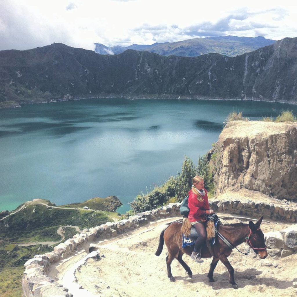
After half an hour of relaxing and enjoying other people celebrating a birthday at the top of their lungs, I decided to get me a horse. Enter Luis, a mule that was drinking the lake’s water when I approached his owner. Like promised, it was $10 to go up. If I could wait by the stables with the other gringos? Okay.
I got grouped together with fellow people with equine interests. The ride up was slow, steady and exactly what I wanted. Horse owner Juan walked with the caravan, so the pace depended on him. When he was not out of breath I tried asking him whether it was a horse (caballo) between my legs or a mule (mulo), but unforgivably I couldn’t find the word at the time. With a phrase consisting of seemingly random words, Juan replied that Luis was a horse.
Back up the mountain, I got back to the hostel for one last night. A big mug of canelazo accompanied the food and the WiFi was strong enough to do some writing at the fireplace. I couldn’t get rid of the smell of horse, no matter how much I tried.
The next day at breakfast I asked around who had a car and was going to Quito. I got a very nice arranged hitch with an Ecuadorian guy named Christian. Before we left, he did the circle hike around the Quilotoa lake in less than four fucking hours! We drove to Quito and he talked very passionately about his country’s amazing nature and his job (mechanical engineer). He wanted to practice his – already excellent -English with me, which is also an unusual thing. He dropped me off in Quito’s center, the capital city of Ecuador and city closest to the equator. I asked him if he lived in the northern or southern hemisphere?
He couldn’t tell.
Add Quilotoa to Bucketlist? Pin Me Please! 😀
Overview & Preparation
Entering the village doesn’t cost you any money at the time of writing (2017), but they are preparing to reinstate the entry fee of around $2 in the future. The caldera trail is open from 7:00 till 16:00 and is 10 kilometers (6.2 miles) long if you take the shortest route. The highest point is 3930 meters (12.890 feet) above sea level. The hike requires a base level of fitness. You can camp for free inside the crater (at the bottom/along the path). There are no Couchsurfing hosts.
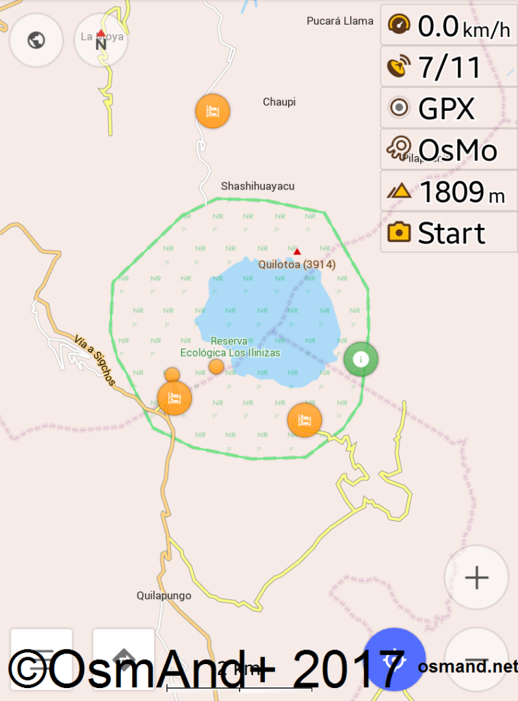
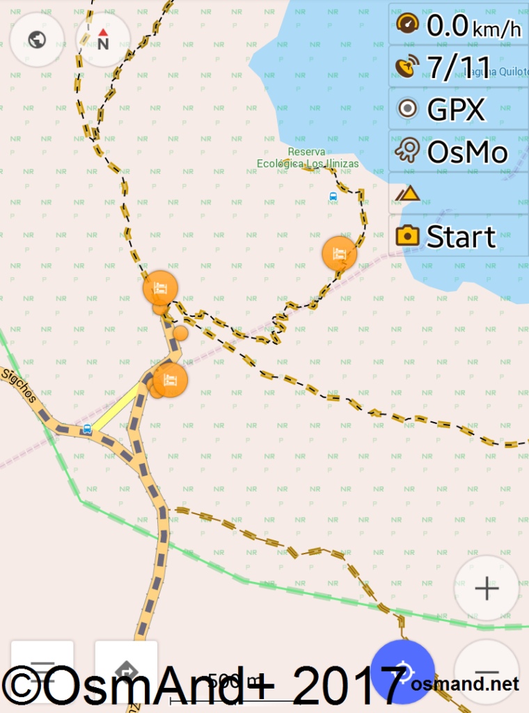
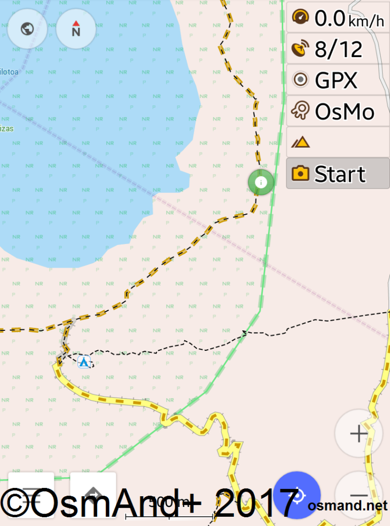
Remember that the Quilotoa circular caldera hike is something different from the famous Quilotoa Loop. The Quilotoa Loop is a multi-day hike that starts or finishes with the Quilotoa caldera hike. Visit the Tourist Information at the wooden lookout at the crater for the latest news on that route. I always recommend getting the OsmAnd map on your tablet or smartphone, as it has (nearly all) the hiking trails on there.
Accommodation will cost you at the cheapest price at about $12 for a bed in a dorm. Nearly all ‘hostels’ do dinner (18:00) and breakfast (7:30) included in the price. You can’t ask for a discount without the food and use their kitchen to cook; there are no ‘proper’ hostels. More ‘upscale’ hotels and lodges are also in town. Make sure to get a room with a fireplace and enough blankets, as it gets cold at night. There is currently no running water in Quilotoa; they truck everything in. Use water from the tap sparingly and don’t shower too long.
Pack in a day bag:
- sun cream
- about 1.5 liters of water per person
- snacks like cereal bars/trail mix/chocolate
- small cash ($1 coins or smaller)
- hat
- (rain/windproof) jacket
- good (hiking) shoes
- GPS/paper map of the trail
- tissue/toilet paper for snotty noses and the other thing
- trash bag, don’t make Ecuador dirty!
- optional: torch/flashlight and gloves
You can buy all of these items in Quilotoa itself, but it might cost you more.
For hiking down the crater, all you need is money, water, and sun protection. At the base, they sell (prepared) snacks and bottled water. For about $2 per hour, you can rent a kayak to go on the lake. Going up by horse (mule, actually) will cost you $10, unless you’re a particularly tall and heavy person, in which case they’ll try to charge you more. I think they treat the horses well, but I can’t guarantee it’s not a case of animal cruelty.








Very cool trip report of an area I didn’t know existed! I’ll pass on the hitchhiking portion, but the actual hike looks amazing! I’m definitely saving this post for my eventual trip to Ecuador…I need to see the country besides the airport on the way to the Galapagos. Thanks for sharing!
Hey Henry thanks for dropping a comment 🙂 I wish you a pleasant trip to Ecuador and Quilotoa! Fortunately there’s also a bus going there 😉
Wow! This place is like paradise for hikers, Iris! What time of the year would you suggest going for this hike and how long should I stay there?
I think it can be done year round, but it seems the temperatures are nicest from June till January 🙂 It’s still a mountain area, so weather conditions change rapidly any day. I stayed for three nights in the area and thought that was adequate, but I’m almost never in a hurry 😉
Hello I will be in Quito for 4 nights in early November 2019 from Australia. I would like to go & see The Quilotoa Crater Lake. I do have a good friend from Cuenca joining me but he is not keen on any big walking but I am happy to do a big all day walking by myself while he rests somewhere. Any suggestions of how to do it from Quito?
Hey Masako! It’s a little late now, but I think you can totally the hike around the crater on your own, since it’s very popular and there are many other people on the track providing social proof. Did you do it in the end?