
")


 to Girne (Kıbrıs)")


")
 to Get a SIM Card in Ukraine (Kyiv)")

")


")

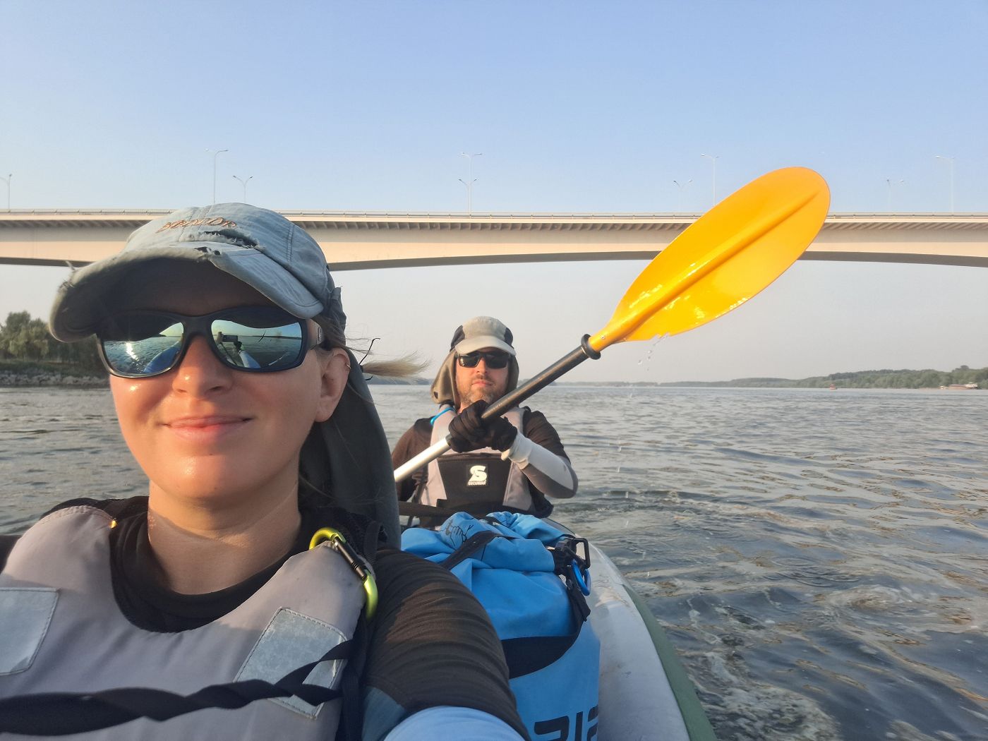
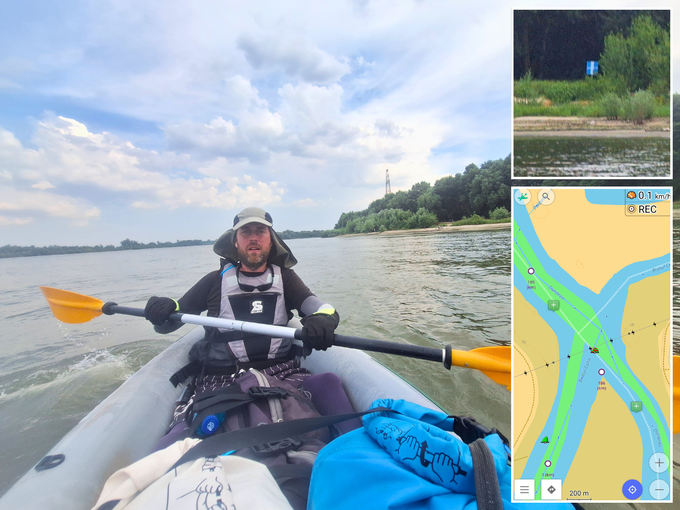
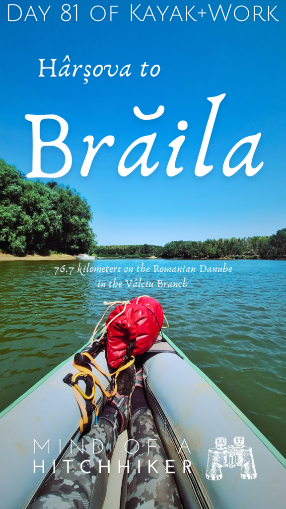
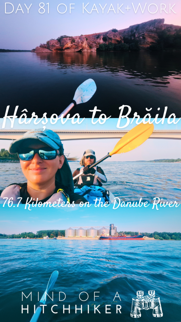
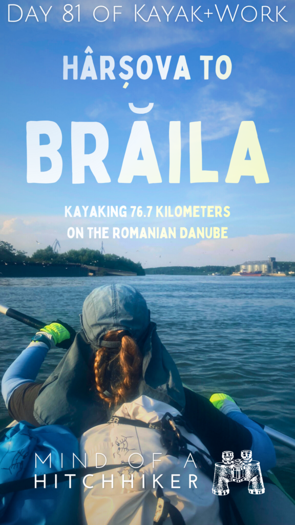
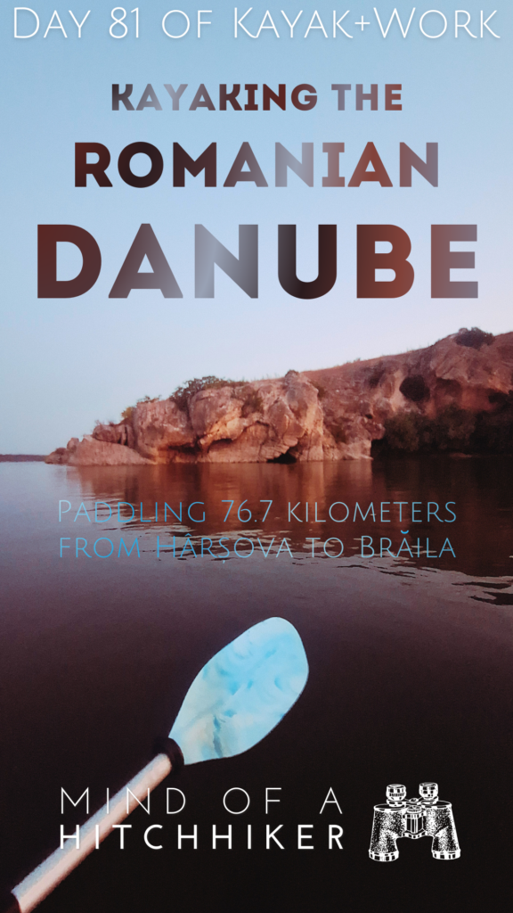
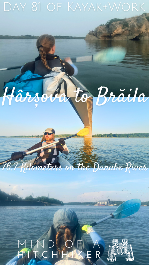
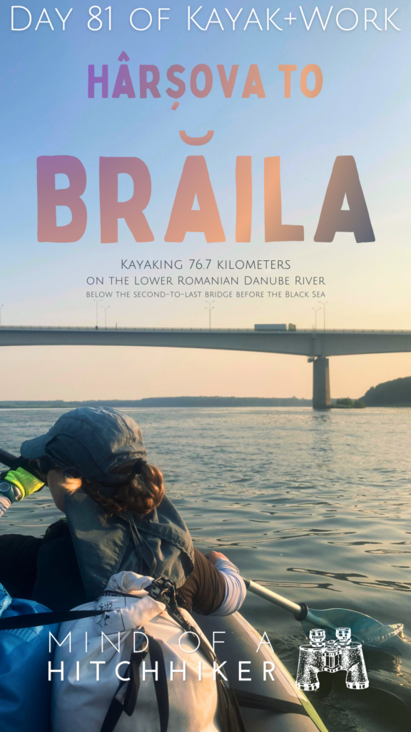
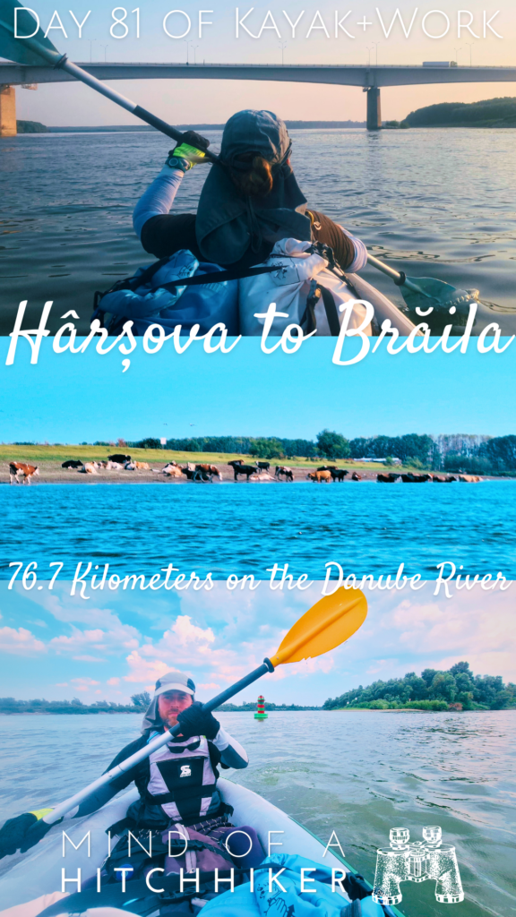
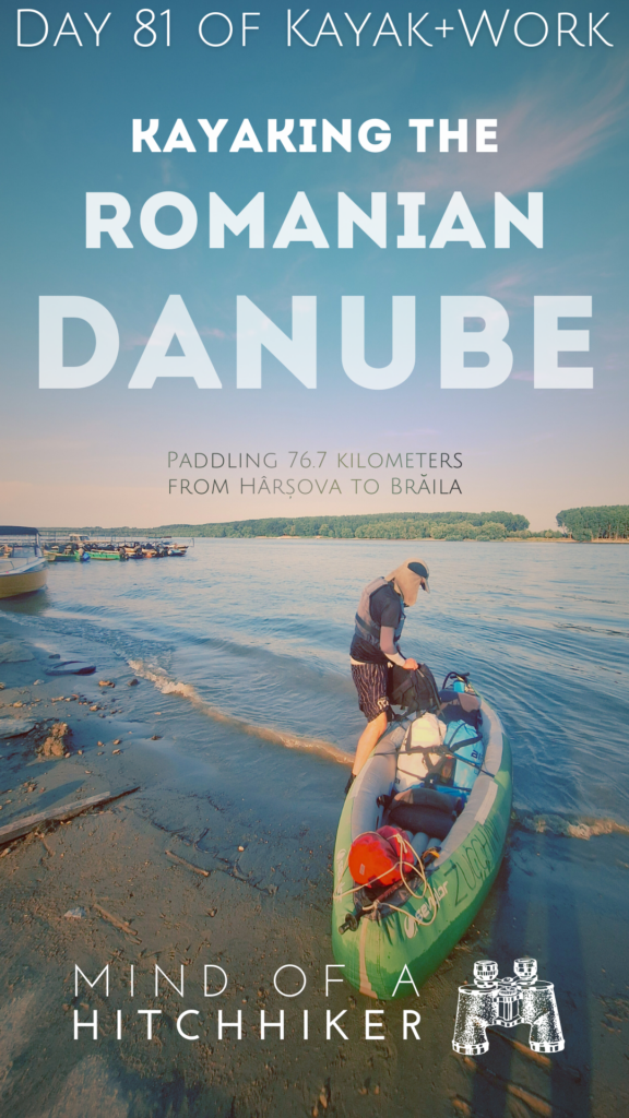
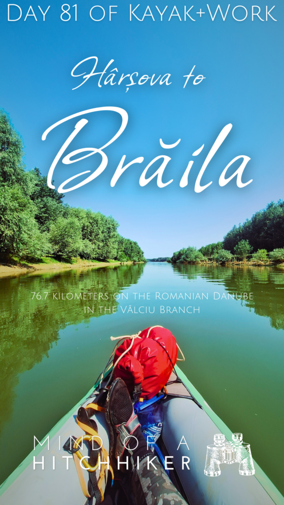
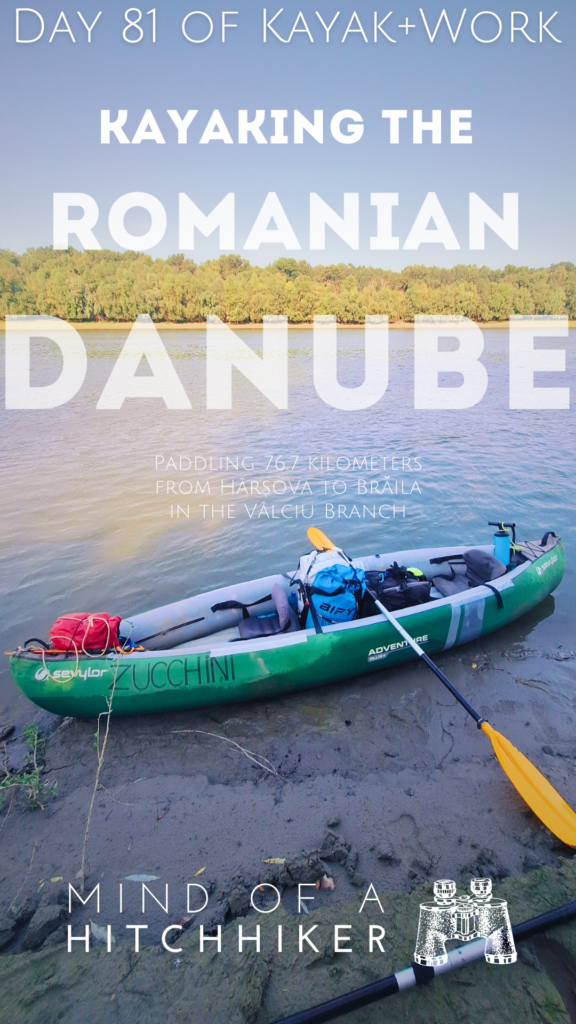
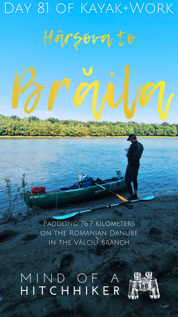
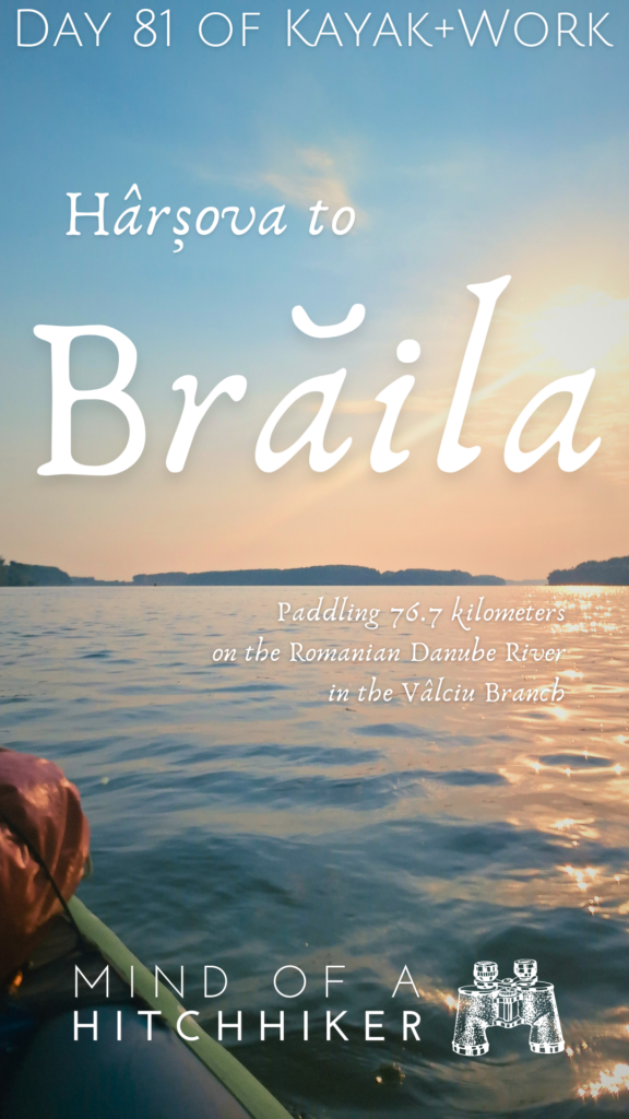
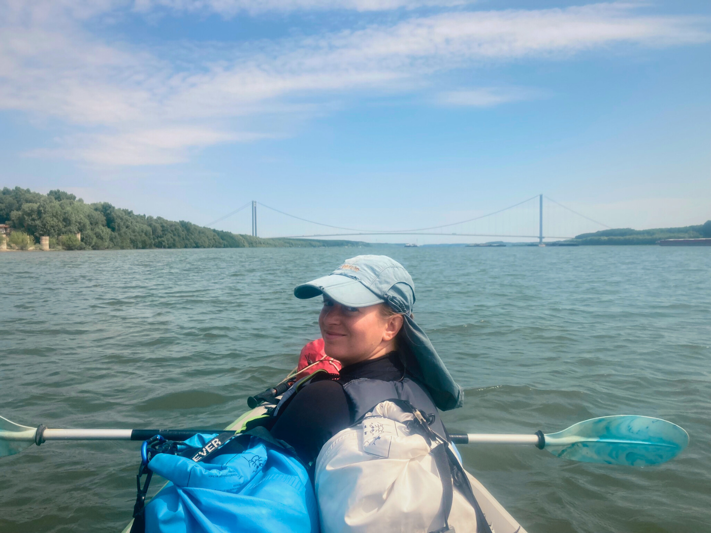
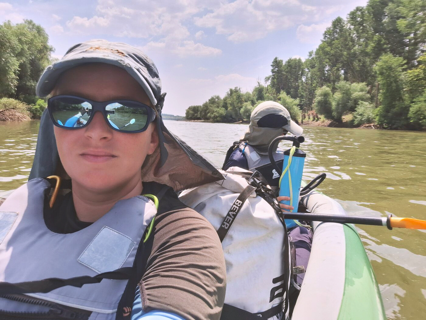
The 81st day of the Danube kayaking trip occurred on Wednesday, the 17th of July, 2024. We paddled from Hârșova through the Vâlciu Branch, intending to go camping. However, things were going well, so we decided to paddle on to Brăila. Brăila is Romania’s biggest city on the Danube River.
Want to travel the (entire) Danube River in an adventurous way? Join our Facebook group Danube River Source to Sea: Kayak / Canoe / Bike / Hike / Sail to find your community
Contents
- 1 Leaving Hârșova Before Dawn
- 2 Stinky Hot Springs + Giurgeni–Vadu Oii Bridge
- 3 Three Branches, Pros and Cons: Cremenea, Vâlciu, and Măcin
- 4 Paddling the Vâlciu Branch: Natural Beauty + Peace
- 5 Re-entering the Danube: Gropeni Ferry + Calia Island
- 6 Red-Green Buoy + Paddling Past Chiscani
- 7 Arapu Branch Military Port + Booking a Hotel in Brăila
- 8 Arriving in Brăila—the End of the TID
- 9 Our Three-Night Stay in Brăila
- 10 Helpful post? Consider buying me a bubbly water!
- 11 Share or save for later? Wonderful!
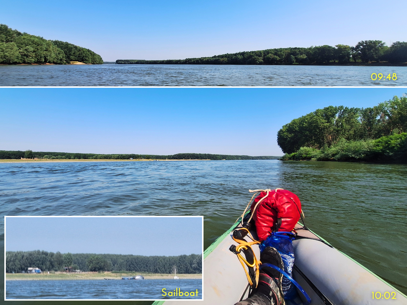
Leaving Hârșova Before Dawn
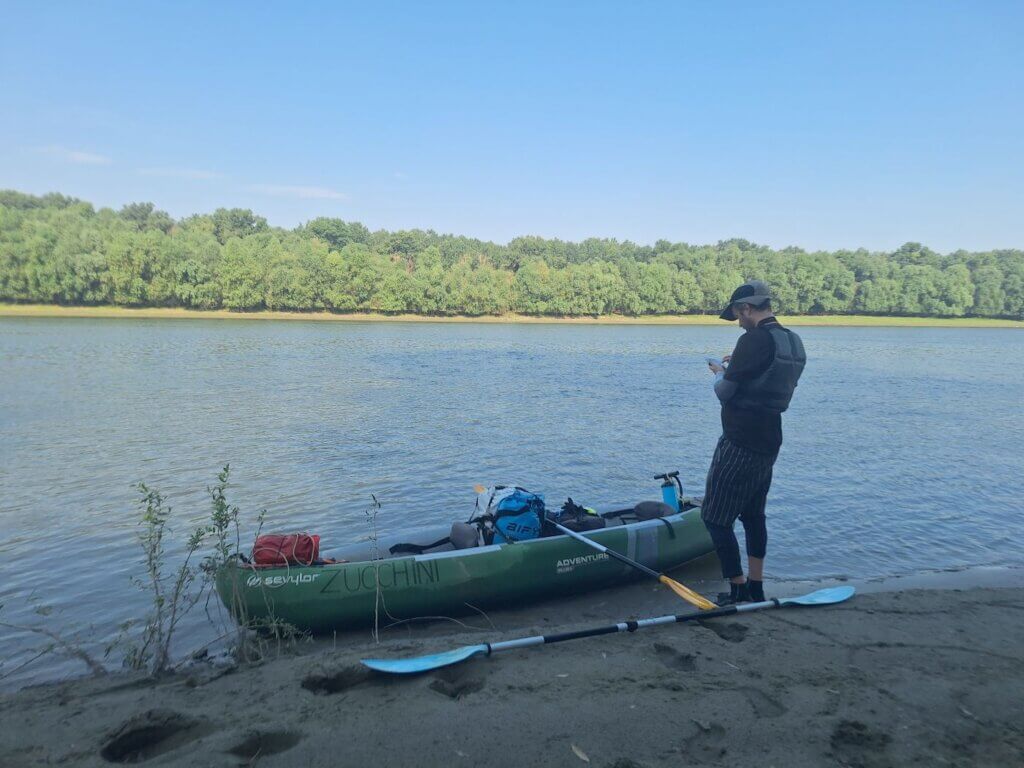
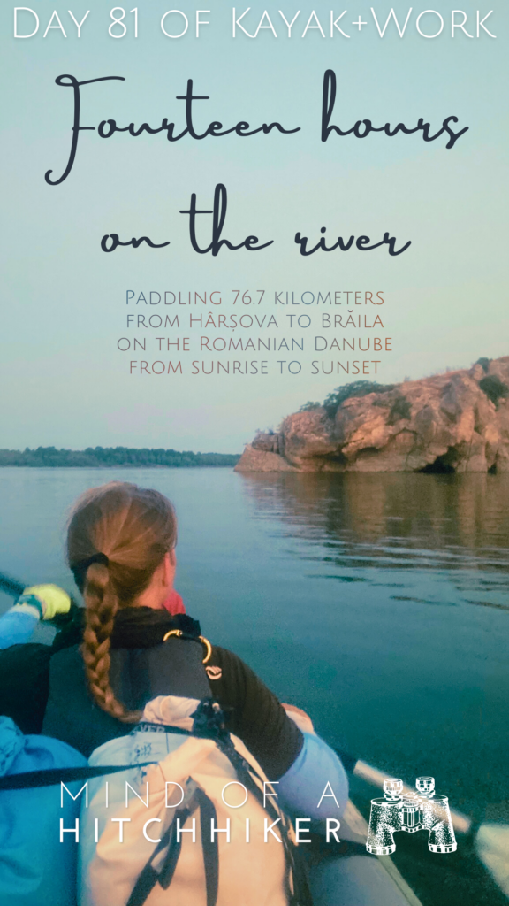
I got up at 4:00 after a long night of waking up several times thinking it’s time to get paddling. After putting on some clothes, I crossed the hotel’s hallway to our bathroom several times to get ready. Jonas got up 15 minutes later. We put on our neoprene socks and water shoes and headed out while trying to be as silent as possible. It was 4:45 when we crossed the levee to walk via the dog-free path to the slipway.
We began pumping up Zucchini when the mosquitoes of Hârșova found us. Getting up before dawn didn’t help jack shit regarding them bloodsuckers. Jonas wanted to pump up the boat by feel instead of using the manometer, but we couldn’t agree on the right pressure. So I adjusted the pressure to summer PSI levels while Jonas swiped the swarm of mosquitoes off my back and arms.
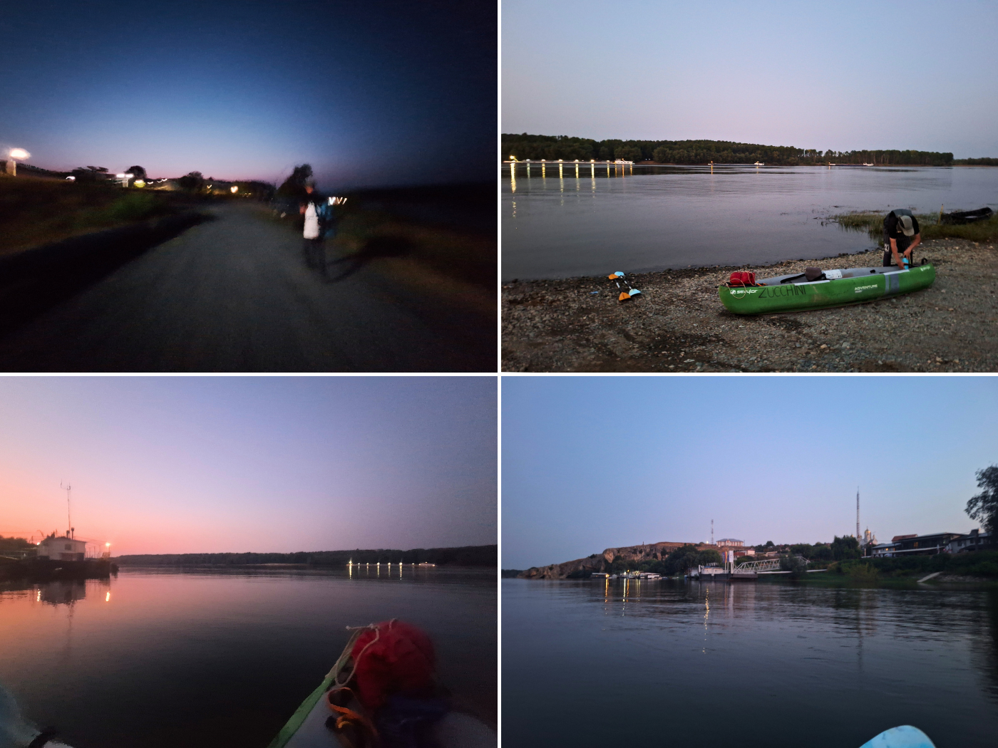
Dawn was here at 5:03. We still had to adjust a few more things before we could leave Hârșova. Some teenage boys arrived to the pontoon where we landed two days ago. I hoped they wouldn’t come to bother us. Teenage me couldn’t be out this early in the AM, not even after a night of partying. They weren’t the only humans; there was also an older man already fishing from the pontoon.
We were ready to go and put Zucchini in the water and immediately hopped in to paddle away at 5:11. That’s our newest earliest starting time.
We gained speed in an attempt to leave some of the mosquitoes behind. Then we spent three minutes swiping them off ourselves and off the boat while occasionally paddling. Once most were gone, we paddled past the cliffs and caves of Hârșova. If there’d been the time and chill, we could have tried paddling inside one of these.
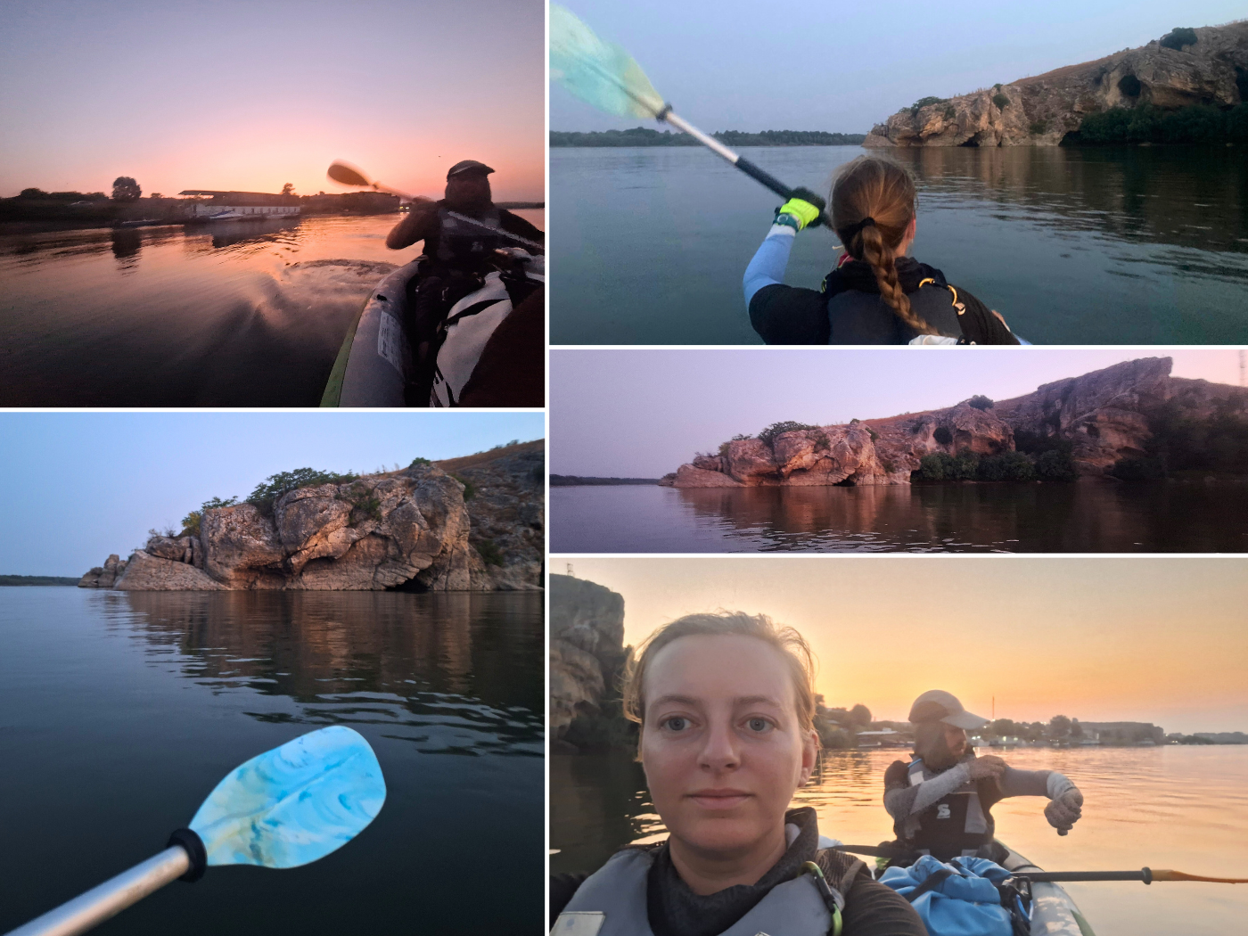
Around the corner, we paddled past the spot where the TID camps in Hârșova. There were some more cool rock formations in the area before we paddled around the right side of an island called Ostrovul 23 August (OSM) or Insula Iubirii (Google Maps).

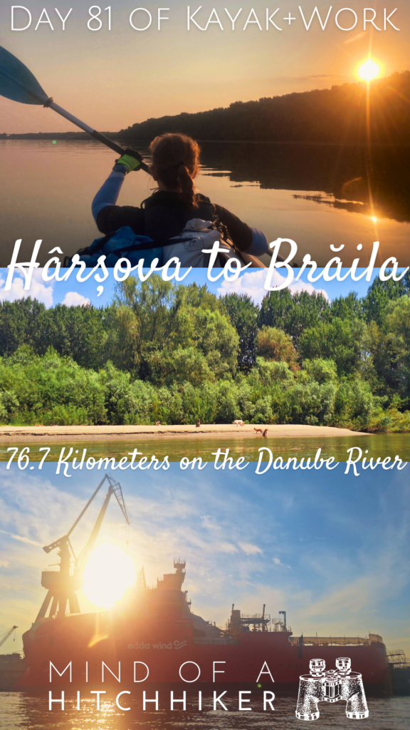
Sunrise happened somewhere behind us at 5:39, but we didn’t really see it as it hid behind the trees. I said to Jonas that I was really happy we have already experienced a sunrise on the Danube on the day from Ostrov to Rasova. Today isn’t really a day to mess around with.

Stinky Hot Springs + Giurgeni–Vadu Oii Bridge
At 5:50, we were beyond the river island. The shipping lane had been on the other side, and a ship was coming downstream in the distance.
To our right was a pumping station to get Danube water, filter it, and put it in the pipes. It was very noisy, but somehow that wasn’t a deterrent for people with caravans and tents to camp next to it. Couldn’t be me.
The line of camping rigs was over a kilometer long and centered around something mapped as a tourist attraction on OSM as la izvoarele sulfuroase – puturoasa. That translates to ‘sulphurous springs – stinky’. And stinky it was as the mild headwind carried the scent towards us. It smelled a bit like chicken soup. Though it was 6:00, the hot spring was already at full capacity. So many people were in the soup. And there were probably people queueing. It better be healthy.
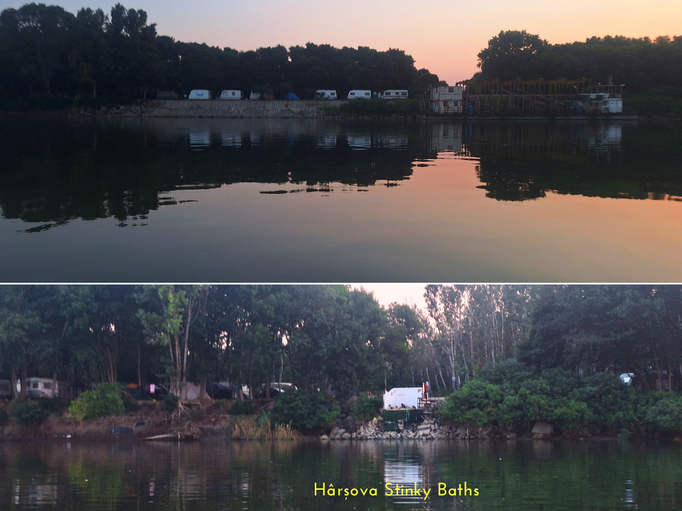
This didn’t surprise me, as I’d read the reviews of this place on Google Maps the night before. First I thought it could be fun to make a stop here, but the reviews weren’t glowing, mentioning trash, dogs, ruffians, and people pooping in the forest. Many of the reviews were also glowing.
The ship aimed directly for us for a while, then turned. They overtook us quite closely, which I didn’t find very necessary.

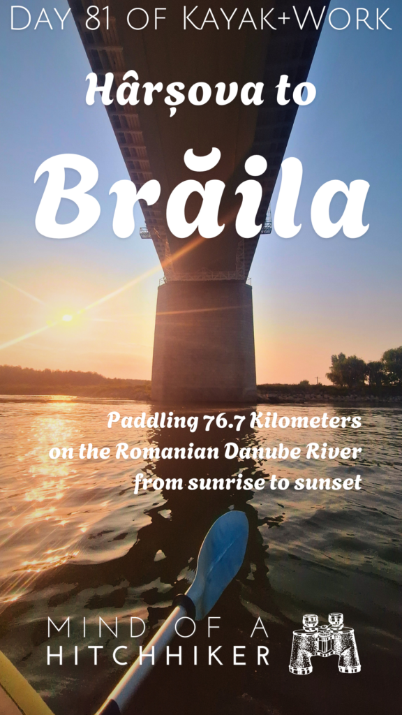
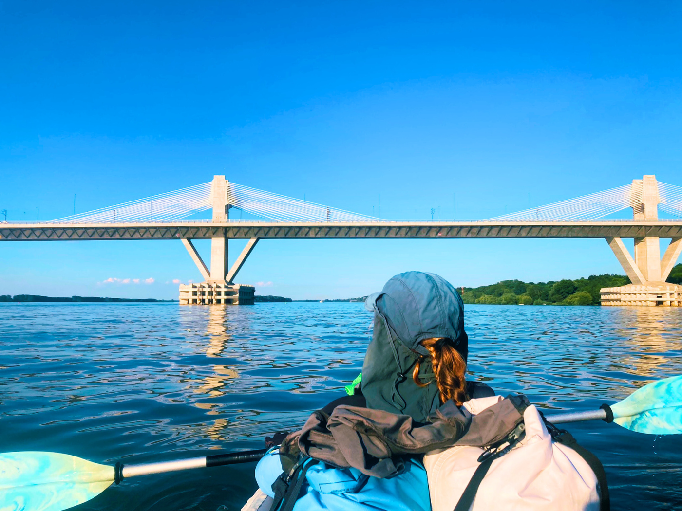
After the campsite ended and the barking stopped, we were paddling the long slow right bend where the Borcea Branch rejoins the Ostrov / Dunărea Veche Branch. And I was hoping to soon catch the first glimpse of the Giurgeni–Vadu Oii Bridge. That’s the second-to-last bridge across the Danube.
It didn’t take long for us to see the tip of Balta Ialomiței island. The Borcea Branch is partially navigable during higher water levels, so I was hoping to see a ship pop out.
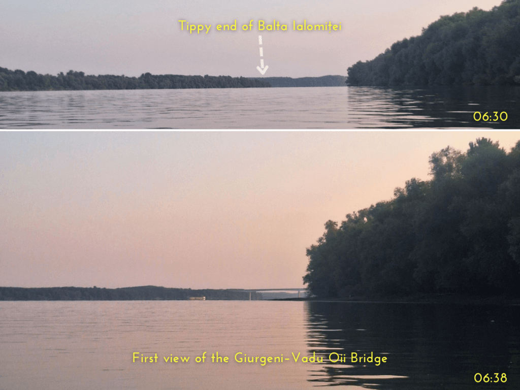

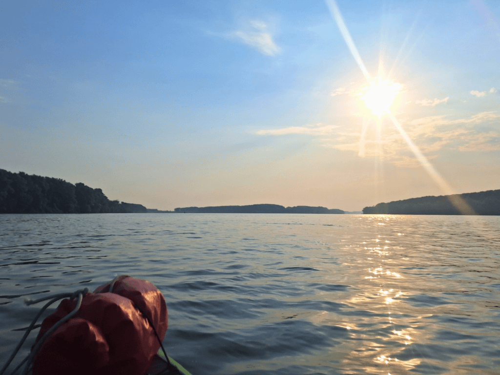
It took an excruciatingly long time for the Giurgeni–Vadu Oii Bridge to become visible, but I was very excited once I saw the first truck moving across the sky at 6:38. We were already near the tail end of Balta Ialomiței. The Borcea Branch rejoined and we didn’t experience any weird currents or an increase in speed.
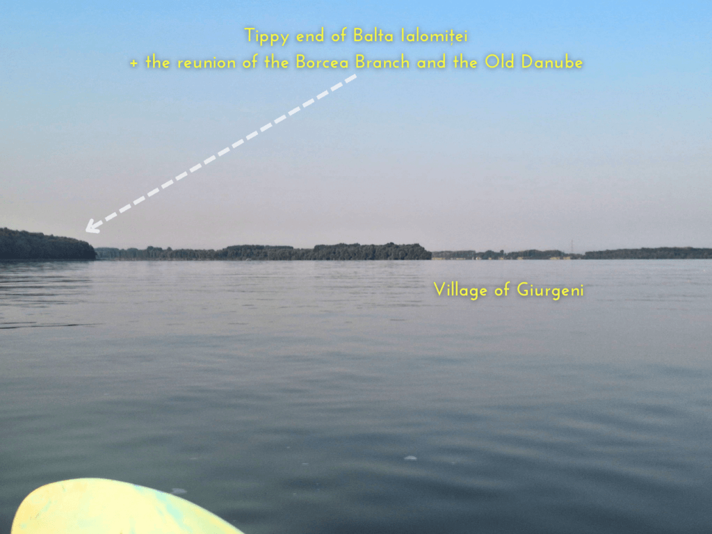
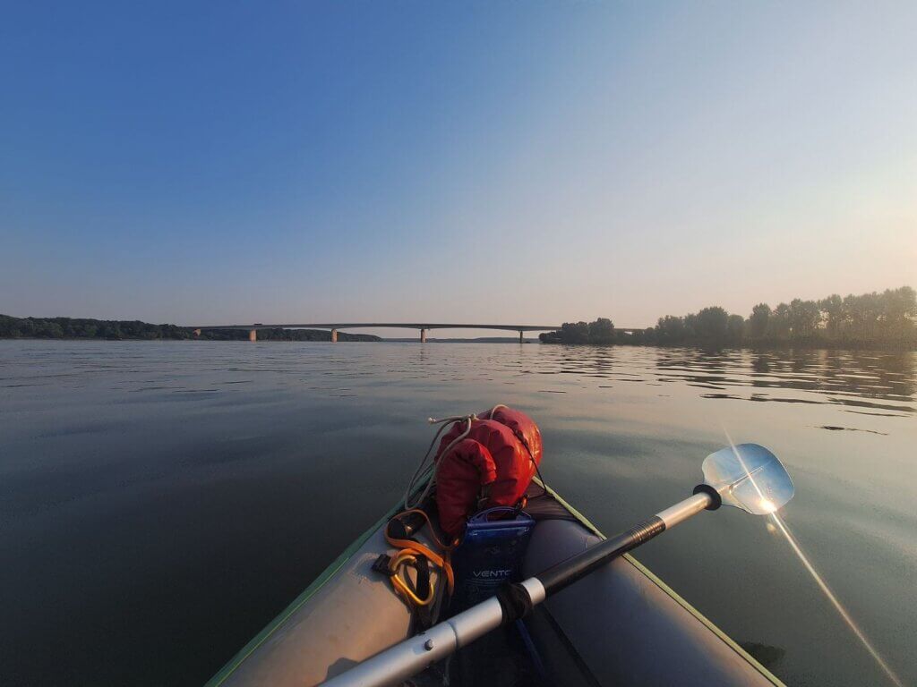
Jonas and I headed for the span under the bridge right of the center one. The shipping lane goes more to the left. We encountered some people in fishing boats in the area. Looking back at the Borcea Branch, there wasn’t much to see. Just the shoreline of the village of Giurgeni. Vadu Oii to our right was practically invisible, though the bright sunshine to our right didn’t help.
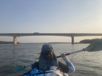
We kept paddling as the headwind was amplified below the bridge and took breaks to take photos and videos. This isn’t exactly the most impressive bridge of the Danube, design-wise. It just carries cars, trucks, and brave pedestrians and cyclists over the sidewalk. It opened in 1970 and today it costs 11 RON in toll to cross.
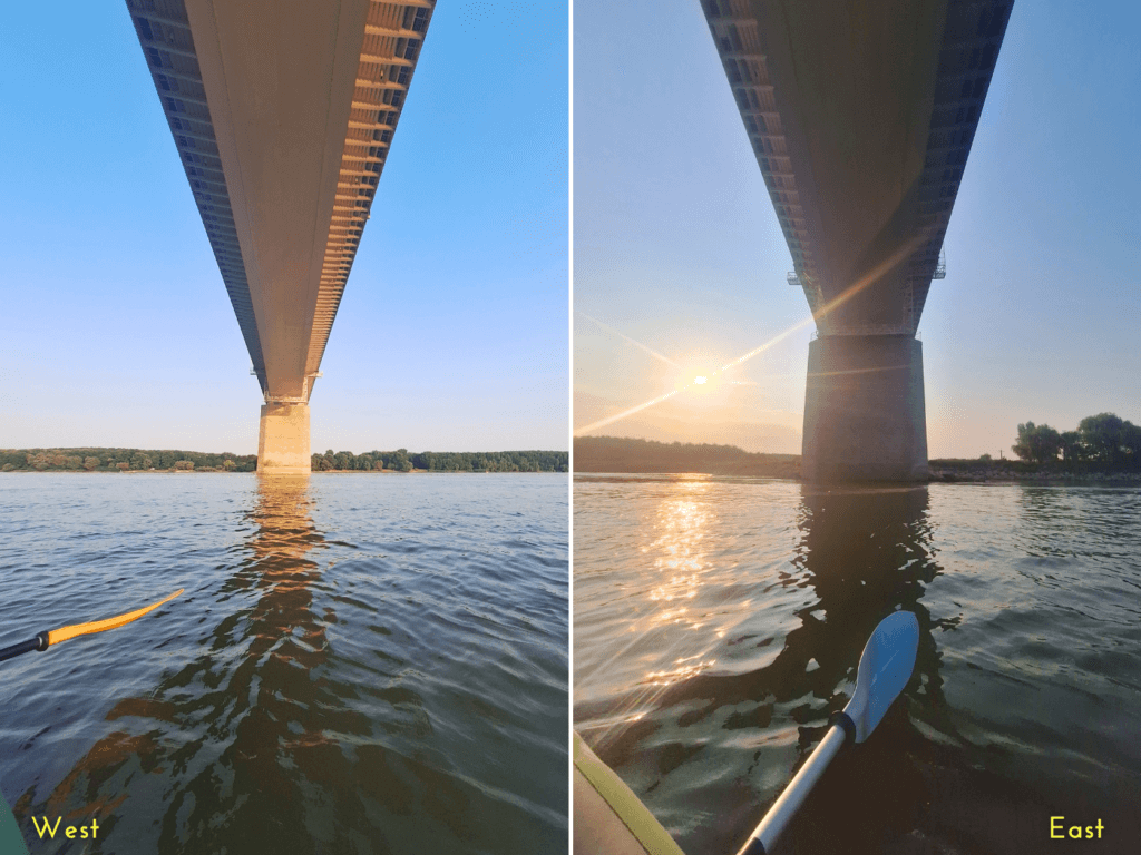
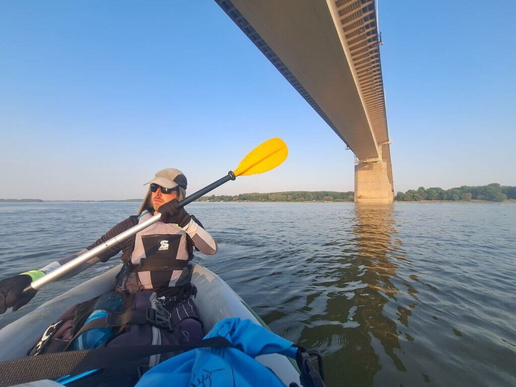
Still, it was very exciting. The bridges in this area of the Danube are far apart, and yet we passed under the last Danube bridge only two paddle days ago when we arrived in Cernavodă. There’s only one more bridge across the Danube before the delta and the Black Sea.
Three Branches, Pros and Cons: Cremenea, Vâlciu, and Măcin
After the Borcea Branch and Ostrov / Dunărea Veche have rejoined to form One Danube, it lasts only very shortly. After 4.3 kilometers, the river branches out again into multiple choice: Cremenea, Vâlciu, or Măcin.
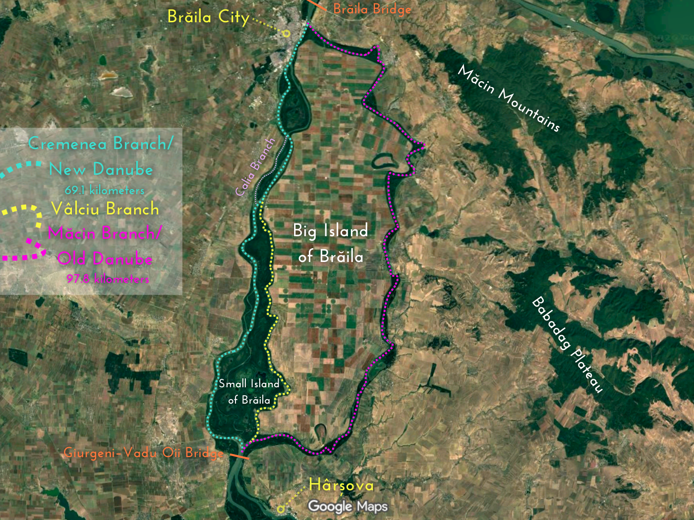
Jonas and I made our choice before we set out paddling this early morning. But each choice is a trade-off. So open this to read more about the choices:
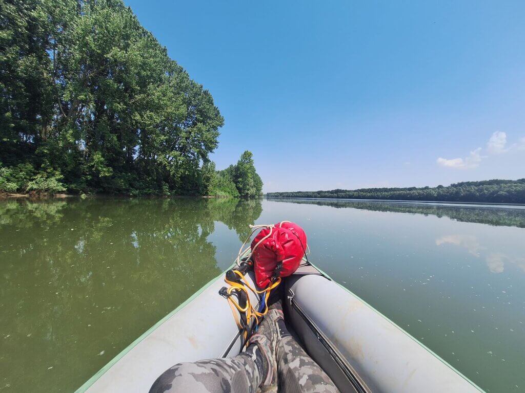
Paddling the Vâlciu Branch: Natural Beauty + Peace

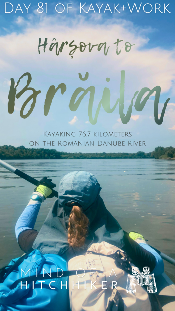
As we sorted ourselves in the Vâlciu Branch while keeping an eye on the navigation, we passed two men in a fishing boat at 7:39. They were friendly.
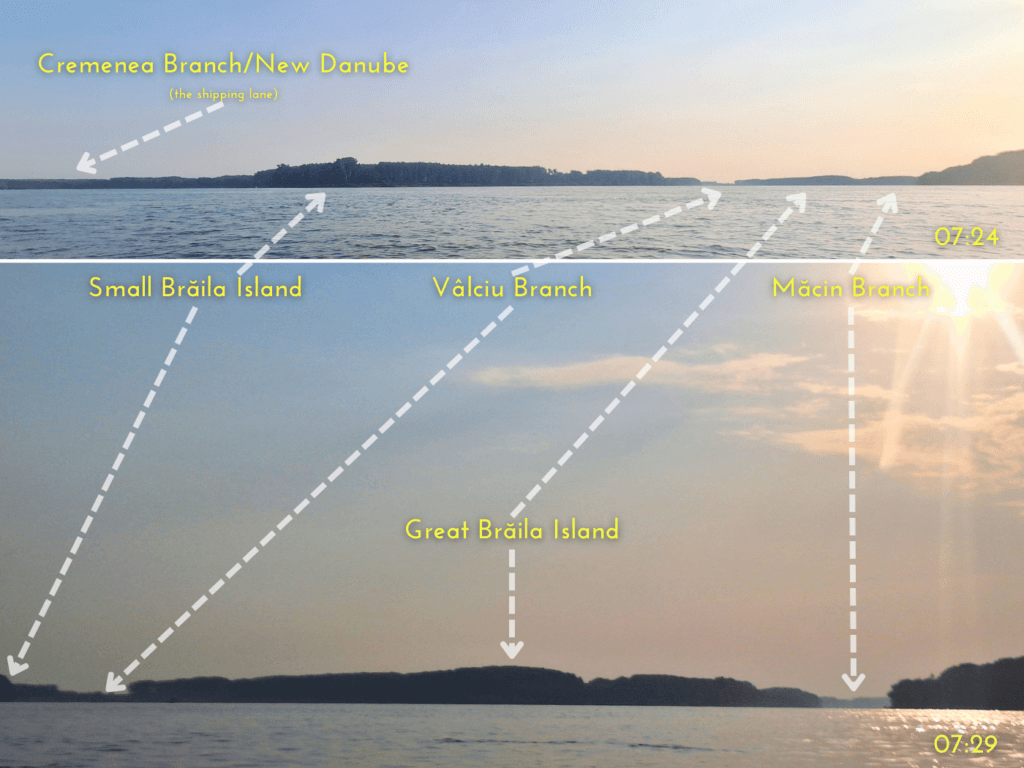
 The Vâlciu Branch to the left, the Măcin Branch to the right
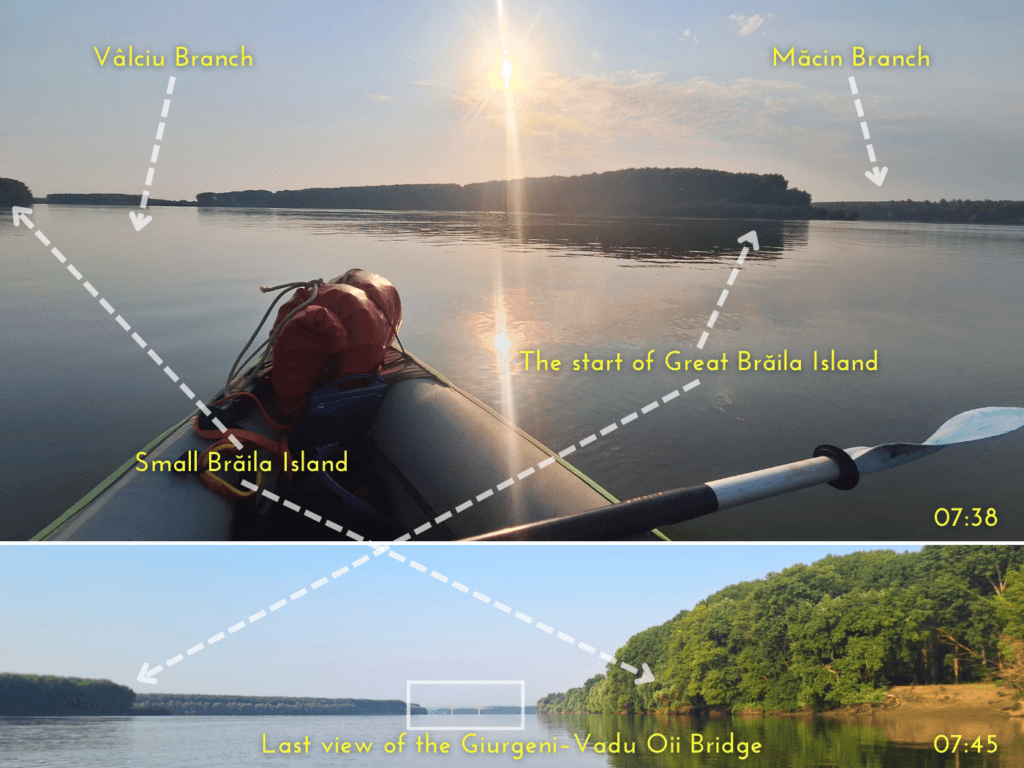
Though there’s a beach mapped at the head of the Big Island of Brăila to our right at the village of Măgureni, we didn’t see a beach. I guess the water levels are still quite hight. We couldn’t see any proof here of a village.
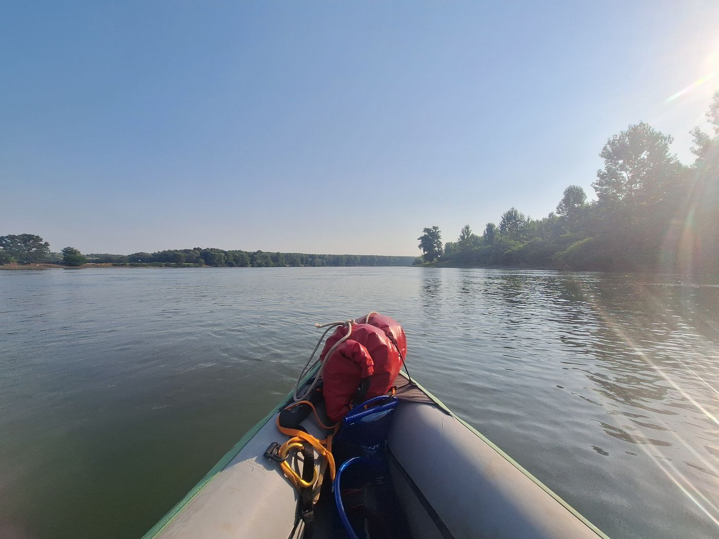
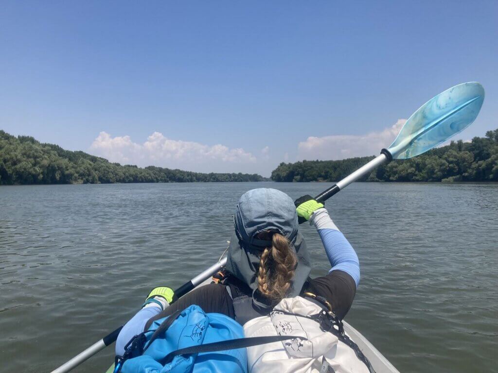
Entering the skinny Vâlciu arm, the current picked up at river bends. It took me some getting used to that we didn’t need to look over our shoulders anymore for big ships as we shortcut the river bends. The lack of a straight line felt very motivating. Jonas expressed how very happy he was to be here. That made me happy in turn.
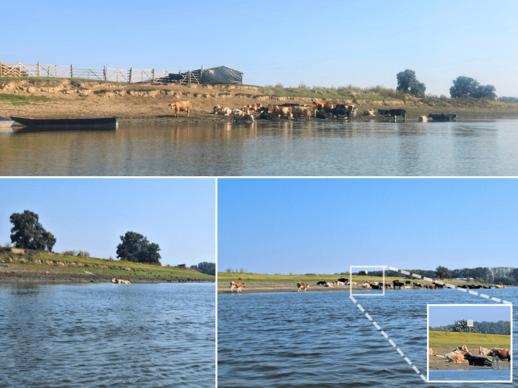
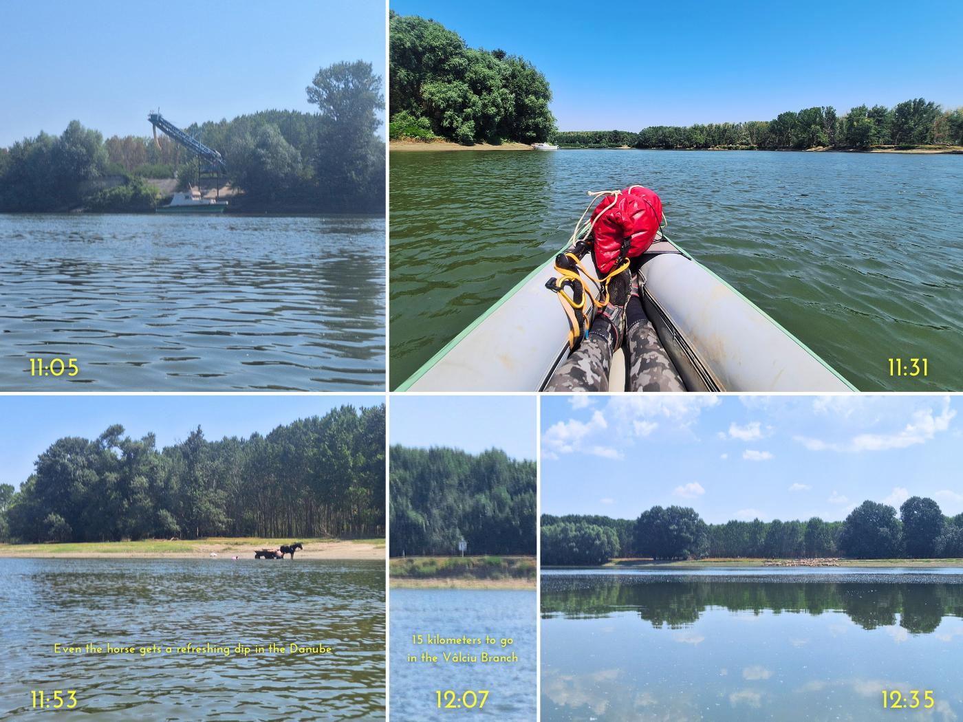
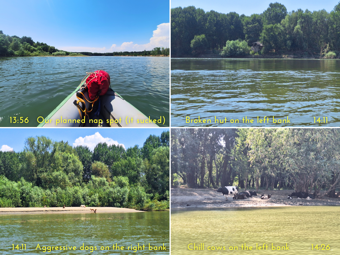
There were cows on land to our left on the Small Island of Brăila, which is mostly a nature reserve, though there are some patches of fenced-off pasture, such as in Nedeicu. There was a frame to hold a kilometer sign, but the sign was missing. We were three hours into today’s trip. On the right bank, there was a horse standing over another horse lying flat on the ground next to a tree. I thought maybe the living horse was mourning the dead one. But thankfully, the dead horse arose as we paddled past.
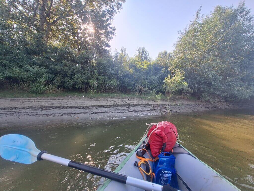
After a tasty protein bar, I was still focused on keeping the pace at least until Mărașu, but it was also time to take a short break on land to pump up the left air chamber. Since the river is very curvy here, the side where the embankment is vertical and impossible to land at kept switching. I wanted a place with some shade as well, but it was difficult to find something. Finally, at 8:51, we found a spot that wasn’t too muddy and had a tolerable number of mosquitoes. I helped Jonas out of the boat by pulling him parallel to the shore, but then some animal ducked under the boat. Jonas said it was a snake, I thought it might have been a frog. Either way, it’s good it didn’t end up inside Zucchini.
Jonas pumped up the left air chamber and tightened the valve more. He tried listening to where the air was escaping, but didn’t hear a sizzle. There’s still a chance that we did fix the leak of the left air chamber in Hârșova, but didn’t tighten the valve enough this morning as we were in a hurry to get going. We left our break spot after 12 minutes.
 Paddling away from our muddy landing spot
Not much later, we were at the village of Mărașu. There were so many bathing cows on the shores of the Small Island of Brăila. Jonas took a little vlog about it. We also spotted the first real kilometer sign of the Vâlciu Branch. It said 30. It’s counting down to when it rejoins the main stream of the Danube, the Cremenea Branch.
As Mărașu is the only place with real accommodation, I offered Jonas the chance to call it quits here at 9:38 in the morning. There wasn’t a doubt in his mind that it would be good to continue paddling. Mărașu is only roughly one-third of the way to Brăila. If we find a camping spot at two-thirds or later, that would set us up for successful paddling tomorrow.
Though we know Mărașu exists, we couldn’t see proof of the village as it’s more than 200 meters from the shores and not a single building towered above the trees. But there were people out on the beaches this early in the morning. The same happened to Băndoiu, which was the next village only a few kilometers away. At Băndoiu, there was a sailboat at anchor across the river to the left. Jonas said that’s a bad omen for what the wind will do to us today. I wasn’t so sure.
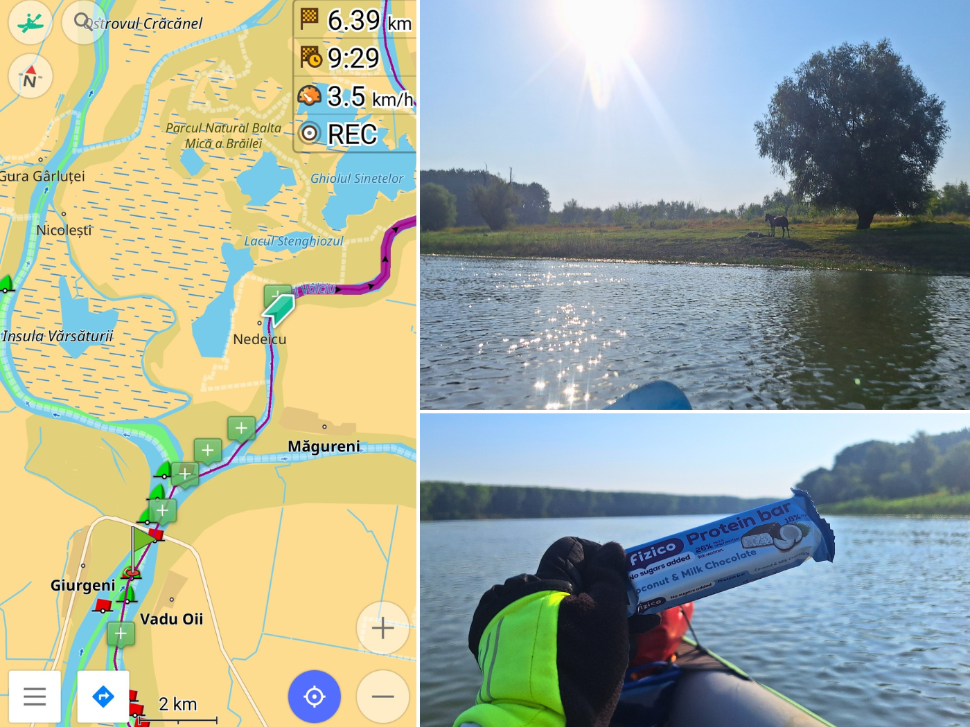
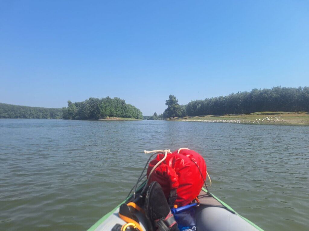
It was time to reapply sunscreen for me. At Băndoiu, we were five hours into our kayak day. There was a small island near the village and we decided to paddle in the narrow channel. I don’t think this would have been possible two days later, as the entry was quite shallow with only 40 centimeters of water. There were lots of geese on the right-hand shore and other river birds on the small island. Perhaps it wouldn’t have been a bad island for camping, but it was too early. Beautiful reflections, though!

The stretch to Țăcău meandered a lot less, which unfortunately meant a decrease in (perceived) current and an increase in headwind. However, there were no big waves as the Vâlciu Branch is still quite narrow. At Țăcău, Jonas wanted to turn airplane mode off on our phones to catch some signal and get the latest weather forecast. Somehow, it didn’t work on his phone, so I opened the Windy app and passed my phone to him so he could analyze the forecast.
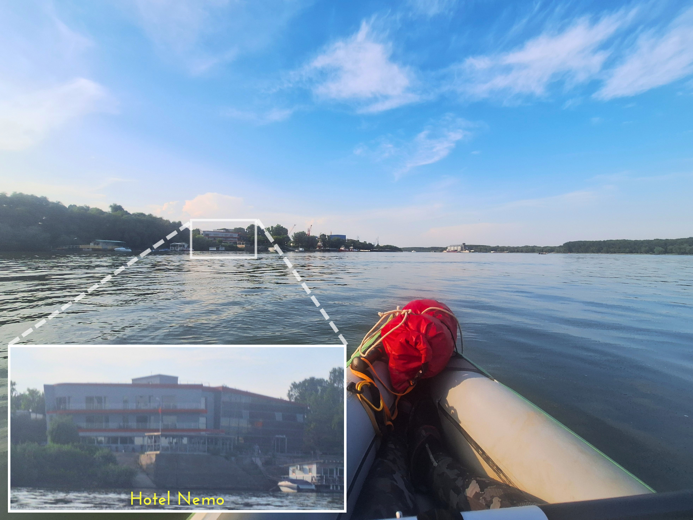
It stayed the same: the wind will increase to 13km/h until 15:00, and then slowly go down. We were now more than six hours on the water, but it was still before noon. I checked the distance to Hotel Nemo in Brăila and found out we now had less than 40 kilometers to go. That’s amazing!
We paddled some more kilometers. A father and daughter on a horse cart kicked up dust on the right-hand shore. The guy drove his horse into the water, hopped off, and spent a good amount of time scooping water onto the horse to wash and cool them down. Then they both went for a swim. I checked the map, we’re over halfway to Brăila! About 38 kilometers to go. It’s now the afternoon.
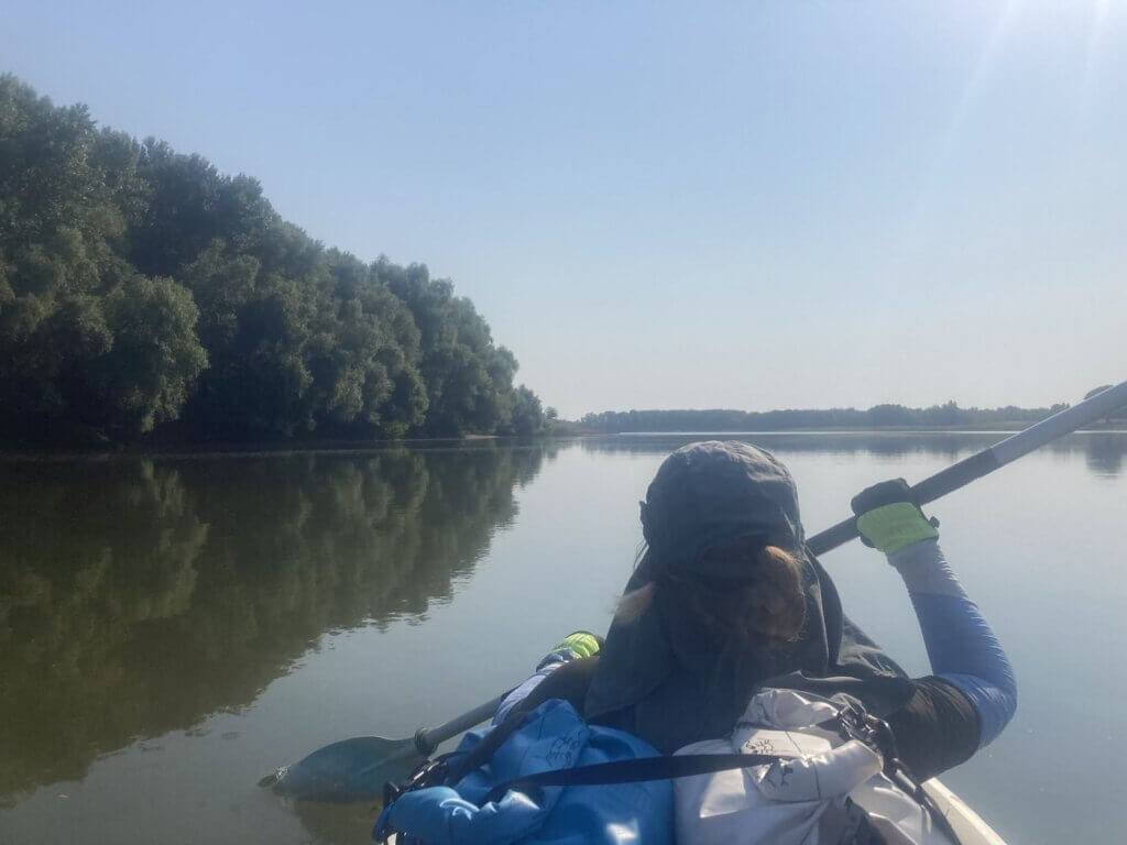
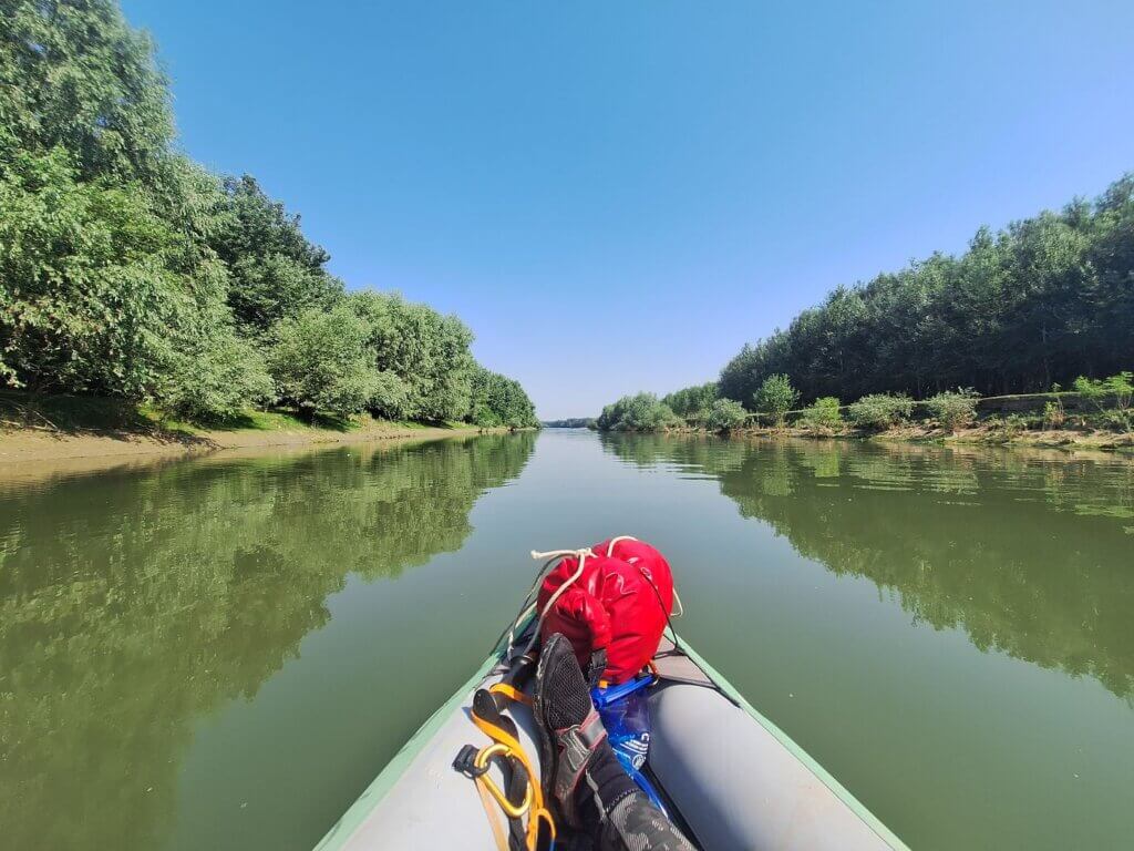
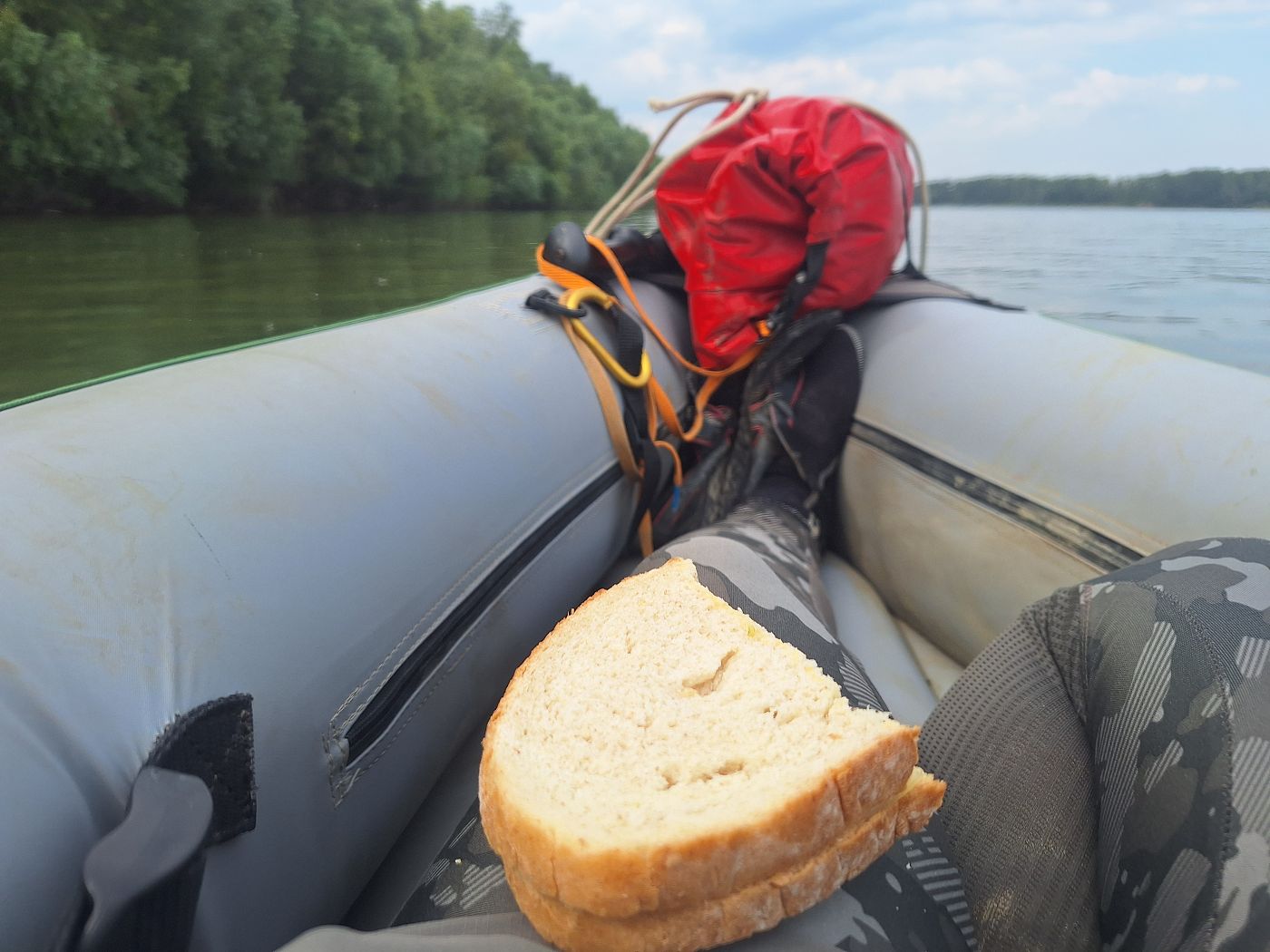
The next stretch of the Vâlciu Branch was a little more challenging as there were no villages left and our arms were a little tired. Jonas ate some sandwiches while I tried to keep the pace. Still, Jonas was so happy to be here and actively enjoyed the area. We practically had this branch all to ourselves.
There were few kilometer signs. Perhaps they existed every five kilometers originally. The next one we saw was at some former conveyor belt that put aggregate on small cargo ships or barges on Big Island of Brăila. It said “5”. This Vâlciu Branch is coming to an end soon.
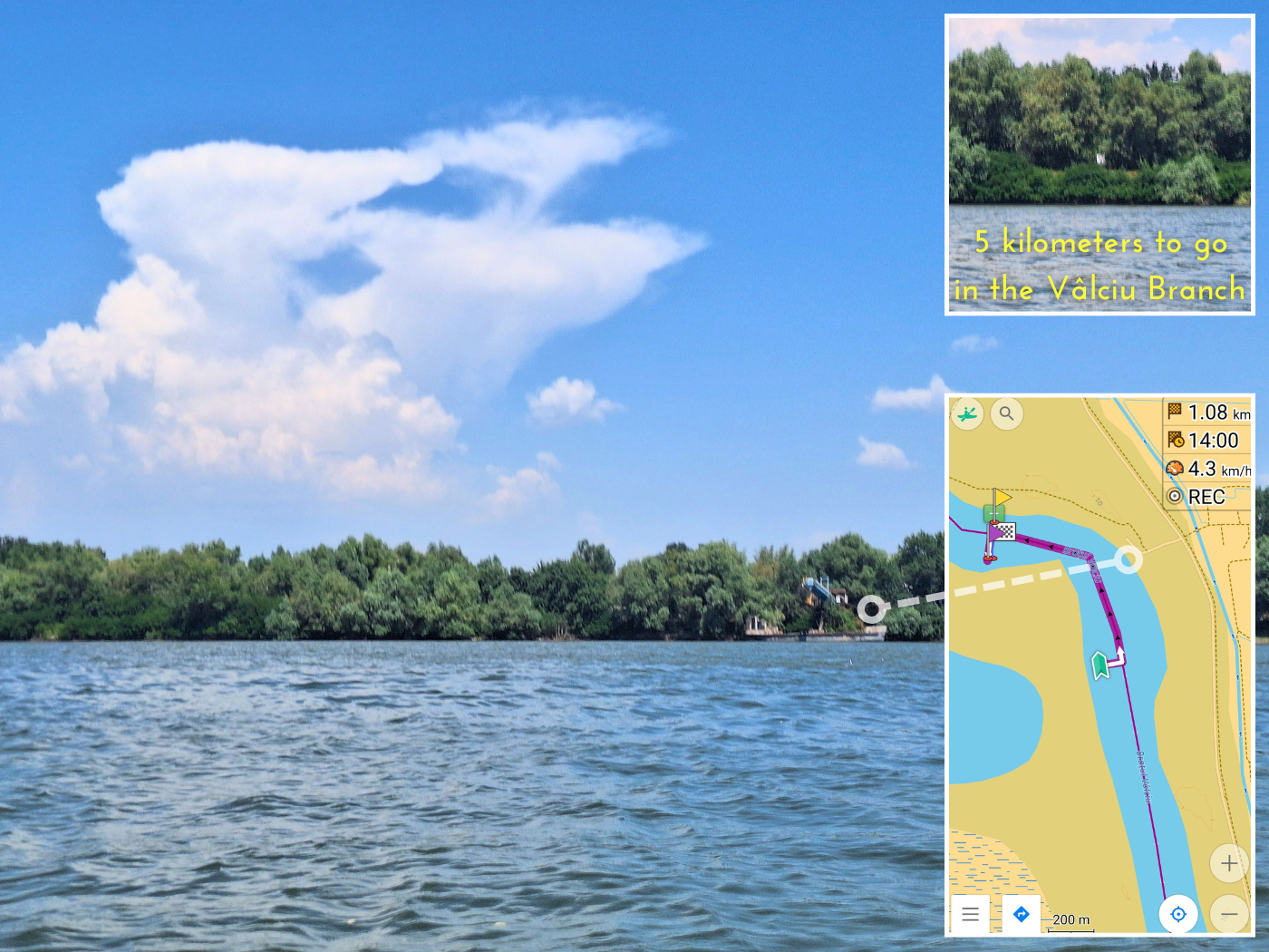
This area had a few sharp river bends, which meant an increase in speed. The day before, we’d looked up potential landing sites on satellite. This area came up as particularly sandy. Jonas hoped to land here to have a nap in the shadow on the beach for one hour or during the worst headwind. It was now 14:00 and it wouldn’t be long now.
We tried landing somewhere, but were immediately swarmed by mosquitoes. It was also too muddy, so I almost lost my shoe to 20 centimeters of silt. We got out of there. And yet it looks so pretty and harmless.
Jonas wanted to land at a similar spot a bit further downstream, but the river made a sharp turn right. I said this spot would be the same. Too much mud and stagnant water. But on the right-hand shore on the Big Island of Brăila, there was a promising sandy beach in the sun. Perhaps we couldn’t have a nap there, but we could take a short break.
As we approached the sand bar, six dogs came storming down the embankment to the beach. Abort! We paddled away from the area, but some of the dogs were hyping each other up to swim after us. A few entered the river, but they didn’t actually follow us. They just kept barking.
Disappointed, we continued paddling a little more. We found an okay landing spot on the Small Island of Brăila and landed there at 14:20. We just needed to get our human needs met and we were done and back on the river in three minutes. Getting rid of the mosquitoes took longer. No photos as this was all business and no pleasure.
These experiences gave us no confidence in camping. Either we’re not alone because there are vicious dogs, or we’re not alone because there’s mosquitoes. If we’d find some kind of golden opportunity campsite, there will probably already be people. Damn. I think we really tried.
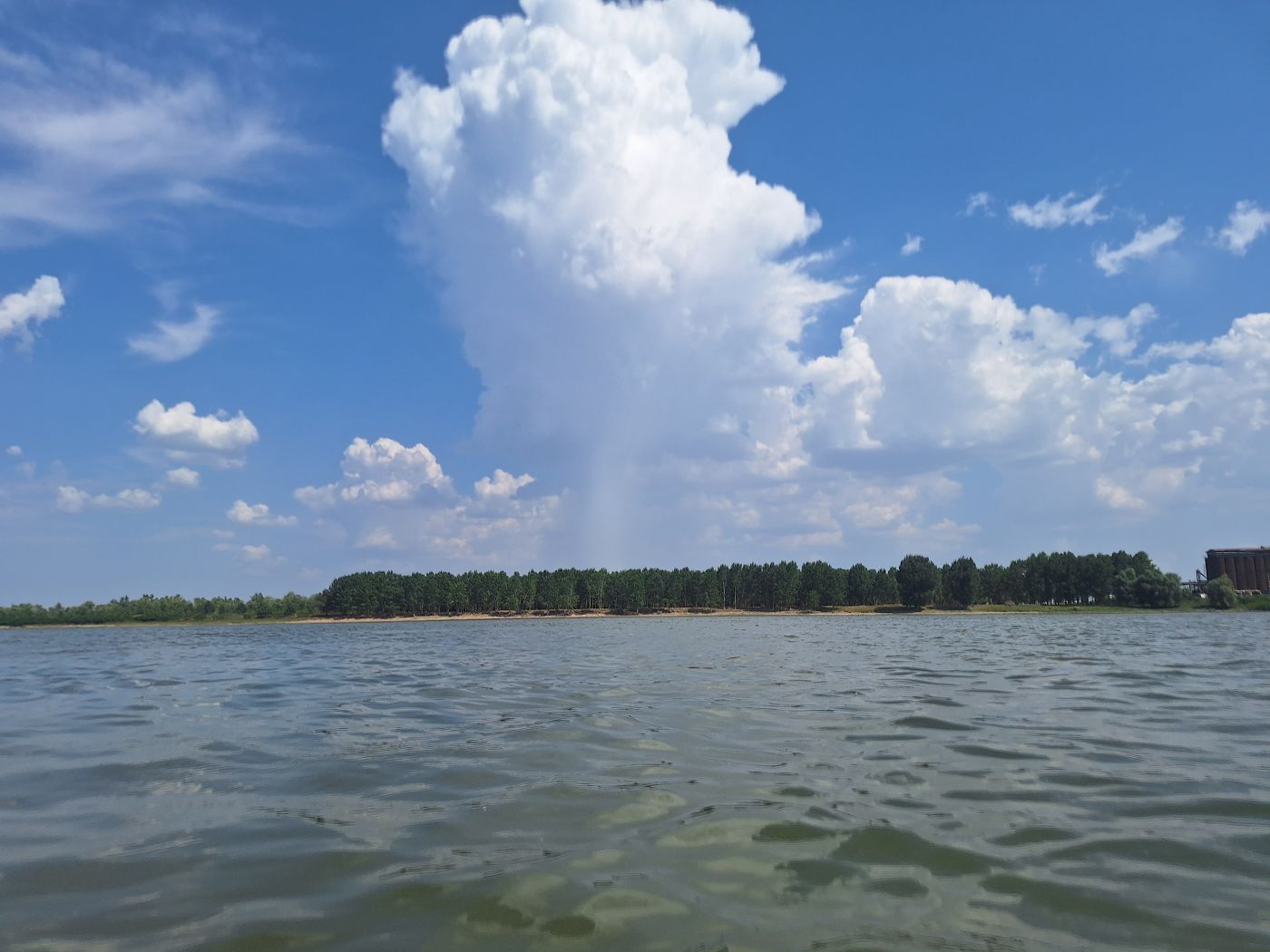
It’s a good thing we’re only 25 kilometers from the first riverside hotel in Brăila. We’re two-thirds of the way and we still have more than six hours to go before sunset. We saw the end of the Vâlciu Branch in front of us and one big crane on the right-hand shore. A potential rain-and-thunder cloud appeared in front of us. I hoped it wouldn’t become our problem.
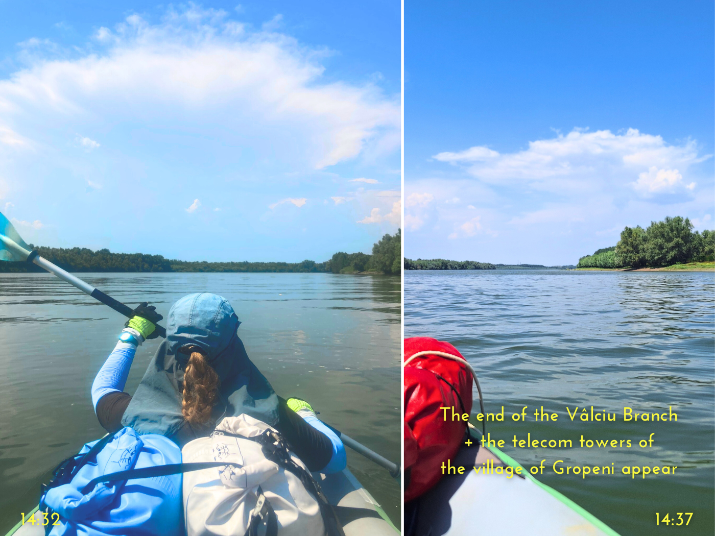
Re-entering the Danube: Gropeni Ferry + Calia Island
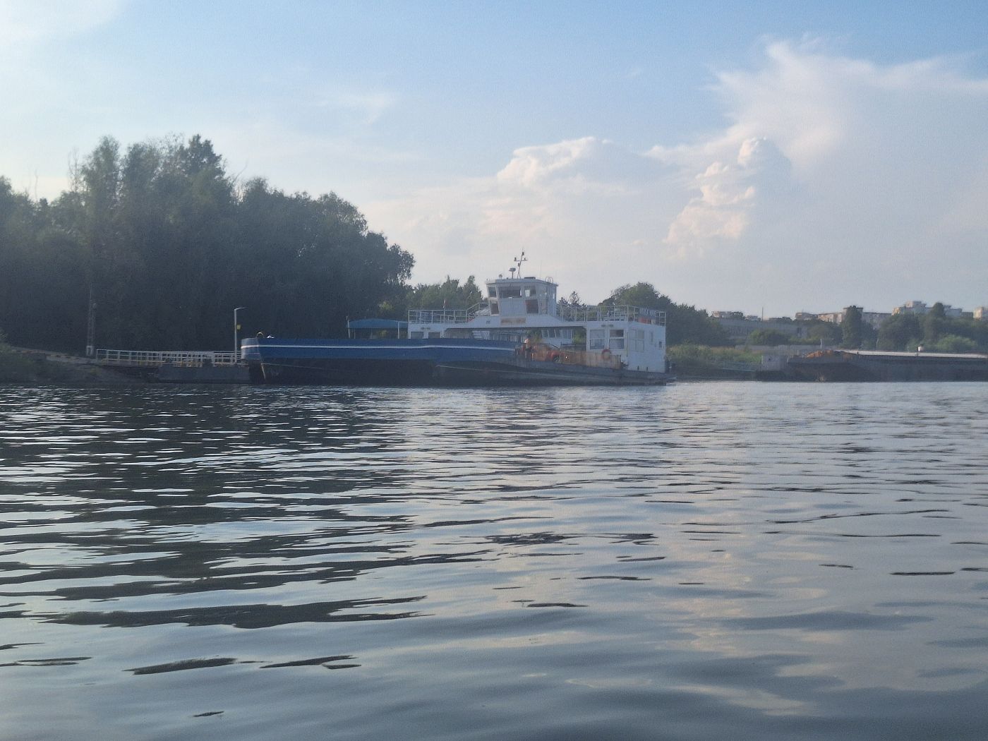
At 14:51, we said goodbye to the Vâlciu Branch. We anticipated big ships on the river, but weren’t ready for the ferry from Gropeni popping around the tail end of Small Island of Brăila to its landing spot at the Big Island of Brăila. It was fast!
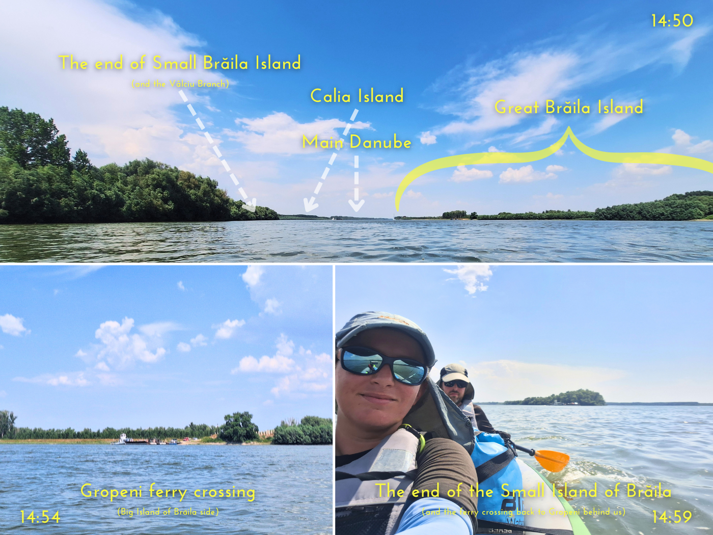
We kept paddling to make sure we’d be gone before it would return to Gropeni, but even the unloading and reloading of vehicles went incredibly fast. At least the captain has seen us.
Jonas first had this idea to try to cross the shipping lane and around the head of the next river island called Calia all the way to the left. The Calia Branch to the west of that island might be a little more calm. But then we’d have to paddle against the current for a bit, which I didn’t think would be worth it. Also, my map says the Calia Branch is also shipping lane, so Jonas’ hope of experiencing more peace and quiet like on the Vâlciu Branch might also be a disappointment.
So we ended up accepting the Cremenea Branch/main stream as our fate and crossed the choppy water. Thankfully, there were no big cargo ships while we did this, because the headwind was strong so out in the open and gave us some big waves. Across the river over the Big Island of Brăila, that heavy rain cloud from earlier had started pouring down.
Once on the lee side of Calia Island, I realized we’d already passed our last pre-vetted campsite on that island. Pre-vetted as in, it looked promising on satellite view. But by now, I think we were both determined to make it to Brăila. No naps, no camping. Just another hotel with aircon at the end of the day and a warm shower. I could already feel it.
Calia Island to our left
Though we were both quite tired and had trouble staying synchronized, I wanted to make it to less than 15 kilometers to go before eating more food. Calia Island is very long. One cargo ship traveled upstream all the way on the other side. Sticking close to the island protected us very well from the strongest headwind of the day, which was now. As long as one of us paddled, we kept moving closer to our goal.
At 16:11, I checked my map. Less than 15 kilometers to go! Jonas grabbed us sandwiches, which were hummus, falafel, and Emmentaler. An excellent combo. We got into a rhythm of:
- I take a bite, while Jonas paddles four strokes by himself
- We paddle together for a bit while chewing
- Jonas puts his paddle down and takes a bite, I keep paddling
- We paddle together for a bit till it’s time for me to take a bite
This way, we never fully lost our speed or direction. I don’t know where Jonas puts his sandwich while paddling, but I balance mine on my knee. The things you become comfortable with while doing outdoorsy things.
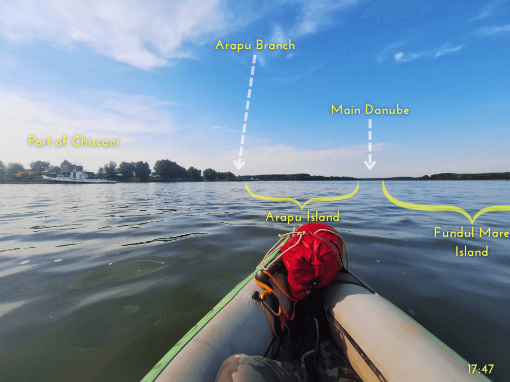
Red-Green Buoy + Paddling Past Chiscani
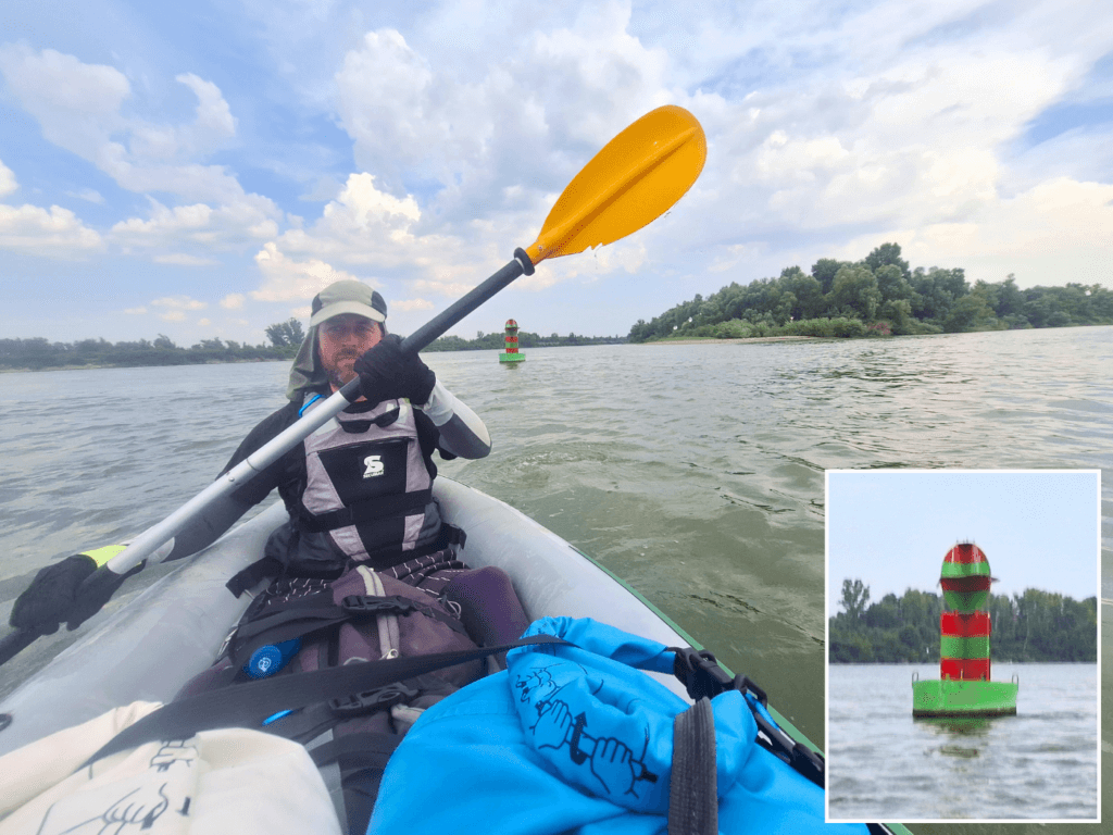
At 16:42, we finished our sandwiches and were at the tail end of Calia Island, which was full of birds and smelled a bit. Up ahead was the elusive red-green buoy. It’s an interesting example of buoyage that splits the shipping lane into two valid ones. Jonas asked if I wanted to touch the rare buoy and steered us towards it, but I thought it was a bit dangerous with the wind and waves. And I thought he meant touch it with my hands. Jonas ended up giving the red-green buoy a nice few slaps with his paddle.
The Calia Branch rejoined us. We looked if there were ships to deal with, but the coast was clear. We had to paddle beneath some power lines. Ahead of us was the village of Chiscani and some tall chimneys from a power plant.
The Danube does a funny thing here: while the Calia Branch rejoins us, the Danube immediately splits up again around another island called Insula Fundu Mare. The right branch around that island is called the Cravia Branch. But we didn’t want to take that because we’d end up missing our target hotel in Brăila if we’d take that arm. However, there’s a cool river sign, which is basically a white + on a blue field, with the vertical bar thicker to mean ‘secondary waterway crossing‘. I don’t think I’ve seen that one before.
Once safely across and on the left side, there were some fishermen on the shore. Those are the first people we’ve seen in a while as we didn’t see faces on the Gropeni ferry.
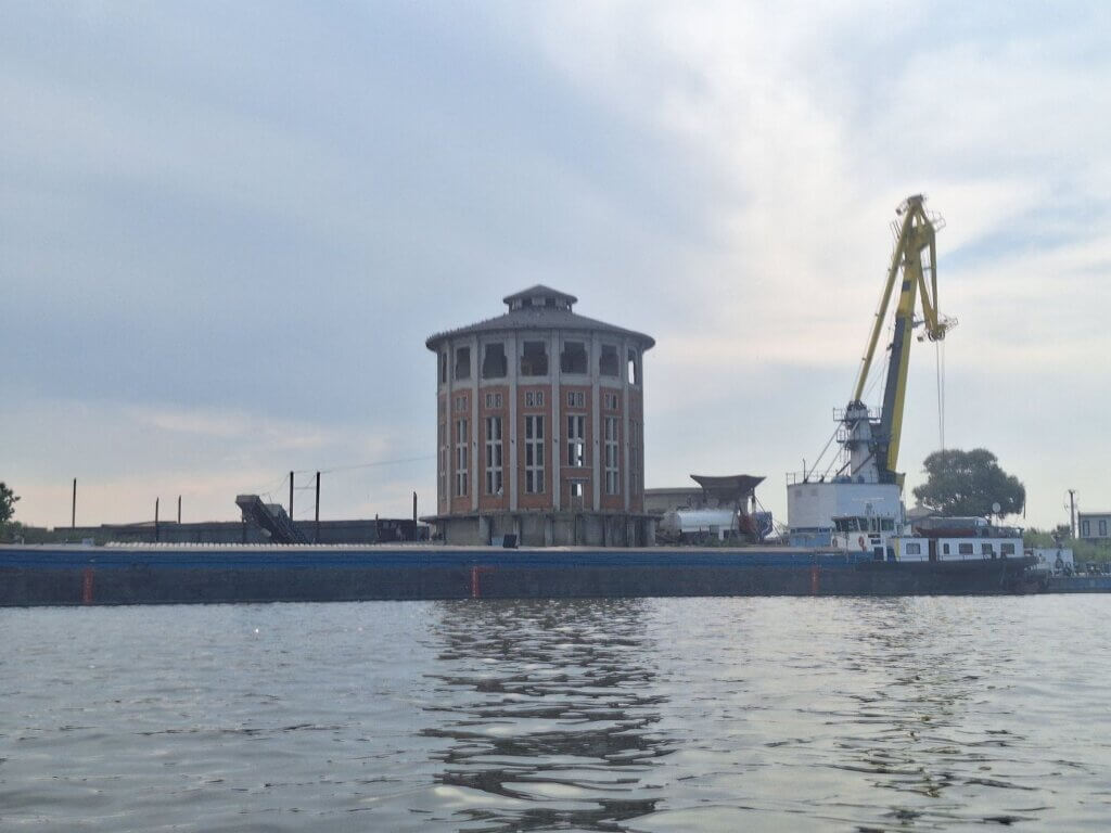
We kept paddling, aiming for different landmarks. It was 17:20 when the water channel leading to Brăila Thermal Power Plant joined us. No steam on the water, thankfully. Turns out this power plant is decommissioned.
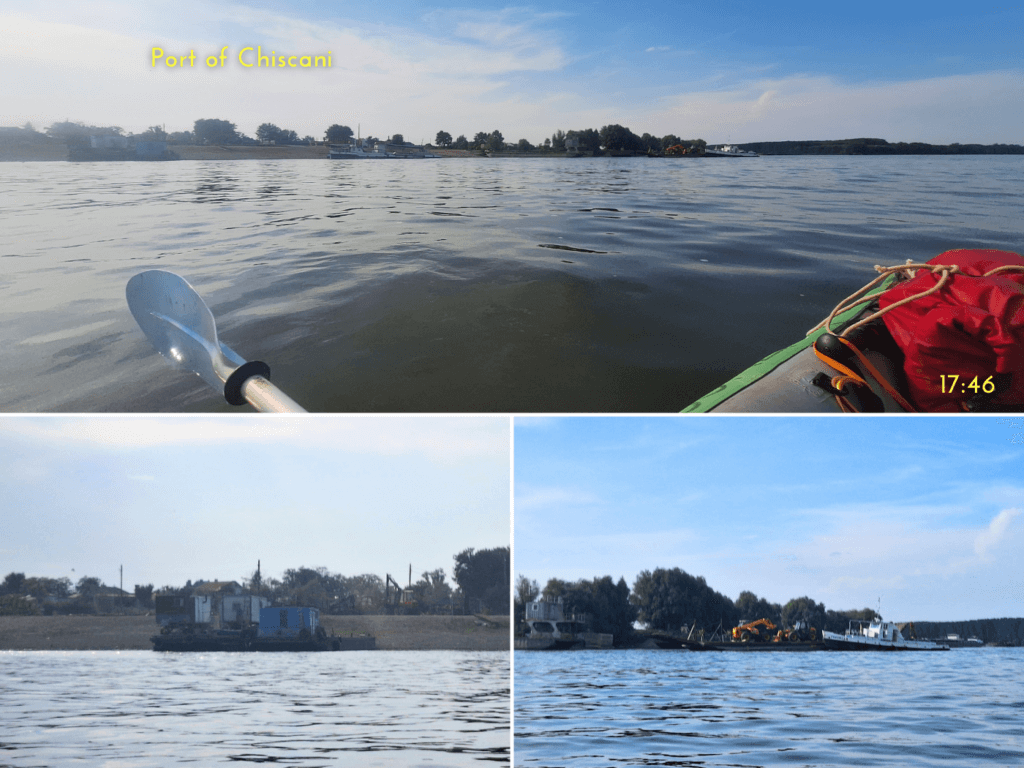
The village of Chiscani had not much going on, except this cool tall round building that looked abandoned. We were very focused on finding the right distance from the shore for the current and not being so far out that we’d have big waves. There were some ships moored and at anchor with people aboard. We had to pay attention to which ships were moving and which were not. Ahead of us, I saw the final island we’d have to paddle around called Insula Arapu. A speedboat circled it in the distance. Let’s hope we won’t encounter them.
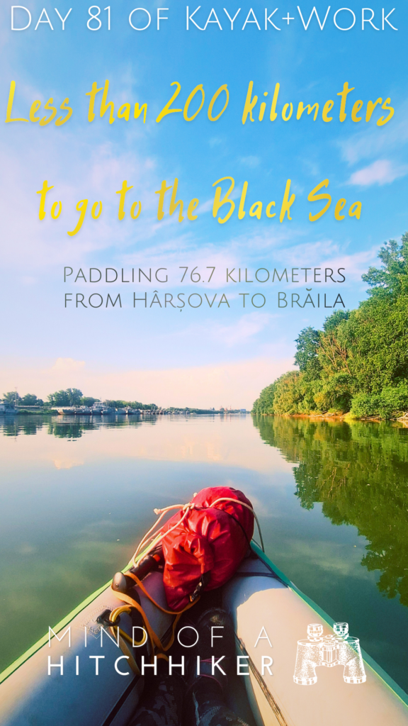
A bit before sorting ourselves out of the shipping lane and into the Arapa Branch closer to the left shore, we passed a man in a fishing boat. He asked us “De unde vai venit?” which was so completely understandable to us as Spanish-speakers. I answered “Hârșova”. It’s actually crazy that we started there today. We’re now less than 10 kilometers away from Brăila.
A ferry came out of the Arapu Branch very unexpectedly. It carried some kind of excavator. We decided to yield and pass it to the right, because there were similar-looking terrifying machines on the left shore in Chiscani. And indeed, the ferry landed there to drop off this mean machine.
Arapu Branch Military Port + Booking a Hotel in Brăila
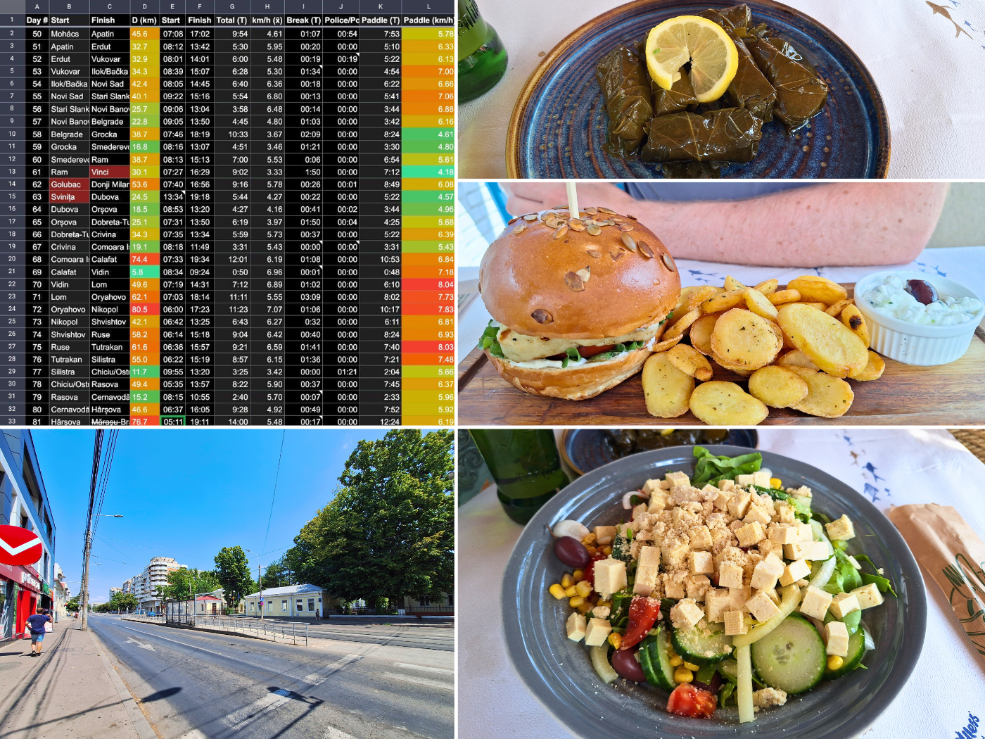
While paddling into the quiet Arapu Branch, it was time to book a hotel for the night. We first wanted to book Hotel Nemo in Brăila, but when checking it, Jonas couldn’t book a room online for today. That means we’d probably need to call them. But… what’s kayaking two kilometers more on a day of more than 70 kilometers? Oh, this better be our second-longest paddle day when I measure it.
A hotel called RaAy also piqued our curiosity when doing the research on Brăila the day before. We know it has a slipway as it’s right at the city’s marina for pleasure boats. It’s a little less business hotel, and more focused on pool stuff. Since that one was online bookable, Jonas prioritized getting that done before 18:00.
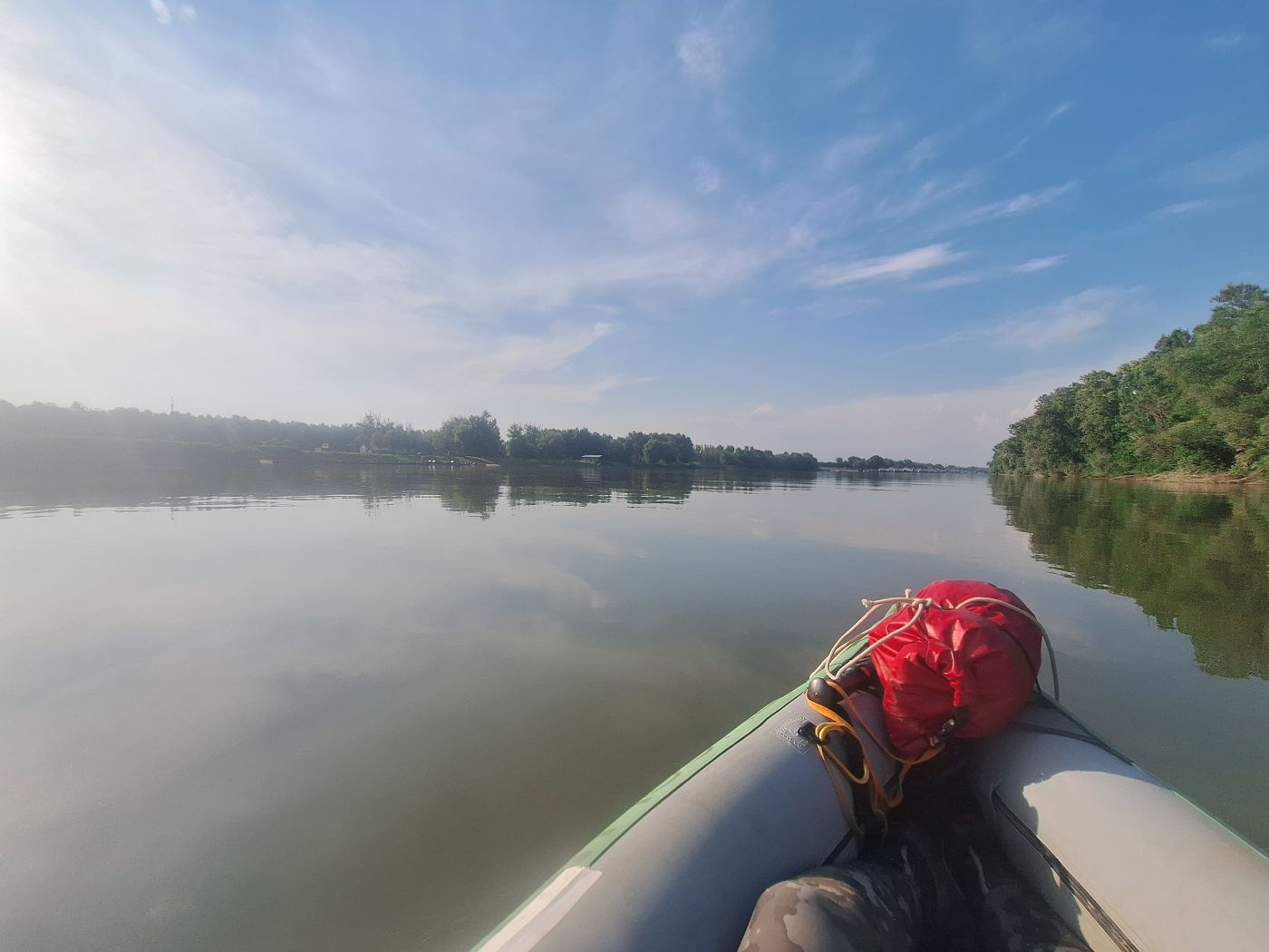
The Arapu Branch was calm besides that one weird ferry. Our arms and grippers were really busted, so I thought it would be nice to land and pee one more time before arriving. We tried on the left shore, got stuck in the mud and attacked by mosquitoes. We tried on the right shore on Insula Arapu, but it was the same story. So we gave up
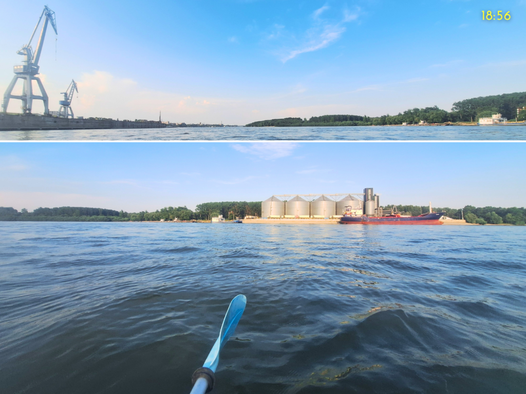
At 18:19, we saw the marina of the Romanian River Crossing Ships Battalion “Danubius” (they’re hiring). At first, we didn’t see the way through, but that appeared as we got closer. There were landing spots on the island in this area that were more suitable as they were partly rocky. Probably because they’re used by this battalion to practice landing with ships and vehicles.
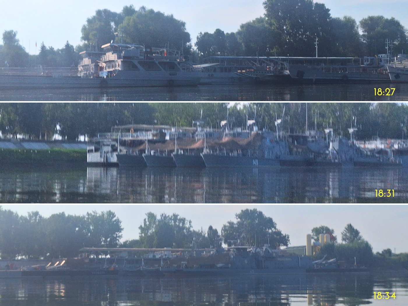
The majority of military vessels in this marina were rusty landing ships, so glorified ferries but not in use. Towards the end of the Arapu Branch, there were also more frigates with camouflage netting and finally some naval guns. I was getting worried about Romania’s chances in WWIII for a second. You know… peace through superior firepower.
Just kidding, I’m still very worried.
Arriving in Brăila—the End of the TID
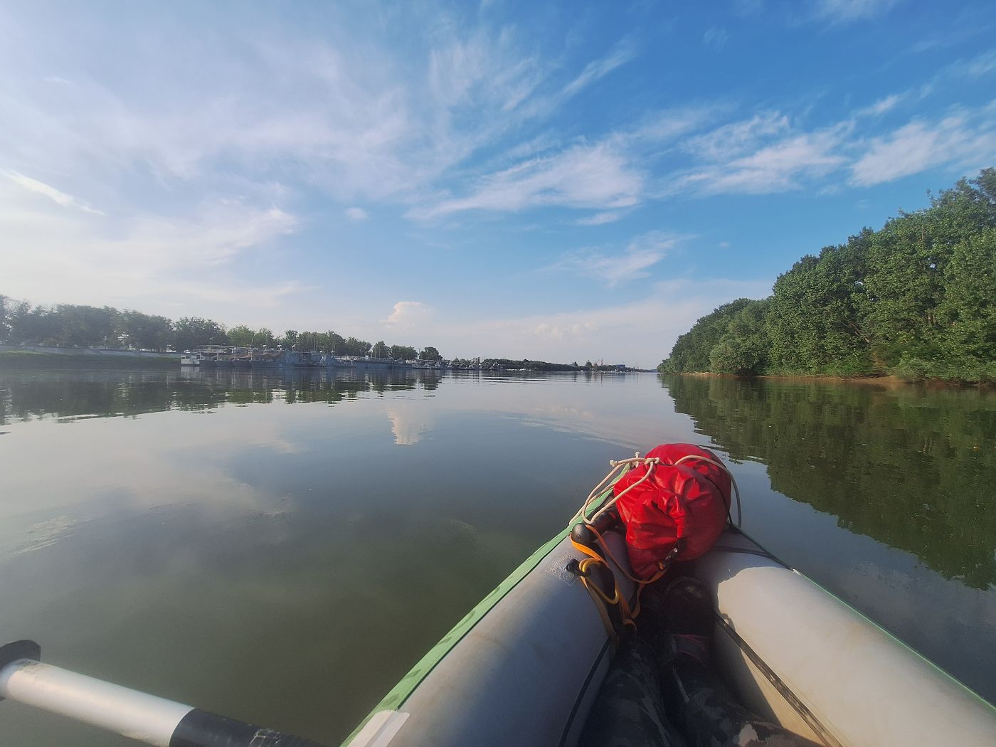
We exited the Arapu Branch at 18:31 and were immediately met with speed boats that didn’t slow down. I tried to signal them with my hands to slow down and not pass us so closely. I even used my whistle. It didn’t look like any of these people are paying attention. They didn’t slow down and we had to deal with their wake. It was okay, but only because our boat isn’t currently leaking air.
We paddled past Hotel Nemo. It would have been possible to get out here as it has a (steep) slipway. But it also looks very soulless and we’d need a Bolt taxi to get anywhere relevant in Brăila. So far, we haven’t taken such a taxi yet, so we don’t know yet if this works well in Romania. In some other countries, we’ve had incredibly mixed experiences with taxi apps. But there wouldn’t have been any children at Hotel Nemo in the industrial area of Brăila, so there’s that.
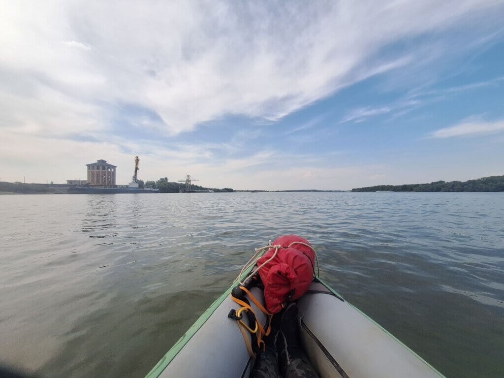
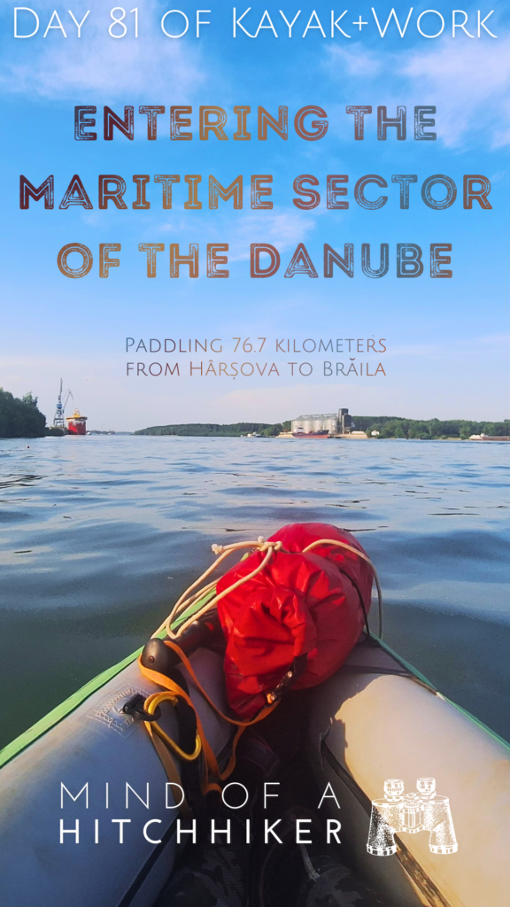
There was a bit more than two kilometers to go to our landing spot at RaAy. I saw a different type of ship across the river. A typical Black Sea cargo ship! So cool!
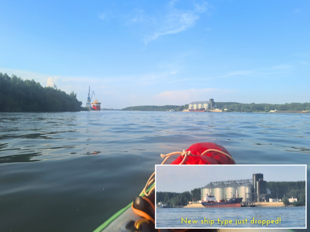
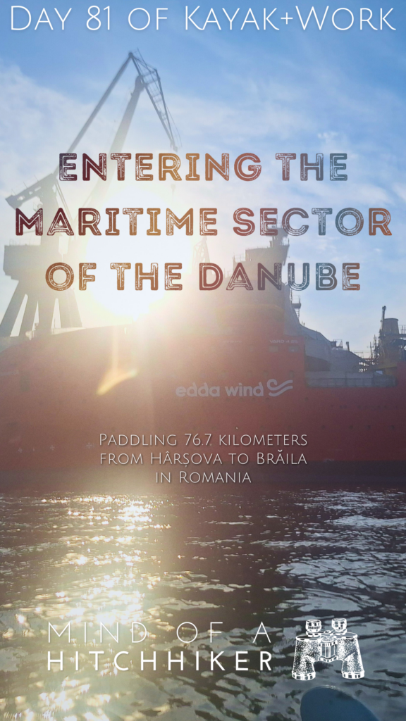
But that wasn’t it. As I was getting excited about that ship, we turned a bit of a corner, which revealed the tallest ship I’ve ever seen on the Danube. It was berthed at the quay, but also listing to its starboard side. There were cloths over its wheelhouse. Brand new or very old? As we got closer, we could see it’s new and almost ready to hit the seas. It’s a ship by Edda Wind, which is a Norwegian company based in Haugesund that provides operation vessels for offshore windfarms. This particular ship was called the something-something Enabler. Part of the name was covered in cloth. I found it online, where it goes by the name NB965. She will soon be towed to Norway where she receives her instruments and will undergo her sea trials.

Welcome to the ✨Maritime Sector✨ of the Danube!
Very exciting area. It’s almost as if we’re very close to the Black Sea. I spotted a kilometer sign to the left, which read 174. Under 200 kilometers!!
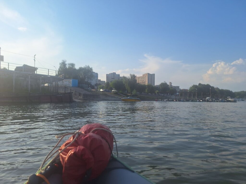
Next, we had to cross the path of the car ferry that goes from Brăila City to the Big Island of Brăila on the right bank. There were also people relaxing on the beach on the opposite shore. Interesting. Aren’t they swarmed by mosquitoes? Perhaps they drop some toxic stuff on the area there to make existing tolerable. Either that, or Romanians as a collective are unbothered by mosquitoes. Meanwhile, my arms and legs are full of bites.
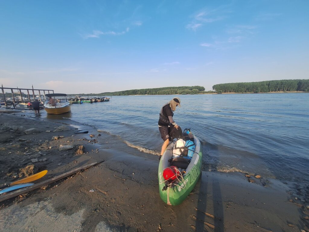
We passed a few more speed boats that we didn’t like as we approached Brăila’s marina Debarcader. Around some pleasurecraft, we found the slipway and landed there at 19:11. Exactly 14 hours on the water today.
And as it stands, I realized that we hit another milestone: we’ve officially paddled more kilometers on the Danube in 2024 now than in 2019. In 2019, we ended in Mohács at 1253.7 kilometers. In 2024 after this 76.7-kilometer day, we ended on 1264.8 kilometers.
And lastly, Brăila is the end station of the Tour International Danubien (TID), the organization that kayaks the Danube from Ingolstadt to the Black Sea each year for many decades. However, since the 2022 russian invasion of Ukraine, they’ve ended the official TID here in Brăila, as after Galați the Danube enters the Romanian-Ukrainian border area. russia occasionally bombs that area, with sometimes debris landing in Romanian territory. And NATO watches, holding their dicks in their hands and doing nothing. The TID arranges (kayak) transport back to Germany/wherever from Brăila. Many TID participants still paddle to Sfântu Gheorghe at the Black Sea, but it’s unsupported and they have to figure out their own way to get back.
As long as Zucchini doesn’t fall apart, we will continue kayaking to Sfântu Gheorghe at the Black Sea.
Our Three-Night Stay in Brăila
This is how we spent our time in Brăila:
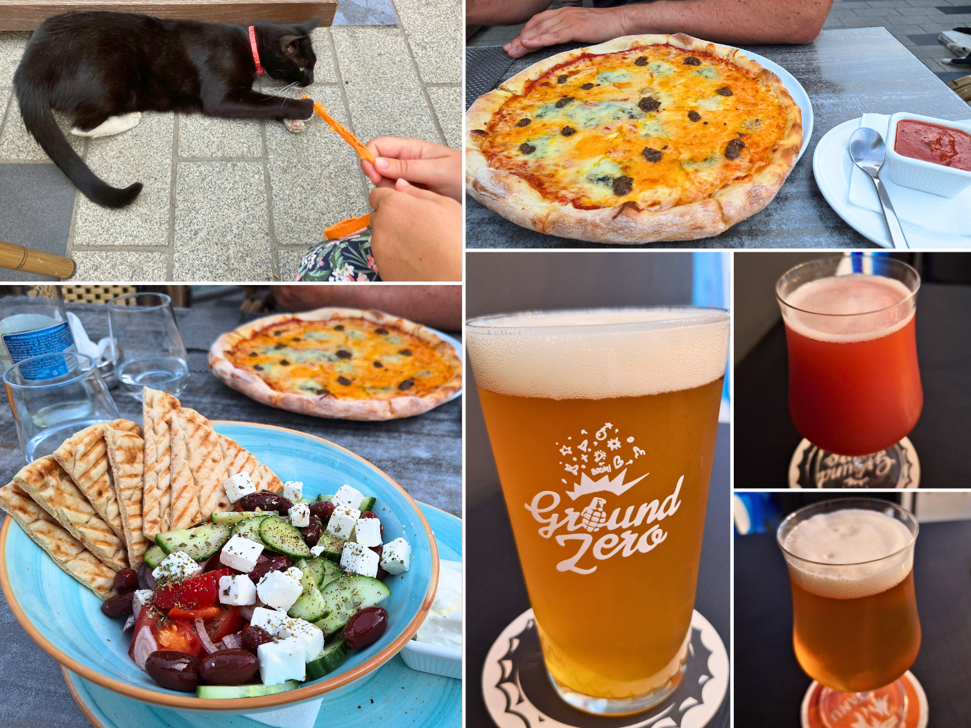
Wednesday: after packing up our loose stuff, we tried to dry Zucchini at the restaurant of Hotel RaAy close to our table. We enjoyed a celebratory beer there and tried to order some food, which only amounted to some simple snacks. A very sweet cat showed up for pets.
At some point, a woman and her shit-aged son walked by Zucchini. They stopped at our kayak and the boy decided to kick it. I went over there to tell them not to touch it.
Unexpectedly, the parent became belligerent. She defended her son kicking our (very fragile) kayak and told us “Get out of my country.” I was shooketh, flabbergasted, nonplussed..!
What do you mean, you let your child kick people’s property? Is this what 21st-century parenting is like?
She was getting more closely physical with every word I said and I was getting ready to defend myself. My body was tired, but getting ready to fight.
Jonas stood up and tried to de-escalate, and a guard (?) from the restaurant/hotel property also got involved. They switched to Romanian when he was there, while she often interspersed her Romanian raging with English raging. More “Go to your home country” and other things we’ve heard people say to immigrants. I found that experience interesting, as I’ve never been on either side of that kind of weird abuse; neither dishing it out, nor receiving it—until today.
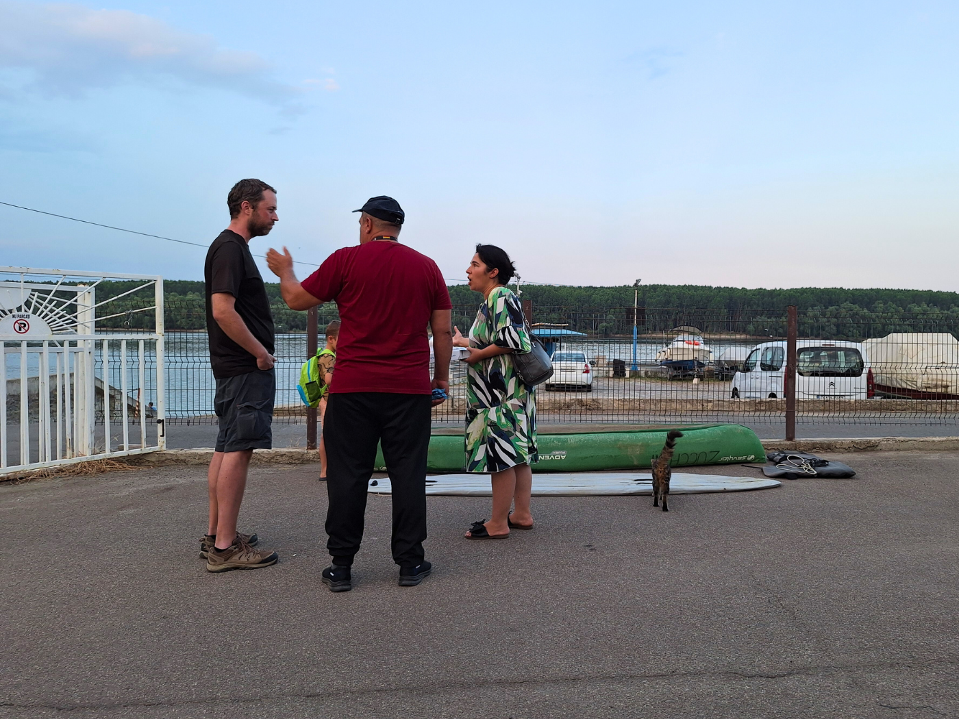
Photo of Romania’s Worst Person. The sweet stray cat is a paid actor.
She and her rabid shitling eventually left. Doing so slowly, while yelling, and while pretending to kick Zucchini through the fence. They even wandered back 10 minutes later, looking to start shit up again. The whole thing lasted for about 30 minutes until we packed up a semi-wet Zucchini and checked into our hotel room.
But of course, our victory beer – and frankly our entire stay in Brăila – were ruined. I decided to take my pepper spray with me during every outing in Brăila, just in case we run into her and her motherless-behaved child ever again.
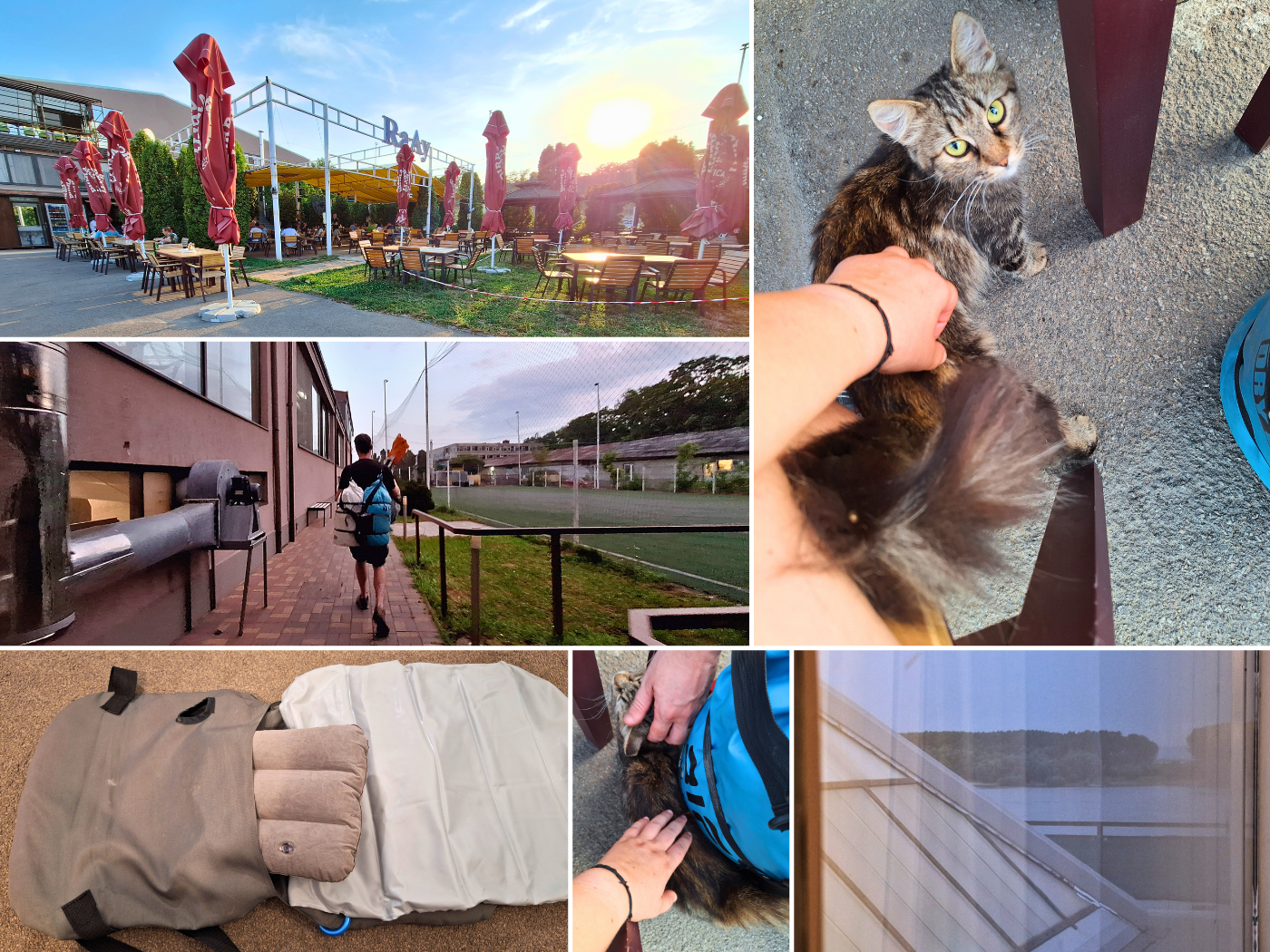
Thursday: we tried to work in the morning, but I was still very depressed from the previous day’s interaction. The low after paddling this much this late on the Danube was also very strong. We tried to fix the leaky kayak seat by putting the inflatable camping pillow in. We’ll pilot this for the kayaking day to Galați to see if this works.
For lunch, we ate our leftover sandwiches. To spend time away from the heat, we watched Exploding Kittens on Netflix.
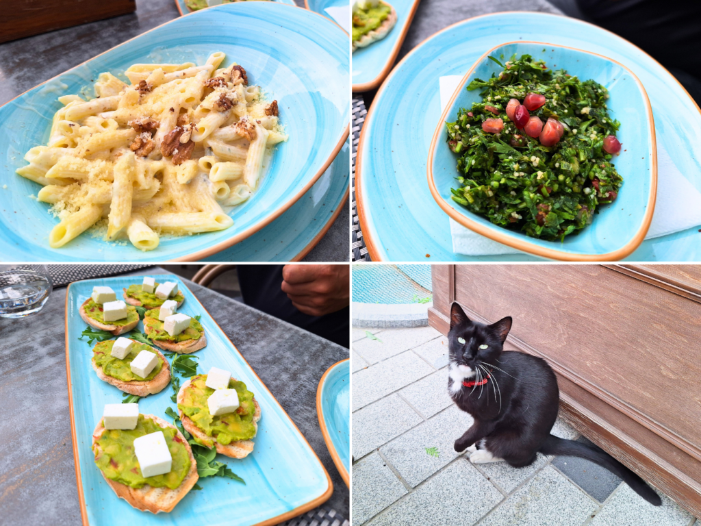
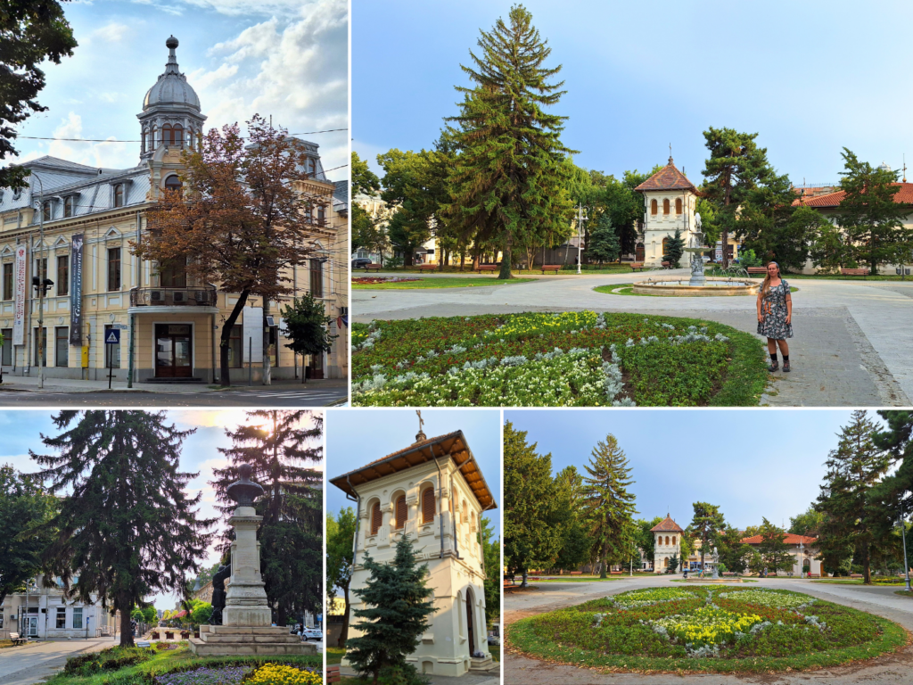
In the evening, we took a Bolt taxi to Restaurant Carol in downtown Brăila. We met a very handsome boy cat with a collar who loved pets. After food, we walked around at the square for a bit, admiring the fin de siècle architecture and its Romanian interpretations.
Finally, we ended up at a beer place called Centrul Berarilor (Craft Brewers House), which is one of the best craft beer places I’ve been to. This definitely made up for the poor first impressions of Brăila the evening prior. We brought one craft beer home with our taxi ride back to the hotel for later in the evening. The Danube was looking peaceful.

Friday: in the morning, I tried hard to get this piece written, but didn’t make it far. This post would end up having a word count of roughly 6000, which is quite much, even for these. The main thing is to always map our route and measure our distance, which usually inspires the writing.
For lunch, we walked to a restaurant called Thassos Food, which features Greek cuisine (vegetarian halloumi burger). OpenStreetMaps shows several tram routes in Brăila, but we haven’t seen any trams, just tracks and stops without passengers waiting.
On the walk back to our hotel, we dropped by a pharmacy to buy me some vitamin B1 pills to hopefully help with repelling mosquitoes. Those have been my greatest suffering on this trip. We also went to the Profi Supermarket to buy some new protein bars for the short trip to Galați tomorrow.
In the evening, we returned to Restaurant Carol and their handsome cat for pizza, salad, and playtime. We also returned to the craft beer place for some excellent beverages. I’m happy to say that these other experiences in Brăila turned it around. And yet, I was happy to skip town to avoid running into that bad parent again.
Helpful post? Consider buying me a bubbly water!


Similar posts:
 Kayak Trip Day 82: Brăila to Galați – The Last Bridge Across the Danube
 Kayak Trip Day 77: Silistra to Chiciu and Ostrov – Goodbye Bulgaria, Hello (Again) Romania
 Kayak Trip Day 68: Iron Gate II Dam to
  Kayak Trip Day 83: Galați to Isaccea – Bombed Grain Silos in Reni, Kayaking the Ukrainian–Romanian Border Danube
 Kayak Trip Day 80: Cernavodă to Hârșova – Third Leak + Swimming Cows