


")


")


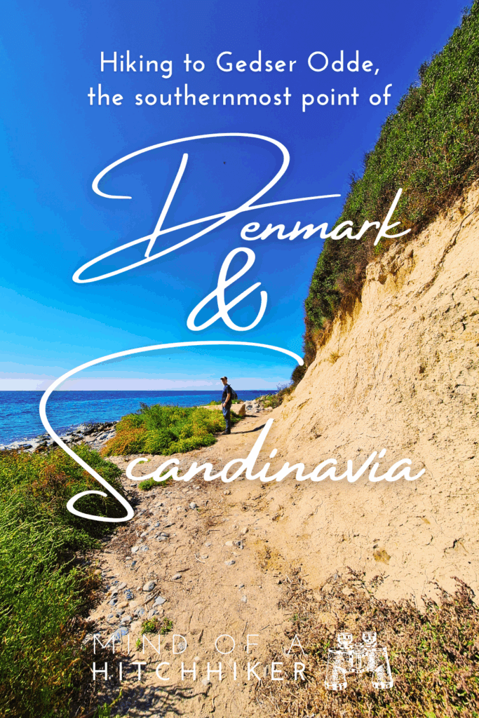
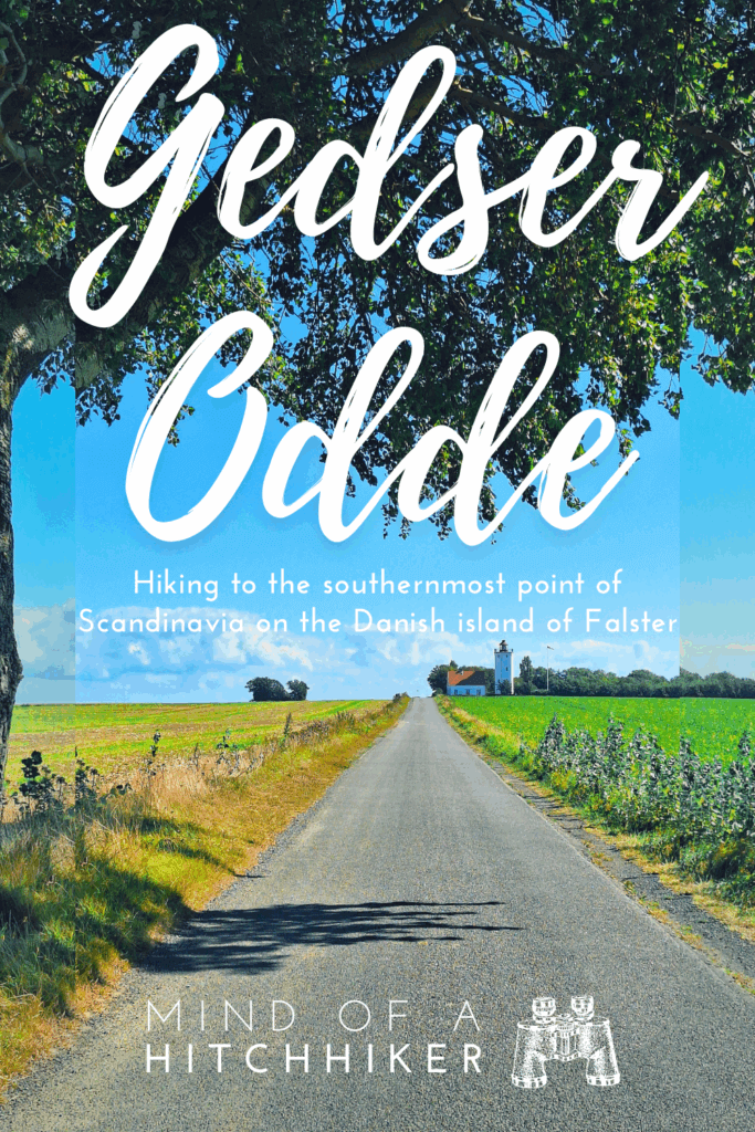
Jonas and I took a day trip to Gedser Odde by public transit and on foot on Monday, the 8th of September, 2025. The southernmost point of Denmark – and by extension the southernmost point of Scandinavia – is located on the island of Falster.
Contents
- 1 Planning the Trip to Gedser Odde
- 2 Marielyst through Bøtøskoven Forest
- 3 Dike Road on the East Coast of Falster
- 4 Beach Walk to Gedser Odde
- 5 Gedser Odde, the Southernmost Point of Denmark
- 6 Gedser Fyr (Lighthouse) + Hitchhiking to Gedser
- 7 Map of Gedser Odde Hike
- 8 Helpful article? Please buy me a rhubarb juice!
- 9 Share or save for later? Nice, thank you so much!
Planning the Trip to Gedser Odde
We are doing a catsit in a village on the Danish island of Falster for almost one month. During our stay, we do a few day trips in the Lolland-Falster region. The one trip I wanted to do most is to Gedser Odde, which is the southernmost point of Denmark. I’ve been (close to) the northernmost point of Denmark – Grenen, near Skagen – back in 2012 during my semester abroad in Aarhus. Back then, I also made my first forays into travel blogging. So here we are today, more than a decade later, and in a very different phase of my life.
Going to Gedser Odde from our village in Falster isn’t easy without a car; the train line from Nykøbing Falster to Gedser has been scrapped, and bus connections to the nearby villages, such as Marielyst or Gedesby Strand, are not that great. This is especially the case on the weekend, when there’s a discount on public transport. While we first intended to do this hike on a Saturday, the connections were a lot better during the week. So we decided to go to Maribo on the weekend and wait for a nice and sunny day to walk to Gedser Odde.
While the Danish buses and trains are on Google Maps, we used the Danish public transportation app RejsePlanen to plan our route and buy our tickets. It’s a pretty intuitive app, even if you don’t know Danish. I recommend you use the same if you want to do the same journey.
The plan was to take the bus back from a different place. So we had to decide how long we wanted to walk on the Danish coastline. We decided to do a longer trip, starting or ending in Marielyst instead of Gedesby Strand, because the latter is really more like a seaside resort with summer homes spots rather than a town. This would make the hike about 15 kilometers long. Since Denmark is mostly flat, the bits of ascent and descent are negligible.
The last decision was whether to start in Gedser or in Marielyst. I was in favor of Marielyst, since we can plan a bus for the start of our hike, but not the return. Gedser is also a ferry port to Warnemünde (Rostock) in Germany, so if we arrive there just after a bus leaves, we can hitchhike as there’s significantly more traffic. Gedser also has cafés and shops to sit down and wait. Jonas agreed, so we decided to start our hike early to catch the 8:45 train to Nykøbing Falster, from where we would catch bus 742 to Bøtøskoven (Sølvpilevej) in Marielyst.
We packed a day bag with 2 liters of water, baked some cheesy pancakes, and brought hats and sunscreen. It would be about 22°C, sunny, and with a light wind. On the day of the hike, we kissed the cats goodbye before beginning our trip.
Marielyst through Bøtøskoven Forest
After the train and the bus, we were on the edge of the tranquility of Bøtø Forest (Danish: Bøtøskoven). We first walked a bit on the skinny road until it ended, and the forest officially started. There was no car traffic here, just some cyclists and fellow hikers with dogs. There were some information signs about the origin of the natural area at the boom gates.

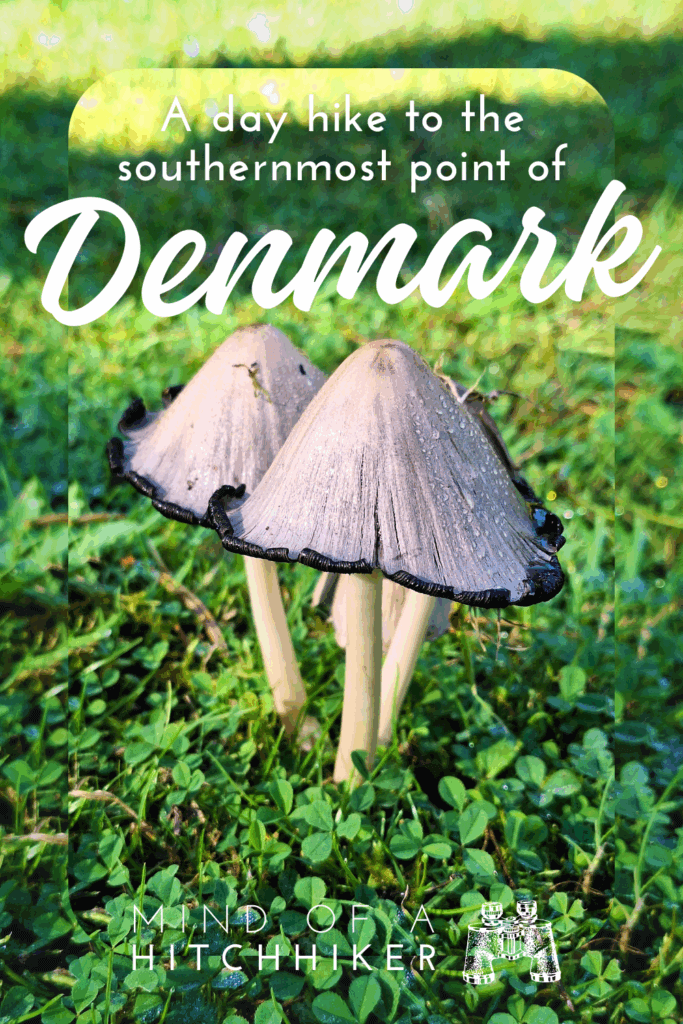
I immediately felt my ephemeral brainfog lift. Very quickly, we met some cows next to the path behind a fence. There were tarns, picnic tables, mushrooms of varying levels of ripeness, squirrels, glimmering slugs, and the occasional butterfly or moth.


The sun shone through the trees in that typical autumn way for northern Europe. Since the forest is quite touched by human hands, the trees would come and go, with farms in the distance. When the forest was dense, there were enormous spiderwebs spun between them, catching light and definitely some bugs. I felt something bite my leg, but couldn’t identify what it was.
Though this forest was my favorite part of the hike to Gedser Odde, our planned exit to the digevej (dike road) was barred by a road with PRIVAT signs. Two women in front of us were planning the same route, who decided not to go up that road to the estate mapped as Bøtøgård. Under peer pressure, we also decided to abandon this route, despite my map telling me there are two paths leading around the property, less than 300 meters beyond this sign.
But okay, we will walk this little detour to take a route through the north of Gedesby Strand. There was another path leading to the coast of the Baltic Sea through that area, past some lovely villas. I think most of the homes in this village are summer homes, unoccupied now that the school year has begun again. The scent of the sea is getting stronger and stronger.

The last fifty meters of this trail to the dike road went through some thick brush. I actually had to pick up a stick to clear a path through the spiderwebs for myself and Jonas. Afterwards, we walked up a few stairs onto the dike and saw the bright beach that we would now follow to Denmark’s southernmost point. It’s 11:15 and we’re getting a bit hungry.
Dike Road on the East Coast of Falster
Careful! The dike road is also a bike path. But it’s wide enough to share it with the few people who have leisure time this Monday morning. On the beachy side, we’d spot the occasional person with their beach chair out, a hat, and a book at the end of a trail through the beach grasses. No one around for hundreds of meters except us passersby.

The German Wikipedia page of Falster claims that Dutch engineers were involved in building some dikes on this island:
“The south owes its present appearance to the dike projects created by King Christian II starting in 1522 with the help of Dutch experts. Further dikes were added in the 19th century, which were interrupted by the storm surge of 1872.”
(translated from German)
This Baltic Sea storm of 1872 killed almost 300 people and left many homeless in Falster, Lolland, and northeastern Germany. The current dike is the longest in Denmark.
The sun is powerful. I put on sunscreen this morning, but it’s soon time to reapply. We are hoping for a sea-facing bench to have a little rest and assessment. We passed one bench on the landside of the dike, with a sign saying that there’s an ice cream vendor and a toilet nearby. My maps show no such infrastructure, and I wonder how far it is. Anyway, we don’t need it. And we made great progress towards our goal on the dike.

To our right were some summer homes of Gedesby Strand. Deadly quiet. Fortunately, no abandoned cats greeted us from there, despite our alertness to them.
At the southern end of Gedesby Strand, there was a picnic table facing the sea. It was such a nice piece of infrastructure that we had lunch there. Cheesy pancakes we made last night for this hike. It hit the spot. Jonas and I were both happy with our decision to start in Marielyst and to walk through Bøtøskoven, instead of starting here in Gedesby Strand. Even if we’d managed to figure out the bus to here, which might not even go at this time of year.

Not far from us, an older couple in bathing suits slowly waded into the sea. It remained shallow for quite a while, but eventually they managed to get to the floating stage. Unfortunately, we can’t do both, because these 21°C feel more like 30°C and I’d like to cool down. That’s in part because I’m walking in my new hiking boots, which are for wintry places, such as Iceland.
We refilled our small water bottles with the big one, repacked the backpack, and continued our hike after this 15-minute break at noon.
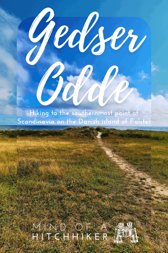
Beach Walk to Gedser Odde
After lunch, the dike continued for a few more kilometers, until the choice to go inland or via the beach arrived. We’d already decided to go via the beach to reach Gedser Odde below its cliffs.

The first walk on the sand was a reminder of the Dutch Coastal Hike we started in March 2023 and completed in February 2024. To the left, the sea, to the right the dunes, and beneath our feet the struggle of sand. We quickly found our way towards the edge of the water, where the sand is slightly firmer. But there were more obstacles here, like rows of half-rotten, half-buried wooden sticks barely breaking the sand.
So much of our research into Gedser Odde had been focused on figuring out the bus that I missed the obstacle course that is the beach on this side of Falster Island. Every 70 meters or so, there was a big concrete ledge perpendicular to the shore sticking into the water. In the beginning, they were quite sunken in and not a big deal, but later, they’d become bigger to climb. Once they became too big, it was possible to go around them at the cliff side, but that required stomping through loose sand. Our speed decreased significantly.

Speaking of cliffs, there was only one ‘legal’ emergency escape: some steep stairs (54.56611338746787, 11.97330042078991) leading up the cliff, one kilometer from Denmark’s southernmost point. A last chance to get off the beach in case a storm is surging. Now and then, there seemed to be unnatural steps carved into the cliffs, perhaps made by people sick of walking on the beach.
As we made slow progress, looking southward in the direction of the low-hanging autumn sun, we spotted something at the edge of the water. It was a bit green from the outside, so I thought it was a mossy rock. Jonas and I were just slowly strolling and talking for a bit when suddenly he realized we were standing next to a drowned deer. As my eyes focused, I could see the flies on the corpse, with its antlers completely intact. Did it try to swim to Sweden? Was it chased?


We will never know, but Jonas’ opinion of Denmark just went down a few points, as there’s no way this shouldn’t have been called in by now to the relevant wildlife department. Though when we saw a dead seal on one of the Dutch islands, we also didn’t call it in either. We were not alone on this beach below the ever-growing cliffs. But so far, most people we’ve come across have said “Hallo” to us instead of “Hej”, so they might all be foreigners. Some people looked mostly at the ground, perhaps scouring it for seashells, fossils, or amber. There was a family of three in deep focus.
In the distance at sea, I saw something chonky and tall with a big tower or chimney on top. I assumed it was an oil platform out there. Closer to us, the beach narrowed, and the cliffs were closing in. I’m not sure how tidal the Baltic Sea is, but if the tide were to rise by 50 centimeters, I think it wouldn’t be possible to walk all the way to Gedser Odde via the beach without getting one’s feet wet. At least the water is calm, despite the strong wind.

In the distance, I counted at least five sailing boats of ocean-going size. One day, I hope to still work on that dream of mine. Jonas speculated that it would be a good area for kitesurfing. Side-onshore wind, mostly flat water, perfect—even for me. It’s just that the beach is kind of narrow to launch and land one’s kite. Perhaps it’s not allowed here.
As we were approaching the cape, there were these rocks or concrete blocks out in the water with colonies of cormorants. Behind them, a beautiful silver sea. The oil platform grew bigger and bigger, until we figured out it’s just the ferry between Gedser and Warnemünde/Rostock. But why the chimney-looking thing?

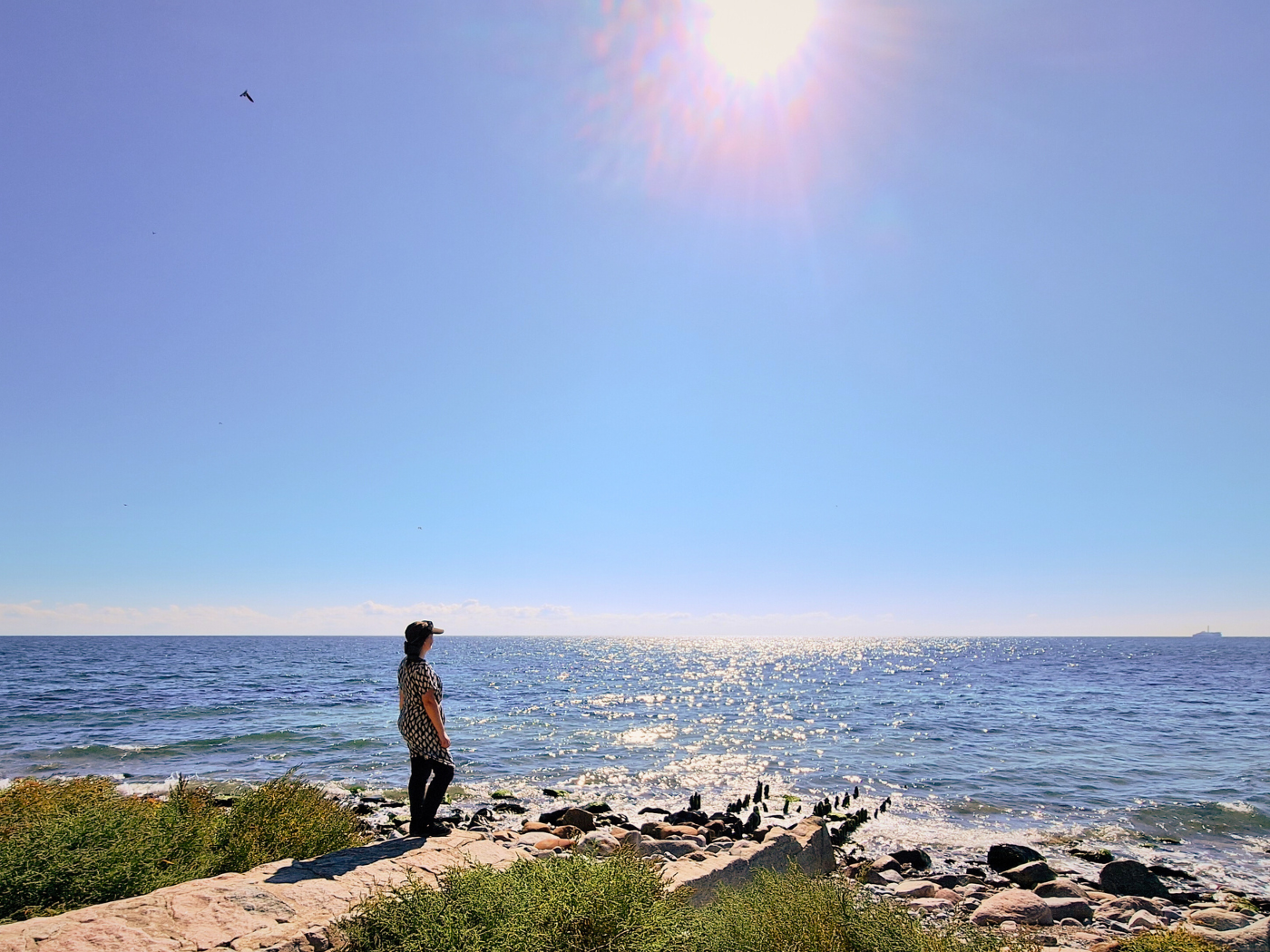
Gedser Odde, the Southernmost Point of Denmark
Rounding the corner of the cliff with a visitor center atop, we stumbled over the last concrete barriers before arriving at Gedser Odde, the tippy end and the goal of this hike. We took it all in and took some photos together. From here, we are looking over the Kadetrenden/Kadetrinne strait and shipping lane towards northeast Germany, a part of the Baltic Sea. It’s quite shallow here for a long time, so the edge of the shipping lane used to be marked by a light vessel named Gedser Rev (Gedser Reef). This light ship moved to Copenhagen before going to Helsingør.

The waters here connect to the Bay of Mecklenburg, the Fehmarnbelt, and the Bay of Kiel. From there, the spy or oil tankers from the russian shadow fleet can make their way through either the narrow Belts and Sounds in Denmark or through the Kiel canal to the North Sea and the Atlantic Ocean, all without taking the long route through the Kattegat and Skagerrak.
I needed to check the MarineTraffic app; I wanted to know what the deal is with this ferry. It’s the Scandlines ship called Berlin, which is a hybrid ferry. And the chimney-esque thing atop is a rotor sail. Ah, yes, I remember reading about the New Age of Sail that is commencing. The Berlin, delivered in 2016, has been retrofitted with this 30-meter-tall Flettner sail in May 2022. That’s why there are still recent pictures of the Berlin without its sail. As of now, it looks incredibly silly to me. But I’m sure I can get used to the sight.
It was time for Jonas and me to decide what to do next: walk to Gedser via the beach or climb the cliff and walk/hitch via the road. I wanted to visit the Sydstenen at the visitor center. And we’ve both had enough of this stony beach, honestly. Cliff access is not straightforward, as no one has built a ramp or stairs down. We had to continue a bit on the coast, where previous visitors have attempted to make paths up the cliff. Jonas checked one of them out, but the brush was too dense to pass through. I checked satellite view to find a more promising option (54.559728016302174, 11.968296657851207), which worked very well.
Up on the cliff, it was crowded for Danish standards. There were quite a few visitors walking to Gedser Odde from the nearby parking lot, or cyclists of the EuroVelo 7 Sun Route having a break on this beautiful day. The building has the coordinates of this point on the side. Inside, the visitor center is in quite a dilapidated state. But there are nice information boards about the birdlife and the offshore wind turbines from Nysted/Rødsand Wind Farm south of the neighboring island of Lolland.

The last thing to see here is the South Stone (Sydstenen). It’s a big boulder carried to Falster on a glacier from Sweden during the Ice Age, supposedly one billion years old. We sat down at one of the picnic tables in the shadow near this stone to eat another cheese pancake and to rehydrate. I walked to the edge of the cliff to have more of a vista, but the view from below was much better.
Gedser Fyr (Lighthouse) + Hitchhiking to Gedser
After 13:30, we continued our walk. My feet were a bit tired in the new shoes. It’s a paved trail from here onwards, meaning it will tire my feet and knees further. We walked past the parking lot with some campervans and many parked cars overflowing onto the road. Perhaps after checking out the lighthouse, we will hitchhike the last kilometers into Gedser town or all the way to Nykøbing Falster. I’m looking forward to hitchhiking in Denmark again.

Careful with the traffic, we walked via the main road to the lighthouse, Gedser Fyr. Though this lighthouse is not open to the public, it’s a nice thing to see on the way back. Its location far from the cape is compensated for by its high light at 26 meters above the ground. Allegedly, it’s possible to see the North German coast from the top on a clear day. That’s about 48 kilometers away.

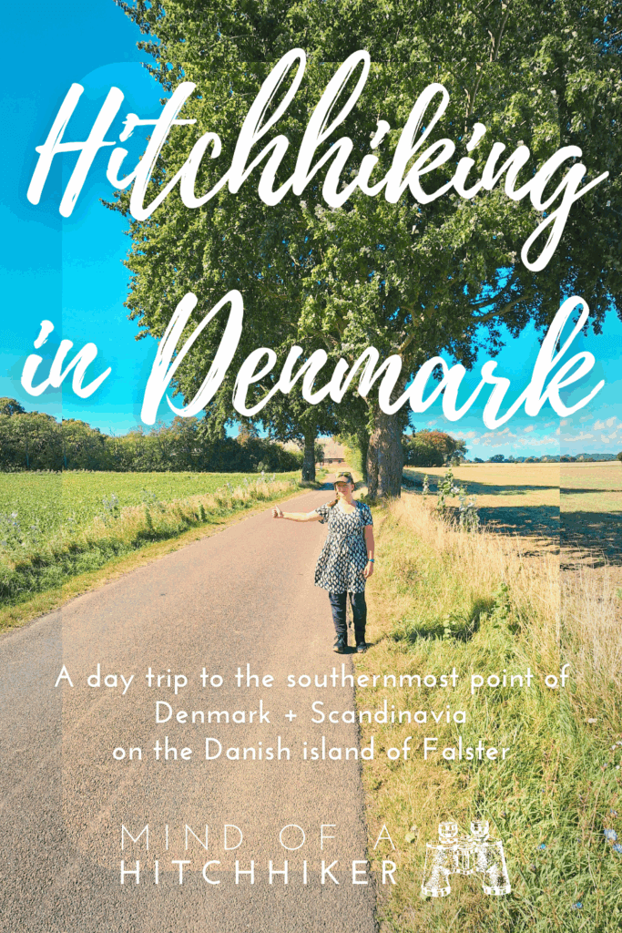
After this, we changed into hitchhiking mode. We took some photos after the first cars passed and continued walking to Gedser. The road is skinny and the cars drive fast, so it’s important to stay alert.

Past some farms, we managed to stop a vehicle with German license plates. Day trippers? A woman and two teenage children were inside. Jonas spoke to them and they agreed to drive us into town. It’s less than two kilometers, but at least it gets us off this road without a sidewalk. We squeezed into the back.
They were not day trippers, but people who live in Denmark. As the ride was short, I didn’t catch their names. They aren’t driving to Nykøbing Falster in the coming hours, so we just drove with them to the bus stop across from the brick church of Gedser. They also said that the train from Gedser to Nykøbing Falster should work, but I think we’ve researched that a hundred times to no avail. We thanked them for the ride and continued on our merry way. After the ride, I realized they were the family of three we had seen on the beach in Gedser Odde, looking for cool rocks.
It’s after 14:00. We had just missed the bus by four minutes, so what do we do? Though it might have been interesting, we didn’t feel like checking out the old train station or the ferry port. Rødby on neighboring Lolland has been chosen for the undersea tunnel to Germany called the Fehmarn Belt Tunnel. Once the longest immersed rail-and-road tunnel opens in 2029[grain of salt needed], I think that Gedser will feel little to none of this economic boost. And what will happen with the rotor sail ferries?
So we first did some shopping at the Dagli’Brugsen. They had an excellent local craft beer selection, so we took a few items home. We even grabbed a little preview for later in 2025: a craft beer from Svaneke, a town on the Danish island of Bornholm.
The rest of the hour, we sat down at a terrace at the Toldcaféen (old customs building) for a refreshing rhubarb and elderflower lemonade. We took the bus back to Nykøbing Falster from the Gedser, Torvet (Langgade) bus stop. I napped on bus 740 and missed the Welcome to Denmark sign that Jonas spotted. I did see the fancy windmill in Gedesby. The layover in Nykøbing Falster was a bit too long, as we yearned for the cats we were caring for. They were so happy when we returned, and they could enjoy the beautiful fall sunshine at home, and us, a new beer.

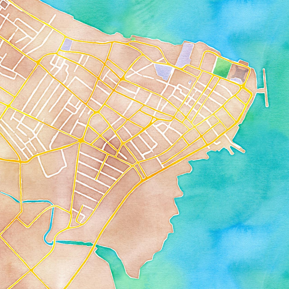
Map of Gedser Odde Hike
Use this map to find POIs such as bus stops and the hiking route we took. If you press ⭐, this route will show up on your phone on Google Maps for a while.
Helpful article? Please buy me a rhubarb juice!
My website is advertisement-free and AI-free. Please support my blogs by donating.


Similar posts:
 Vlieland: 5 Days of Quietude, Craft Beers, and a Lighthouse (Walk + Work)
 Penang National Park and the Meromictic Lake at Pantai Keracut
 Cycling Trip from Aalborg to Skagen and Grenen – Semester Abroad in Aarhus
 144 Hours in Shanghai: My 5-Day China Itinerary
 Pandemic in Penang: A Play-by-Play from Two Digital Nomads in Malaysia