


")


")


 to Get a SIM Card in Ukraine (Kyiv)")


")
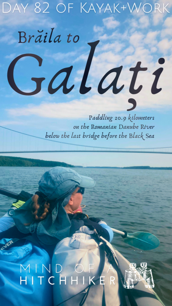
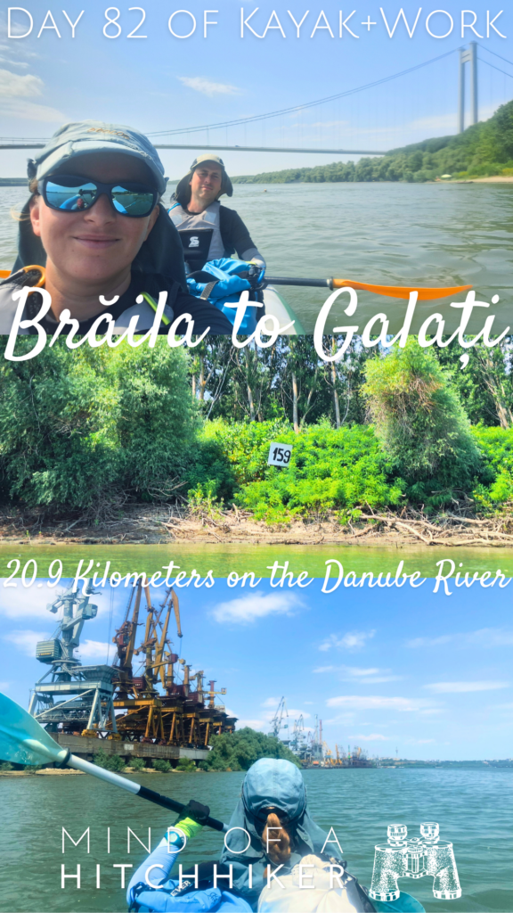
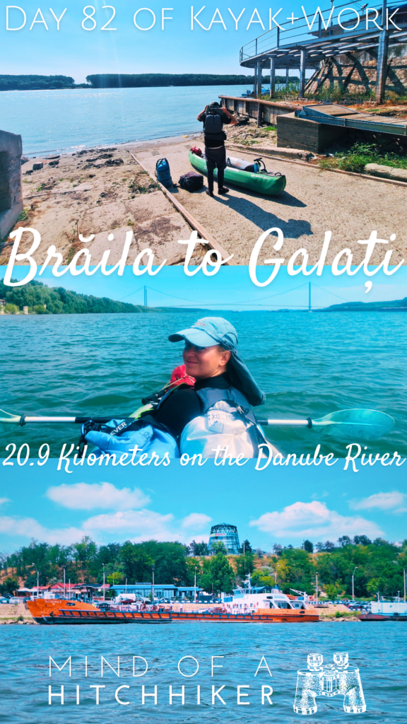
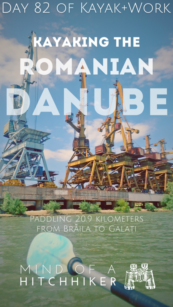
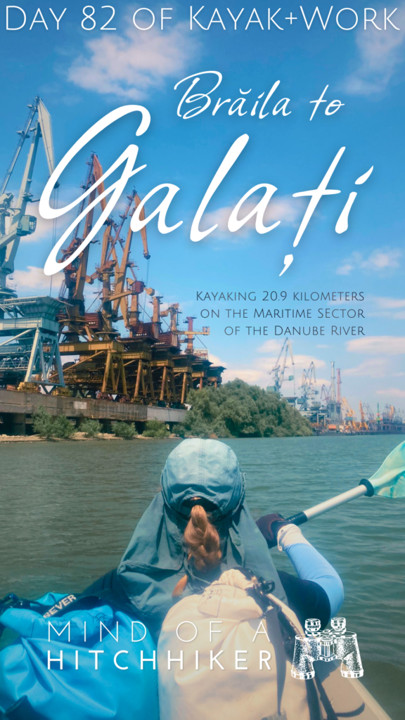
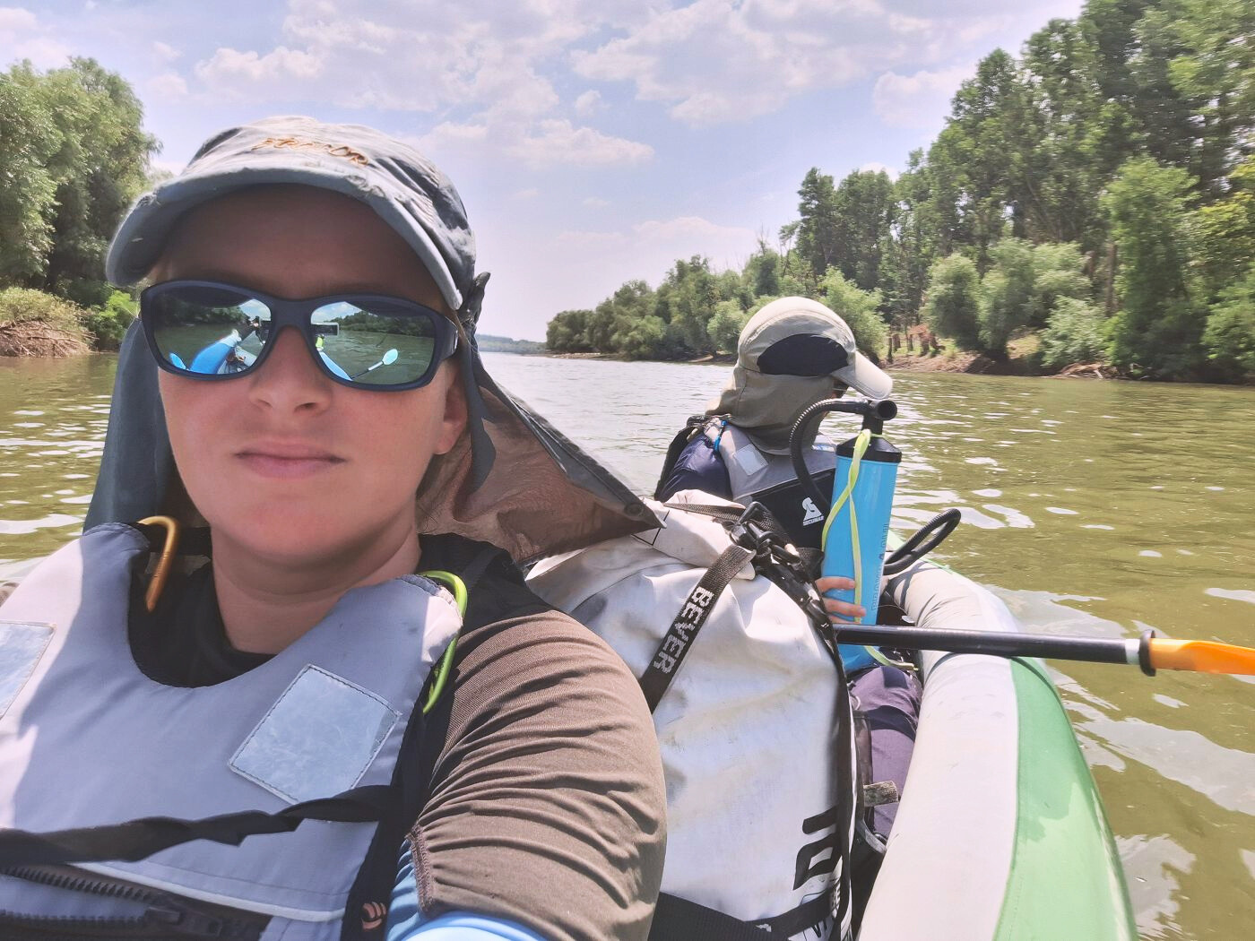
This kayak day happened on the 20th of July, 2024. Jonas and I paddled the Danube from Brăila to Galați. This was a relatively short day between two major Romanian cities.
Want to travel the (entire) Danube River in an adventurous way? Join our Facebook group Danube River Source to Sea: Kayak / Canoe / Bike / Hike / Sail to find your community
Contents
- 1 Leaving Brăila for Galați
- 2 Big Ships of Brăila + End of the Măcin Branch at Smârdan
- 3 Brăila Bridge: The Last Bridge Across the Danube
- 4 Not Much Happening on the Way to Galați
- 5 Arriving in Galați
- 6 Five Days One Week in Galați
- 7 Good read? Consider buying me a craft beer!
- 8 Feel free to share this post if you enjoyed it!
Leaving Brăila for Galați
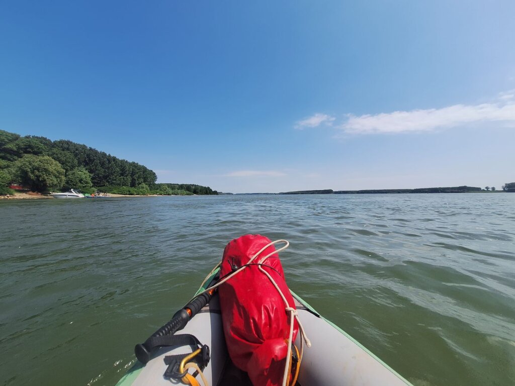
Because we only had about 20 kilometers to kayak, we woke up at Hotel RaAy without an alarm. With some instant coffee, we finished packing up at a leisurely pace. Jonas was looking ready for the summer with his new haircut. The forecast said that the headwind should get less the longer we waited, so we tried to find a balance between leaving late for the wind, leaving early to beat the heat, and not leaving so late that the hotel staff will bother us.
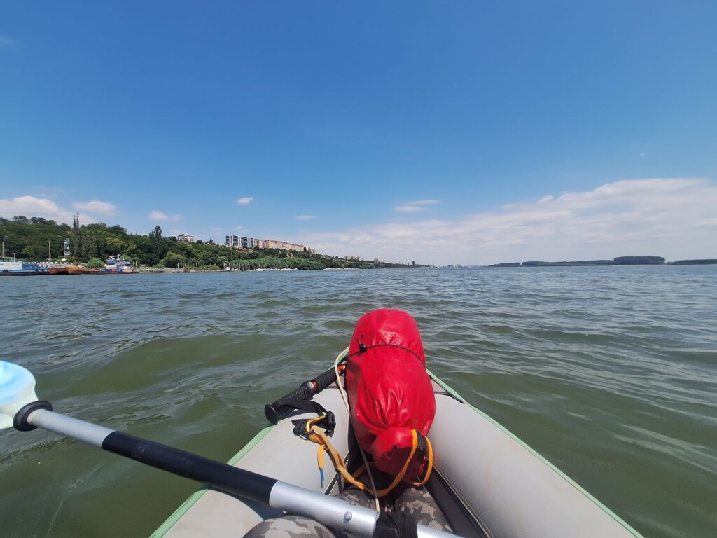
We left the hotel a bit after 9:30 and made our way to the slipway. There were many kayakers out this sunny Saturday. They were all headed upstream.
While setting up Zucchini with the Măcin Mountains in the background, I suddenly heard vomiting noises behind me. It was a cat who was sitting in the shadow nearby, looking really sick and miserable. Poor baby! There was so much snot dripping from his little nose and mouth. It was so sad and I had nothing to offer except some dry food. I get that after vomiting, he wasn’t interested in that.
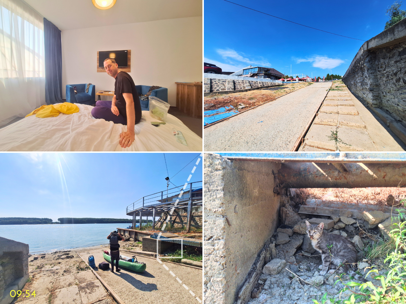
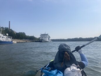
The cat kept relaxing in the shadow while we finished our preparation works. Jonas and I carried Zucchini into the water. With my heart a little more broken each day, we left Brăila at 10:00. It seems like we were leaving at the same time as a tour boat.

We first paddled past the promenade of Brăila for a long time. There were more kayakers spawning from somewhere. After a few minutes, we found their point of origin. A woman and two boys were about to leave the jetty with a motorboat while carrying two kayaks that didn’t fit. She waved at us and we said hello.
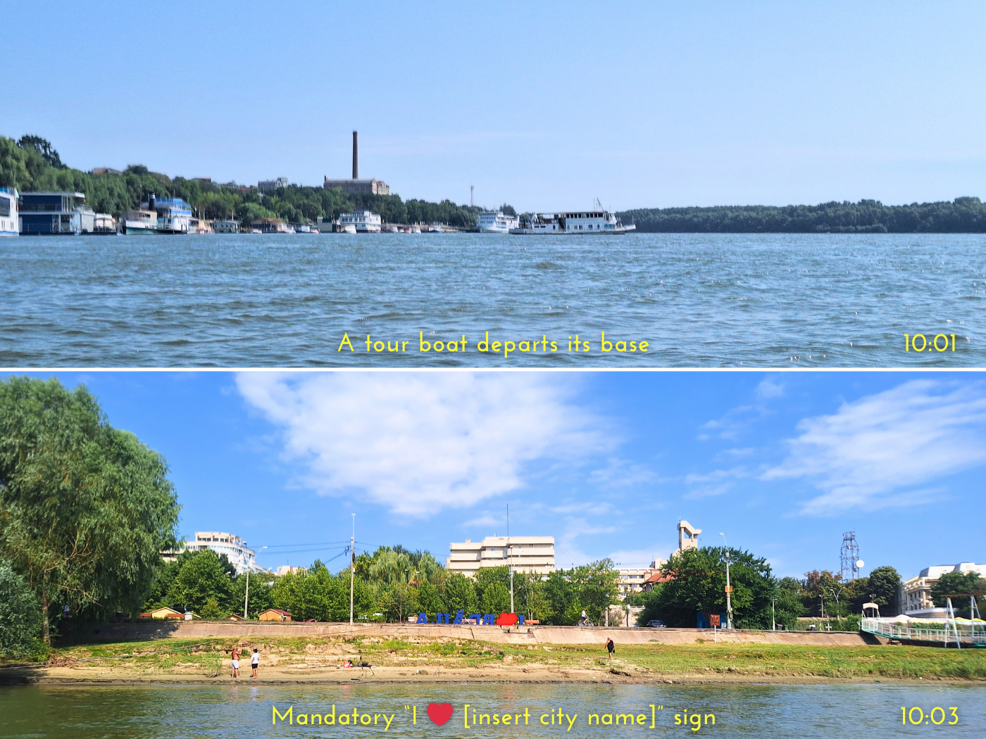
There were quite some people on motorboats out already, but thankfully, most of them went upstream. And there were so many people sitting on the terrace of their floating summerhouse, usually fishing or smoking a cigarette.
But it didn’t last, as we were entering the northern port zone of Brăila.
Big Ships of Brăila + End of the Măcin Branch at Smârdan
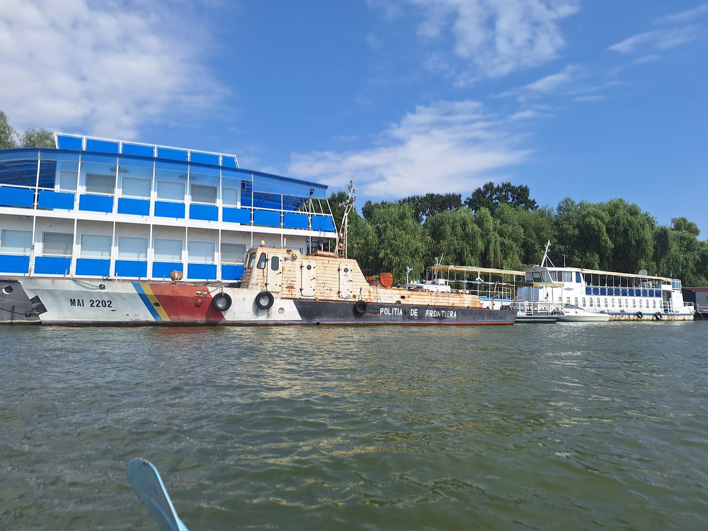
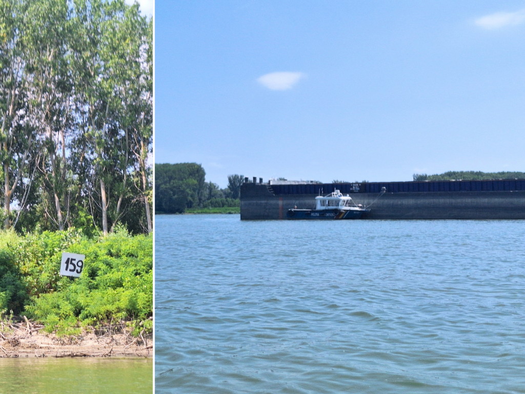
We first passed a bunch of rust bucket ships that have seen better days, including a Romanian border patrol boat. This is nothing new, really, as the Danube is full of neglected ships and barges.
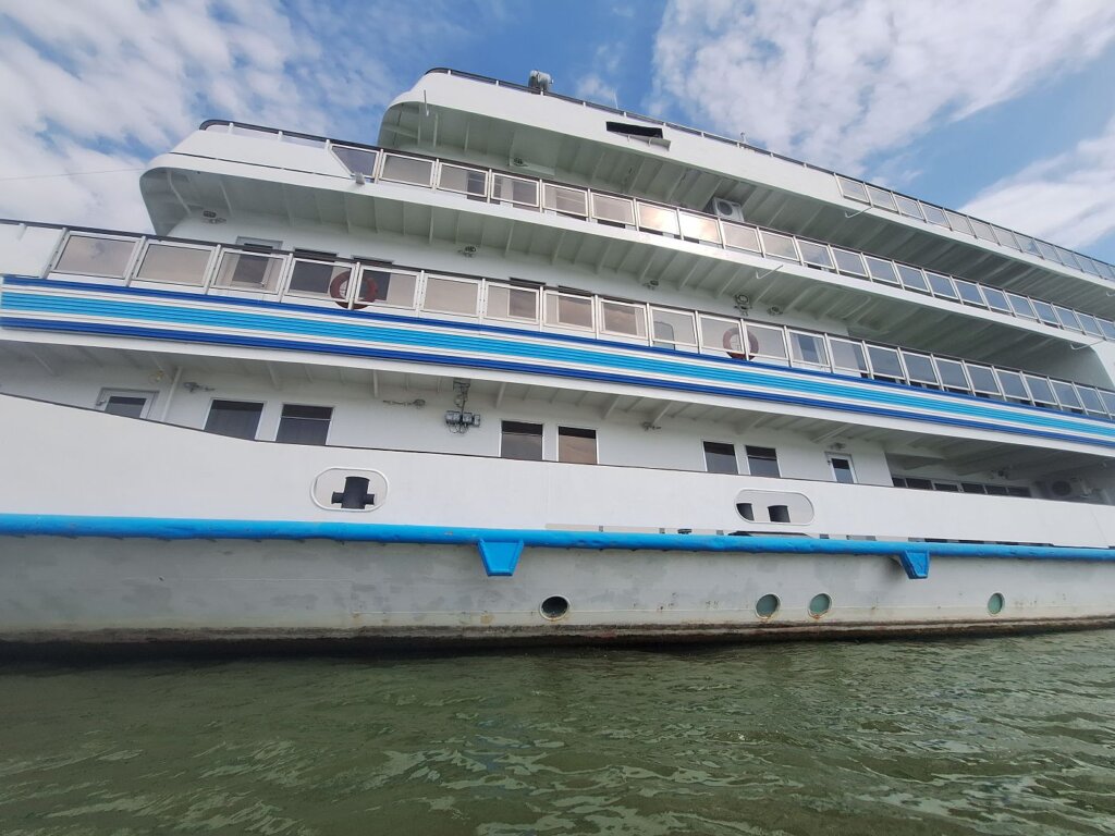
Then we passed the (at least) five-storey cruise ship that had been visible since our arrival in Brăila. I only realized when writing that this is the Vaporul Mureş ship that’s mapped as a museum. According to reviews, it was Ceaușescu’s presidential ship, launched in 1986 and only used once by them. Ceaușescu wanted one after a visit to the Nile in Egypt. It has a lot of dictatorship features, like a very large ballroom unsupported by pillars.
Some say it’s a shame it practically never sails, saying it would sail non-stop to Vienna if it was “in a normal country”. I’m fairly sure that the height dimensions of this ship limit it to sailing below Novi Sad, or even the Iron Gates I Lock. The only time I’ve seen cruise ships on the Danube with a higher air draft than a standard Viking/Avalon/A-Rosa ship – i.e. skinny, narrow, but very long – is in Ruse, Bulgaria. In fact, the air draft limit until Novi Sad is 8.15 meters above the water line in 2013, before the New Žeželj Bridge with a higher clearance opened in 2018 and replaced the 6.60 meter temporary Boško Perošević Bridge, which was dismantled. The ~17 meters tall Mureş simply wouldn’t fit.

We approached the beautiful building from 1906 designed by Anghel Saligny, who we know from the old Cernavodă railway bridge. It’s currently owned by Romnav. It used to be a river station with a road directly leading into downtown Brăila when it was a free port. Part of me wishes fluvial travel between cities would become popular again. Journeys could start and end again at elegant stations that make the passengers feel appreciated, the same way some train stations have a very human design.
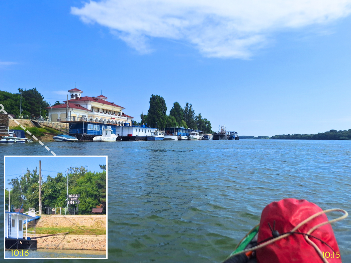
There’s a sign on the shore that read “BRAILA 20 VII 203 – 7” and I had no idea what that meant, until I found a Wiki for the classification of European inland waterways. I first thought it meant that the Danube is a Class VII (max) waterway of international importance. But it turns out it’s already Class VII between Novi Sad and Sulina (page 40). I finally found a graphic that says it all, but it only counts it as Class VII starting in Belgrade “from Estuary of Save all the way to the Black Sea”. I can only assume “Estuary of Save” means the confluence of the Sava River in the Danube at Belgrade.

Source: Rewway.at under CC 4.0 license. I made no changes to this graphic
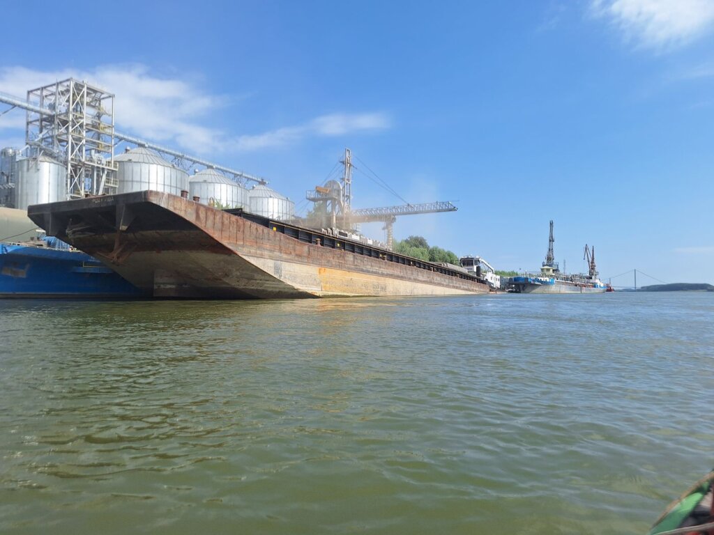
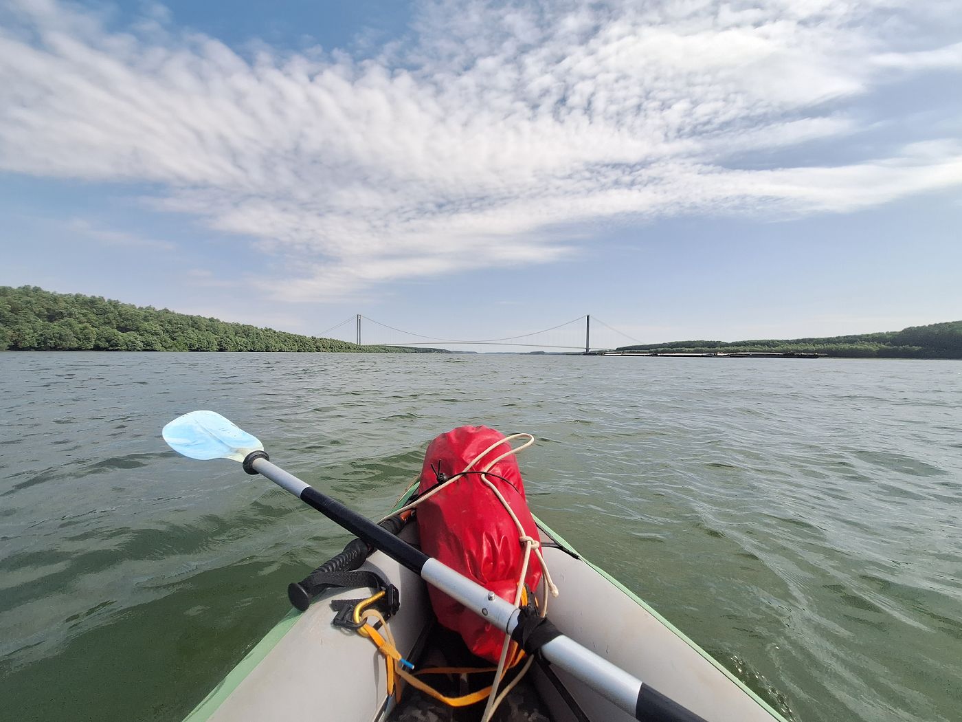
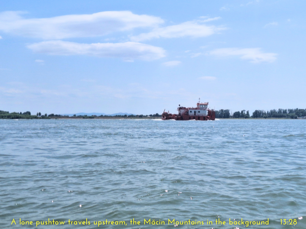
After that, it was all shipping of goods. We first passed another diagonal barge being emptied of its grain. Then we passed a bunch of cranes on a quay as we spotted the Brăila Bridge with its flashing lights in the distance. Every now and then, there was a rusty corpse of a ship on land.
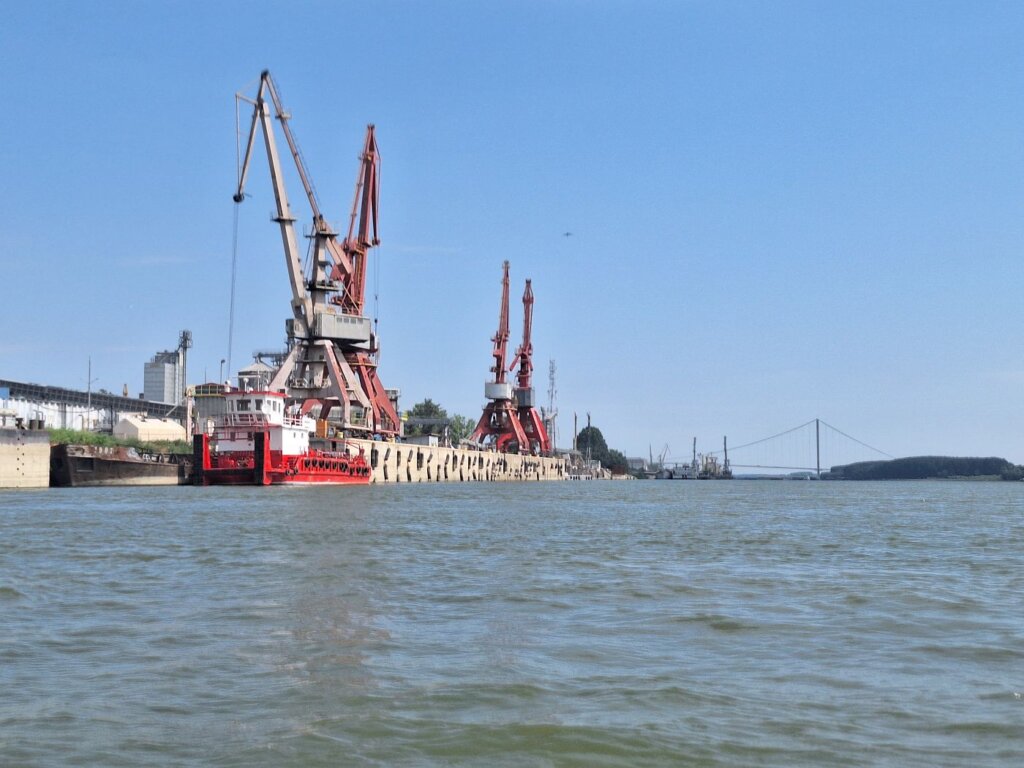
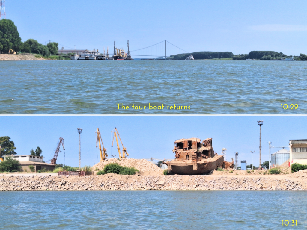
The small tour boat that had left Brăila at the same time as we did returned. It probably went to the new bridge and then came back, as this voyage was too short to make it to Galați and back. The captain steered their ship closer towards us, which I didn’t appreciate. Probably to entertain the passengers. To my surprise, none of the people on deck yelled or waved at us, like the passengers aboard the Flamingo near Orșova had done as we approached the Tabula Traiana.
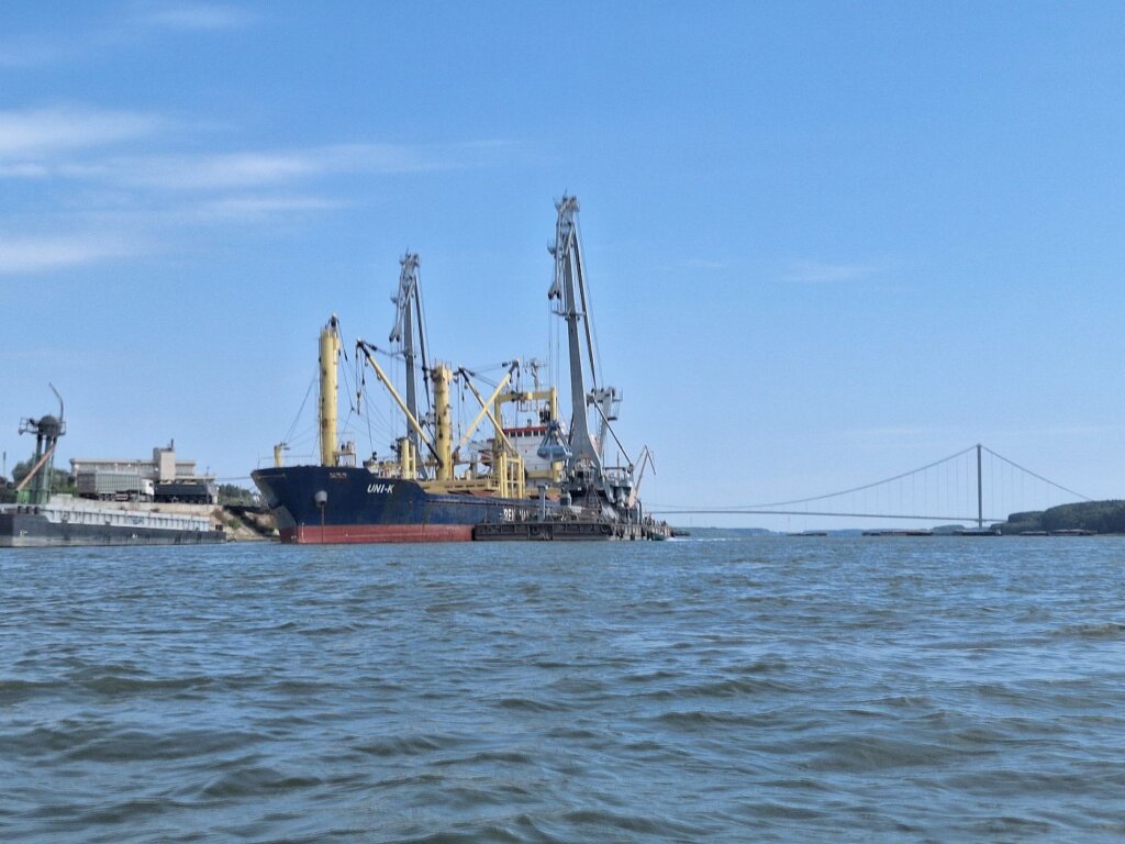
Moored outside another sheltered river port was the sea-going vessel Uni-K. It flew a semi-ripped flag on its stern I couldn’t immediately place. So far, all flags on the Danube have been European countries. This was from somewhere in Africa, but it took me looking up the ship to find out it was Togo.
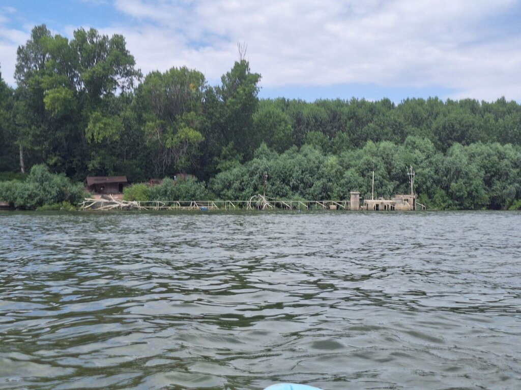
We were now in the area where the Măcin Branch of the Danube rejoins us and where the maps say there’s no less than four ferries crossing the river in this place. However, none of that was true. There were only a few small fishing-sized boats making the journey across to Smârdan with foot passengers. Another barge was being loaded up to our left with something dusty after we passed the ferry landings.
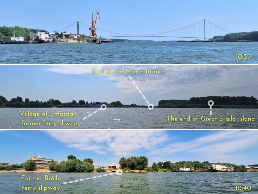
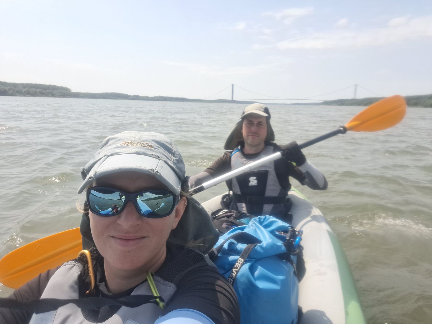
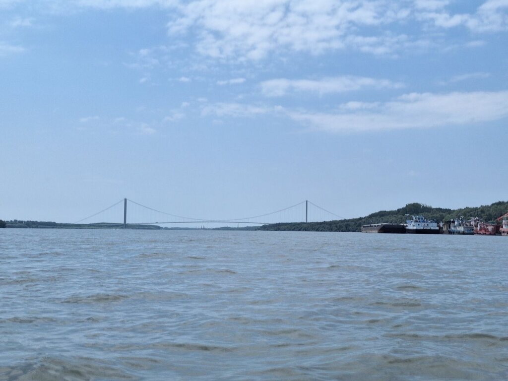
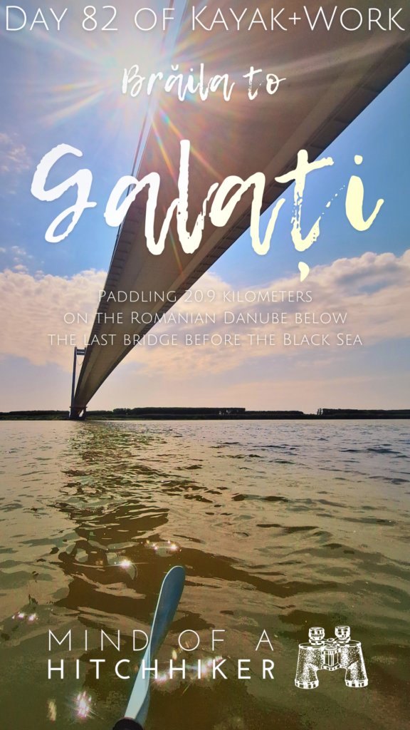
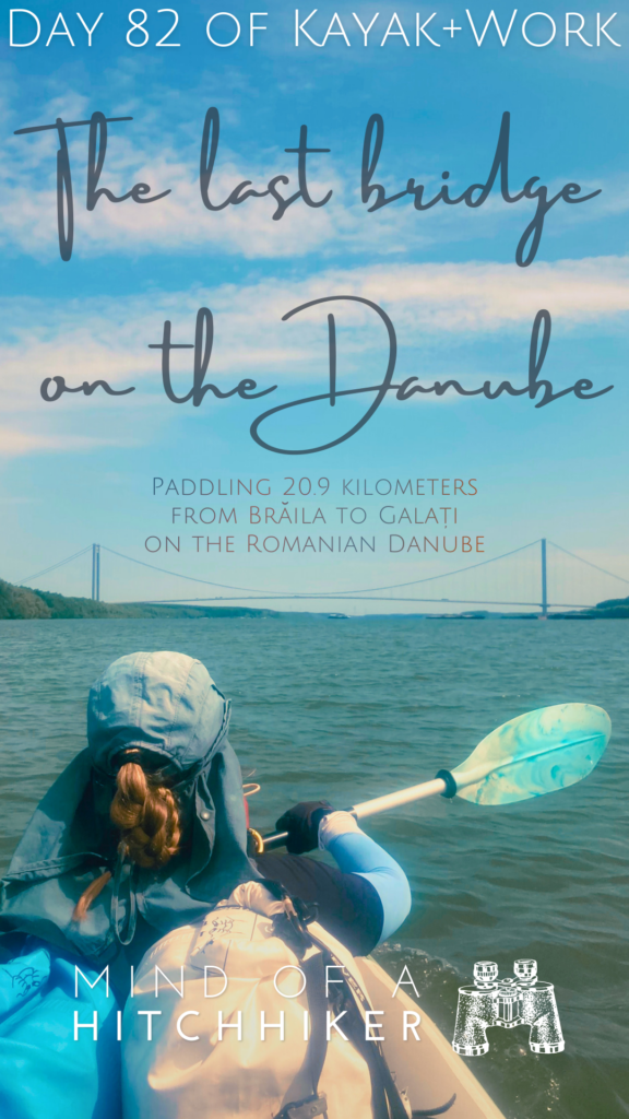
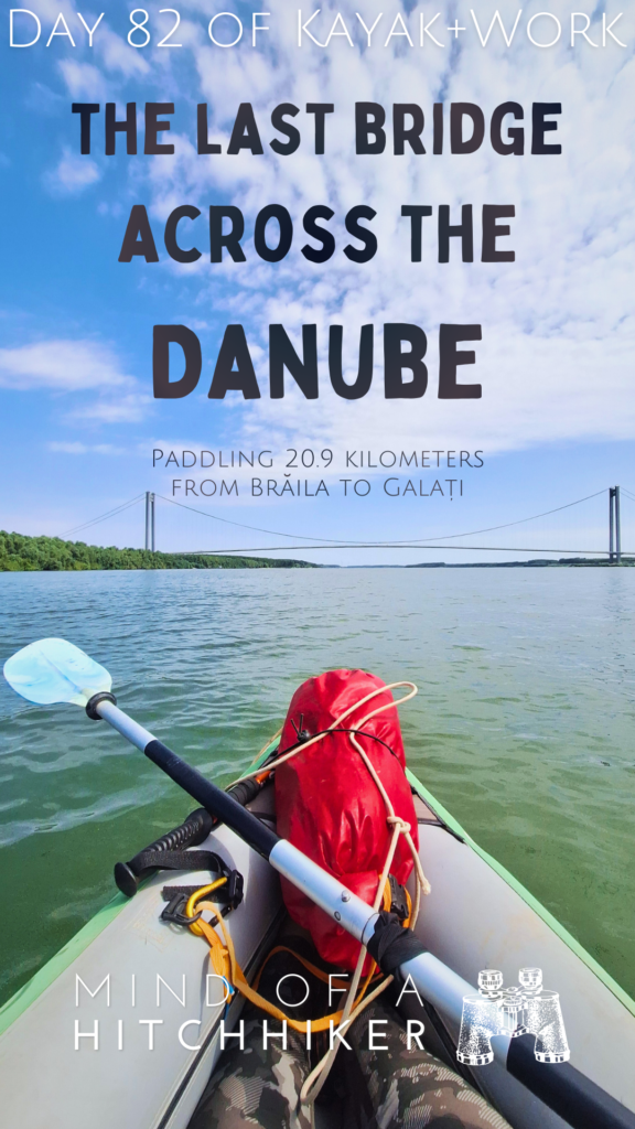
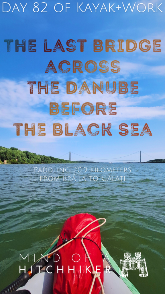
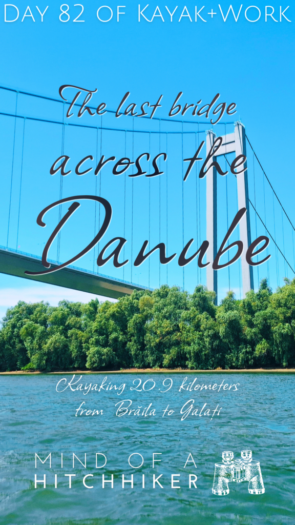
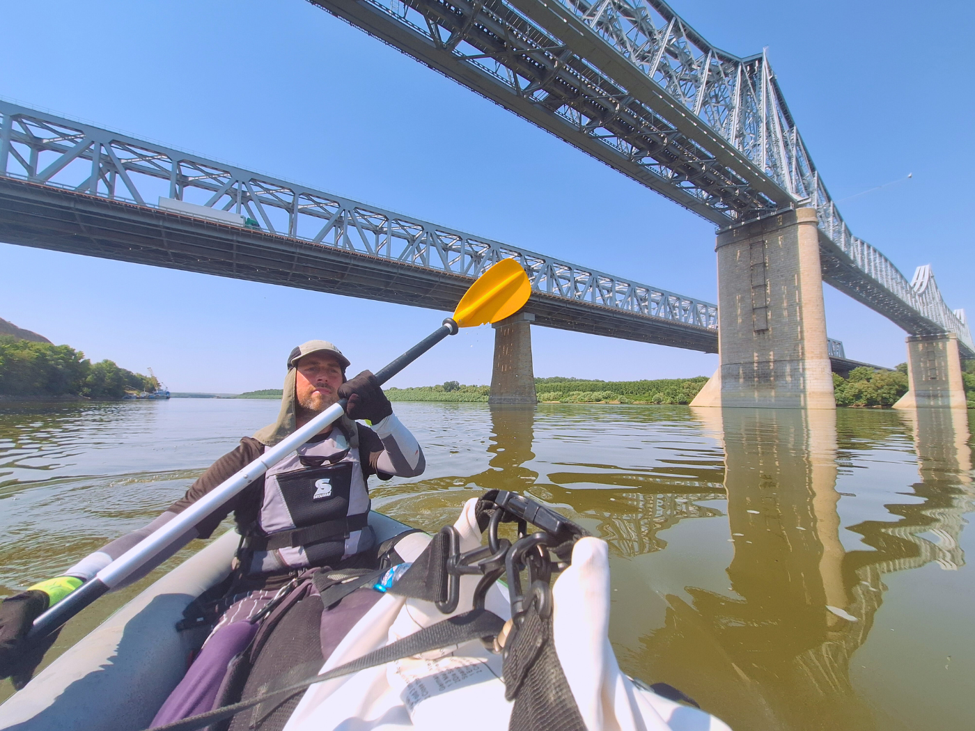
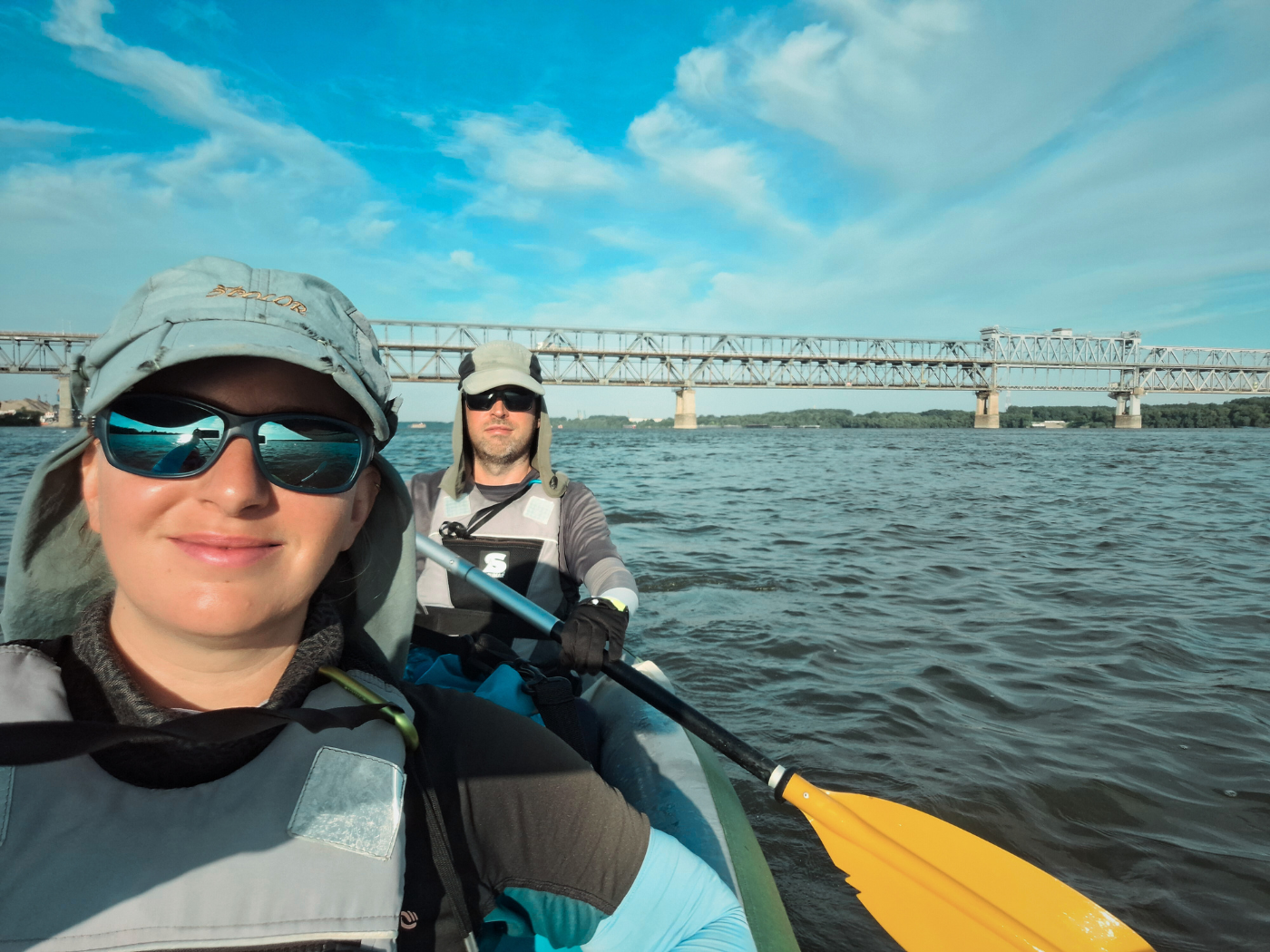
Brăila Bridge: The Last Bridge Across the Danube
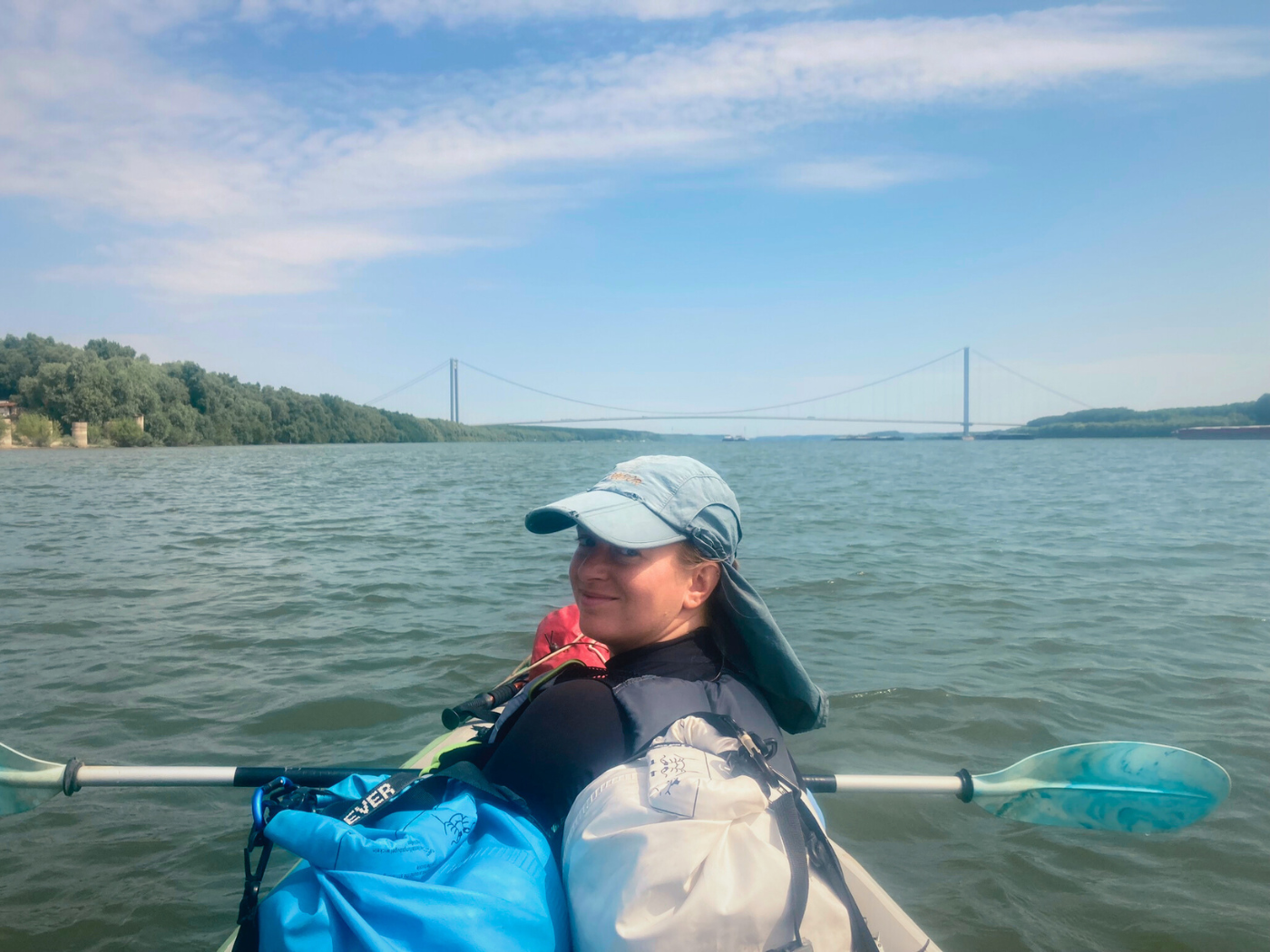
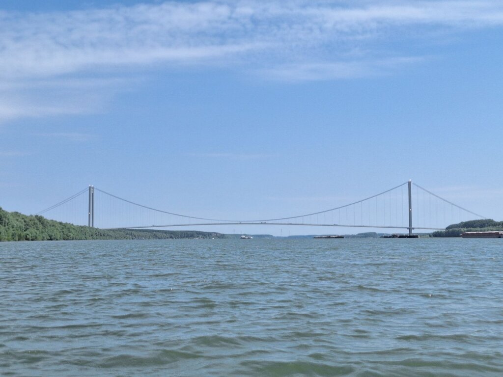
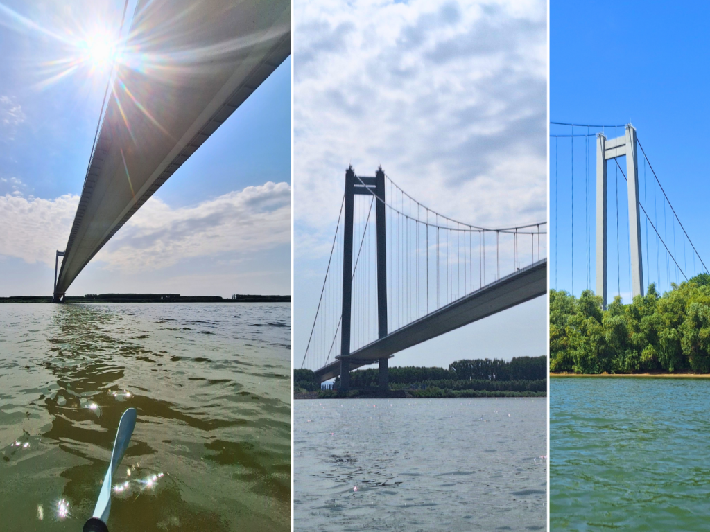
The reason these ferries have stopped is the opening of the Brăila Bridge a bit further downstream. It’s one of the Danube’s newest bridges, having opened a little over a year ago on the 6th of July, 2023. It’s a suspension bridge with a single span crossing the entire river. So the shipping lane goes kind of anywhere. Big maritime ships can pass under it, as the air draft or clearance is about 38 meters at maximum flood levels.
 Lights flashing on the top of the bridge
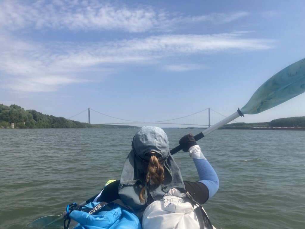
 The Ocarina traveling upstream
It’s interesting that for the first five years, no one will need to pay toll to cross the bridge. Usually, it’s the reverse: you pay toll to cross in the first years until its paid off, and then it’s free. At least, that’s how it worked in Norway with the Nordkapp Tunnel, which was free for the first time when I traveled there in the winter of 2012 with my Norwegian friend John. That one took 13 years to pay off.
Perhaps they made it free so the ferries would cease to operate? The Wallmart model?
The Brăila Bridge has a lifetime design of 120 years. The cables are of Japanese manufacturing and the road deck comes from the nearby Galați steelworks. The concrete pillars are 192 meters tall, which makes them taller than the tallest building in Romania (Floreasca City Sky Tower in Bucharest). If you want to see amazing pictures from the towers and the steel cables during its construction phase, I recommend reading this review.
I was wondering why the Wiki says there are sidewalks big enough for pedestrians and cyclists to cross the Brăila Bridge, but then also says they’re for maintenance vehicles only. Kind of sad for all the Danube cyclists. But then I read reviews that call it “Romania’s Golden Gate Bridge” and it suddenly makes sense why no pedestrians.
So far, I don’t think there’s a bus line that uses the bridge to Smârdan. So for carfree people, it’s still impossible to get to the other side without a helpful skipper. But the boats get a lot smaller.
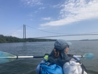
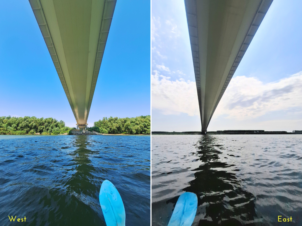
To my great anticipation, we paddled beneath the Brăila Bridge at 11:13. I was feeling the moment, the closeness to the Black Sea. A major milestone reached. And yet, we have still about 180 kilometers to paddle to Sfântu Gheorge.
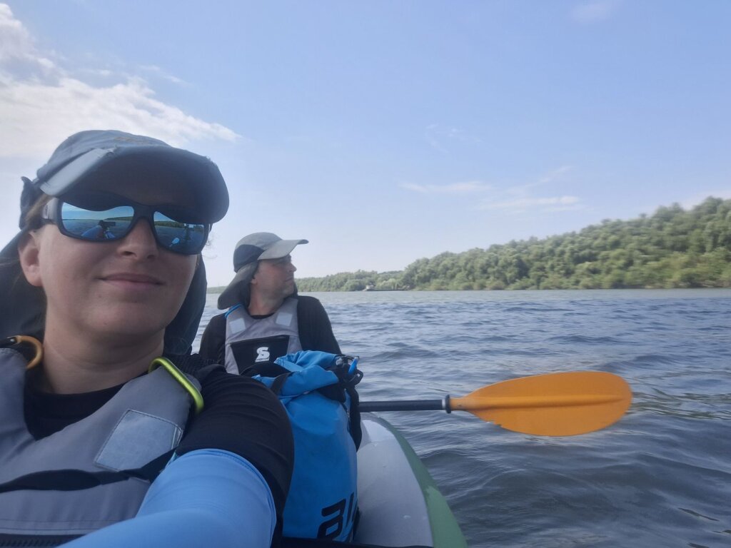
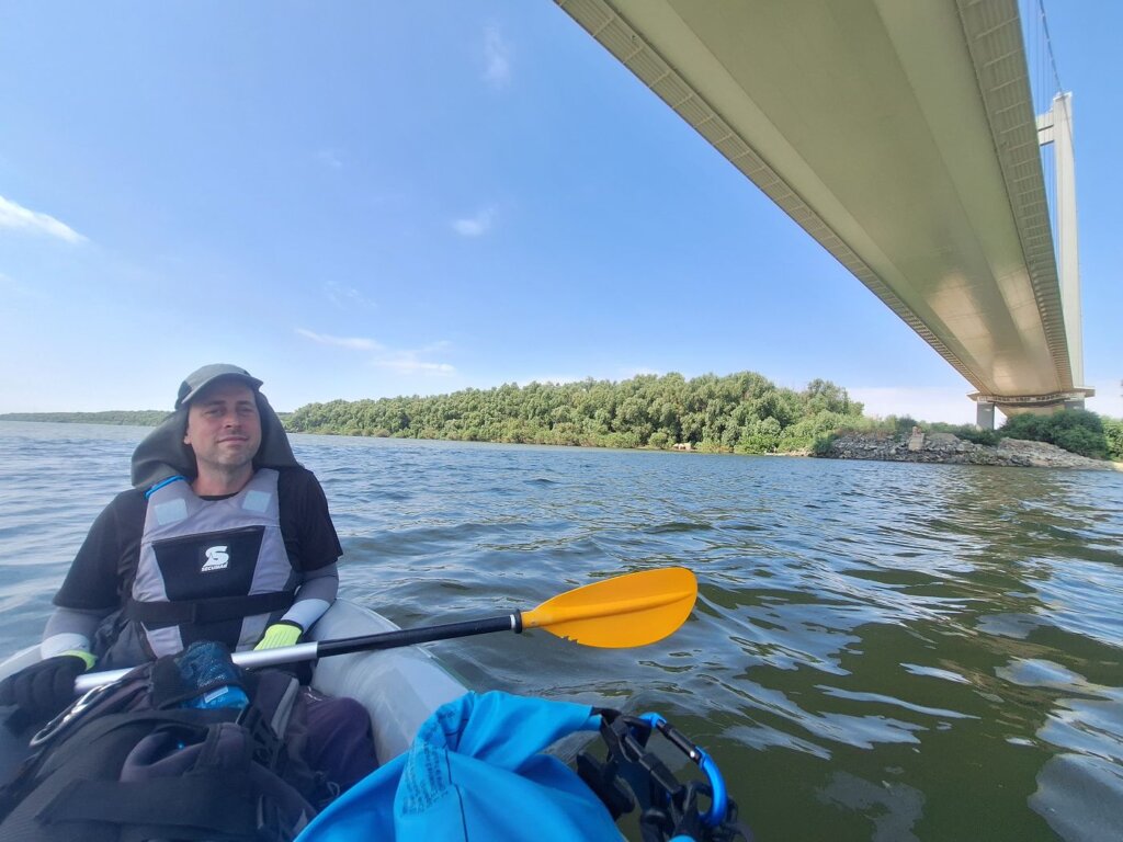
I told Jonas about my feelings and the excitement, but he didn’t share it with me. “Yeah, it’s a cool bridge.” I’m sure I was clear that it’s not the bridge itself that makes my heart flutter, but what it represents.
I feel like the two of us are having more and more diverging views on this trip.
Not Much Happening on the Way to Galați
To our left was a nice beach with lots of people swimming or tanning. A small tour boat named Camelia traveled upstream from Galați. It was more modern than the tour boat from Brăila. Or perhaps it’s a ferry?
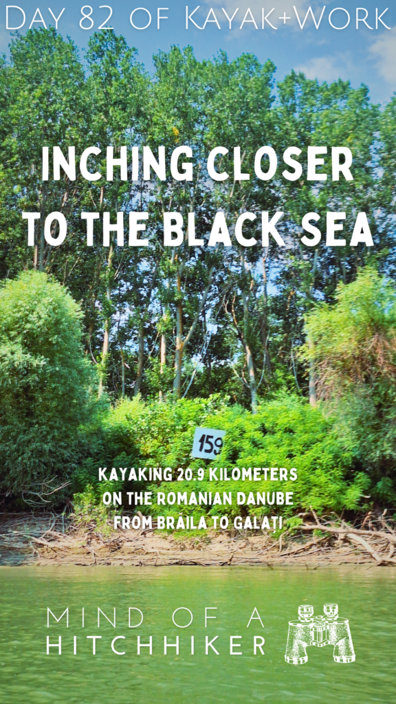
Not much happened in this area before Galați. There were river kilometer signs with a new design, counting down 165, 164… This time it’s black writing on a white background and the quality looks almost like it’s made freestyle with a spray can of graffiti. It’s very odd.
A little before noon, it was time to eat something. I opted for a protein bar, but Jonas chose the four-cheese truffle pizza we’d boxed up. We were both happy with our choices. The Camelia came back. I bet it also just visited the brand-spanking new bridge and then returned.
We then entered a zone with trees on both sides of the river with only the occasional fisherman on the shore. The Danube is really wide here. The island on the other side was so far away. There was one zone with lots of (condemned?) ships and barges anchored or washed ashore to our left.
The day before, we’d researched the distance to the Black Sea. Big mistake, because now we don’t trust the signs anymore. Today we started at about 173 in Brăila. But I’d measured with my OSM app that it’s more to get to Sfântu Gheorge. Now the measurement can be wrong as the app sometimes does weird stuff, but it seems like Sfântu Gheorge is at least 12 kilometers further away than signed. The Sulina branch is about the same distance and the Chilia Branch is even longer. So Jonas stopped trusting the signs.
But I only look one or two days ahead with my measurements on OSM. Every day, the first real world kilometer sign sets the baseline. What I measure with my highly-detailed map of our Danube journey is not a measure of the length of the Danube. It’s simply a measure of what we did. I’m not going to get upset with what lies ahead and how far away it is when I still don’t have full confidence Zucchini will make it.
After lunch, we tried to make some progress. The motivation felt kinda off today. Starting this late isn’t beneficial to our paddle performance. Feels a bit uncoordinated.
We tried to land for a quick break. There was a sunny spot that looked beachy and mosquito-free. Once we landed, Jonas tried to get out, but his foot sank 15 centimeters into the mud. After a few minutes of trying to find solid ground to walk on, he retreated back into the boat. I guess we don’t need to pee that badly. Thankfully, there were no mosquitoes. Is our attempt at taking lots of thiamine working to repel them, or were we just lucky?

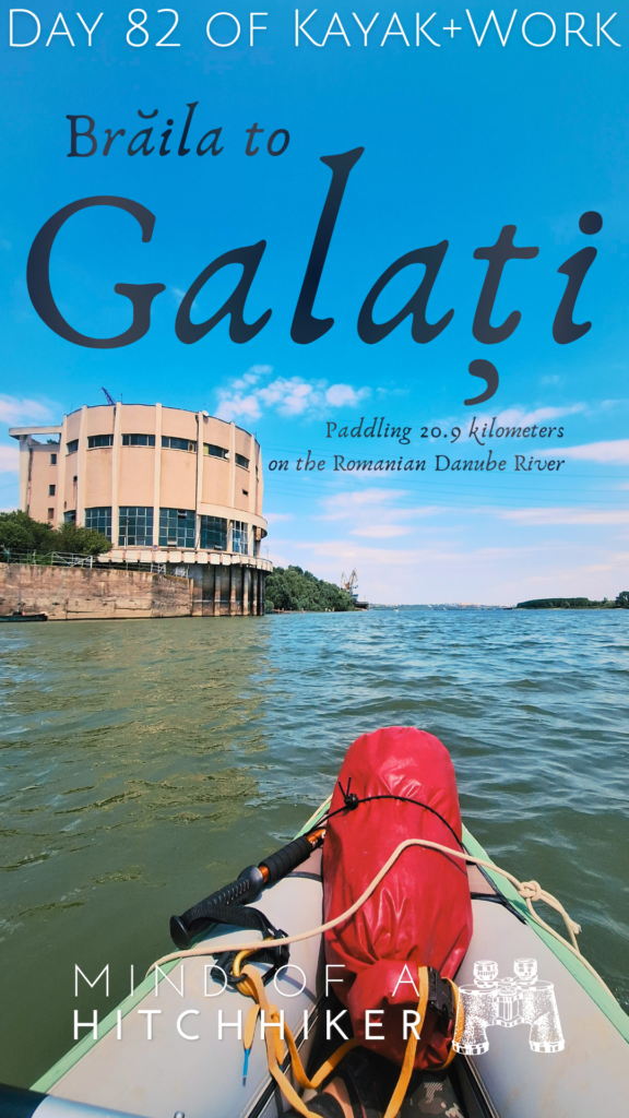
Arriving in Galați
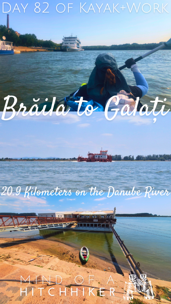
In the distance, we got our first impressions of Galați. To our right, there was a Romanian border police boat moored to a cargo ship, probably inspecting it. We first had to pass by a round building that had something to do with water. Jonas smelled barbeque, which came from the beach full of people right behind it. Lots of people were swimming, once again.

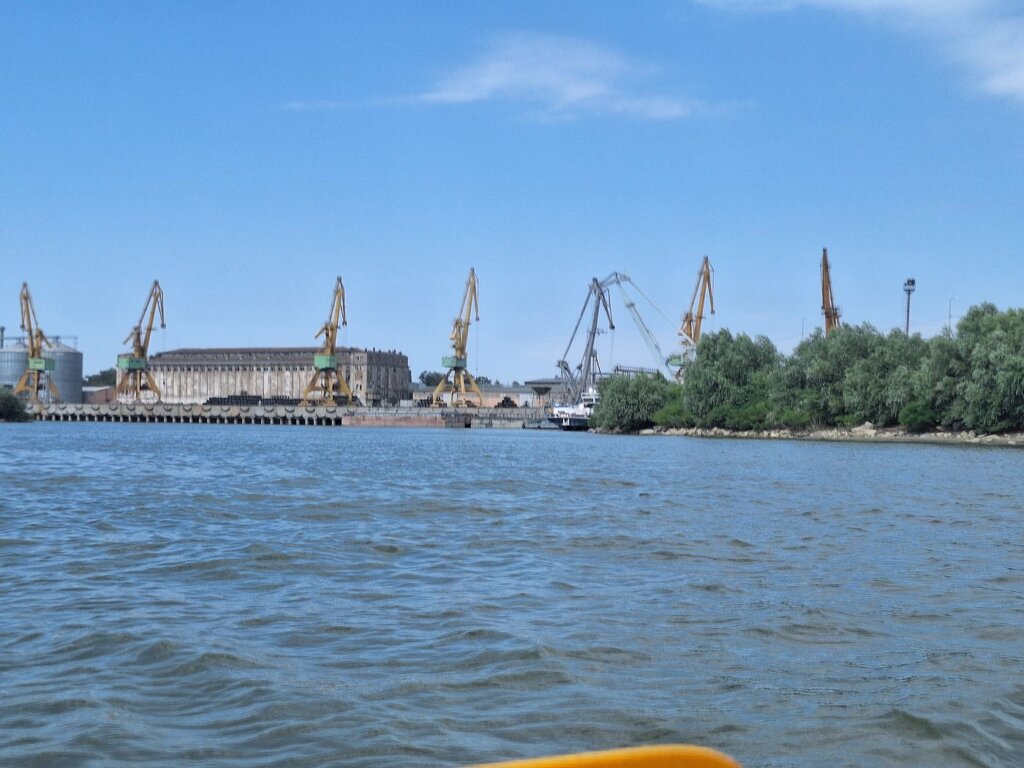
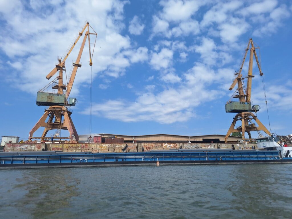
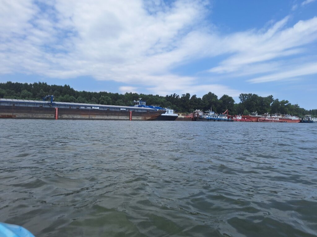
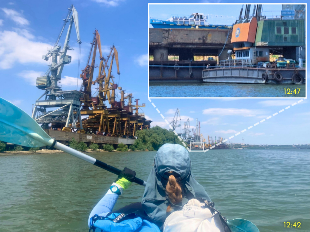
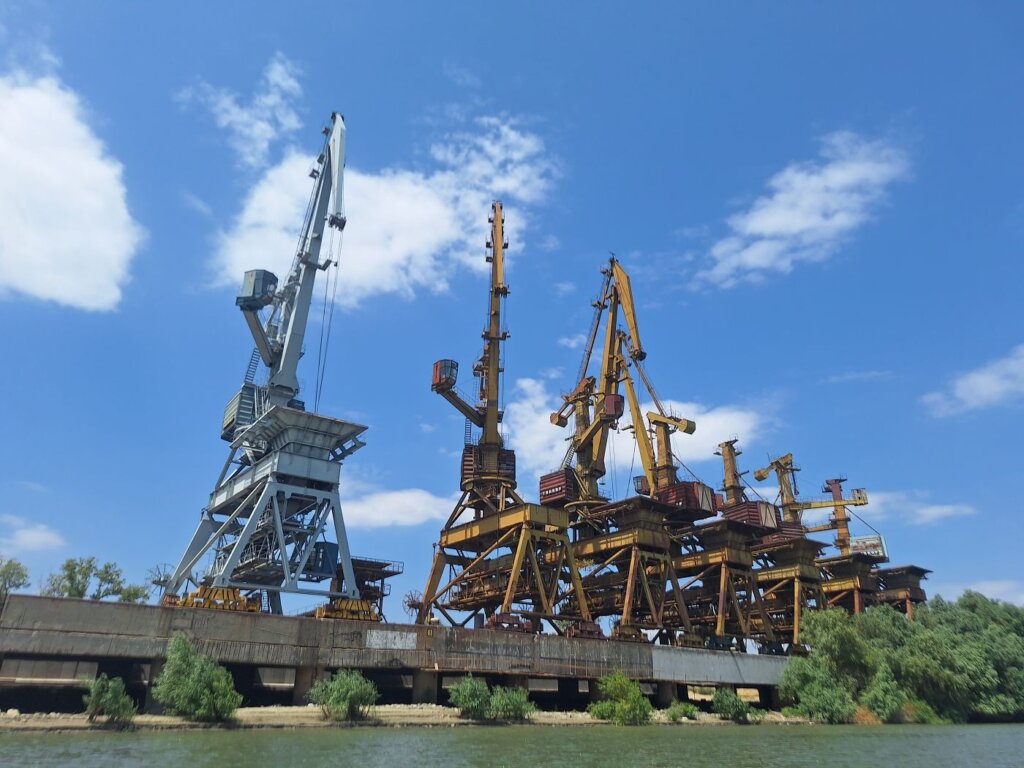
Beyond that, the southern port area of Galați began. It was the most magnificent collection of cranes I’ve ever seen. So many were rusty as hell. There was even a boat on the shore for no reason in particular.
To our right was a large area full of barges anchored and tied together side by side. I counted one row of at least 16 parallel barges. It’s big enough to form an archipelago not unlike Finland’s Åland Islands if you look on satellite view. To our left was a Navrom Portservice base, which I think is where the little pilot/police boats that visit ships on the river spawn from.
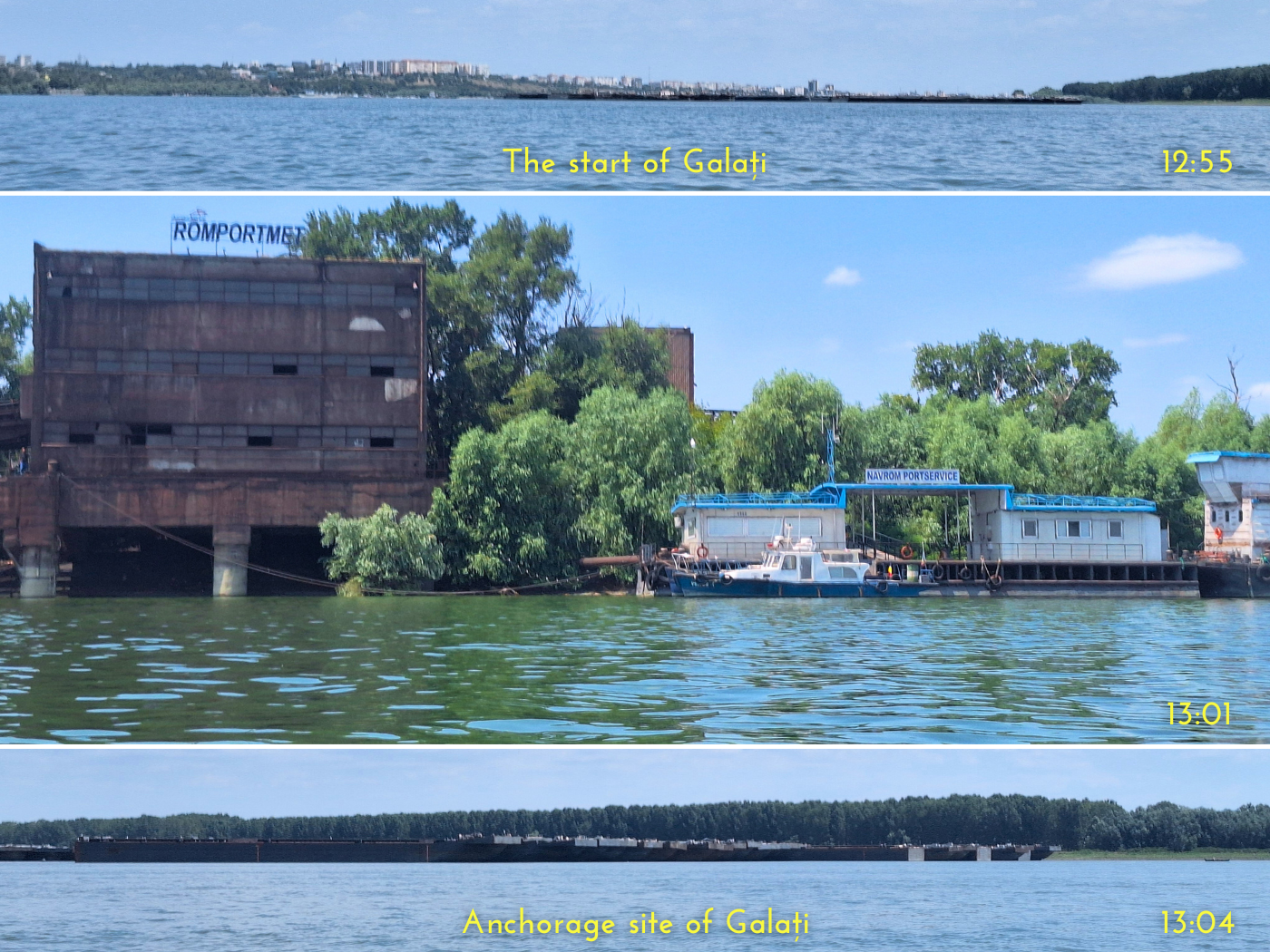
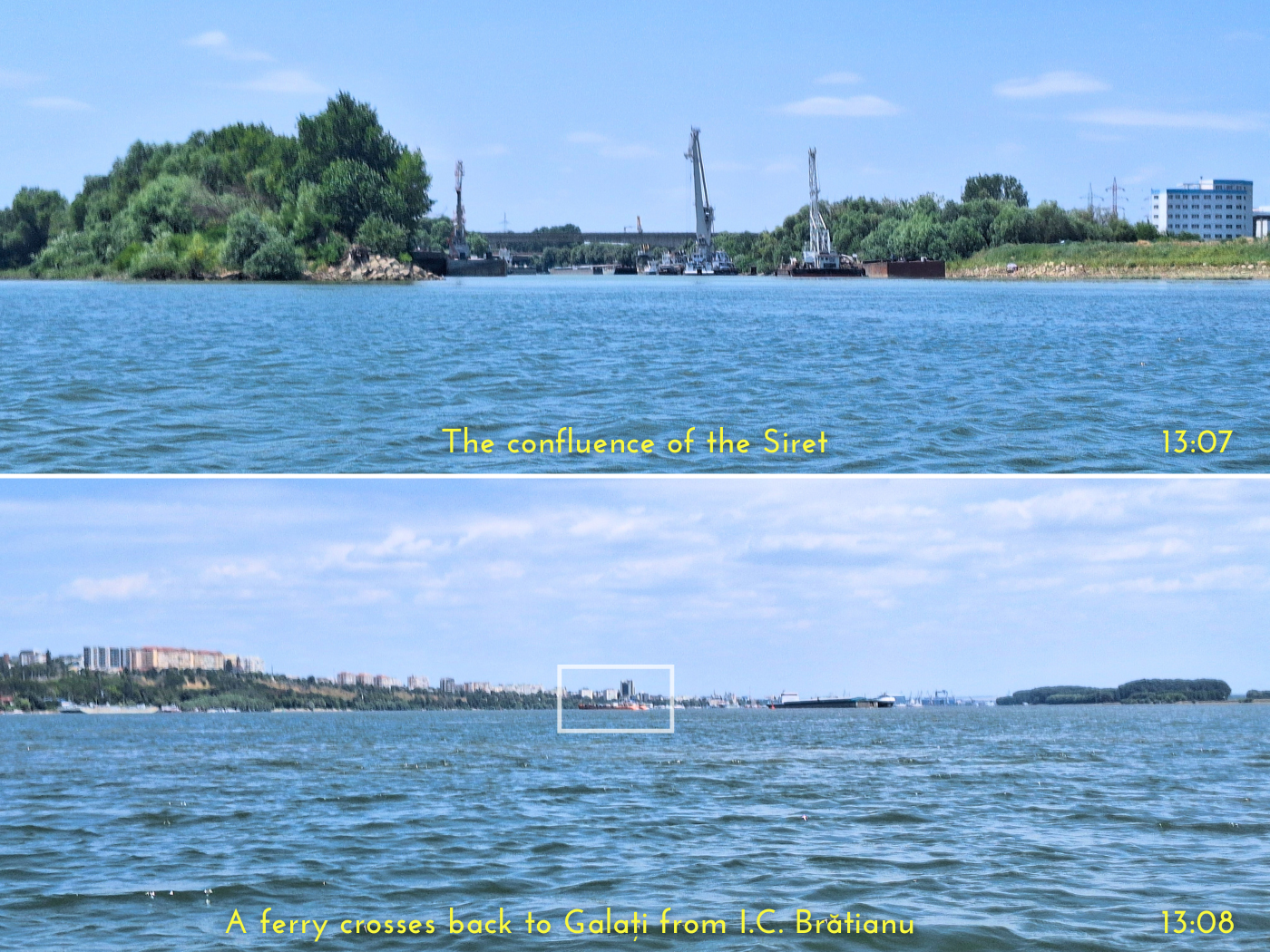
Motivated to finish this trip, we paddled past the confluence of the Siret River after 13:05. Though it’s mapped as non-navigable on my OSM map, it was chock full of ships and barges that will probably not go anywhere anytime soon.
To our right was a large area full of barges anchored and tied together side by side. I counted one row of at least 16 parallel barges. It’s big enough to form an archipelago not unlike Finland’s Åland Islands.
I don’t know how, but I was under the impression that Brăila was bigger than Galați in terms of population. But it’s actually reversed. It actually makes more sense that Galați is bigger, since most of the barges I’ve seen on the Danube in 2024 mention Galați. Brăila is the 11th biggest city of Romania, but Galați is number 8. Perhaps I got confused because Brăila has a Decathlon.
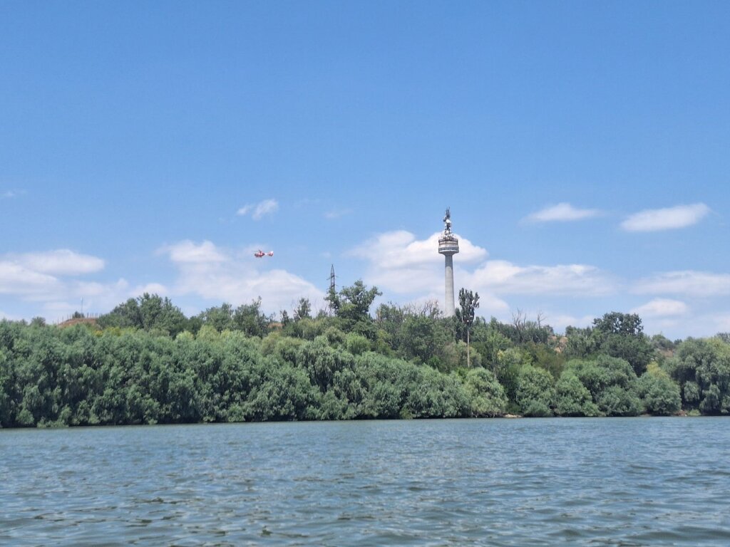
We saw a helicopter fly by the TV tower and a big orange ship crossing the Danube from right to left. That’s the ferry. A speedboat came from further downstream and a guy on a jetski came from the beach. Both of them approached us at high speeds and I was not amused. Jestki guy tried to get us to wave, but I’m not doing that to people who lack foreseeing the consequences of their own actions. They passed us within 20 meters on each side and their wake was coming from both sides. We chose to face the wake from the speedboat. We paddled right into the V of these two douche vessels. That wasn’t fun.
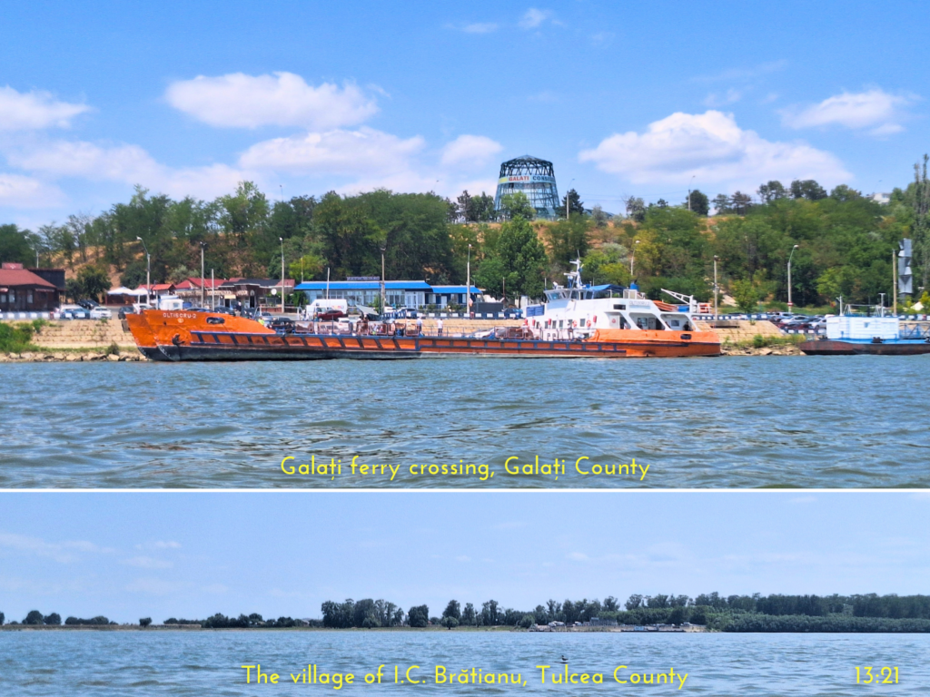
The ferry was just loading up new vehicles and foot passengers as we were about to cross its path without hesitation. The timing with the ferry was pretty good. The Camelia had just begun another tour and traveled upstream with new passengers.
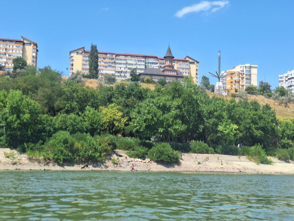
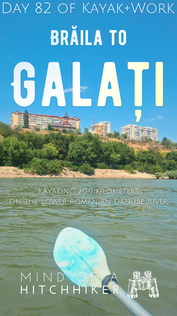
The cliffs of Galați towered above us with their apartment blocks. The city’s wild opposite shore reminded me of the Argentinian city of Rosario on the Paraná River. Across the river, I could see tents of happy campers. That’s incredibly similar to the beaches on the river islands across Rosario, which we visited back in 2016. And beyond that, the Măcin Mountains.
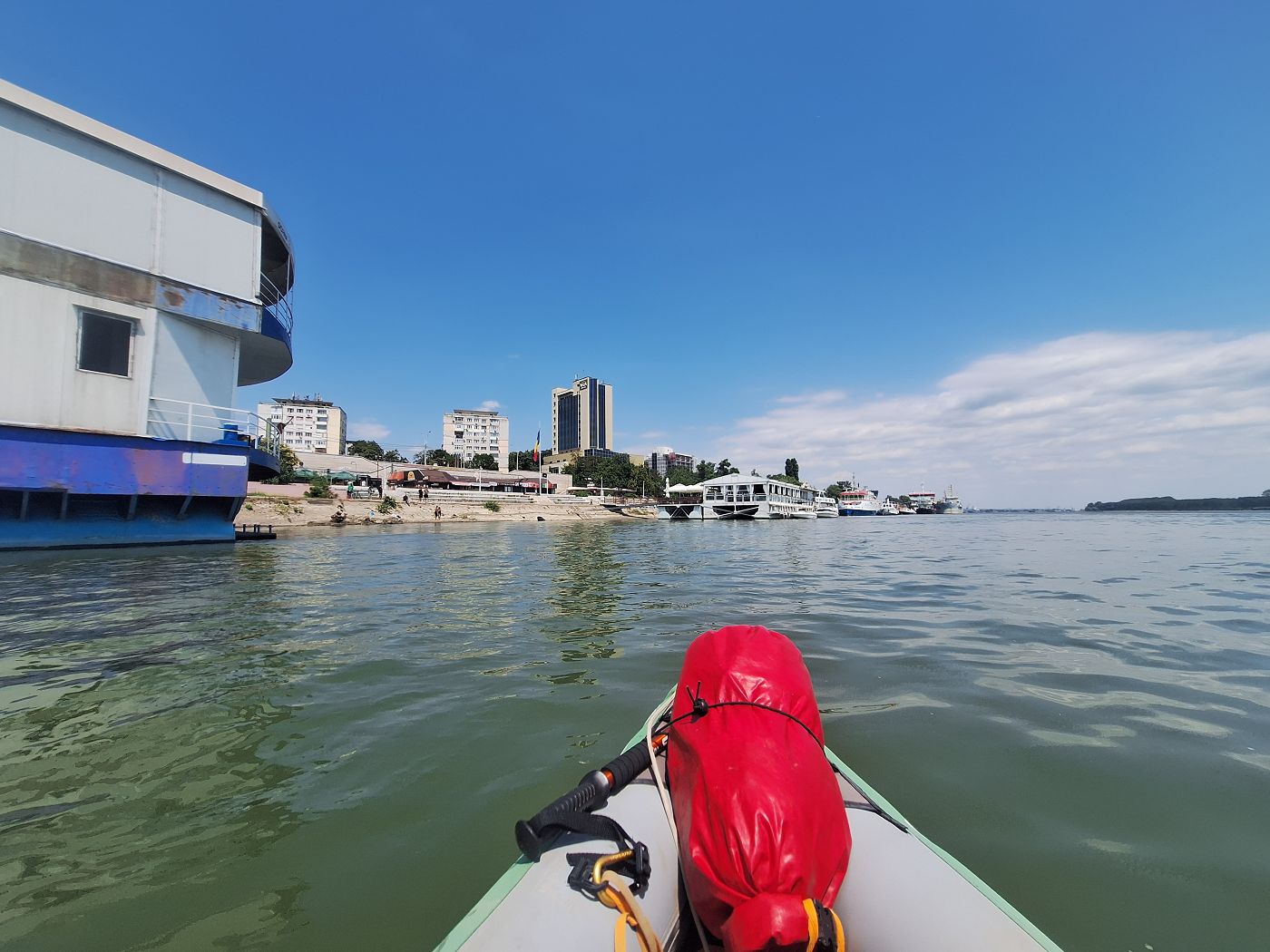
The floating houses and restaurants of Galați began. In the distance was Hotel Vega, which is a good landmark since it’s in the same street as our apartment. We had a rough area in which we wanted to land, but no specific spot. And the reality was very different from satellite view.
We paddled past many restaurants full of kids that wanted us to acknowledge their existence. We kept going, till we spotted some stairs out of the water near the restaurant of Patru Pesti. Jonas and I abruptly turned Zucchini around and paddled beneath the cables to get to the stairs.
Arrival time in Galați: 13:42. Not a record-setting day, for sure.
This landing spot wasn’t great. It was very muddy and it stunk. Jonas got the luggage out of the boat and onto the embankment. We lifted Zucchini out and found a spot to dry her.
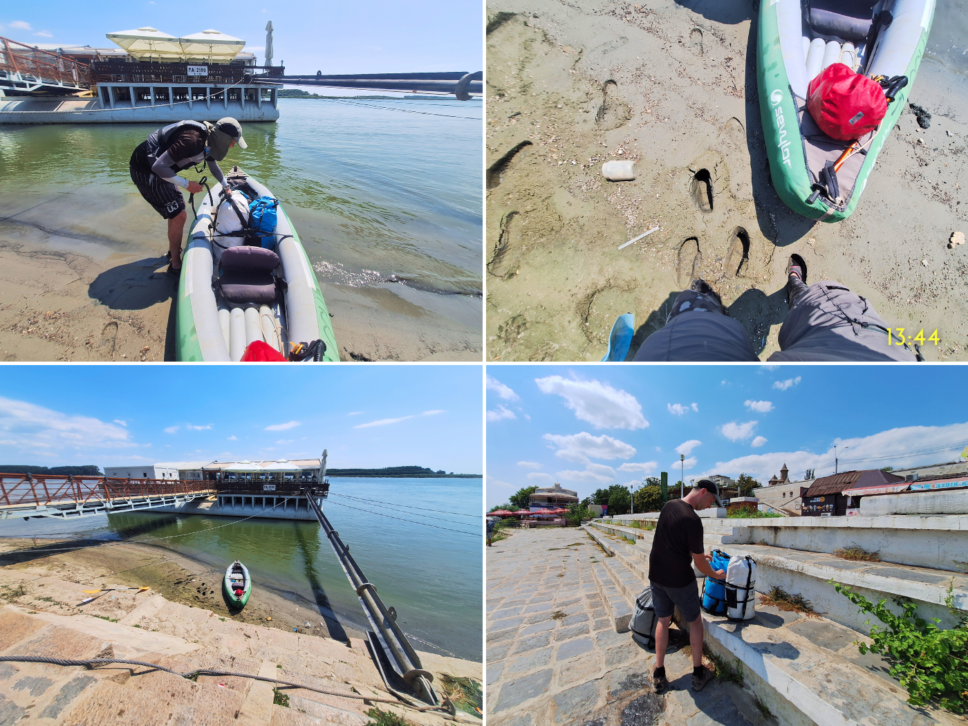
It was very hot on the embankment. Spending an hour here drying the boat was a bit of hell. But fortunately, nobody bothered us and tried to touch Zucchini. By 14:24, we’d packed up and began our walk to the apartment.
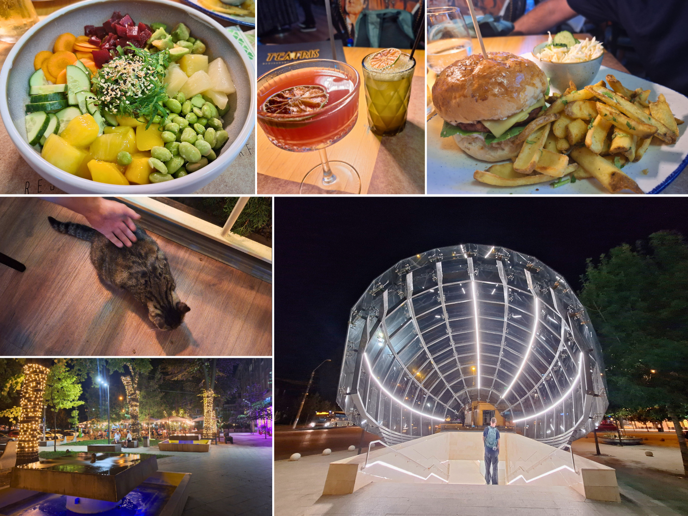
Five Days One Week in Galați
This is how we spent our time in Galați:
Saturday: after checking into our amazing apartment, Jonas showered while I unpacked. The entire white dry bag (i.e. camping bag) had to be emptied to analyze the leak it has. There was actually dirt inside the dry bag that had washed inside. When it was my turn to shower, I also gave the dry bag a wash so we can patch it when it’s dry.

We were very happy to finally do laundry again. And with the wet clothes from the camping bag, we have a lot of it. Jonas also ordered some groceries via Glovo so we can finally cook for ourselves again. But not today.
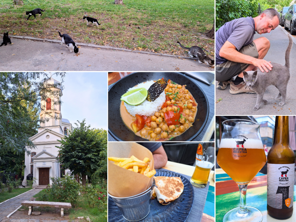
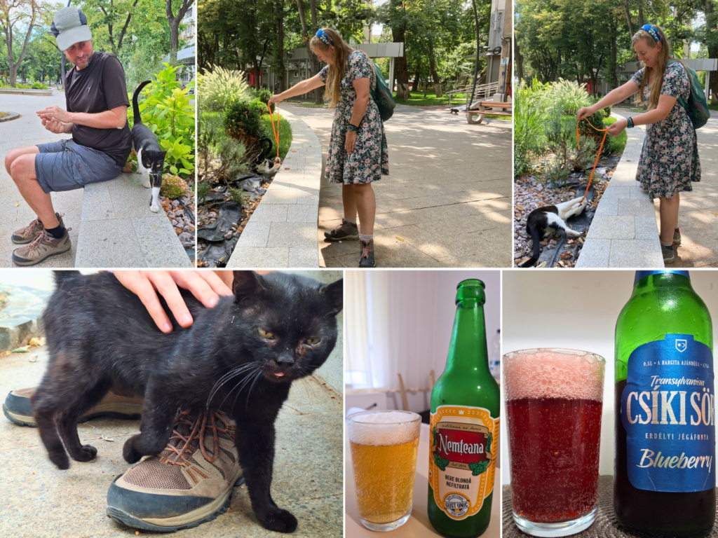
In the evening, we walked to Craft Rebel Food for vegetarian food and craft beer. It’s a super nice place, but we only got a table because we were early. We also met a lot of sweet street cats in our neighborhood and the restaurant neighborhood. The first impressions of Galați were very good.

Back at home, we started watching The Brothers Sun on Netflix. We liked it.
Sunday: we worked and cooked food for ourselves, which was so nice. I wasn’t as productive as I hoped I’d be. I also called with a few family members since I had the time and energy to keep in touch. Can’t really do that from a hotel.
Per my initiative, Jonas and I also patched up the white dry bag with a patch from the boat repair kit. I’m glad that task is out of the way. Ate that frog ‘n all.
We joked around about how we’d arrive at the Black Sea. Jonas imagined we’d be paddling off to the deep while slowly sinking like these fellas:
With a lack of motivation to finish writing about the day from Hârșova to Brăila and from Brăila to Galați, I addressed the prospective issue of getting back to Germany and the Netherlands. We’ve looked at the options a few times before, but not with a dedication. One plan was to look at Interrail tickets. Perhaps that would make sense (it does not).
I’m in no hurry to get back to the northwest and would like to savor the journey back as well. One idea is to take the train from Tulcea to Bucharest, Bucharest to Deva for an AoE2 Wonder, Deva to Budapest/Bratislava/Brno/Prague, and then from there perhaps a stop in East Germany before going to Utrecht.
Jonas found the prices alright, but then he dropped the bomb that he won’t do it with Zucchini. Though it’s not a surprise as he’s been hinting at this before, my heart sank.
Barring total destruction, I’d like to take Zucchini back. I don’t feel right about trashing her. I understand she’s bulky and impractical to carry around, but perhaps I’d still like to do a kayaking day trip on a river we stop by on the way home. Like we did kayaking the Morava River when we stayed in Bratislava for a month in 2019.
We only went out for a short cat walkie in the evening in our very pedestrian-friendly neighborhood, after eating vegetarian sushi ordered via Glovo.

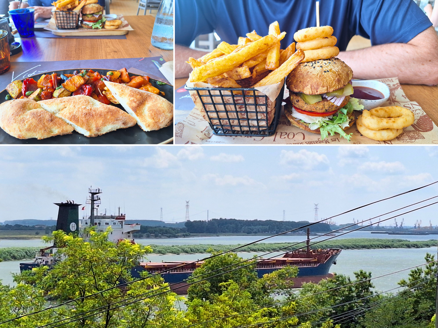
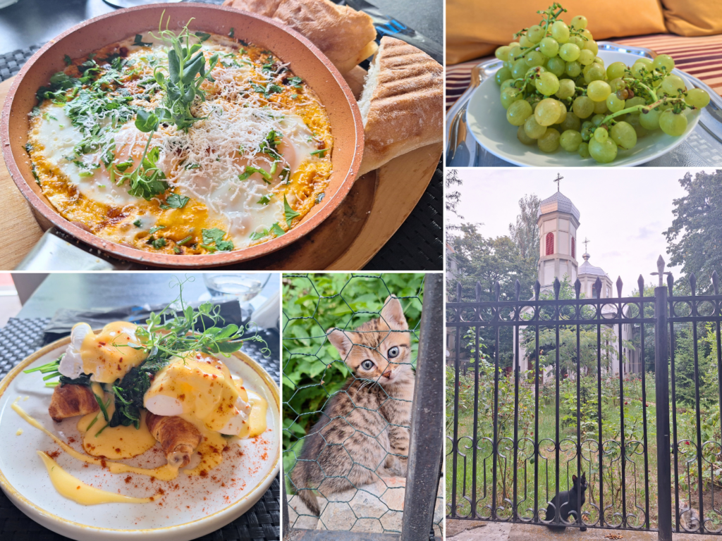
Monday: since we loved our Booking apartment in Galați so much, we decided to extend our stay with another two nights. After that, we walked to Alex Restaurant Galați for an excellent lunch from our block. From our terrace table, we could even see these deep-draft vessels traveling upstream. It’s so cool that we’re on the same river as the big ships.
After lunch, we walked along the Danube embankment in search of a better launch spot when we continue kayaking to Isaccea. Since our arrival was so muddy, we tried to look for something within reasonable walking distance from our apartment with concrete steps/a paved slipway into the water. We found nothing, except a very cute stray cat on a gangway. We also saw other interesting things, such as a high-tech buoy, some kind of European version of a mangrove tree, and small unusual vessels of uncertain purpose.

In the evening, we went out for drinks and a light dinner at the nearby Malú- Lounge & Bar, meeting cats on the way going and the way back. One black-and-white cat near our building is quickly becoming our favorite.

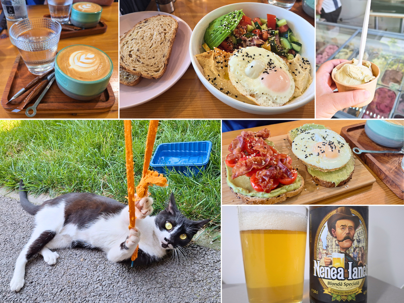
Tuesday: we took a Bolt to the DM of to buy new protein bars and such, and then had lunch at Altceva Brunch Club. We treated ourselves to ice cream afterwards at Zin Zin Delicatese, before buying some groceries at a Profi supermarket. Back in our pedestrian area, we played with our favorite cat.
Wednesday: working on this article and such, we only left the apartment past the heat in the evening. We walked to Teatris Restaurant, which was quite lovely and fancy and we had cocktails we enjoyed very much.
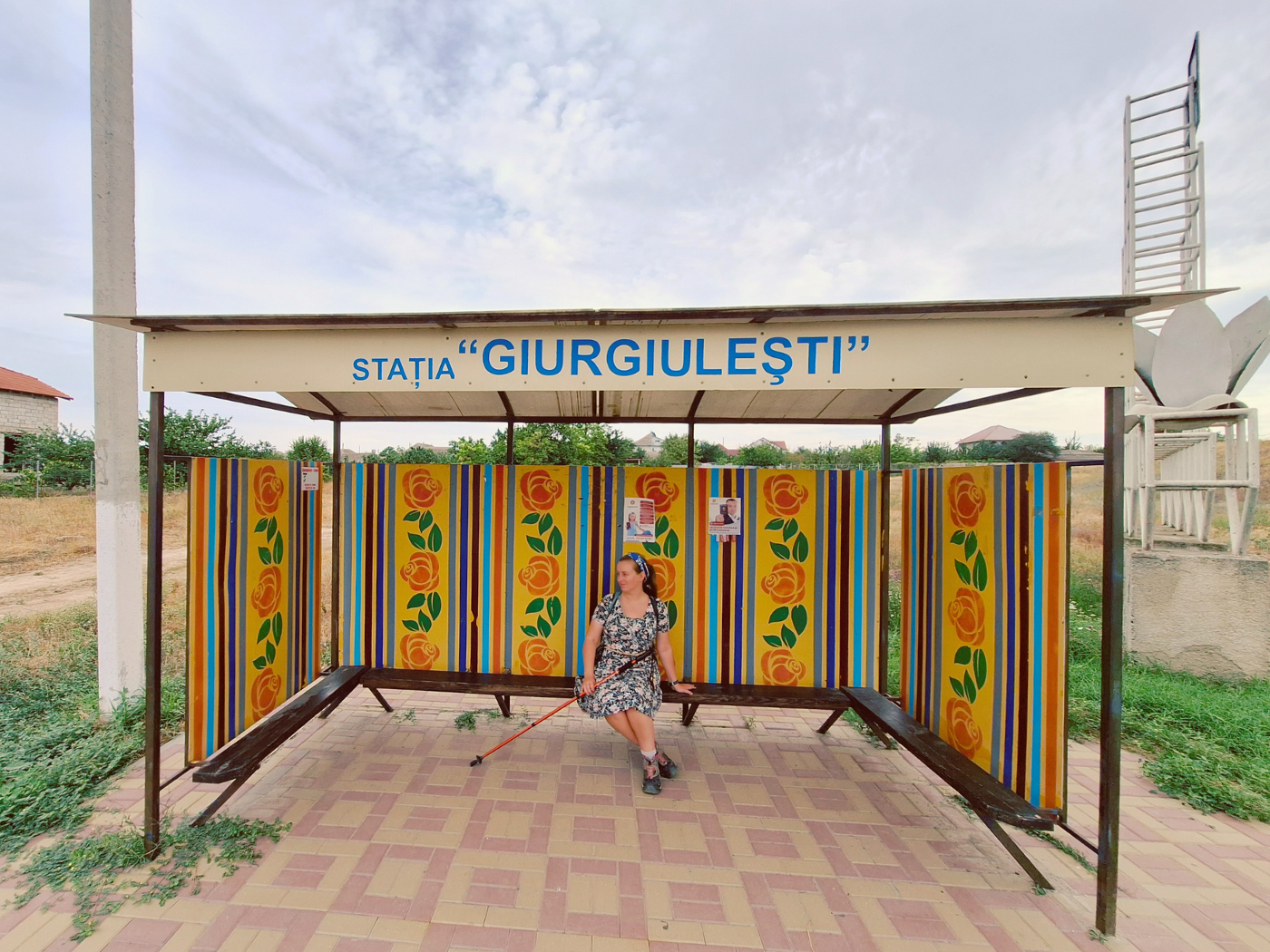
Thursday: I really wanted to visit Moldova’s only settlement and port on the Danube called Giurgiulești. Yes, Moldova is a Danubian country as well. But Jonas really didn’t want to. Until I said I’d pay him €500 to do it with me. Yes, this is what this relationship has come to.
This Thursday morning, we took a Bolt taxi to the border. I will link a dedicated article about Giurgiulești here once it’s up. So for now, here’s only this photo:
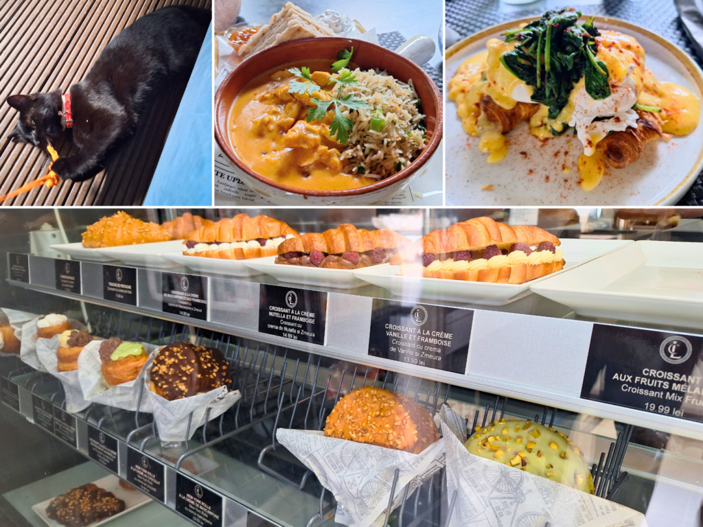
After we hitchhiked back to Galați, it wasn’t even noon yet, as I’d promised. We immediately went to Malú for some breakfast and to play with their cute cat. In the evening, we walked back to Craft Rebel Food, just for some craft beer. We revisited the church cats in the hopes of seeing the graybie again, but we met so many new cool cats and kittens.

Friday: we returned to Malú for lunch and to play with their cat, and then walked to Carrefour to buy road food for the following kayak day. On the walk back home, we stopped at Les Croissants for a pistachio croissant (it was very good). On the walk back, we played with our favorite neighborhood cats again before returning home to rest, pack, and drink the last few craft beers we’d gathered.
Good read? Consider buying me a craft beer!


Similar posts:
 Kayak Trip Day 81: Hârșova to Brăila! – An Unexpected 70-Kilometer Day in the Vâlciu Branch
 Kayak Trip Day 80: Cernavodă to Hârșova – Third Leak + Swimming Cows
 Kayak Trip Day 79: Rasova to Cernavodă – Danube–Black Sea Canal
 Kayak Trip Day 75: Ruse to Tutrakan – New Kayak Sail + 1000 Kilometers Paddled
 Kayak Trip Day 68: Iron Gate II Dam to