

")


")


")

")


We finished our kayak trip down the Danube in Mohács. After that, we traveled back to Bratislava – our favorite city on the Danube – to work for one month. One day, we wanted to do a day trip with our kayak named Zucchini. We chose the tributary to the Danube named the Morava. Here’s the story of how we paddled part of the Morava River on Friday, October 4th (2019).
Want to do it yourself? Here you can find the route details and the interactive map.
Want to travel the (entire) Danube River in an adventurous way? Join our Facebook group Danube River Source to Sea: Kayak / Canoe / Bike / Hike / Sail to find your community
Contents
- 1 Plotting and Planning a Kayak Trip around Bratislava
- 2 Kayaking the Morava River
- 2.1 The Taxi Ride from Bratislava to Záhorská Ves
- 2.2 Getting Ready to Paddle
- 2.3 Meandering Down the Iron Curtain
- 2.4 Paddling Past Vysoká pri Morave
- 2.5 Noon Paddling Past the Oxbow Lakes
- 2.6 The Few Bridges
- 2.7 Devínska Nová Ves: The Final Stretch on the Morava River
- 2.8 A Wild Ride: Entering the Danube from the Morava River
- 2.9 Arriving in Karlova Ves/Bratislava at the Kayak Club
- 2.10 Landing our Zucchini and Getting Home
- 3 Interactive Map and Route Details for Paddling the Morava River
- 4 Save for Later? Pin This!
Plotting and Planning a Kayak Trip around Bratislava
The Idea
The idea to paddle a stretch of the Morava River came already the first time we visited Bratislava. On the day that we paddled from Haslau to Bratislava, we already spotted that cute little confluence at Devín that also marks the border between Austria and Slovakia—Western Europe and Eastern Europe; the Iron Curtain of old.
One alternative to the Morava River would have been the Little Danube (Malý Dunaj). That distributary river starts at the port of Bratislava on the southeastern outskirts of the city. That’s a rather industrial area. Then it flows past the airport and meanders past (but not closely) to some little towns. Taking the bus to the Bratislava part of the Little Danube isn’t hard, but we couldn’t really find an appealing exit village with a train or bus station. The Little Danube would probably be more fun as a multi-day kayak trip from Bratislava to Komárno.
So we decided on the Morava River instead. Some basic research showed that this wasn’t a crazy idea. But as the weather cooled down, we had to pick a day to do it. And we had to do it sooner rather than later.
About the Morava/March River
The Morava River is an international river that originates in the Czech mountains near Poland. There, it flows through the Moravia region – hence the name. It flows from north to south through Czechia until it hits Slovakia. Then it forms the Czecho-Slovak border for roughly 40 kilometers. After that, there’s the triple border of Czechia-Slovakia-Austria. The Morava (German: March) River then gets shared between Austria and Slovakia for more or less 80 kilometers until it joins the Danube from the left-hand side at Devín.
The entire river is 354 kilometers long. My best guess is that the Morava river becomes part-time navigable for kayaks and canoes at the confluence with the Krupá at a town called Hanušov in Czechia, but this is pretty much a wild guess based on Google Streetview data. I don’t know if it’s legal to paddle there, how easy it is to get in and out, or how many weirs and dams you’ll have to portage around. The river can also flood very fatally, such as in 1997.
What apparently makes the Morava kind of special is that it’s a blackwater river. Most blackwater rivers occur in the Amazon/Orinoco basin and the USA. They’re very rare in Europe. Because of their chemical composition, certain riparian species that occur in clearwater or whitewater rivers don’t like it in a blackwater river.
The Morava of Czechia, Slovakia, and Austria should not be confused with the Great Morava. That river is formed by the confluence of the South Morava and the West Morava. That one flows from south to north in Serbia and has one of the highest meandering ratios in Europe. It also joins the Danube river, but only 9 kilometers downstream at Smederevo in Serbia. We will see this river when we continue paddling the Danube in 2021.
Anyway…
Doing the Research
But we just wanted to do a day trip from Bratislava, so we weren’t looking too far upstream for a place to launch our boat from. Within the radius of one day’s worth of leisurely paddling (<50 kilometers), we found two towns that touched the river: Vysoká pri Morave closer to home and Záhorská Ves 10 kilometers further upstream. Depending on the exit spot, we’d need to paddle 40 to 45 kilometers in total.
We decided to pick Záhorská Ves because there’s a ferry that crosses the Morava to the Austrian town Angern an der March. Ferry crossings are good for paddlers because there’s usually an easy way to reach the water. There’s a Google Streetview photo there that shows the ferry crossing and how we can quickly use its slipway to enter the water while the ferry is on the Austrian side.
Our exit spot could be the familiar site right before the Most SNP at the Nemecký Veslársky Klub the maximum distance of 45 kilometers away. That’s quite a lot, so we found some alternative exits spots that come earlier: the Canoe Club of Karlova Ves (Kanoistický Klub Karlova Ves KKKV) at around kilometer 40 and the confluence of the Morava with the Danube at the Devín Freedom Gate at about 32 kilometers. Depending on our energy levels, we could get out of the river earlier or later and still get a Bolt taxi back home.
Now the big decision was… how to get to Záhorská Ves?
Taking public transit would require us to first take a tram in Bratislava and then the train to Záhorská Ves. With a lot of walking, of course, it would take 2 hours and 18 minutes according to optimistic Google. The price for both of us would easily exceed €10. The price of taking a Bolt taxi all the way there was just under €30 and take us around 40 minutes. Bolt taxi it is!
Kayaking the Morava River
The Taxi Ride from Bratislava to Záhorská Ves
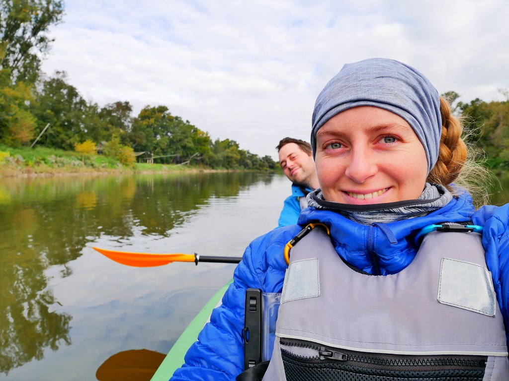
Finally, on the 4th of October, we grabbed our reduced luggage and walked through the old town to the taxi pickup spot at the Billa supermarket. We were out of the apartment and in the morning cold by 7:10. I carried the kayak backpack and Jonas carried the duffel bag with random items. Our luggage was much reduced from our usual pack; only water, sandwiches, warm clothes, a few dry bags, and cameras joined today’s trip.
At the Billa, we waited for our Bolt to arrive. The vehicle turned around and we opened the trunk to put our stuff in. The driver saw we had to go quite far away, but he seemed excited about the little road trip.
But as Friday morning traffic in a European capital city goes, everything was a little clogged. Our driver used Waze to take alternate routes parallel to the highway to Brno to avoid getting stuck. We got rerouted all the time, and the 40-minute ride seemed a bit optimistic. We even detoured as much as to the Stupavar brewery: the source the craft beer for our biweekly quenching session at Piváreň Stupavar.
Once we left the road to Brno, the traffic thinned out. We drove between fields of decorative pumpkins for the gloomy season. Then we drove through Vysoká pri Morave – the alternate town we considered as our launch spot. When we drove past the Morava, we saw that there wasn’t actually a good place to enter the river in this town. So it seemed like we made a wise choice picking Zahorská Ves.
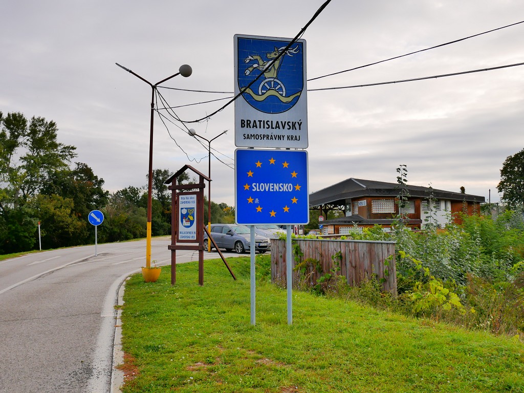
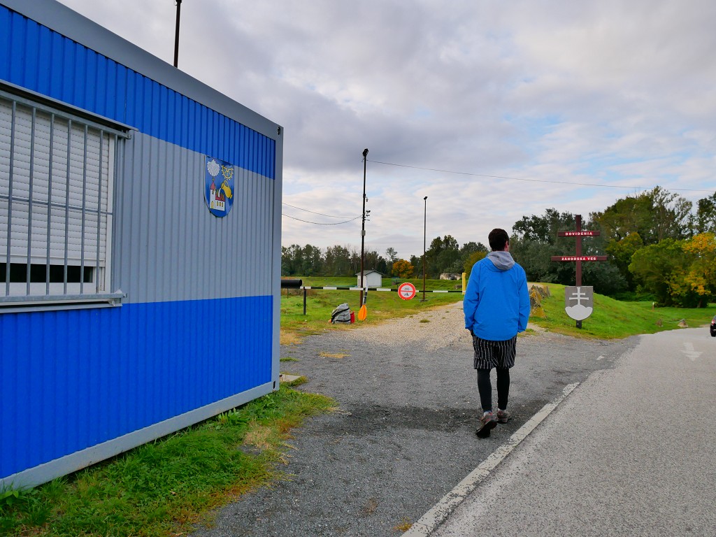
Soon, we arrived in Zahorská Ves. The town looked sleepy. We spotted the ferry, which is a dead-end. The driver asked “Kompa?” and I said “Dobrý” and nodded my head like I wanted to get out there. I’m worried he was worried he had to take the ferry with us and drive into Austria. The driver stopped his car out of the way for the queue. It was 8:25 and there was quite some demand in this town for the ferry to and from Austria. The total price of the taxi ride was €26.50—cheaper than anticipated. We got our stuff from the trunk and thanked the man for the ride. I hope it was worth driving out of the Bolt zone for him.
Getting Ready to Paddle
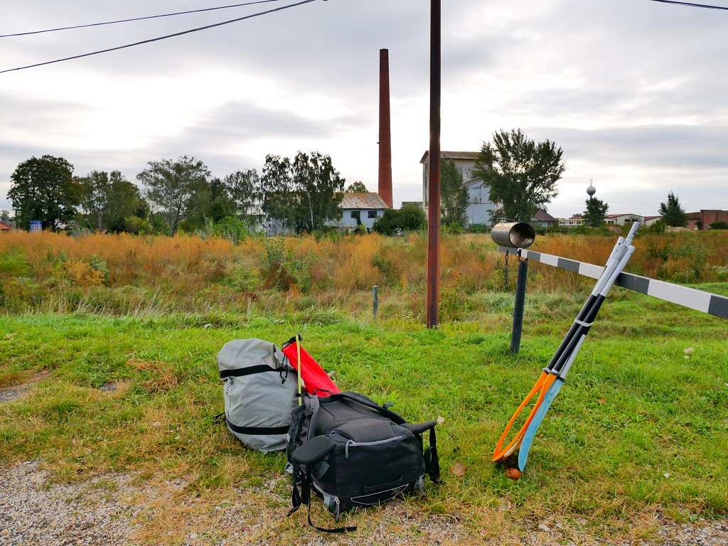
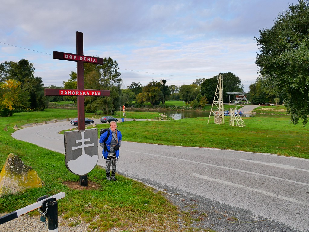
We snapped some photos at the “Slovensko” sign, the closed border office, and the “Dovidenia” sign and then put our stuff at the picnic table. We started prepping Zucchini for one last paddle journey in 2019. Bored queuing people l stepped out of their cars to smoke a cigarette while staring at what the hell we were doing.
The ferry is a reaction ferry on a cable that spans the two countries. It uses the current to move between the shores. It’s only after the Kayak+Work trip that I finally learned the name of this type of ferry.
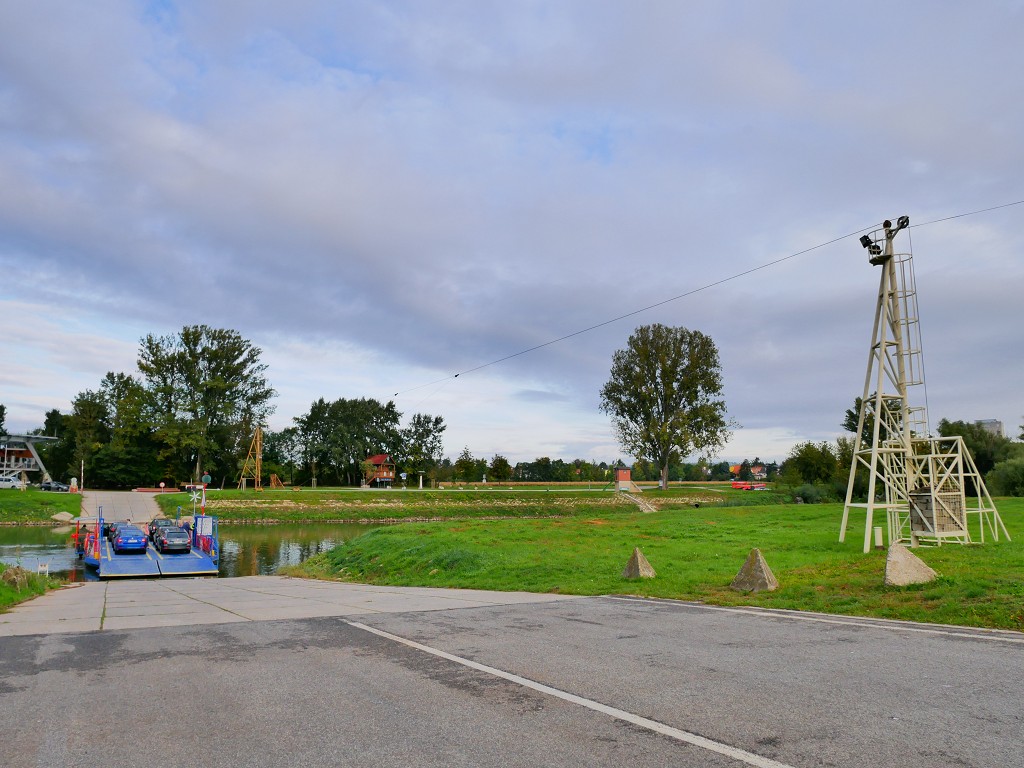
I don’t think the water levels are very low, but the ferry seems a bit big for the width of the Morava. The pontoon part of the ferry reaches about 70% across the river. The ferry itself is… almost a bridge. At this time of day, there are more people going from Slovakia to Austria than the reverse. The platform fits about six vehicles and is operated by three guys. It’s a very smooth system.
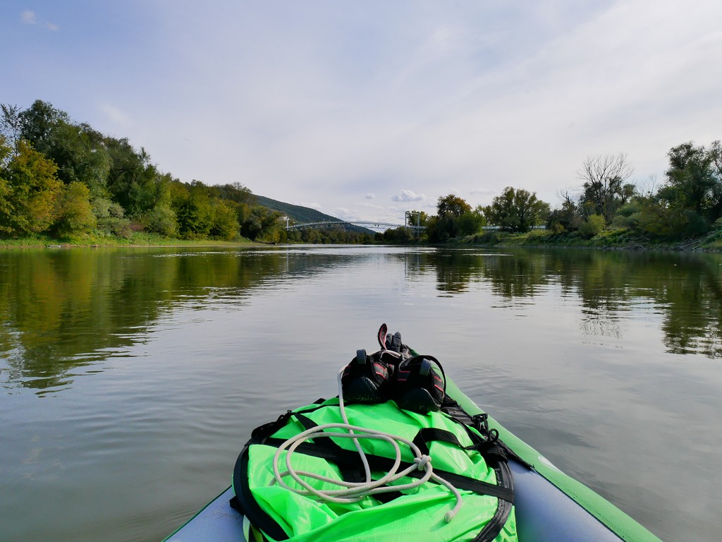
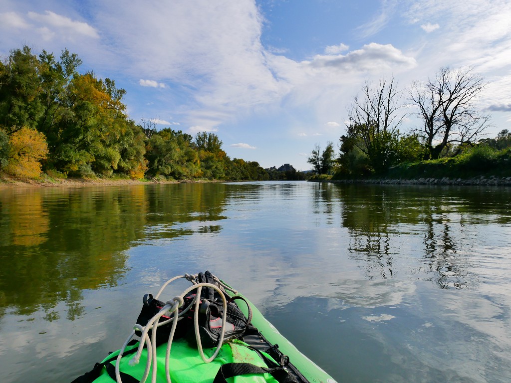
We mounted the fin and inflated Zucchini successfully. Then we packed the empty CabinMAX with the loose items. We have a lot of space in the boat suddenly, but it’s important not to have too much space; Jonas needs to lean his feet against something so he doesn’t get leg cramps. I wonder if we’ll be faster now that we carry about 20kg less in luggage.
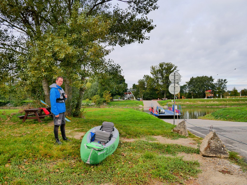
Once the ferry travels to the Austrian side, we carry our Zucchini behind to the slipway. We put Zucchini in the water, hop in without getting our feet wet, and paddle away. It’s 9:00.
Meandering Down the Iron Curtain
I’ve missed this… a lot.
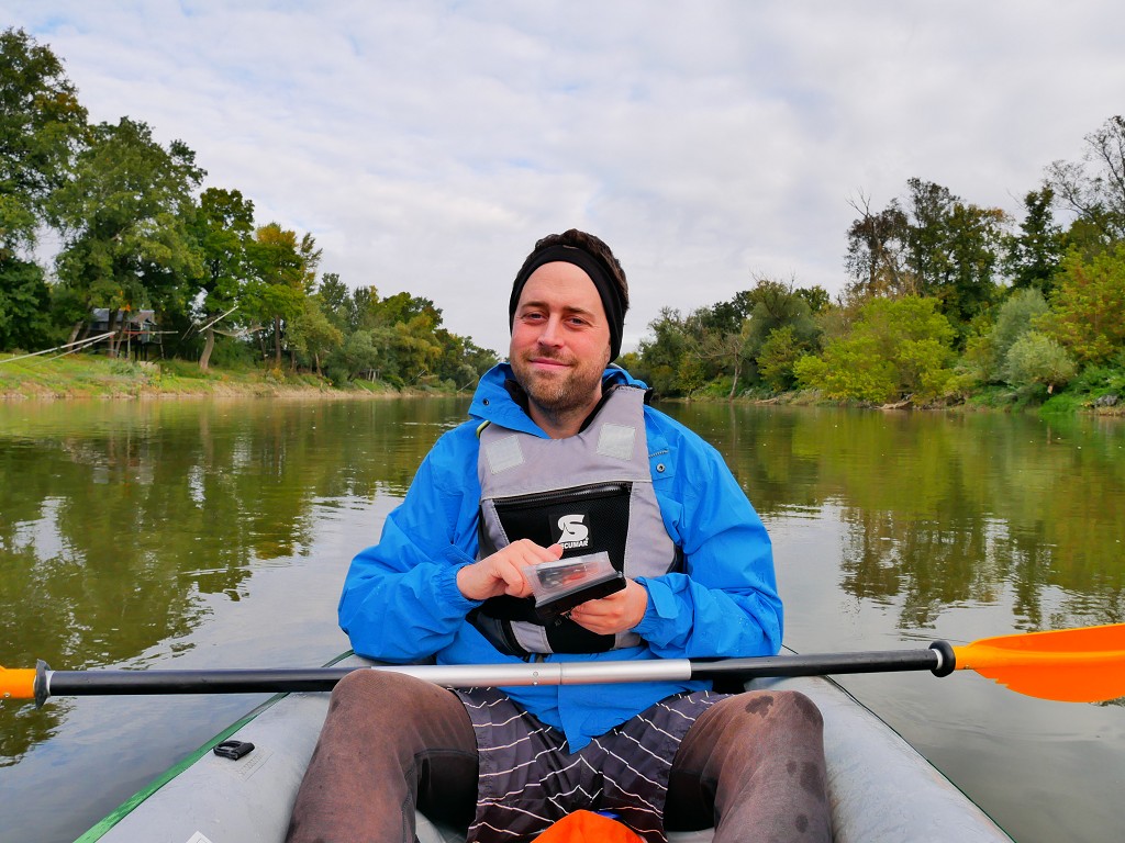
It’s funny that we’re floating quite high without the extra weight. It actually requires a different seating position to reach the water. Jonas is trying to get comfortable with his long johns and headband. It’s cold, but not Day 1 levels of cold. Still, Jonas doesn’t wear gloves. We both try to get into paddle mode to warm up quickly.
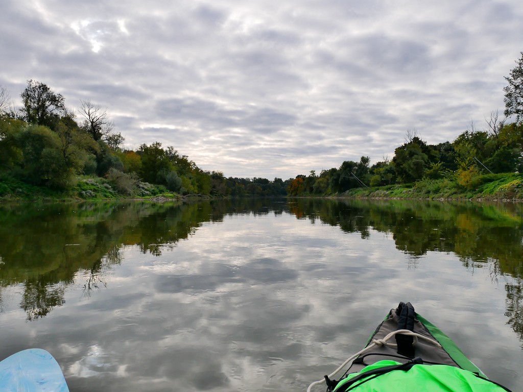
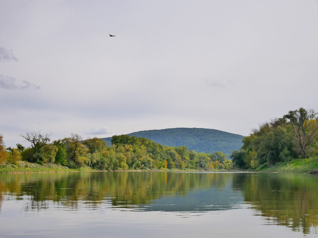
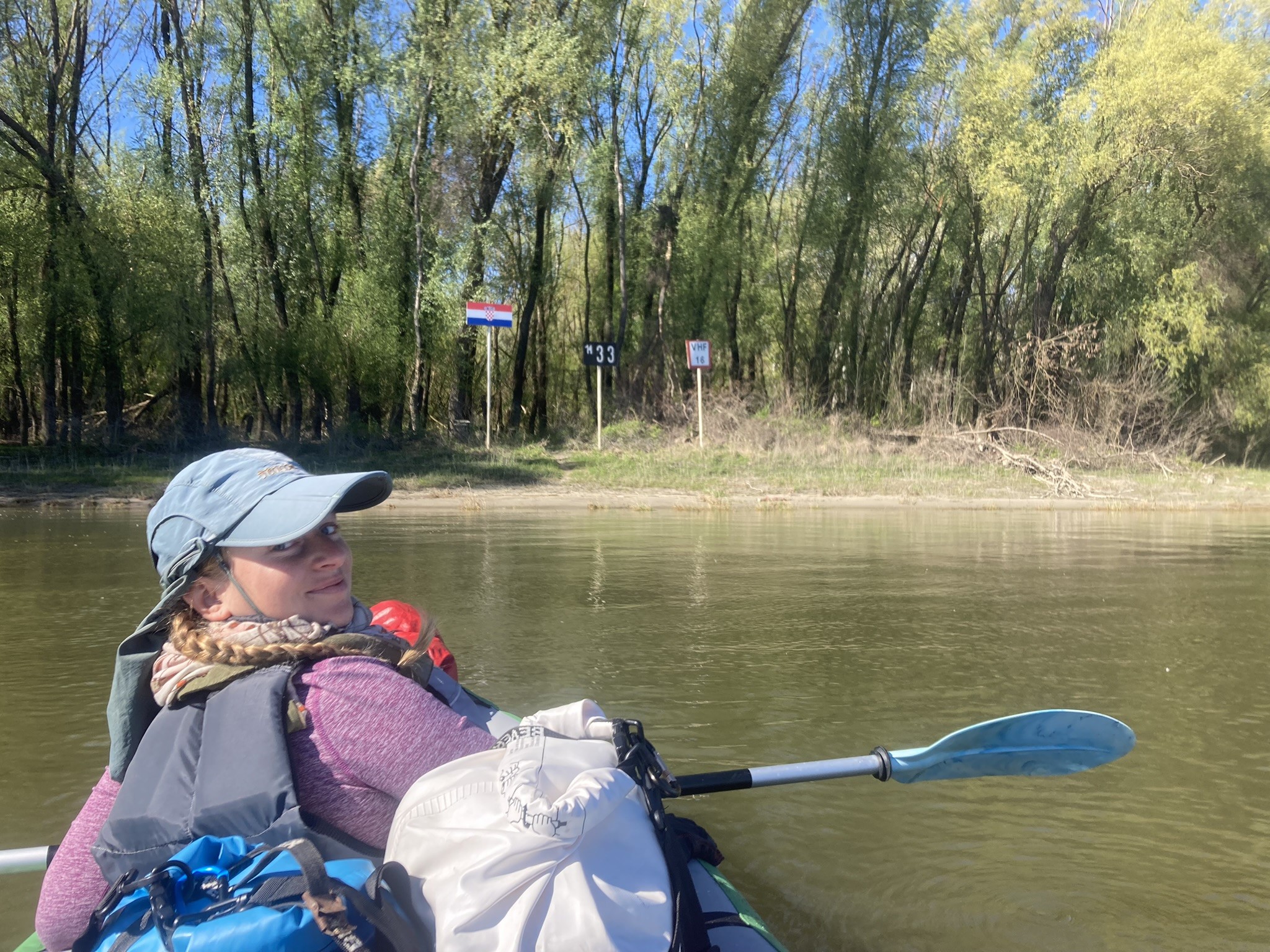
Before we know it, we paddled through a bend and can’t see the ferry anymore. This is the westernmost point of Slovakia. The water is very calm and reflects the tree-lined shores spectacularly. The current is clearly present, but not always that strong.
This is where the Iron Curtain was back in the olden days. What I heard and read about it, at least a 2-kilometer wide band of the Czechoslovak side of the Morava river was a complete no-go zone for civilians. The border villages and its inhabitants were either under strict control or forcibly abandoned. A barbed-wire electric fence was installed with watchtowers for the guards, who had permission to shoot on sight any emigrants. This particular area of Iron Curtain was of course even tougher to pass because of the natural barrier: the Morava River.
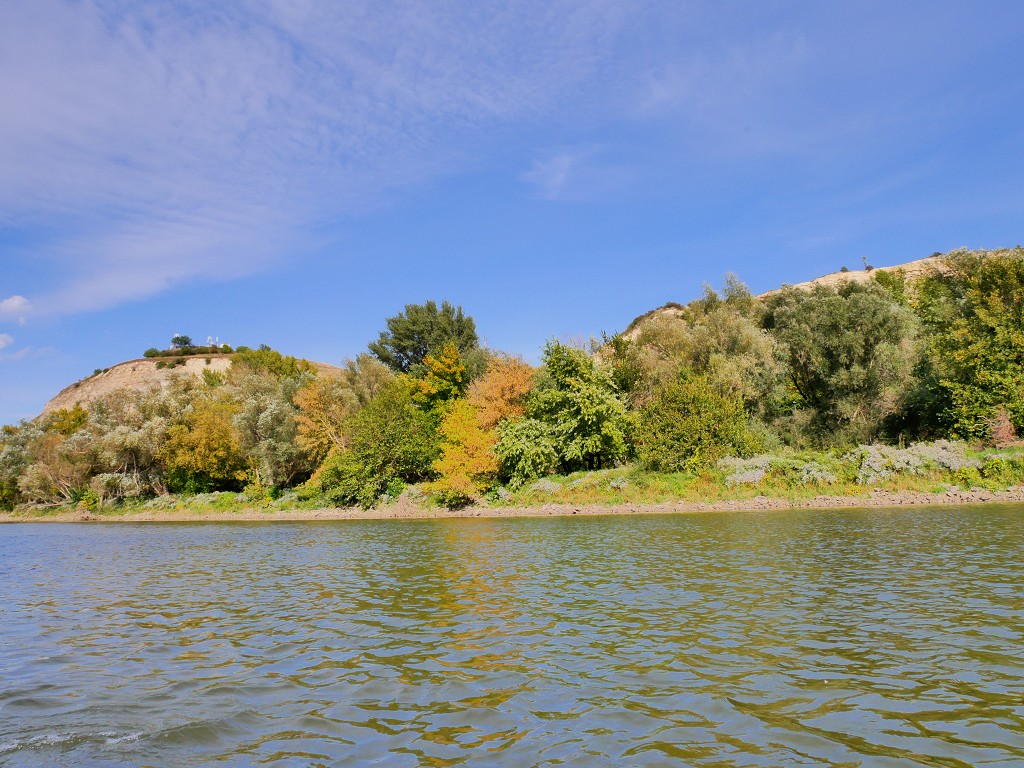
It’s still cloudy, but the skies are slowly clearing up. The typical Austrian fishing huts we know mostly from the Donaukanal (Danube Canal) in Vienna line the right-hand shore. They stand tall above the current water levels and are fortified with riprap. The Slovak shore, on the other hand, looks much less intervened in. That’s because the forests on the Slovak side have been left in peace for decades and are now protected under the Záhorie Protected Landscape Area.
Both sides color a golden autumn yellow at times.
Paddling Past Vysoká pri Morave
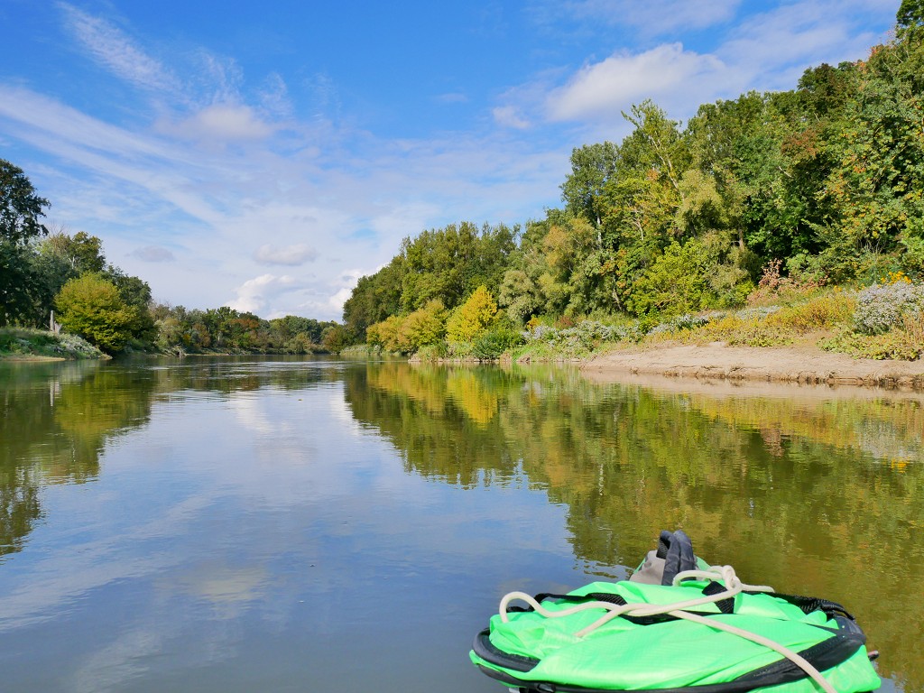
We’re making slow progress. The water levels are quite low and we can almost constantly see the pebbly riverbed. It’s like going back to Young Danube 101: take the outside of the turn to avoid getting stuck in the sediment deposit areas. The whole area is a floodplain and riparian forest area, good for wildlife, farming, fishing, and obtaining drinking water from water wells. Though I didn’t download the Austrian map for this day, I have little pieces of it on my offline map app and see the water wells that follow the meanders.
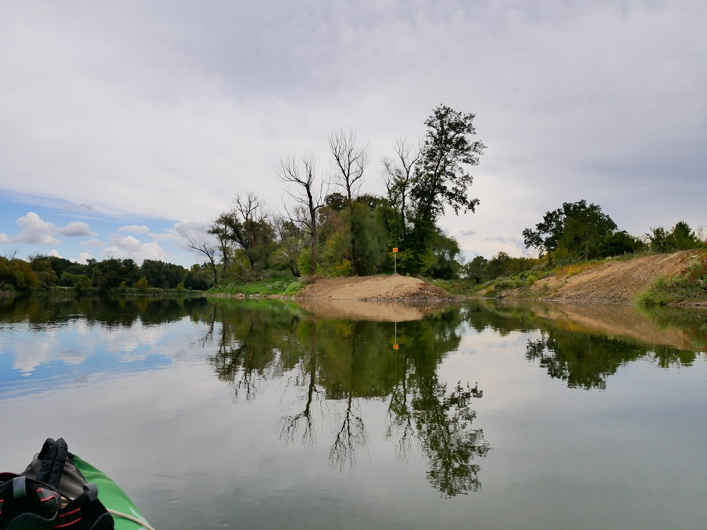
I’m slightly worried about arriving back in Bratislava or Devín. We’re much slower than anticipated. After 1 hour and 15 minutes, we paddle through the relatively sharp bend at Horný Les (Upper Forest). The current speeds up and we make a few bad decisions. We run aground and have to get our feet into the water to free Zucchini from the sediments.
Thirty minutes later, we take a break. We wanted to get out on the Austrian shore, but it was too steep and the earth was very loose or incredibly rocky. We eventually picked a nicer part on the Slovak side, but we’d already made our boat very dirty with our muddy feet. It’s time to get the snacks out and rehydrate a bit.
We continue paddling and eventually reach Vysoká pri Morave. The flood barrier is about five meters tall from our riverside. Vysoká pri Morave means ‘High beside the Morava’, which is apt. Just a few hours earlier, we drove in the comfort of the taxi over that road. I’d tried to look at the Morava River from there but could barely look over it. At least the town looks very prepared for heavy precipitation and subsequent flooding. We see a few friendly and curious faces, but we paddle right past town onward.
Noon Paddling Past the Oxbow Lakes
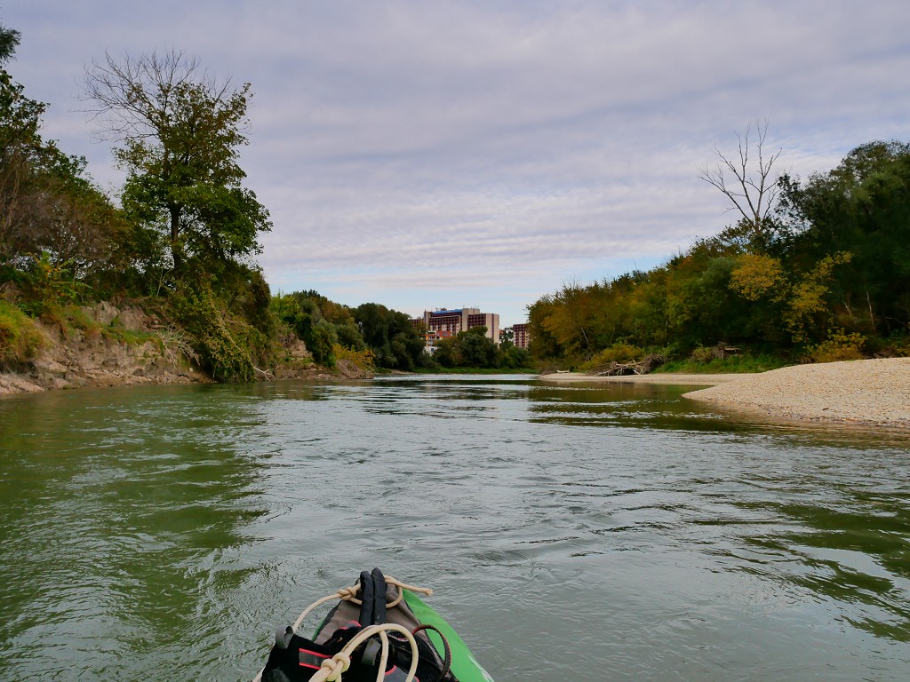
The river changed a bit after the village; the landscape flattened out and the river widened. We saw a Bambi-aged fawn, a chonky beaver, and a bright blue and orange bird that I thought was a Kingfisher. A few times we heard a woodpecker or other animal that knows how to slam into the wood. The sun came out and my thick gloves came off. I could see the Devínska Kobyla mountain in the distance. We don’t just have to paddle to that mountain, but even past it to get home.
The map shows many dead arms that are now oxbow lakes beside the main course of the river. I wonder how long it really takes for a river to meander so far off that it cuts through the course. There are quite some signs in the river for small motorboats – including distance markers – so perhaps the humans intervened and stopped the river in its tracks.
As the day warmed up, the fishermen arrived at the Morava’s shores. On the Slovak side is a little trail that allows access to the water. On the Austrian side, there’s sometimes a man fishing from his hut on tall poles – not using the huge fishing net. We say “Dobrý deň!” to one side and two hundred meters later “Grüß Gott!” to the other side. It’s noon and we’ve now arrived at the other forest Dolný Les (lower forest). The river straightens out a bit.
On our right appears the town of Marchegg Stadt. The rest of the Marchegg town is further away from the river. This is one of the few places along the Morava with a slipway for small motorboats with a shallow draft.
Sometimes there’s a little split off from the Morava river to the right with a very small sign saying something like “don’t enter here with your boat”. The water was shallow enough to see that it’s a dead-end, but thanks for the heads up. Perhaps that’s only a problem when the river is filled up.
We take another break after the humble Malina joins us from the left. There we land on the Slovak side between two fishermen and head for the trees. We hear a train in the distance. It’s getting to me that we haven’t been able to land our boat in Austria yet. It has been incredibly difficult to get a foothold in that country.
The Few Bridges
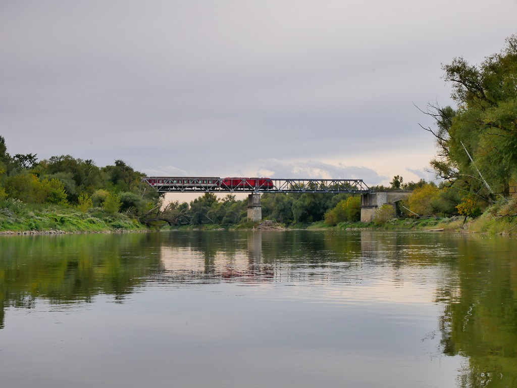
At 13:30 we continue paddling along with the return of the clouds. The Devínska Kobyla appears closer and closer. Once the river straightens out, we see the train bridge (Marchbrücke/Marcheggský most).
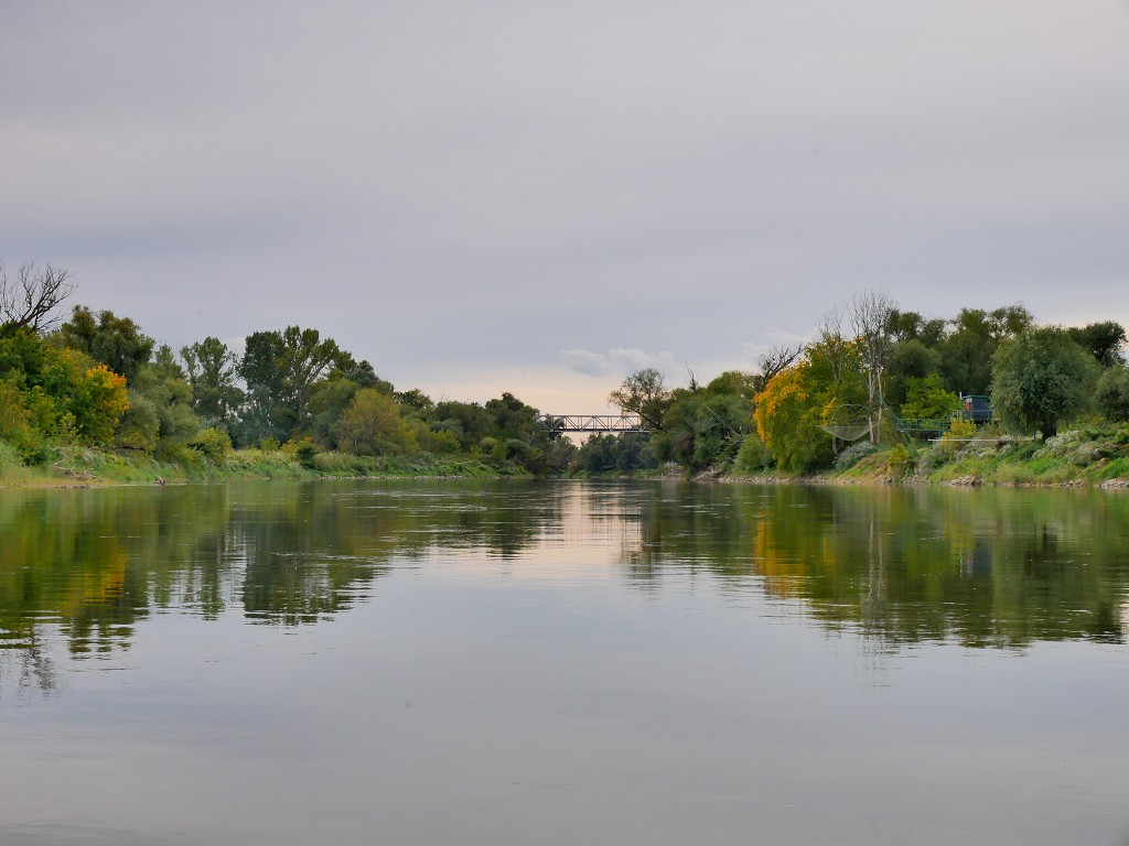
As a connection between east and west, this bridge has played a role in Cold War-era history as the site where hostages were taken during the Schoenau ultimatum. I grab my camera and a few seconds later a train crosses the bridge into Austria.
There’s one pillar in the water that has collected quite some river trash from floods or something; entire trees are stuck there with non-biodegradable stuff. Jonas spots a kayak paddle and my brain goes in a weird way:
“Is it in good condition?” I ask, preparing to paddle back upstream against the current for a better paddle for Jonas.
“Eh, no. It’s not a good paddle.”
“Oh.”
Right after the train bridge is a little fishing hut with a human around. The man actually drops his big fishing basket into the water to try and get fish. This is the first time we’ve seen someone use the basket. Those fish don’t stand a chance.
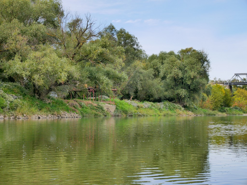
800 meters downstream from the train bridge is the location of the planned new highway and bridge across the Morava River. It’s called the Marchfeld Schnellstraße or the Expressway S8. It’s going to connect Bratislava with Vienna north of the Danube. The Slovak wiki says construction should have started in 2011 and finished in 2018. The German wiki says construction has been delayed until 2021 because archeologists found a Napoleonic mass grave. They now claim it should be finished in 2023. I wonder if the three ferrymen had anything to do with this.
Paddling through another bend opens up the view to Devínska Kobyla again. We’re getting close now. Close to the Devín Gate, which I only now learn about might actually be the same as the elusive Hungarian Gate I’ve been trying to identify for several months. Its wiki page says that the Latin name for Devín Gate is Porta Hungarica…
By 14:30, we’re on the northern outskirts of Devínska Nová Ves. We pass under the Freedom Bike Bridge (Fahrradbrücke der Freiheit/Cyklomost slobody), which opened in 2012. It connects the Austrian Danube bike path (Donauradweg) with the Iron Curtain Trail bike path parallel to the Morava River on the Slovak side. There are signs on the bridge to help guide ships underneath it, but it’s all a bit… self-explanatory? It also seems like a really bad idea for any type of motorboat to enter this river, to be completely honest.
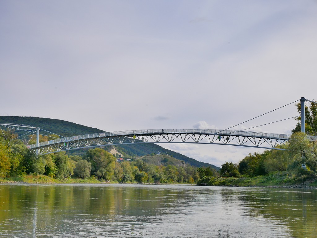
In a similar fashion to the Megyeri/M0 Danube bridge in Budapest, this bike bridge was also nearly named the Chuck Norris Most/Brücke due to an open poll crowdsourced name in the year of its opening…
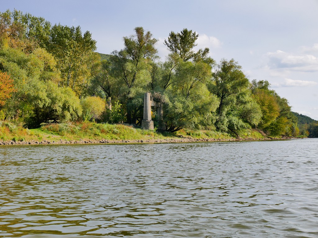
After the cycling bridge, we see the remnants of an old border-crossing bridge on the Slovak side. But its materials look too modern to be the Maria Theresa bridge that was destroyed by ice in 1880.
Devínska Nová Ves: The Final Stretch on the Morava River
The shores got busier with fishermen waiting for an afternoon catch. From our lowly angle, we could see some edges of Sandberg – a place I’d perhaps still like to visit during my one-month stay in Bratislava.
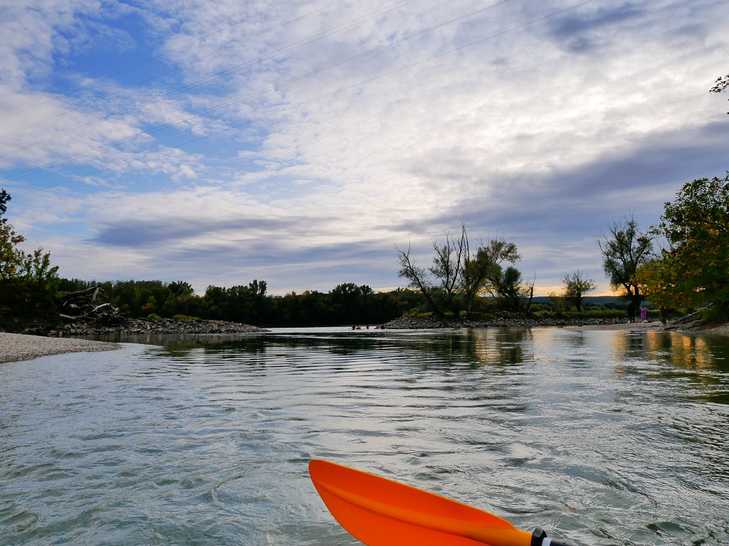
The surroundings flatten even more and some long river islands appear and end. We know we always have to stick on the left-hand side of these islands to not run aground, as that’s where the water is deep enough. I notice my arms tire very suddenly. We’re in the last few kilometers of the Morava River and we’ve fallen still. We take a break at 15:20 on a river island that’s on the Austrian side of Thalweg – which technically makes this break our first successful landing in Austria today.
A few kilometers later, we notice that it’s not just a slow current, but that the Danube river might actually be pushing upstream of the Morava River to give us a hard time. The good news is that we’re getting close to the confluence with the Danube. I ask Jonas how he feels, and he says he’s tired but knows that the current on the Danube will be swift. We could still get out in Devín, but the easiest paddling part still has to come.
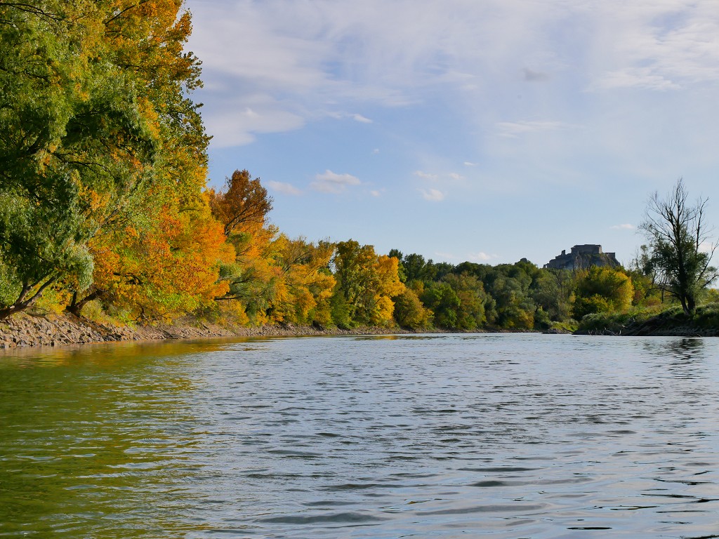
The peak of Devínska Kobyla – the highest peak of Bratislava – is now behind us. There’s an abandoned military rocket base on top which I still intend to visit. Up ahead we see the outline of Devín castle.
I still remember how cool that vista was when we entered the Slovak-Austrian border region from the Danube river. This other angle is also really cool. The bike path joins us and we’re really entering civilization now. I see the murmuring silhouettes of people on top of the castle more clearly now.
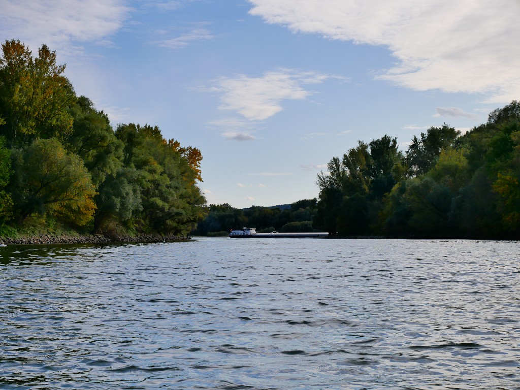
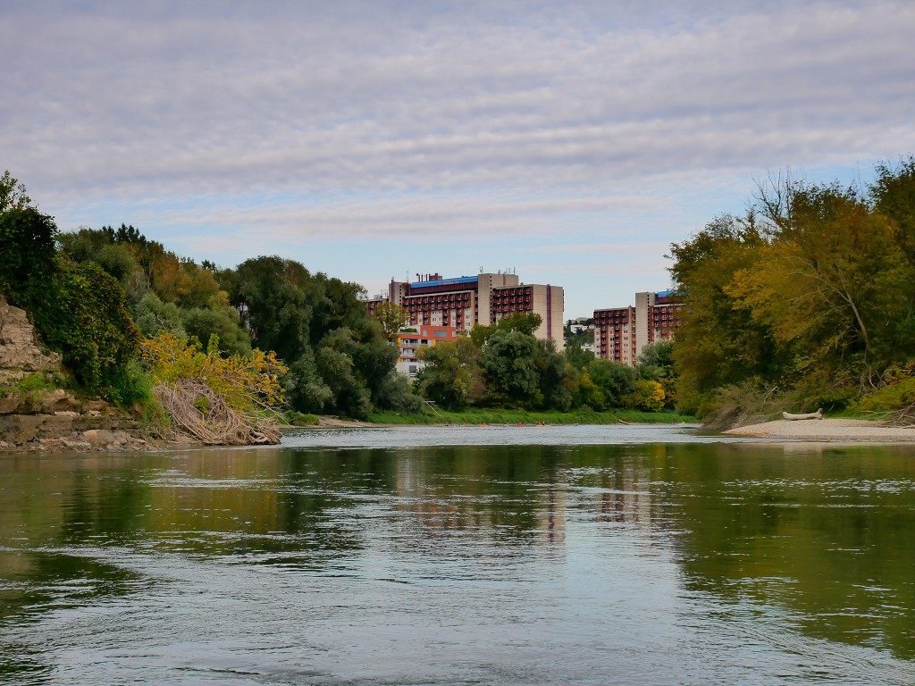
And we see our Danube.
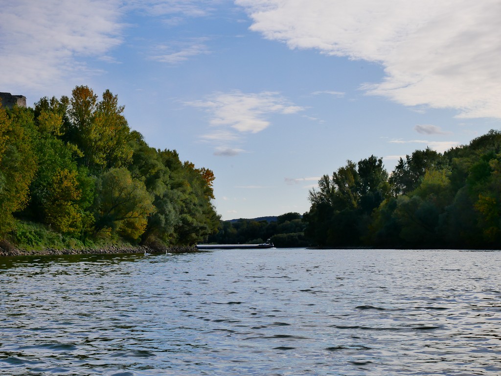
The first sight of our favorite river scares us shitless when a big barge passes in front of the confluence. The bow of the cargo ship is aimed directly at us and we’re thinking it’s going upstream on the (definitely non-navigable) Morava River. But because we’re still so far away from the confluence, the perspective is distorted and our eyes are playing tricks. Soon, we see the barge turn away from us and block out the entire view of the Danube. It’s only now that I realize we’ve been alone on the Morava all day.
A Wild Ride: Entering the Danube from the Morava River
We see the Gate of Freedom memorial and the people hanging around it. It’s almost 16:00 by now and people are enjoying the autumn sunshine on the west-facing shore. They’re watching and sometimes waving at us as we’re approaching the gushing clash between the Morava and the Danube.

The Morava looks overwhelmed by the power of the Danube. Where their waters meet, there are a lot of funny currents and bumps and twirly eddies and strong back currents. We double-check whether all our stuff is attached to the boat and then prepare to get tossed and turned for a bit. Meanwhile, there’s quite a watchful audience on the shore anticipating something exciting.

Zucchini holds well as we try to maintain our course through the currents. Once we’re on the main river, we look back and see the barge that had traveled upstream a few minutes prior. We pass in front of the decaying amfiteáter – a Second World War-era building that stands out badly aesthetically-speaking.
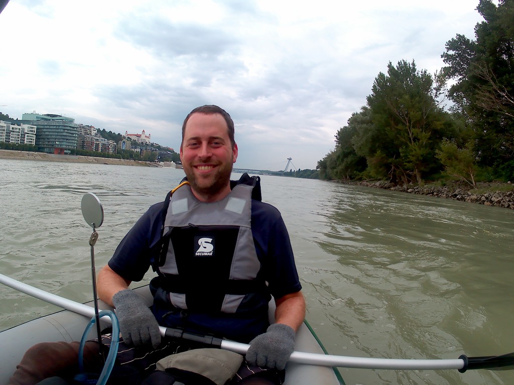
I’m fully enjoying being back on the Danube. This time, we’re paddling on the left-hand side and not on the right-hand side as we did when we arrived in Bratislava the first time. We pass in front of the cruise docks of Devín and the little lighthouse. The current is strong and we need to paddle more inside of the shipping lane to avoid going over the speedbumps. We pass the familiar quarry and share the river with a few boats. The speed awakens us.
Arriving in Karlova Ves/Bratislava at the Kayak Club
We have two choices now: exit at the kayak club in Karlova Ves or paddle on and cross the Danube to the German rowing club at the SNP bridge. It’s late in the day and we’re quite tired, so we pick the Karlova Ves exit. But there are four routes to get to that exit.
One is to get out of the Danube and inside the side-arm around the island of Sihot’. Sihot’ is the largest river island on the Danube near Bratislava and a major source of drinking water for the city. The island is a protected area with lots of forest and wildlife. It submerges whenever the Danube’s water levels are high. If we weren’t that tired and if we were sure the water levels would be deep enough, we’d probably have taken this route to the kayak club.
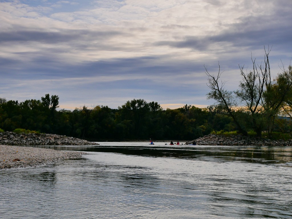
But we paddle on through the river turn until we see Bratislava Castle. A cruise ship travels upstream a little too close to our shore. We pass a couple of adult kayakers who are paddling upstream.
The next two possible exit routes are pretty close to each other: one at the upstream end of a breakwater and one at the downstream end. I’d seen this exit from across the river a few months earlier. There were slalom sticks hanging above the first exit, which means it’s probably shallow, wild, and not good for our boat. Meanwhile, a few groups of kids paddle upstream in slalom kayaks. We pass the first exit and decide we’ll slow down and try for the downstream exit.
Once we’re there, we have to negotiate right-of-way with a group of kids. We go in there first and battle the back currents to get into this little backwater bay of peace and paneláky in the background. The kids break the peaceful silence, as they always do.
There are two beaches here and some non-paddlers are wrapping up their picnic here. We see that up ahead is a little rapid to get on the other side of the mini Sihot’ island. There are a gazillion paddlers there at this time of day. It’s absolutely crazy how many people there are on the water. Where the hell did they all come from?
We drop down the rapids without even a scrape and then join the busy cove of kayaks and canoes. It’s mostly kids that are racing their kayaks and flanking us from both sides. We’re slower in our Zucchini, not only because our boat has more drag but also because we’re really tired by now. Their kayaks are very pointy and we don’t want them to bump into our inflatable boat, so I give the kids some snide looks to tell them to back the fuck away from us without words.
Landing our Zucchini and Getting Home
As anticipated, the riverside pub named Mark Twain adorns the shore. It’s about 17:00 and we have to queue to land our boat at one of the two piers. We try to get out as fast as we can for people carrying this much stuff around and manage to piss off an impatient boomer in the process. I clearly remember why we enjoy paddling without people around.
We carry Zucchini up the tall embankment and find a bench next to the bike path at Mark Twain to pack our stuff. The sun is gone behind the trees and it’s getting colder. Usually, we drink a beer while our boat dries. But if our boat won’t dry, does it still make sense to drink a beer?
A man lies in the grass about 30 meters away from us. He looks passed out drunk from having a good time and we think he’s decided to sleep it off. After a few minutes, the man starts screaming for help at passersby. The first people stop, try to help him up, then he says he doesn’t want any help and falls down again, closer to the bike path. Not speaking any Slovak or understanding the situation, there is nothing we can do. This repeats for another 30 minutes while we change clothes, and pack up our stuff. Eventually, the man semi-consciously rolls in the middle of the bike path. The next passerby decides it’s time for an ambulance, which arrives five minutes later.
All the drama was a bit much. We packed up our boat completely wet and full of autumn leaves and dirt inside the CabinMAX. I’ll find a way to dry and clean the boat once we’re back at our apartment. We order a Bolt taxi to our location at the flood protection. A man who’s picking up his son from kayak practice makes some small talk with us, asking about our boat. We tell him it’s in the backpack and inflatable. He looks very interested.
Our bolt arrives and we put all our stinky stuff in the boot. We drive back to the Billa where we started that day and carry everything home through the old town’s pedestrian zone. The kayak is really heavy now and Jonas offers to carry it. We arrive home pretty late and we’re absolutely knackered. It was a beautiful trip and I’m happy we accomplished it, but perhaps we overdid it just a little bit!
Interactive Map and Route Details for Paddling the Morava River
Save for Later? Pin This!
Similar posts:
 Kayak Trip Day 35: Bratislava to the Čunovo Dam
 Kayak Trip Day 34: Haslau to Bratislava – Austria to Slovakia
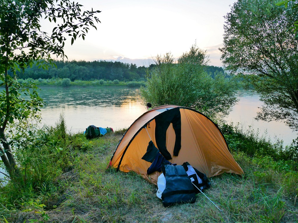 Kayak Trip Day 36: Čunovo to the Danube Floodplains – Freecamping
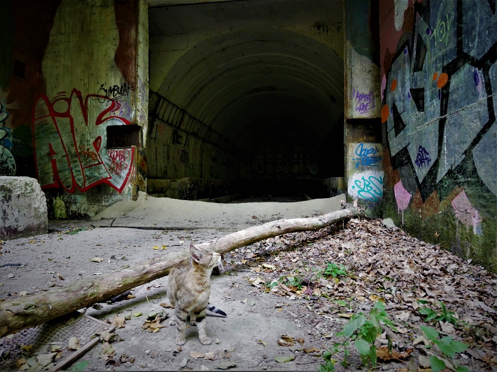 Hiking and Urban Exploring at Devínska Kobyla, Bratislava – with Pirate Kitty!
 Kayak Trip Day 50: Mohács in Hungary to Apatin in Serbia – We Meet Again, Danube