


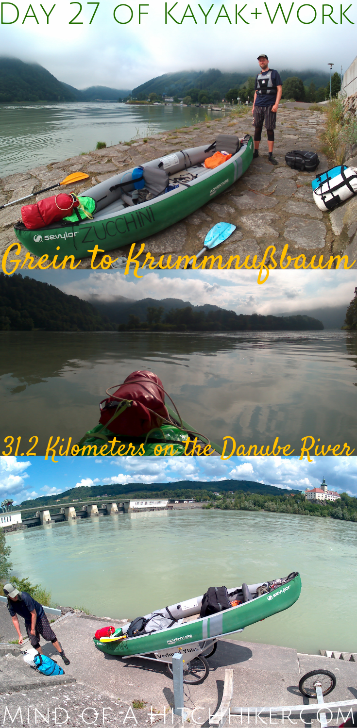
Events in this article happened on Monday the 15th of July, 2019. We propelled our inflatable canoe named Zucchini for 31.2 kilometers on the Austrian Danube. We started the day in Grein in the state of Upper Austria and ended the day in Krummnußbaum in Lower Austria.
Want to travel the (entire) Danube River in an adventurous way? Join our Facebook group Danube River Source to Sea: Kayak / Canoe / Bike / Hike / Sail to find your community
Three Nights in Grein
We stayed at hotel Martha in Grein for three nights. Our room was very big and comfortable and the internet very good. The hotel mainly targets cycling tourists of the Donauradweg (Danube bike path), which meant they had cool stuff like a drying room for shoes.
On Saturday we just worked from our hotel room. We sought out the cleaning staff to ask them to please not clean our room, but they were very insistent despite our request to please don’t. The two days we spent in Grein were mostly rainy, which was great for some indoor time while we let the rain pass over our heads. In between the showers, we walked to the nearby Halterkreuz (a viewpoint on a rock) to check out the view before the rain returned and we headed back to town.
On Sunday, we went on a big hike across the river to Wiesen in Lower Austria. We wanted to work in the afternoon instead of the morning because of the ferry schedule, but ended up not doing much else besides booking our next accommodations on the trip. The hike was very pleasant despite the many rain showers that made the trails slippery.
Leaving Grein for Krummnußbaum
We awoke at 6:30, which turned out to be a little too enthusiastic for our energy levels. Jonas made a run to the local Spar supermarket to get some baked goods for the road while I packed up some more things. We didn’t have breakfast included for our morning of departure, but we did have the time for some coffee from the downstairs machine. Only by 8:00 we were ready to leave the hotel.
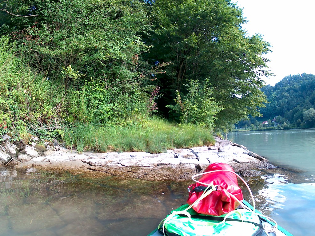
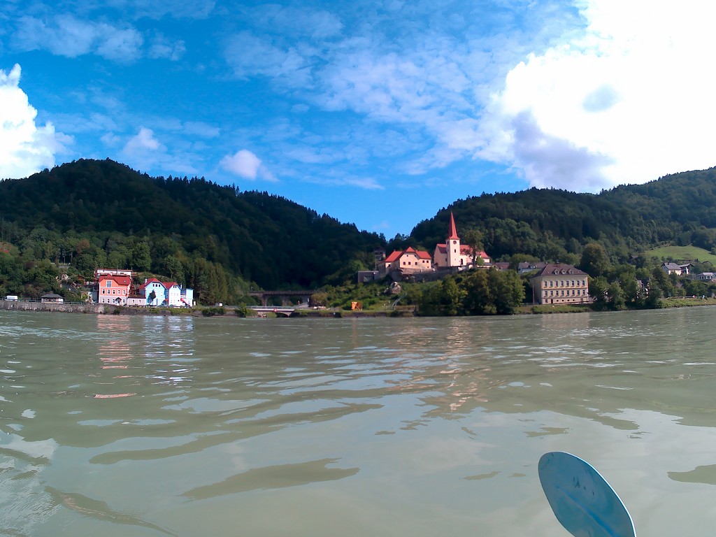
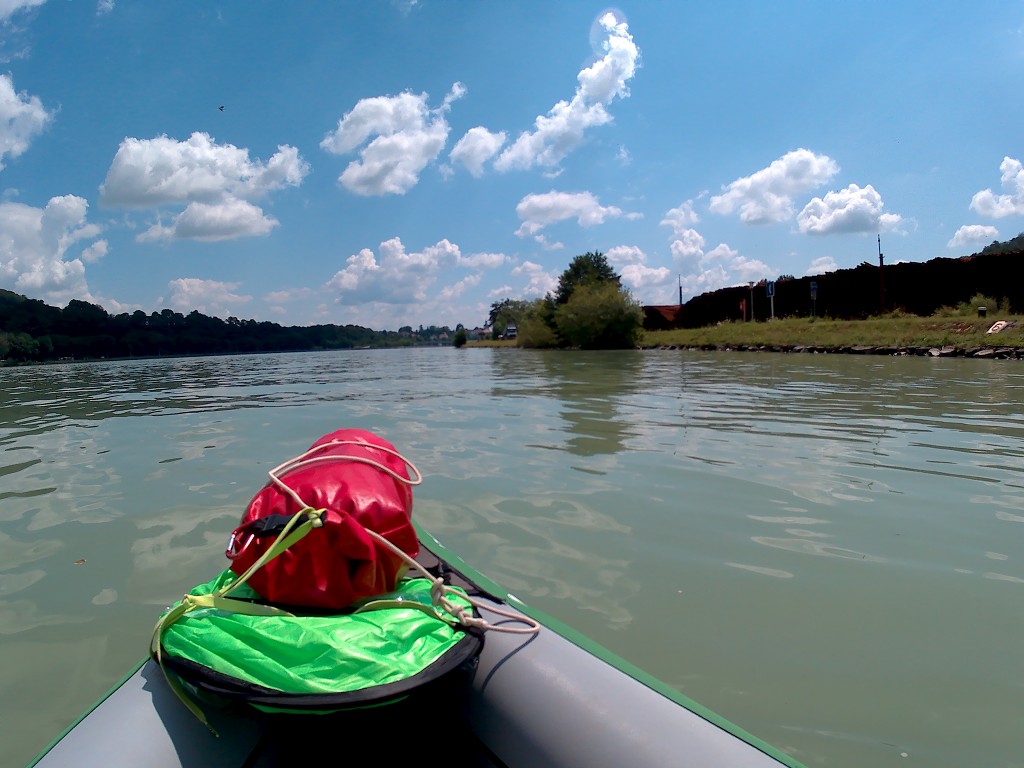
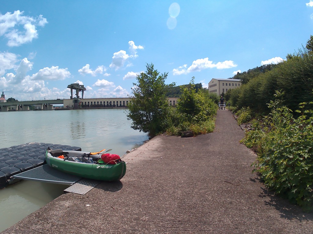
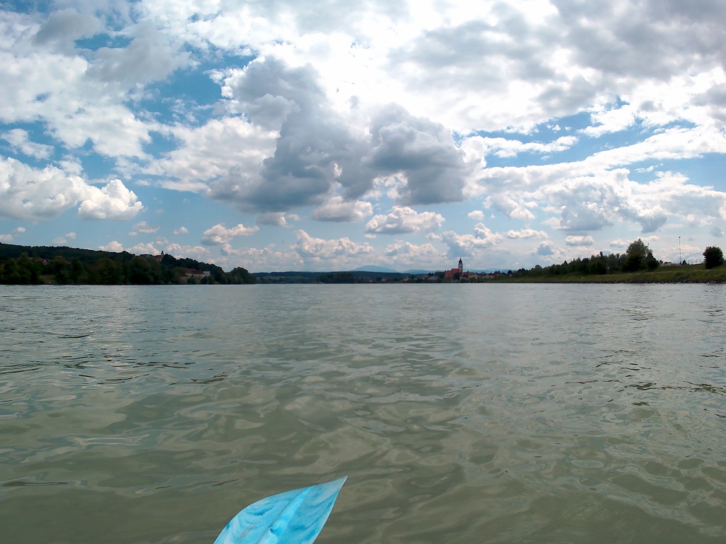
At 8:05 we arrived at the same spot as our arrival day in Grein. The little ferry runs between Grein and Wiesen between 8:00 and 18:00, so we saw the wooden boat make its first run across and back. The weather was very hazy from the previous rainy days. By 8:30 we were ready to paddle away. We started at kilometer 2079 and expected to paddle till 2049 today.


We crossed the river from the left shore to the right shore almost immediately, first giving priority to a big cargo ship that produced a calm wake. It’s such a beautiful morning and we both had quite a good feeling about today. The river looks more like a shiny liquid metal than water. The dimmed sun peers behind a thick layer of clouds that quickly thins out. They said it would be ‘partly cloudy’ today, which honestly could mean anything.


Wörth River Island
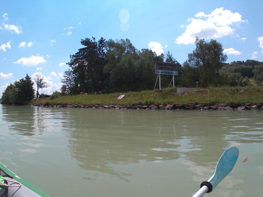
We’d not been paddling for long before we saw the river island named Wörth. It’s one of the biggest river islands in the Danube as of the humble beginnings, and I’d spotted some landing points and the ruins of a castle on my map. I really wanted to land there and maybe visit the ruins. Jonas agreed to the side quest.

The shipping lanes around the island are weird here. We expected that all the ships had to go on the left side of the island, but the sign on the island said that big ships had to go on the right. We passed the island on the left so that we could reach the landing spots. The current was quite strong and we almost got pushed into the right distributary instead of the left one.
We paddled past most of the island on the left-hand side. While the island is mostly flat, the ruins are located on a cliff, and surely, we soon passed a steep cliff. There was no sign of a castle from here. We paddled on until we saw the slipway, where we landed with ease and got out of the boat. We were pretty sure we were the only two people on this island right now.
There was a trail leading past a fire pit into the dense forest of the island. There were two signs, one of them illegible due to constant weathering. The other one just said that the Wörth island is a protected natural area. I followed the real world trail between the trees and under the canopy past a pond covered in duckweed. There must be quite some mosquitoes around here and maybe some other unexpected creatures. It didn’t look like anyone had visited this island in a while.

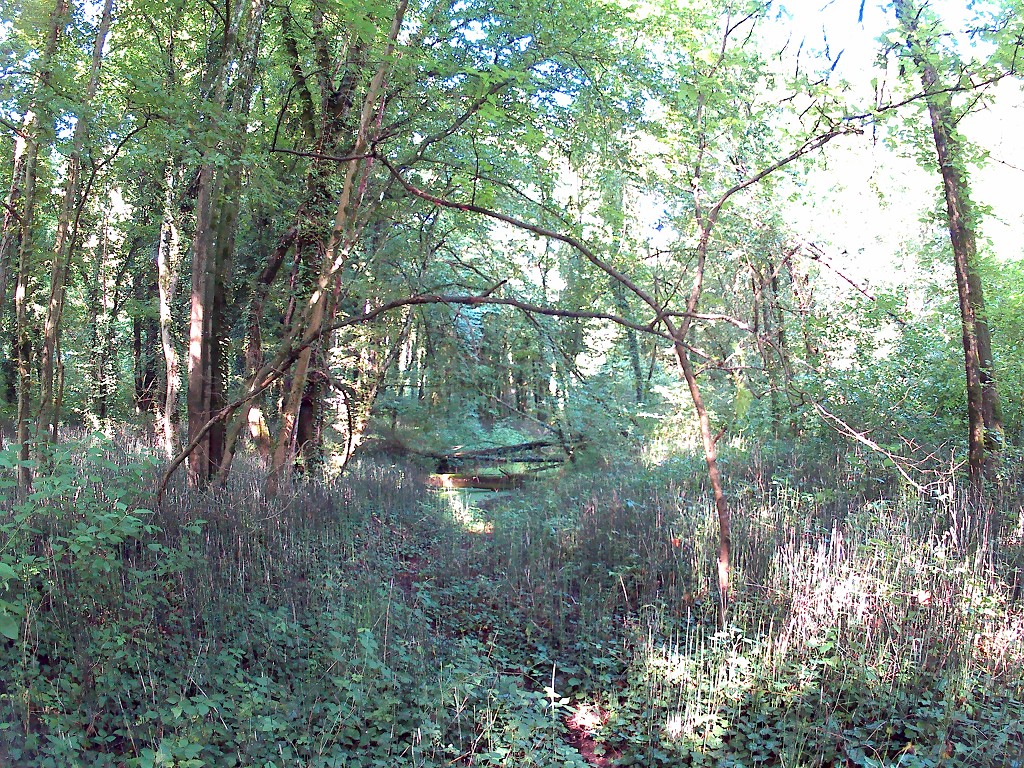
I continued the trail but felt not very at ease. The path became more and more overgrown and I had to watch out not to crush any of the very large snails. Of course, I walked into a few spider webs. There were fallen trees and large muddy patches for obstacles. When the path turned steeply left, it looked like it was impassable without a machete.
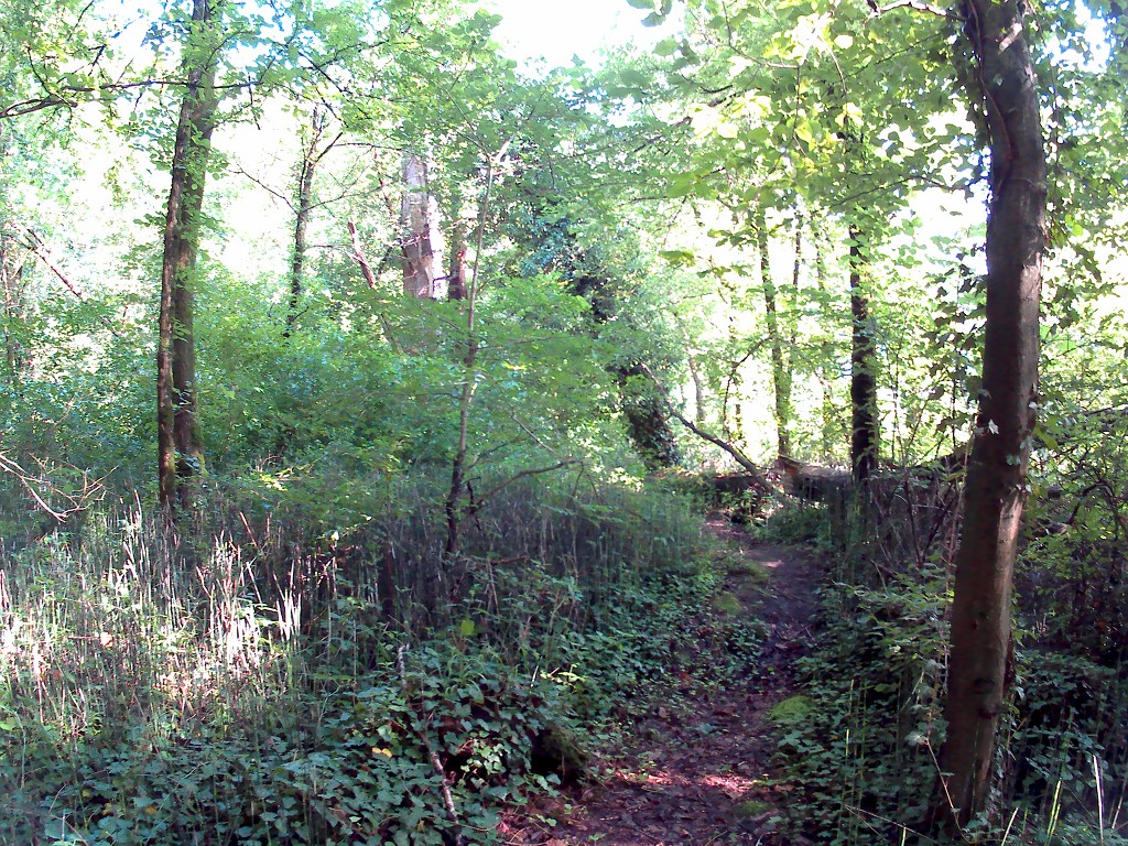
I looked on my map: yay, you did 80 meters out of 250. I considered continuing for a moment before returning to Jonas and Zucchini. Perhaps I’m not brave enough. This was a waste of valuable paddle time anyway. Maybe I am not brave enough for this. What I’m certain of is that I was wearing the wrong kind of shoes for a hike like this.


Getting Our Groove On
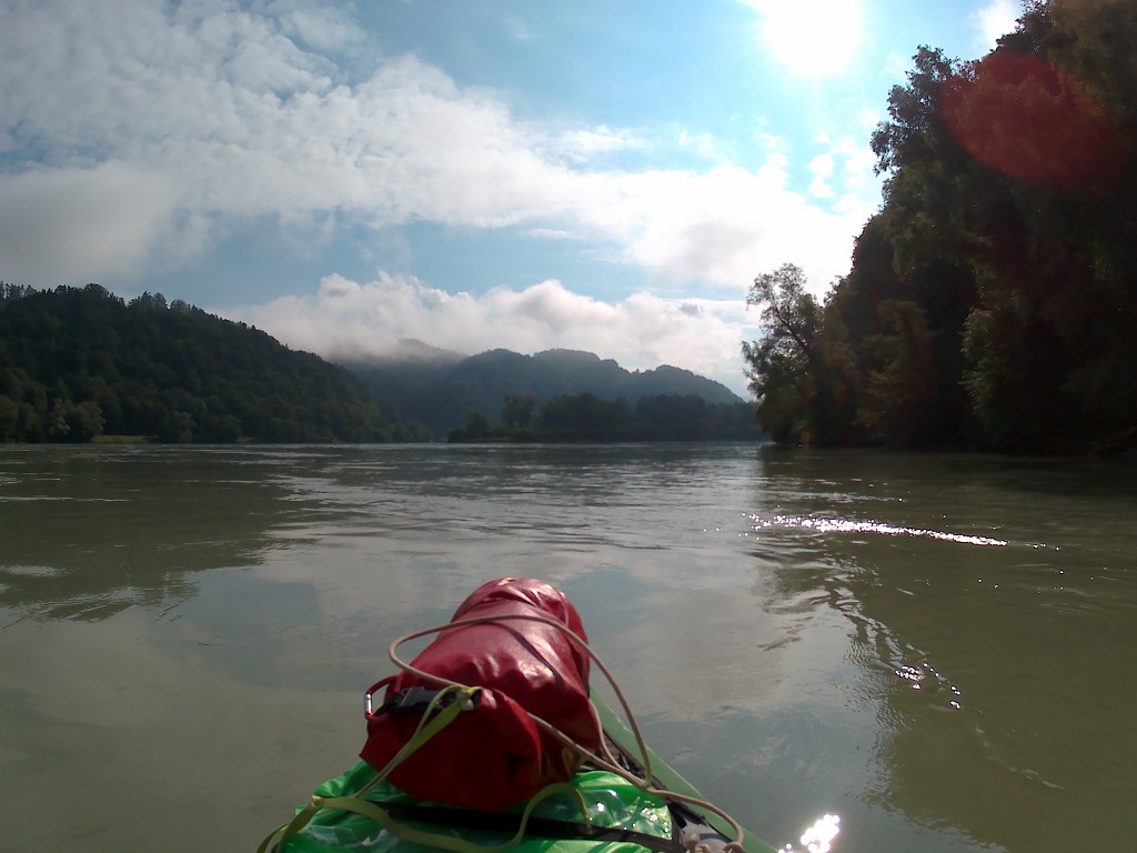
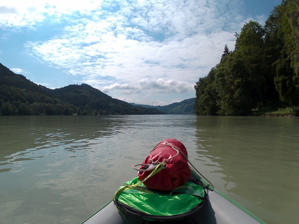
We paddled away from the adorable little island at 9:15. It was time to make some distance. I’d been working on making a music playlist during our stay in Grein. There are big roads and high hills fringing the Danube here, so it’s not like we’re disturbing the utter peace and quiet of the river with some music. We’re just drowning out the constant drone of truck engines with some tunes.
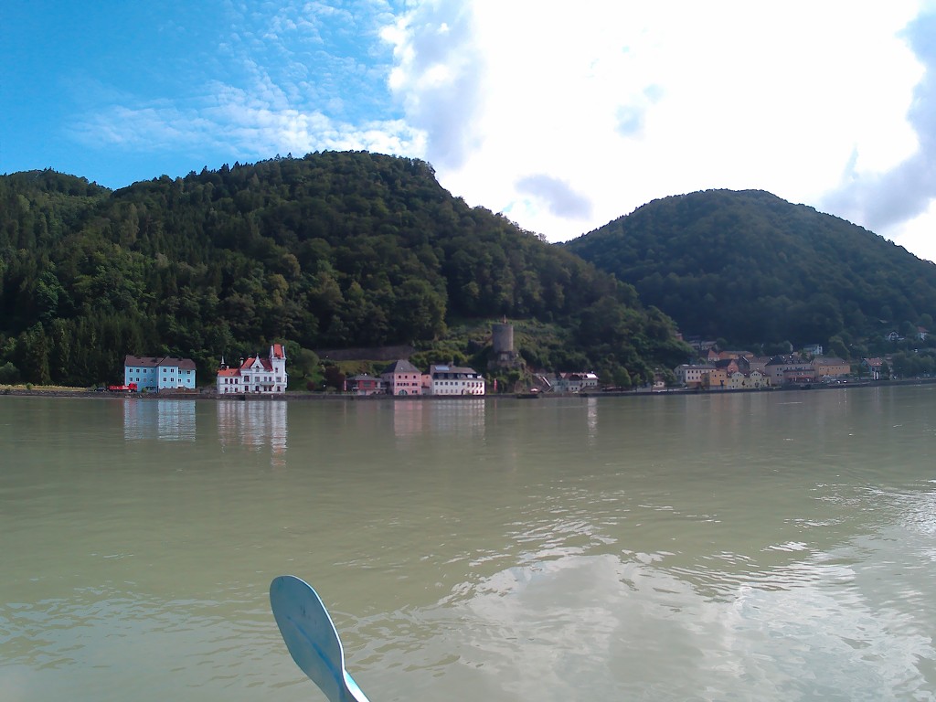
The beat caught on and we were paddling calmly past St. Nikola an der Donau, the Mautturm of Sarmingstein, and the campsite Krenn with its large harbor for small boats. At times, the views of civilization disappear out of sight but not out of earshot. It’s incredible how much a tall forest and some hills can conceal.
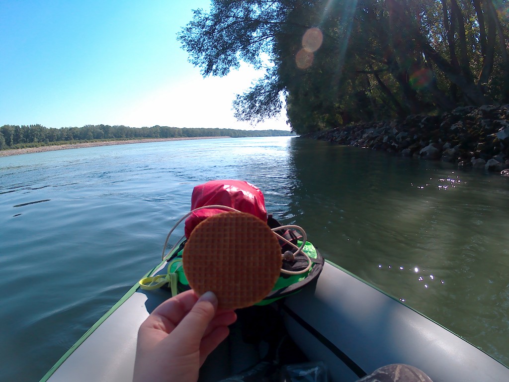
At the 2069-kilometer sign, we decide to paddle another 5 kilometers before taking a break to eat. The sun came out a little more and so did the headwind. By 11:20 we arrived at the 2064-kilometer sign, where we got out on some slippery stairs. We first needed to hit the head before even thinking about food. Afterward, we sat down on the dry part of the stairs to eat some bread with cheese.
Within a minute, Jonas shouted at me to get up. I didn’t know what was going on and why he was freaking out, but I got up without questioning things. He starts wiping me off and I’m still not sure what’s the problem. He says we apparently sat down in an ant trail and are now covered in ants. I see a few more, but not the masses he describes. We help each other get the ants off and return to our boat to eat our food while slowly floating downstream. It’s less than 4 kilometers to the dam, so there’s not much current to help us get there.
Arriving at Kraftwerk Ybbs-Persenbeug
We eat and chat while many cyclists pass us on the shore. It’s not a bad choice to just stay in the boat and float a few hundred meters before we paddle the final stretch to the hydroelectric power plant (Kraftwerk) named Ybbs-Persenbeug. There are many felled trees neatly stacked on the opposite shore that are getting watered constantly. We’re not sure what the point is.
After finishing my food at 11:45 and continuing the paddling, a fast green boat pops up from behind the river bend. And another. And another. Ten such boats travel upstream from the locking area. We conclude that they must be military boats. We’re afraid they’re going to practice some stuff in our area, so we pick up the speed towards the dam.
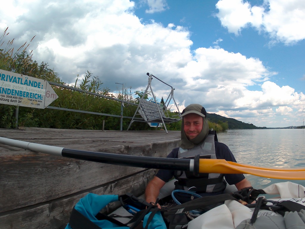
In the final hundred meters before the dam, we see a kayak appear behind us. There are two people in there. Since we’re not exactly sure where the promised pontoon would be for us to portage our boat around, we’re hoping that they might show us. There’s one sign saying “sport boat paddlers beware!” but that’s about it. But they cross the river from the right to the left to go into the locks instead of carrying around. Or maybe they know an even better way to get around this dam.
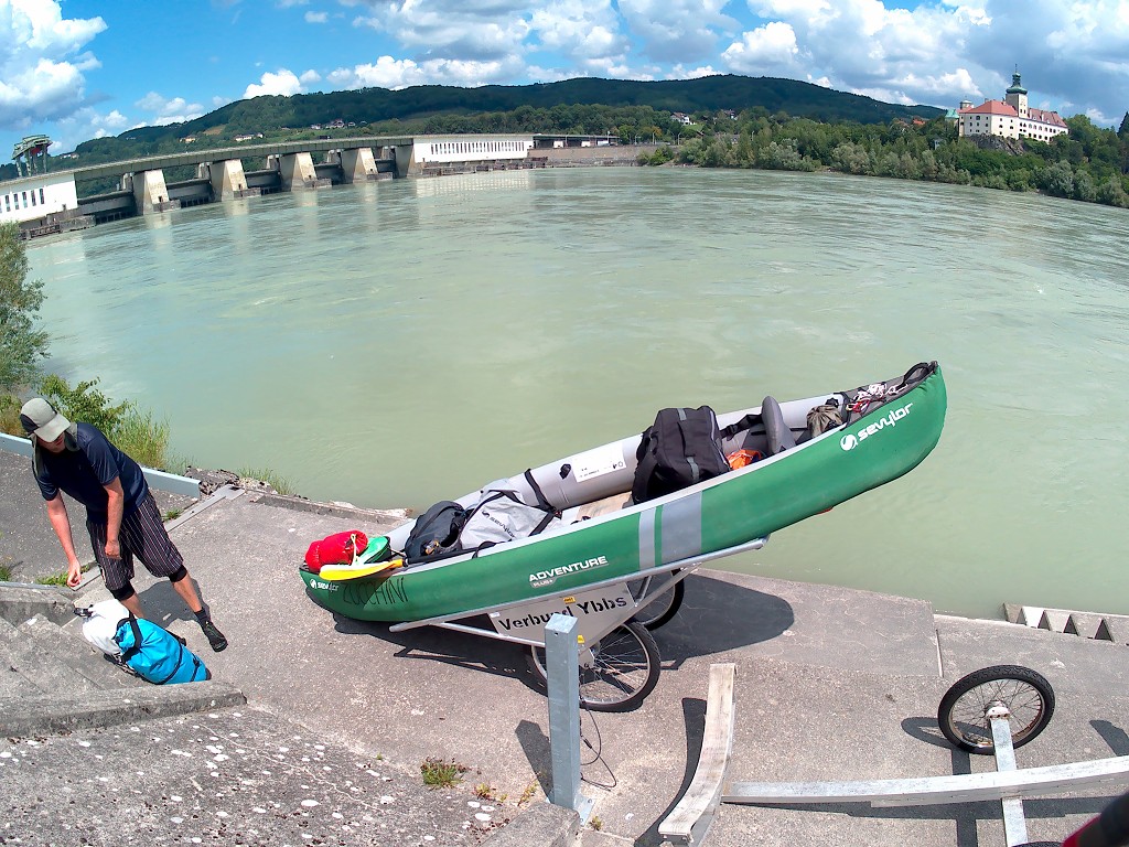
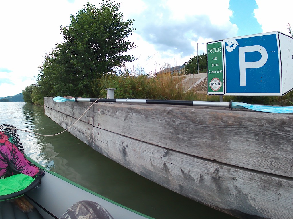
We continue to the pontoon and have to approach the Kraftwerk quite closely. Usually, we portage our boat around the dams at the opposite end of the actual power production area. This time we have to land our boat in that area.

Portaging Around the Dam
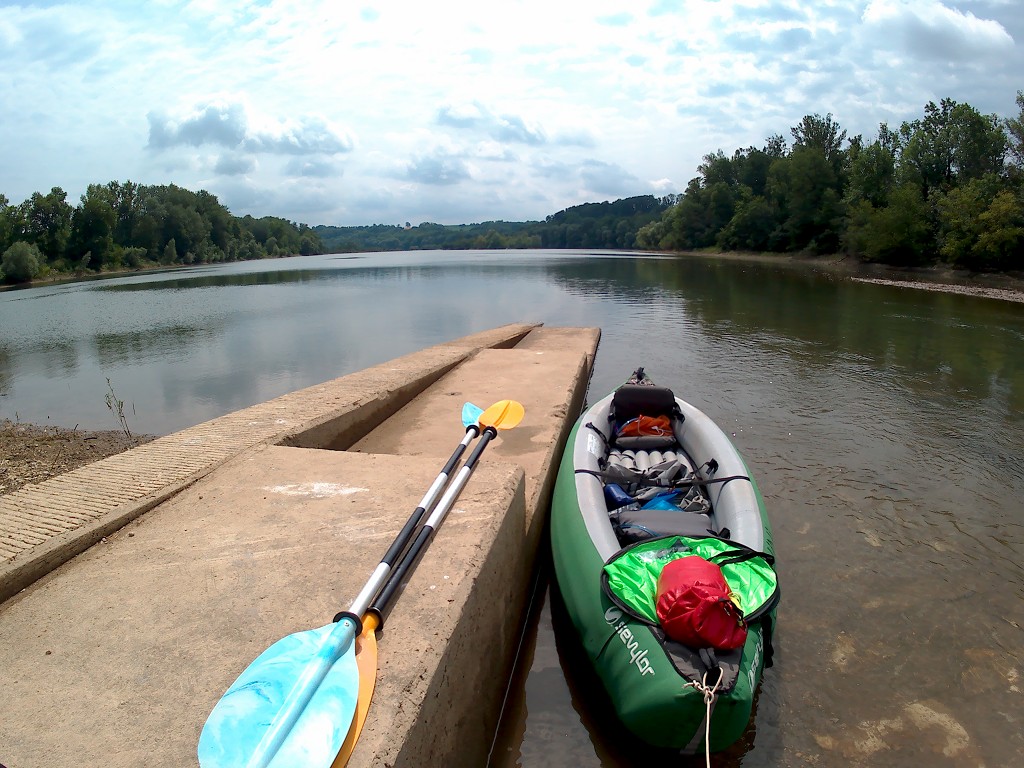
We find the pontoon after some commercial shipping docks and land our boat at 12:15. The floating pontoon is made of black plastic, which is very hot to the touch since it’s been out in the sun all day. Jonas gets out of the boat first and struggles a bit since it’s so high. I tie the boat to the shore and get out myself. Jonas goes to get a boat wagon which was promised on the paddle boat folder from the Austrian hydroelectric dams.

In the meantime, I put all the heavy luggage on the shore and wait for Jonas to return. He doesn’t, so I find some more tasks to do. I move the boat to the side of the pontoon to get the boat on the land, which is actually not so difficult since the boat is so light. I’m waiting in the sun for quite a while waiting for Jonas to return and I’m all out of tasks.
Kraftwerk Ybbs-Persenbeug was the first hydroelectric powerplant on the Austrian Danube, built from 1954 till 1959. To be fair, it also looks a bit old in certain places, and very new again in others. Its construction made the section of the Danube valley called the Strudengau more navigable for ships, especially around the river island Wörth, which was sometimes accessible on foot with low water levels. It also forms the border of Upper Austria (the northern shore) and Lower Austria (the southern shore). The power plant is about 8 kilometers after both shores become Lower Austria.
At 12:30 Jonas returns with a very shiny boat wagon. Jonas is very impressed with the preparation work I did, especially getting the boat on land. We lift the boat onto the wagon and balance it perfectly. Then we’re confident to also put in the luggage so we don’t have to carry it on our backs. We push the boat cart confidently, but it snags. The boat leans on one of the wheels and slows down its rolling potential. We take everything back out of the boat and then put the boat completely level. The luggage goes back in. Finally, we’re doing this.
It’s quite a long walk to the other side. Jonas took so long because he couldn’t find the boat wagons at first and thought he’d gone there for nothing. We walk past quite some employees of the dam to the ramp that leads back down to the water level. The water flows very fast here and we have a pretty good view of the Persenbeug castle.
Paddling Past Ybbs an der Donau
The sun’s out and we reapply sunscreen before getting back into the boat. Jonas messages back and forth with his father, who cycled from Germany to Egypt before the war in Syria. Though we use different means of transportation, our route has a lot in common since he also pedaled along the Danube and stayed in Grein just like us.
Jonas also checks his app DoRIS Mobile to see if there are any big ships in the locks, currently locking, or approaching the locks. It’s an app released by the Austrian government. The app tells us there are three ships traveling upstream to approach the lock and one going downstream.
We get back into the boat and continue paddling. The fast flow gives us an energy boost. We check if there’s anything in the locks, then check if any of the three ships are approaching from downstream, and then cross over to the left-hand side. There’s quite a sharp left turn coming up soon. We see some sparks and loud sounds near the waterline at the left-hand shore. I can’t see the person doing it, but they’re dicking around with fireworks. Let’s hope they don’t throw fireworks in our direction.

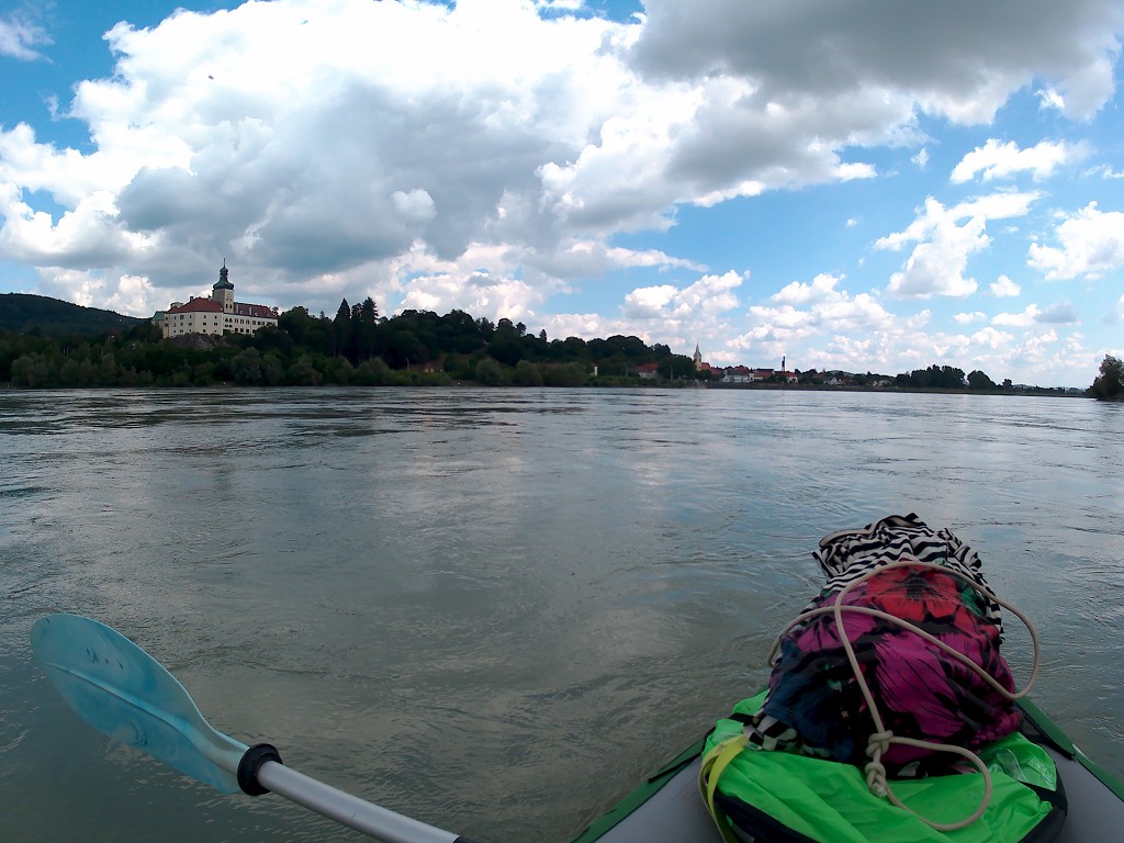

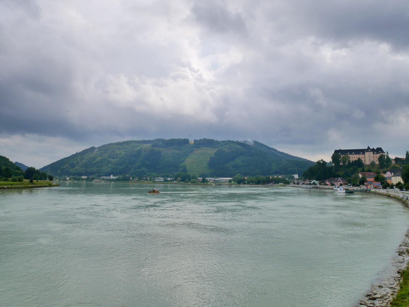
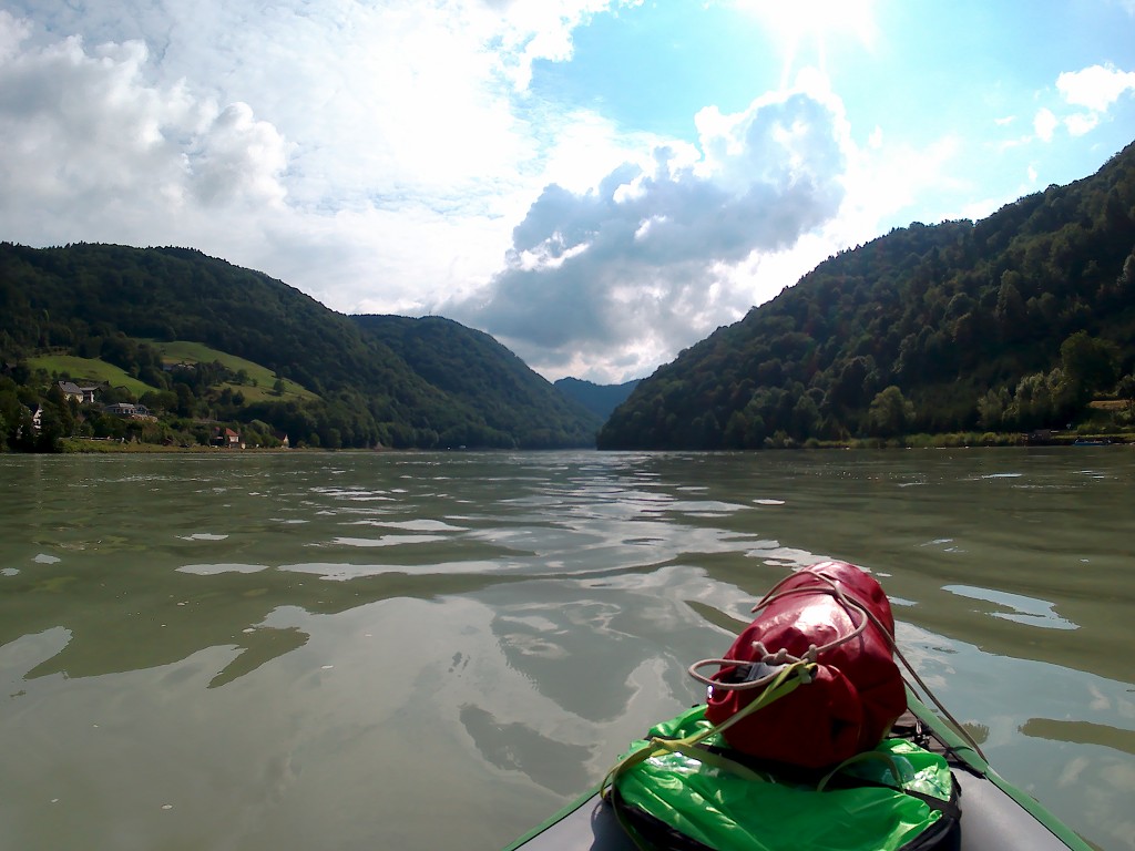
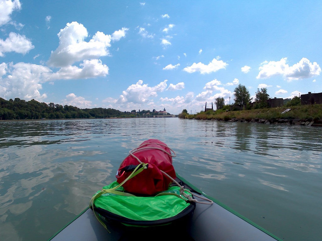
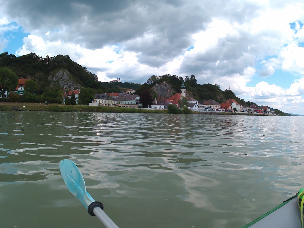
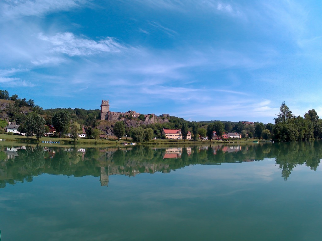
On the right-hand side, we see Ybbs an der Donau. It’s much smaller than we expected. Some big yellow-painted buildings line the shore. They look like former palaces, but they’re actually psychiatric/therapeutic institutions. Jonas says that the name “Ybbs” sounds very non-German. A little digging into the history of Ybbs says that the name comes from the Egyptian goddess Isis since apparently, a group of Egyptians lived here back in Roman times. Jonas says “Ha! I knew it.” but the German Wikipedia makes no such claims as to its origins.
The backdrop of Ybbs is a giant mountain. It looks far away. I take some time to scan the map for possible names of the mountain, and I concluded it could be the 953-meter Runzelberg. It turns out it’s actually the 1890-meter Ötscher. I’m savoring the beautiful view.
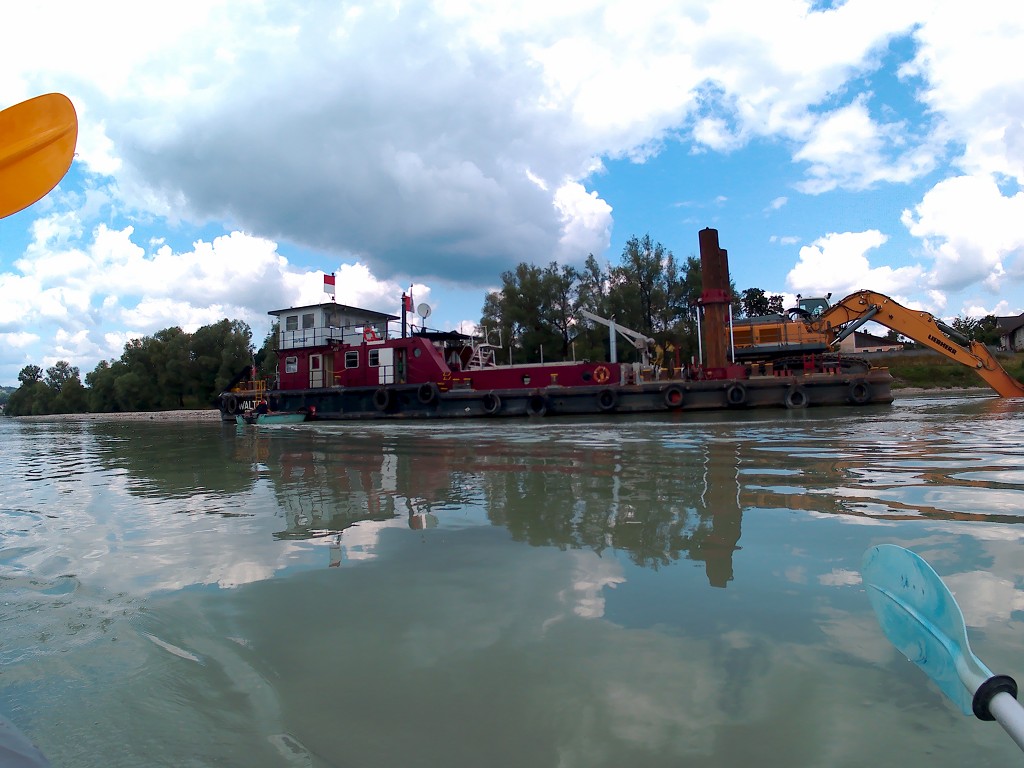
The Dredgers
I put back on the music as we approach the left turn. Once we’re in it, I see some big ships on our side of the river and a big stony island. This is unexpected. Jonas sees the kayak with the two paddlers instead, who seem to be confused about which direction to go around the island and the big ships. The left side definitely seems to shallow to pass. They eventually settle for crossing the whole river from left to right to be out of the way.
We also make a stop at the shallow island to see what the hell is going on. There seem to be two big ships. One has an excavator machine for dredging on it and a little motorboat on the side of it. There’s a big ship behind it that’s moving. We run aground with our fin at the little stone island and wait for the moving ship to leave. It travels a bit upstream to eventually land on the right-hand shore. We dislodge ourselves from the shallow riverbed and slowly approach the scene.

The moving ship apparently catches whatever the excavator dredges up. They’re digging in the river in an area where the big cargo and cruise ships can’t go. The little motorboat has a guy in it who sometimes pushes the big dredging boat closer to the shore. It’s a funny solution to a weird problem to have. Just when you think you’ve seen it all on the river. We paddle past the activities and stick to the left-hand shore.
Later, we find out that this Austrian app DoRIS Mobile also mentions these kinds of maintenance activities. The more you know!
Arriving in Krummnußbaum
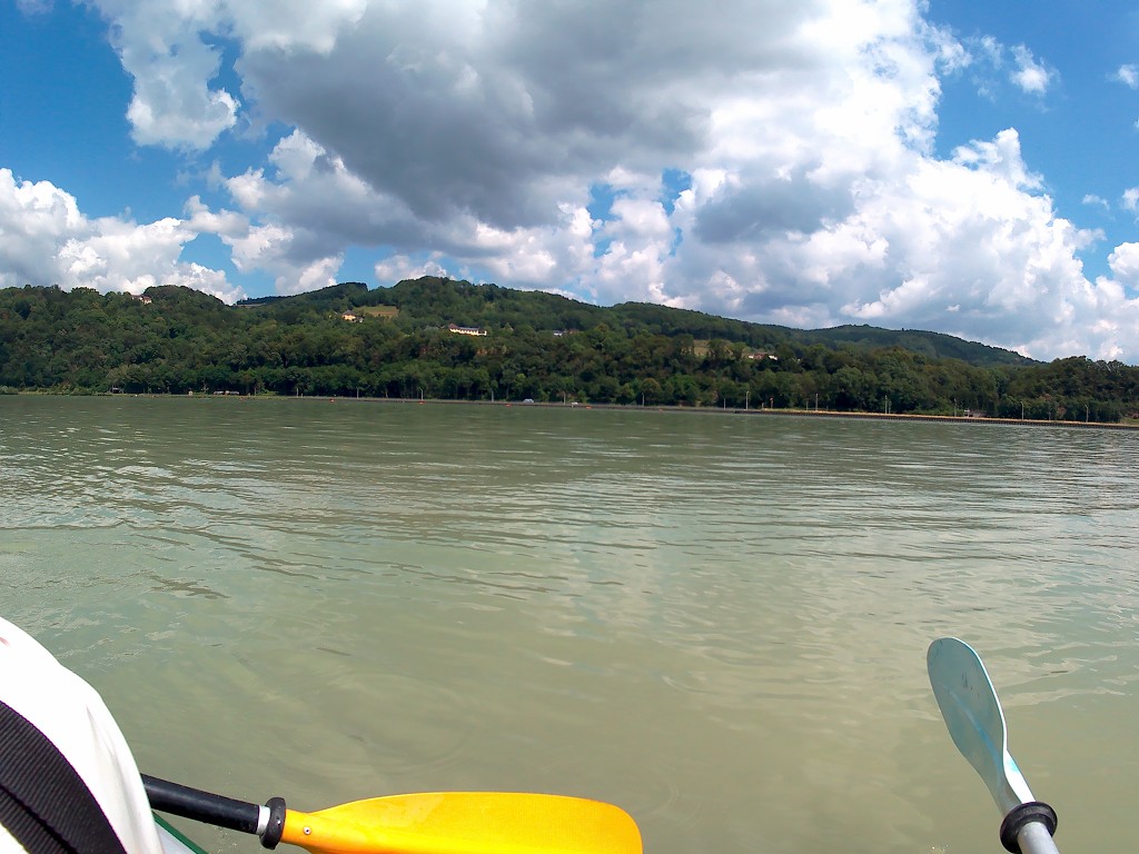
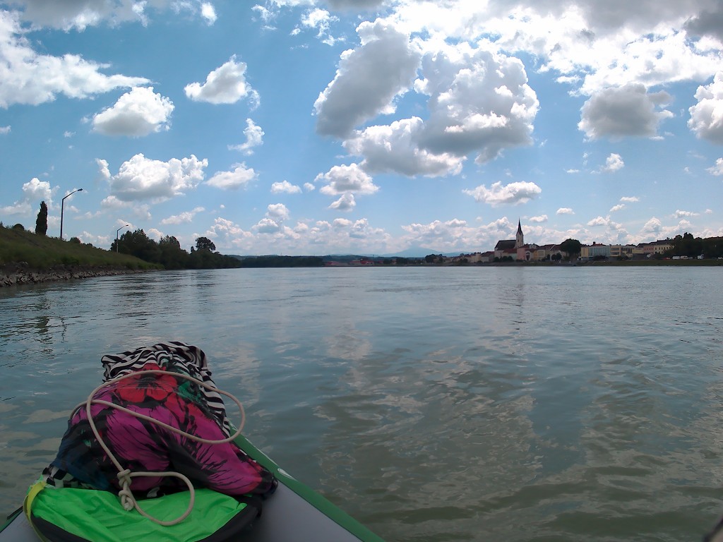
We’re now in the final kilometers of our day. We paddle past a cute small town named Gottsdorf (God’s village) and deal with one big cargo ship from the front, two big motorboats from the back, and another big cargo ship also from the back. Looking behind us, we again have a view of Ötscher mountain.

It’s 14:10 when we enter the last river bend to the right. That’s when we see the church with the two towers in a village called Maria Taferl on a spectacular hill. A cruise ship approaches from the front right before we enter the ‘don’t make waves’-zone and we think this will be the last big boat of the day. We pass the campsite of Marbach with its little marina. The sun is out but a big angry cloud comes in to block the sun for a pleasantly cool stretch to Krummnußbaum.

We always kept referring to today’s destination as Marbach an der Donau instead of Krummnußbaum, mostly because that’s the nearest place name in our spreadsheet. Jonas booked our accommodation here online because he sometimes struggles with understanding the Austrian dialect of German. He never considered himself a speaker of Hochdeutsch (High German), but people we met here have asked him where he’s from as a Hochdeutsch speaker.
We paddle past the piers of Marbach an der Donau and spot the alternative accommodations and the local mall. In the last stretch, we always get a bit tired in anticipation of rest. The pier of our Gasthof (inn) appears and we prepare for landing. It’s quite a high pier, so I use the rope to fasten us to the shore before we attempt to get out of the boat. It’s 15:00 and all we have to do is cross the road with all our stuff to arrive at our place of stay.
Gasthof Zum Guten Kameraden in Krummnußbaum
After crossing the road carrying our inflated boat, we get to our inn named Zum Guten Kameraden (for good mates/comrades). We take up a table at the restaurant and order our end-of-paddle-day wheat beer. It’s very good.
Jonas says he really enjoyed today. We didn’t only cover quite some distance, but it was also very doable while still remaining a challenge. These are the kinds of days we really hoped for on this trip. The boat dries while we unwind on the terrace.
A woman and an older man run the place. The older man suggests we put our kayak in the shed so we can keep it inflated. We’re only staying here for two nights and our launch spot is right across the road, so it doesn’t make sense to put in the effort to deflate the kayak and fold it up into a neat package for the CabinMAX. We take the offer.
After our beer, we check ourselves into the room. It’s very pleasant with a good table and plenty of charing spots. The internet is fast, but we boost it with our Mango Box – a device we ordered off Amazon to Linz to make the WiFi signal stronger.
In the evening, we eat at our place of stay and then retire to our room to watch an episode of Stranger Things. Tomorrow we’ll have a rest day to get some work done and hike around Krummnußbaum, Maria Taferl, and Marbach an der Donau for a bit.
Feel Free to Share Some of My Stories! This One About Krummnußbaum or Any Other!

YES I am planning the same voyage in my origami kayak..I live in Grein and want to know ..are the streams strong..Does one stay on the north bank?
Hey David, the currents are not generally super strong, just this one spot at the island it’s a lot stronger. You can look on my interactive Danube kayak map to see which sides of the river we paddled on. On day 27, we crossed from left to right, went around the island on the left side but close to the island, then went to the right bank and stayed there until the dam. After portaging around the dam, we crossed over to the left bank and ended up in Krummnußbaum. Enjoy your paddling in your folding kayak!