is Canceled")


")


")


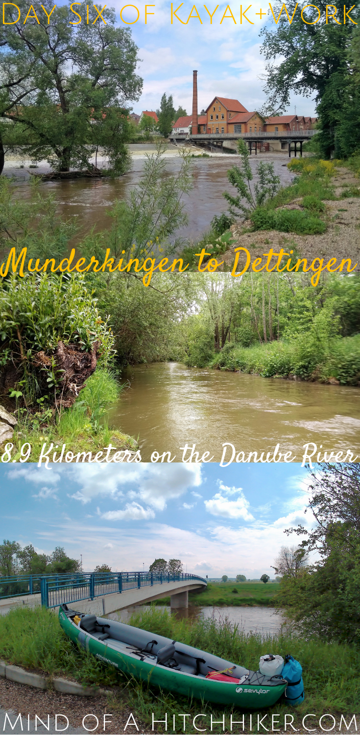
Events narrated in this story happened on Wednesday 22nd of May, 2019. We paddled our inflatable kayak from Munderkingen to Dettingen in Baden-Württemberg in South Germany. This was only a trip of 8.9 kilometers. We are paddling a stretch of the Danube river this year. If you want more information on our trip, you can read about the idea aka ‘Day Zero’, or read previous entries of our paddle days.
Want to travel the (entire) Danube River in an adventurous way? Join our Facebook group Danube River Source to Sea: Kayak / Canoe / Bike / Hike / Sail to find your community
Contents
- 1 Booking Accommodation for The Days Ahead
- 2 The Forecast
- 3 Leaving Munderkingen for Dettingen
- 4 Testing Our Abilities
- 5 The Rottenacker Wehr
- 6 Landing at Nettle Harbor
- 7 Fighting the Urge to Scratch
- 8 A Long Break in Rottenacker
- 9 Rottenacker Hydroelectric Power Station
- 10 The Confluence of the Stehbach and the Danube
- 11 Arriving in Dettingen
- 12 Dettingen and Ehingen
- 13 Please share this Paddle Story on Social Media!
Booking Accommodation for The Days Ahead
We tried booking another hotel somewhere between Munderkingen and Ulm – a total distance of about 35 kilometers by the river. We think paddling 35 kilometers in one day is too much; we’ve only done 22 kilometers thus far in one day as a maximum. The most logical place to stay the night would have been Öpfingen, which is sort of halfway at about 17 kilometers downstream.
We called some hotels and guesthouses in this area – Öpfingen, Oberdischingen, Ersingen, Erbach, and even Donaustetten – but none of them had available rooms for Wednesday and Thursday. The more places we called, the more rejection we got. The more we got rejected, the more we panicked internally. At our last rejection call, Jonas asked the lady on the phone “Is there something special going on that you’re all booked?”. She answered “No, nothing special. We’re usually booked out during weekdays because craftsmen stay in our kind of hotels.” Interesting…
After that streak of bad luck, we found a hotel in Dettingen that had room for us for two nights. Hotel Knupfer is also a hotel that many craftsmen stay at during the workweek. Dettingen it is.
The Forecast
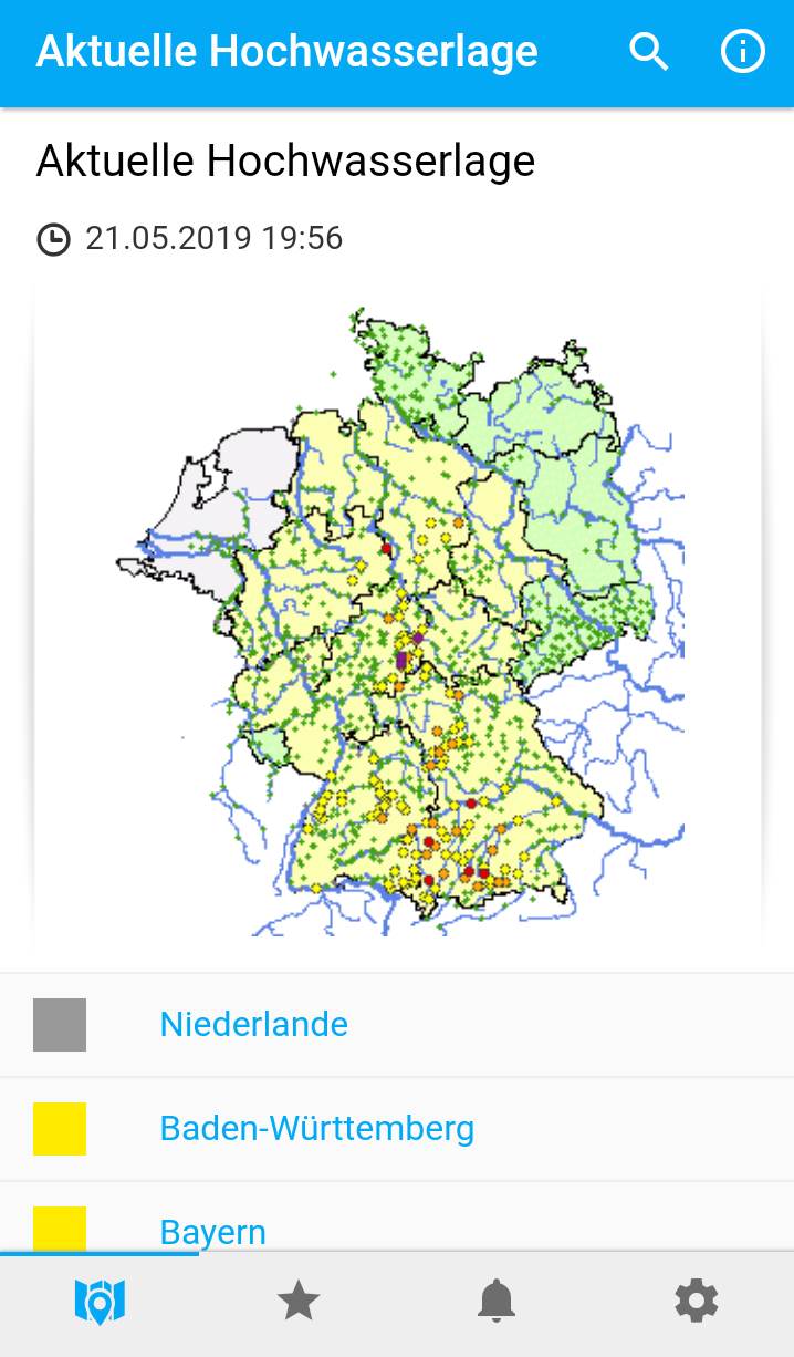
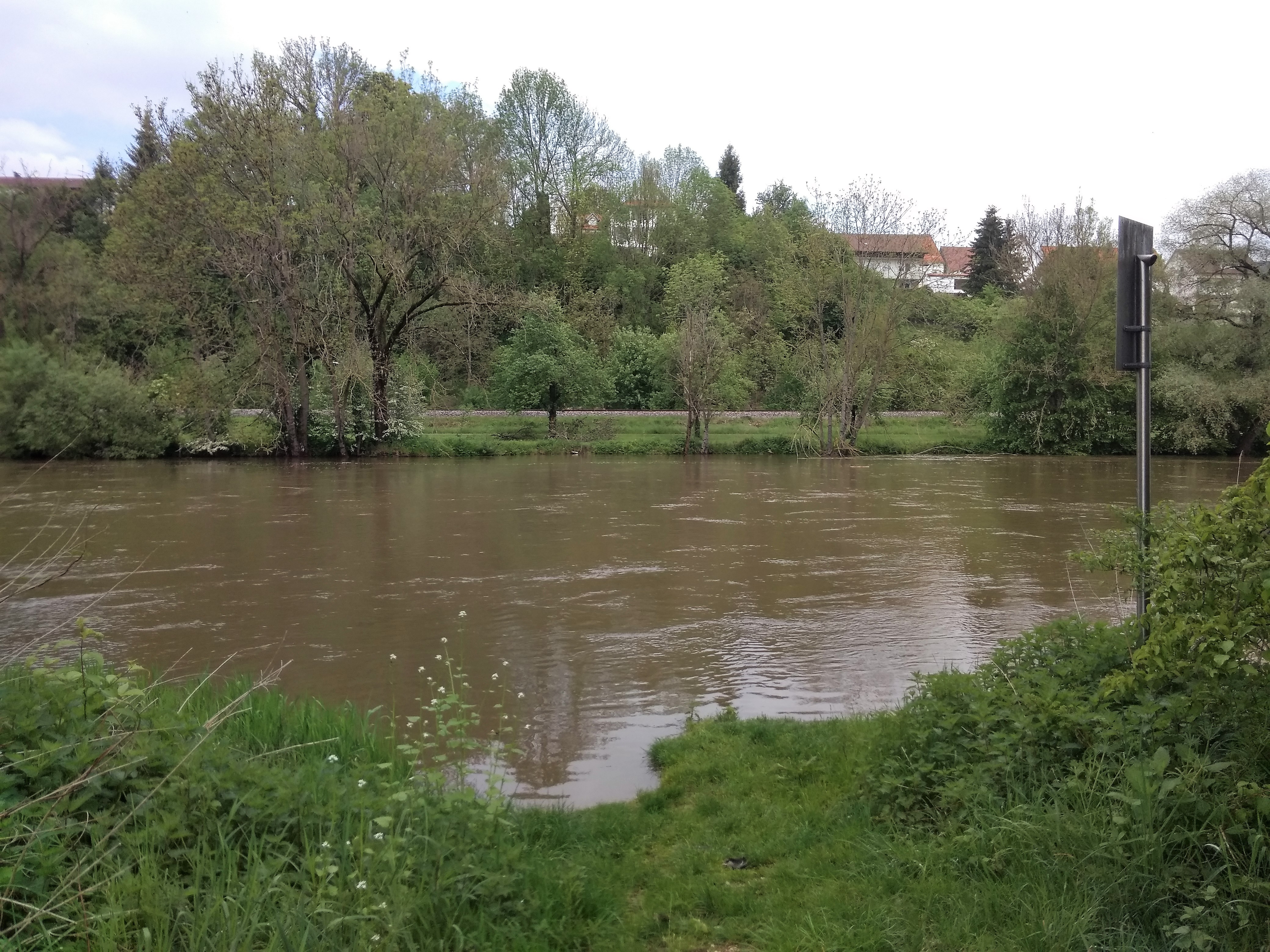
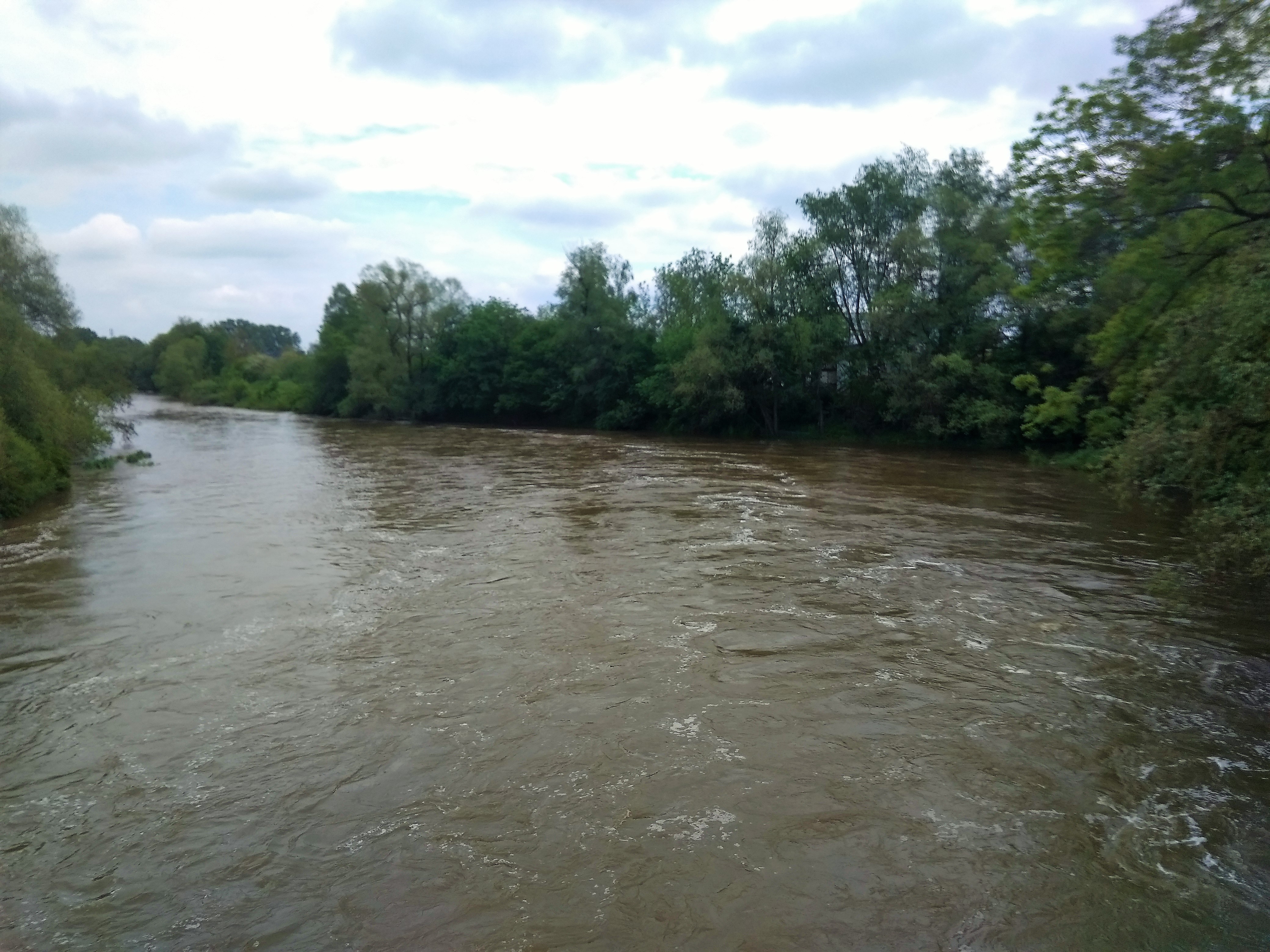
But… there was this one little thing getting into our way: the water level forecast on the Meine Pegel app. It had just rained for a couple of days in the Sigmaringen/Munderkingen area, but also downstream the heavy rainfall affected the side rivers of the Danube.
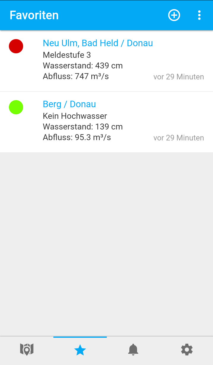
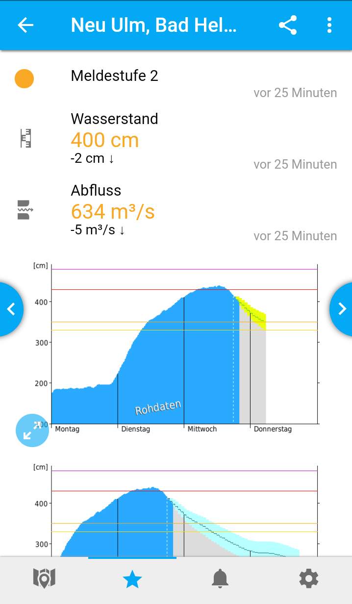
The monitoring stations we were mostly looking at were the ones in Hundersingen (we’d passed) and the one in Berg (right next to Dettingen). They were higher than usual, but still in the green. Then we saw the warnings for Neu Ulm, the first Pegel after Berg. It was yellow (>330 centimeters) when we looked at it on Monday, then turned orange (>350 centimeters) on Tuesday and even red (>430 centimeters). The whole alerts for nearly all of Germany turned yellow or orange. Hour by hour, we saw the water levels and the outflow go up.
We visited the Danube from our hotel Rose in Munderkingen. It had changed from this harmless stream it was when we arrived, to this engorged monster that flowed at a terrifying speed. It carried large chunks of broken trees in it. The kind of chunks that the managers of the weirs mechanically remove every once in a while when they eventually get stuck behind one. Tree branches hung inside the dragging water like they had regrets.
Jonas and I walked next to the river and looked at it while it was raining in a drizzle, calmly adding fuel to the fire.
“This is fine,” I said, “our launch spot is well-protected from the current.”
Leaving Munderkingen for Dettingen
We enjoyed breakfast at Rose and then finished up our packing for the day. We already knew today wouldn’t be a long day on the river. The 10 or so kilometers wouldn’t really be a bother. And the weather forecast was great: cloudy, then sunny, and not very windy.
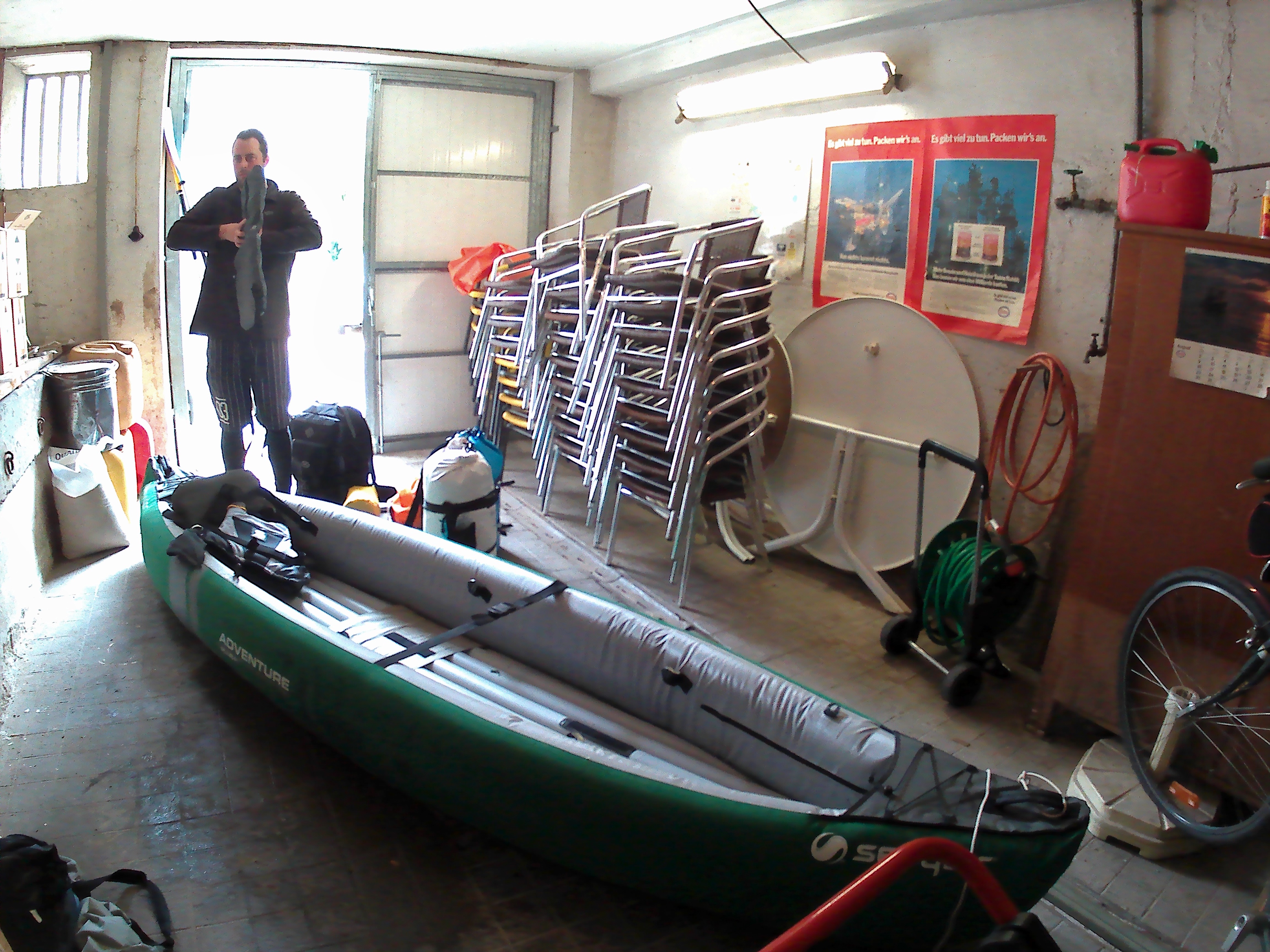
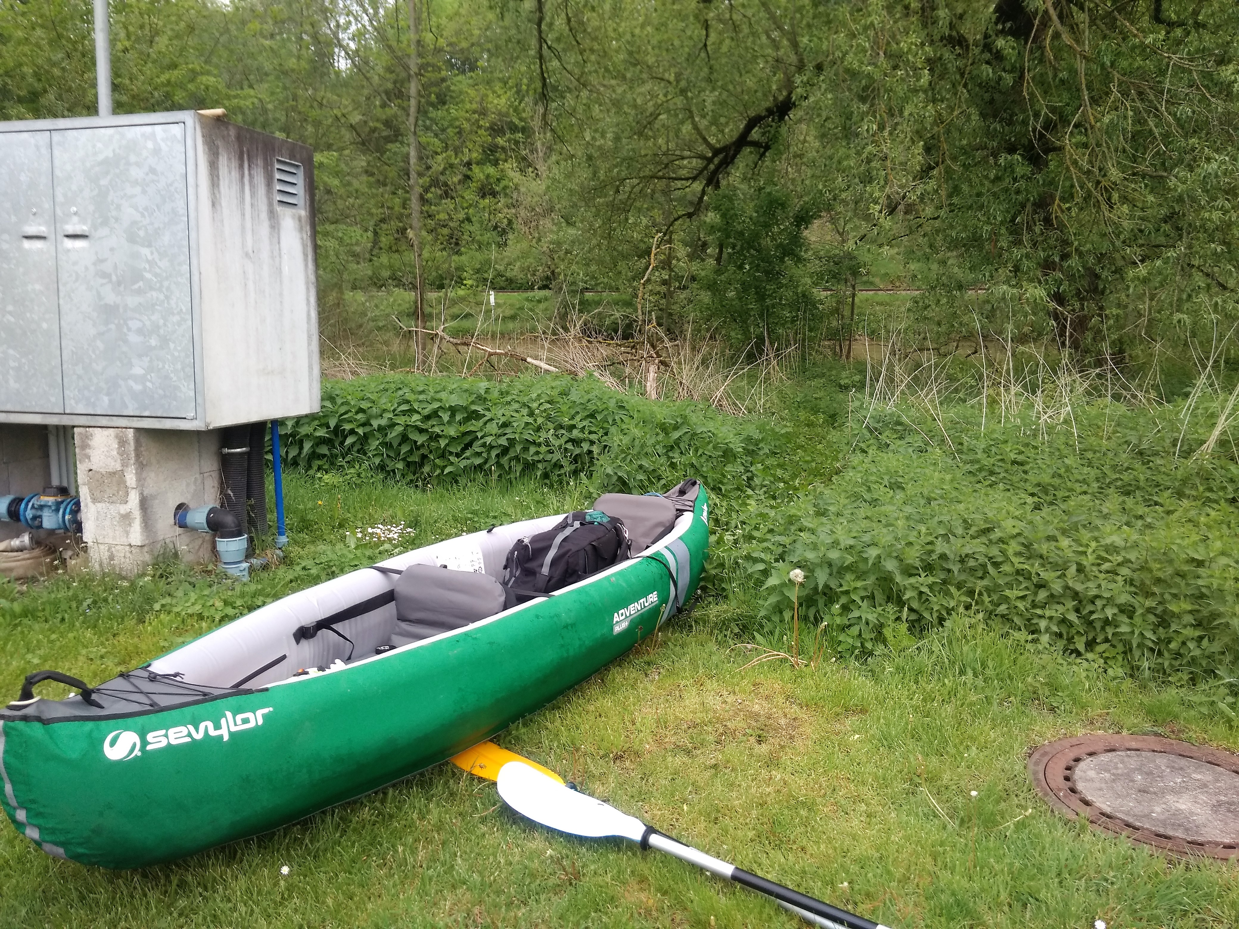
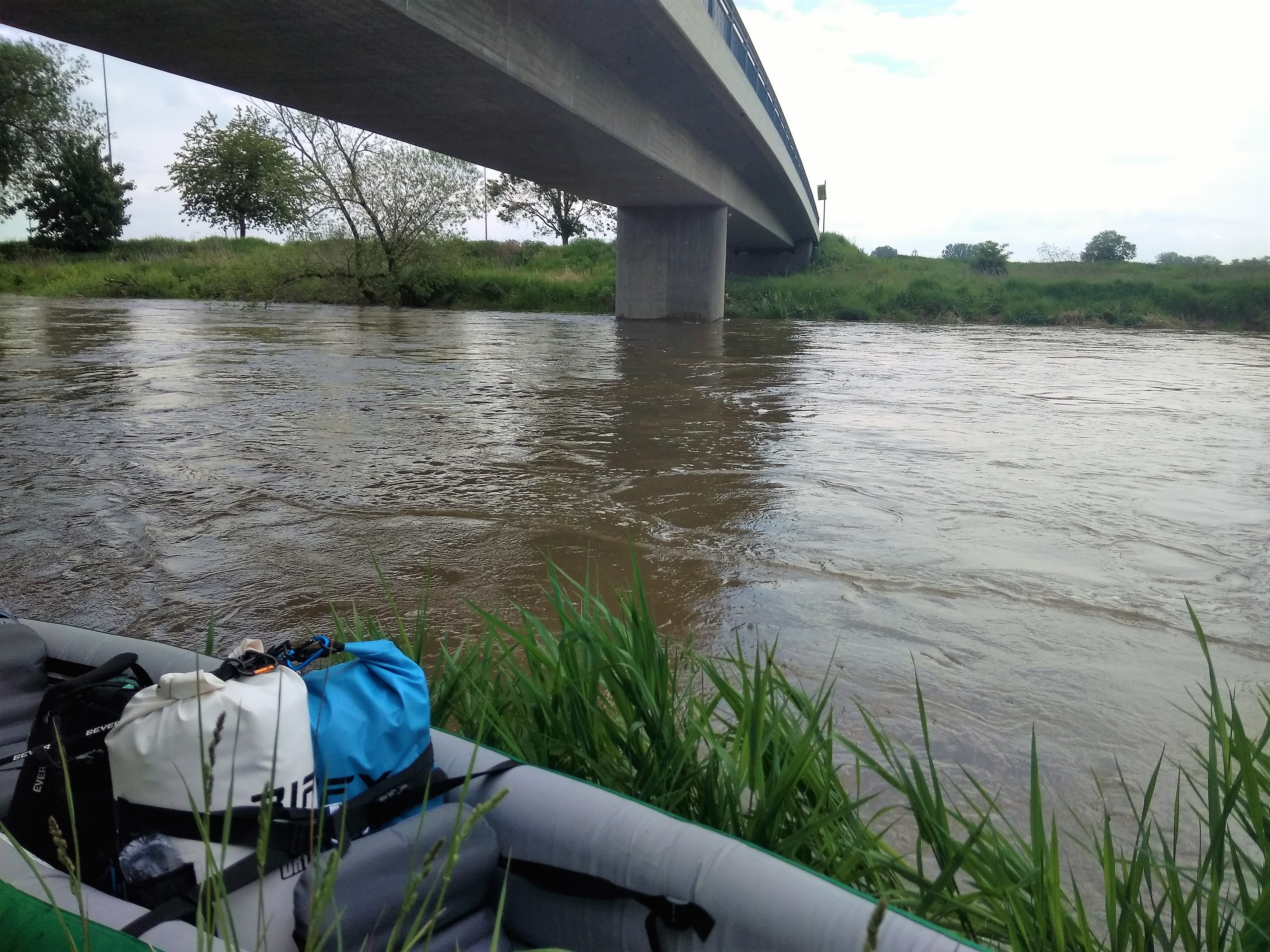
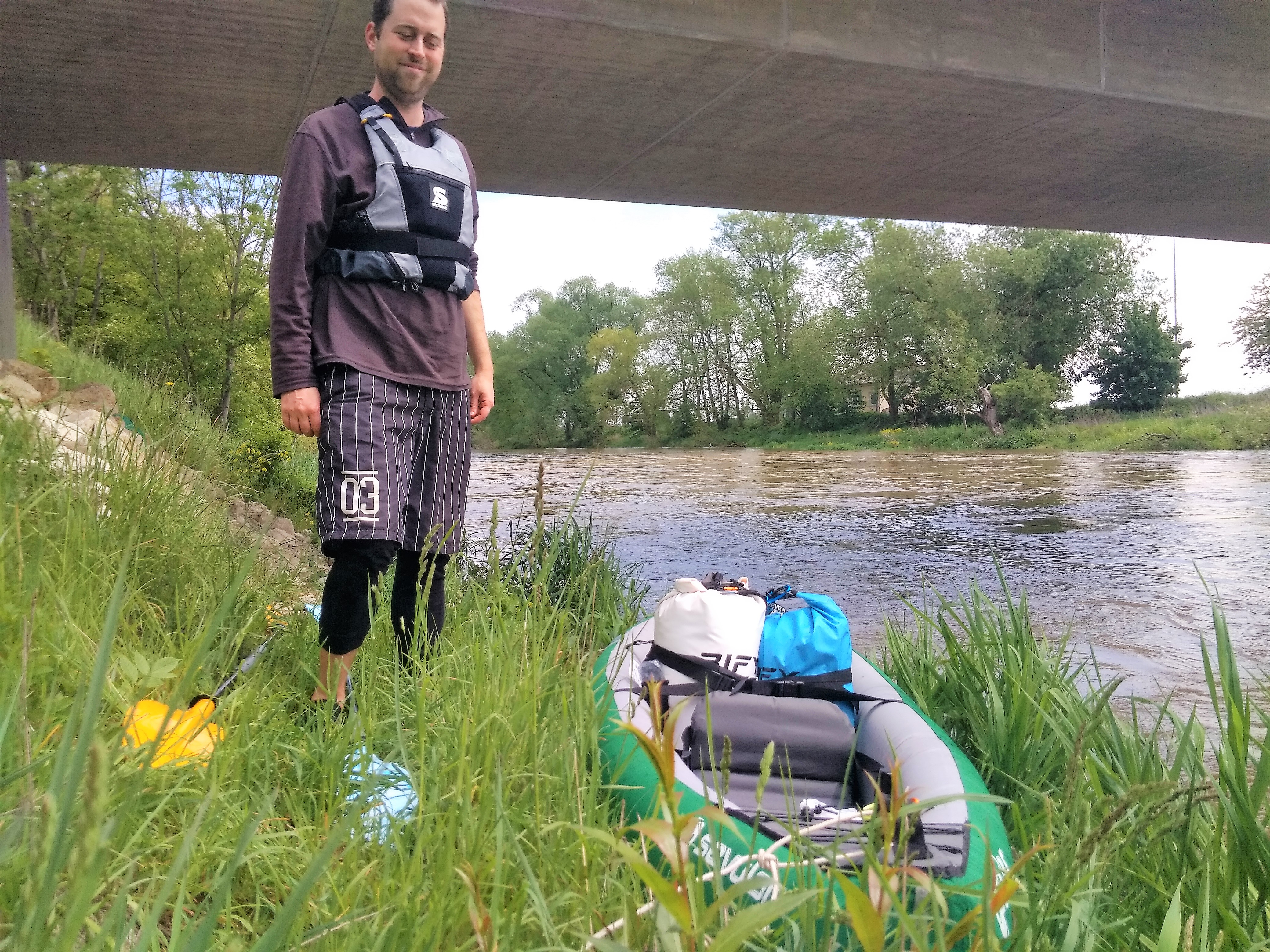
So we checked out late, then went to the garage where our canoe had been at for two days. Our launch spot was only 100 meters away from the garage. We inflated the boat under the roof and then moved it to our sheltered spot along the river.
Our sheltered spot was… higher than it used to be. Our first move after pushing off-shore would be to paddle through a willow tree that hung in the river. Then the current would immediately grasp our boat and carry us along. There is only one Wehr on this short stretch. Getting in isn’t really ever the problem. Getting out is.
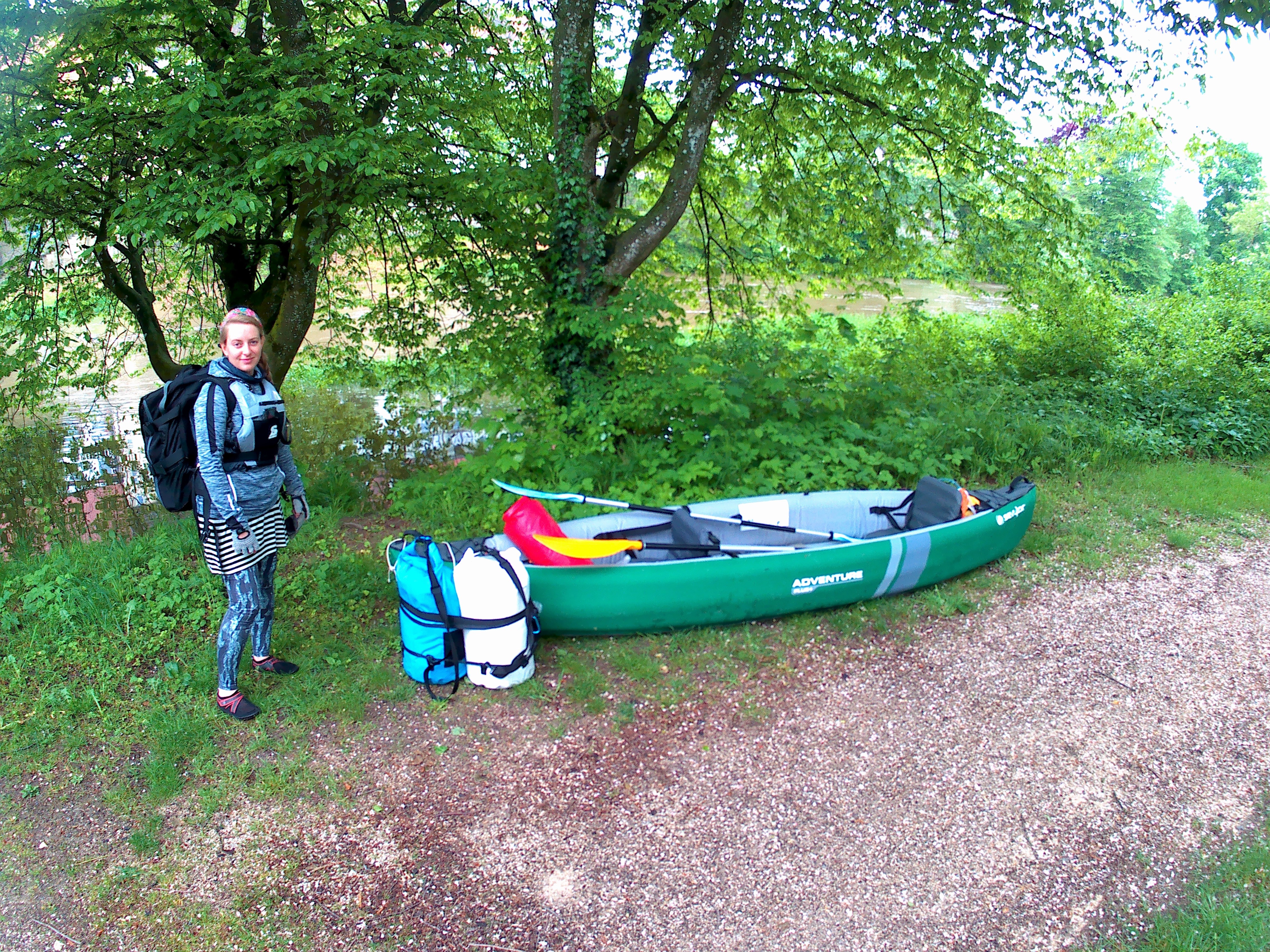
Jonas came back from a second walk to the hotel, ready to paddle. At a lazy 11:15, we started our trip.
Testing Our Abilities
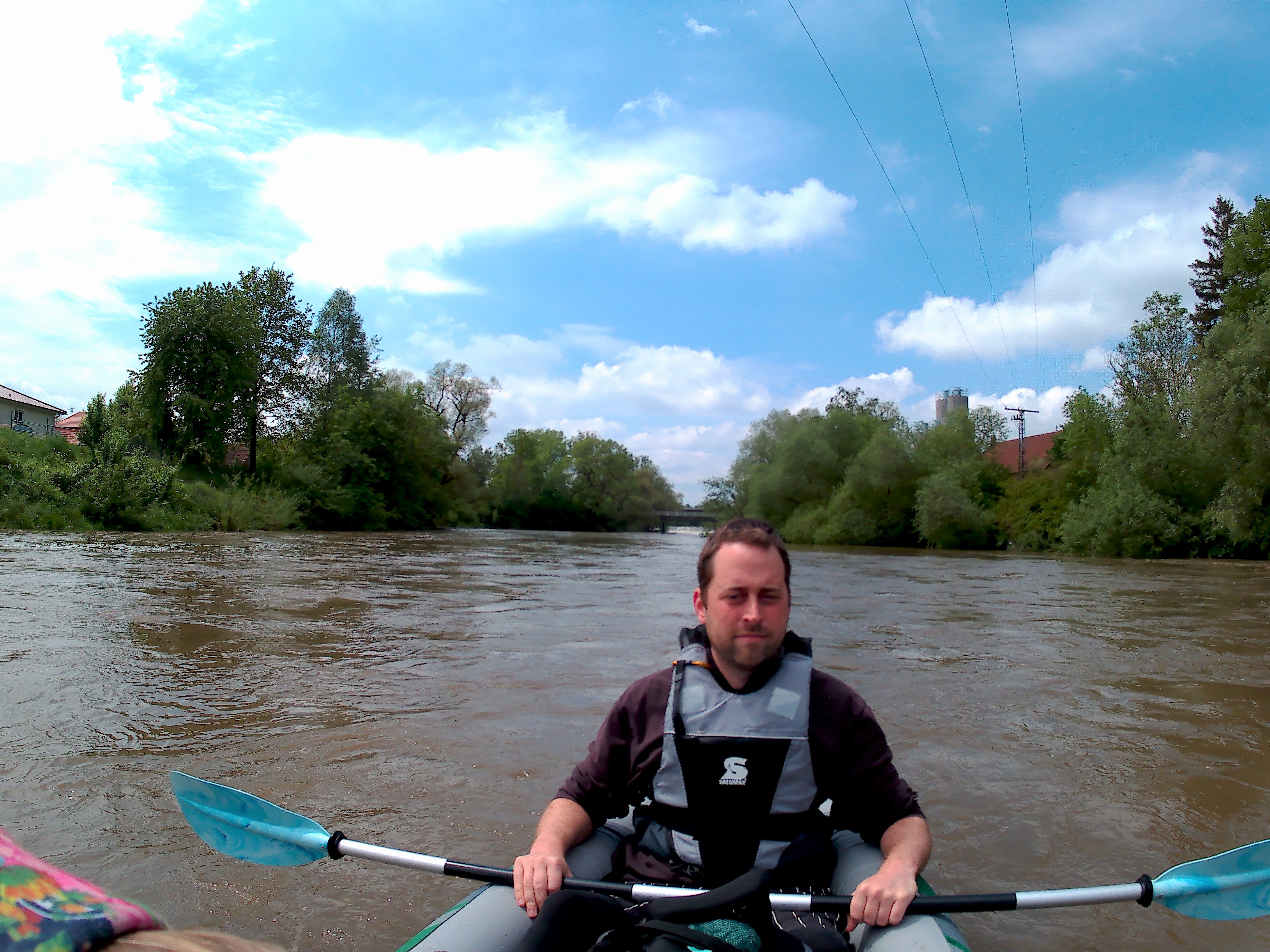
We immediately have a high speed. We pass under the bridges and see the first effects of the water speed on the pillars: standing waves and back currents. Do I know what I’m talking about? No, not really. All I know is that standing waves can be dangerous, depending on what you are and what you’re doing at the moment. We pass through them without making a splash. Our inflatable boat is quite rigid but not as rigid as other canoes. This means that our boat mostly bends with the depth of the waves like a wobbly magic carpet.
I looked on my GPS to see the speed. A solid 8 kilometers per hour. Before we knew it, we had passed the ‘official’ entry/exit point of Munderkingen at the right-hand shore next to the fire brigade. A large tree joined us for the ride.
Neither of us is paddling for speed. We only paddle to correct our course or to avoid hitting our heads in the (mostly) soft tree branches. At some point, Jonas suggests us to turn our boat around and try to paddle against the current to see if we could moor like that. We turn our boat counter-clockwise into the stream and paddle on one side with all our might. The best we can achieve is standing still compared to the shore for about two seconds. Then the current drags us down again at a fairly stable 11 kilometers per hour without our collaboration. Sometimes it gets very choppy.
A reminder: this isn’t yet high water or a flood. Our warning systems say it’s all green and good to go. We’re not reckless according to science. We did our research.
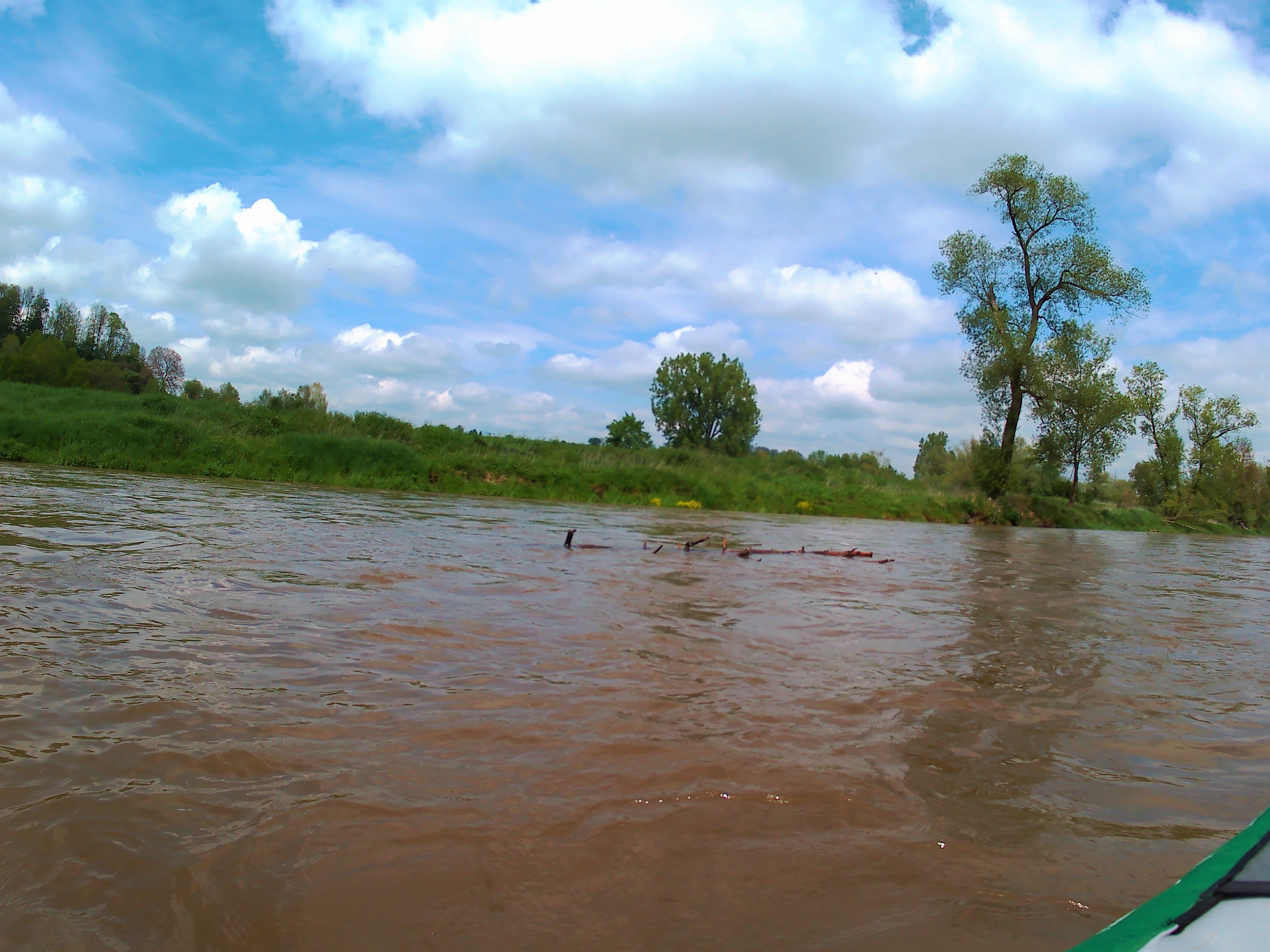
Our new tactic is not to paddle along at all, but just use our paddles to break and steer and dodge floating debris. We’re constantly slowing down and looking on our GPS to see if the Wehr is near. That’s where we’d have to make a crucial decision to stop our boat, get out, and portage around the dam safely instead of dropping off the unknown.
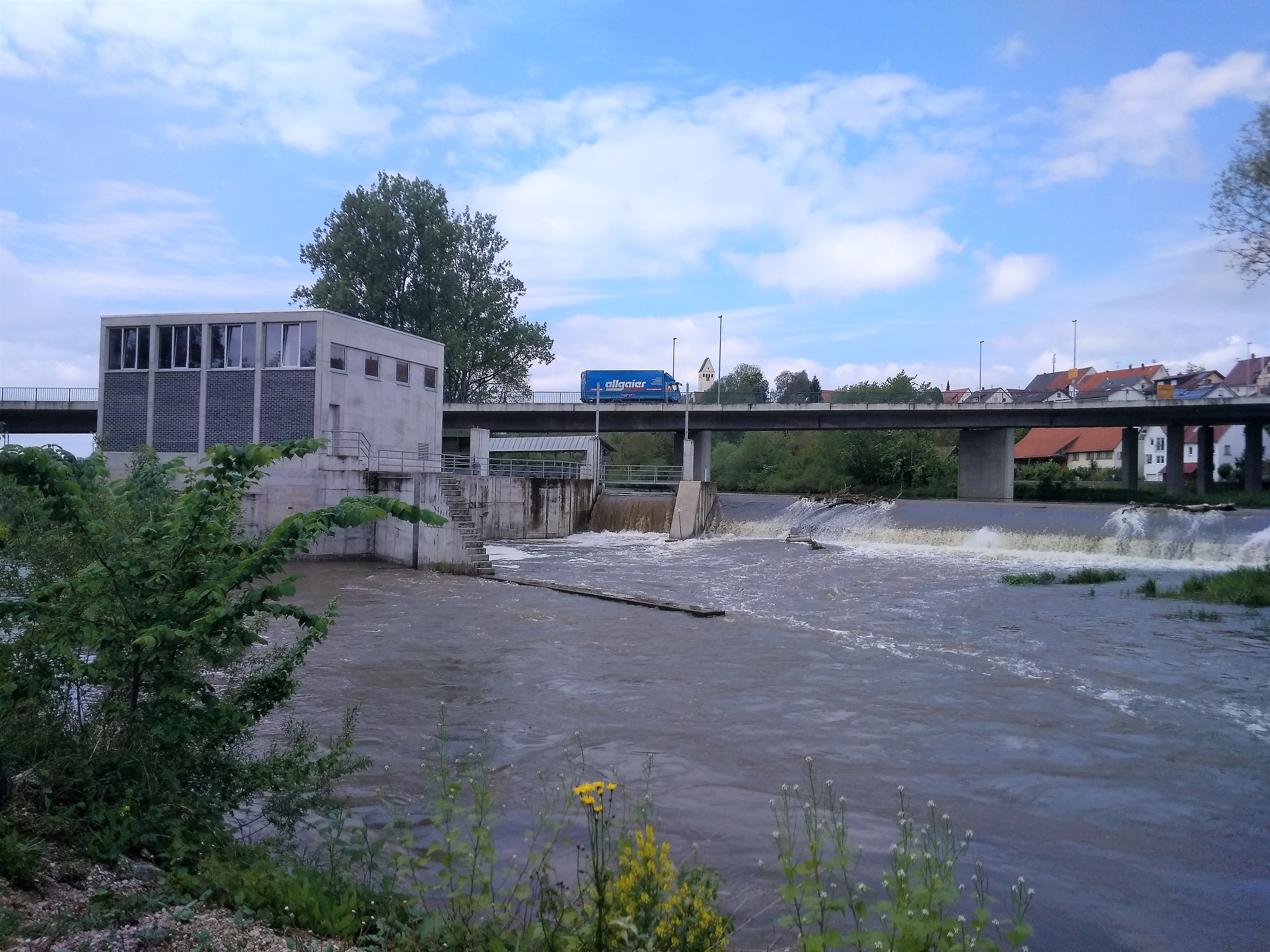
The Rottenacker Wehr
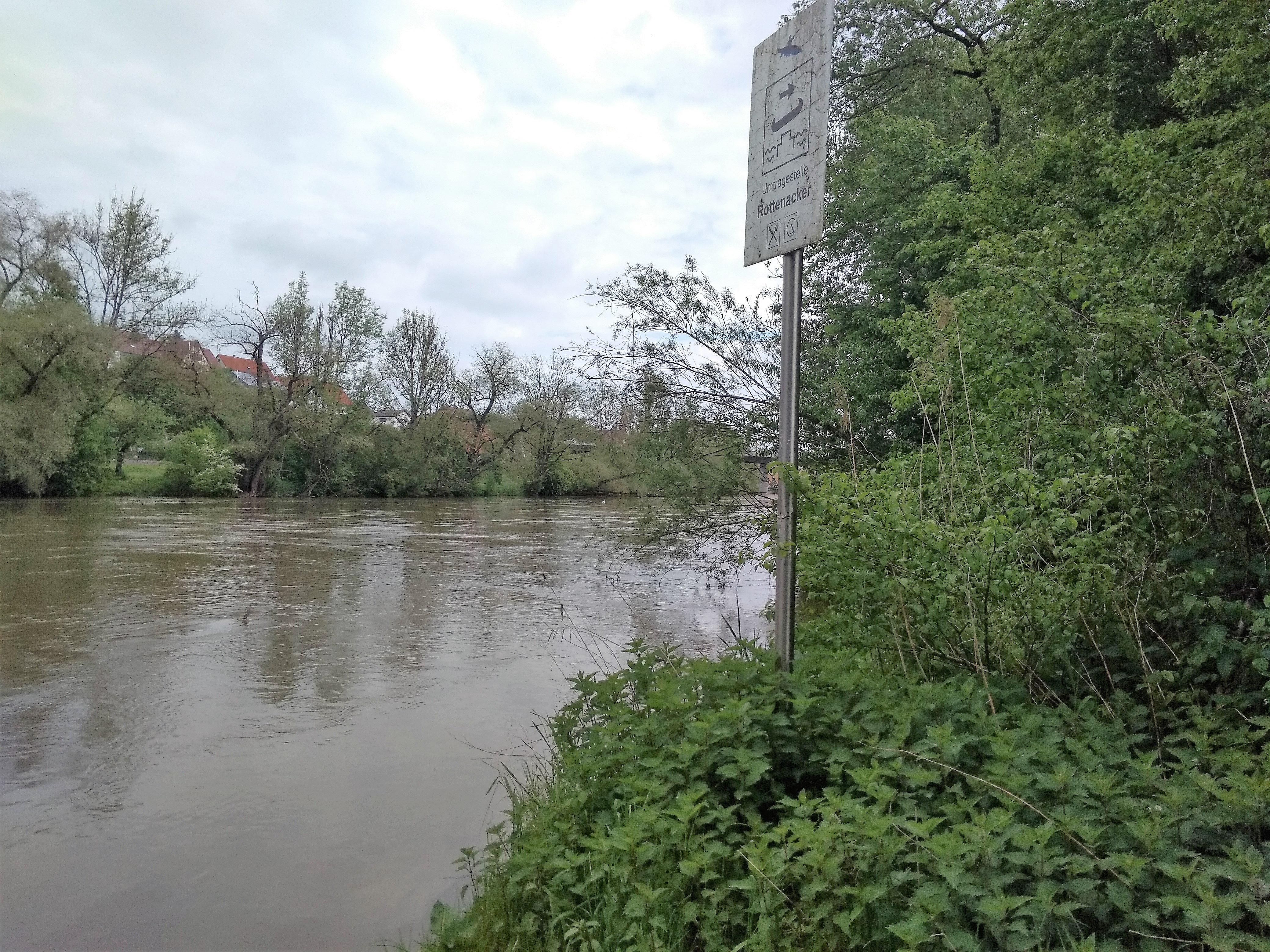
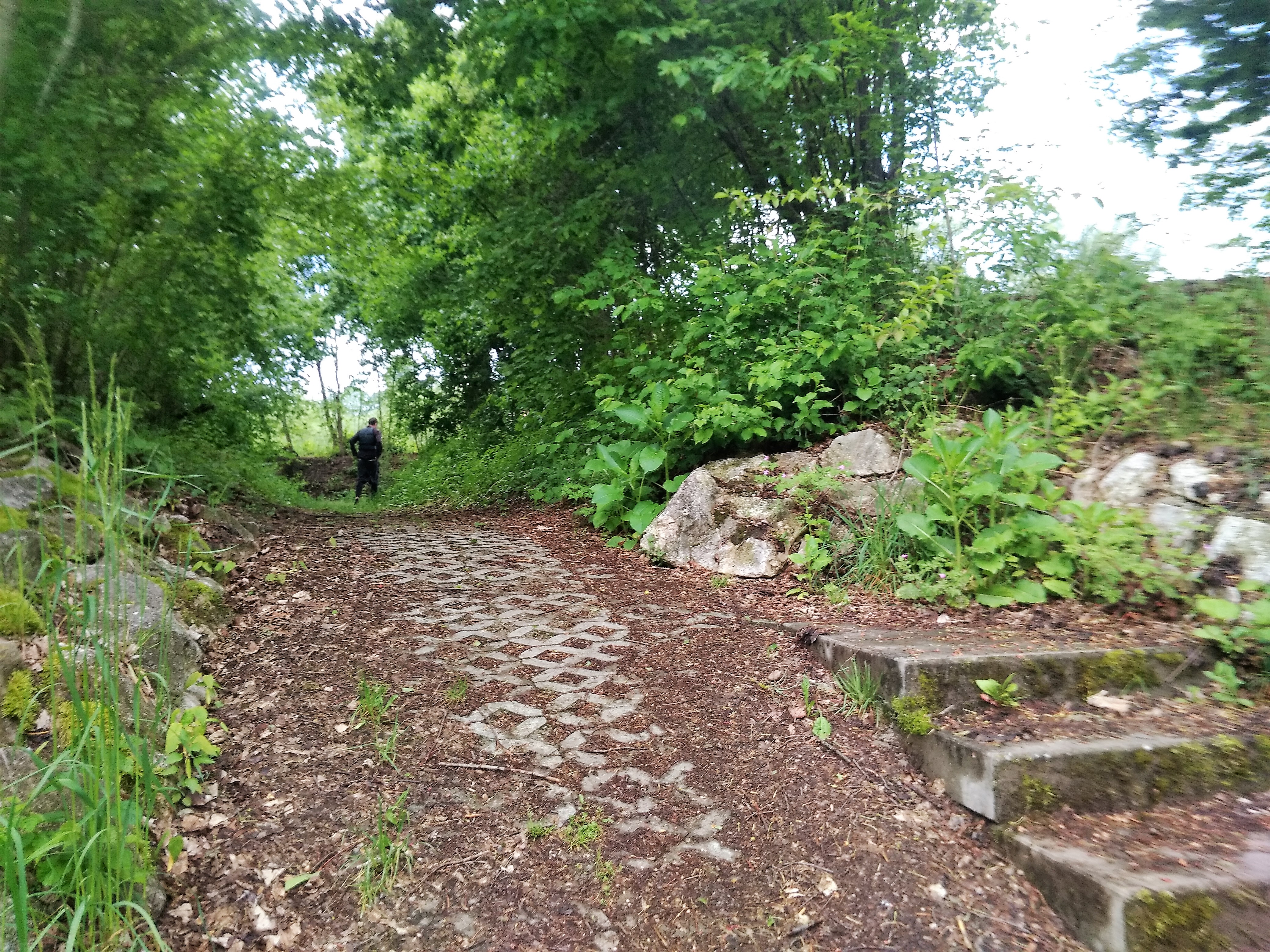
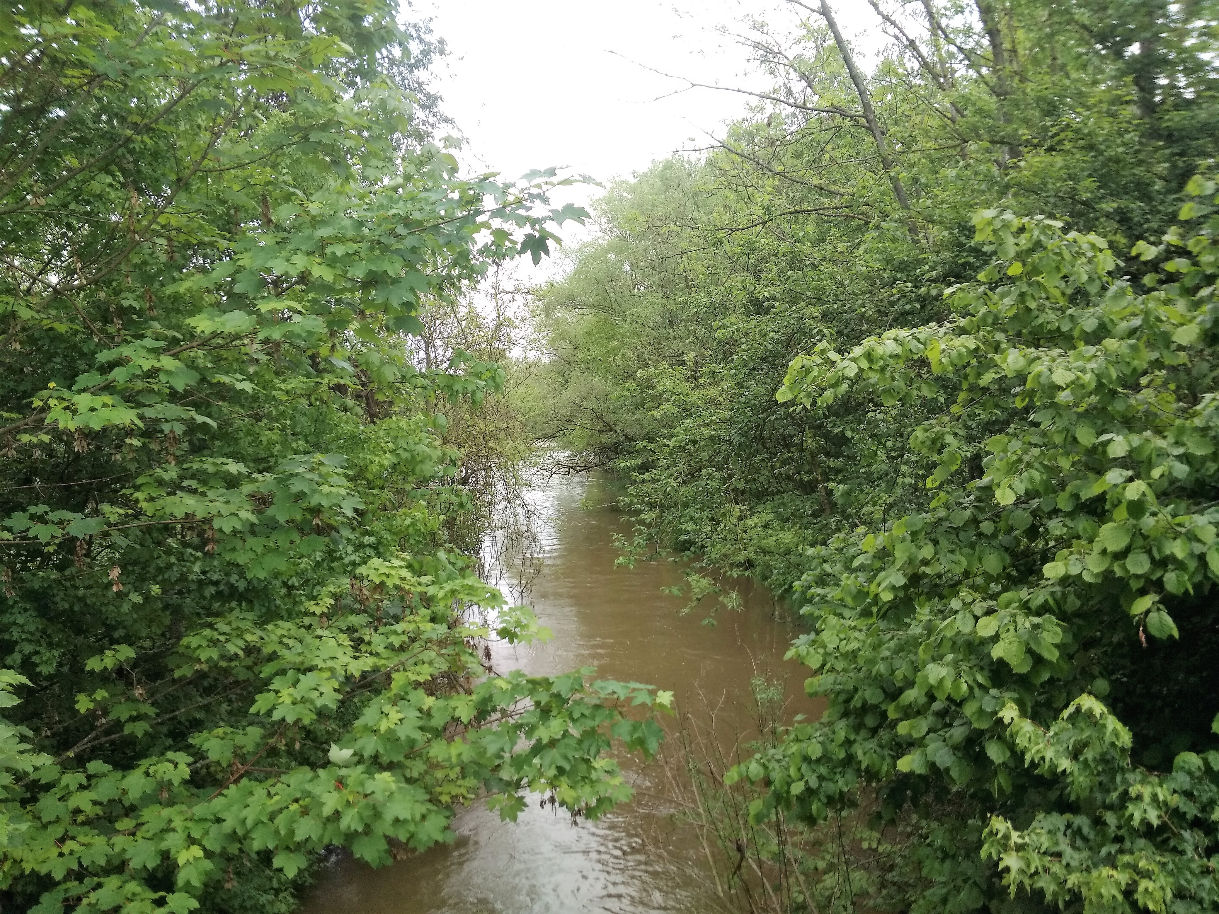
Our first – and fortunately last – weir of the day was the one near a town called Rottenacker. Through satellite images and online information, we’d figured out to get out on the right-hand shore and then re-enter a side-river (the Stehbach) before it re-connects with the Danube. On paper, it wasn’t hard.
But in the real world, we started looking for an exit point about 300 meters before the official exit point. Wherever on the right-hand shore, the water would be slow enough and the embankment not to steep would be our exit. We had no idea what elevated water levels would mean for the danger of the dam. We had no idea whether the official exit spot would be well-signed or merely interpretative yet again. I hate the saying, but in this case: better safe than sorry.
Now I should tell you that I spoke with my mom about floods and high tide on the river back in early April before I embarked on this trip. She said that paddling would be too dangerous with high tide. I don’t dispute that, but my experience now has taught me that what scientifically counts as a ‘flood’ doesn’t translate well to what is a ‘too dangerous’ river to paddle. River speed would be a useful metric for us boat people, but the app only gives the information of river “discharge” which is in cubic meters per second.
Landing at Nettle Harbor
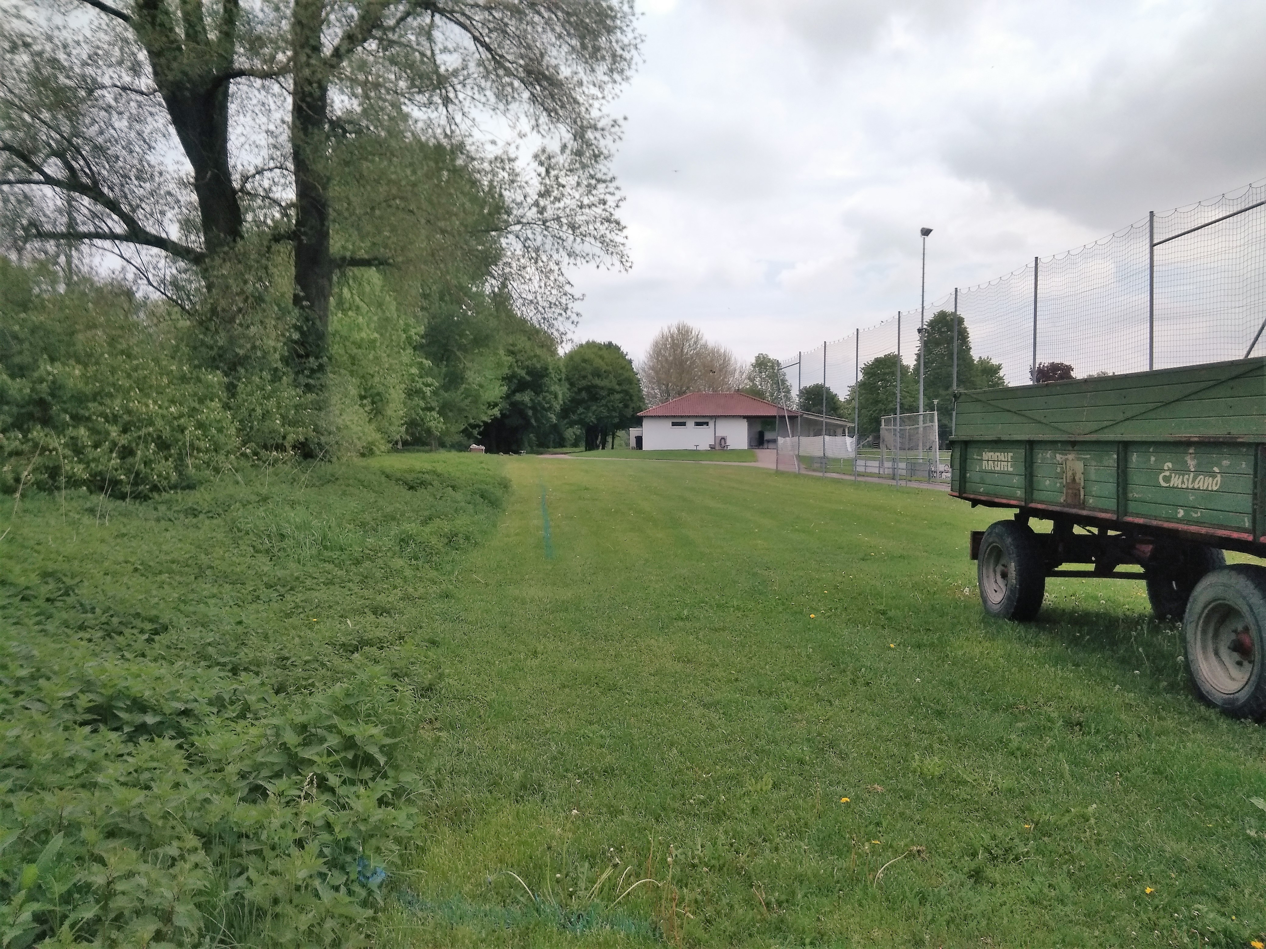
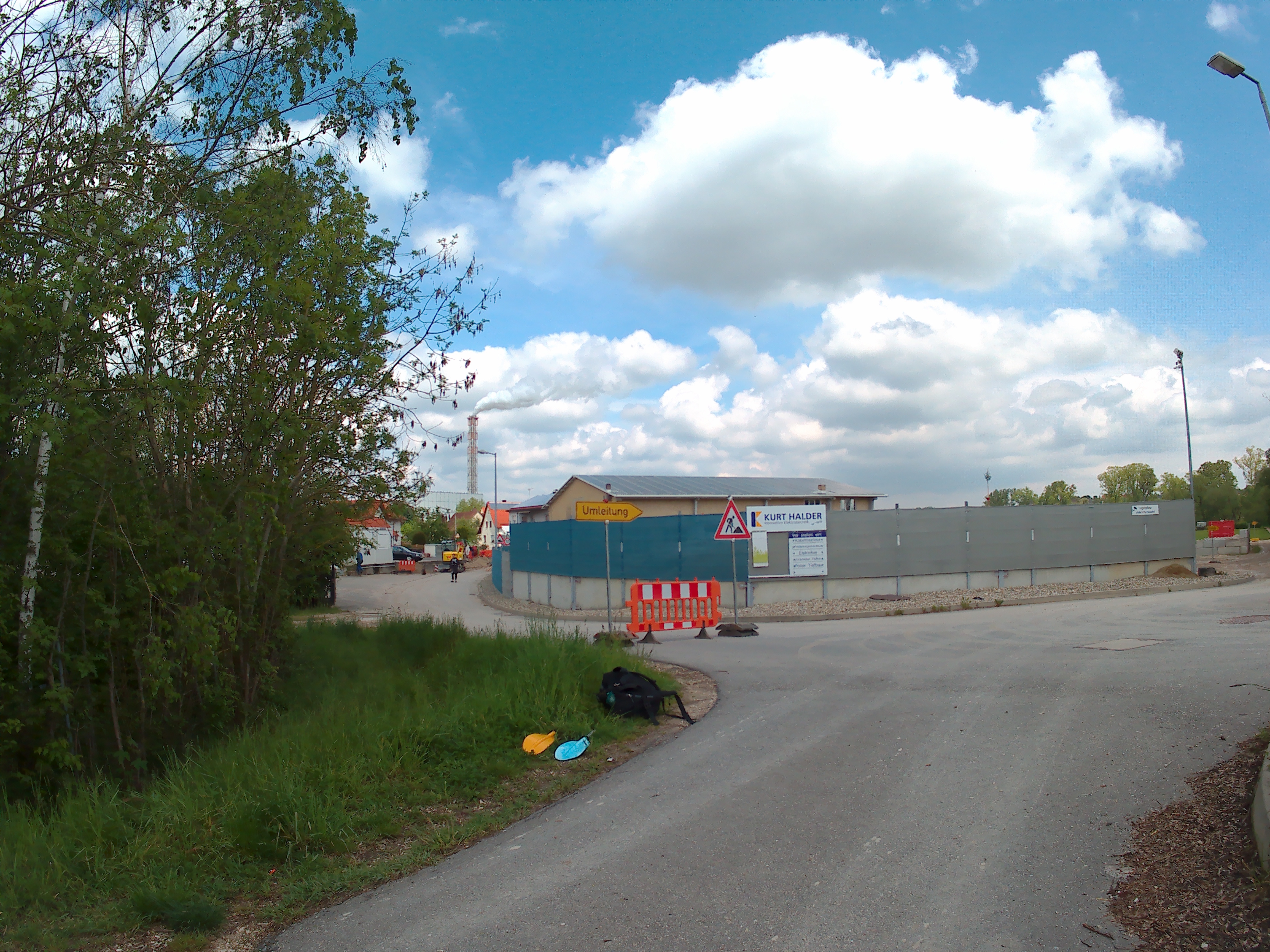
When we passed a little dammed-off part of the river on the right-hand side, we knew we’d arrived at the island where we had to get out. Our speed was quite fast and the right shore had many overhanging trees to ram into. Some 250 meters before the landing spot on our map, we decided to get out at a sheltered spot. But getting on land would mean plowing through a large amount of tall stinging nettles.
We discussed from inside the boat whether we should try somewhere later or really get out here. I wasn’t looking forward to being the first person to wade 40 meters through the forest of nettles to the nearest road. But paddling further and risking not being able to stop or backpaddle meant it was probably better to get itchy than injured.
I got out with my paddle and put the boat far enough ashore for Jonas to get out. Still, I couldn’t see the road from here… only more nettles and then the infrastructure for the Rottenacker football club. The nettles touched my skin through my leggings and set my skin on fire. I helped Jonas get out of the boat by pulling him up with his paddle, then I took his paddle and made a run for the road, looking for a way to get through, thinking I’d probably have to walk twice through the nettles anyway. That wasn’t very cash-money of me.
Fighting the Urge to Scratch
On the asphalt, I checked my legs and let the itchy-burning sensation take over. Jonas put the dry bags on his back and started pulling the boat all by himself. I used one of the paddles to squash the stinging nettles flat to make a path for him. The nettles were now flat and good to step on with our rubber-soled water shoes. I wish I’d come up with this idea to make a path by squashing the harmful plants earlier… It’s 11:50 in the morning, and it only took us a very short time and virtually zero paddling to get here.
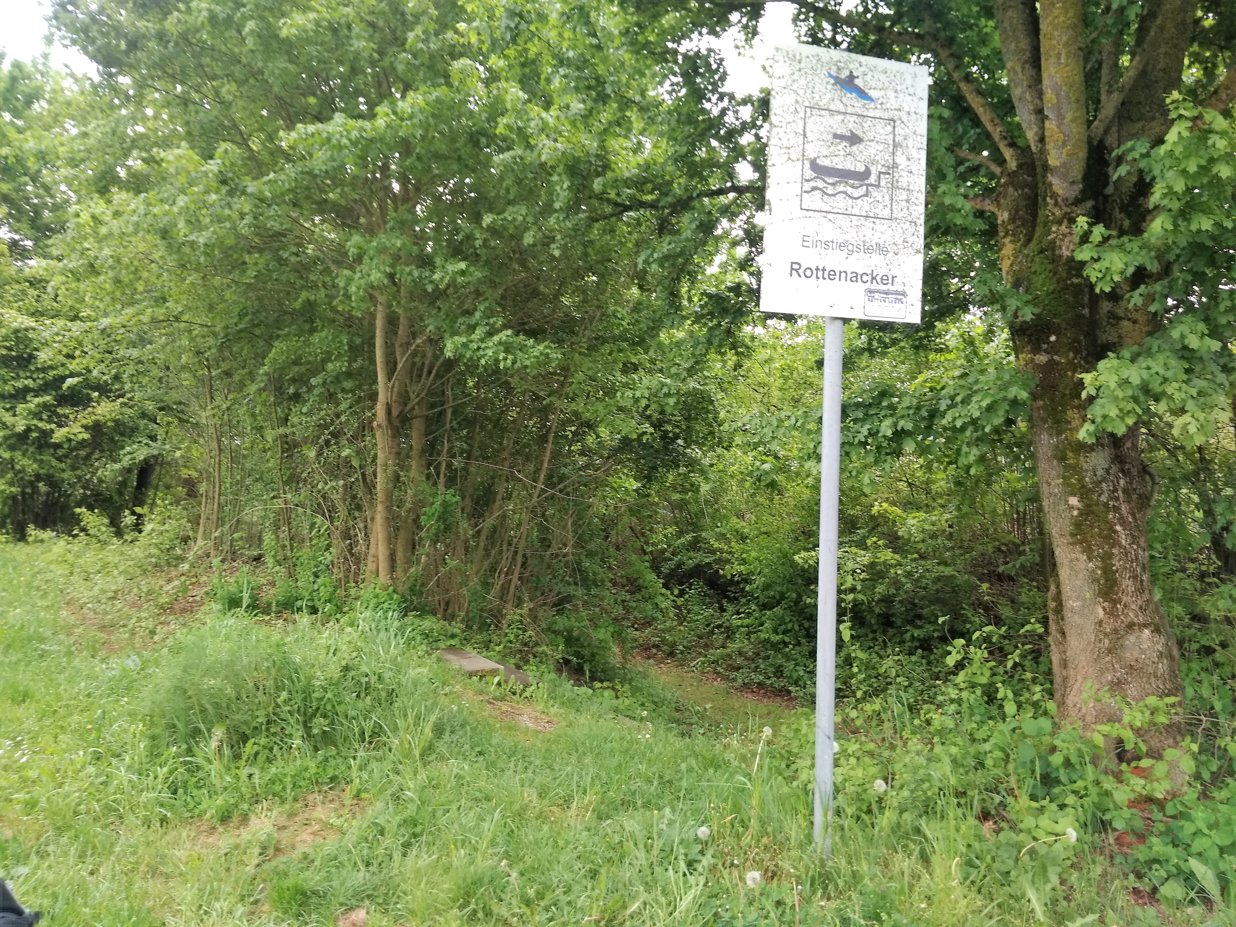
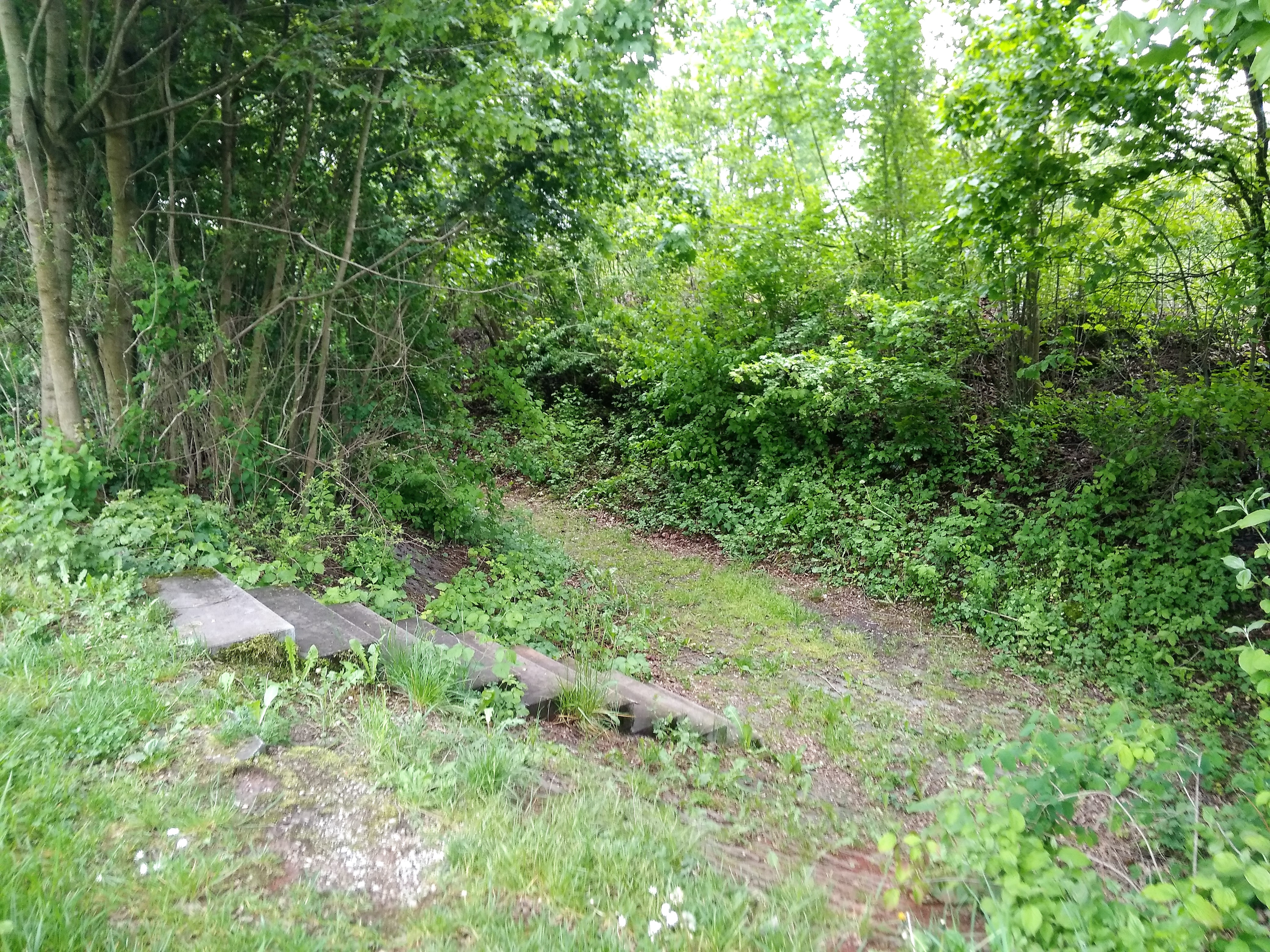
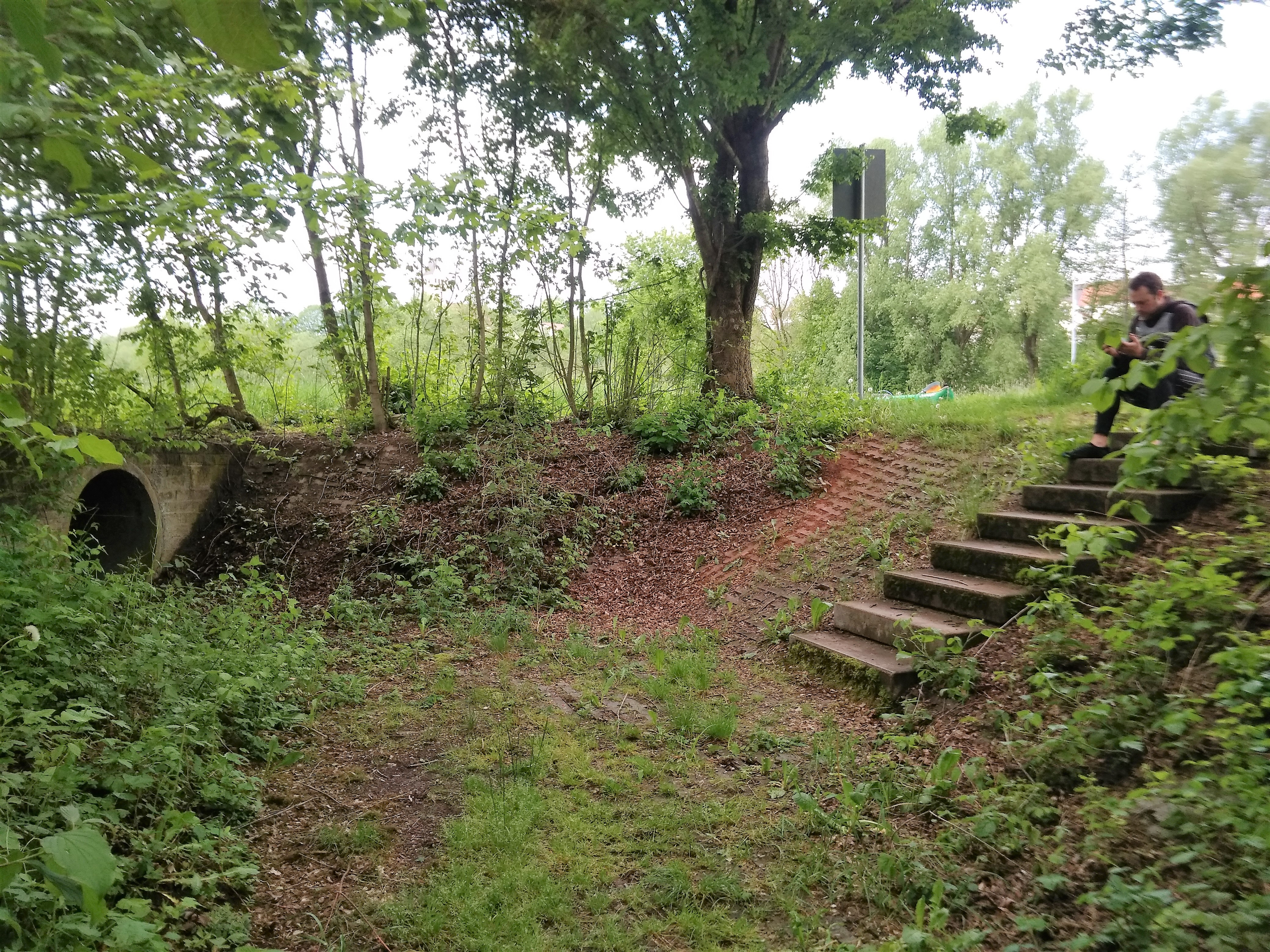
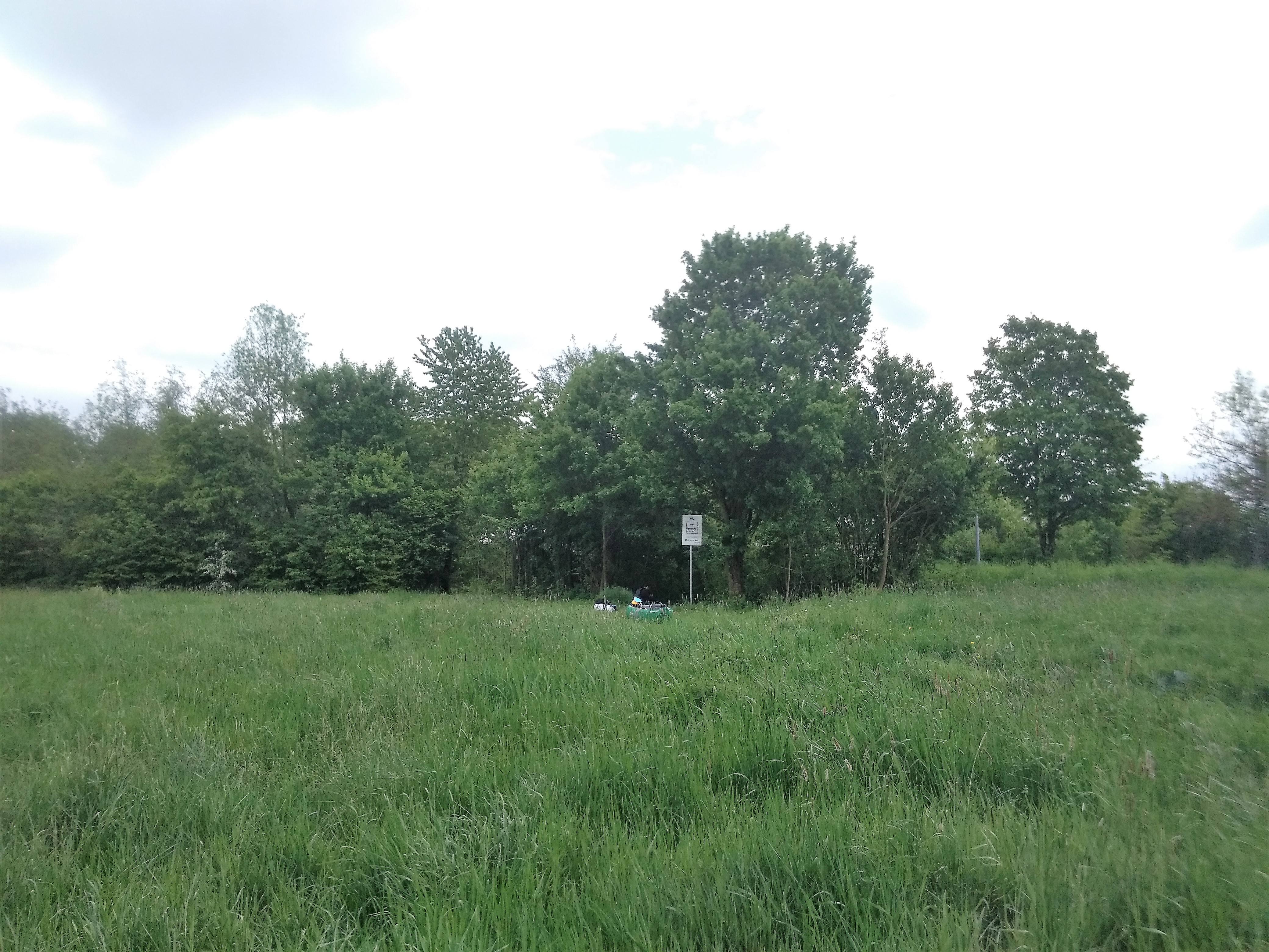
When Jonas got through, I put the CabinMAX on my back and grabbed the rear handle of the boat. We walked quite a bit before we took a break. The place where we had to relaunch our boat was 400 meters away from where we’d gotten out. We carried over our boat past an unofficial and unmarked spot that looked much better than our choice that also had a slow current. Too bad for our legs. We continued walking until we got to the sign saying “Enstiegstelle Rottenacker”. But it miraculously had no water in it. I decided to go for a walk to check out the spot where we should have actually gotten out before solving this mystery.
A Long Break in Rottenacker
The water levels were already going down on this stretch of the Danube. Very slowly. It was a sunny day and the distance was short, so it didn’t make sense to hurry our arrival at Dettingen. Dettingen can wait.
I walked around to the official exit spot next to the parking lot of the football club. A guy sat in his car. Another guy was in a different car a bit closer to the tennis courts. It looks like a great place to do some drug deals or generic crime.
The official Umtragestelle exit spot also looked not bad. It would have been a bit more difficult to land there. I marked the actual location on my OSM map to help other paddlers later. The unlabelled spot that was currently marked as “Ausstieg Rottenacker” was definitely too close to the edge.
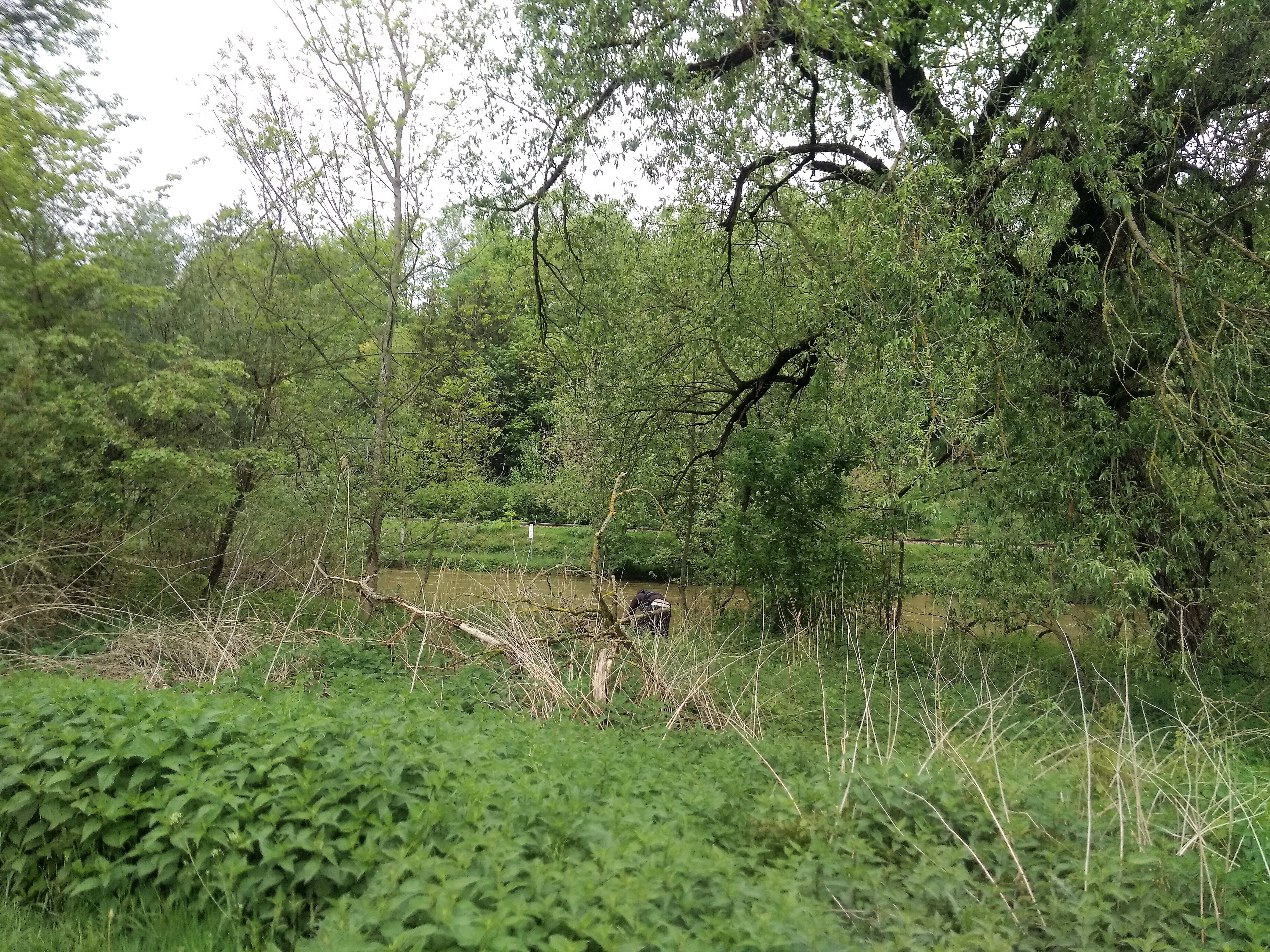
I walked back to Jonas, who told me he had found the Stehbach river just 50 meters down the dry path. It turns out there was a really nice infrastructure right around the corner with some more stairs leading down to the skinny river. But Jonas felt quite exhausted now, so we decided to have a break here. I take this time to walk to the dam to take some photos and see what the confluence of the Stehbach and the Danube looks like.
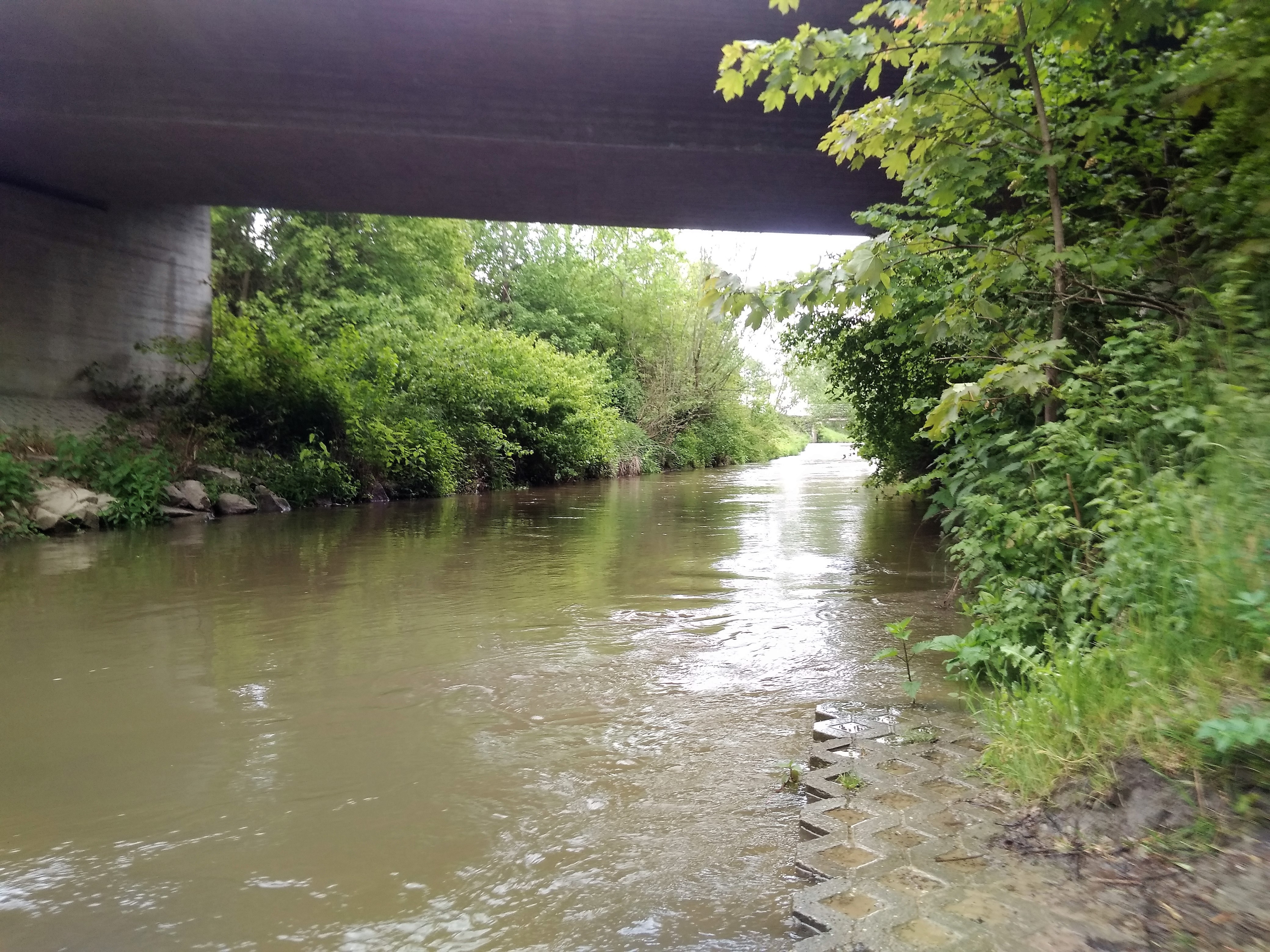
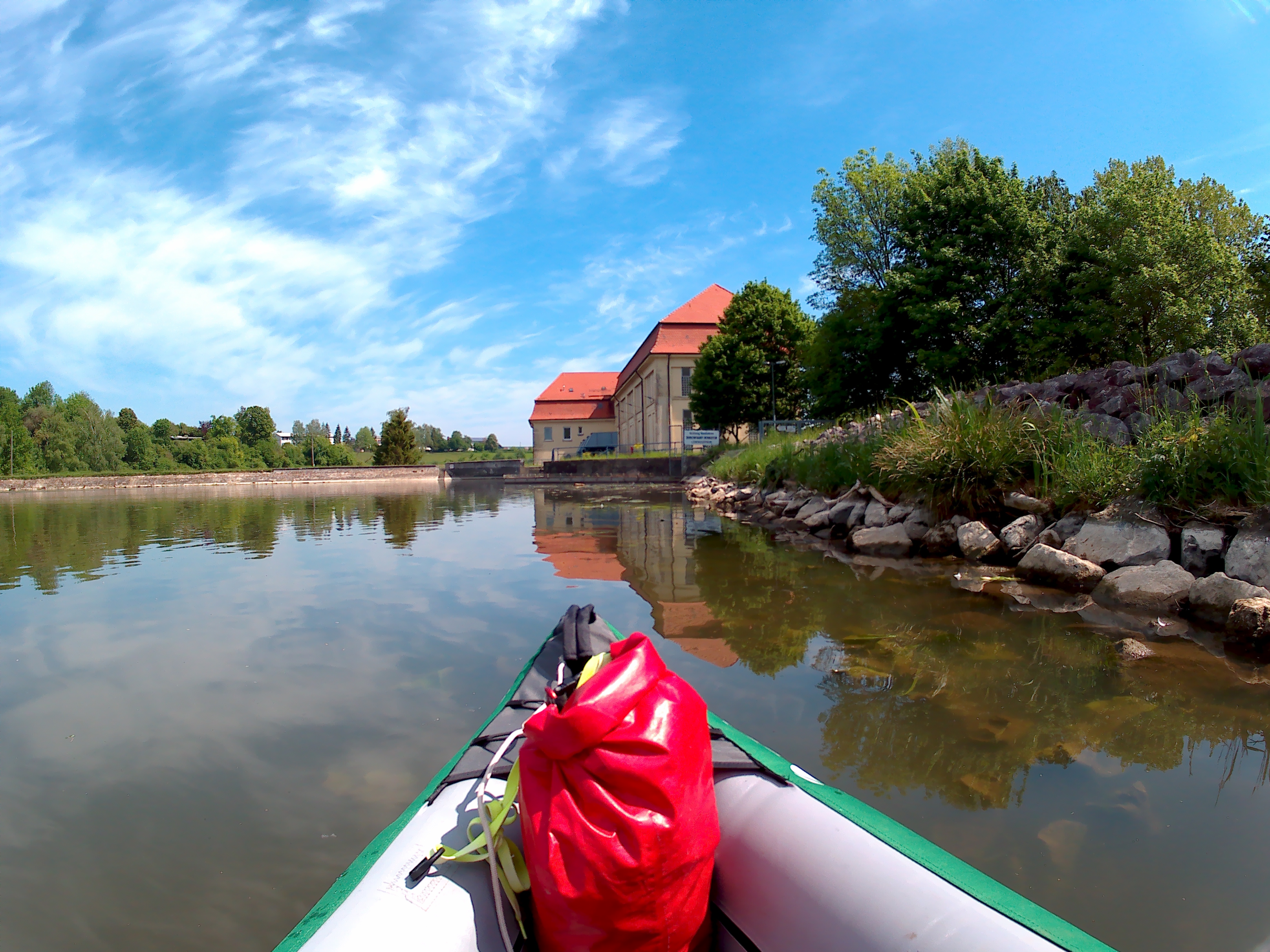
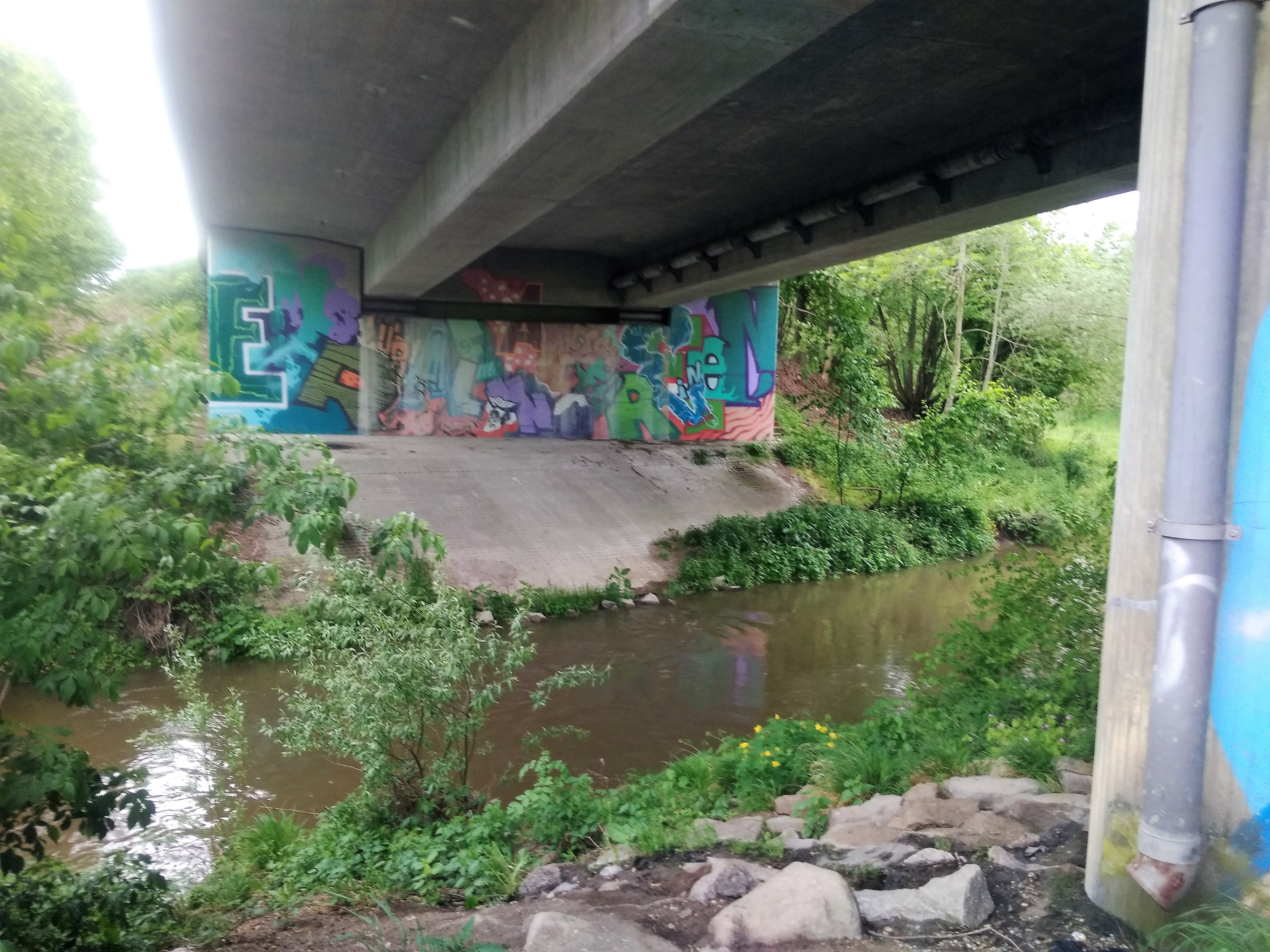
Rottenacker Hydroelectric Power Station
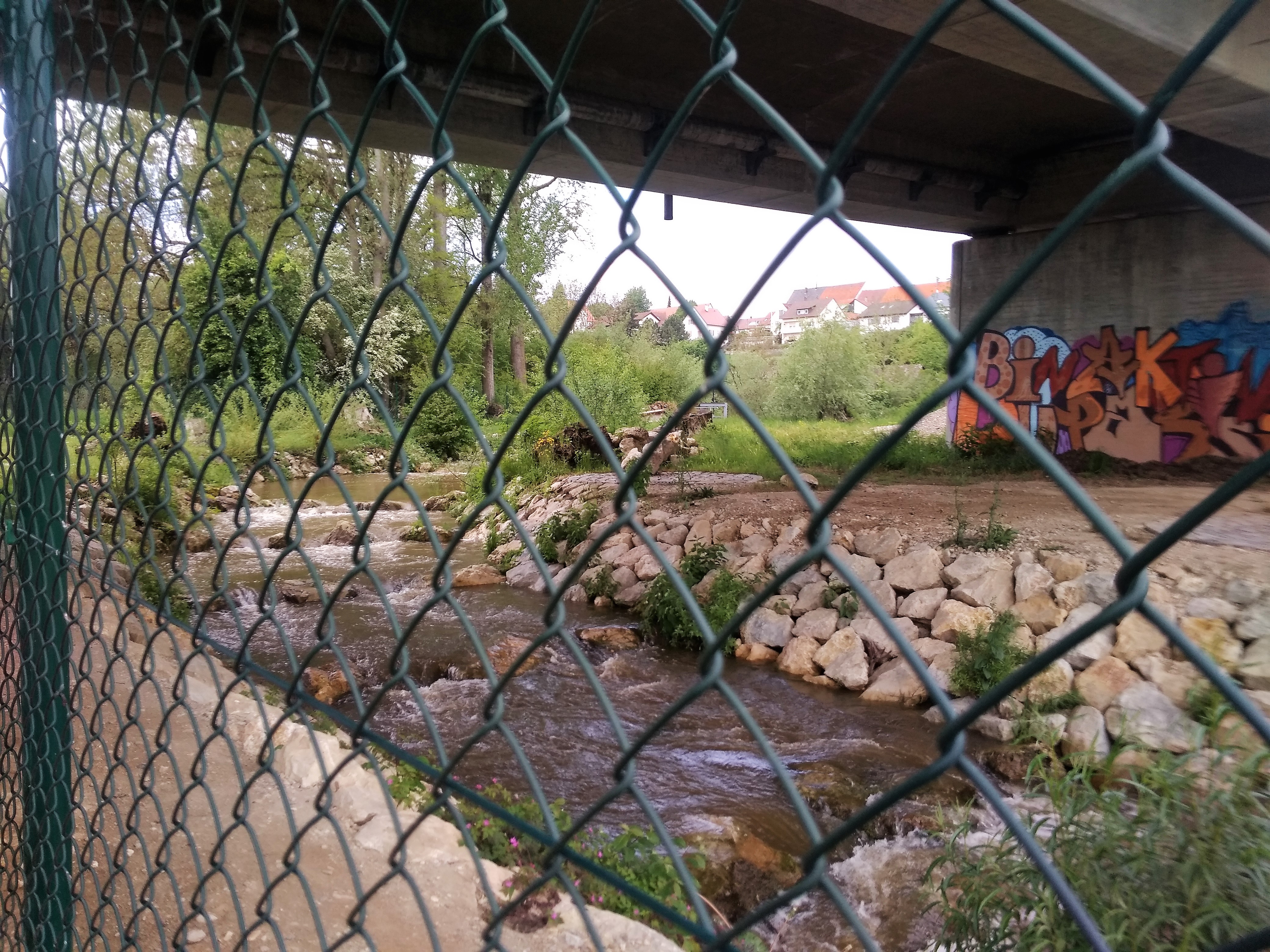
Rottenacker has a very prominent Wasserkraftwerk, or hydroelectric power station. We could hear its water falling from the river and the shore, but hadn’t sighted it yet. I walked via a path parallel to the Stehbach and the Danube under a bridge to see the thing for myself. First I spotted the fish ladder, then the dam itself. It’s a big one!
I continued down another path to look closer at the danger. Had we dropped off this weir, we would have probably survived. Perhaps we would have even stayed upright with our canoe. But I’m really happy that we’re portaging around as it would probably be painful nonetheless. Also, this trip is not about surviving. It’s about our enjoyment of kayaking.
[Edited to add: Today I learned that this is actually incredibly dangerous if you fall out of the boat. I’ll publish some links to someone who can explain the danger of the back currents better at some point.]
I followed the path up till it joins a bigger road that’s a bridge over the Stehbach and the Danube. This Wasserkraftwerk looks pretty cool. I walked onto the bridge to see if I could spot the confluence of the two rivers. I somewhat saw the confluence. It didn’t look like a problem or danger zone to me. Just a rough patch of small standing waves and a few ‘white horses’ that make scary sounds but are harmless. A proverbial rough patch.
My trip proved useful, so I returned to Jonas. With some food, I showed him the pictures of the situation up ahead and shared my positive and confident judgment. Now we could finish this day and paddle on to Dettingen.
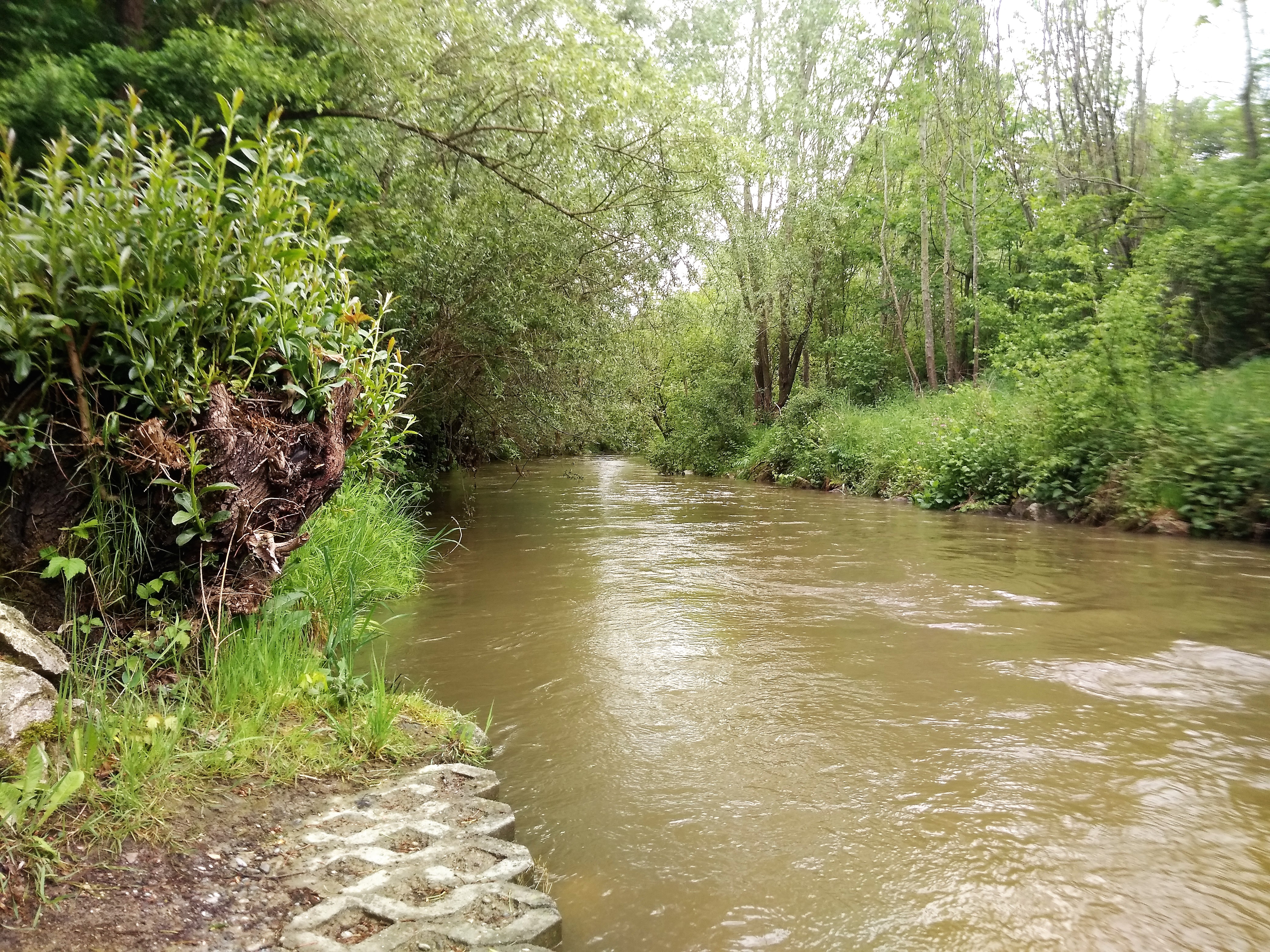
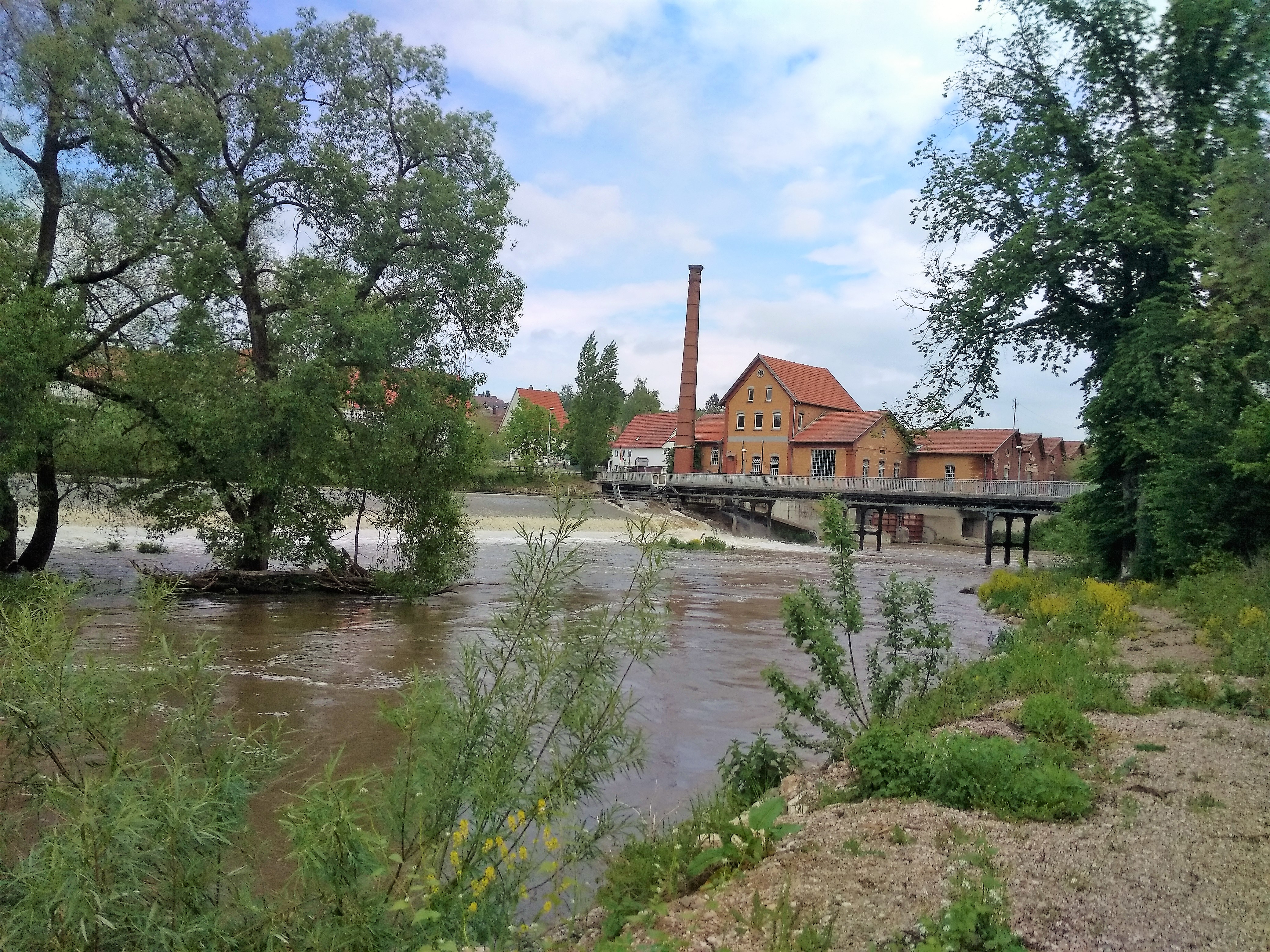
The Confluence of the Stehbach and the Danube
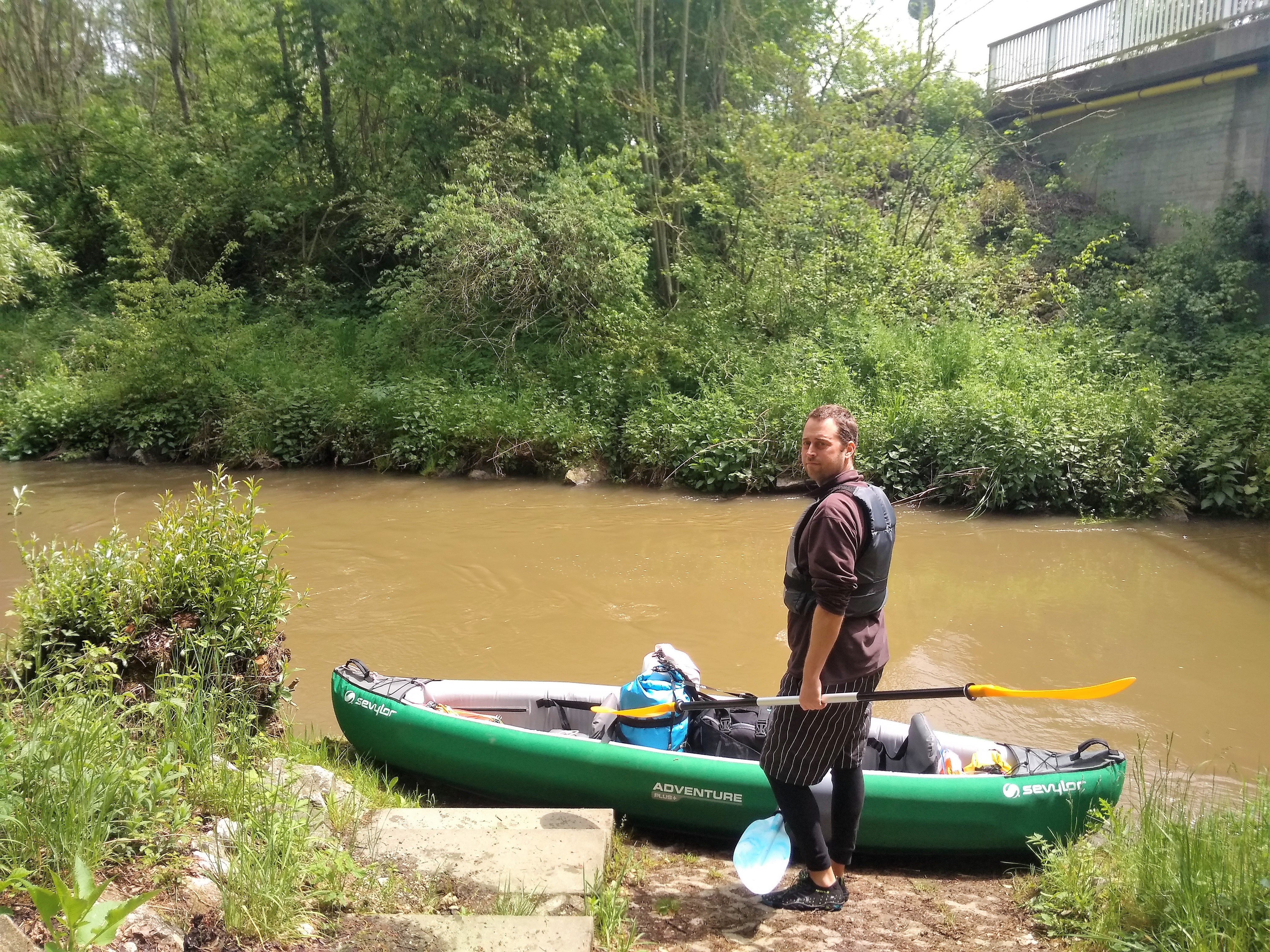
We moved our boat down at the water level and strapped our luggage in. The Stehbach had quite some overhanging trees that we’d need to dodge. I got into the boat first and Jonas second, and off we went.
On such a skinny river it was hard to dodge the soft tree branches. Especially at our speed. At the confluence, we had to swing to the left to avoid the big trees on the right embankment. Some paddle work and then we again were on the Danube.
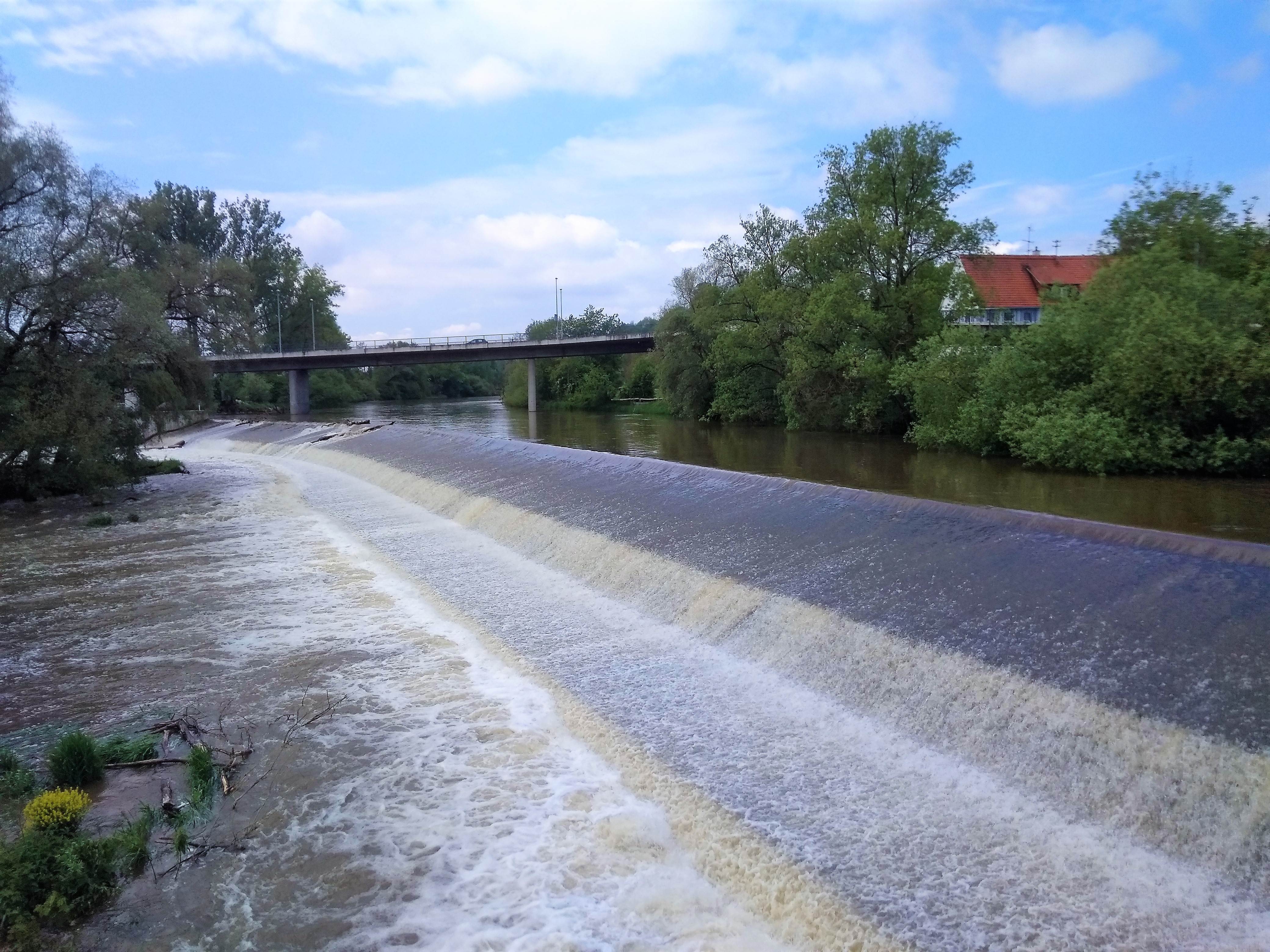
We came across a couple of more shallow patches of water, where the swollen river would bump over and cause choppy waves or standing waves. We passed under a bridge that showed the whirlpool effect of the pillars very well.
Arriving in Dettingen
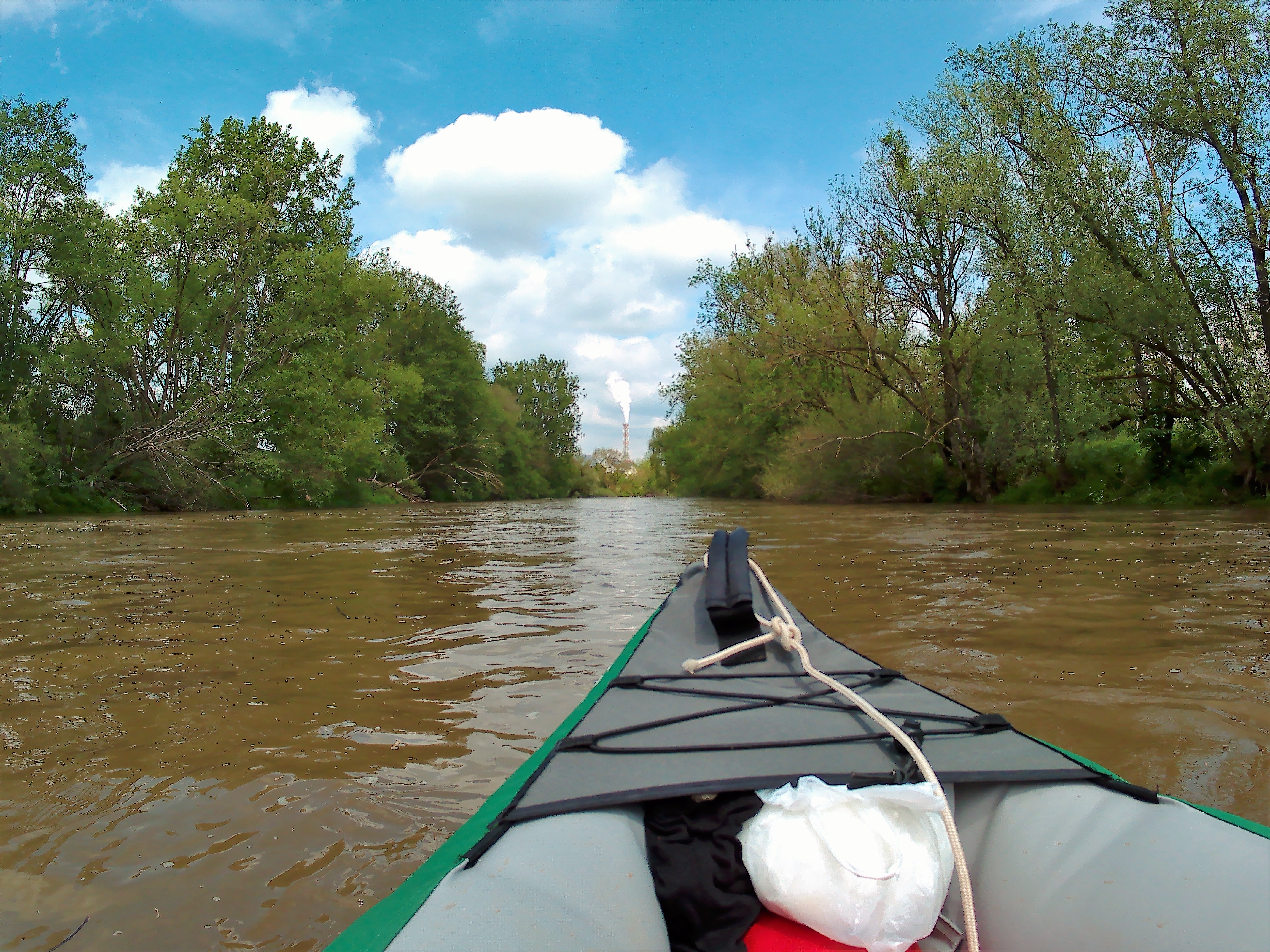
It felt like we’d just gotten back into the boat when a river bend showed us the big steaming industrial tower of Dettingen. I checked again with my map, but it just confirmed that we’d arrived at our destination for the day. We’d later learn that the industrial tower is from the paper factory in Dettingen.
Now we had to land our boat. Though not as urgent as before the weir, we did want to exit as close to the bridge as possible. From there, we’d only have to walk 300 meters to hotel Knupfer.
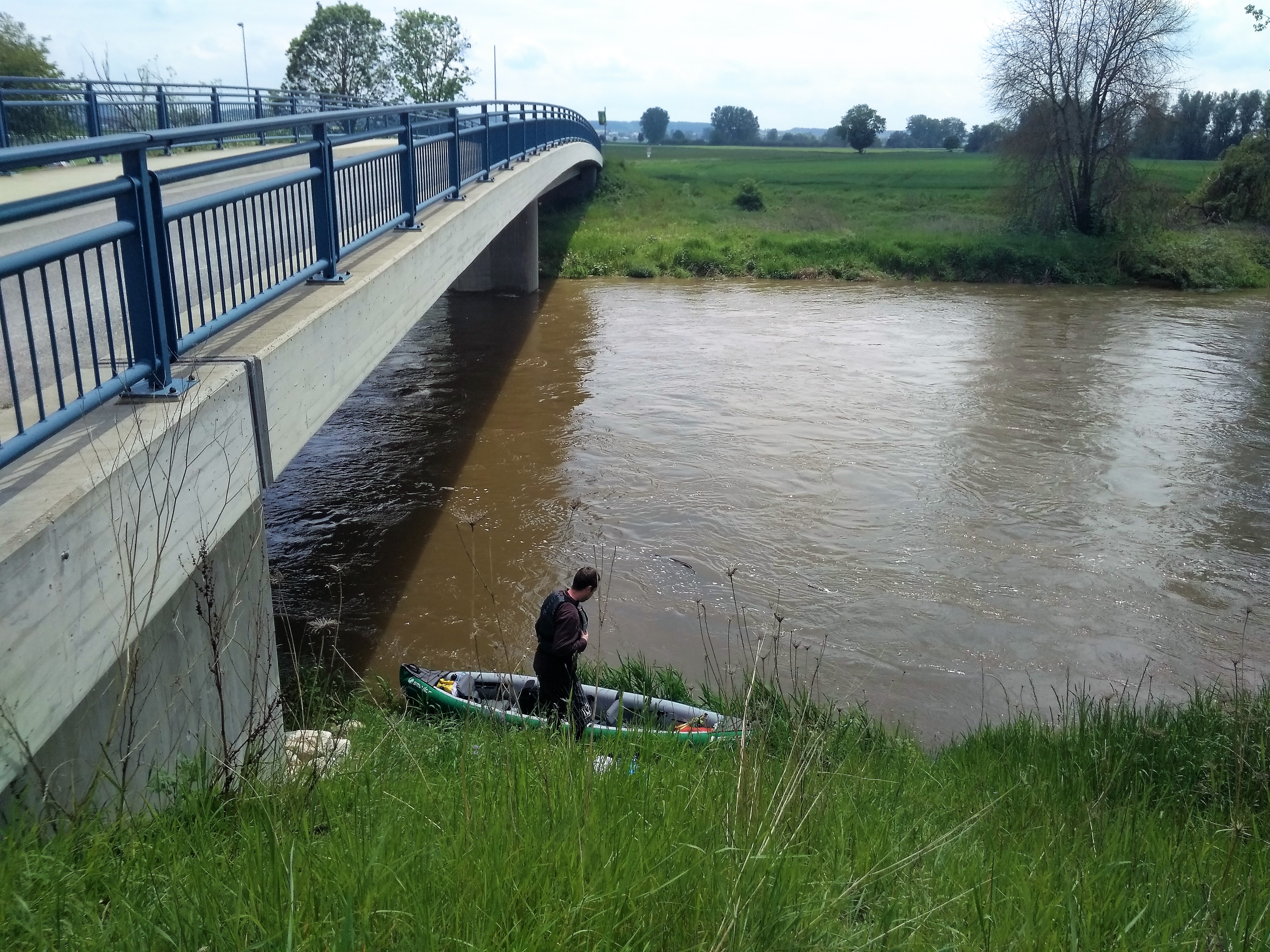
At the bridge, we prepared to land our boat on the left shore. The left side featured Dettingen, and the right side a village named Berg. Berg has a water level monitoring station (Pegel). We turned our boat around and paddled against the stream to land as close to the reeds as possible. No stinging nettles here. Great!
But the embankment was very steep. I first got out of the boat, then helped Jonas get closer to the shore by asking him to divide his weight by lying down. I pulled the boat closer onshore and he went ashore without trouble or wet feet. Now I walked up the steep embankment with the paddles while Jonas got the luggage out. Walking the embankment back down was more tricky than up. The second run I brought the CabinMAX up and Jonas brought the dry bags. Together, we pulled the boat up from the water level.
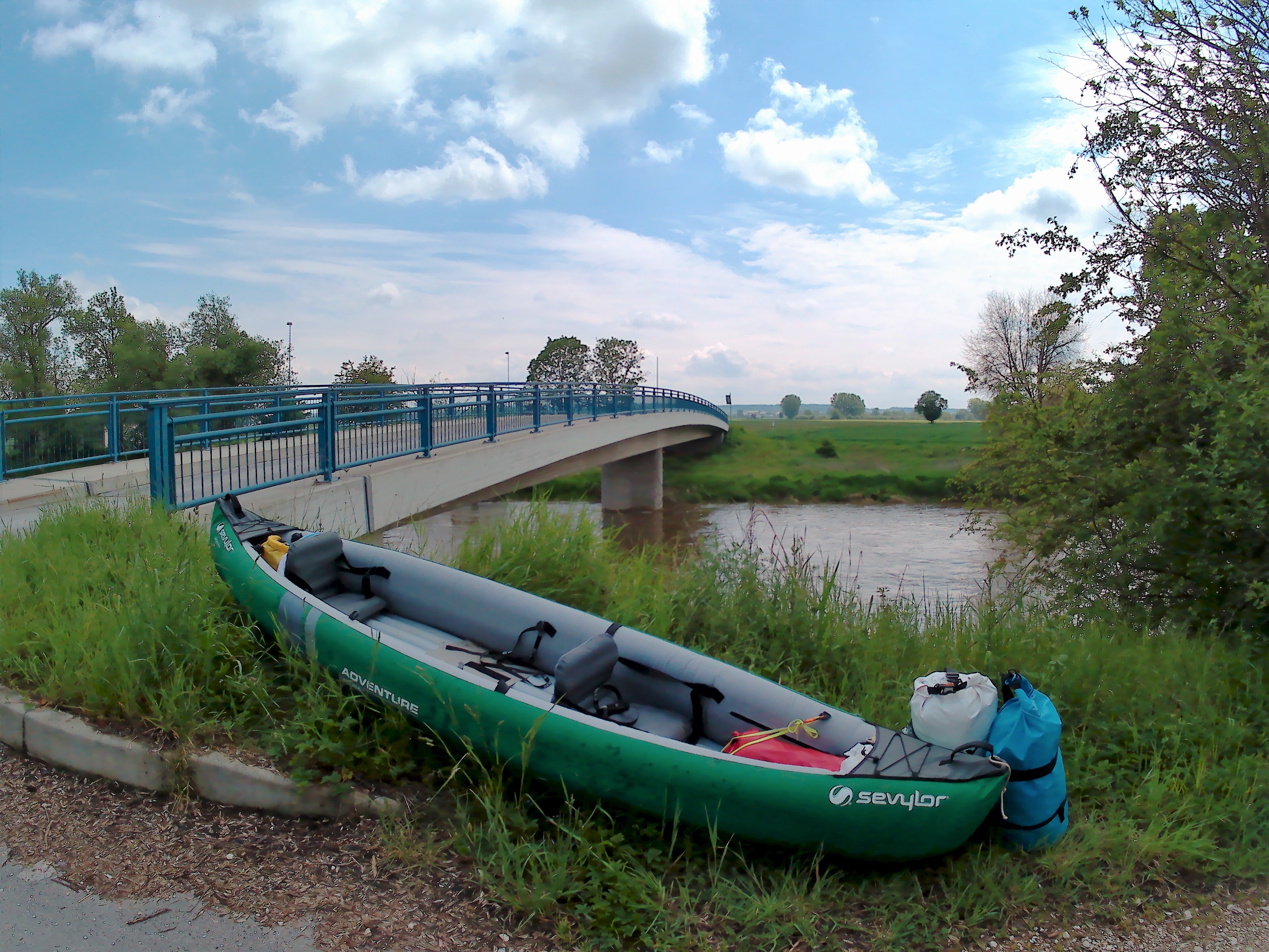
We harnessed the power of the sun to dry our boat while we ate a sandwich and rehydration session next to the road. I checked out a spot on the other side of the bridge to start our trip from to Neu-Ulm two nights from now. A large bunch of cyclists used this bridge in the time we spent waiting for our boat to dry and calmly packing up our stuff.
Dettingen and Ehingen
Once we checked in and put our kayak in the garage of Hotel Knupfer, we wanted to eat something. There was a shopping mall nearby on the road between Dettingen and Ehingen. Ehingen is kind of the big city in this district before Ulm and Neu-Ulm.
We visited the shopping mall to eat some Asian food, but they were already closing. I did find a potential boat mirror for Jonas in one of those shops that sell a lot of plastic items. The large shopping area also had an Intersport nearby, where I found a replacement buckle for my personal dry bag and some storm lines for our tent and to use as a boat leash on the backside of the boat.