—Snorkeling and Urban Exploring from Mahébourg")


 to Travel")


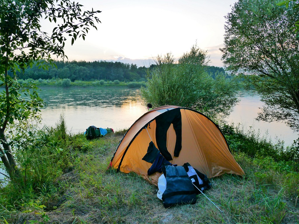
This story is about us when paddling our inflatable canoe from Sigmaringen to Mengen on the 20th of May, 2019. The total distance was 16.1 kilometers. Our original plan was to kayak to Hundersingen, some 4.8 kilometers after Mengen – a total distance of 20.9 kilometers – followed by a train ride to Munderkingen. We had a permit to go from Sigmaringen to Hundersingen, after which the river becomes a natural protected area until Munderkingen.
Click here for information on how to get a permit to paddle this stretch of the Danube.
Want to travel the (entire) Danube River in an adventurous way? Join our Facebook group Danube River Source to Sea: Kayak / Canoe / Bike / Hike / Sail to find your community
Contents
- 1 The Second Permit
- 2 Leaving the Holiday Home (Monday 20th of May)
- 3 Bus Ride to The Launch Spot
- 4 A Lot to Unpack
- 5 The Sigmaringendorf Dam
- 6 The Situation in Scheer
- 7 The Dam from Hell
- 8 Getting Stuck and Finding Help
- 9 Dam Number Four
- 10 Shallow Waters
- 11 Weighing the Choices
- 12 Calling it Quits
- 13 Train Ride to Munderkingen
- 14 Please Share this Story on Social Media!
The Second Permit
Jonas learned that we needed yet another permit for the stretch of the Danube between Sigmaringen and Hundersingen. The area between Hundersingen and Munderkingen is yet again a natural protected area. Plot twist: you can kayak that bit, but only after the bird breeding season is over after the 1st of July. It’s late May but somehow we’re still too early.
On the Friday before paddle day, we went to the tourist information in Sigmaringen to get the permit in person. A friendly lady who really seemed to know everything about the rules surrounding the river arranged the whole thing in under 10 minutes. A good experience. €5 paid in cash and we got the print out we could show eager… river regulators? I’m still not quite sure who are the guardians of the Danube in the state of Baden-Württemberg.
We got the permit for a specific date (20th of May) and now we knew we had to paddle that day – rain or sunshine.
Leaving the Holiday Home (Monday 20th of May)
In the morning of the 20th, we were pretty well prepared to leave the Ferienwohnung (holiday home) we spent a week at. I was very ready to leave. We got dressed, had some coffee, cleaned a few things, and then did the final packing. Our landlady came by one last time to say goodbye to Jonas. I was too busy packing to get tangled up in small-talk.
Jonas told me that the weather prediction had changed from “Definitely a thunderstorm on your path” to “Just some rain showers”, which made us very happy. I decided not to put on my down winter jacket as the temperature was above 10°C and it would probably just get wet. Though weak, the wind would also come from the right direction (from west/north-west) to add to our speed.
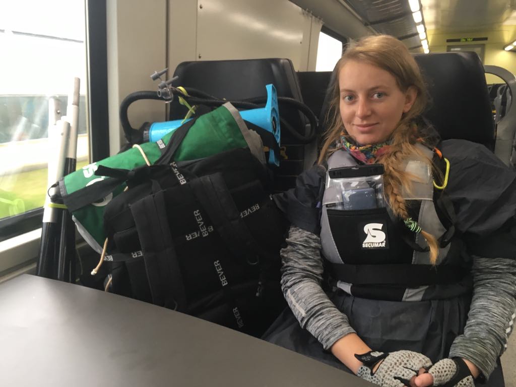
We picked up the fully prepped kayak backpack from the garage and ran into the landlady’s enforcer one more time. He did offer to drive us near our kayak spot, but we’d made up our minds already to take the bus.
Bus Ride to The Launch Spot
We were already wearing our ponchos. A fine drizzle accompanied us while waiting for the bus at 8:30 in the morning. Jonas got into the bus at the front. I waited some more outside in the rain until the driver opened the back door so I could get in with the kayak backpack and the paddles. It wasn’t a long ride to our stop at the Burgstraße bridge.
We hiked the familiar path to our anticipated launch spot. We’d spotted one a short distance before the Pegelhäuschen (little water level measuring house) that looked very promising on a sunny day. We walked it down and then changed our minds about the spot. We could walk back up the stairs to go to the spot next to the Pegelhäuschen, or walk next to the water to get to the same spot. I miscalculated how far away the spot was, so we walked through the tall wet grass to the other spot.
By the time we arrived, my leaky boots had soaked up so much water. My socks were completely soaked. I could feel the cold water sloshing around the boot. A disgusting feeling.
A Lot to Unpack
At our spot, we had a tough time readying our kayak. The right-side air chamber seemed to have popped back into its shitty unbalanced position. I’d forgotten to put back the tiny SD-card into my tiny action camera. The fixed buckle of my dry bag broke again. My shoes and socks were wet and wouldn’t dry on such a cloudy and rainy day.
The river was nice and full and flowed very swiftly. I was generally very excited again to get paddling, though I didn’t feel very fit. That’s because I’d eaten my last hot meal on Saturday evening. The whole Sunday I’d been eating (delicious) cold sandwiches. The previous paddle days, I’d always made sure I’d eaten a big steamy meal the evening before. We couldn’t buy food on Sunday because Aldi was closed. I hate Sundays.
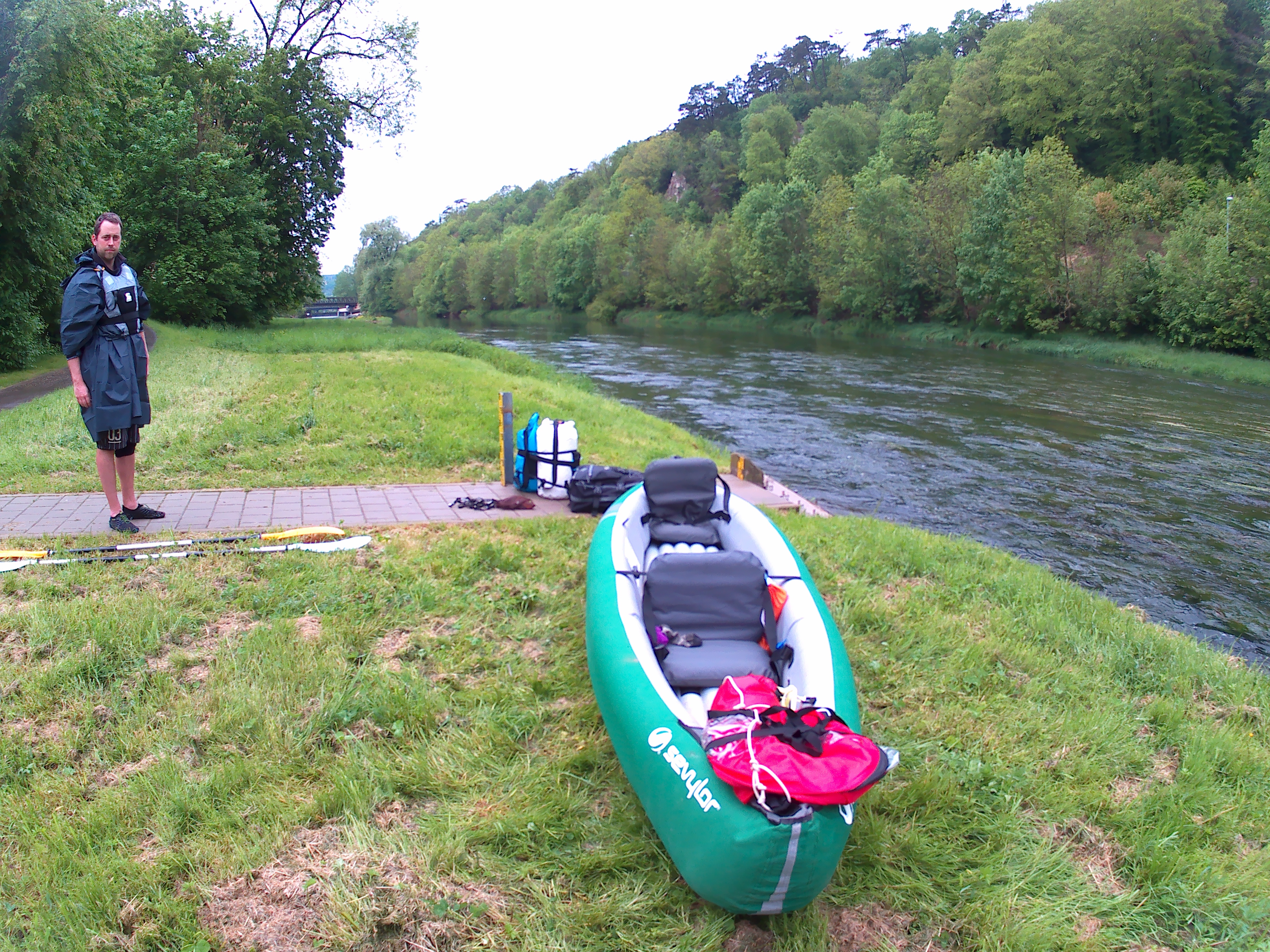
We had to deflate and reinflate the boat a couple of times before we got it right. We did waste a lot of time on this and the other tiny fuck-ups despite our levels of preparation. At 9:45, we finally put our boat in the water. We decided to change things up a little, so Jonas got in first, and I got in second. The strong current gave us a nice push to start our 22-kilometer day followed by a train ride to Munderkingen. We knew it would be tough. We knew what we signed up for.
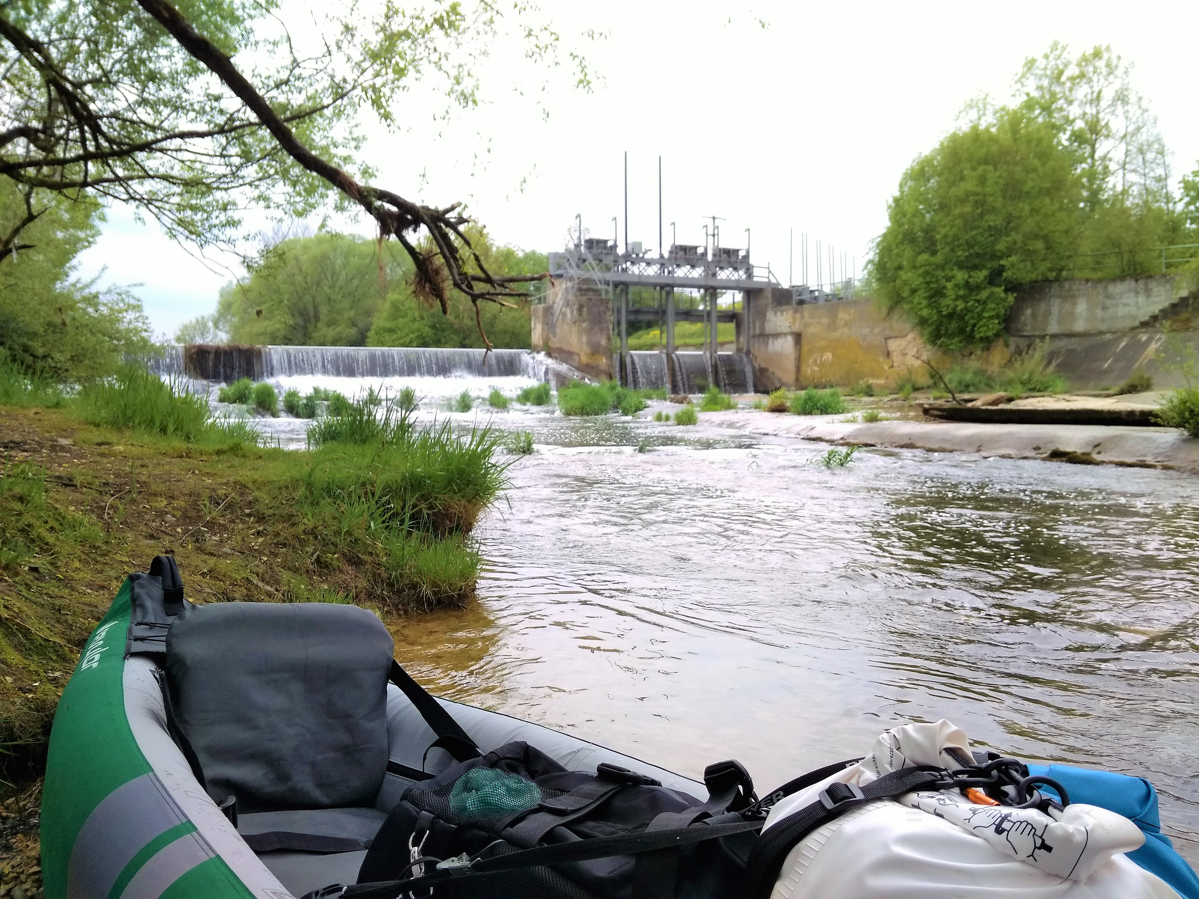
The Sigmaringendorf Dam
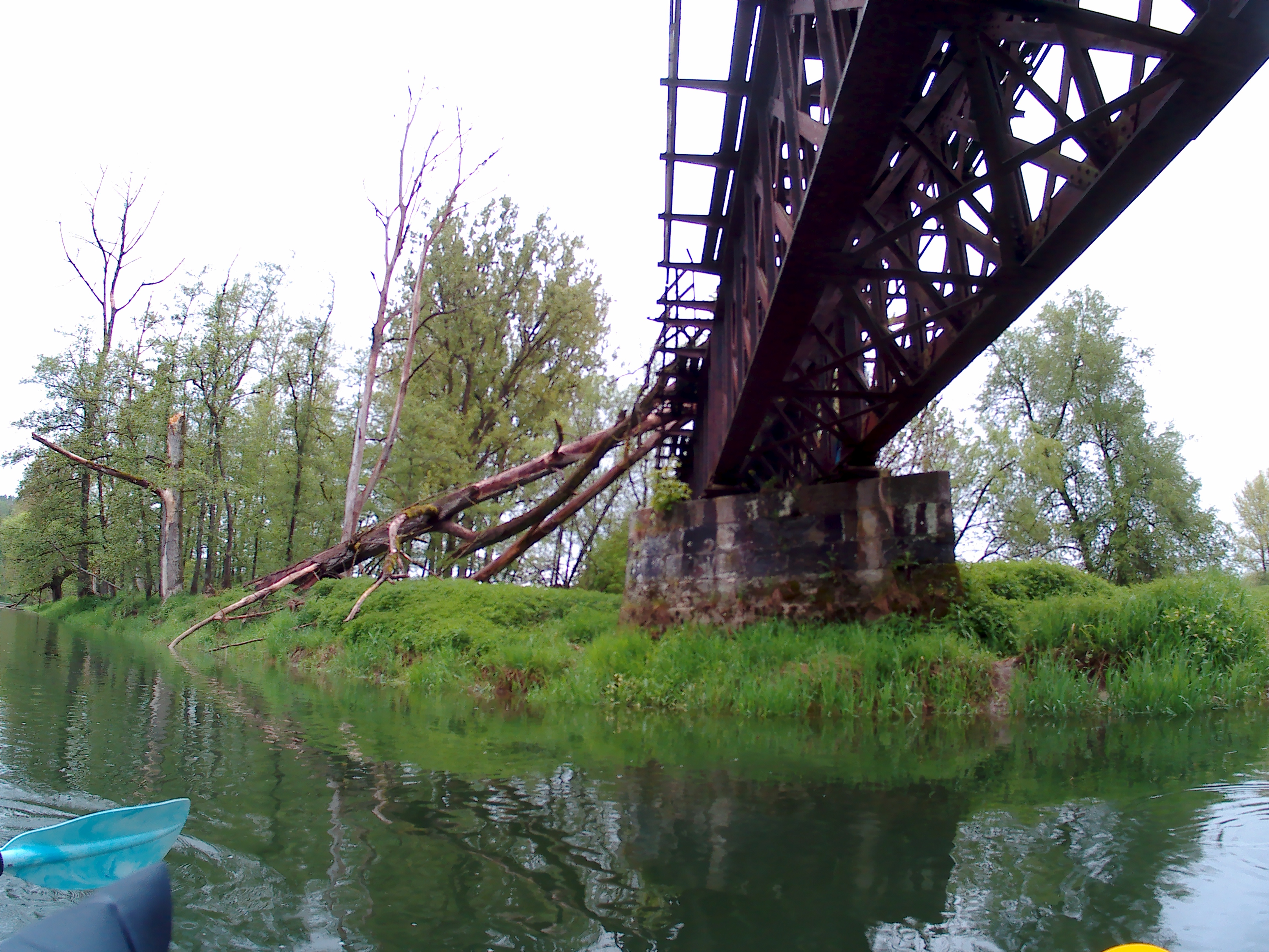
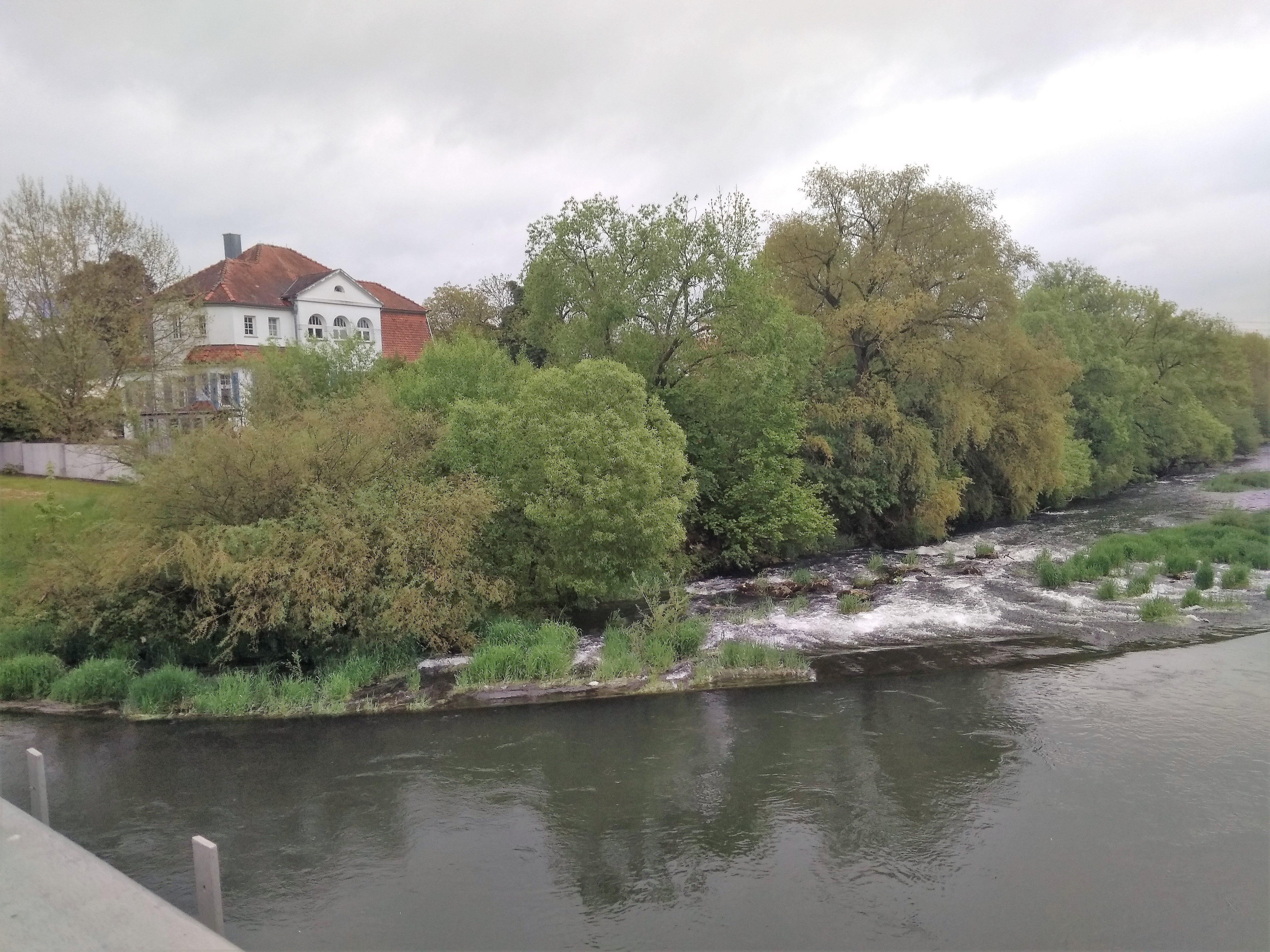
We passed a spectacularly damaged train bridge on the way to Sigmaringendorf. From the flyer we received at the tourist information office in Sigmaringen, we knew there would be a dam in Sigmaringendorf some 6.5 kilometers from our starting point. This dam wasn’t on our offline map. As we didn’t have unlimited internet in the week before, we hadn’t looked on Google Earth to see exactly where this dam is at. Jonas’ guessed that the dam was right after the main bridge in Sigmaringendorf.
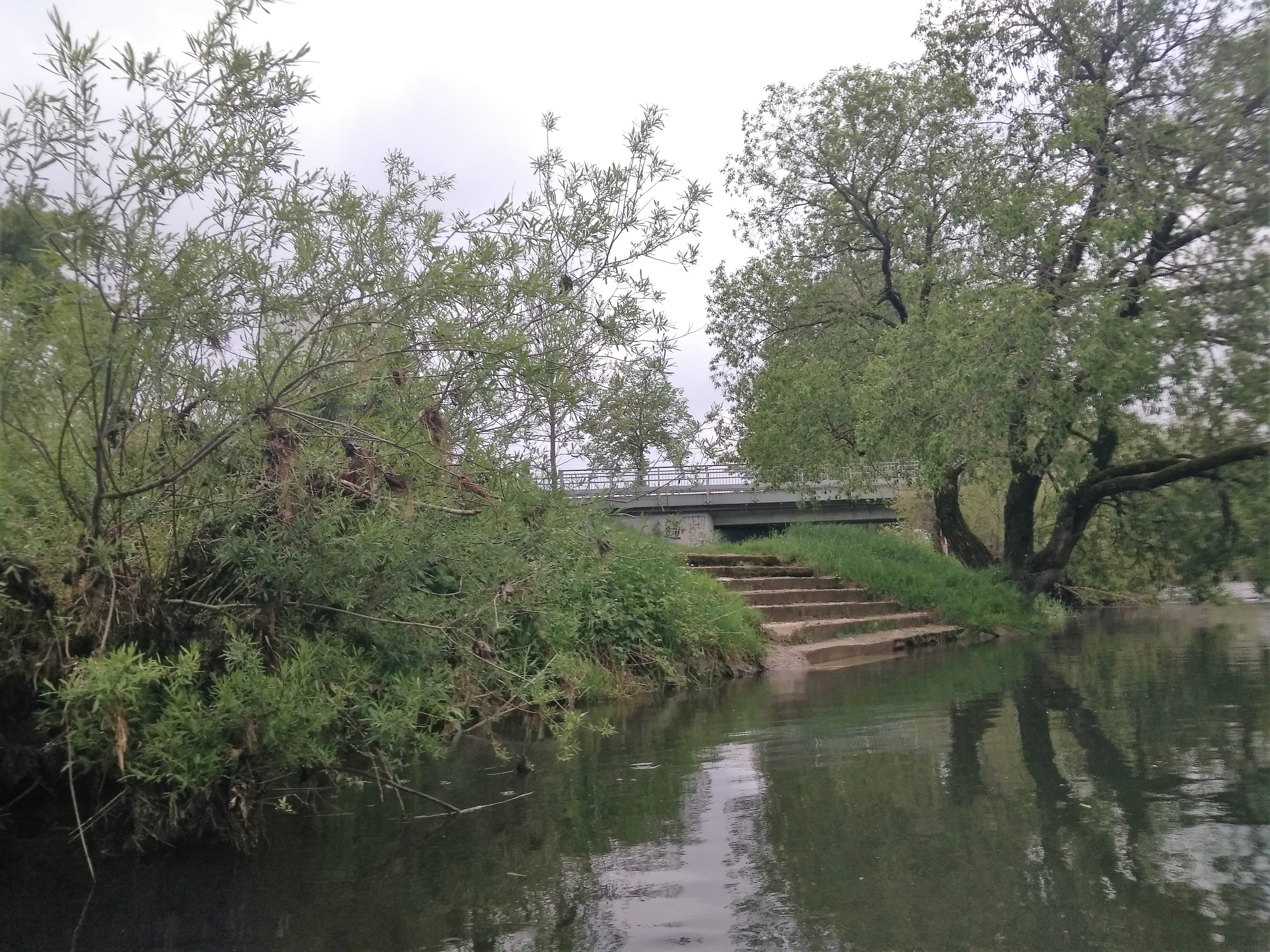
Unexpectedly, some warning signs appeared on the shore about 600 meters too soon. Soon, we heard the conspicuous sound of dropping water. Some nice stairs appeared on the left side. We landed, launched our boat, and I decided to add the dam and the “slipway” to Open Street Maps. Hopefully, this will warn some other paddlers who depend on these maps.
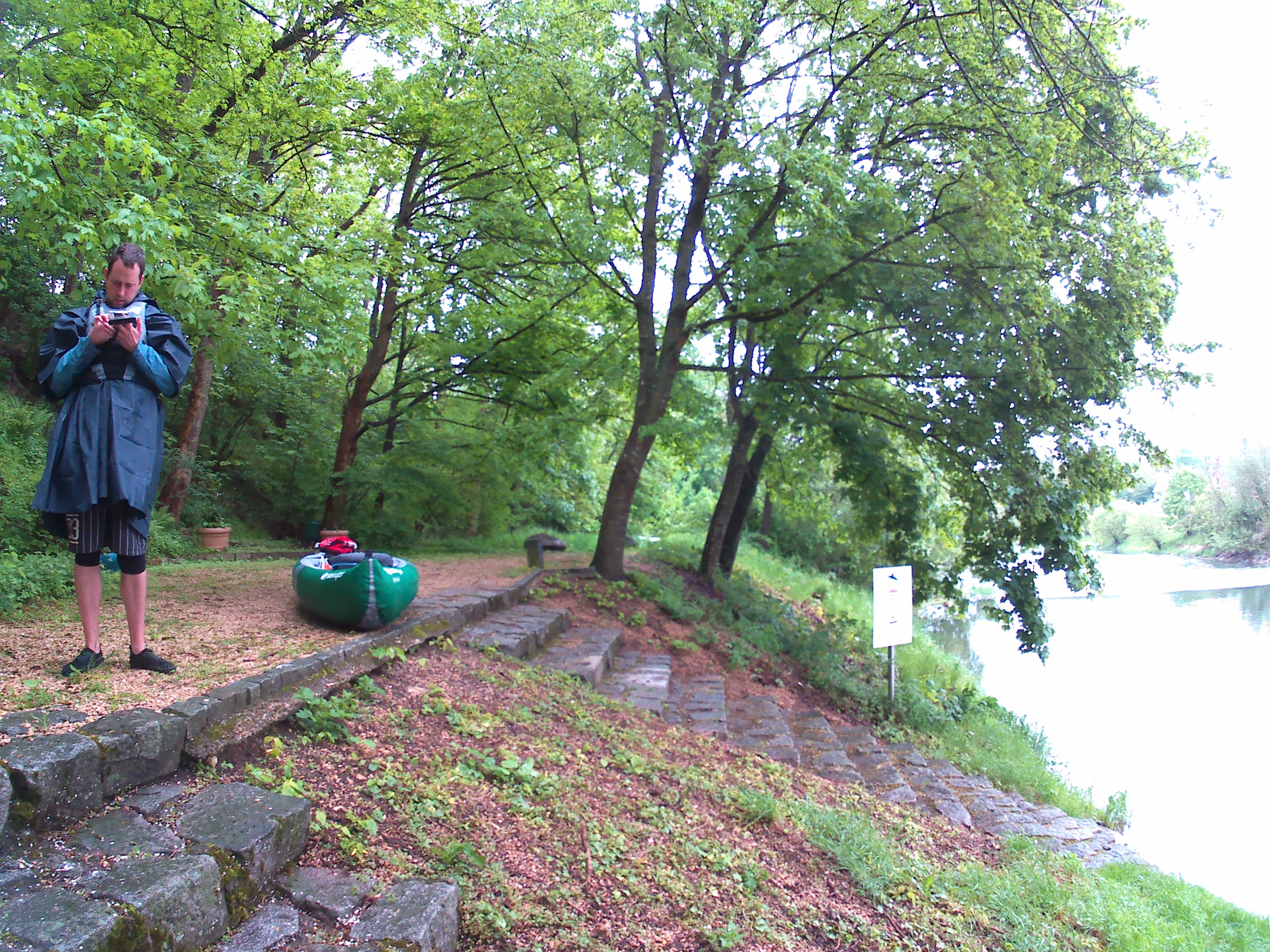
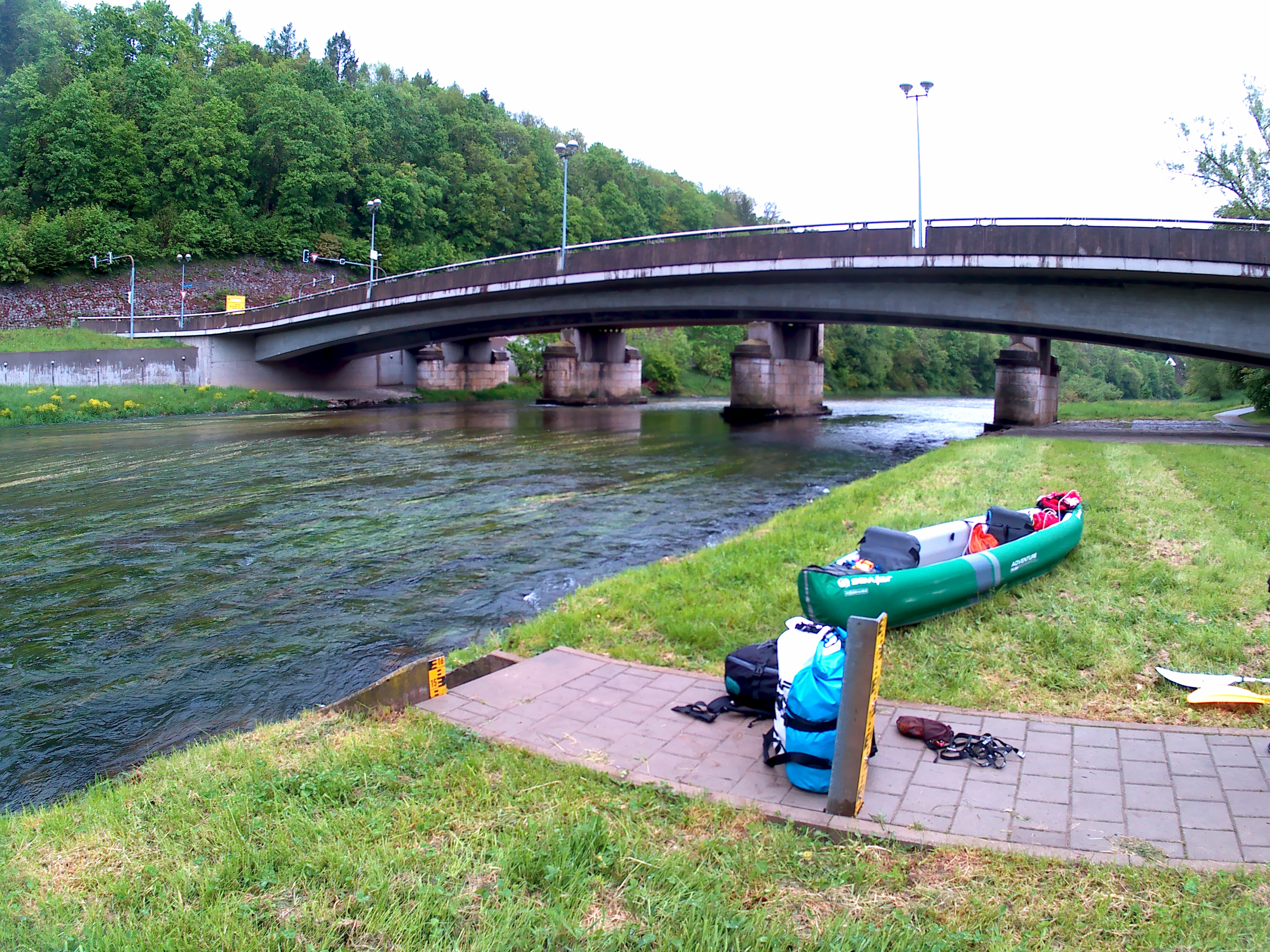
Portaging around is always very easy if the infrastructure has been built. At 10:10 we were paddling again.
The Situation in Scheer
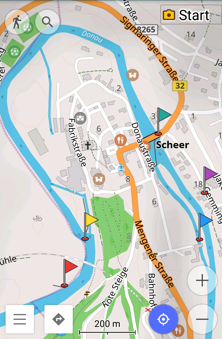
The red flag is the side dam, yellow is the main dam #1. The green-blue flag is dam #2 and the blue flag is the hydroelectric plant. The purple flag represents the spot in between we finally re-entered the river thanks to a friendly lady. ©Open Street Maps Contributors
The distance from Sigmaringendorf to Scheer is even less. We knew that Scheer posed a different challenge; Scheer is in a very tight river bend and has a dam on both sided of the loop. The distance between the two dams is only 1.6 kilometers, which is barely worth getting out twice. Shortcutting the loop by walking on land would only be 400 meters as the crow flies. The problem? There isn’t a clear path on our map that shows where to get in again on the other side. See screenshot.
We decided to paddle it instead of looking for a way to cross by land. This stretch of the Danube was well-signed, right? We could trust this infrastructure for paddlers… right?
When approaching the first dam, I also remembered something odd: a weird side-dam on my map, which was entirely on land. In reality, this is a side-river and actually the part of the Danube we had to re-enter after the portage. Where the river continued on the right-hand side, it would partially enter a mill, and partially flow under the castle in Scheer and emerge again in the river bend.
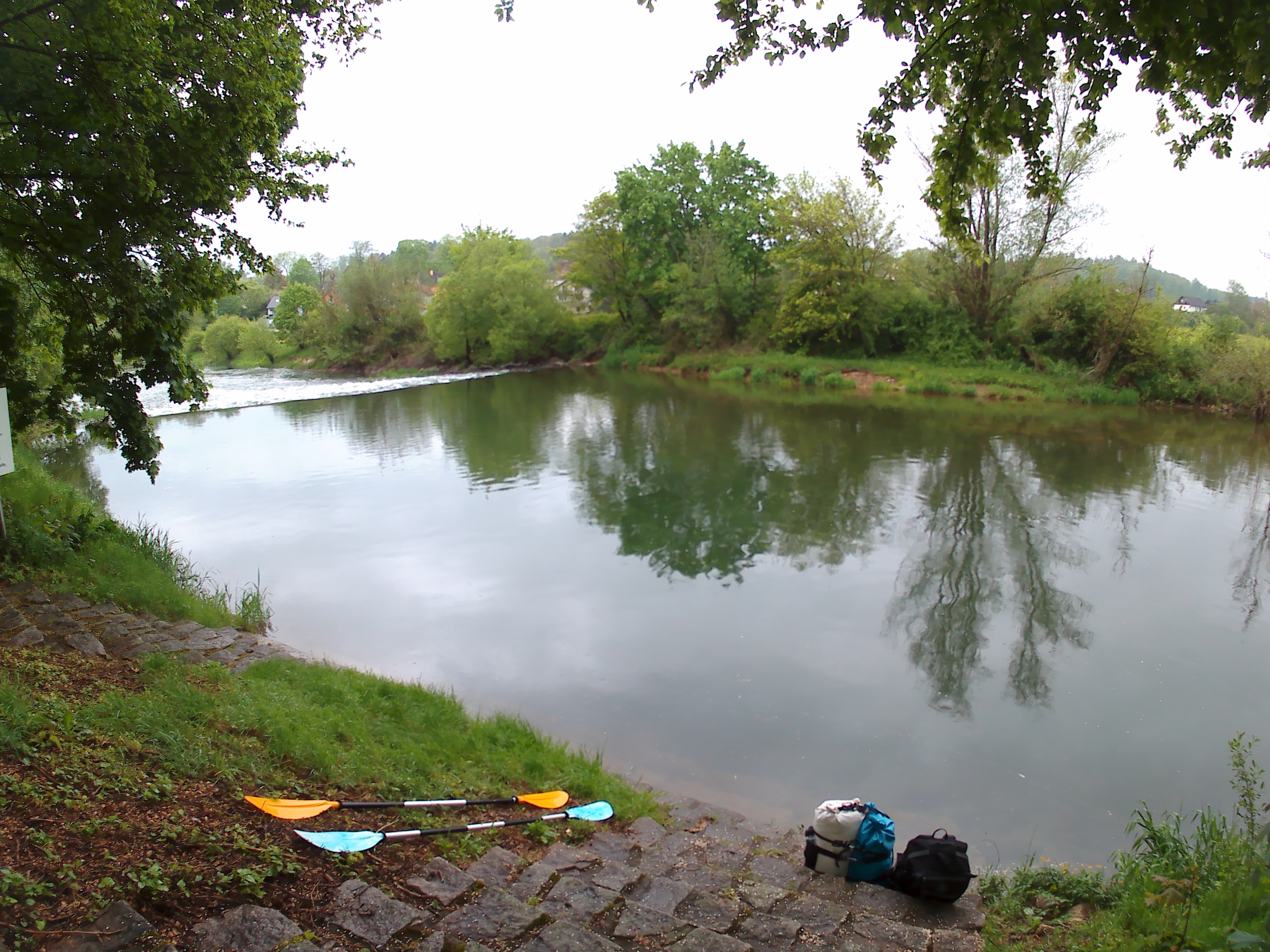
We successfully completed the portage of the first dam without many problems. There was a sign telling us where to get out. Where to get in again was fairly intuitive. At 11:50 we moored and by 12:00 we were paddling again.

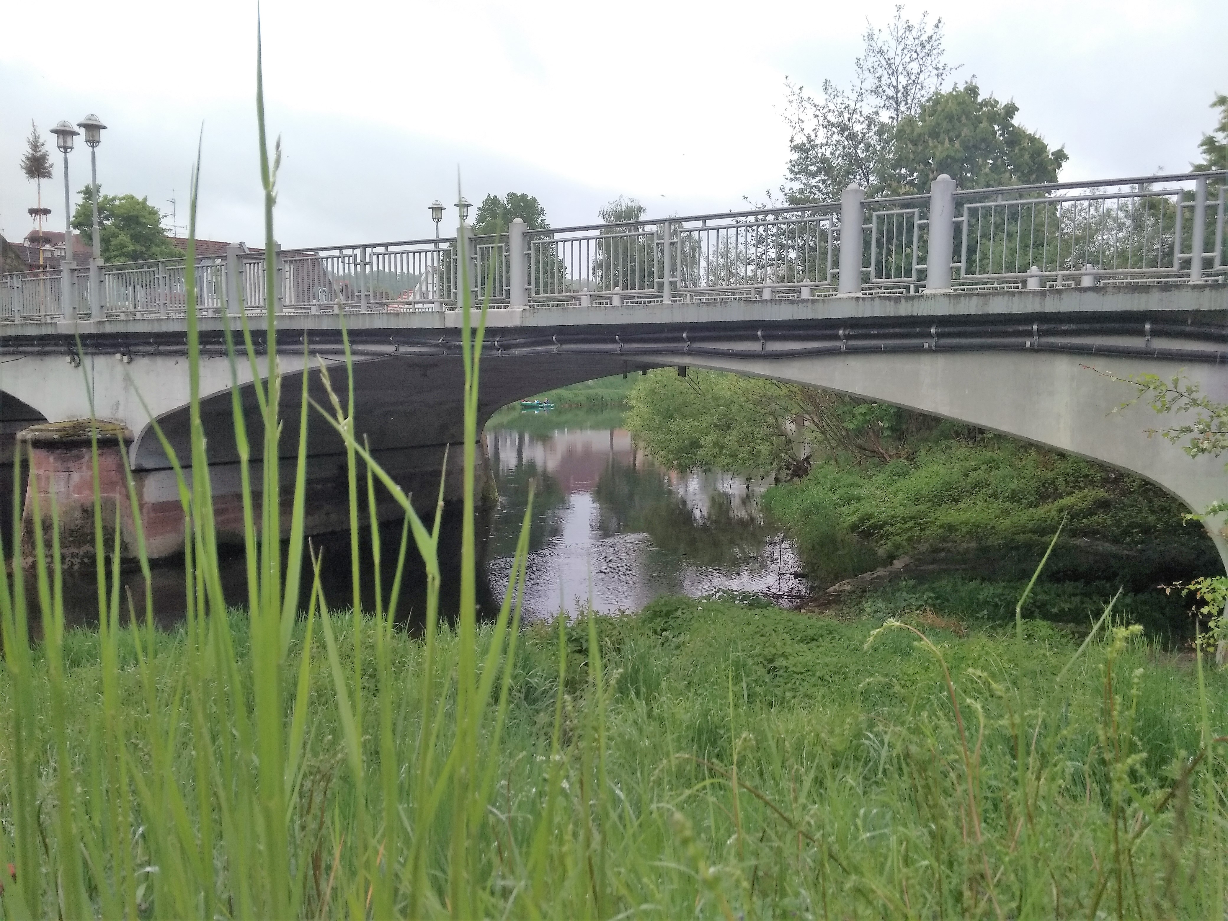
Happily, we paddled through the river bend and approached the bridge on the other side. The next one should also be easy… right?

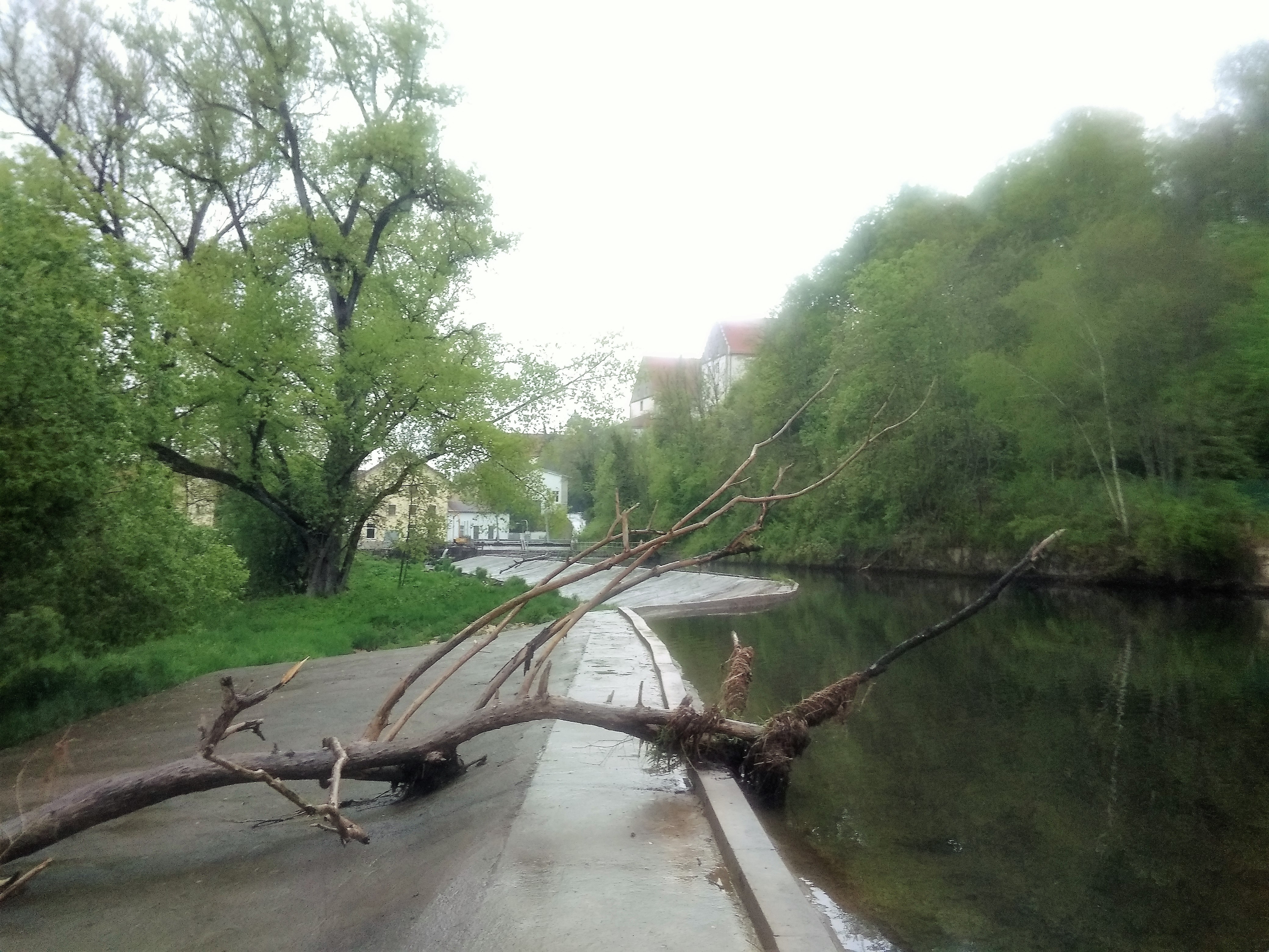
The Dam from Hell
We knew the dam was right at the next bridge. The right-hand side of the dam would funnel the water into a mill or hydroelectric plant (Kraftwerk). The left-hand side would probably be our portage spot.
The bridge had a sign on it that we couldn’t read. We moored on the right embankment and I got out to walk closer to read the sign. Jonas stayed behind in the kayak while I did on the ground research. It was 12:30 and we were getting hungry.
I walked onto the bridge to take a good look at the dam and how dangerous it was. It didn’t look passable. Jonas had read on a blog called Ulmer Paddler that it’s apparently possible to not portage around the dam but just go it down on the left side. The paddler also wrote that he chose to portage his boat around it. In our inflatable canoe, we’d obviously do the same.
The landing spot under the bridge would be full of nettles, but there was a path to go get our boat out and a path that continued on that I was sure would lead to a new launch spot. I went back to Jonas, got into the boat, and we paddled to the left side of the bridge. The sign read something like “boats-people, go down the dam on the left”. This was strange, but I assured Jonas that we could portage around.

Getting Stuck and Finding Help
We moored with some trouble and getting the boat out was very hard. The path that led up some stairs to bridge-level also had a small stream that we had to cross. It was a struggle. We continued down the path on the other side in automatic mode. We’d covered some 200 meters with our luggage and our boat when the path abruptly ended with a sign saying “private property”. Shit.
We looked down the edge to see if we could re-enter the water from here. It was a five-meter steep drop through bushes and plants and slippery rocks. It started raining. We walked back with our boat and looked again at the dam and whether we could paddle through. It felt hypocritical to go down this dam and not the others that weren’t super dangerous. Besides, the river kept flowing so fast that it seemed like an all-around bad idea.
The heaviness of the rain increased as our frustration grew. We decided to walk along a street named Gemminger Straße to hopefully find a new launch spot again. We’d need to walk about 600 meters with our boat and luggage before we could re-enter. Now would be a really great time to have wheels under our boat. I cursed a lot as we carried the boat in 50-meter bits. This would take forever.
At one house, a lady opened the window and said something to us. Jonas talked to her and then she came out and walked around the house with Jonas. He came back with the information that we could launch our boat from her backyard. Then she said something about the neighbors. Jonas followed her again around the other side of the house through a fenced-off area and came back with the announcement that we had a launch spot.
The neighbor’s backyard featured a jetty. We carried over our boat while thanking the lady a thousand times for her help. She held my arm so I wouldn’t fall over when lifting the boat for its final descent to water-level. I re-attached the luggage from inside the boat and Jonas held the boat with his feet dangling from the jetty. We thanked her some more and then waved at her once we were paddling again.
It was now 13:10. We wasted a good forty minutes on this crappy dam. Jonas was nearly ready to call it quits.
Dam Number Four
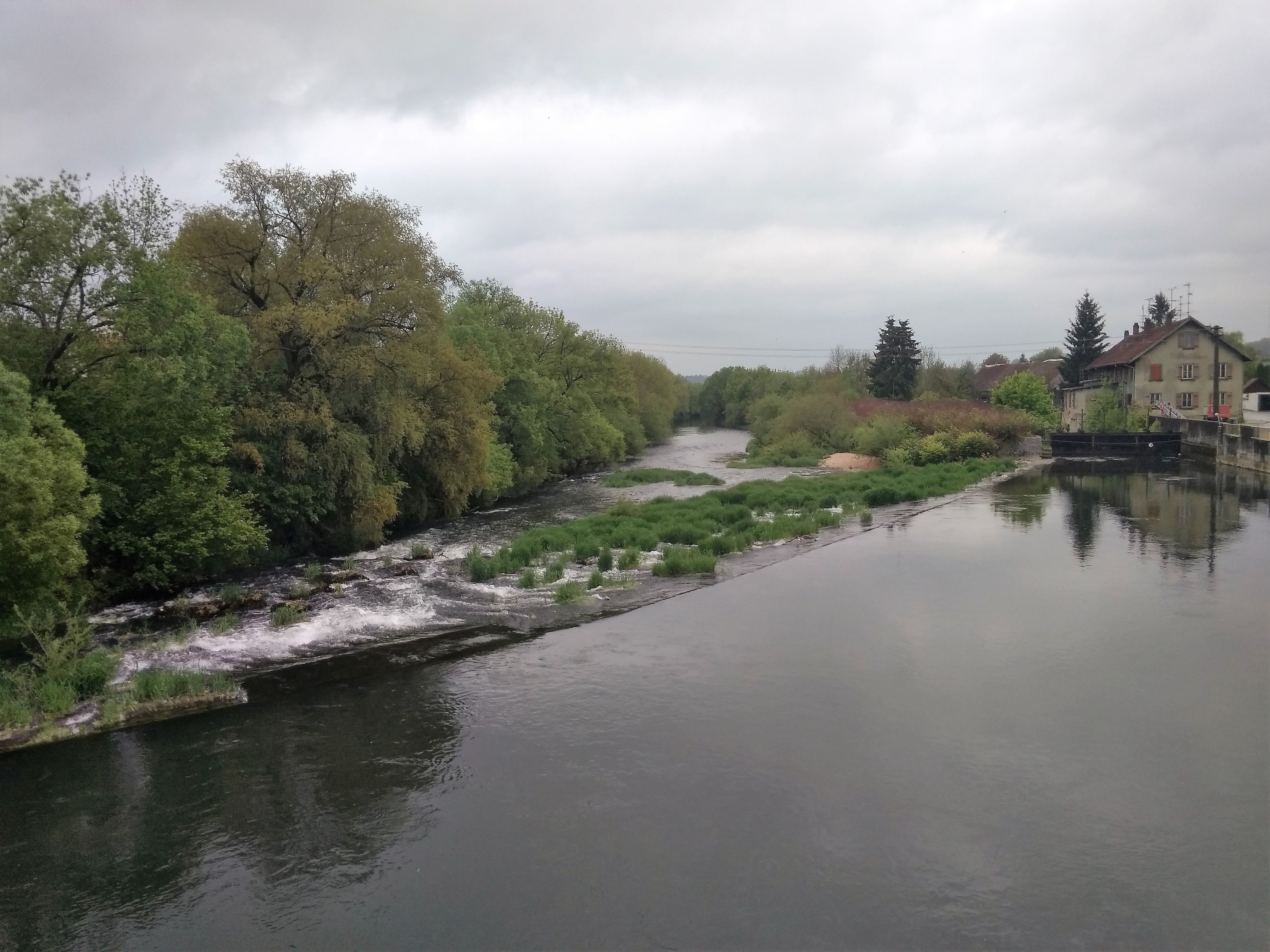
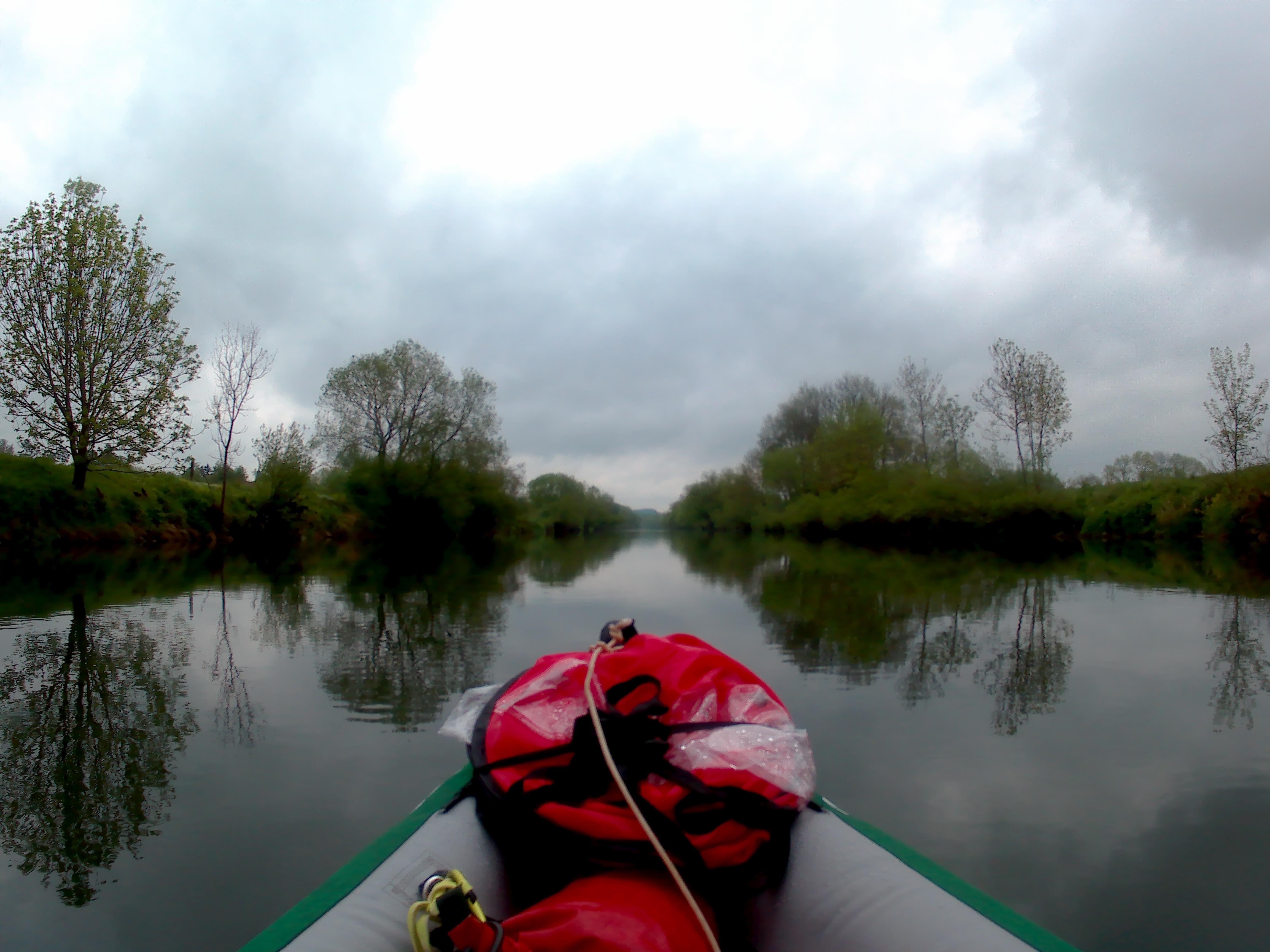
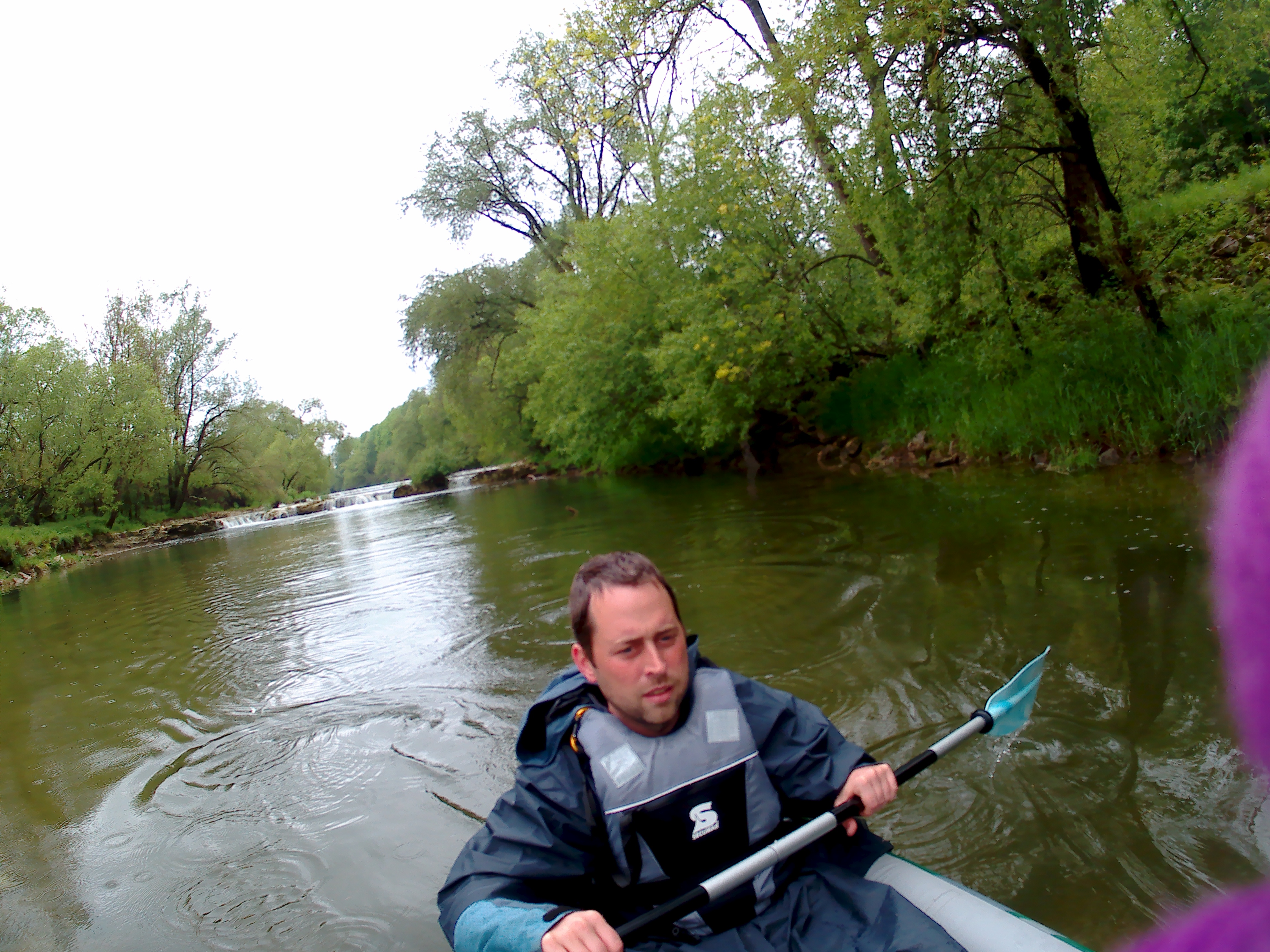
The short stretch between Scheer and the next dam (about 2 kilometers) was really pleasant. The weather cleared up and the slightly canalized Danube reflected the landscape beautifully. As promised, the wind picked up a little from the back. Jonas ate a rye-bread sandwich, then I ate half of mine. My stomach craved some warm food and the rye bread tired my jaws too quickly.
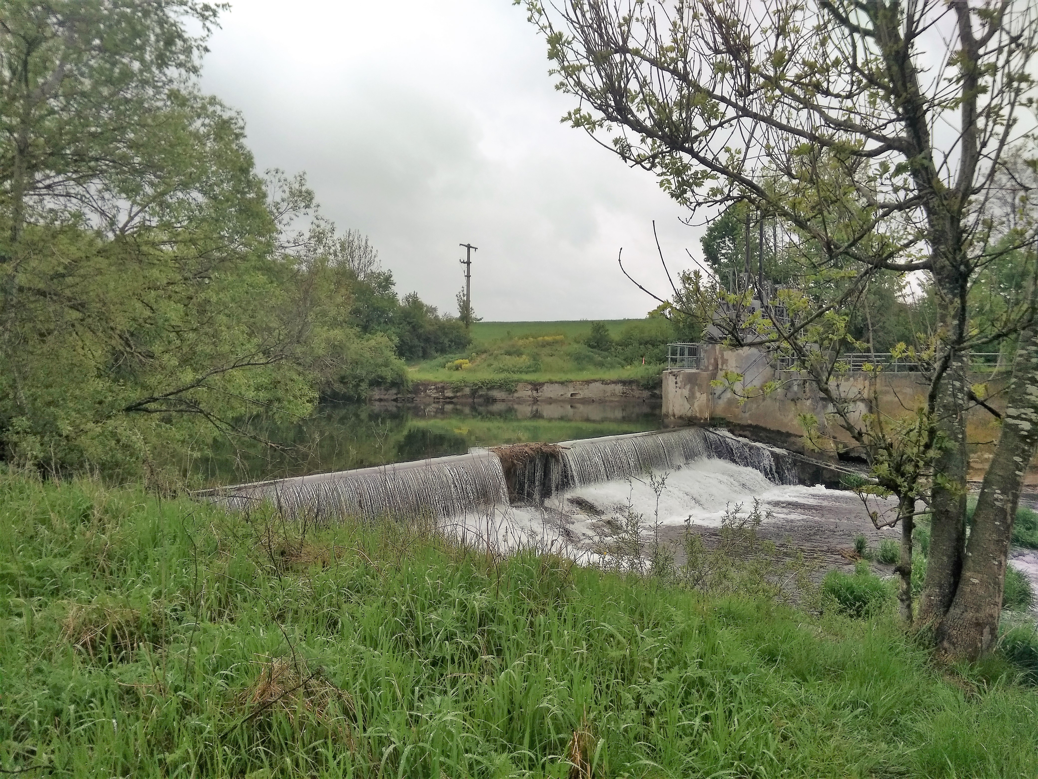
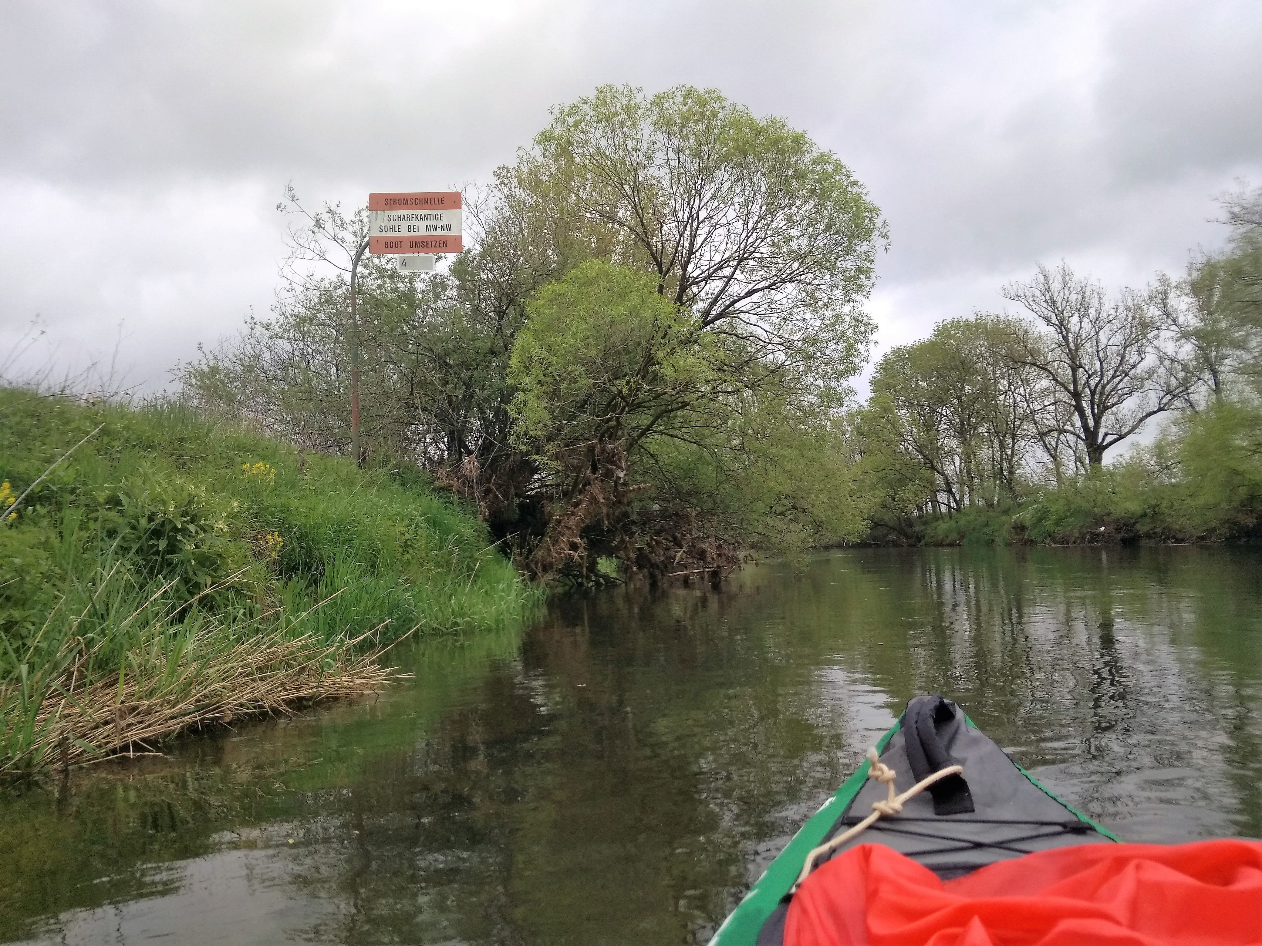
The next dam already came up. We’d barely gotten over the clusterfuck that was the last dam. Again, the sound of dropping water warned us on time. There was no good place to get out, nor any signage about the level of danger this dam would pose. We’d read that this dam would flow around a river island. The dam diverted most of the water to the left, where it would pass through a hydroelectric plant. The right side – which was our side – would have very little water.
I walked around to see the danger before Jonas got out. Maybe I’d even find him a better landing spot. All I found was that it’s ridiculous that this dam didn’t have any serious warning signs, as it would have possibly been a death-drop. I’m getting really irritated with the shabby signage.
There was a car parked next to our launch spot. While portaging, the owner of that car arrived with another car with two plastic kayaks on top. The older man spoke to Jonas about our trip and how this man had a special permit that allowed him to paddle this stretch for seven days for €25. He also said something about the forbidden stretch between Hundersingen and Munderkingen, that it would be possible to get a permit to paddle there anyway – except for a small area that is truly forbidden. This didn’t change our plans, as we would not wait another month to paddle that stretch of the river to Munderkingen.
The woman he’d paddled the river with today showed up and told him she wanted to go home. He still added that he lives in the next town (Blochingen) and paddles here a lot. And that the water on this stretch is indeed low, and that it had a few more dams before our destination Hundersingen. More dams?!? Shit.
He wished us the best of luck and said goodbye. We completed our portage and got into the river again at a pretty decent spot. I asked Jonas to translate the conversation a bit more, but he’d already forgotten most of it. We paddled on at 14:00.
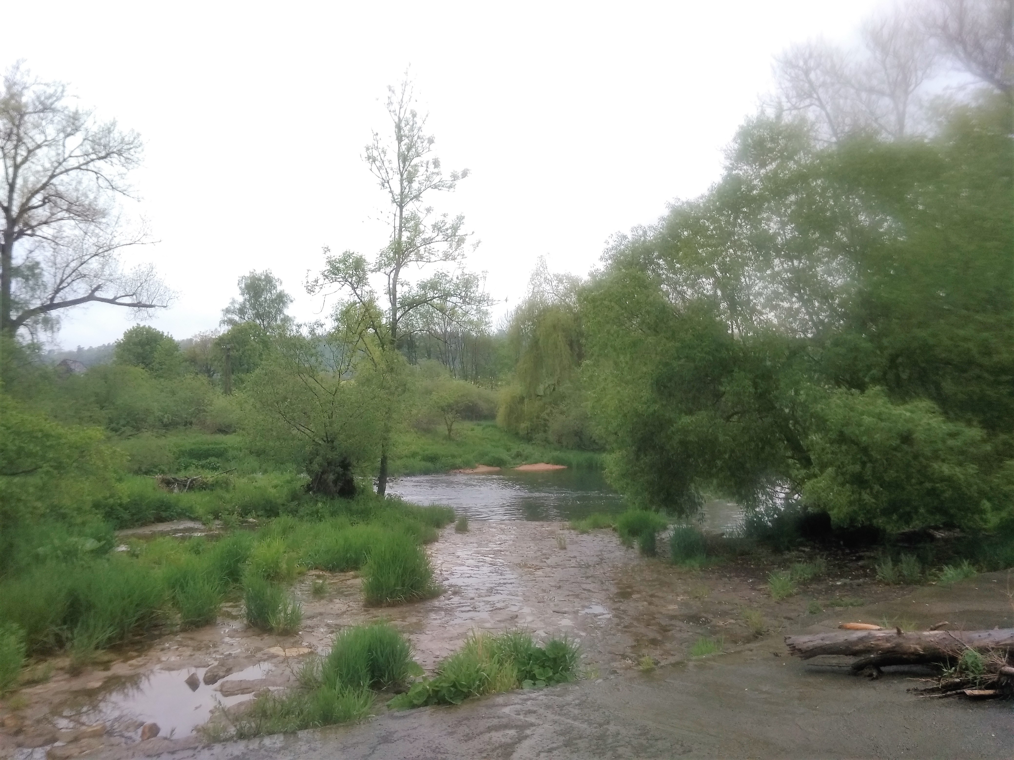
Shallow Waters
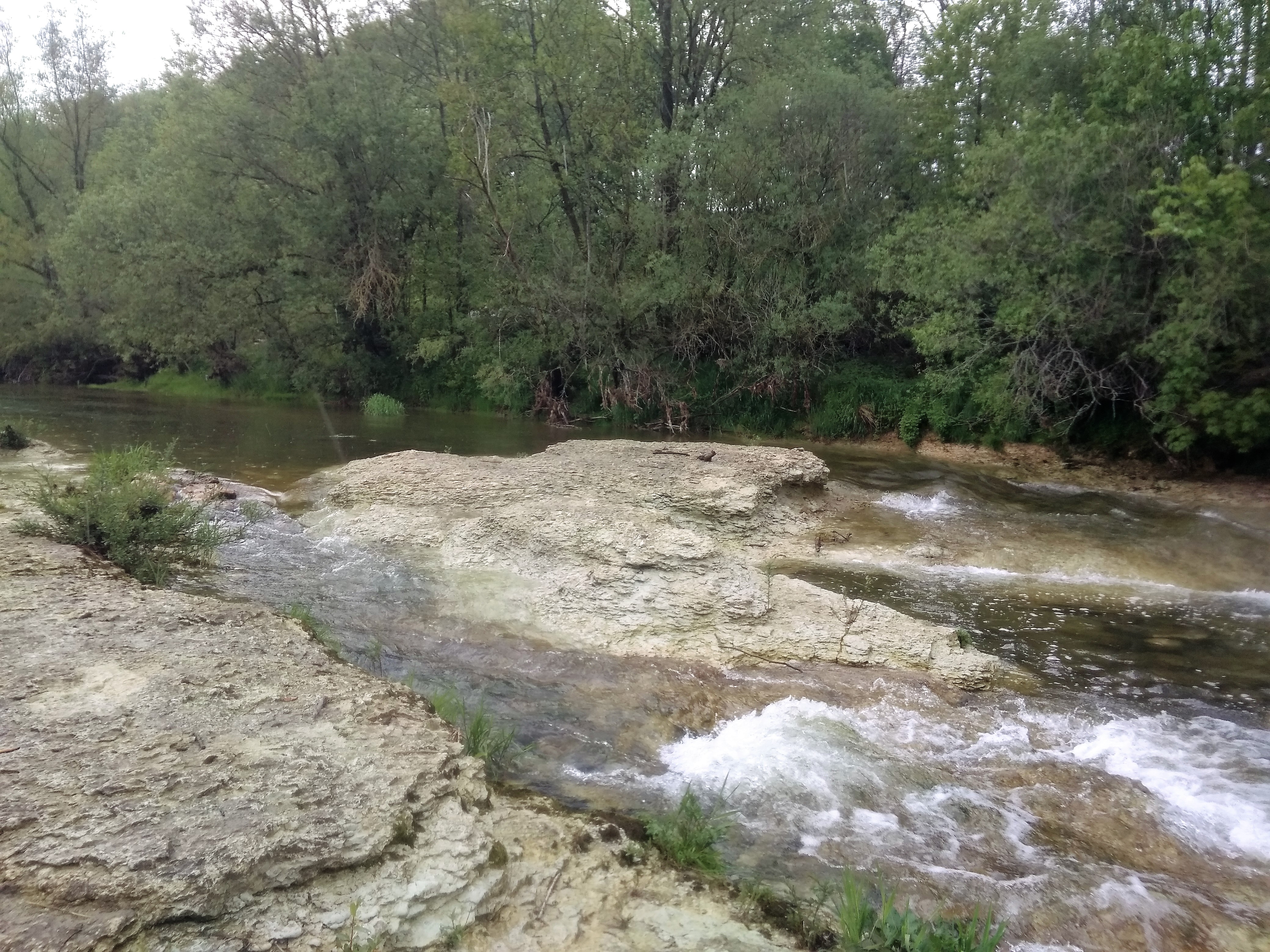
Even though the water levels in the river were generally higher than usual, that point was moot when the majority of the water gets diverted to the Jakobstal Kraftwerk. We did a great job dodging the shallow patches and protruding rocks. Under the surface, we saw exposed bedrock, rather than the common muddy bottom we’ve gotten to know on this river. The water is crystal clear. Then we heard the sound of falling water.
I could look over the edge and it seemed like a very low drop. So we tried to paddle over it while in the boat. We got stuck at the edge and had to sort of exit the boat and get into it again once the tip touched the water below. It was messy. Like, Day 1 levels of messy. I thought we had a system by now.
Right after the drop was yet another, deeper drop. We scooted over it in a similar manner as before. But we were paddling again. How long is this stretch still before the Jakobstal water replenishes the river? Another 900 meters…
Oh no… we hear the sound of falling water again. This time, we get out of the boat. Jonas is really sick of this shit by now. He talks about getting out one stop earlier and catching the train from Mengen instead of Hundersingen. I don’t yet want to hear it.
I guide the boat by its front leash through the next shallow rapids over the sandpaper-like bedrock. This way, we don’t have to take out our luggage. Jonas pushes the boat from the back to guide it through the narrow passage. We get in again and continue on.
Weighing the Choices
For a little bit, it seems like the wind picks up from the back. I happily deploy my kayak sail and attach it to my life jacket so I can still paddle. For a bit, everything is nice and it looks like we’ll continue on to Hundersingen for a total distance of 20.9 kilometers today. I’m enjoying it, but it doesn’t last.
It starts raining again. The wind dies down and we’re one kilometer away from our alternative exit point in Blochingen (left side of the river) or Mengen (right side of the river). We had surveyed this exit point a few days earlier because the forecast told us there would be a thunderstorm today. Obviously, we don’t want to paddle in such dangerous weather. In case of lightning, we’d exit the river here and then walk 1.4 kilometers to the train station in Mengen to take the train past Hundersingen to Munderkingen.
We didn’t expect that feeling miserable would be a reason to get out earlier. I talked to Jonas about how he felt about paddling the remaining 4.8 kilometers to Hundersingen and then walking 1.8 kilometers to the train station in a town called Herbetingen. Besides, there would be one more dam at the bridge in Blochingen and one final dam somewhere before the exit spot in Hundersingen according to Jonas’ flyer some 200 meters before the bridge in Hundersingen. 200 meters is too little to paddle, but also 200 meters extra to walk, making it a 2-kilometer hike to the train station.
Did it make sense to paddle more only to walk more with all our wet and heavy gear?
Calling it Quits
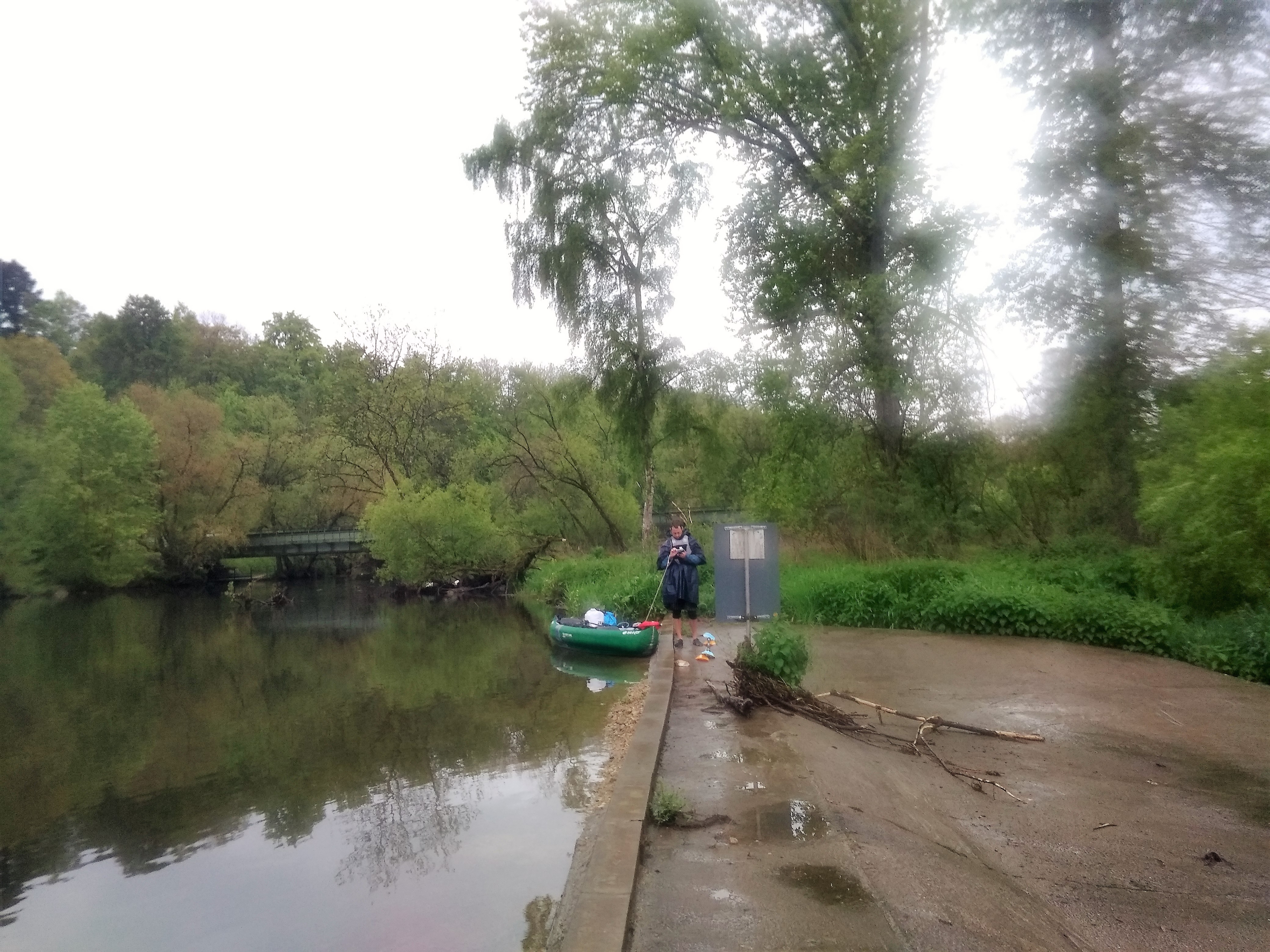
A huge warning sign appeared before Blochingen. We had trouble reading what it said, but something about a sharp edge and danger within 400 meters. The bridge called the Mengener Straße appeared. On the left-hand side was a sign saying this is an official exit spot for paddlers. There were nice stairs. Getting out at the nice stairs is an act of self-care, so we called it a day at 14:45. Jonas said we could take the train to Munderkingen at 17:45, which would give us plenty of time to prepare.
Out of curiosity, I walked up the bridge to see where that hecking danger zone would be. There were some little rapids right under the bridge, but nothing crazy or impassable. From the bridge, I gazed further downstream and saw… nothing. No dam. No danger. And certainly no sharp edge to drop off. I feel cheated by both the warning signs and the flyer given to us by the tourist information in Sigmaringen.
There was a weird public barbecue spot and we could use the bride to hide from the rain. We started emptying out the boat, packing our stuff, and preparing for a hike. I finished my half-eaten sandwich. We managed to put the wet kayak into the CabinMAX instead of the duffel bag. It’s definitely the superior way of carrying the heavy kayak.
Jonas was the first to put on his dry shoes. My shoes were still soaking wet from the dewy hike that morning. I dried my feet and put on dry socks in the hopes that this would make the hike to the train station manageable.
The hike was OK, but towards the train station, I did feel the distinct sensation of a budding blister. My shoes are a breeding ground for a bad case of trench foot. Yikes. At least I knew that I wouldn’t have to walk very far in Munderkingen from the train station to our accommodation for the night.
Train Ride to Munderkingen
At the train station, Jonas got the tickets while I waited with our stuff. Mengen train station featured a great amount of sketchy-looking people. He announced the good news that there was one earlier train at 16:45 to Munderkingen. The ticket was quite expensive because apparently, it’s a train that crosses from one district (Landkreis) to another.

When boarding the train, the doors fucking closed on me. I had to fucking fight the door with the kayak and the paddles on my back. I was not. fucking. having it.
The train ride to Munderkingen was quite fine in the end. We followed the Danube only in part and it felt silly to see all the bits we missed out on between Mengen and Munderkingen. That is quite a lot of river. But Jonas said he was fairly certain this would be the last forbidden stretch of the Danube. At least in Germany.
We arrived in Munderkingen at 17:10 and walked the final 300 meters to Gasthof Rose. Our place for the night promised to have unlimited WiFi in the rooms, something my belated blog posts were really craving. From what I saw, Munderkingen also looks like a cute town.
Jonas went in first, while I waited outside in the rain to see if we could put the kayak in the garage. A friendly lady I recognized from an online picture came out and Jonas followed. We spread out our stuff in the garage. Christiane introduced us to her adorable 12-year-old Border Collie on the way to our room. There were WiFi-repeaters everywhere.
The next day we’d be able to watch the Game of Thrones series finale on this beautifully fast WiFi and enjoy the lively kebab-scene of Munderkingen. Downstairs is a restaurant with excellent Weißbier. This will suffice!

Permit Rules For the Sigmaringen – Mengen – Hundersingen – Munderkingen Area
Get in contact with the Tourist Information Sigmaringen about permits for ‘Kanufahrer’. I did this in person instead of online. You can paddle between Sigmaringen and Hundersingen year-round with the right water levels in Beuron (53 centimeters minimum). It will cost you €5 per boat per day you wish to paddle, and you have to tell them the exact date you intend to paddle the Danube. They will print it out for you.
After July 1st, it’s possible to paddle a longer stretch of the river after Hundersingen and before Munderkingen. I’m not sure where exactly the zone is where you can’t paddle under any circumstances. You might have to inquire and press for getting a better permit than I did and tell them you want to really paddle all the way to Munderkingen (perhaps over two days).
If you find out, please share your experience with getting a longer permit in the comment section!