


 Romania")

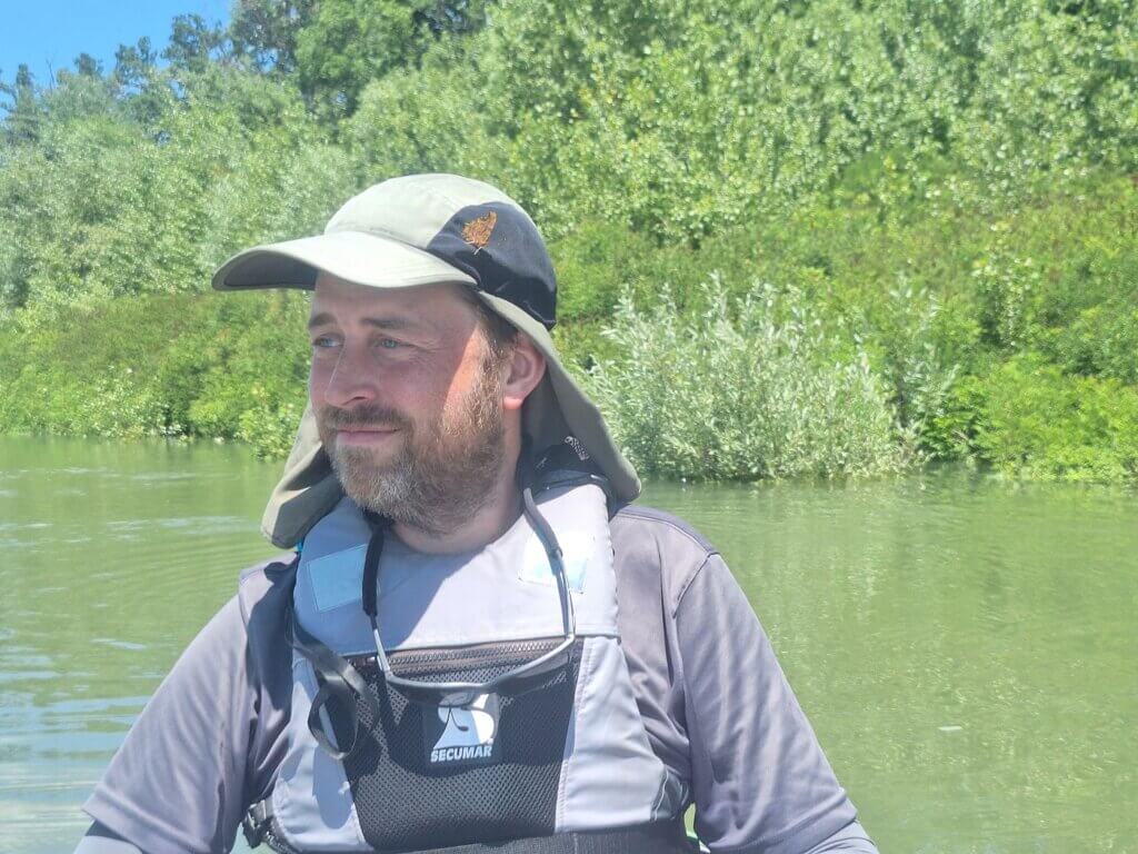
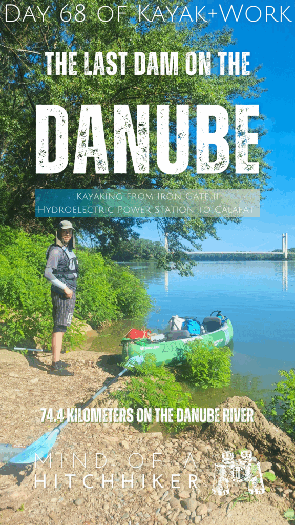
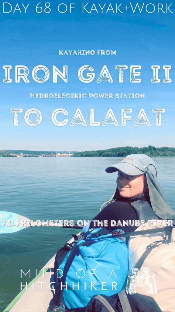
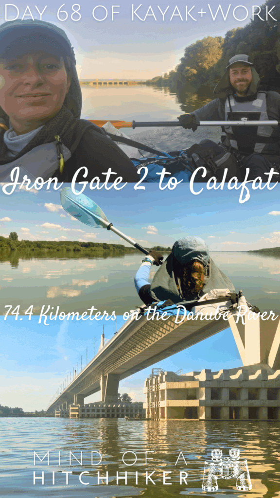
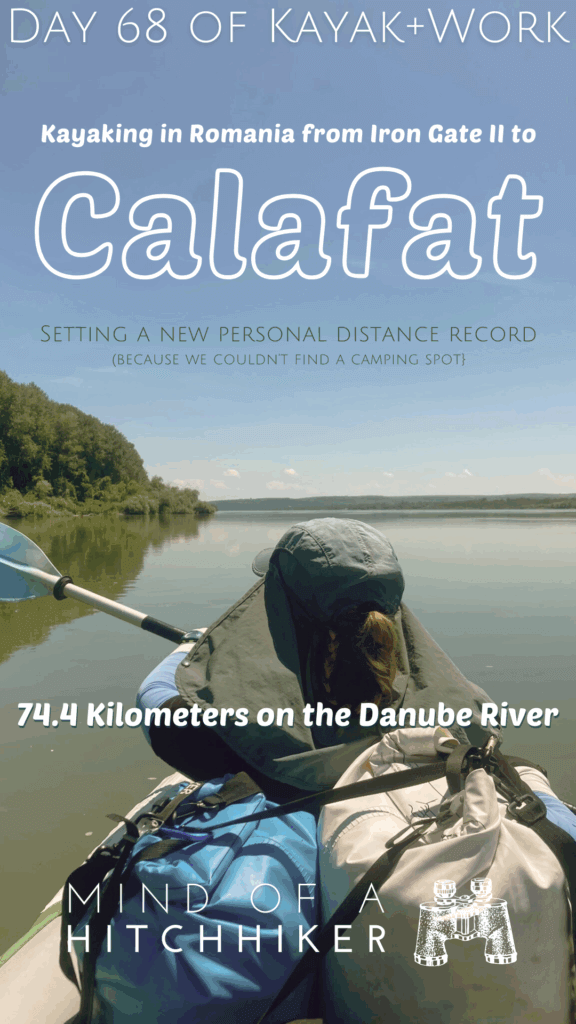
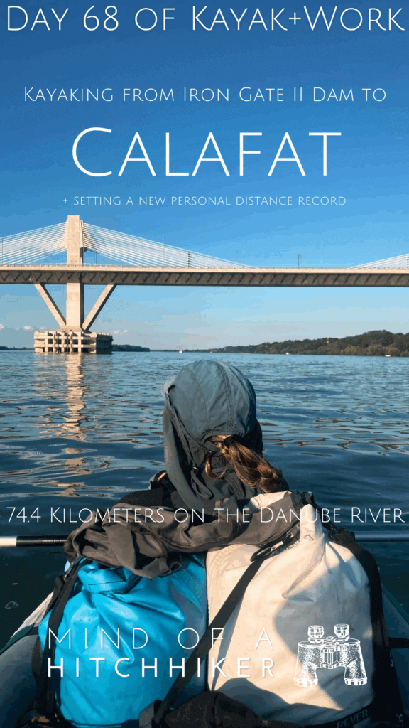
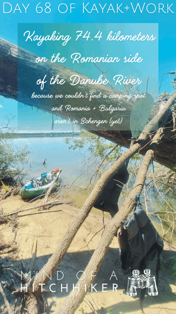
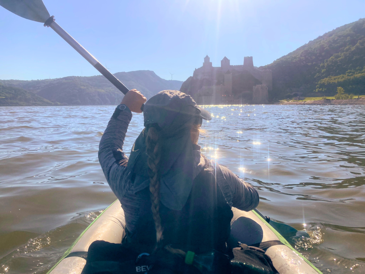
This kayak day happened on Friday the 7th of June, 2024. We kayaked from Comoara Istrului on the Gogoșu Branch of the Danube past the Iron Gate II hydroelectric power plant to Calafat. The Iron Gate II (Romanian: Porțile de Fier II – Serbian: Đerdap II) dam is the last (mandatory) Dam on the Danube before the Delta. Though we intended to go camping for one night and then kayak to the Romanian city of Calafat the next day, we ended up doing the whole distance in one go. This was a whopping 74.4 kilometers. Our previous distance record was 53.6 kilometers.
Want to travel the (entire) Danube River in an adventurous way? Join our Facebook group Danube River Source to Sea: Kayak / Canoe / Bike / Hike / Sail to find your community
Contents
- 1 Departing Comoara Istrului
- 2 Kayaking the Gogoșu Branch of the Danube
- 3 Iron Gate II: The Last Dam on the Danube
- 4 Triple Border: Romania, Serbia, and Bulgaria
- 5 A Break on Gârla Mare Island + Deflating Zucchini
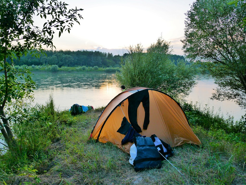
- 6 Wildcamping Along the Romanian Danube?
- 7 The Possibility
- 8 The Sharp Turn Westwards
- 9 New Europe Bridge: Our Arrival in Calafat
- 10 Packing Up + Walking to Our Hotel in Calafat
- 11 Our Stay in Calafat
- 12 Useful post? Consider buying me a beer!
- 13 Good read? Will you share it with your mates?
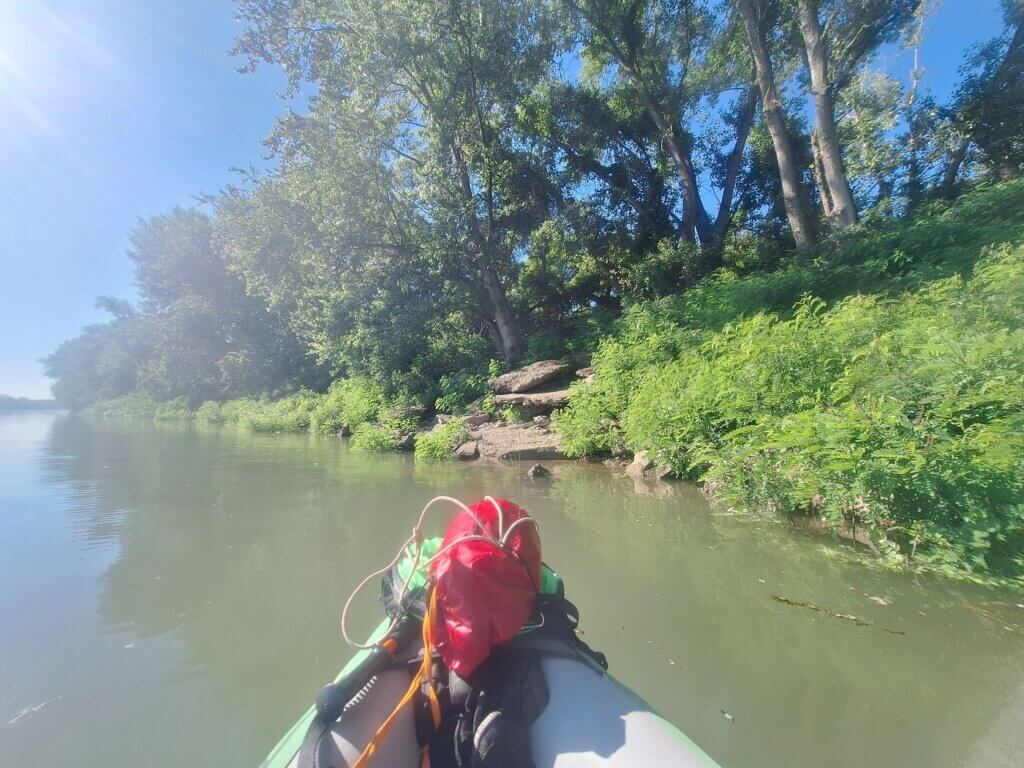
Departing Comoara Istrului
We woke up fifteen minutes before the alarm at 6:00 and decided to get cracking. Jonas reheated the cup of coffee he’d made the day before in the microwave and prepped the sandwiches with vegan mushroom paštet while I finished packing some stuff I’d left out the day before. We didn’t try to get up as early as possible for a distance of about 35 kilometers in (presumably) a good current, but it was still smart to get an early start since it was going to be 34°C. As per usual, we slapped on some sunscreen.
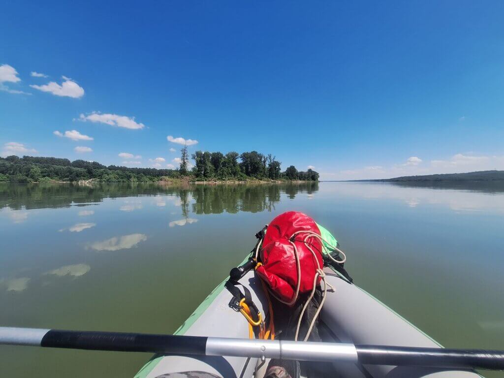
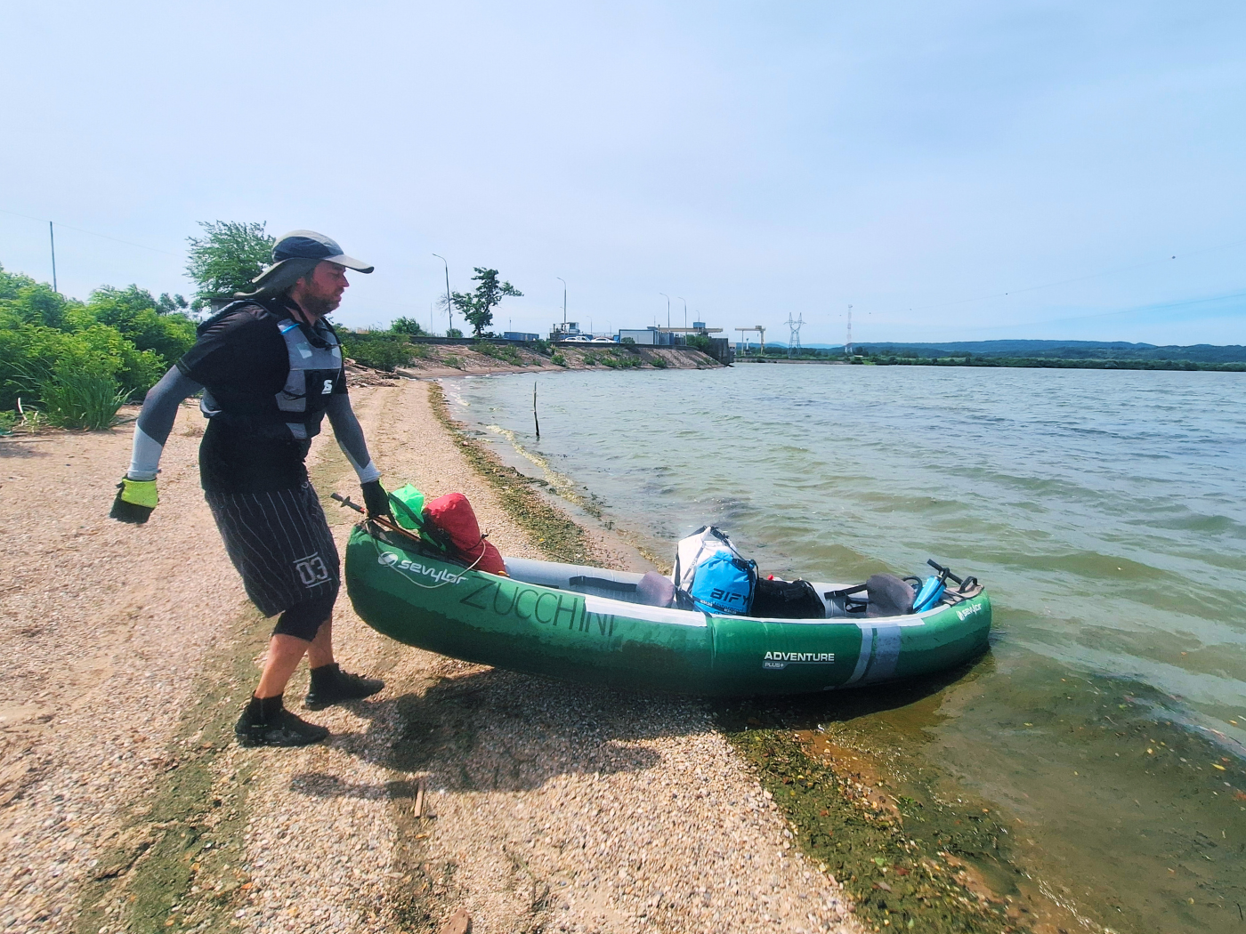
With all our luggage and 11 liters, we walked the 110 meters to the river. Some of the neighbor’s dogs had hopped the fence and they got triggered by our presence, barking incessantly. I tried to shoo them away so we could inflate Zucchini in peace.
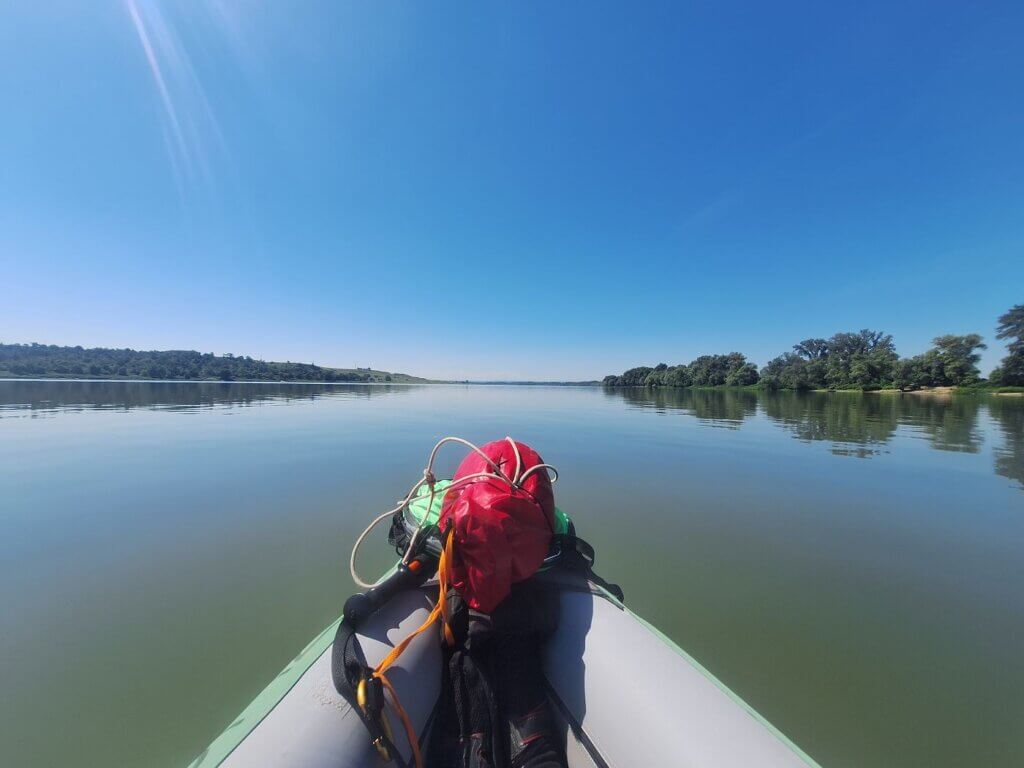
When we were almost done, our host arrived to see what the deal was and wave us goodbye. Jonas led the way when we carried Zucchini to the river and I lifted the back, guiding her down the steep embankment. The host helped me move the luggage to the edge where Jonas could install it into the boat. It was tricky to find a spot for all this water, so we tucked one hydration bladder at my feet and another was hooked in and strapped under the bungee straps behind Jonas’ seat.

We thanked the host for this lovely two-night stay and waved goodbye.
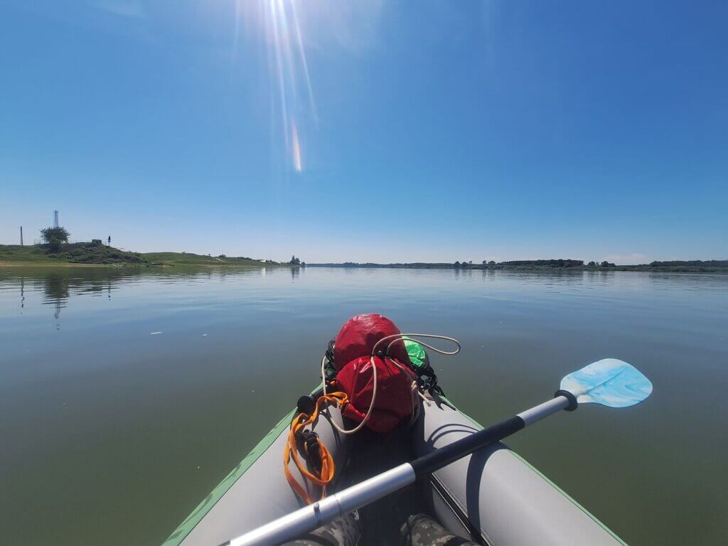
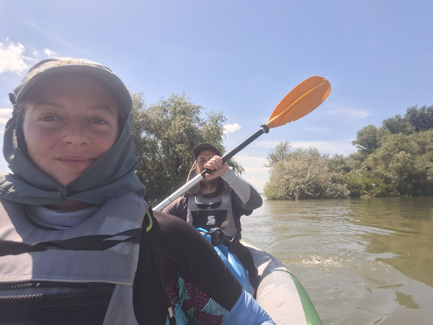
Starting time: 7:33. We snapped some pictures of ourselves with the Gogoșu dam behind us.

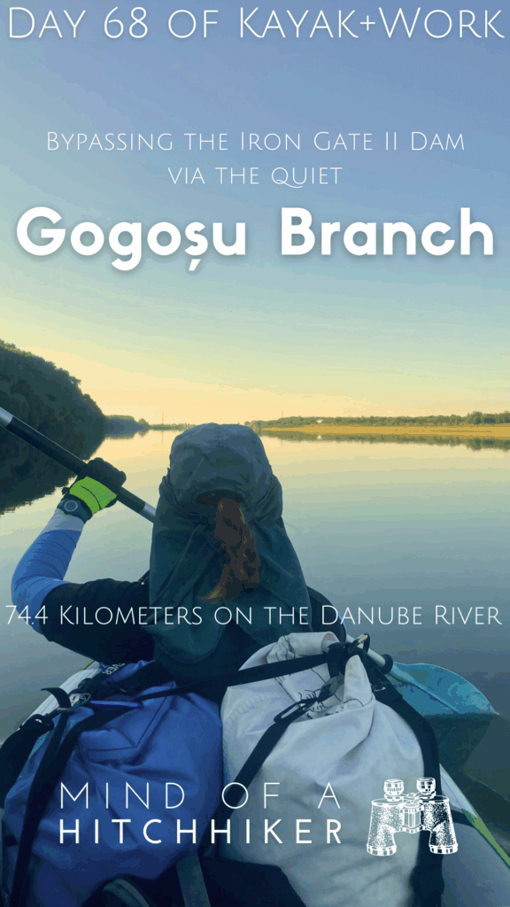
Kayaking the Gogoșu Branch of the Danube
The dam soon disappeared from sight. We drifted off into the center of the river. I was honestly a tad disappointed with the strength of the current. I felt like it was a lot better the day we arrived.
It’s funny how the dimensions change in this smaller branch of the Danube, passing to the east of the river island Ostrovu Mare. She is not skinny, but since she’s not as wide as the main river has been as of recently, it feels like we’re paddling a young river.
Lots of people were camping on both shores. Some had already set up their fishing gear, others were in the process of doing so. Slowly it dawned on us that today is Friday, which is basically the weekend for some.

With our paddling direction being somewhat southeast, the left shore had some nice shadow. The temperature difference between in the shadow and outside of it was already quite big, even before 8:00.
We kept paddling through the curves. I hoped to exit the Gogoșu branch of the Danube quite quickly, because my theory is that the waters from the main Danube flow upstream in this branch towards the end, slowing our progress. There’s also a stream adding water to the branch here called Râul Blahnița, which curiously finds its source only 5 kilometers from the big Danube bend just after Drobeta-Turnu Severin.

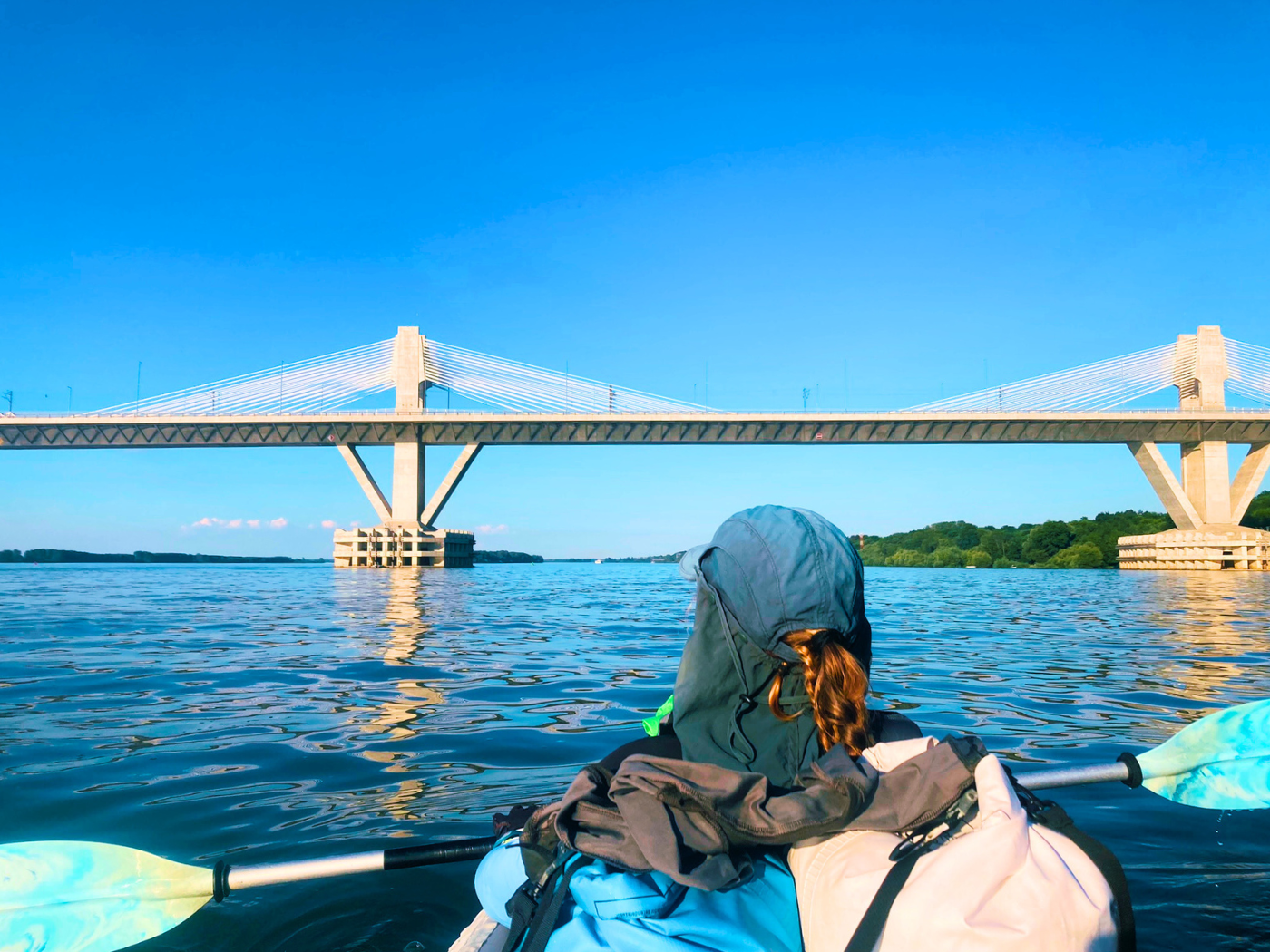
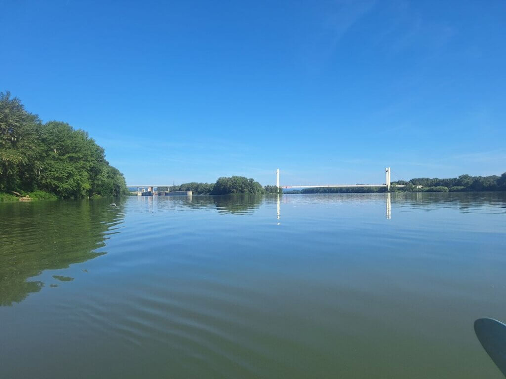
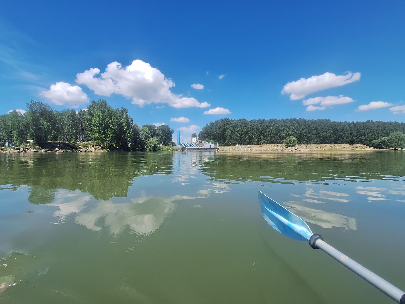
There were some river bends we paddled through trying to cut the corners. At 8:45, we saw the Ostrovul Mare suspension bridge that crosses the Gogoșu branch. This was a wonderful sight for taking photos with the calm and reflective waters.


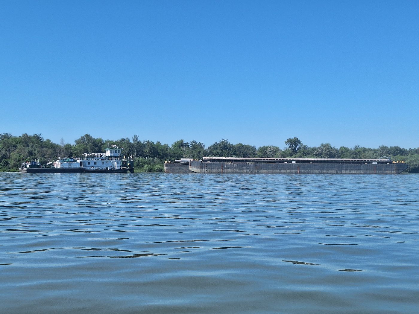
Beyond the bridge was a lot of activity. A cargo ship sailed out of the lock gap, a cruise ship lied in wait and started moving. She sailed into the lock channel a mere minute before we were at the bridge.
At 9:13, we paddled under the bridge. It was much skinnier than expected. My theory was that it’s a bridge that switches traffic direction with demand. Looking at the Wikipedia page, that sounds right.

 Romania's (small) Golden Gate Bridge
There wasn’t a better time to cross to the right through the lock channel shipping lane than now. No massive ships were on the move. But why cross to the right and not the (safer) left? Because I wanted to be in the good currents beyond the Iron Gate II dam as quickly as possible once we were past Ostrovu Mare. I want to feel those sweet, sweet currents pushing back against my paddles. I told Jonas my motivation, and he agreed after some thinking.
The Romanian ship lock, with a cruise ship in the chamber ready to go upstream
But first, we needed to take a short break. We spotted one right on the other side of the lock channel on the split island of Ostrovu Mare. We made a six-minute stop there, looking at the gates of the lock closing before we continued paddling. We’re just a few kilometers away from being back in the Danube.

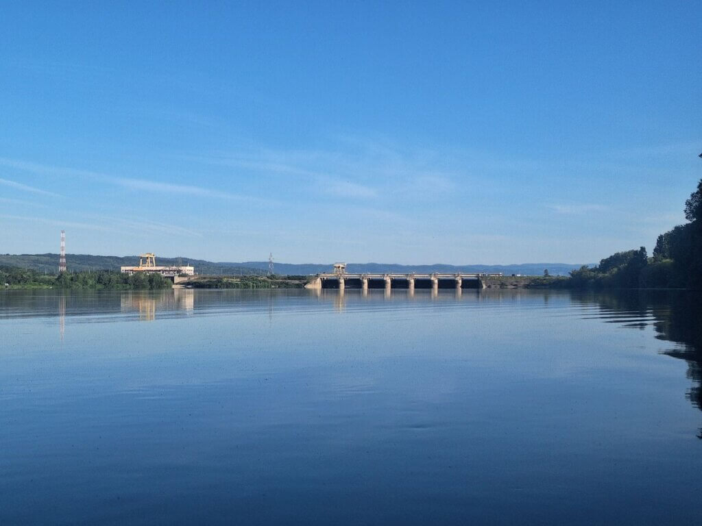
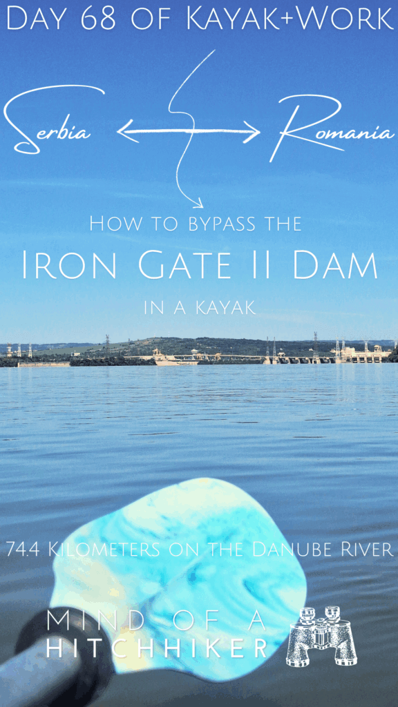
Iron Gate II: The Last Dam on the Danube
The last few kilometers in the 13.5-kilometer Gogoșu branch were full of anticipation. We could see the wide river and the industrial Serbian town of Prahovo on the far side. Behind us, the Ostrovul Mare Bridge and the Romanian navigation lock.

In 2024, it’s not possible to use the Serbian ship lock as it’s under renovation. We only found this out after kayaking here. Here’s an overview of the situation:
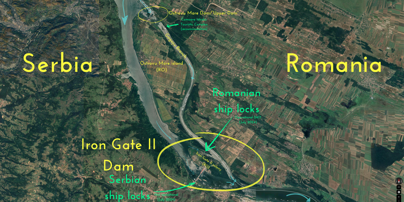
A pushtow with several barges was headed into our lock channel as we were about to enter the Danube again. We aimed for the buoy to be safe from the traffic that forks into the Romanian lock or the (defunct) Serbian lock. At the downstream tip of Ostrovul Mare were predictably some fishermen using the tailrace currents to catch some unsuspecting fishes.


Behind us we could see the Iron Gate II dam and its spillways. But because 1) this dam setup is much more detached and 2) we’ve portaged and aren’t paddling through its locks, I feel a lot less like passing this is a big achievement. On the other hand, Iron Gate I made me feel a whole rollercoaster ride that lasted more than six hours. And looking back, we are already so far away from the dam that I have a hard time distinguishing where the Serbian lock channel is. And there are no ships coming from there to tell us how it works on this side.

As the pushtow passes us, it turns out, we know that ship. It’s the Ybbs. We’ve seen that ship on the day we kayaked to Drobeta-Turnu Severin. One of its employees threw food out the window while we were kayaking by. Meanwhile, we snap a bunch of mandatory pictures with us, the dam, and sometimes the Ybbs.


This area is also where there are several scuttled Nazi German warships from WWII meant to block the Soviets. They were revealed during the extreme drought of 2022. As usual, we didn’t see or paddle over any sunken warships as far as we knew.
The kilometer signs were back. On the Romanian shore to the left, we could see 860. I don’t know to what kilometer we’re paddling to today, but if we’re going camping on the Romanian island of Chichinețelor (also written as Chichinetele or Kikinetele on maps), we still have about 32 kilometers to go from here to that island.
Iron Gate II is the last dam on the Danube and the official start of the Lower Danube. Though it’s still so far, it feels like we’re now beginning the last long stretch before the Danube Delta.
It’s 10:00 now. Time for a protein bar.
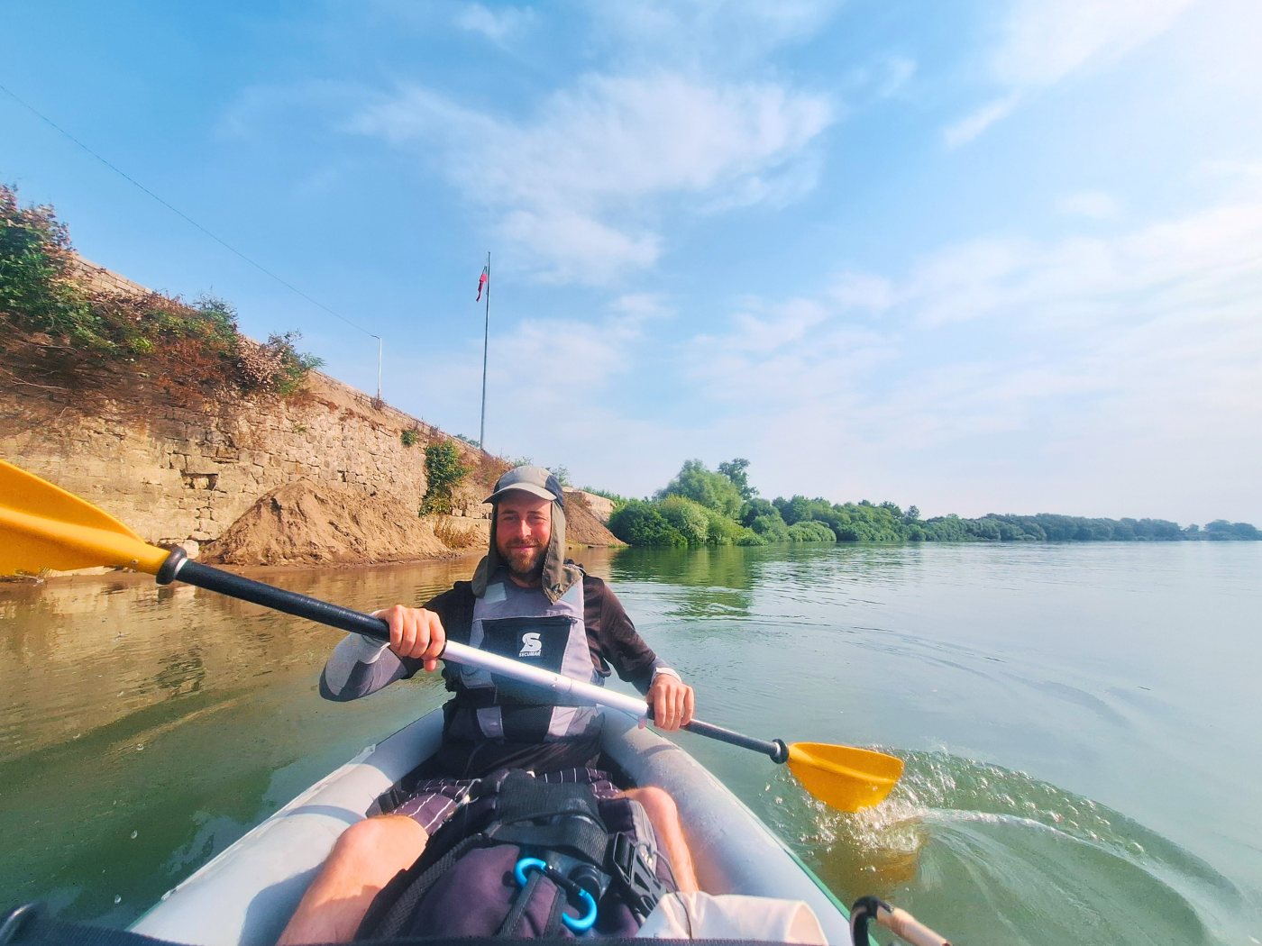
Triple Border: Romania, Serbia, and Bulgaria
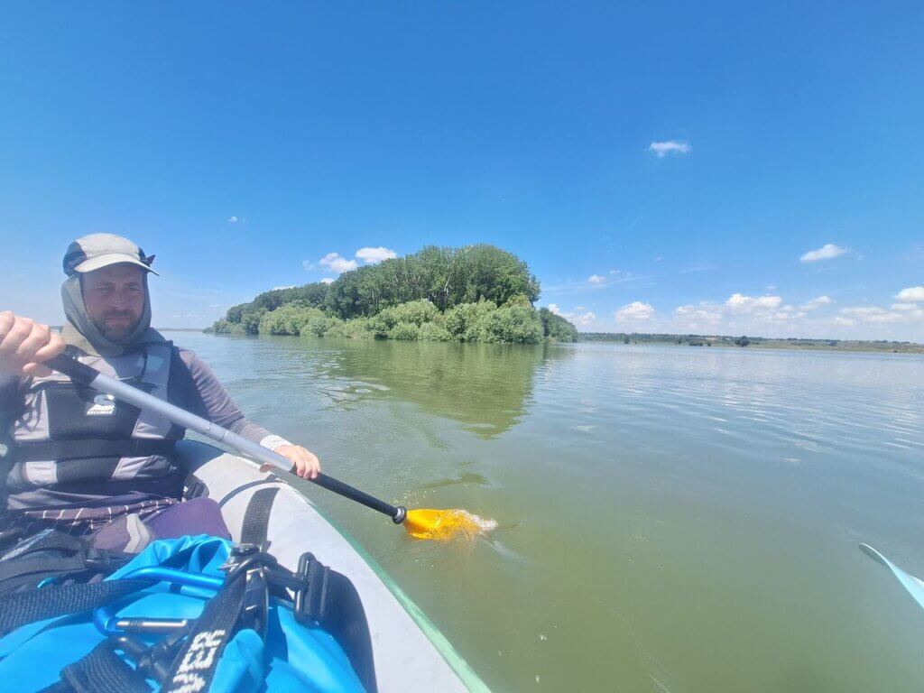
We continue paddling the tailrace of the dam and slowly begin to cross over to the Serbian side of the Danube to shortcut the right turn that’s upcoming. The current is strong and fun. There are a lot of small fishing boats in the river, sometimes stationary, sometimes coming upstream. Being in the center of the river where the big ships sometimes pass feels quite defiant. But we have such a good view on each side that there’s a fat chance they will sneak up on us and scare us away.
Since it started getting hot, I decided to restart an old 2019 Danube kayaking tradition: dipping my hat in the water and putting it back on. Jonas followed suit and enjoyed the coolness of the water for about 25 minutes before it dries again.
To the right, there’s an anchorage site for barges. We think nothing is moving. What we’re looking for: barges with a pushtow attached behind them. If they have a pushtow, it means they can start moving anytime. If they have a pushtow, we look for a smoke plume from their engine or little waves at the front of the barges to indicate movement.
As it happened, one pushtow started to move. But away from its barges. It went a little upstream, then used the current to turn and went a bit downstream. We slowed down to give them more space, but once their direction was clear, we started paddling after them, like a chase.
The pushtow unexpectedly took a right to some other barges. It approached them from behind. Besides the captain, there were like at least five people on deck in preparation to attach some barges to the pushtow. We witnessed the moment the first guy hopped from the pushtow onto the barge. How big are their crews? I thought they were smaller, but perhaps this inland shipping business needs a lot more people than I guessed.
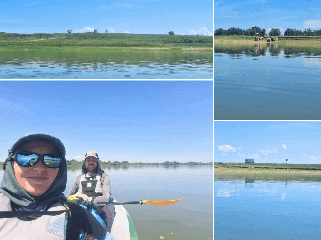
We entered the turn to the right. The Serbian village of Radujevac appeared on our right. There were quite some people enjoying the shores of the last Serbian settlement on the Danube. It was beautiful and green over there.

The Romanian side has this weird lagoon before the town of Gruia. There’s a road to the river where there’s also a hotel. We tried talking to the owners of that hotel to see if we should split up our kayaking to Calafat there for a night (or two), but they never answered. But it was 11:00 and we still had many good kayaking hours ahead of us. It would be a waste of energy to stop here already.
We were now on our final approach to the triple border between Romania, Serbia, and Bulgaria. Unlike the triple border Hungary, Croatia, and Serbia, which is like a T where both shores are Hungary and then left becomes Serbia and the right one Croatia, this one is shaped like a Korean ㅓ (eo); the left shore remains Romania, the right shore changes from Serbia to Bulgaria. I hope that helps to explain it, but I bet it doesn’t.
We slowly try to cross to the left (Romanian) side of the Danube, which is the country we are checked into in case the water police shows up. But every time we check, we are still closer to the Serbian shore than the Romanian one. When a cargo ship traveling upstream meets us, we try to aim for its back so we can cross right after it passes us. This works and we are now on the Romanian side.
Somehow, the Romanian shores here are almost barren. It’s Serbia that’s so green and full of trees. I don’t understand why.
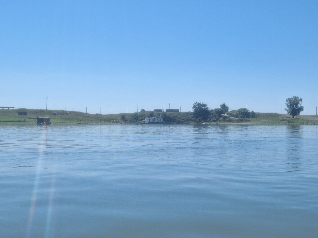
On the Romanian shores, I suddenly spot a Romanian water police base. It’s not a big surprise, but I am not in the mood to deal with police right now. Behind it is something of a dam or a water treatment plant mapped as Cheson (caisson) Pristol (a village).
We pass them unnoticed. The signs on the shore say we’re at kilometer 847. Today seems to be flying by.
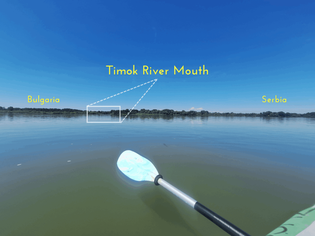
The river turns left and we stick closer to the Romanian shore. To our right, we try to establish where the Timok River flows into the Danube across the river. It’s very green on both sides of the border. We eventually spot a small gap of water. That’s the northernmost point of Bulgaria. We take photos and videos of this moment and say our goodbyes to Serbia. Besides the indoor smoking, you were quite alright. Soon, we’ll even say (a temporary) goodbye to Romania so we can stay in Bulgaria and form an opinion on a country I’ve hitchhiked through (twice!) but never spent the night.
To our left, there’s white obelisk (another ‘Triplex Confinium‘) on the Romanian shores. It has a plaque from 1919/1948 about the establishment of the border here when the Austro-Hungarian Empire ended and Yugoslavia was formed. It still only mentions Yugoslavia, not Serbia.
The time is 11:47.
A Break on Gârla Mare Island + Deflating Zucchini
We kept paddling, but felt the heat of the day beginning to get to us. We needed a break to eat some of our sandwiches with vegan mushroom paste. There were some mapped shipwrecks on the Romanian side if the river near the village of Cozia, but we again didn’t notice anything of them. Ahead of us was the split around the river island of Gârla Mare.
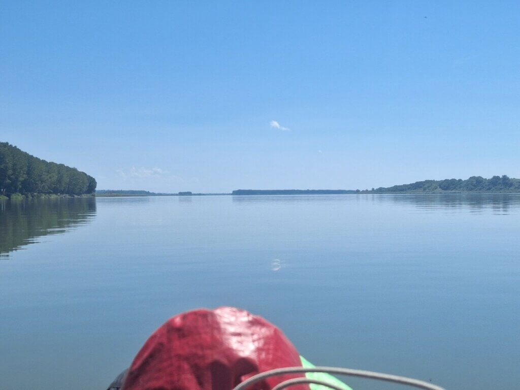 Gârla Mare island and a long river bend in the distance
Insula Gârla Mare was my first suggestion for wildcamping on the way to Calafat, but after some analysis, it would be less than halfway to Calafat. On days where we have to freecamp overnight, it’s important to frontload the kayaking work, so we don’t have to do a lot the next day after a night of (probably) poor sleep in our tent. That’s how I came up with the second Romanian river island before Calafat, which is called Chichinetele.
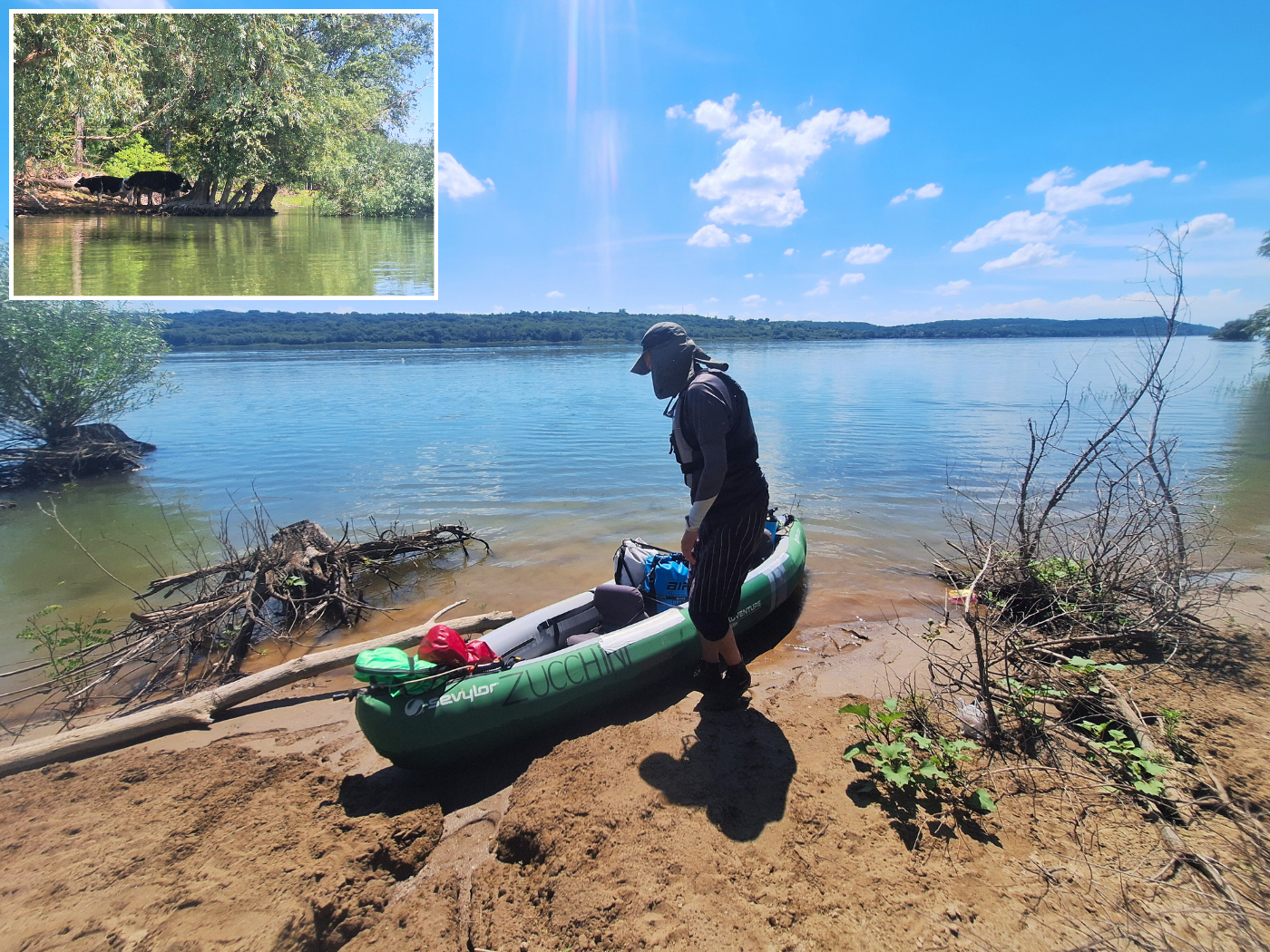
Still, we wanted to land on Gârla Mare to see what we’re missing out on and to eat a sandwich. But upon approach, it wasn’t beachy as anticipated. In fact, it was very densely overgrown well over the edge of the water. Usually, the head of the island isn’t a bad place to land, so we tried finding a spot there. It was very twigsy and not a good place to land, but we made it work for the sake of our appetite.

We landed at 12:46. I crawled out of Zucchini into the mud and made my way up, almost losing a water shoe to the suction. Jonas had to paddle away solo and turn the boat around so he could get out. That’s how narrow it was.
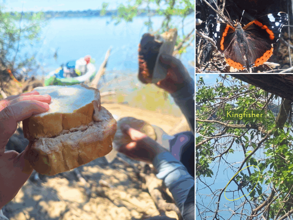
We found a bit of shadow and a tree trunk to sit on. Jonas distributed the sandwiches. I know we have a rule of ‘no sad sandwiches’, which we usually interpret as 1) two delicious vegetarian ingredients or more and 2) a surfeit of the delicious vegetarian ingredients. I don’t want dry bread to scrape my esophagus on the way down. But scarcity of shops and ingredients in the previous days made it so that we had sandwiches that I wouldn’t call sad, but maybe… simple? Anyway, it hit the spot. Meanwhile, we shortly spotted a kingfisher on a twig. They’re some elusive-ass birds.
I let both side chambers of Zucchini deflate for 16 seconds. In this heat, the air in the side chambers expands rapidly, especially when we’re on land and the boat isn’t lying in the shadow. I didn’t feel like measuring with the manometer because of the risks of getting the vent flaps stuck and needing to pump up the boat again. Also, there wouldn’t be an accurate measure if we don’t take out all the luggage.
We also had to refill our water bottles. I realized the hydration bladder behind Jonas’ seat shouldn’t just bask in the sun there all day and had to move inside. We had packed 11 liters of water and already had gone through about 3 liters. Jonas did some hydration math I didn’t follow, mostly because I disagree; I don’t drink symmetrically throughout the day. And after a workout, like, say, kayaking more than 40 kilometers on a hot river, I enjoy chugging water until I’m satisfied.
This 28-minute break was accompanied by several beautiful butterflies. When we climbed back into the boat and left, several butterflies tried to hitch a ride. One landed on me, but then decided I smell bad or something like that, and moved to Jonas. First on his arm, then on his hat. He’s such a Disney princess with the animals. It’s amazing and I love him so much. Behind us, we can see some mountain range in Serbia that I’ve identified as Deli Jovan, nearby Negotin.
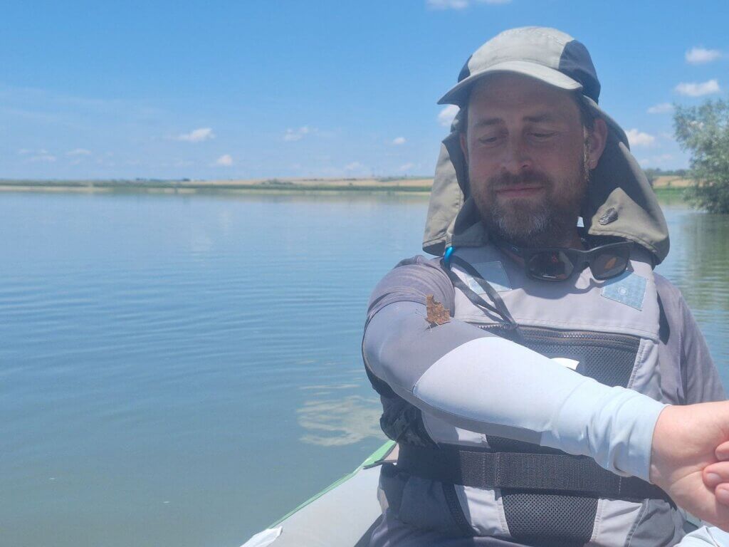
Paddling past the broad side of Gârla Mare, we saw that we had made the right choice to land on the island’s head. There was absolutely nowhere to land. All the satellite footage we had analyzed so carefully was basically useless knowledge because the satellite images were taking during low water or even drought. The butterfly joined us well beyond the tail of the island, which we paddled past at 13:41. We are about 11 kilometers away from the island of Chichinetele. Suddenly, our idea to wildcamp on that island was cast in doubt.

 The butterfly is still holding on
Wildcamping Along the Romanian Danube?
And we kept paddling…
To our right, the Bulgarian town of Novo Selo appeared. Our original idea was to stop there and freecamp illegally or at least stop to buy more water or food. But we wouldn’t have Bulgarian Lev to pay with and I couldn’t tell Jonas if it’s common to pay by card in that country I’ve been to but can’t say I know. The TID sleeps there and I guess Bulgarian immigration comes to them to check them into the country.
At 14:34, we could hear Balkan music blasting from the Bulgarian shores from the village of Florentin. The headwind was beginning, as the forecast had predicted. It carried the sound to us. Ahead of us was the long and skinny island of Chichinețelor.
We scouted for a landing spot. Satellite view had shown an area where the trees are cut down in the middle, but when we paddled there, it was already occupied by campers and fishermen. Bummer. I don’t feel like sharing a wildcamping spot. It also would have been incredibly difficult to land in most places except the already-occupied part. Mostly because of the wildly growing plants, once again.

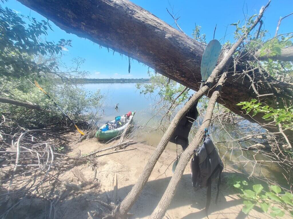
When we reached the end of Chichinetele island, there were some flooded trees. We decided to duck in between them for fun and to go closer to the Romanian mainland. We needed to be on land to discuss what to do and let some air out of the bottom chamber as well. That one is usually fine because it has the most contact with the cold water of the river, but it had started to bulge upwards at my legs.
We found a spot on the land. As we prepared for landing, a motorboat approached from behind us. It’s very busy on the Romanian side of the river. Has been all day!
We had a break on land from 15:15 till 15:39. Jonas let out more than 10 seconds of air from the bottom chamber, but the bulges at his spot and mine didn’t go away. I needed shadow, so we found a spot somewhere beneath a tree. The sun is brutal.
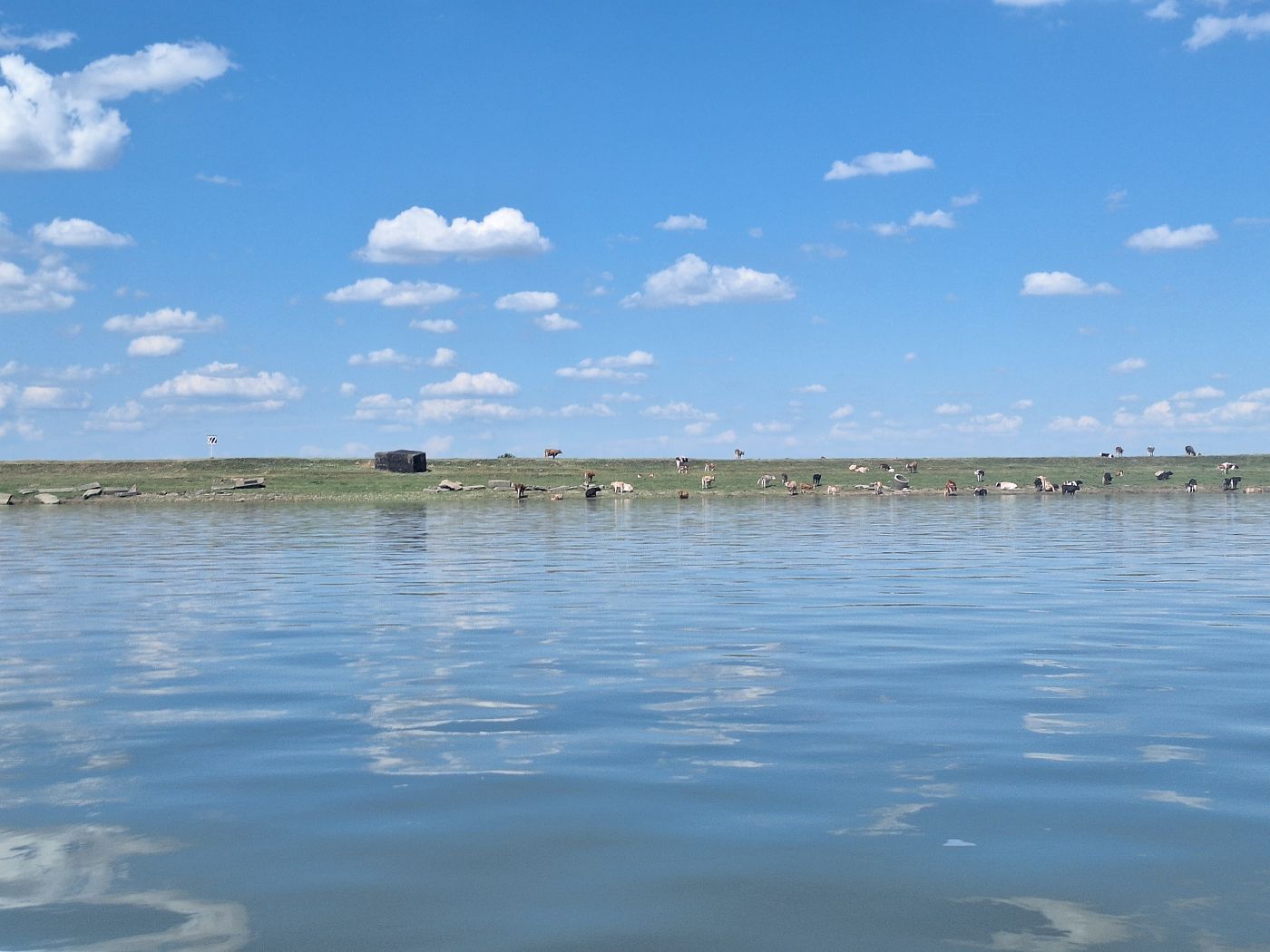
There were other people here with fishing gear and tents. And there was a herd of cows. Jonas argued that we could camp here because it looked like these guys were leaving. But there were like three cars. Some of them might just pitch a tent for the daytime and then drive home in the evening, but it’s unlikely that all of them will go.
What do we do? Will we go camping? Shall we keep paddling until we find a happy camping spot? Should we paddle the remaining 32 kilometers to Calafat?
The sun won’t set until somewhere after 21:00, so technically we have enough time to kayak to the big Romanian city and postpone inaugurating our tent for another day. There is something to be said for just getting over with the camping so we know the strengths and weaknesses of our setup. But what if we kayak the whole way to Calafat? Paddling more than 70 kilometers is also a feat!
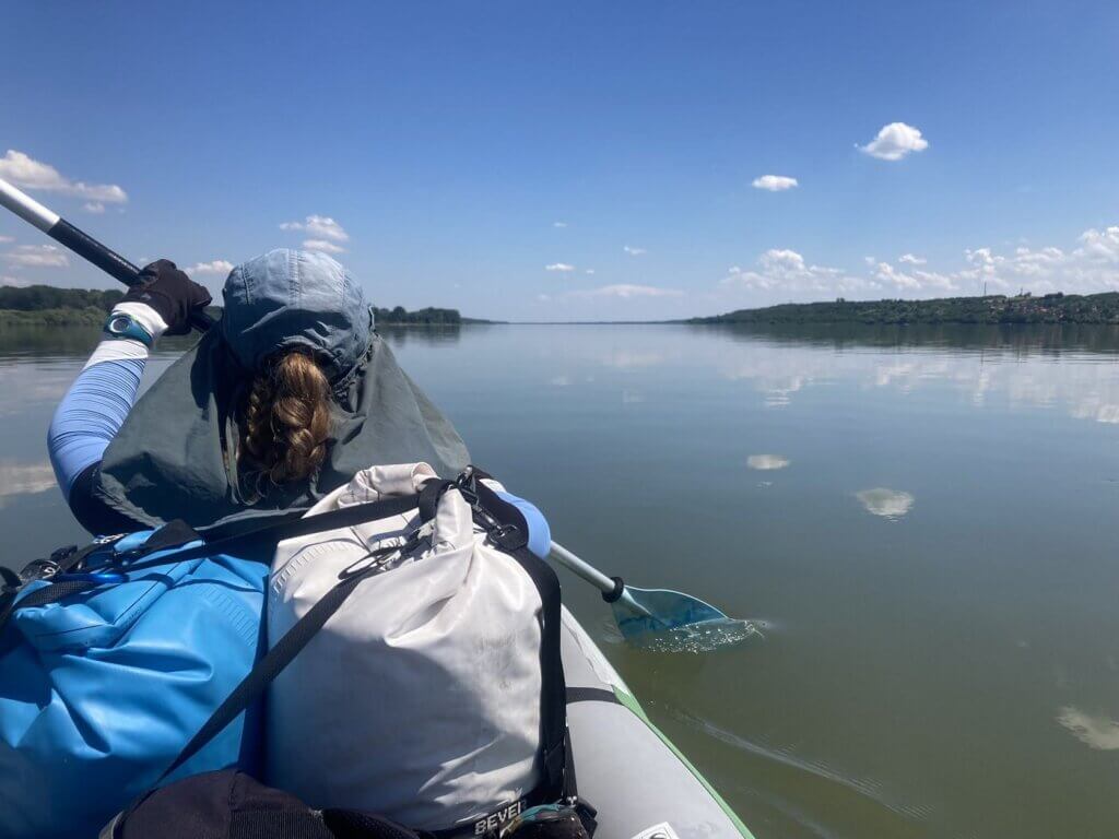
Let’s keep paddling for now. At least until 18:00 we can just see how far we get. Perhaps the headwind picks up and pisses in our cereal. If we pitch a tent now, we’ll still have hours of hot weather and absolutely diddly-squat to do while our phone batteries are running low. But before we got into the boat, I took off my leggings that were way too warm and itchy. I was only wearing shorts now and the bare legs exposed to the sun was also a bad idea, so I grabbed my sarong to make a blanket.
The Possibility
Because I’ve played around with the idea to paddle the whole distance from Iron Gate II to Calafat in one day, I didn’t say anything about making it to Calafat on the way to our next flag marker in Romania: a town called Cetate. It was just time for me to put in the work if I wanted it. This goes for the both of us, but because I don’t control Jonas’ thoughts nor have any inkling as to how physically or mentally tired he is, all I can do is paddle paddle paddle.
We first paddled past a semi-official campsite mapped as Statia plutitoare Salcia on Google Maps. I’d seen it before and it looked nice. It was quite busy at this moment. There’s a reinforced embankment with two people on the shore. We paddled quite close by them. One of them asked us something, so I shouted back “Bună ziua!”
I had revealed myself to be not Romanian, so he asked us “Română?” and I said “Olanda!” He then asked “Constanța?” and I yelled “To the Black Sea!”
It was a fun interaction. Behind this area, which is apparently yet another water treatment plant or pumping station, there was a beach with many people, tents, and also some dogs. It looked nice for camping and perhaps we could find a place with a tree for shadow and enough space to be left alone. We discussed it shortly, but I told Jonas that if we’re found out to be foreigners, the Țuică will probably start flowing. I just feel much safer stealthcamping or camping at an official paid campsite than this in-between stuff. And if we have to keep kayaking tomorrow, I don’t want to drink alcohol tonight. Kayaking with a hangover is a recipe for disaster.
After this nice beach with nice people, we entered a zone that was a little less nice. Basically because there was one guy on a jetski. We hate jetskis and the people who ride them. And yes, we’ve ridden a jetski in the UAE, which is probably the douchiest place to do such a douchy activity.
We approached with care. At some point, the rider noticed us and came upstream. I dreaded the fucking worst, but in the end, he slowed down when he passed us to not cause us too much wake to deal with. Either he was considerate, or he was just checking us out before moving on.
We kept paddling towards the point where jetski boy originated. When we arrived there, there was a large group of teenagers – some swimming in the river – on the shore doing teenager things. Jetski boy returned, passed us, and picked someone up from the water and zipped off again. Luckily, we didn’t meet him again. The shore was treeless but full of cows, so also not a good place to land and camp.
Now that we’d faced off with this annoying threat, the possibility of paddling more than 70 kilometers in one day suddenly became real. And still, I switched between believing in it and not believing in it, and still keeping my eyes peeled for potential camping spots. I asked Jonas how he felt, and he said we’re going to do it. All the way to Calafat in one day. I’m not going to be sure of it till I lay my eyes on the New Europe Bridge. There’s still so much potential for shit to go sideways. I told Jonas that he can book the hotel in Calafat we’d previously vetted when we see the New Europe Bridge.
Opposite the Bulgarian town of Gomotartsi or Gomotartzi, about 20 kilometers from Calafat. I don’t remember how I know this, but I know it’s a wine village of Bulgaria. When on the wiki, it had this interesting tidbit:
“The village has a strange history. It used to be somewhere else, miles away from where it is now. After a terrible plague ravaged a large part of its inhabitants, the survivors decided to burn their houses and look for a new place to settle. They chose the big river bend, and the high bank also attracted settlers from beyond the Danube, where the water often flooded the lowland. Is his name Gomotartsi, which means noise, noise from the gathering of many people in one place.”
On the Romanian side, we saw two anchored boats. I first thought they were fishing boats, but to my horror, they turned out to be Romanian water police boats, one big white one with the flag colors and one small dark blue boat. If we have to deal with them, we might not make it to Calafat today. The closer we got, the better I saw what was going on: a towel hung over the window facing south meant they’re trying to avoid sunlight heating up the space inside too much. They’re probably napping. I would too if I had that job.

The Sharp Turn Westwards
Once we had passed them unnoticed, we began shortcutting the river to the Bulgarian side as the Danube began to turn right. We ate a protein bar one by one. If we’re hungry, we can eat the last two protein bars before we arrive in Calafat as well. It’s all fair game if we kayak more than 70 kilometers in one day.
I did some mental math to keep my brain focused while paddling and realized we just crossed the mark of having paddled more than the day we kayaked from Golubac to Donji Milanovac in Serbia. That day was 53.6 kilometers and now we should be over that. Even if we somehow won’t make it to Calafat, we’ve already broken the distance record.
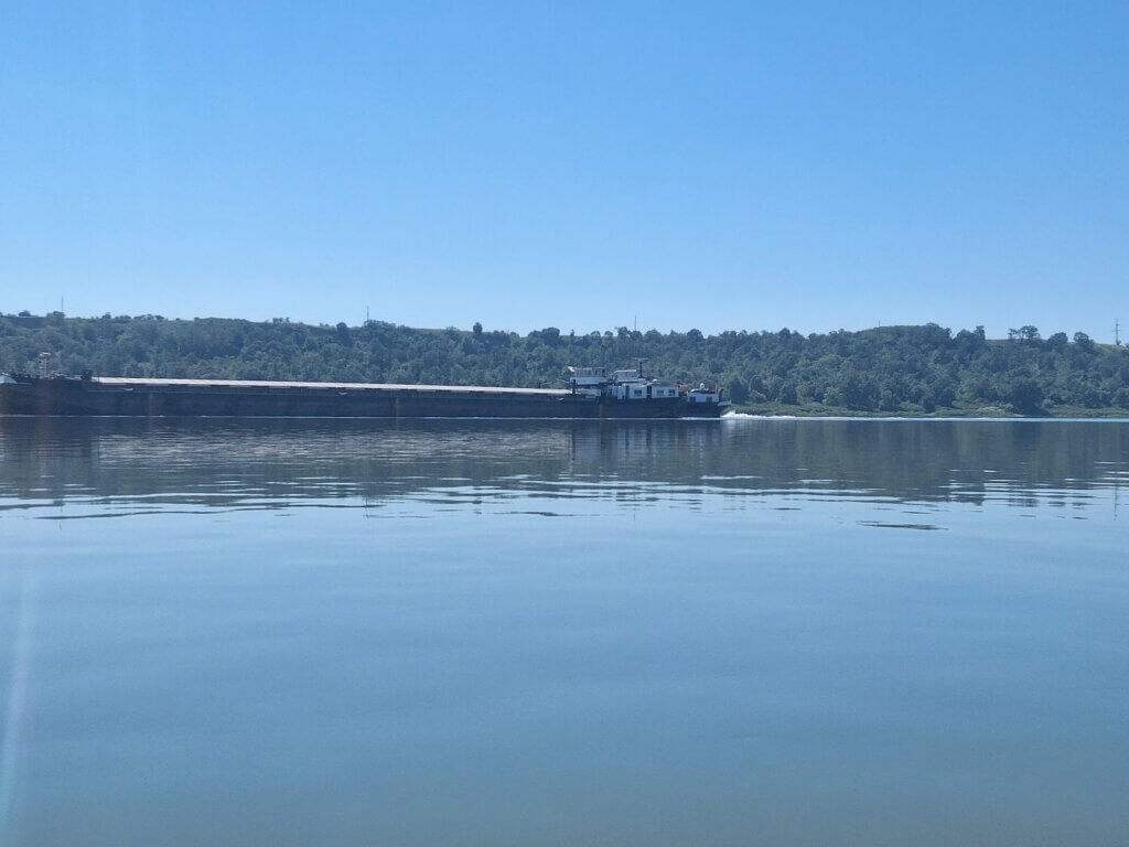
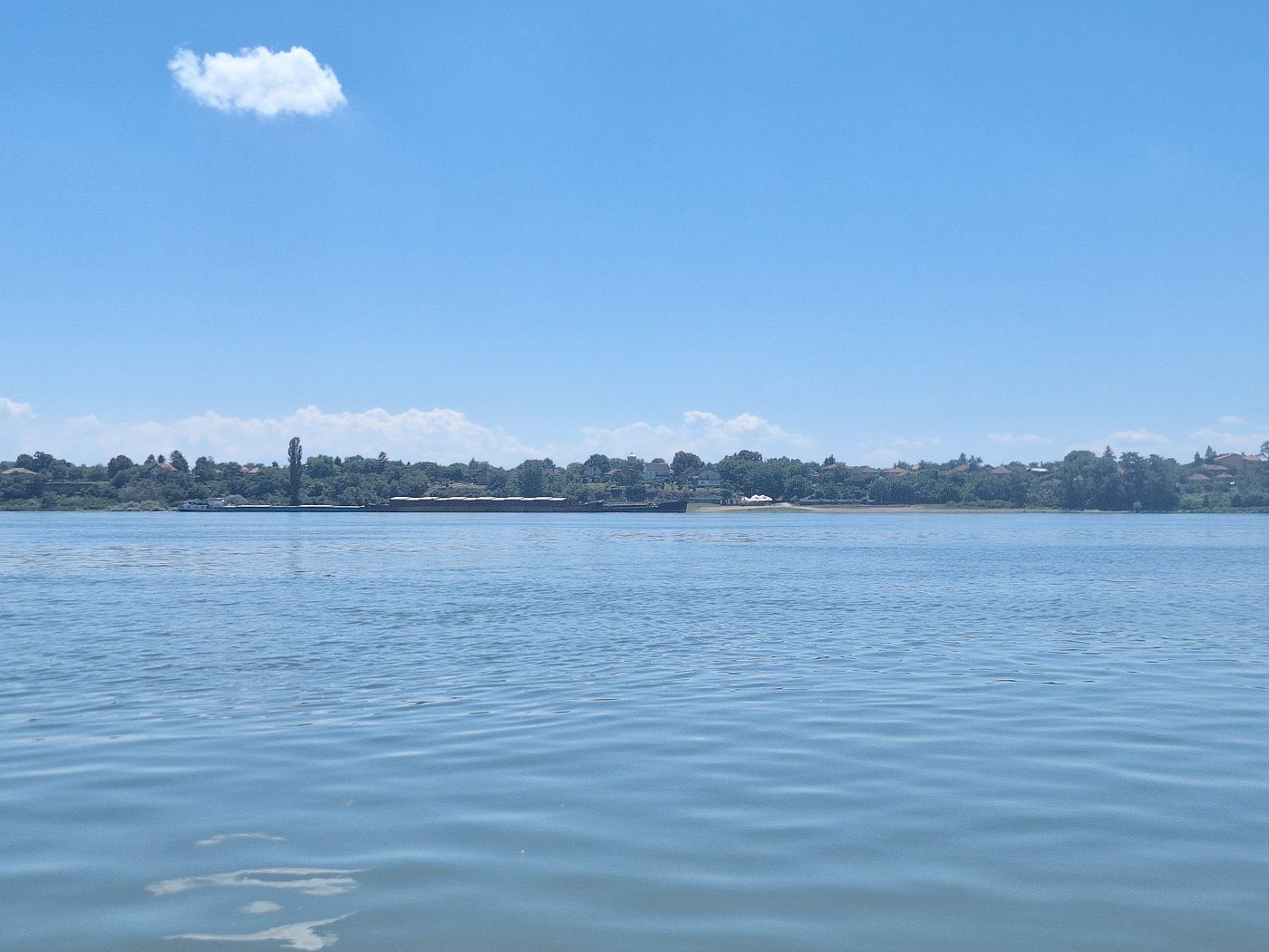
As we crossed, a pushtow with several barges appeared and traveled upstream. We took the inside of the turn as they traveled up. It was a TTS Line pushtow. It was going very slowly.

I dipped my hat into the water again. I’ve done that at least 10 times today. My hair is permanently a little wet and probably smelly. Sticking my gloved hands into the Danubian waters to cool down helps. I hoped this was the last time I needed cooling as the sun’s radiant powers diminished. It was 17:30 now and getting cooler.
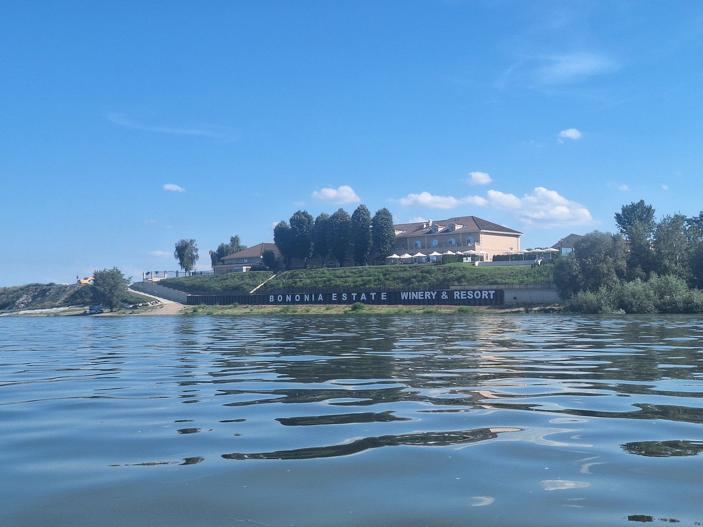
The current picked up as we entered the turn so close to the Bulgarian side. We passed the Bononia Estate Winery and Resort. In our attempts to not go camping, we had even looked at staying there, although it’s very expensive at more than €200 per night. The possibility of booking one night there without being properly checked into Bulgaria wasn’t worth it for that kind of money.
The Romanian side of the river had the port of Cetate. My OSM map has a hotel there, but it wasn’t online bookable. There are some reviews on Google Maps, but it wasn’t clear at all and at this point, it’s about 15 kilometers to go to Calafat. One might as well… paddle more than 70 kilometers in one day.
I feel like I was going rabid, foaming at the mouth to catch a glimpse of that bridge across the Danube. As we turned more and more westward, I felt like it was going to be very soon. We passed the Bulgarian village of Košava. Yes, the Košava like the strong, cold easterly wind we’ve experienced since leaving Belgrade. Apparently, the village is named after the wind, because the downwind villages always felt this terrible wind came from this area. Does that mean we’ve officially left the Košava wind-affected zone? That remains to be seen.
We also paddled past the elongated island of the same name. It was there that we saw the very first Bulgarian kilometer sign: 807. Holy shit, we started at 874 today.
 Island of Koshava, Bulgaria
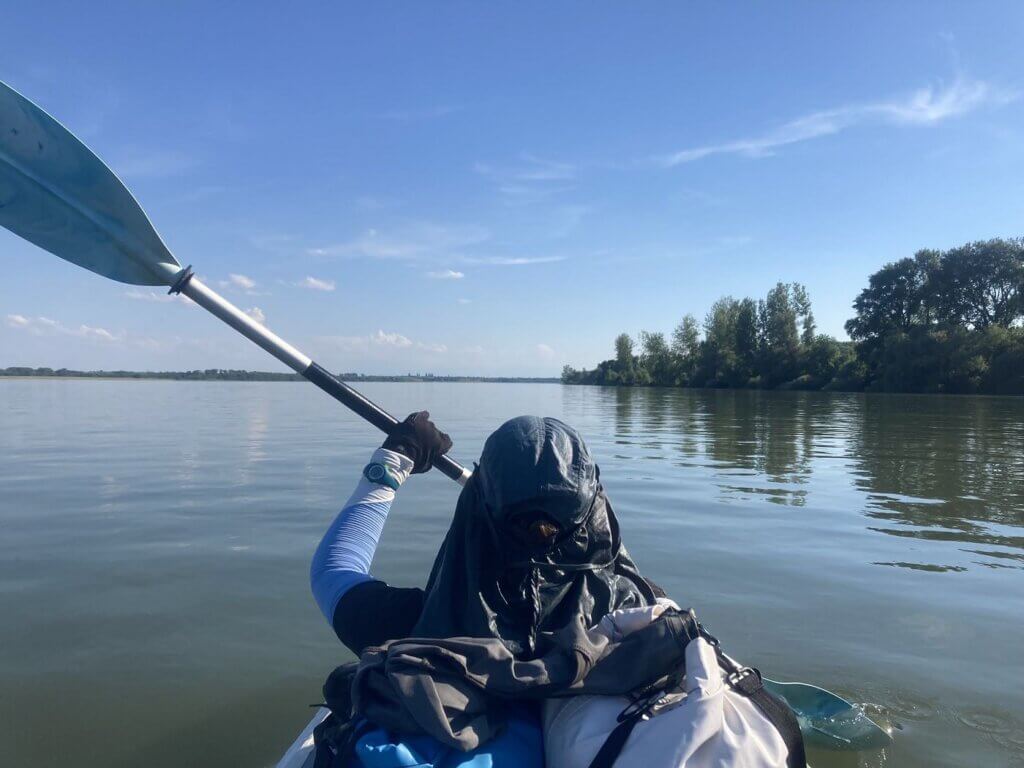 Wet hat, but the heat has already broken
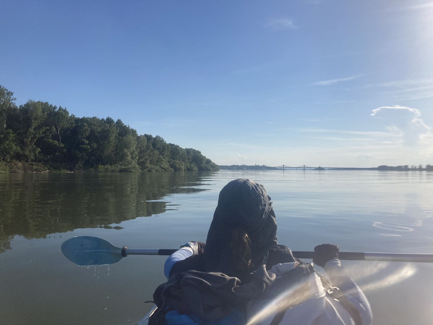
We kept paddling on the Bulgarian side. It was now after 18:00. Still no sign of the bridge.
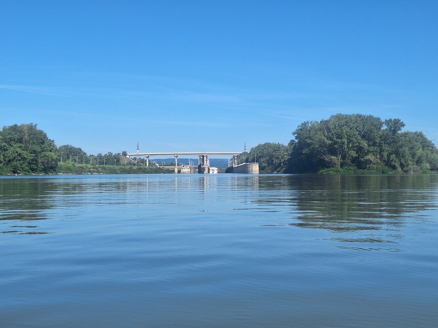
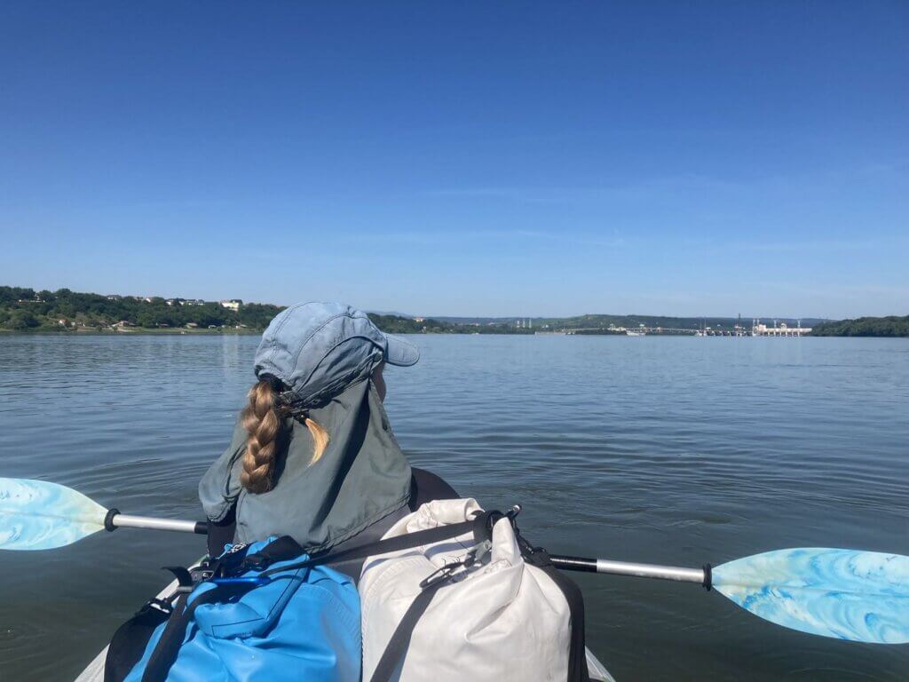
New Europe Bridge: Our Arrival in Calafat
At 18:33, we saw the first signs of the New Europe Bridge past the Bulgarian village of Slanotran. Hip hip, hurray! We’re not there yet, but we’re so damn close. I let out a shriek of relief and my eyes filled up. Ten kilometers to go to Calafat. We have paddled more than 60 fucking kilometers.

We were coming towards the Bulgarian river island of Kutovo or Golya. Though the channel to the right of Kutovo island is wider than the one on the left, it’s deeper on the left, which is why the shipping lane goes through there. But we’re a kayak, so we can traverse the shallow waters without issue and chose to paddle between the Bulgarian island and the Bulgarian shores.
A cargo ship was traveling downstream, followed by the big white Romanian water police boat and a cruise ship. The difference in speed meant that the cruise ship overtook the cargo ship on the way down. Everyone disappeared behind Kutovo island from our point of view. Then another cruise ship appeared behind us, also traveling downstream. We’ll have to watch out for those ships when we cross back to the Romanian side after the island.

It was time for Jonas to book Hotel Coliseum in Calafat. He somehow didn’t have reception, so I opened a hotspot on my phone for him to book it. I still had plenty of battery left to do such a wasteful thing. I kept paddling while he booked it for two nights and sent the hotel a message about our arrival time. What do we think? I said 21:30 by the time we’ve dried and packed Zucchini and walked to Calafat center.
At 19:03, we were about to paddle beyond the tail of Kutovo island. I had spotted one tent on its overgrown shores and many river birds. As we approached the tip, the sound of jazzy music became louder and louder. It felt like a fever dream.
Behind the island, we had to cross to the left side. There was a beach on the Romanian shore with some kind of bar and the speakers that emanated those trippy jazzy sounds. We slowly crossed while watching out for traffic.
 Plaja Bașcov Calafat
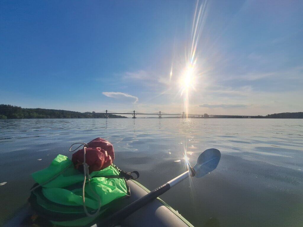
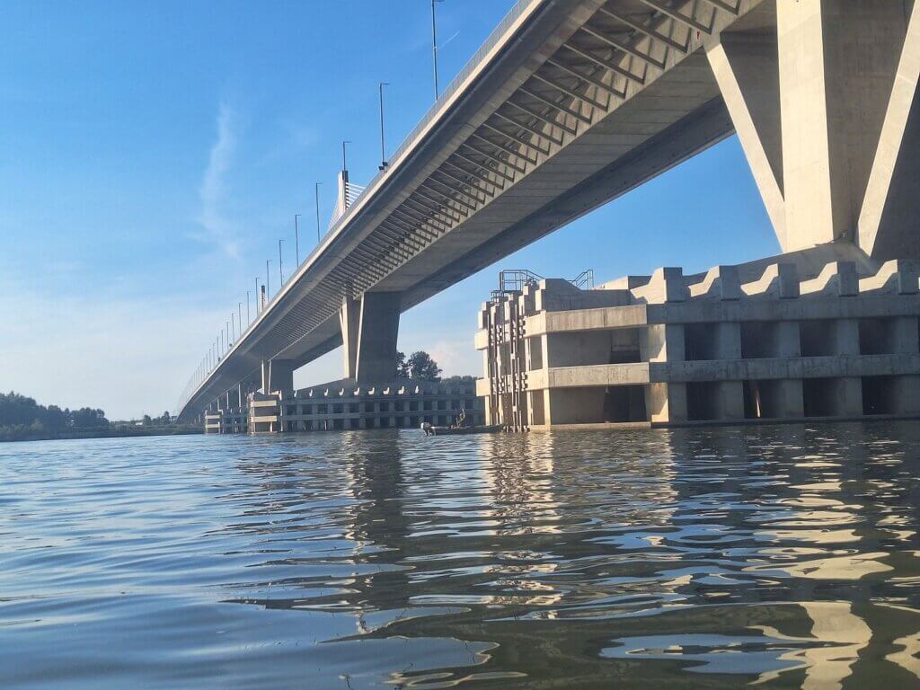
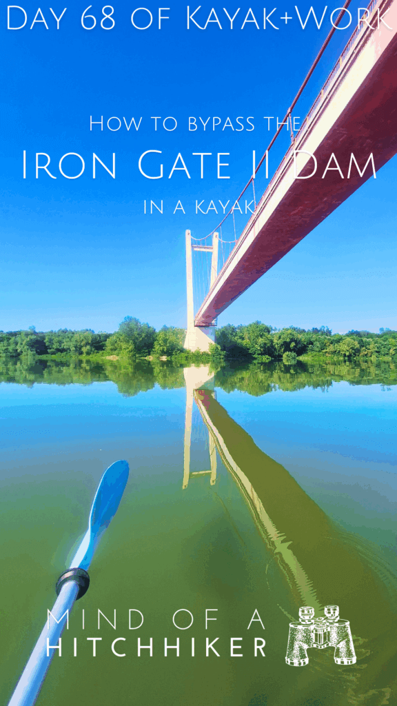
Once we were at the green buoy, we knew we were safe from the big ships. We approached the gap of a span of two pillars of the New Europe Bridge and took photos and videos as we passed beneath them, eclipsing the sun for a few seconds. A fisherman in a boat had moored at one pillar and used it as his fishing spot. Kinda smart.

We were now less than one kilometer from the beach in Calafat we’d decided to land at. We paddled closer to shore to make sure we wouldn’t miss it. That would be disastrous.
The trees made way for a gap with shallow water plants and the sound of frogs. A man in a speedo stood on the shore, enjoying the remaining sunrays of the day. We landed right behind him on the beach.

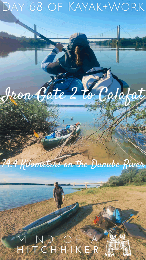
Arrival time: 19:34. Paddling more than 70 kilometers from Iron Gate II dam to Calafat took 12 hours and one minute.
Packing Up + Walking to Our Hotel in Calafat
What a crazy day.
We did our dance to dry the boat and pack our stuff. There were more people at this beach in Calafat. Most were there for the sunshine. Frankly, we’ve had enough of the sun. Throughout the day, we had reapplied sunscreen twice beyond our original base layer.
There was a bit of glass on the beach, which we tried to remove. When the sun disappeared behind a thin cloud and the mosquitoes started to attack us, we decided we should just pack up and go to the hotel in Calafat. We did our best to do that quickly and efficiently.

When packing up, I noticed that our beloved kayak sail had broken. Shit, that actually sucks a lot. The kayak sail is the only reason we managed to paddle our previous distance record to Donji Milanovac. I’ll have to deal with that later. I don’t know how, but perhaps it’s fixable. I don’t want to toss another kayak sail.
We hiked up the embankment to the town and took the pedestrianized routes. We had to take a break on a bench, but quickly regretted that due to an incessant mosquito attack. Jonas regretted unzipping his zippable pants and also falling victims to the only species on Earth that is worse than humans.
The vibes we got from Calafat were really good. The evening had begun and there were lots of people out on the streets, going to bars and restaurants. It was a relief to arrive at our hotel in Calafat.
I didn’t know how many kilometers we’d paddled yet, but it’s definitely over 70 kilometers.
Our Stay in Calafat
Here’s a summary of what we did during our two-night stay in Calafat:
Friday: after we checked into the hotel, we went to restaurant Trésor for some pizza and salad. We then went to the Profi supermarket and bought some stuff for in our hotel room, which had a fridge.
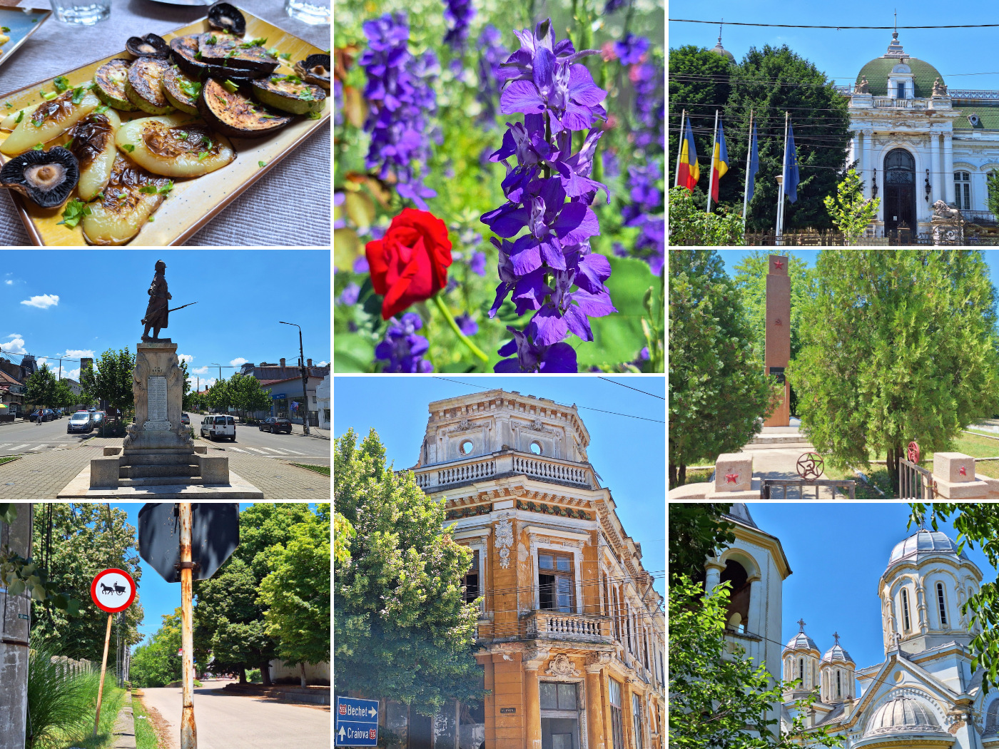
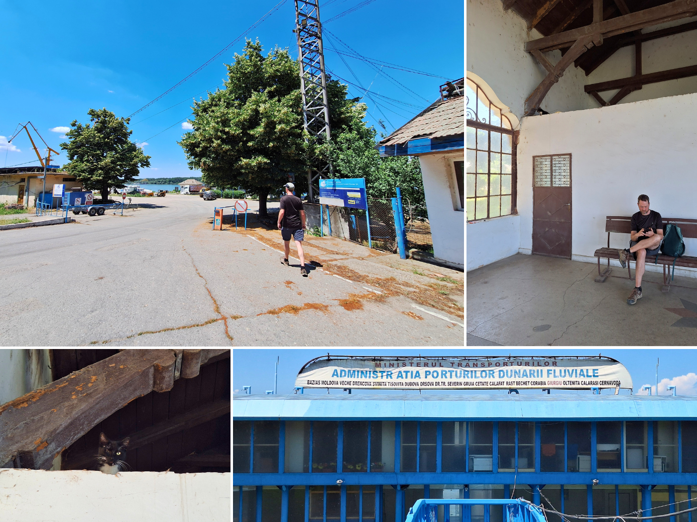
Saturday: we worked a little in the morning, which for me was mapping the kayaking from Comoara Istrului to Calafat. That’s when I confirmed our distance: 74.4 kilometers. Despite the 34°C heat, I found the walk we took through Calafat to the Romanian water police quite lovely: monuments, beautiful buildings in decay, flowers, and the occasional cat.
We ate lunch at Restaurant OK, which was more than OK. I’m a little sad that we’re almost leaving Romania (temporarily) and that I still don’t have the basics of ordering food under control. I must improve my Romanian speaking skills.
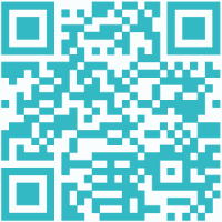
After lunch, we walked to the Romanian river police to see if we can check out of Romania by boat today or tomorrow. Either that, or we have to take a very late Flixbus minivan across the bridge to Vidin in Bulgaria. Or take a taxi. I’d asked a staff member who spoke good English at Restaurant OK how much a taxi from Calafat to Vidin would be for Romanians, and he had no idea. He said we would definitely be screwed over on the price. Maybe €25? That was his best guess. The bridge itself has a toll as well, so that complicates the cost. Though a train can cross the bridge, there’s no direct train connection from Calafat to Vidin. Nor can I find out if passenger rail exists across it.
Read more about (our attempt at) checking out of Romania via river police here in the next article about Day 69 (nice): Calafat to Vidin. It also has info about checking into Bulgaria as a boat.
Once we’d spoken to the Romanian river police, we were exhausted. We returned to the hotel and relaxed with the aircon on till the evening. We then went to restaurant Trésor again, but this time the food wasn’t fast. In the evening, we packed for our shortest kayak day ever: less than 6 kilometers down the Danube from Calafat to Vidin.
Useful post? Consider buying me a beer!


Similar posts:
 Kayak Trip Day 69: Calafat to Vidin – Border Crossing from Romania to Bulgaria by River
 Kayak Trip Day 62: Golubac to Donji Milanovac – Entering the Iron Gate + Breaking Fifty
 Kayak Trip Day 65: Orșova to Drobeta-Turnu Severin – Iron Gate I Locks Unlocked!
 Kayak Trip Day 36: Čunovo to the Danube Floodplains – Freecamping
 Kayak Trip Day 67: Crivina to Comoara Istrului – Iron Gate II Dam + Danube Gogoșu Branch