")


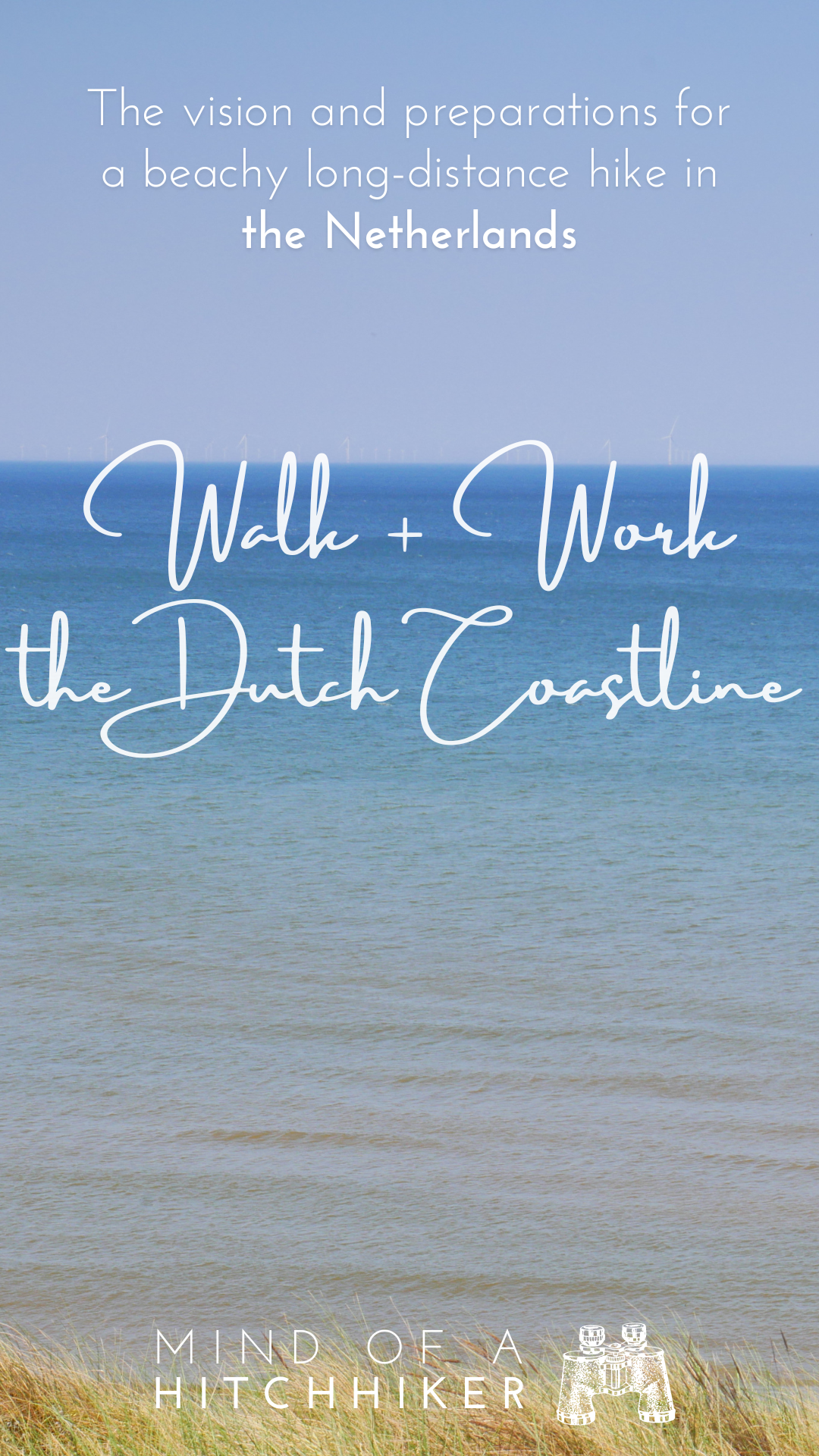
After traveling by hitchhiking for long distances and kayaking a generous portion of the Danube, we felt it was time to return to the basics: feet. As Jonas and I were both born able-bodied, walking was our very first mode of transportation as little shitlings. And now we’d like to experience traveling on foot for a bit. But because our fitness levels for hiking are atrocious, we decided to make the first long-distance hike something easy and flat: the Dutch coastline. Here’s how we planned for this trip.
Contents
Mind of a Hiker
While traveling in parts of Asia, Europe, and Africa between 2019 and 2023 was marvelous, we couldn’t walk much in many of these places. That’s mainly for three reasons:
- Pedestrian infrastructure in cities was either unsafe or missing
- People wouldn’t leave us alone
- It’s too hot
So our legs wilted away as we took Grab taxis and rented scooters instead of simply walking. Sure, some of the cities and villages we visited were more walkable than others. I have fond memories of exploring Bishkek on foot and all cities in Ukraine were a breath of fresh air and a pleasure for the legs. But I also remember competing with car traffic in the ancient and narrow streets of Edirne, asking Jonas to drive me 600 meters by scooter to go to yoga in Chiang Mai because there was no sidewalk, and taking a bajaj everywhere in the otherwise walkable Lalibela because it’s hot, at altitude, and I don’t want people asking me for money every 20 steps.
Sure, we still hiked. But that was often limited to dedicated hiking trails in national parks. And getting to those trailheads is always a bit of work. Put differently, I missed walking out the door with little preparation and wandering off freely to somewhere green, rocky, or full of seasonal bugs and pollen. It didn’t really matter as long as it was outside and didn’t require payment to enter or lots of research.
Famous Long-Distance Hiking Trails
I have been wanting to do a long-distance hiking trip since forever, but never really found something that fit my tastes.
- El Camino de Santiago: too crowded and religious
- The Appalachian Trail/Pacific Crest trail: too many guns
- Land’s End to John O’Groats: too much Brexit
- The Lycian Way: too steep? Too hot? Idk, the food is too good so I’d simply never leave town
- The Transcaucasian Trail: not finished yet, and knowing Georgians and Armenians, I’d never finish the hike due to invitations to stay in people’s homes
Anyway, I’m not really into prestige trails, a sense of community, or suffering for the sake of it. At the ripe age of above 30, I just want to walk, not think, have a good time, see some cool and beautiful stuff, and then have a shower and a good night’s rest. Well then, where do I want to hike?
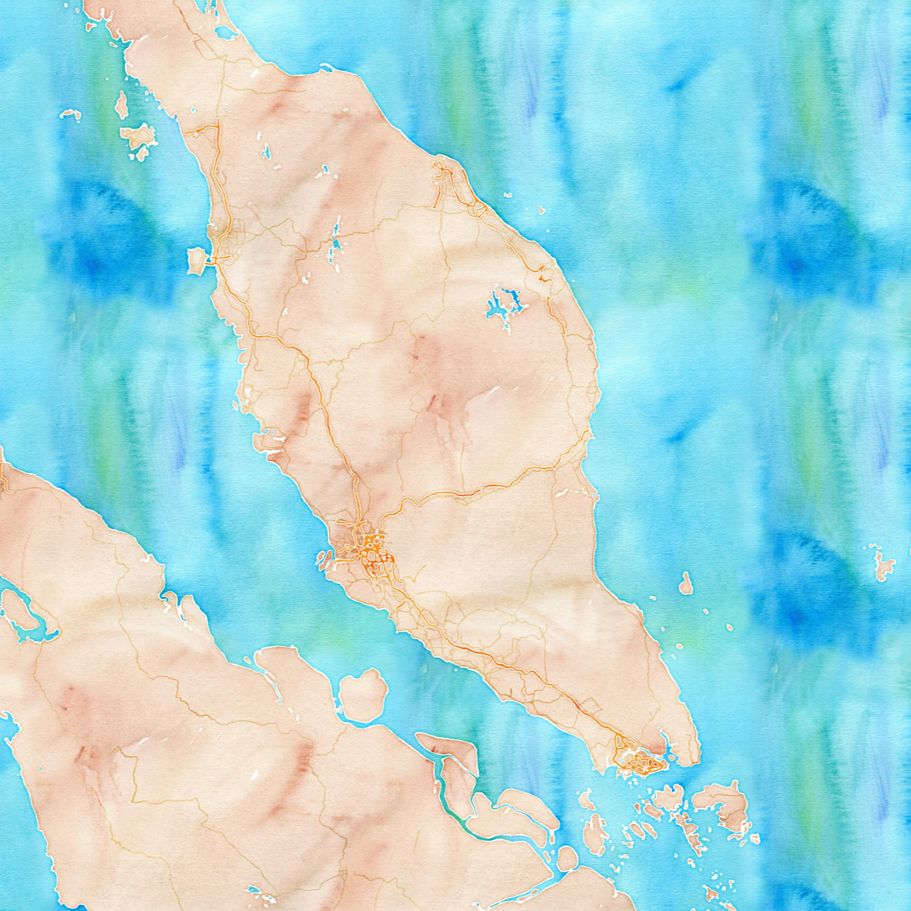
I started with the Wikipedia page for European long-distance paths. There’s a total of 12 of them and I’d love to hike the Cypriot section of the E4.
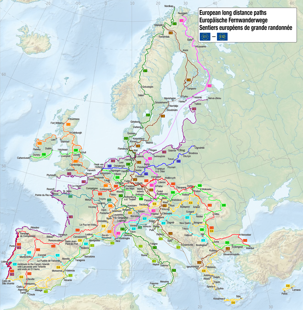
By Maximilian Dörrbecker (Chumwa) CC BY-SA 3.0
So for starters, I need something flat and low commitment. Something to strengthen those knees and ankles. Something to get in walking fit shape. And something suitable for winging it.
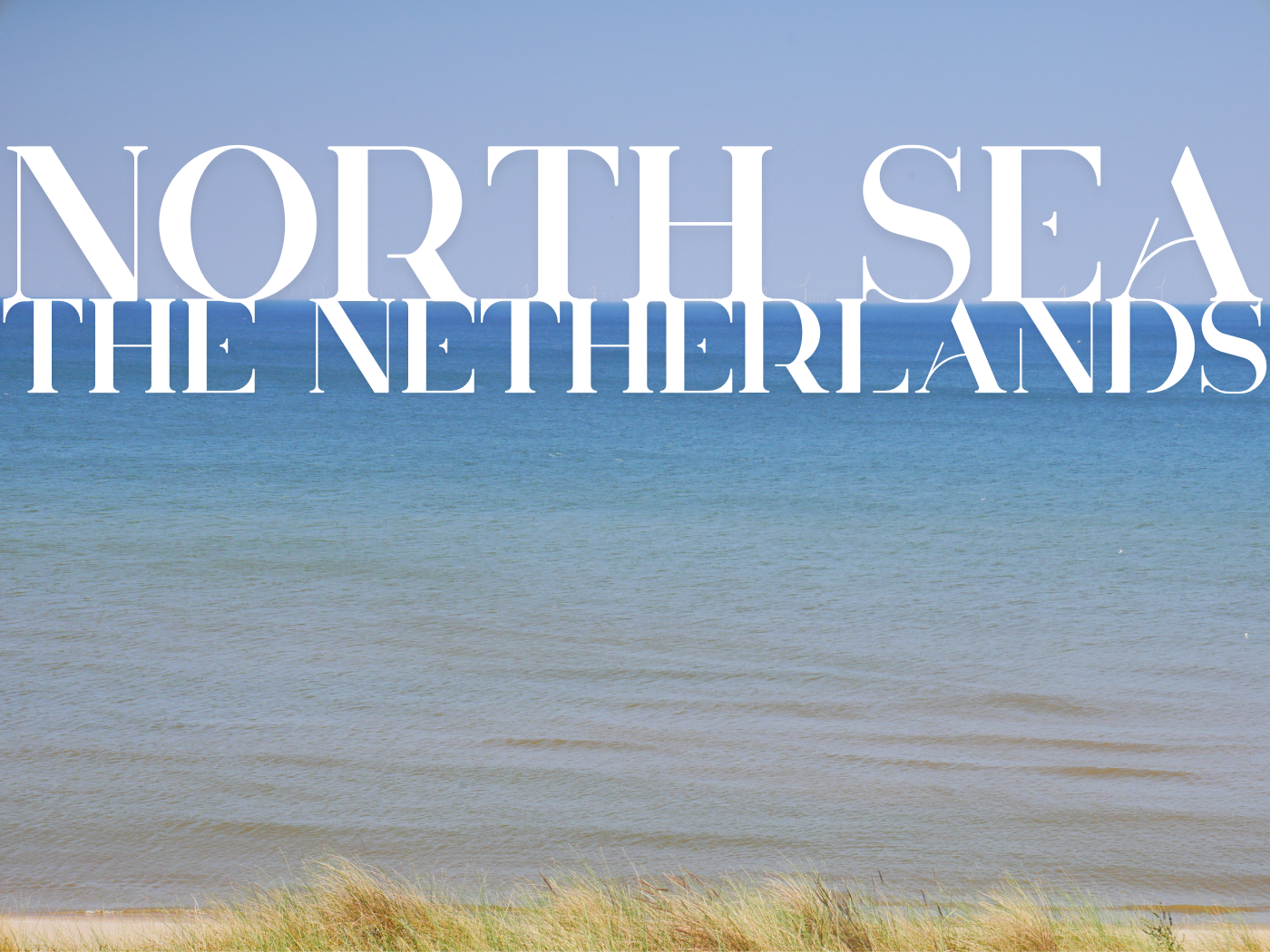
Mapping the Dutch Coastline, While Bored
During the long months of the first covid year, I expected that at one point we’d have to leave Malaysia and return to Europe. So in my head, I made plans for what we’d do if we’d get trapped in the Netherlands after some mandatory evacuation flight. None of this materialized in the end, but still, I thought the best way to spend our time in the lowlands was by hiking the Dutch coastline.
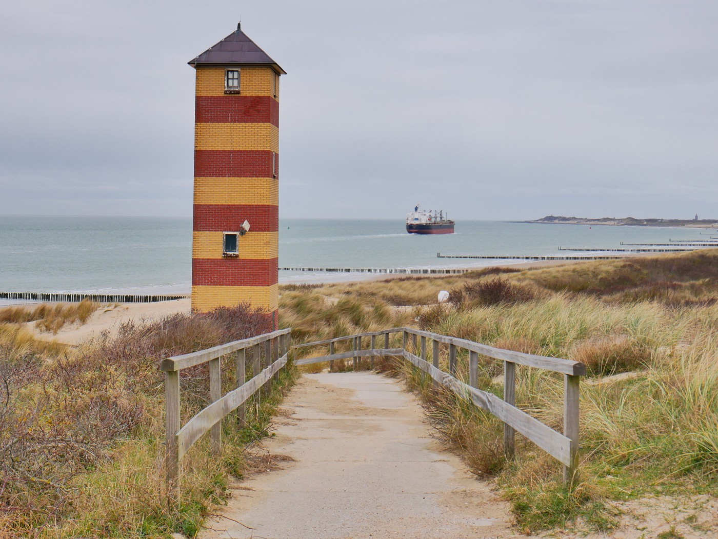
So I started mapping one evening. Just drawing a line on GoogleMyMaps and measuring the Dutch coastline in sections, starting at the Belgian border. This section is the most straightforward one; there are sandy beaches and dams you can walk over. Then from Hook of Holland (Hoek van Holland) till Den Helder, it’s pretty much a straight line with some places you need to cross some water. I know this section of the coast a bit from my childhood beach days.

At the Dutch Wadden Sea Islands – aka “Frisian Islands“, a name I’d never heard before – the map became a bit complicated. Does one go to the islands to walk the coastline there or stay on the mainland? Or both?
If one goes via the mainland, there’s the Afsluitdijk which separates the Wadden Sea from the IJsselmeer. This giant dam and vehicle causeway dates back to 1932 and is more than 30 kilometers long. Hiking more than 30 kilometers in one day should be doable once one has a basic level of fitness, but is it allowed? Back in 2020, the website of the Afsluitdijk said the following:
“Walking across the Afslutidijk is a special experience with a vast vista across the Wad! There are ambitions to build a [dedicated] hiking trail across the dam. Due to the reinforcement of the dam, from the 1st of April 2019 till the 1st of April 2022 the bike and hiking path are closed and hikers will be transported with a shuttle bus.”
Having grown up in the Netherlands, any deadline for construction work should be completely ignored. And covid probably pushed back the reopening by another two years. Continuing via the mainland after the Afsluitdijk bypasses the Wadden Sea Islands completely, which is a pity. Also, the mainland coast in the provinces of Friesland and Groningen isn’t charming and beachy. Nay, it’s walking on a paved or grassy embankment with sea defenses to the left and polder farmscape to the right.
If one goes via the Wadden Sea Islands, there are five islands one can visit: Texel, Vlieland, Terschelling, Ameland, and Schiermonnikoog. In school, Dutch kids learn the mnemonic TVTAS and 23 years later, I still remember this. But to hike here, one must decide what counts as coastal. I first thought about hiking the outer edges of the islands. But that’s a bit arbitrary and complicated because all the towns are on the inner side. Also, not all ferries have direct connections between the islands, so one must hike a bit of the mainland on the east side of the Afsluitdijk between ports.
The final bit to the German border would have to go via the mainland either way. It’s about 100 kilometers from the town of Lauwersoog to the hamlet of Nieuwe Statenzijl.
In total, this hike could be as short as 135 kilometers or more than 700 kilometers. If you’re noticing that this hike has a lot of overlap with the European long-distance path E9 aka “the European Coastal Path” from the Estonian border with Mordor till Tarifa in Spain (where Jonas and I met), you’re correct. But they skip all the Dutch islands, which I just know is the wrong answer.
By Maximilian Dörrbecker (Chumwa) CC BY-SA 3.0
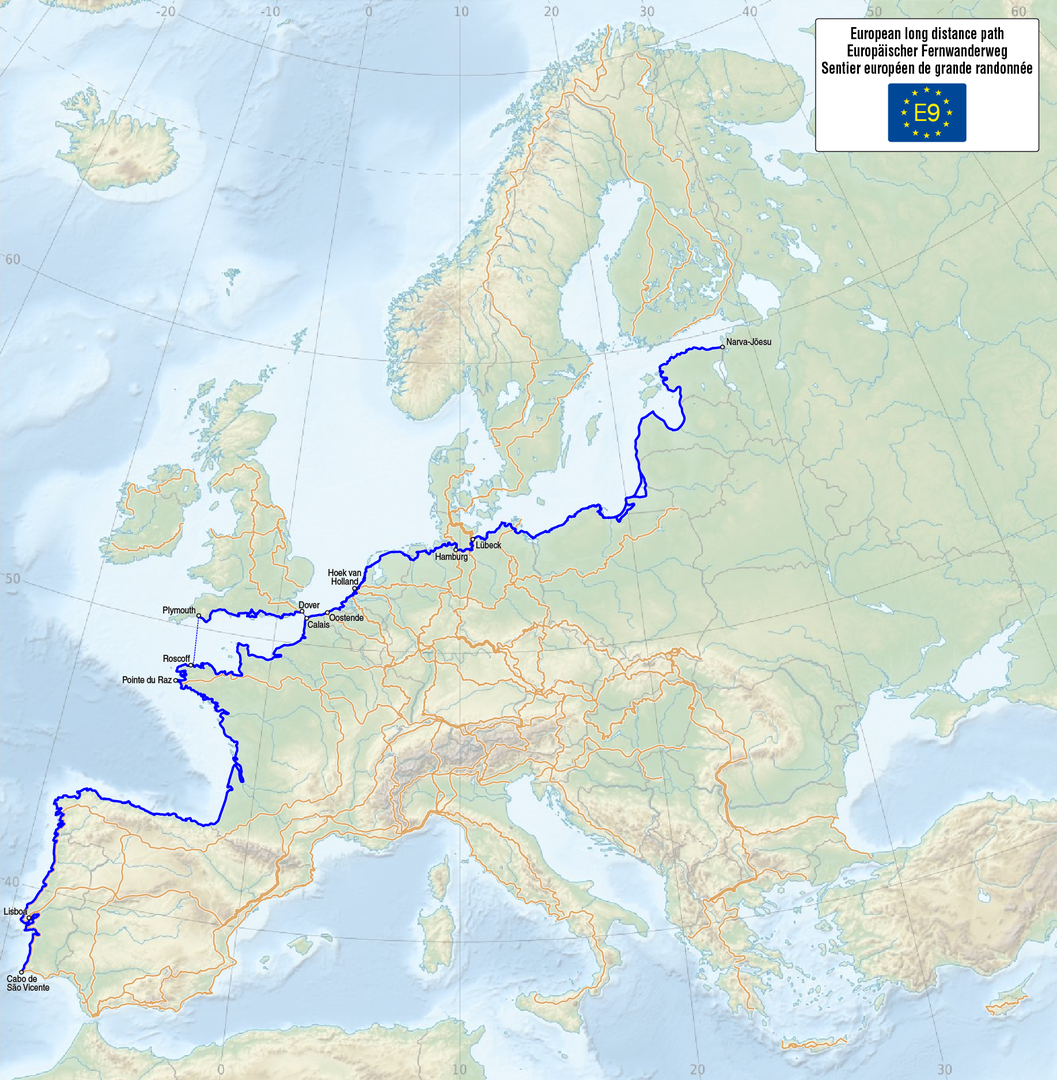
By Maximilian Dörrbecker (Chumwa) – CC BY-SA 3.0
The Idea for Walk + Work: Envisioning the Hike
Walk + Work the Dutch Coastline 2023 is basically meant as a hiking analog of Kayak + Work the Danube 2019—the good year. This means that we’d carry our laptops so we can still work online on our non-hiking days. Yes, we want to keep being digital nomads while hiking the Dutch coastline from village to village.
That means we carry around more weight than the average long-distance hiker. About 1.5 kilograms of tech per person. That will have to be reduced in other items such as food and clothes.
Working online means we also cannot go overnight camping. Not that freecamping is legal anywhere in the Netherlands anyway. But working means that we can afford to stay in hotels, rented apartments, and Airbnbs. Accommodation in the Netherlands is very expensive, so it’s not like we’re going to earn more than we spend if we keep the same ratio as Kayak + Work: 1 kayaking day for every 2.5 resting/working days.
But staying in hotels will also allow us to recuperate after every hiking day. Unlike Jonas, I’m very prone to developing blisters. So airing out my feet will be important.
Also, we can explore every Dutch village we stay in. It’s one thing to walk the entire Dutch coastline. That’s cool and all. But it’s also great to see what’s beyond the sand dunes.
In my head, there’s no other place to start than at the Belgian border; every Dutch person knows that the prevailing wind comes from the southwest. Jonas still asked me why we wouldn’t start in the opposite direction, but I told him it’s best to have the wind gently pushing our backs and the sun too to protect our eyes and faces.
Some might say that this isn’t adventurous enough. That may be right. But this is my idea of having a good time, not a hard time.
It’s Time
While still in Ethiopia, we carefully started planning our Walk + Work the Dutch coastline trip. This was a bit tricky since we were also applying to catsitting opportunities in Europe like crazy. The vision of this long-distance hike was already there, but now that Jonas was on board, it was time to flesh out the details.
It already started not great, since the section between the Belgian border and the ferry from Breskens to Vlissingen didn’t have accommodation available in March. Okay, back to the drawing board. My original map measured 14.8 kilometers on this stretch in Zeelandic Flanders (Zeeuws Vlaanderen). We could hike it out and back, which would be nearly 30 kilometers in one day. Oof, that’s a bit much for a first hiking day. Then we considered taking public transit to the Belgian border and then hiking it. But there wasn’t anything going close to that area that wouldn’t take hours.
So we ended up planning three nights in a hotel in Vlissingen and one day where we rent bicycles from Vlissingen and we cycle the first stretch. It’s a very Dutch solution. So yes, the first bunch of kilometers of Walk + Work the Dutch coastline will be pedaled not plodded. But at least we will keep the sea on the left-hand side when we’re cycling through the dunes.
But with the first and last puzzle pieces in place, we now managed to set up a rough timeline:
- Arrive in Vlissingen on the 13th of March
- Bike the section to the Belgian border on the 15th of March
- Hike to the first next village called Westkapelle on the 16th of March
- Keep walking till we need to take care of my sister’s cat Ulicoten in The Hague (Den Haag)
- Take care of the cat
- Travel back to where we last hiked
- Continue hiking the Dutch coastline till we need to go to Freiburg in Germany to take care of Moritz (another cat) in April
- Be catsitting all of May in Germany and Switzerland
- Come back to the Netherlands from catsitting in June and go catsitting in The Hague again. Perhaps hike some more Dutch coastline while we’re there
Perhaps this doesn’t sound like a solid plan to you, dear reader, but it’s pretty elaborate by our standards.
Buying the Backpacks
In order to hike, I also had to downsize my backpack. Jonas has been very happy with his Osprey Farpoint 40L backpack since 2015, so he didn’t want/need to get something new despite the turtle look of the backpack. I was looking for something of a maximum of 35 liters.
We had to order it to Jonas’ mom’s house near Bonn in Germany, so we used the German version of Amazon. Since it’s not just for the Dutch coastal hike, I was looking for an all-around decent backpack that is also useful for further travels in Europe (and beyond). Selecting a decent backpack was no easy feat. Preferably I’d have all of the following features in one backpack:
- Internal frame
- Good laptop pocket
- Exit for a hydration bladder
- Hip and chest straps
- Side pockets
- Rain cover
- Straight back and not bendy
- Under 900 grams
- Optionally: a zipper to put the shoulder straps away
Yes, I didn’t even have a price tag in mind. If I’m going to travel for years with this backpack, it can be a bit more pricey than I’m used to. That being said, under €50 would be great 🙂
After scouring German Amazon for hours, Jonas and I came up with the following (frameless) three:
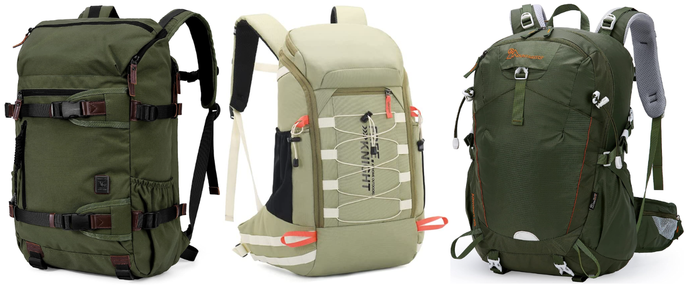
From left to right: green TAK €67, pea green Bseash for €33, and army green Mountaintop for €50
While out of Africa and in Koblenz, I ordered all three with the plan to send two of them back. The cheapest one by Bseash was of poor quality and not at all capable of carrying the things I needed to pack. But the TAK and Mountaintop were both great backpacks.
The Mountaintop is a very decent hiking backpack. It has good thick straps and a decent hip belt. It comes with a rain cover that fits the backpack perfectly. But it’s pretty tricky to pack the backpack efficiently because of the rather round shape. There is a risk of looking like a turtle.
The TAK is much more brick-like in shape, which I like, and makes it easier to pack. I think it’s also secretly a bit bigger than 35L. There’s a dedicated laptop pocket and inside there is another laptop/hydration bladder pocket. The aesthetics of it are also *chef’s kiss*. But it supposedly weighed 1.3kg by itself, there’s no rain cover, and the hip straps – though there – ain’t shit.
In the end, I decided to take both these backpacks to the Netherlands. Jonas’ Osprey is also on its last legs in my opinion, so then he can take whichever backpack I’m not using.
At my mom’s, I dropped all my old gear and spent a good few days contemplating how to pack the backpack. I ended up reducing what I packed by a lot. In the end, I chose the Mountaintop backpack for the first section of the hike, knowing I could change it for the TAK at a later point or before going to Germany.
Headed to Vlissingen
After visiting my mom’s place in Loosdrecht and visiting the grandmas, it was time to begin the 2023 Walk + Work Dutch coastline hike. I was very excited and also a bit nervous about whether it was going to work at all. My mom gave me the tip for a Dutch cycling and hiking app and website called Fietsknoop/Knooppunt for route planning. I was skeptical at first but Jonas would still give it a try.
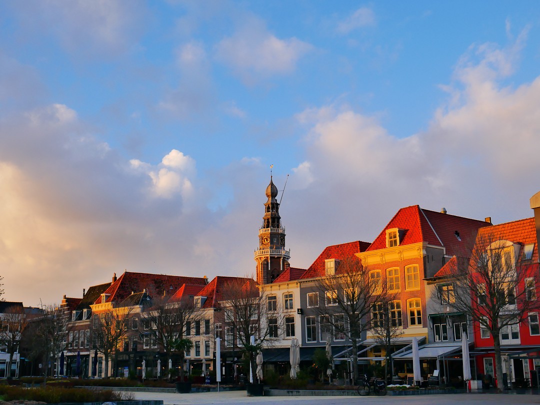
We took the train to Vlissingen on Monday the 13th of March. It was very nice to have little and lightweight luggage with us. It’s very freeing.
Once we had checked into our hotel in the center, we wandered around the sleepy city. I didn’t know that most food businesses would be closed. We instead bought some food at the Albert Heijn supermarket and ate it in our spacious room while looking at the map of the province of Zeeland and preparing a spreadsheet to keep track of our statistics.
The following day, we spent some time walking around Vlissingen, including a bit of the beach. We bought more food to make sandwiches for the cycling trip from the Belgian border and for Day 1 of the coastal hike. In the evening, we picked up our rental bicycles for an early morning departure.
And that’s it. That’s the vision and the preparation we did to start this journey.
Soon you’ll be able to read about the early days of this trip:
- Day 0: the Belgian border to Breskens (by bicycle)
- Day 1: Hiking from Vlissingen to Westkapelle
Thanks for reading!