
")


 in Trujillo, Honduras")

")

 Romania")
")


")


 to Get a SIM Card in Ukraine (Kyiv)")


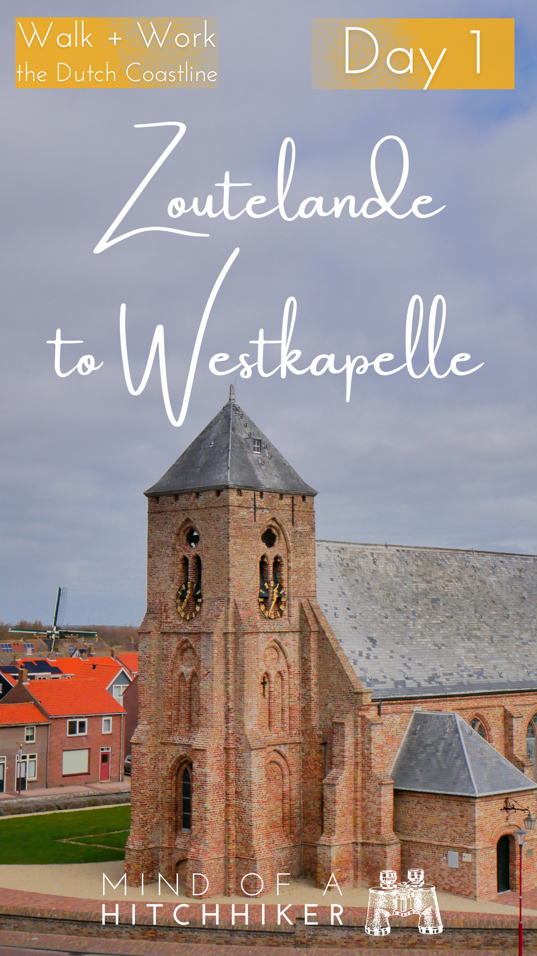
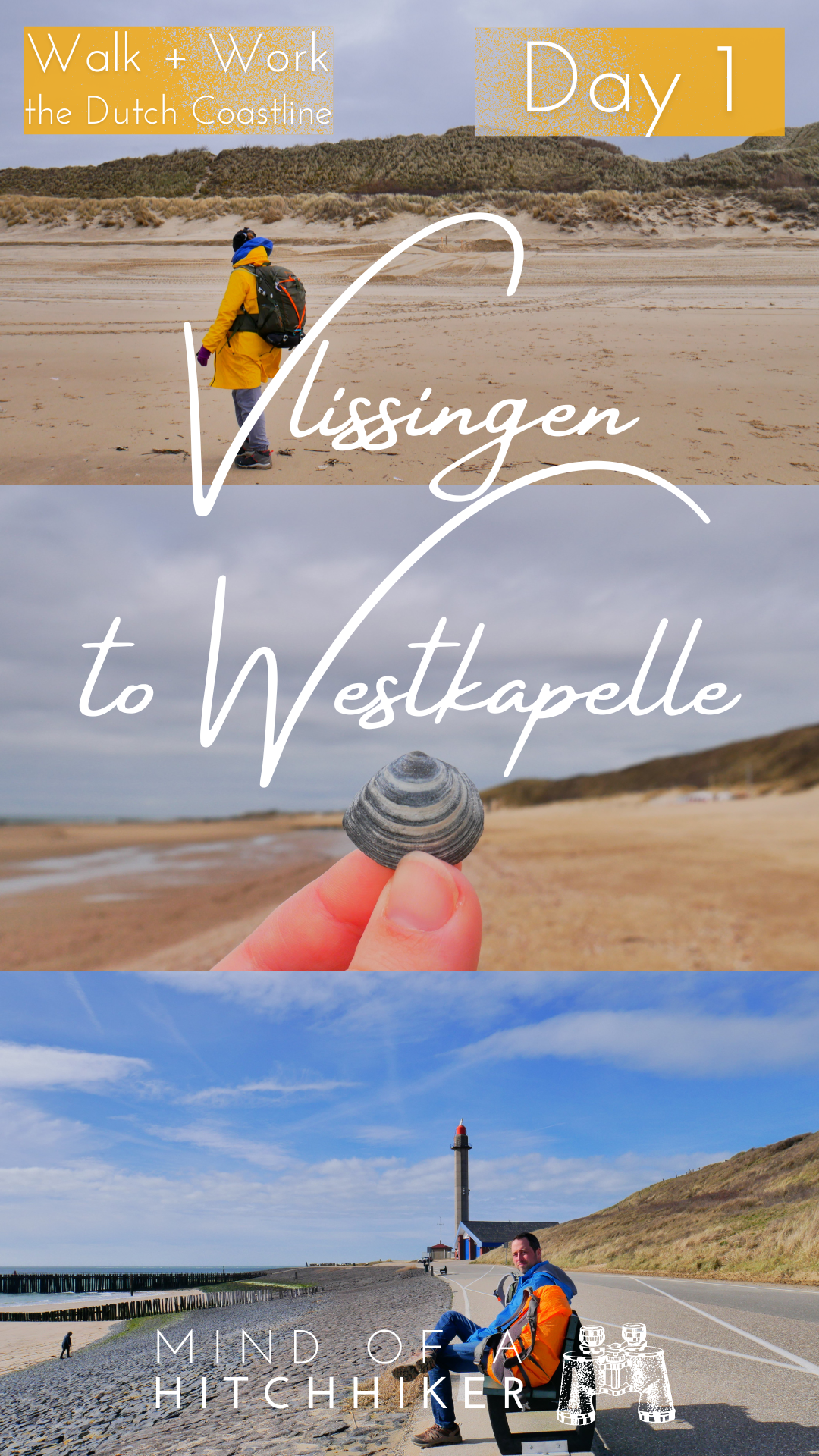
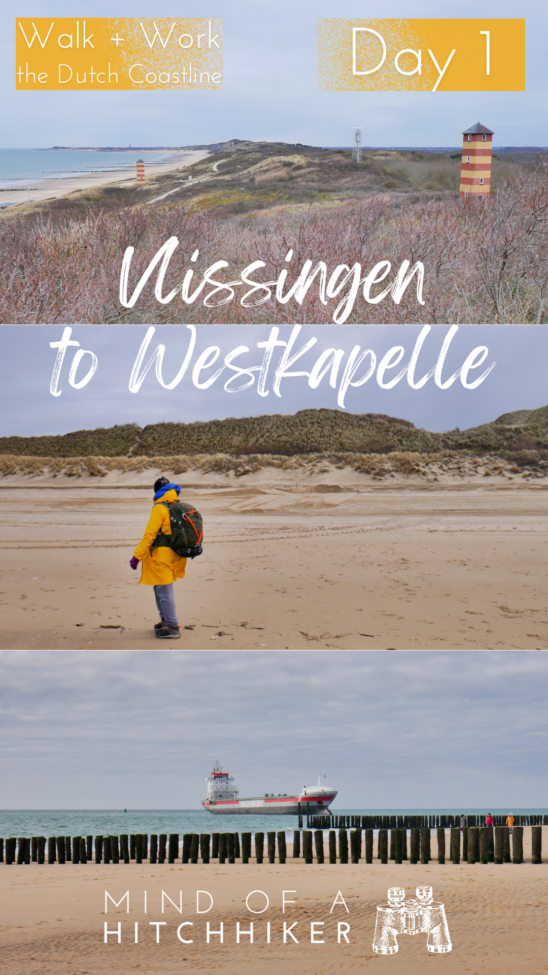
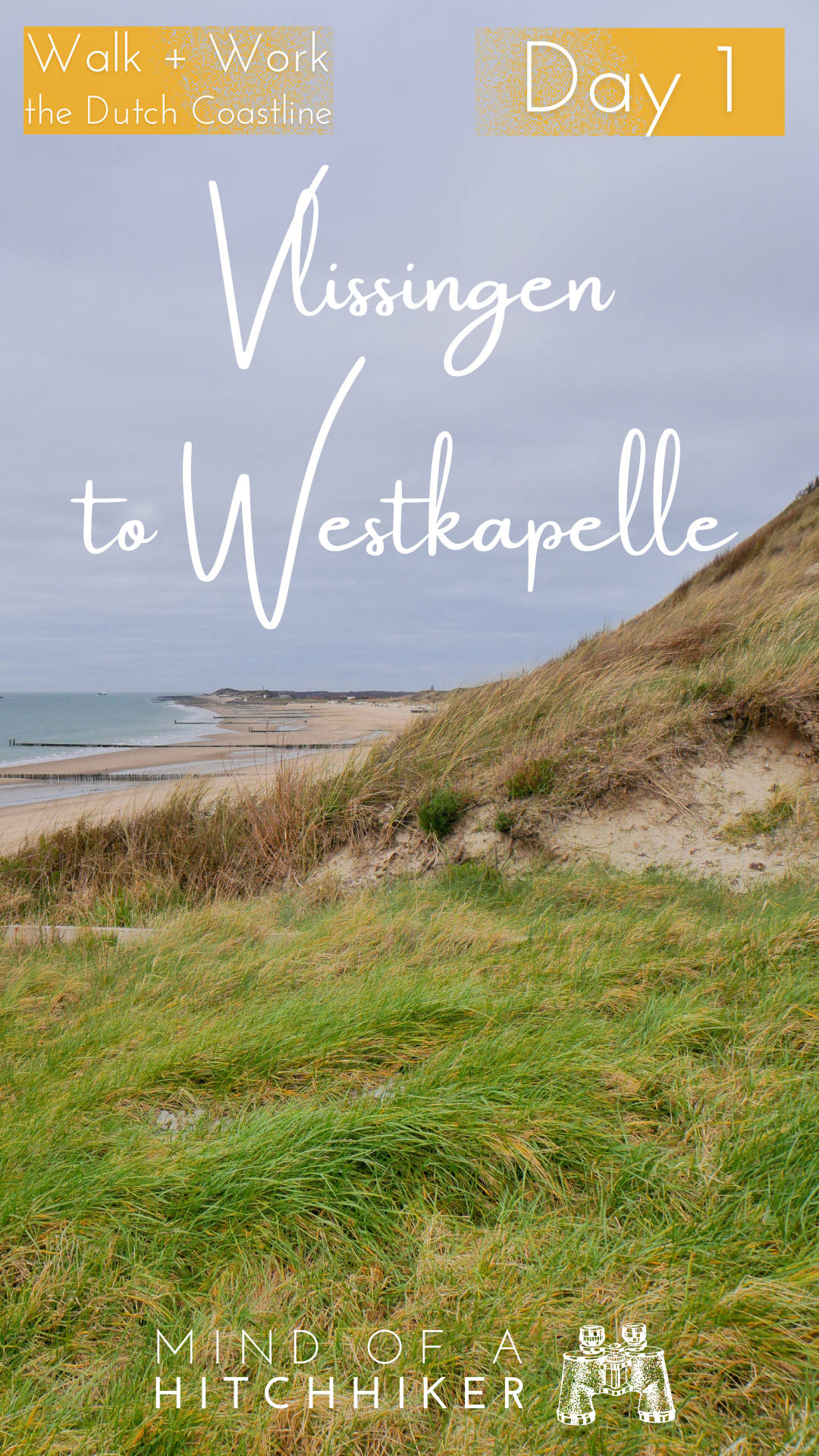
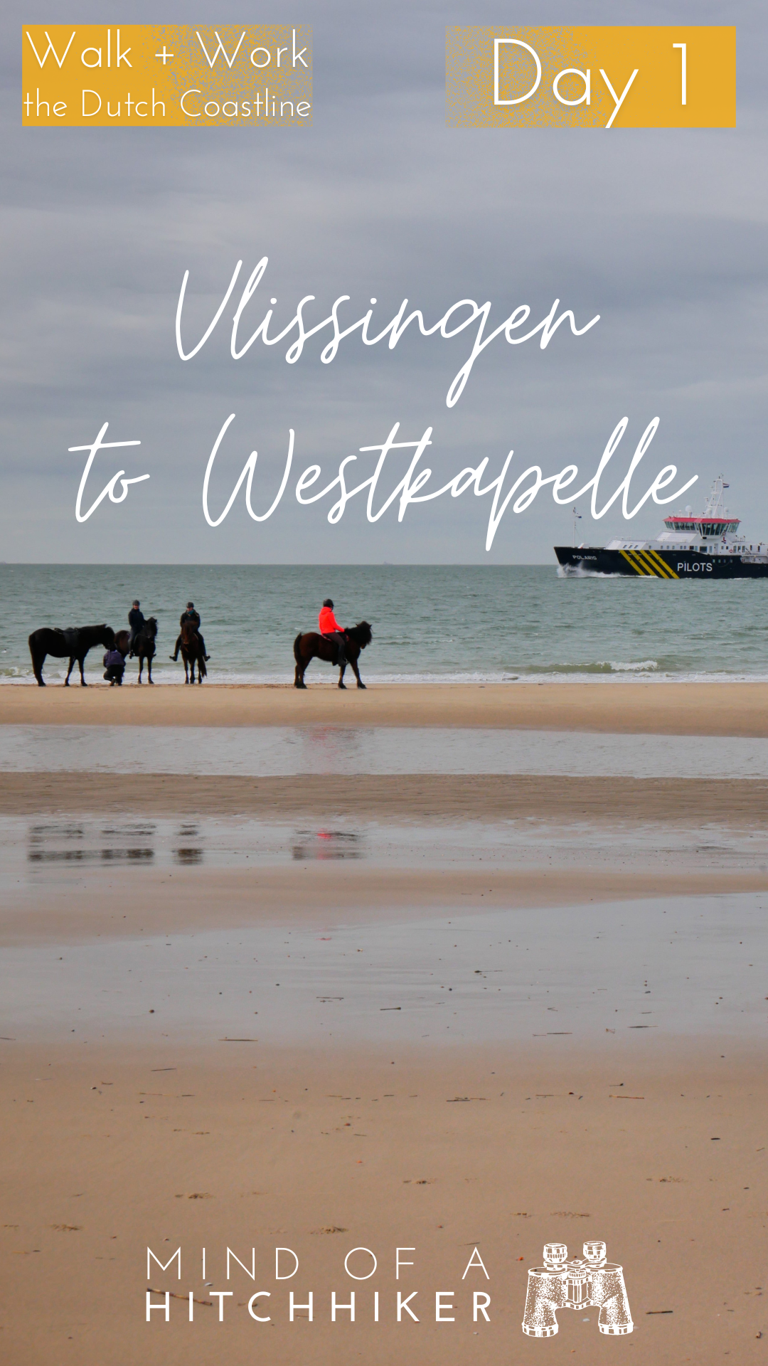
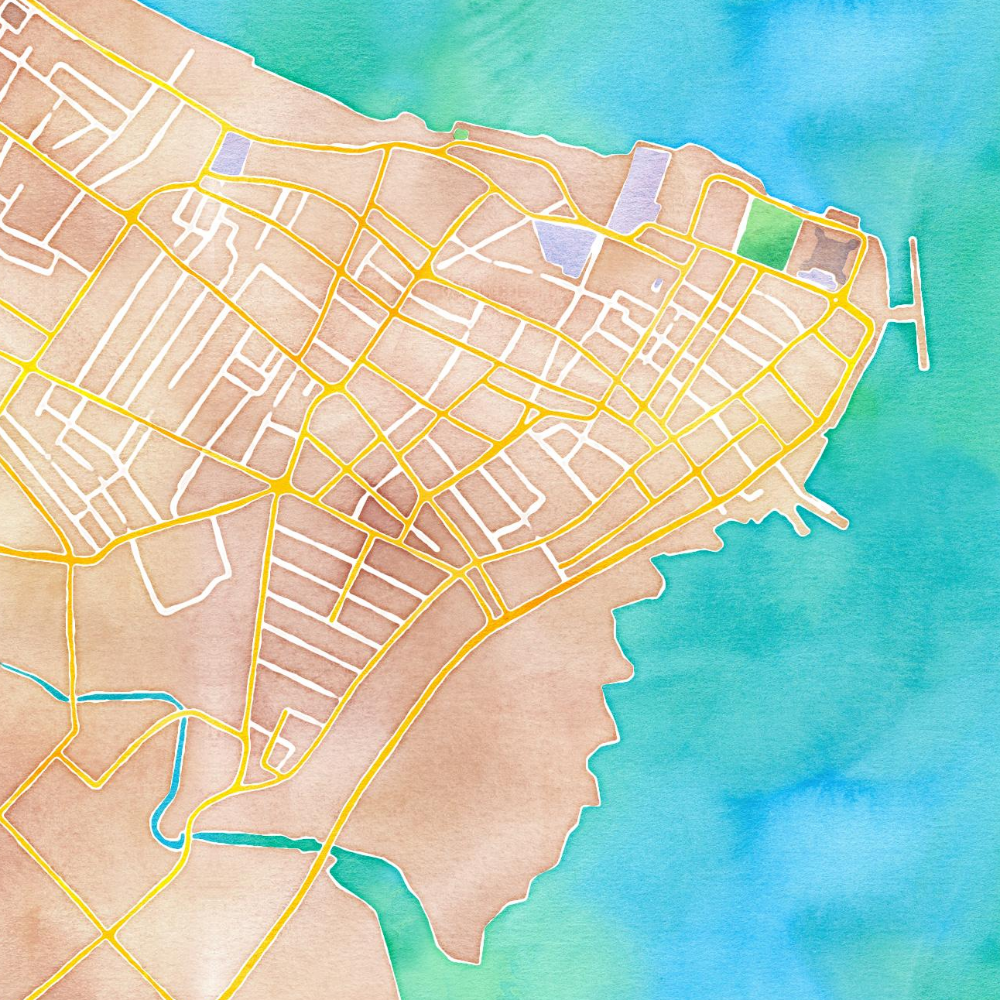
This hiking day happened on the 16th of March. On our first day of traversing the Dutch coastline, we walked from the city of Vlissingen to the village of Westkapelle on the island of Walcheren. This ended up being a 16.2-kilometer hike.
Departing Vlissingen: Meeting the Paalhoofden
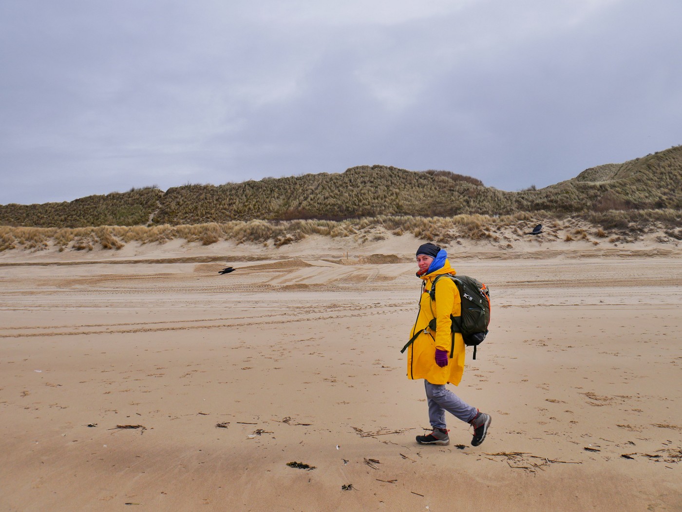
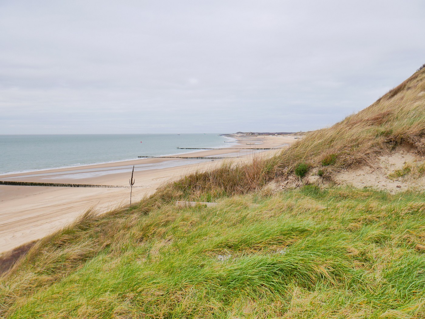
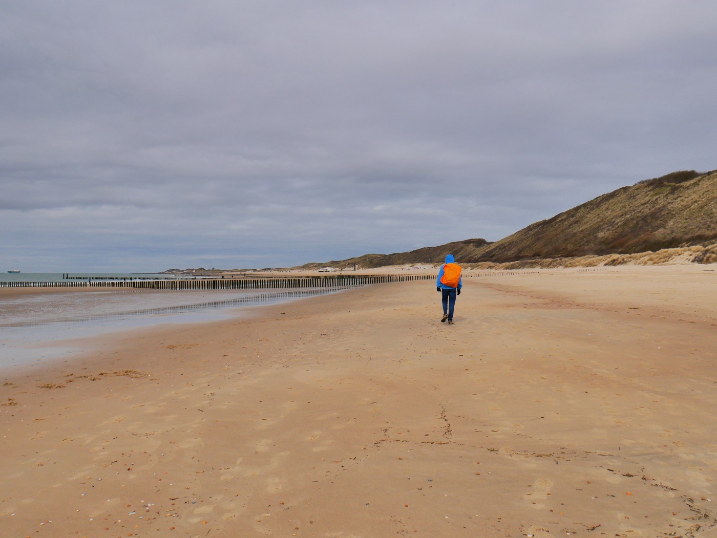
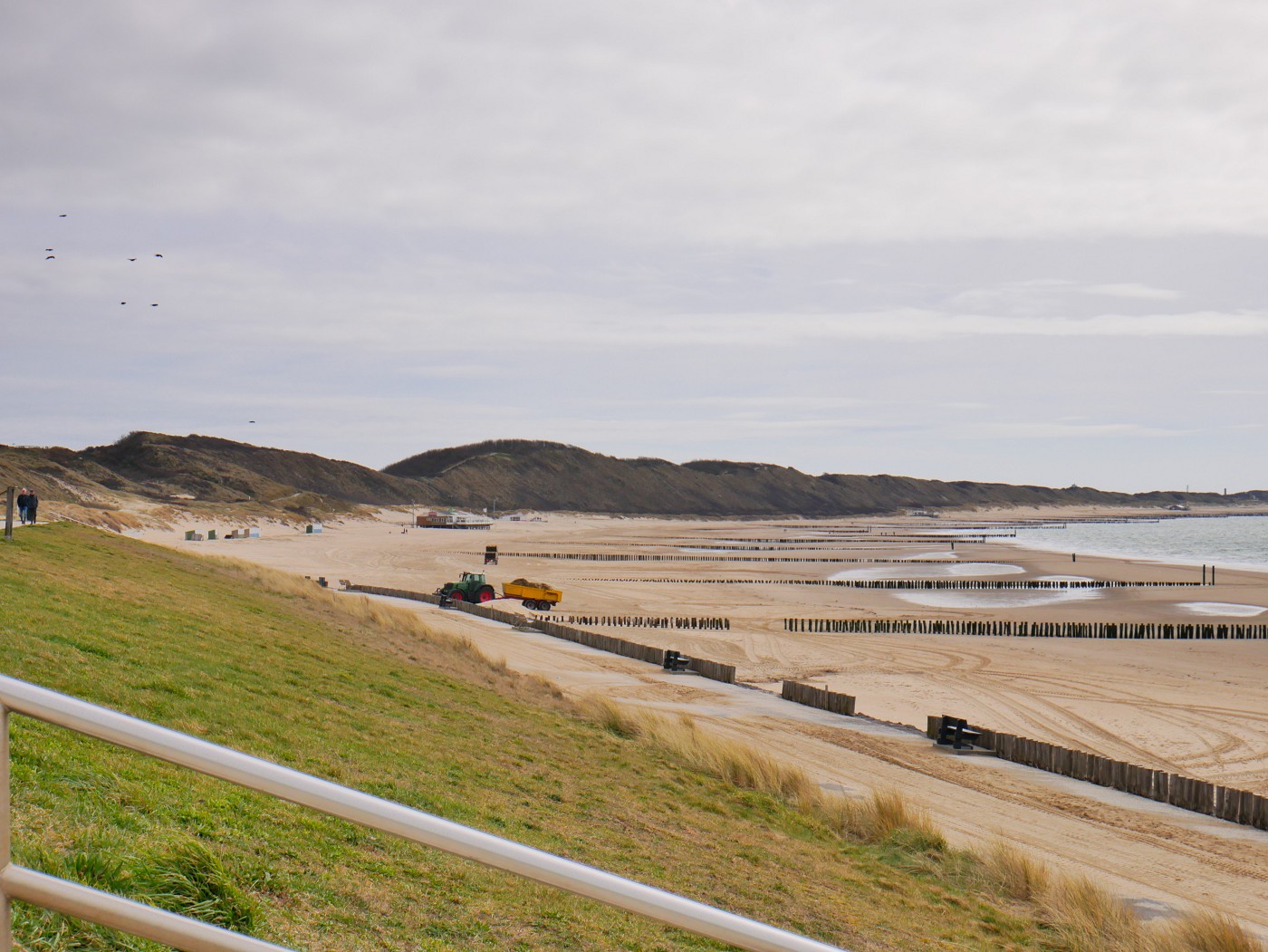
Though we aimed to leave Hotel De Concurrent at 8:30, it was only at 8:50 that we walked across Bellamypark through some small streets to the waterfront. We walked on the seawall past people on their morning routine going to work while walking out of the city. At the restaurant near the wind chimes, we walked down from the embankment and onto the beach called Nollestrand. There were a lot of tractor tracks that had messed up the otherwise flat and firm sand. Why are there tractors on the beach? Because mid-March is apparently when all the seasonal beach houses are built.
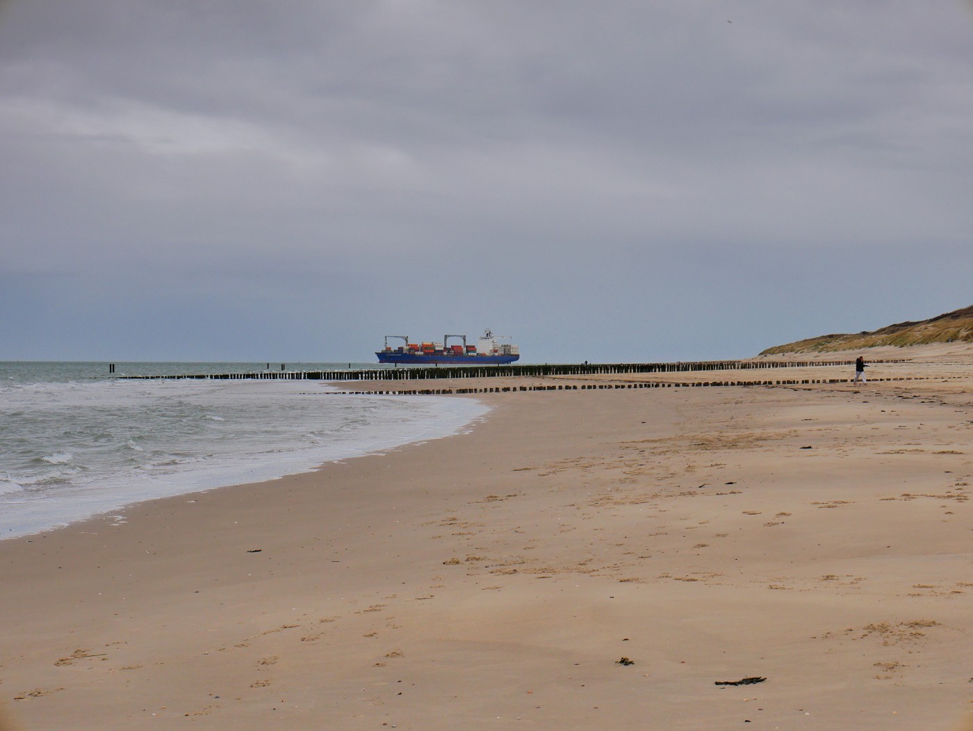
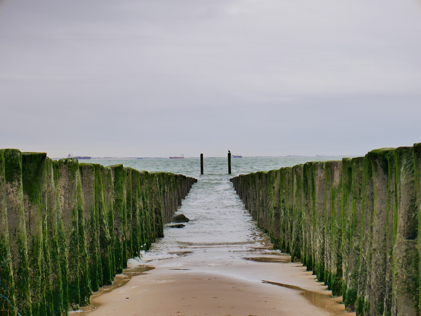
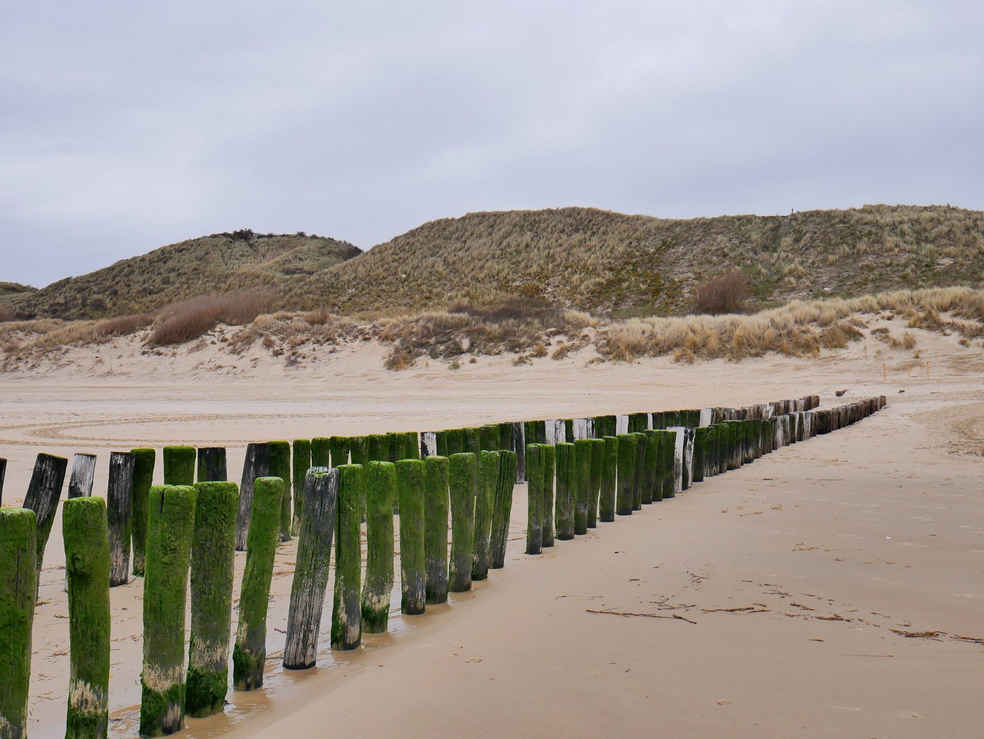
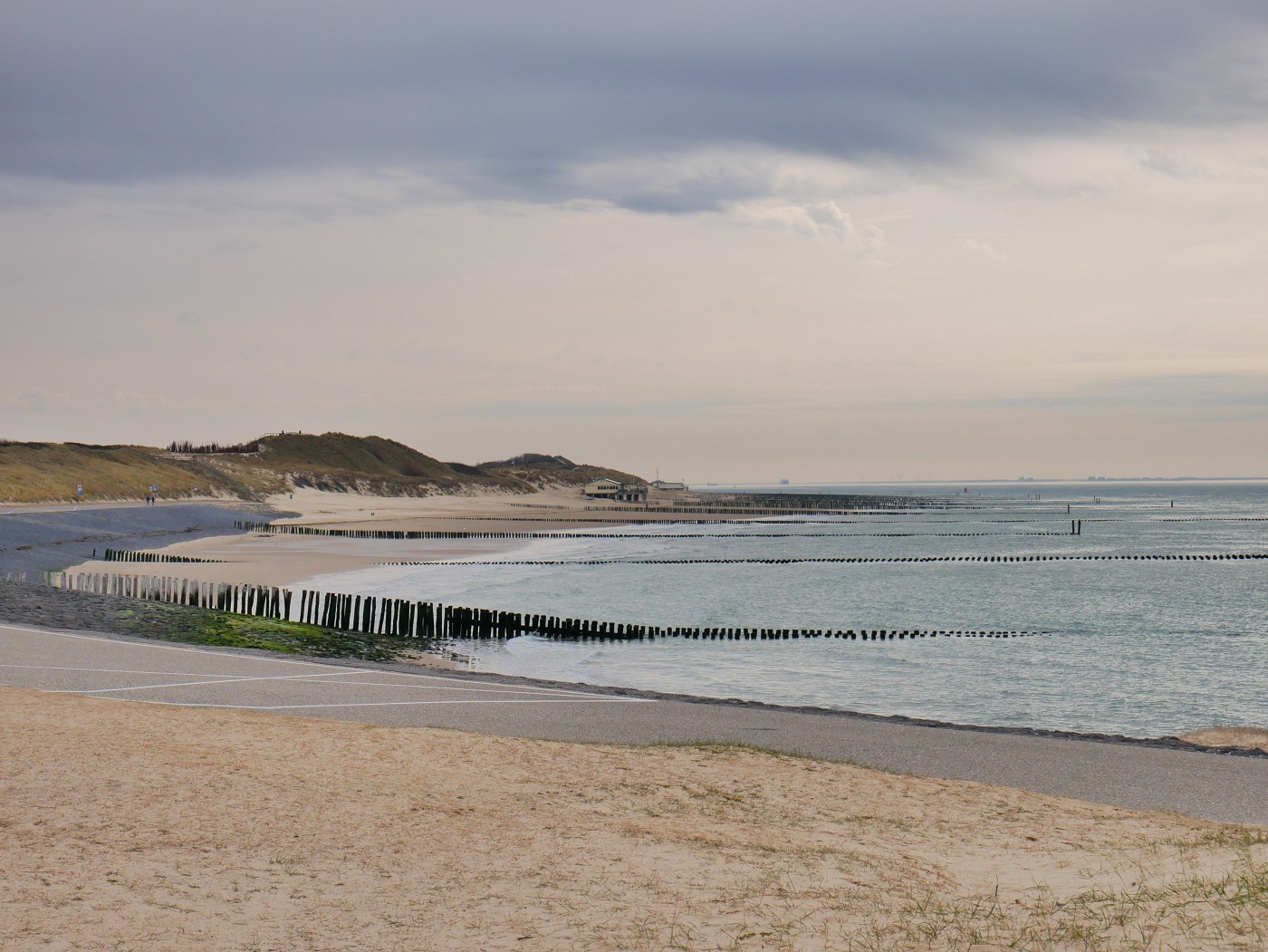
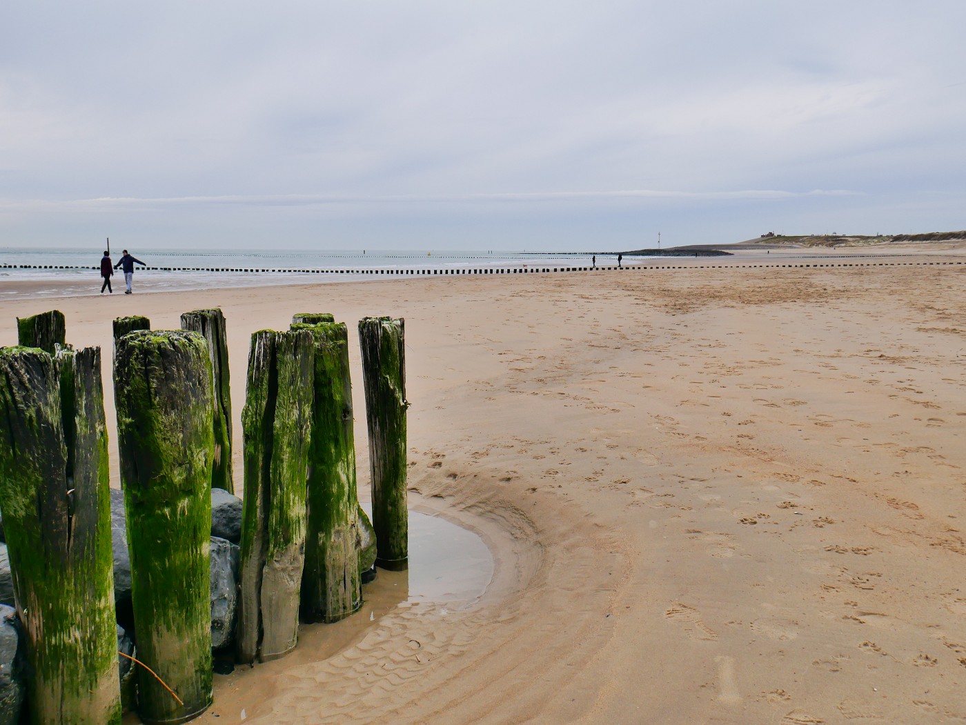
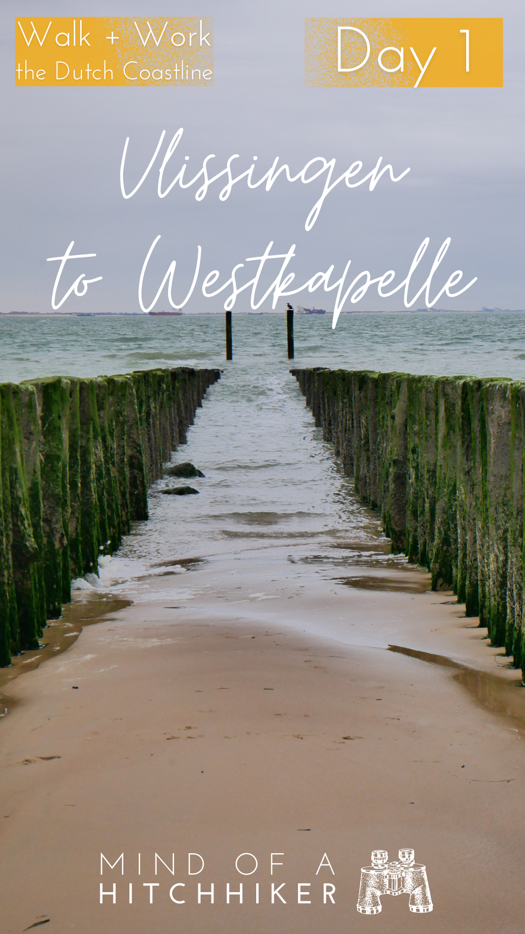
After the WWII monument, the (in)famous rows of wooden poles perpendicular to the dunes appeared. My grandma had pointed out to me just days before that if I were to hike on the actual beach, I’d have to overcome these obstacles. Especially at low tide when the firmest sand to walk on is far from the dunes. But the first ones were short, so we just walked over them. It was at the second hurdle that I got a little stuck with my backpack between two crusty poles and scratched my brand-new backpack. And these double rows of wooden posts partially blocking our path occur every 130 meters!
Jonas asked me, what are these and what do they do? I couldn’t answer that question with certainty on the spot. But my educated(-in-the-Netherlands) guess was a coastal defense against the sea. Like everything in this country, it’s about protecting the land and the people from the water.
After the hike, I asked the internet gods. These things are a type of breakwaters meant to prevent erosion of the beach. In Dutch, they’re known as golfbrekers or paalhoofden. And it’s not just wooden poles, but there’s a hidden construction of big rocks of foreign origin (there’s no basalt rock mining in the Netherlands) beneath the sand to stabilize it. When it’s high tide much of the poles are covered in water, hence their crustiness of seaweed, algae, and barnacles. At low tide, hikers like me get stuck between them.
The good people of Zeeland have constructed the first iterations of paalhoofden for over 500 years. They’re the cultural heritage of Zeeland. Iconic. The most photographed object on the coast of Zeeland. But why wood instead of rocks? Because if the height difference between low and high tide, they’d need too many rocks. At €60 a pop and with more than 100.000 of them, that’s quite the price tag. Between the double rows of wooden posts exists an ecosystem of seaweed, barnacles, and worse offenders, such as crabs. The wood itself originally came from the forests of the Ardennes in Belgium.

Single rows of paalhoofden at Zoutelande and Dishoek on a map of the Scheldt River from 1504 (Zeeuwse Ankers)
Dunes, Brick Lighthouses, and Dragon’s Teeth
We had planned our route with the help of our trusty OSM map and the new app and website my mom suggested called knooppunt or fietsknoop. It’s originally for cyclists, but they also have a route planner for hikes. I started referring to it as wandelknoop to Jonas since that makes more sense to me. But their route from Vlissingen to Westkapelle goes via the dune path and not on the sandy beach, so we mostly use it as a guide and distance calculator.
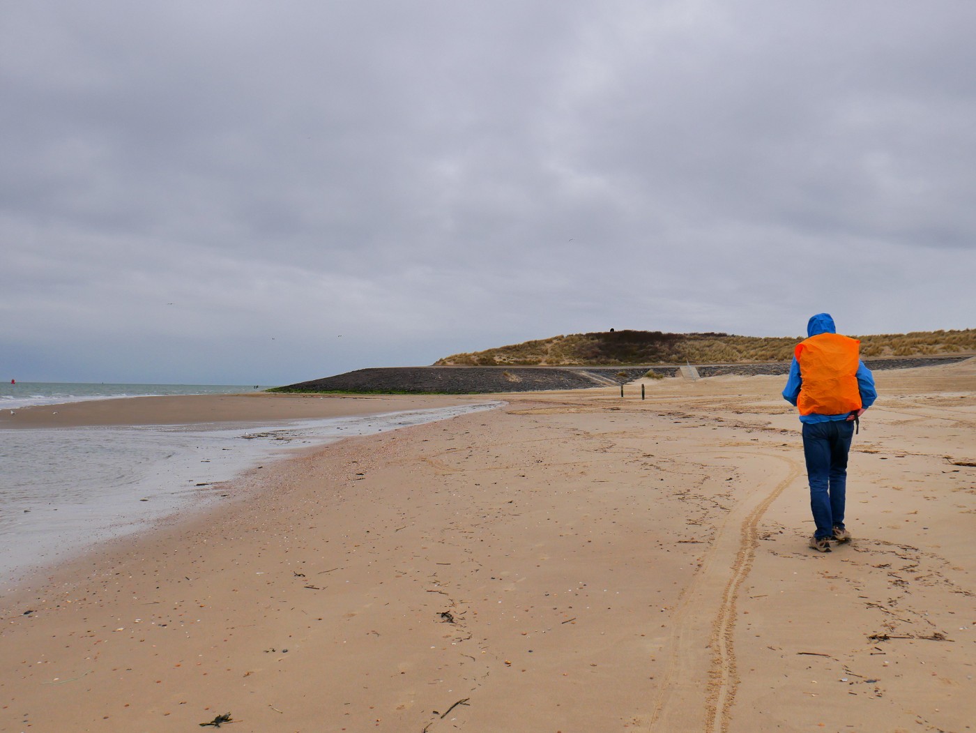
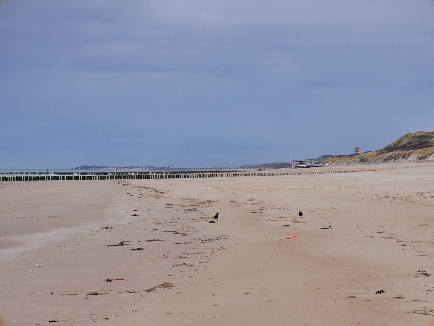
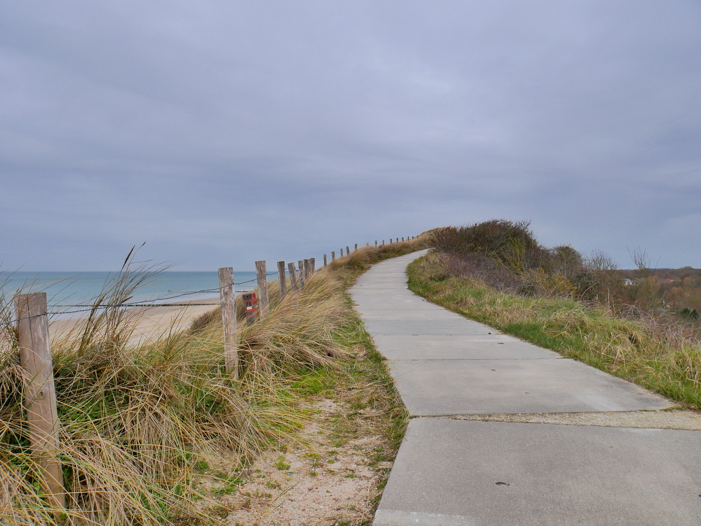
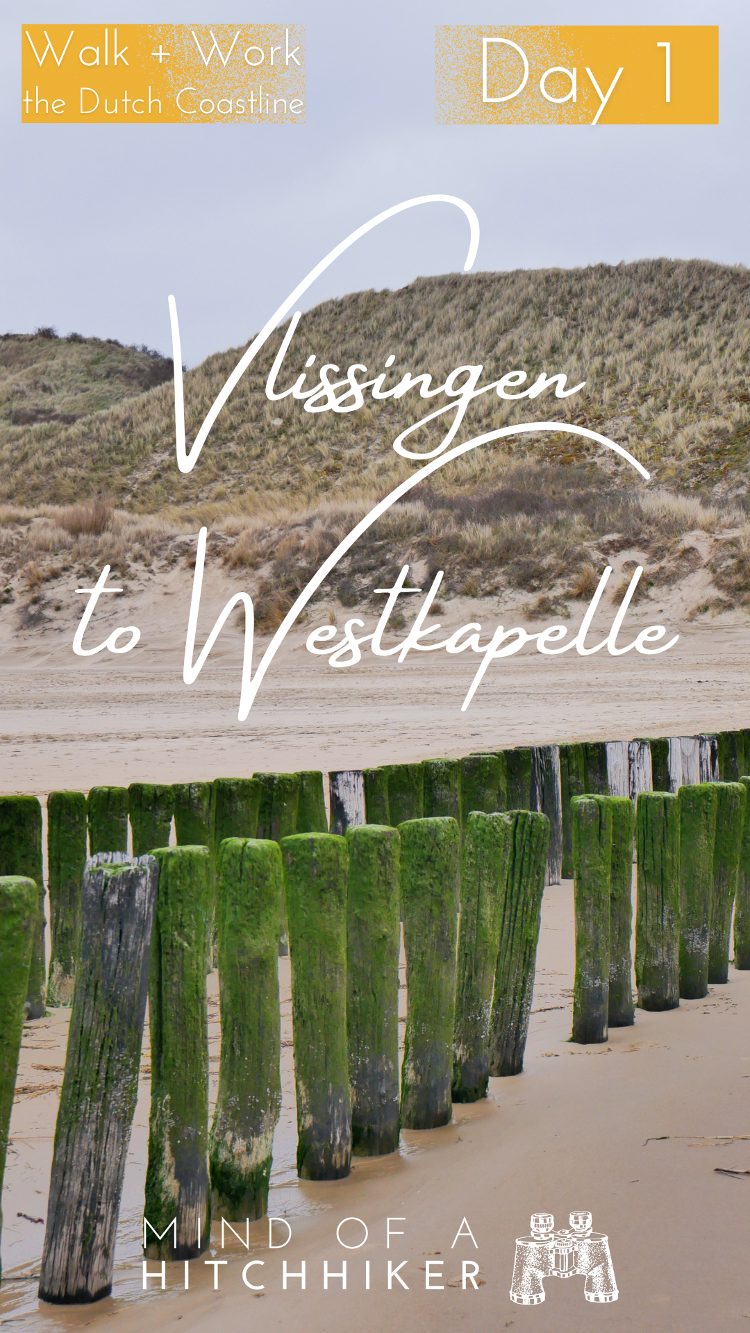
However, we did want to experience a bit of dune path on our first day so we didn’t feel like we missed out. So at one of the dune crossings (51.467400, 3.523440) we left the beach and the paalhoofden behind. Concrete slabs partially covered in sand formed this trail and there were loads of benches. Sometimes it was a bit steep.
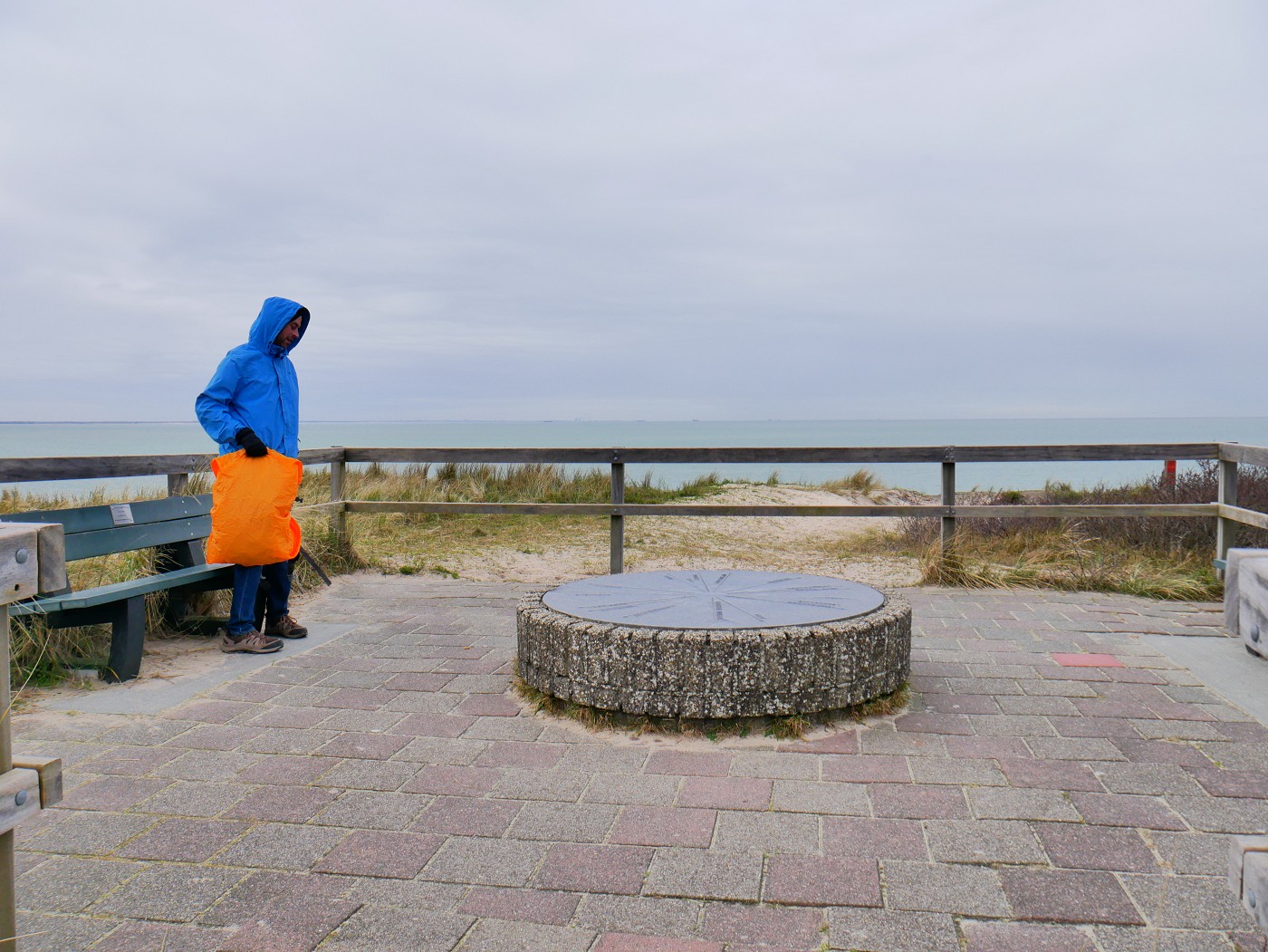
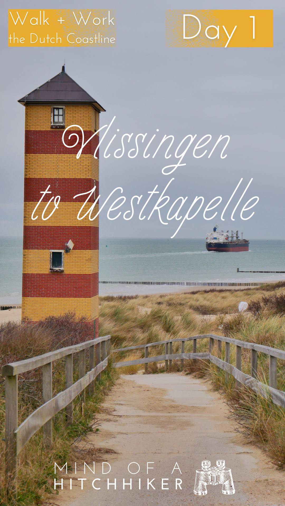
We kept walking until a viewpoint with benches for our lunch stop (sandwiches). We took a 20-minute break while enjoying vistas of the upper and lower lighthouses of Kaapduinen and the beach of Dishoek. There was a compass that showed what one looks at in which direction, some visible like Zoutelande and Westkapelle, others too far away such as London in England and Zeebrugge in Belgium. There was also a mention of Breskens and Cadzand, which we visited by bicycle on Day 0 of this trip.

After our break, we continued the hike inland. Following the suggestions from the knooppunt app, we descended the dune path and went into the forest. There were many trail markers here, not only for the knooppunt app, but also for the GR footpaths in the Netherlands marked with a Polish flag. This section is part of the langeafstandswandelpaden LAW 5-1, the Dutch coastal path.
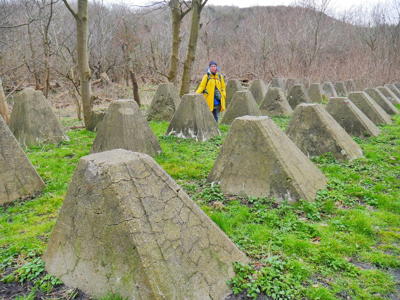
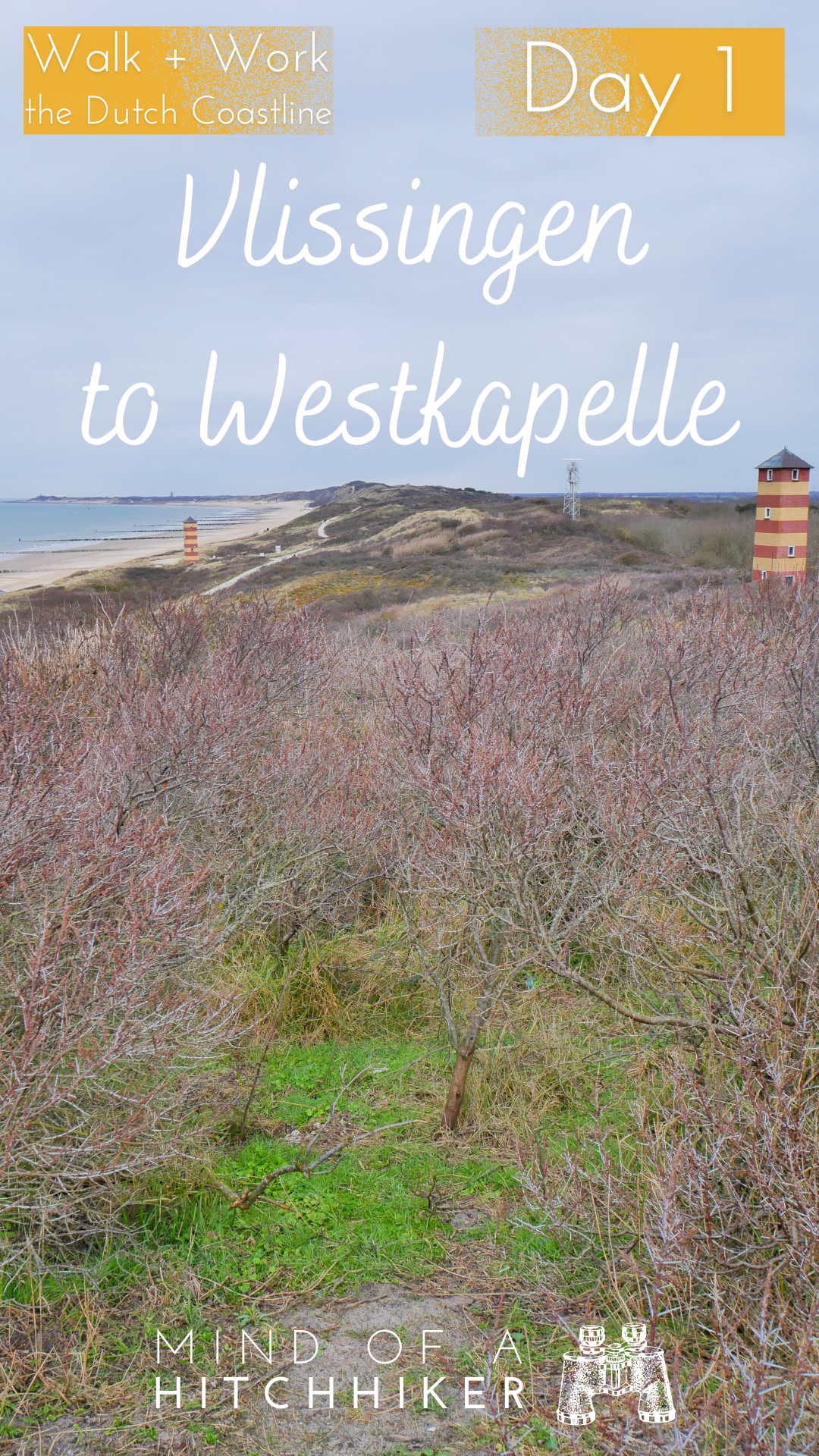
That’s where we met the Landfront Vlissingen defense line, built as part of the Atlantikwall by the Nazi German occupants during World War II. Back then, it was a complex fortification with an anti-tank ditch, casemates with bunkers, anti-tank weaponry, dragon’s teeth, Czech hedgehogs, and minefields. What’s left today are rows of dragon’s teeth and some bunkers you can visit at your own discretion, such as Widestandsnest Fledermaus. Though the area is generally de-mined, it still happens that WWII-era mines are discovered and neutralized in this century.

This area of the Netherlands was liberated by the Allies in late 1944 as part of the Battle of the Scheldt. To defeat these Nazi strongholds, the Allies decided to bomb the dykes around the island of Walcheren. Despite dropping leaflets on towns to warn the civilians to evacuate, hundreds of people died from the subsequent flood in Westkapelle and elsewhere; there was simply nowhere to go for the people living under occupation. Consequently, this was one of the reasons why the 1977 Geneva Convention outlawed attacks on dams and dykes. Not that this would stop Mordor from doing the same to Ukrainians living under occupation in 2023.
Poffertjes in Zoutelande
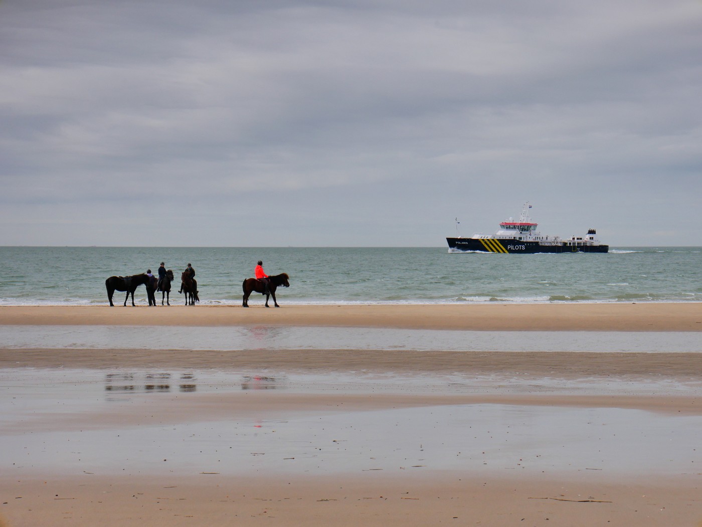
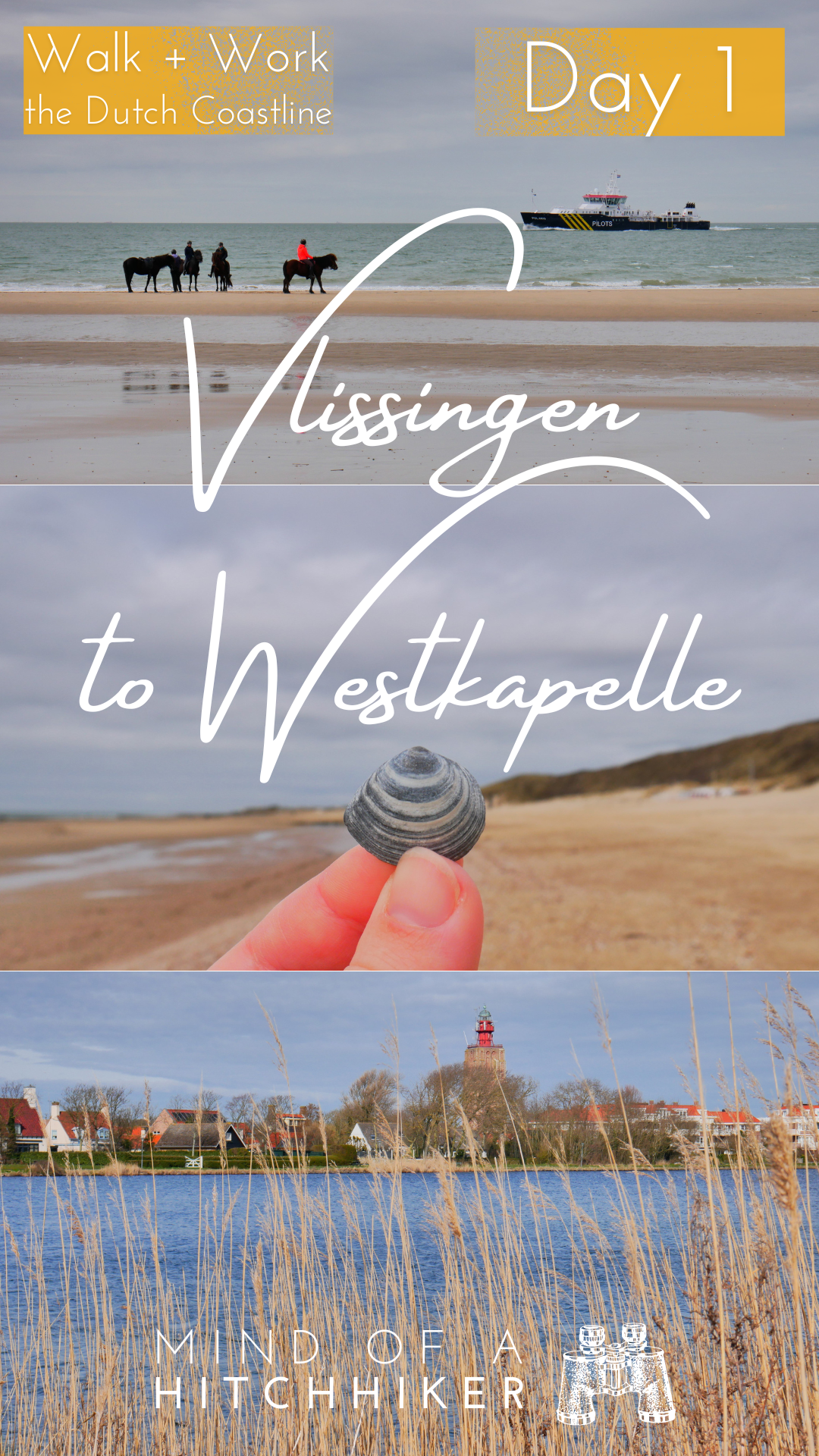
We crossed over the dunes again and entered the beach for a few kilometers to Zoutelande at noon. It was much windier and therefore colder on the seaside of the dunes. We squished ourselves between the paalhoofden bit after bit, becoming quite adept at spotting places we’d fit between with our backpacks. Some people on horseback came up behind us and would run around the paalhoofden to gallop at the sea. The horses are probably scared of them.
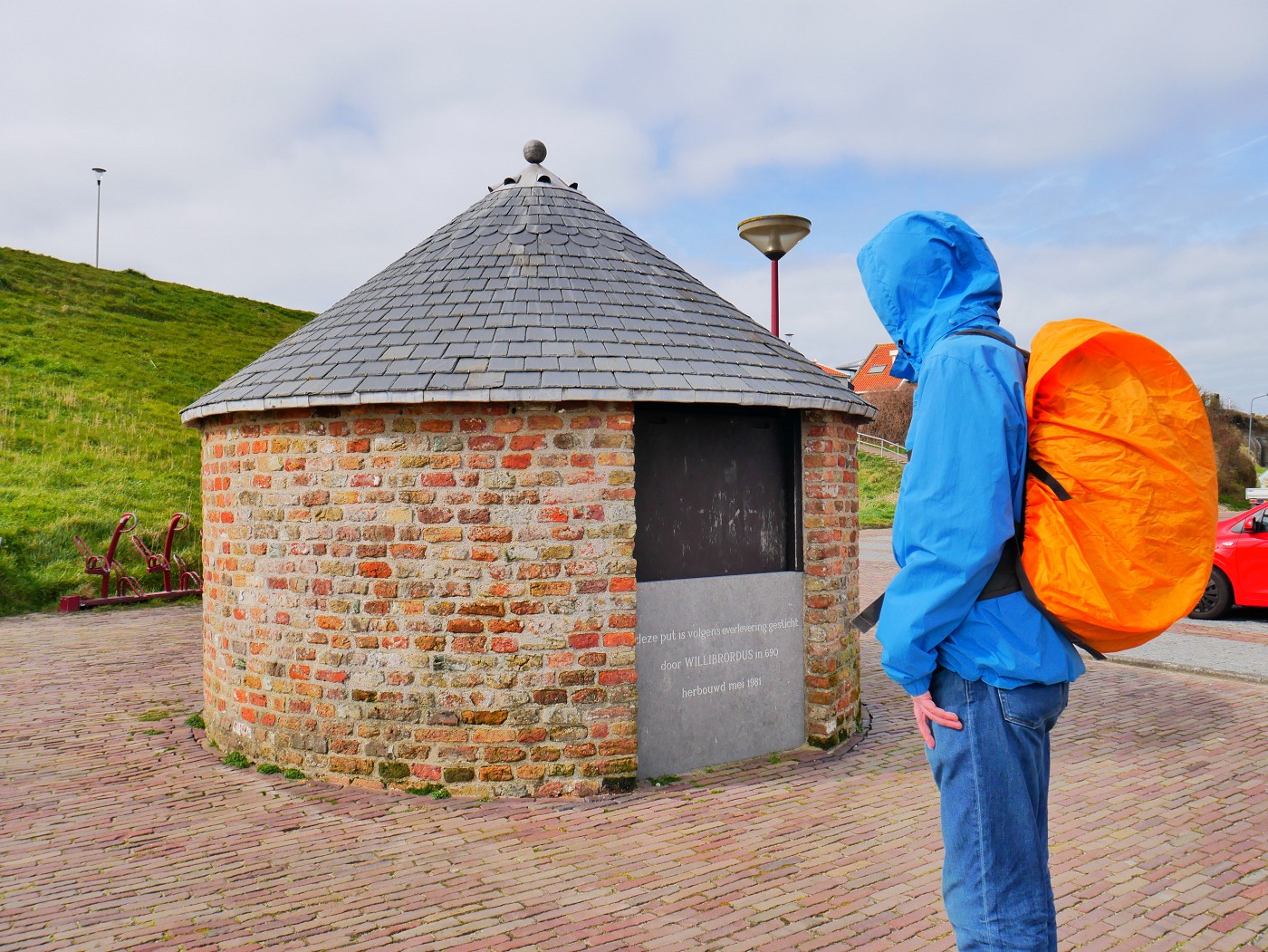
It was time for lunch when we arrived at the beach of Zoutelande. There I picked up a seashell, the first ‘shell of the day’ if you will. A nice bluish-grey one with white bands. I’ve been looking at them in the sand all day and this will be a prominent part of the trip. We crossed the embankment and saw the cute little church and the well of a saint. From the embankment, we also had a good view of the beach and the rather ugly lines that the tractors leave behind in the sand.

We headed into town to a pancake house Jonas had looked up the night before. I got a portion of poffertjes and Jonas ordered a pancake, which we both shared. We drank two cups of tea while warming up outside of the wind. Meanwhile, we talked about Zoutelande—a place I don’t think I’ve ever visited before. It’s apparently super famous among Germans and Jonas’ mother has definitely been here before. Similarly, Jonas has been to nearby Oostkapelle before. Germany doesn’t have a good beach-to-border ratio, while Zeeland is only a three-hour drive from a big city like Cologne. Zeeland’s most famous band BLØF also made a cover of a German song and changed the lyrics to Zoutelande instead of Frankfurt Oder.
The staff was really nice as well and was ready to serve us in German, Dutch, or English. It doesn’t really matter over here. Despite the high prices of food and drinks in Dutch restaurants and cafés, I think it was a good investment to treat ourselves on our first hiking day. Also, very important: it’s good to plan a stop to freshen up in the bathroom.
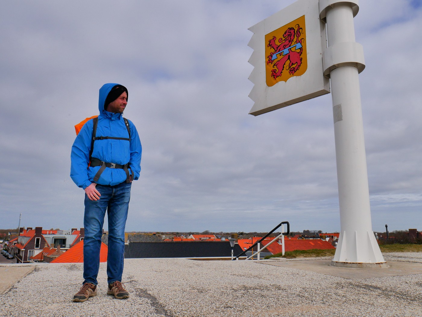
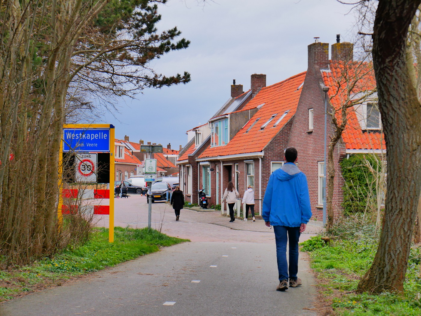
Arriving in Westkapelle
We walked out of Zoutelande and crossed the embankment again to go to the beach. The plowed sand tracks left behind by the tractors were a bit of effort to overcome without getting sand in my shoes. The clouds were clearing up just a little bit to warm us up, which came unexpectedly. However, I forgot to write down the accurate times of our breaks; I intend to keep good data on this hike and how we improve, but the spreadsheet will only be as good as the inputted data. It was about 14:00 when we continued hiking after filling our tummies with pancakes.
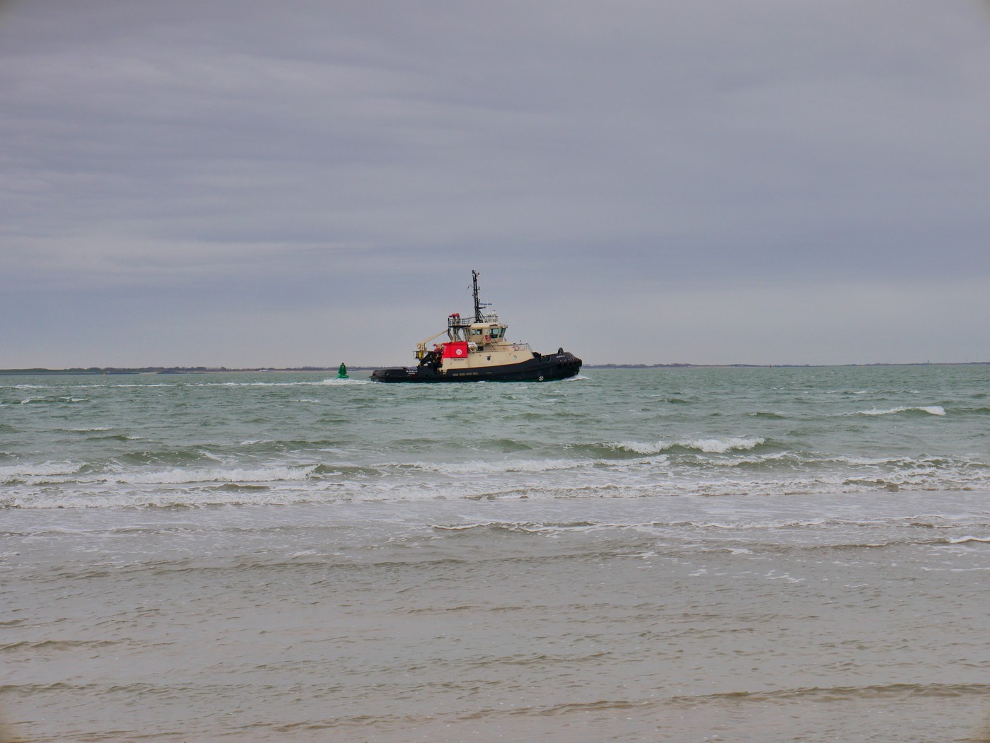
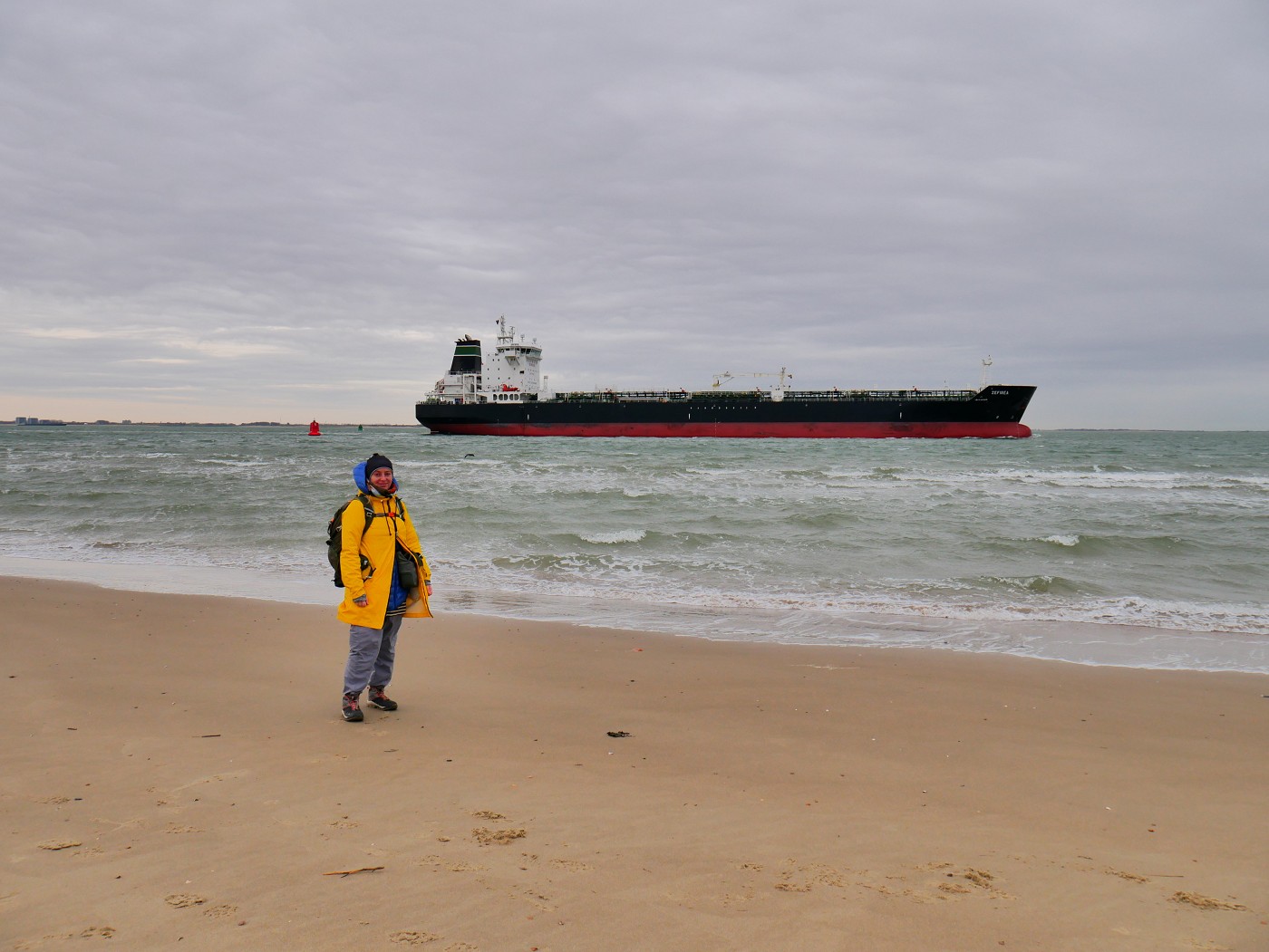
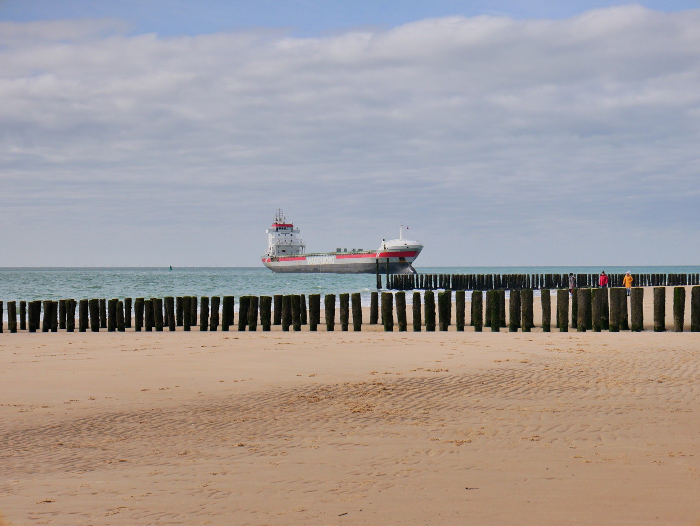
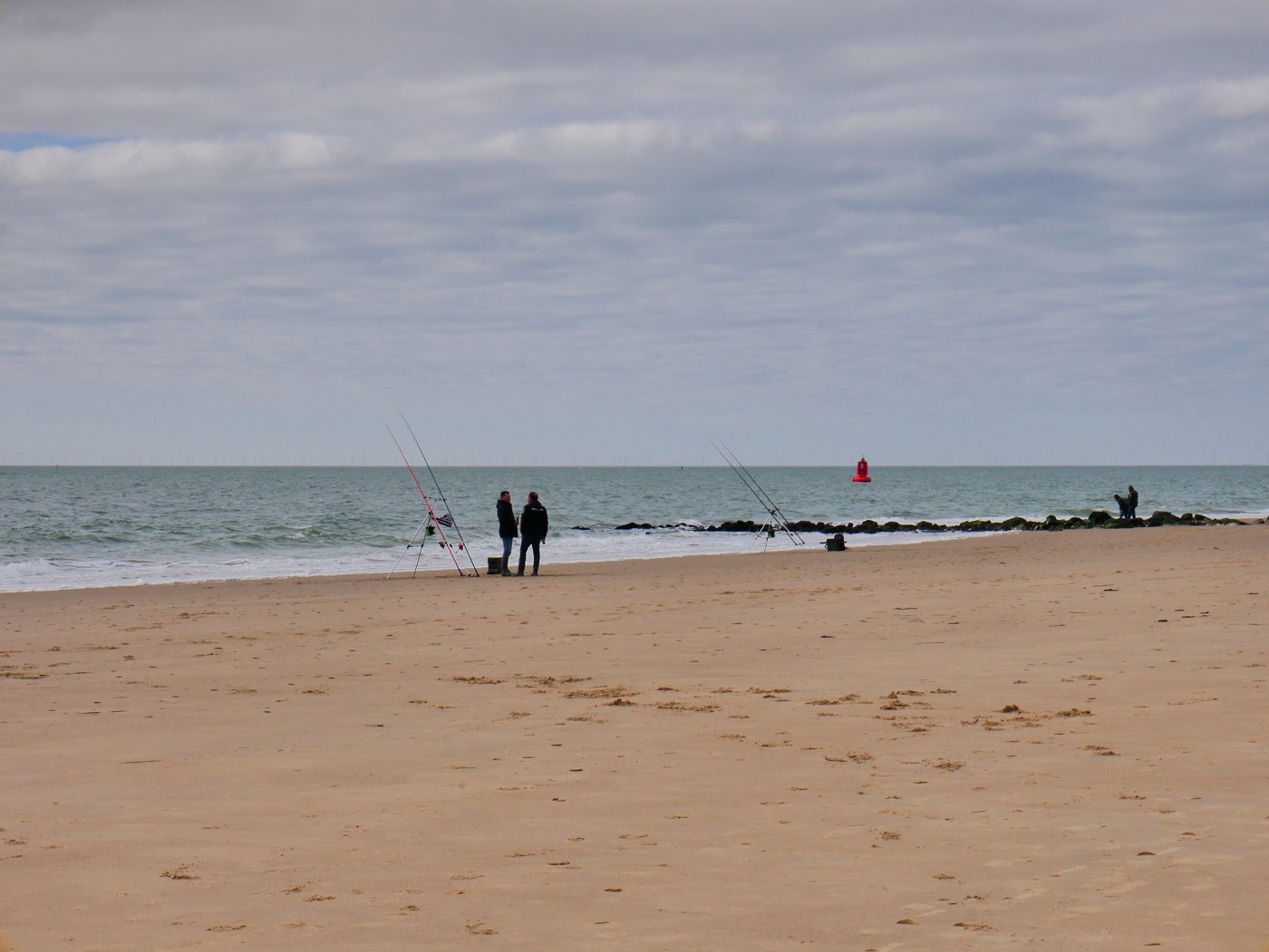
Because of the sudden weather change, we enjoyed this last stretch to Westkapelle thoroughly. We saw a gas or oil tanker sailing past the coast really closely and turning towards the beach for a few minutes, which seemed a bit unnecessary and – dare I say? – reckless. They could have beached that ship as I swear it was only 50 meters from the shore. Some other guys were at the shore fishing with a lot of expensive-looking fishing gear.
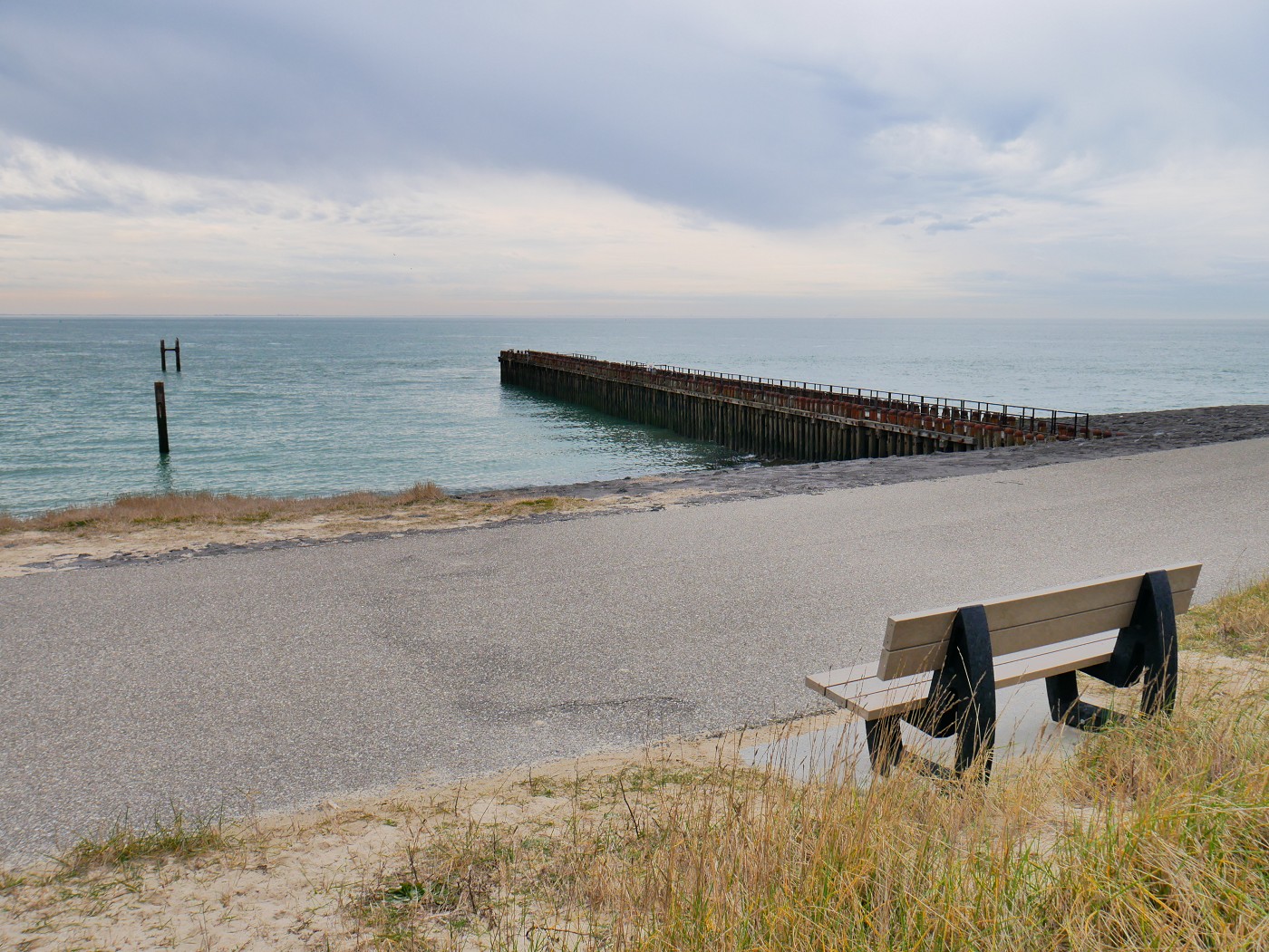
We decided to part from the beach for the last time today at the rocky/asphalted embankment at Westkapelle that leads to the sea rescue station (KNRM reddingstation Westkapelle) with its turning radar. There was an excellent bench to have one last rest, admire the view, and empty the sand out of our shoes (very necessary).
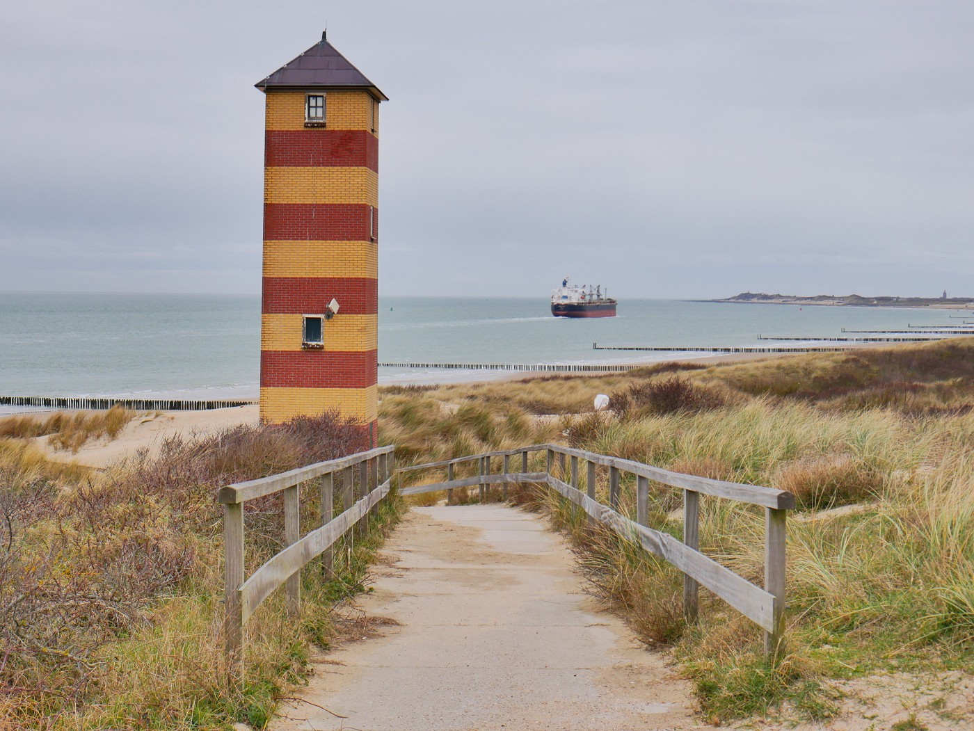
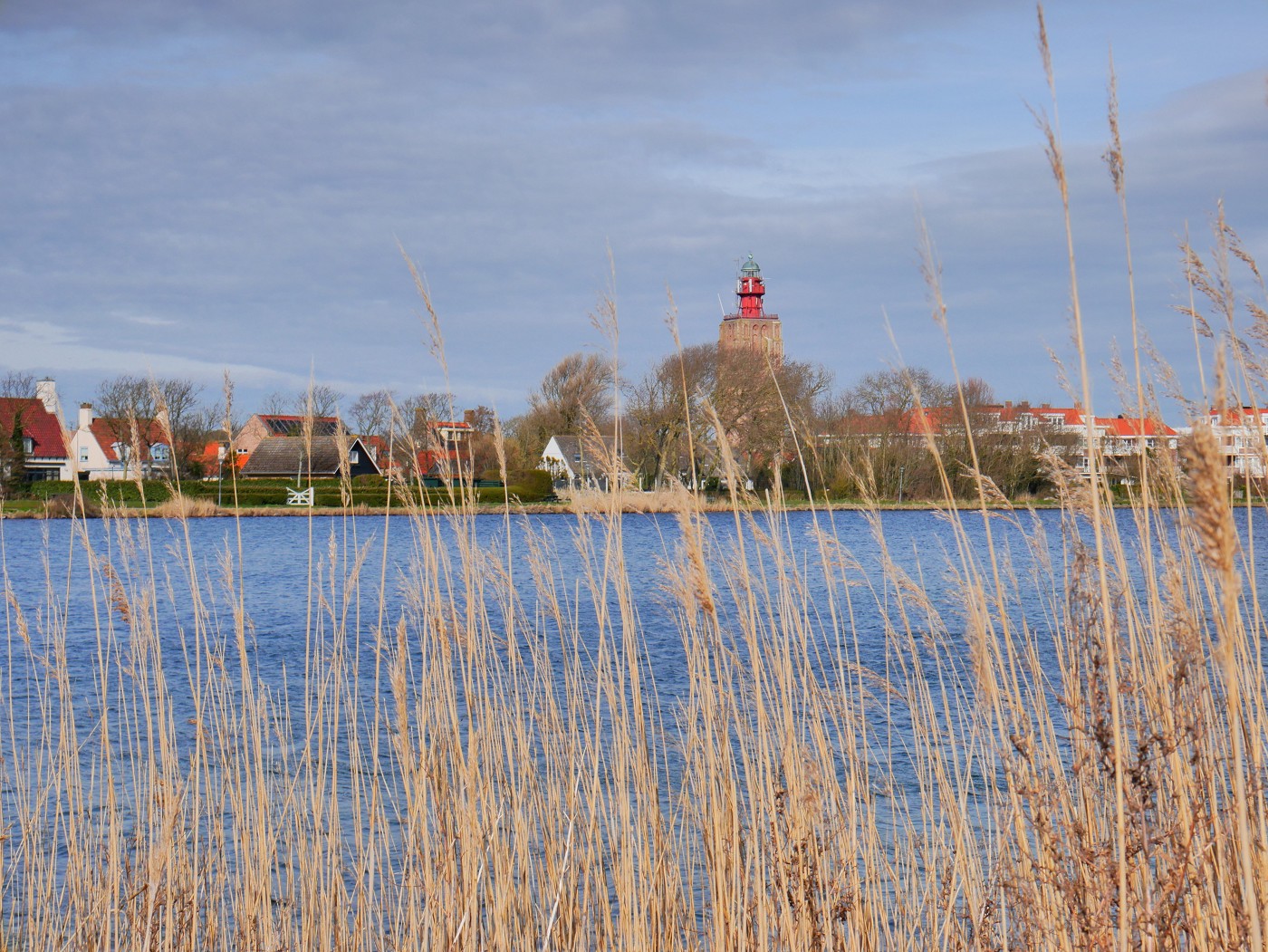
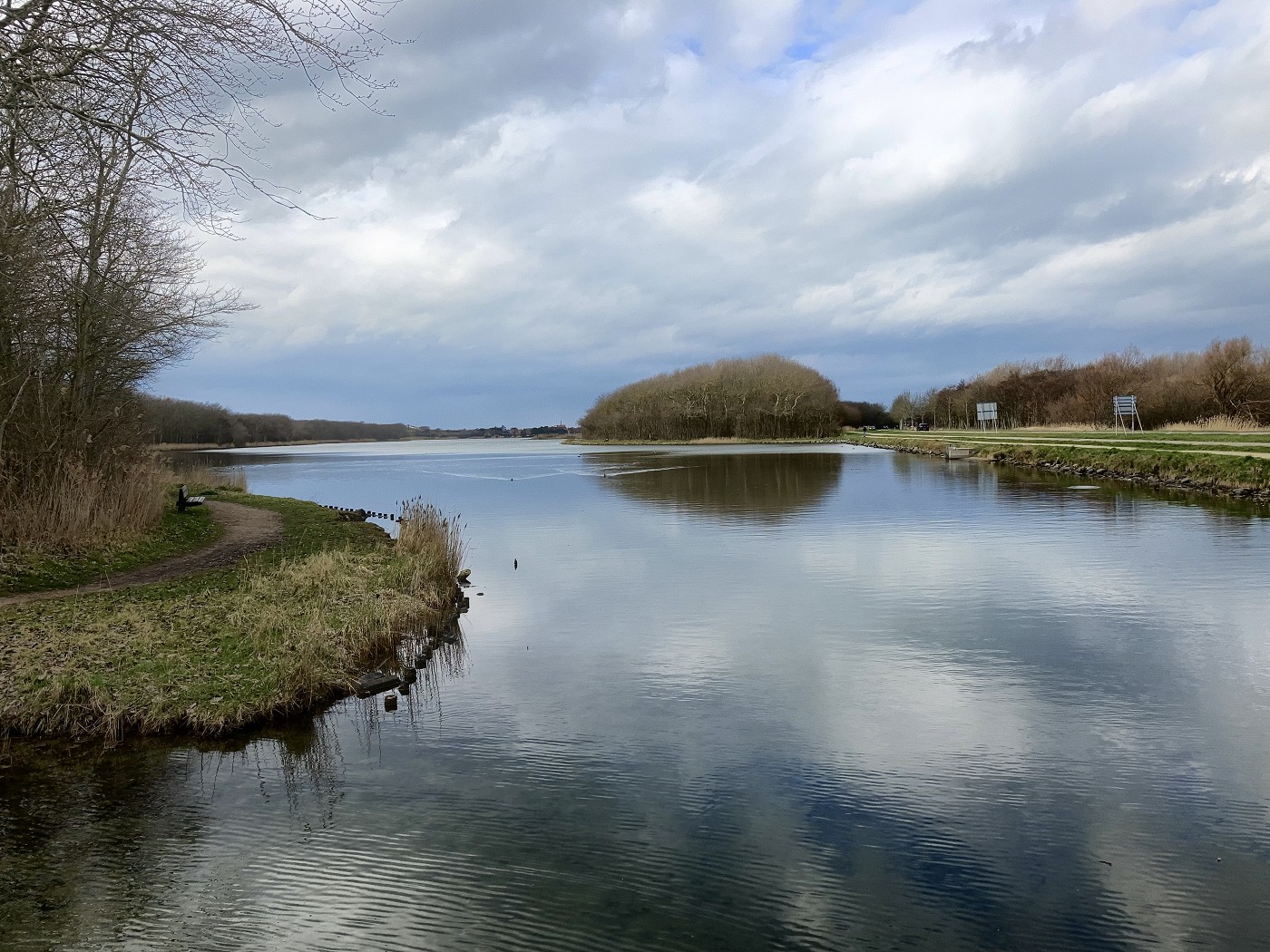
From there, we walked the last 800 meters to our Booking.com apartment in Westkapelle. We came past a beautiful little lake called Westkapelsche Kreek with across it a very tall lighthouse called Het Hoge Licht.
Once we arrived at the accommodation, we could do a self-check-in. I checked the time and we’d arrived in Westkapelle a little after 15:00. Not a super fast day, but also not super slow. I was happy with it.
The apartment was really nice and thoughtfully equipped. We spent the rest of the day warming up, relaxing, buying some simple food to prepare, and thinking about what we wanted to see in Westkapelle the following two days. We had booked three nights in Westkapelle.
Two Days in Westkapelle
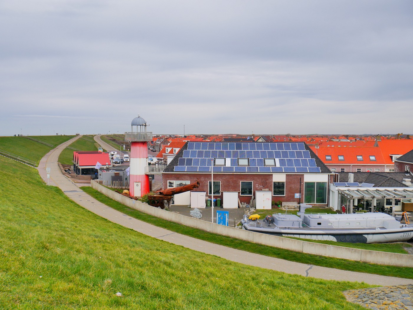
On our first off day, we worked a bit till there was a gap in the clouds and rain. We walked to the sea rescue station and wandered over the embankment to the special paalhoofd called Grôôt Ôôd. It’s a popular fishing spot.
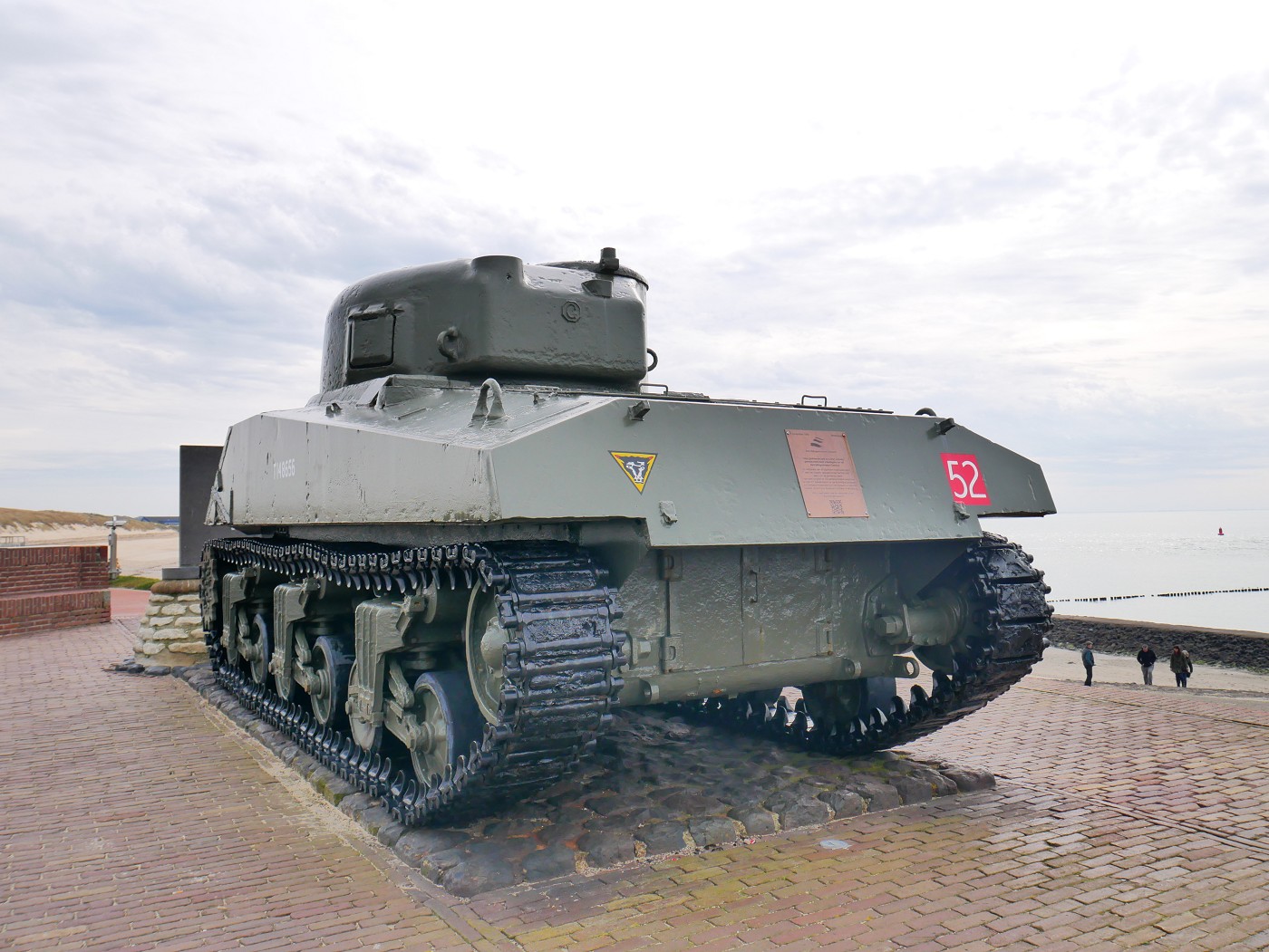
The embankment continues past a Sherman tank from WWII to memorialize the liberation and destruction of Westkapelle during its inundation. From there, there’s also a good view of the whole town of Westkapelle and the little fake lighthouse Polderhuis museum. There’s a real tiny lighthouse called Noorderhoofd further north on the dike that we’ll walk past on the next hiking day. Speaking of the next hiking day, we could already see that the first few kilometers would be over a soulless asphalted embankment and not a charming beach.

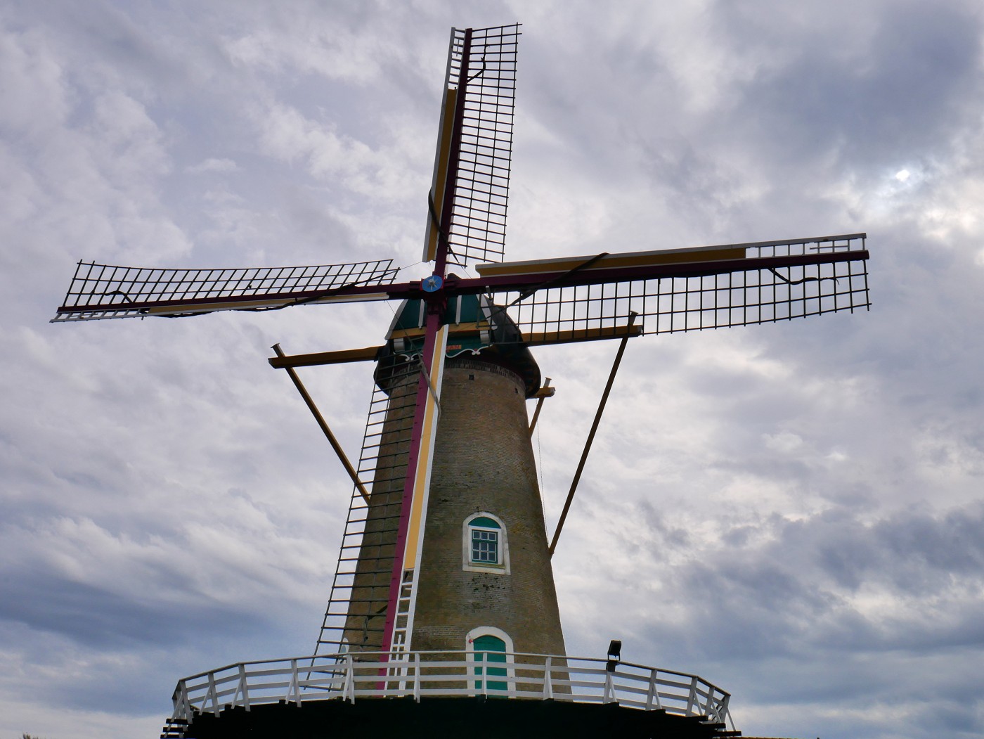
Jonas craved Dutch frietjes, so we descended to Melis Ambachtelijke Friet for fries and Dutch fried goods. He ordered his favorite patatje moeilijk (fries with mayo, curry ketchup, peanut sauce, and raw onions). We did some more shopping at the supermarket and a bakery before walking past the windmill. We used the mapped back alleys between houses to increase our chances of spotting a cat. No cats, but Jonas found lots of geocaches around town this day.
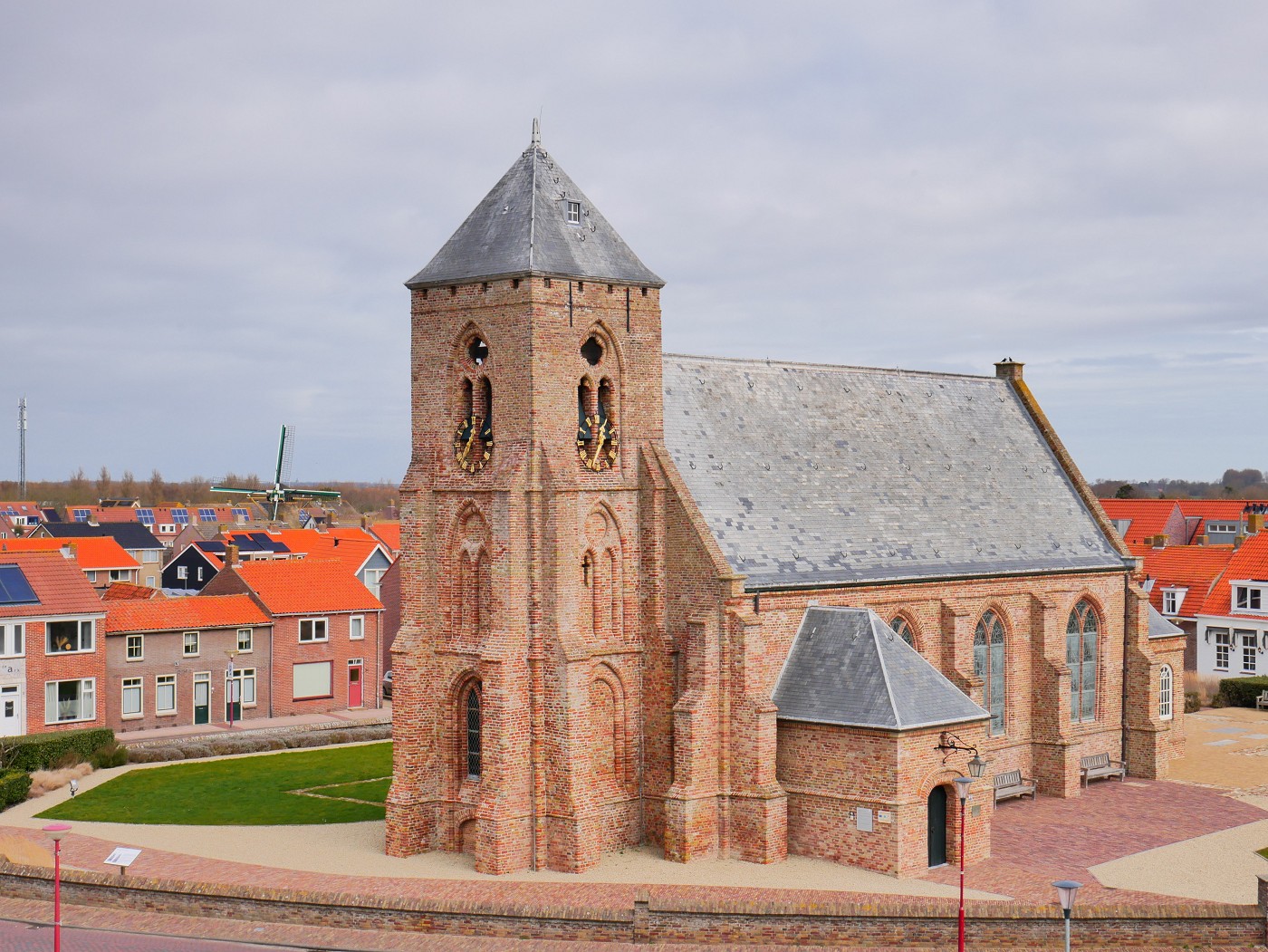
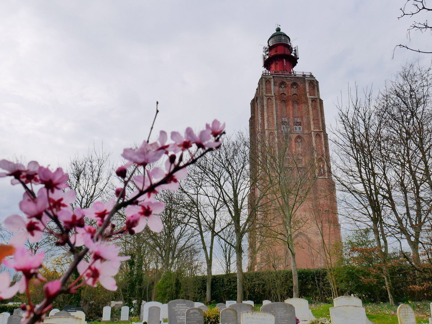
We visited the lighthouse Het Hoge Licht with its strange tower. There used to be a church here, but only the tower survived a 19th-century fire. Instead of a spire, the top now hosts a gigantic Fresnel lens. Sometimes the tower is open to the public to climb, but not on a random Friday like today. Below it lies a cemetery where Jonas and I sat down on one of the benches and enjoyed the peace and quiet among the early spring blooms. Then we returned home.
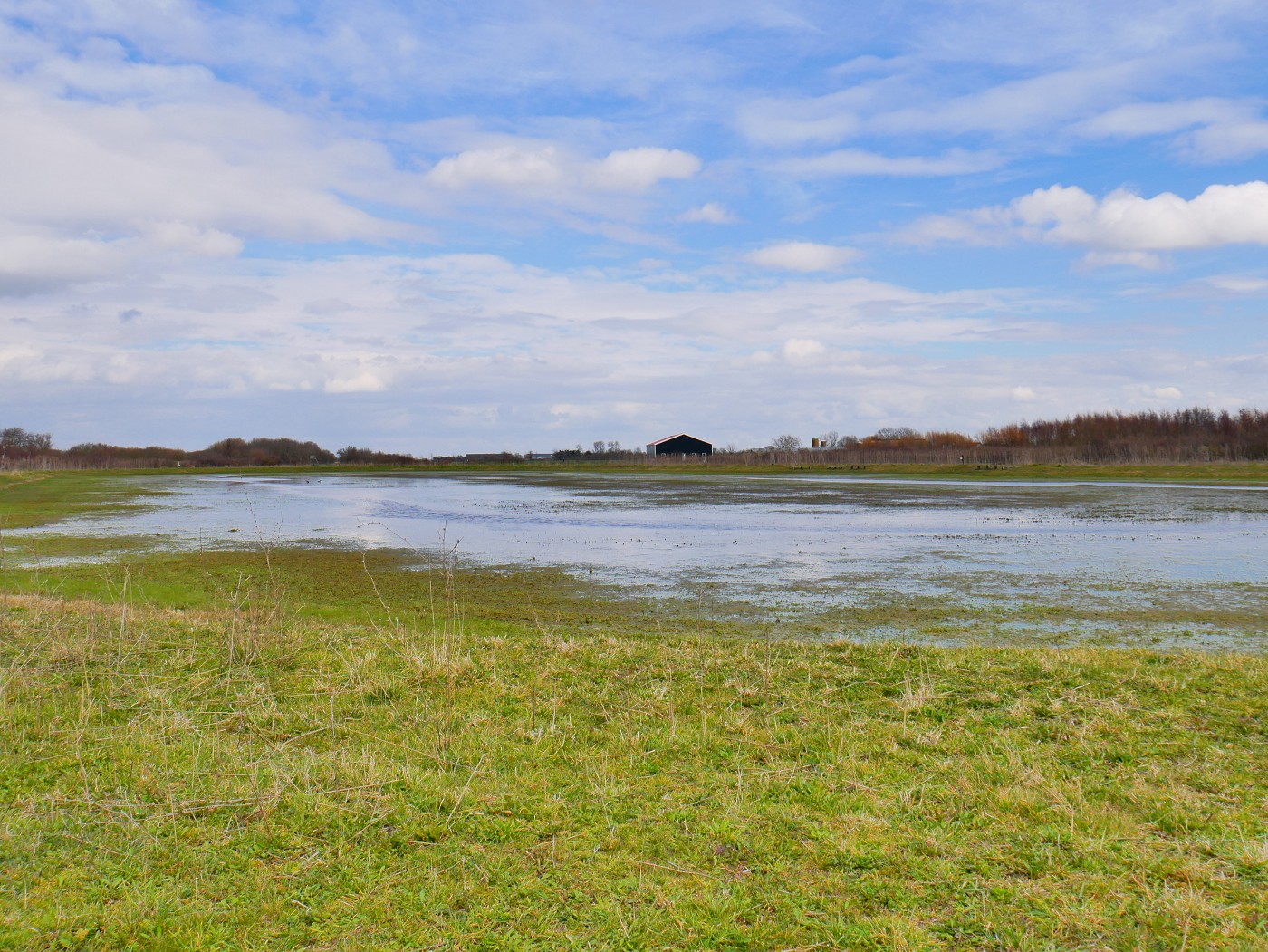
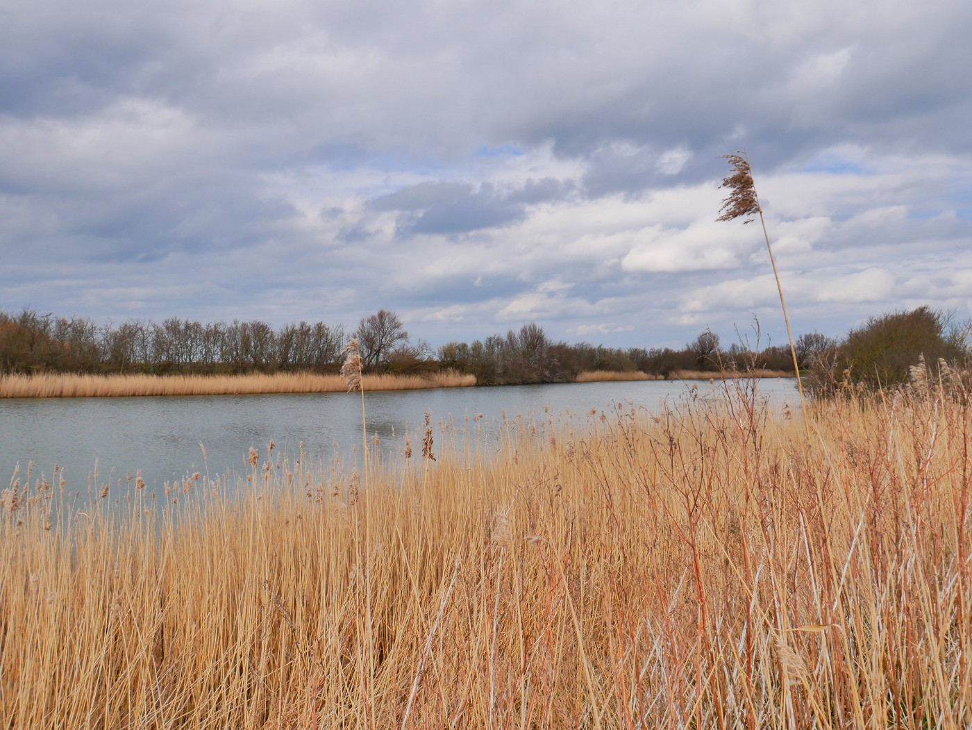
The following day, we did a bigger walk around the Westkapelse Kreek. It’s a brackish water lake created by the inundation of Walcheren in 1944. We walked all the way to a small towing ferry for pedestrians. This was great entertainment for a bit. On the other side is an ice skating rink, which with these non-freezing temperatures was just an oval patch of muddy grass.

Then we returned via the other side of the Westkapelse Kreek to our home and began planning the route for Walk + Work the Dutch Coastline Day 2: Westkapelle to De Banjaard via Domburg. It involved preparing a huge amount of sandwiches.
Wish to support the journey? Consider buying me a beer

Donate via PayPal
Sharing is caring! That also applies to this post


Similar posts:
 Penang National Park and the Meromictic Lake at Pantai Keracut
 Vlieland: 5 Days of Quietude, Craft Beers, and a Lighthouse (Walk + Work)
 Melaka Desert – Sauntering About the Shifting Sand Dunes at Sunset
 Pandemic in Penang: A Play-by-Play from Two Digital Nomads in Malaysia
 Walk + Work the Dutch Coastline: the Idea, Long-Distance Hiking Preparations, and Interactive Map