


")


")
")
")


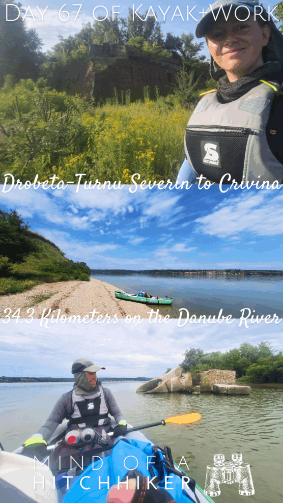
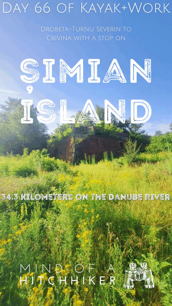
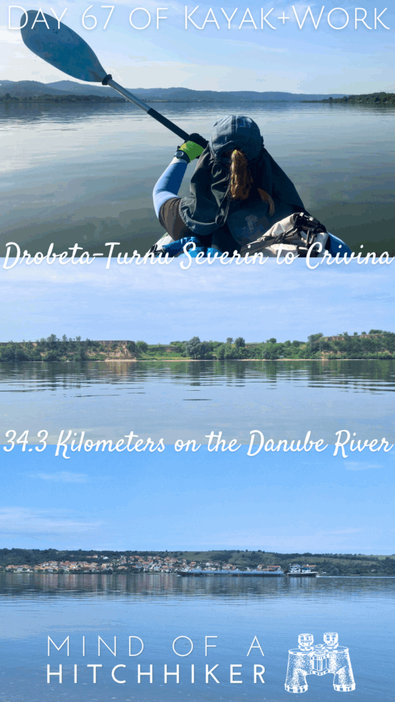
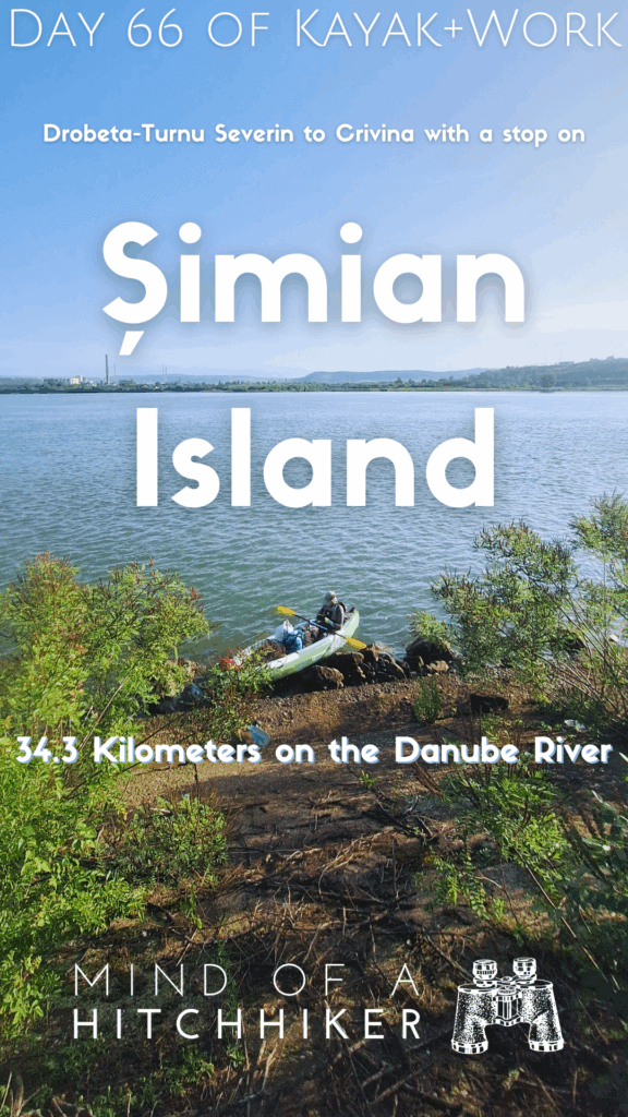
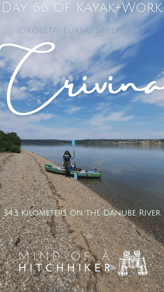
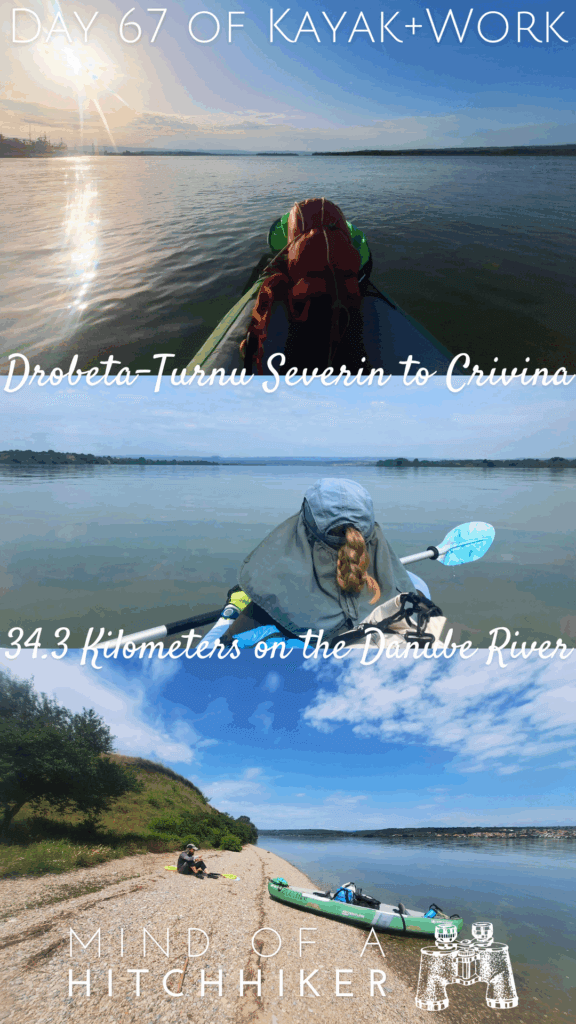
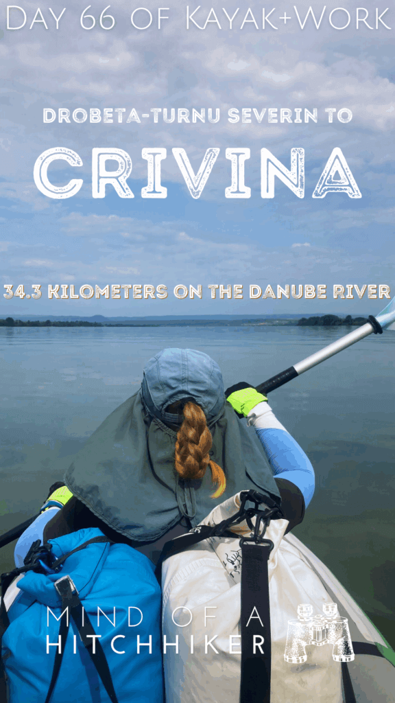
On the 3rd of June, 2024, we kayaked down the Danube from Drobeta-Turnu Severin to Crivina on the Romanian side. We also made a quick stop on Șimian island.
Want to travel the (entire) Danube River in an adventurous way? Join our Facebook group Danube River Source to Sea: Kayak / Canoe / Bike / Hike / Sail to find your community
Contents
Departing Drobeta-Turnu Severin + Șimian Island Stopover
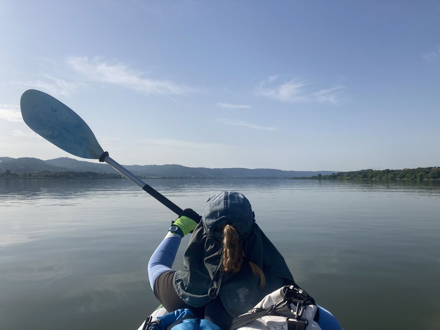
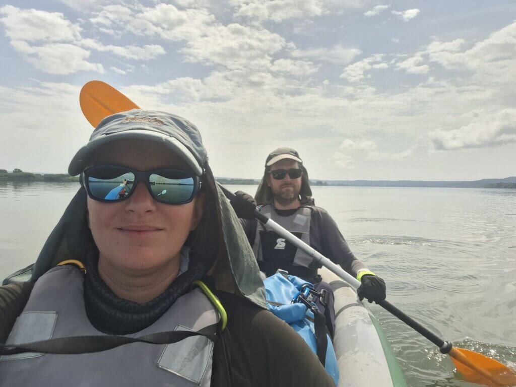
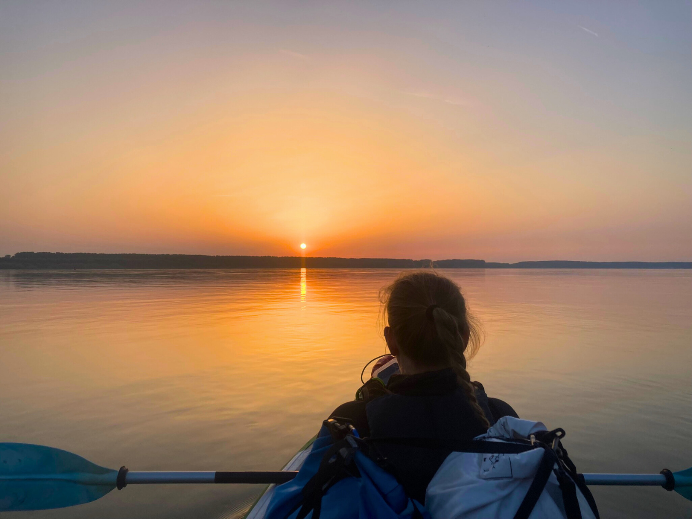
Without our usual morning coffee, we departed the Airbnb in Drobeta-Turnu Severin. I’d hoped we’d be ready and out the door 35 minutes after the alarm, but it all took a bit longer. We were walking past the unvisited Severin Fortress a little before 7:00 and crossed the train tracks to the launch spot next to restaurant Marinaru. We didn’t see Mafia the cat, who is probably out hunting at this glorious cat hour.
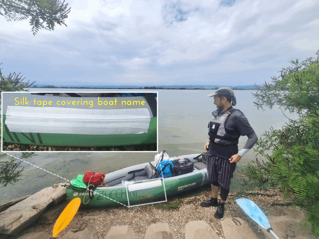
It also took a bit longer to inflate the boat next to the swirling Danube waters with the low-hanging sun to the east. The reason being that we bought silk tape a few days earlier, and I intended to tape up the spots where our paddles sometimes scrape Zucchini. Just to prevent further damage. Perhaps it looks a little stupid, but anything to protect our vessel.
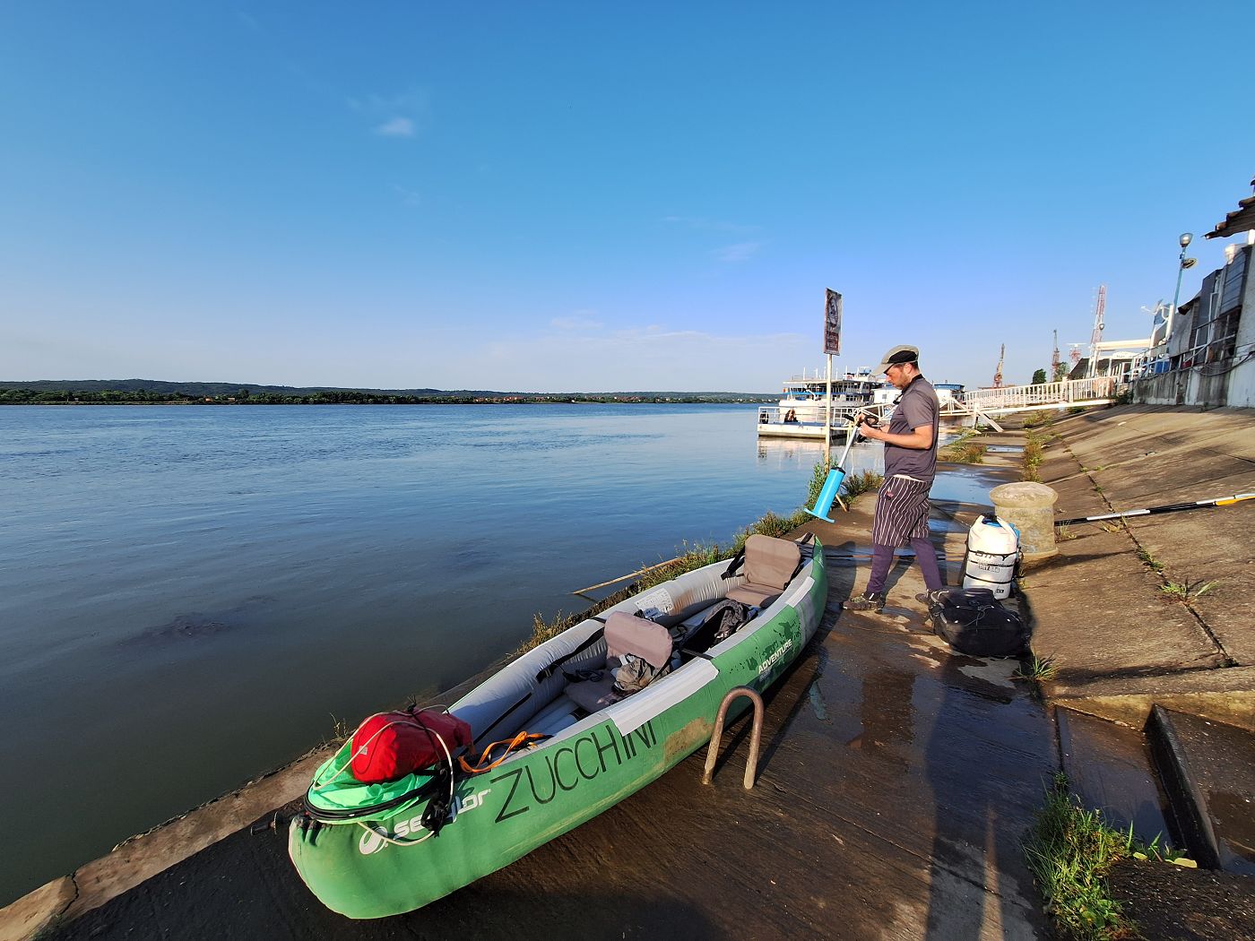
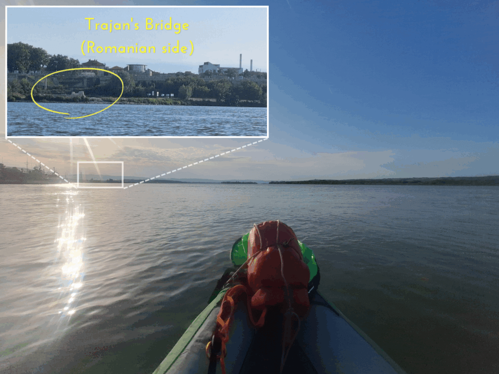
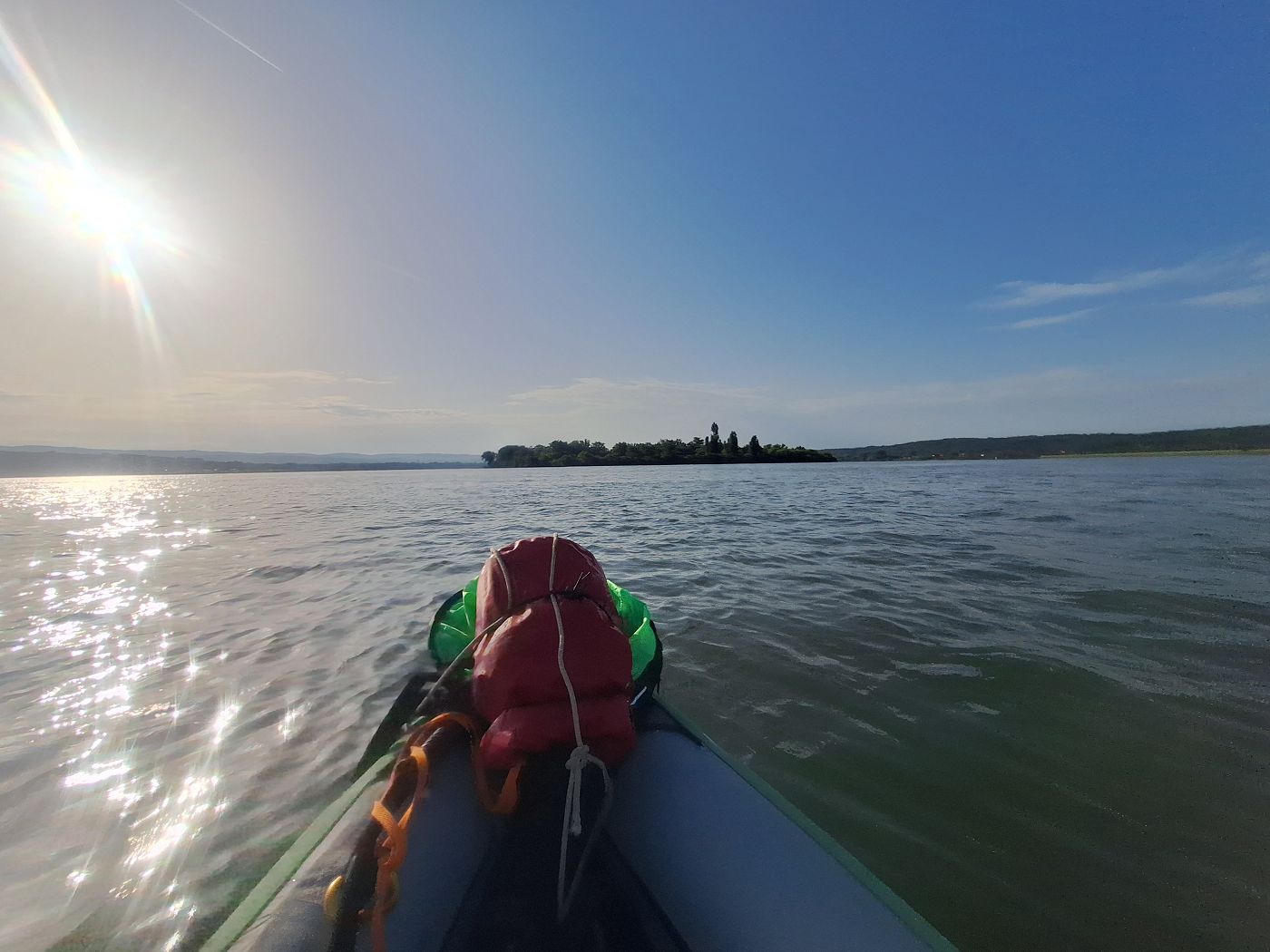
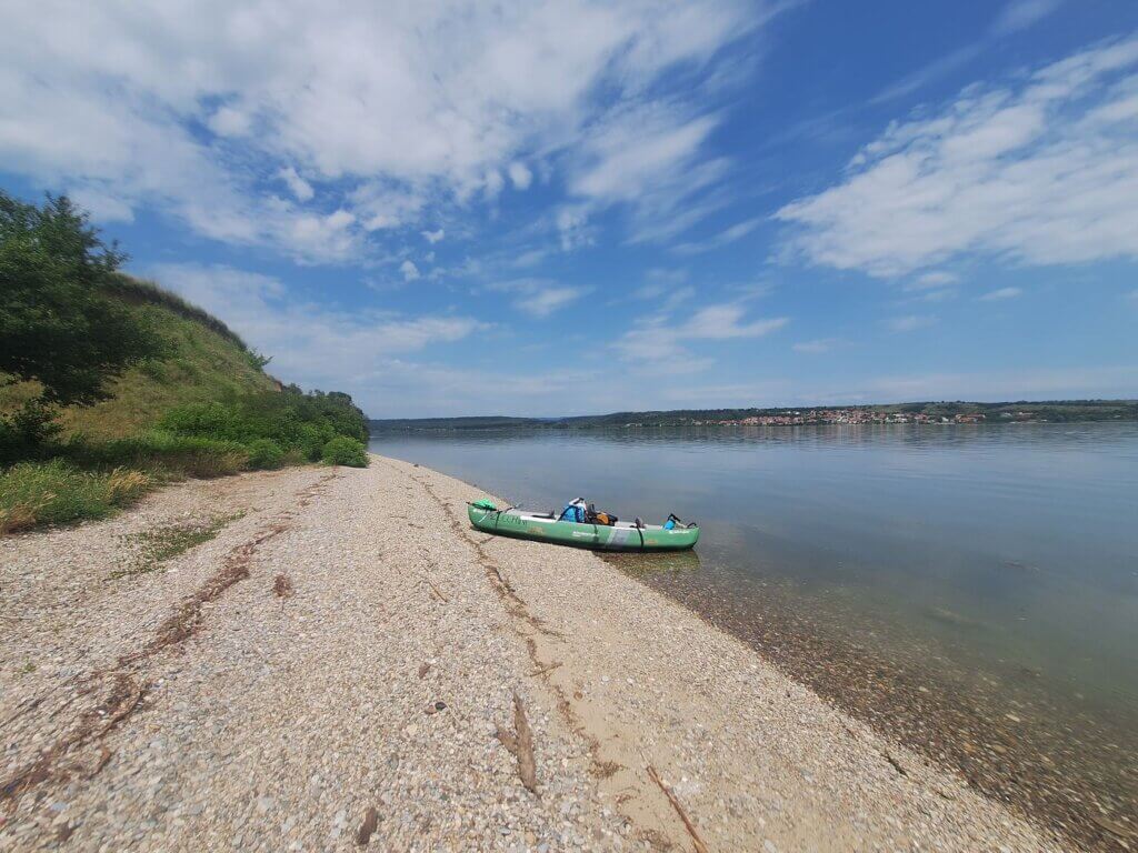
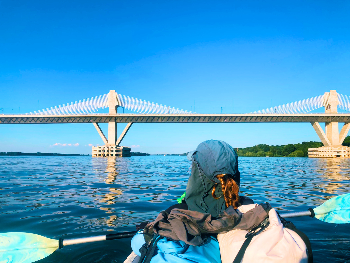
We departed Drobeta-Turnu Severin at 7:35. The currents more than 10 kilometers downstream from the Iron Gate I dam were still good, but we won’t need them for long, because I want to make a stop on Șimian island. It’s only 2.5 kilometers away from us. We paddled out and paddled toward the island in as straight a line as possible. A cargo ship traveling upstream quite close to us made us take a slightly longer route. I scanned the horizon to see the Romanian side of Trajan’s Bridge one last time. I’m not sure why I didn’t look for the Serbian side when I was much closer to it on the river.
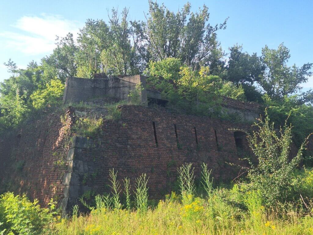
The head of Șimian island already has the vague outline of a fortress. That is the reconstructed fortress of Ada Kaleh. I’m not sure if it’s a replica or if the stones of the fortress were moved from the now-drowned island to Șimian. Once we got closer, we also saw some rusty water tanks towering high above. None of this is functional.
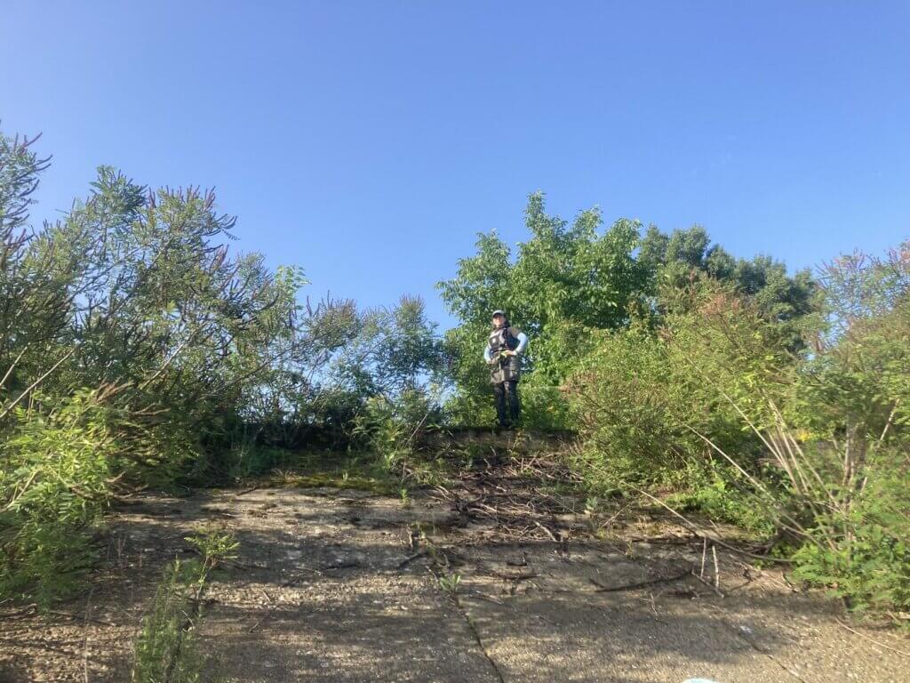
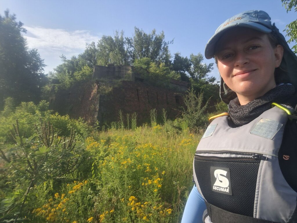
Though there’s a mooring spot for a cruise ship paying a visit to Șimian island, I saw a suitable landing spot a bit earlier at the embankment. We landed and I climbed it up while Jonas stayed in the boat. He wasn’t interested. The embankment was quite steep, but I made it up there and had a good look at the reconstructed and then again semi-abandoned fortress. It was fully overgrown with bushes and trees. My original plan was to walk there, but I couldn’t find a way through the dense shrub that was full of unbothered snails. Was the soil even stable? I couldn’t tell.
The reason for the move of buildings – from the mosque to the graveyard and the bazaar – from one drowned island to one that still exists is unclear to me. Was it even properly communicated to the inhabitants of Ada Kaleh that they’d get their homes back? Did they (rightfully) decide to not trust the Romanian government of that time? Was it always the intent to rid themselves of this minority, most of whom have gone to Turkey? Was it the plan to make Șimian island a sort of Ada Kaleh theme park where you can try menemen with bacon?
I took some photos of the northern corner of the Ada Kaleh/Șimian fortress and returned to Jonas and Zucchini without falling on my face. Perhaps if the official landing site is doable, we can also still make a stop there and I can check if there’s a path. But Jonas wasn’t very interested and wanted to just get going—we have a long day ahead.
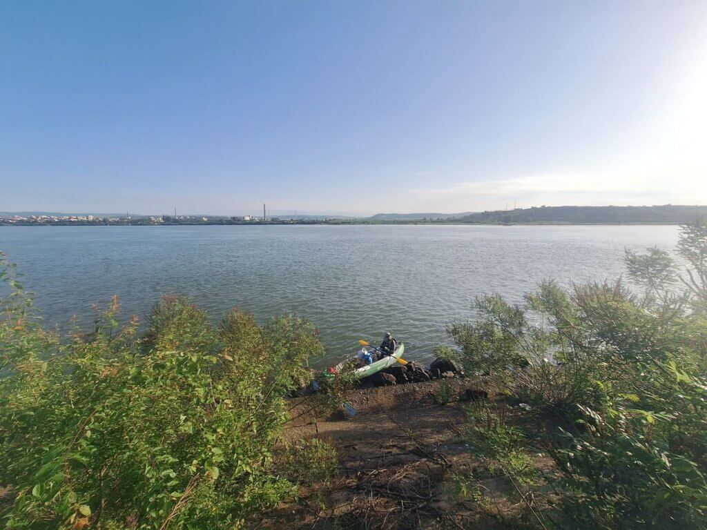
When we paddled past the cruise ship jetty, I could see it was too high for us to get out, too pointy for Zucchini, and there was no guarantee there would be a path to the fortress there. My visit to Șimian island was just eight minutes.
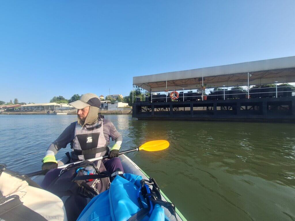
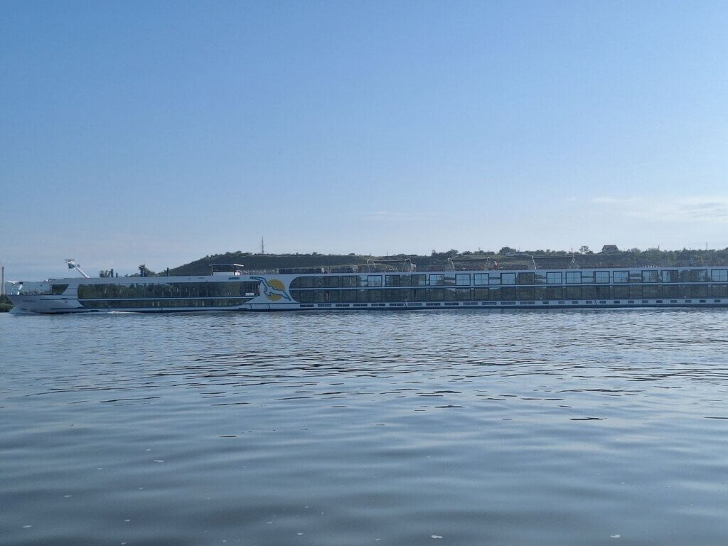
We paddled a little away from the island to catch some current. Cruise ship Andrea II came upstream. It’s making a round-trip journey from Passau down the Danube to Sfântu Gheorghe and back to Passau over 16 days.
Almost at the end of Șimian island, we passed the last potential landing spot (coordinates: 44.61059416725796, 22.69333387178235) on the island. I vetted it only on satellite view the day before. A small motor vessel on the water just landed there as we approached. Supposedly, there’s a bridge there over a little backwater as seen from this 360° photo:
We passed many similar inlets, all with birds waiting to catch a fish in peace. Perhaps it’s possible to enter there with a kayak, but we don’t have time for more side quests today. At 8:18, we had left the island behind us.
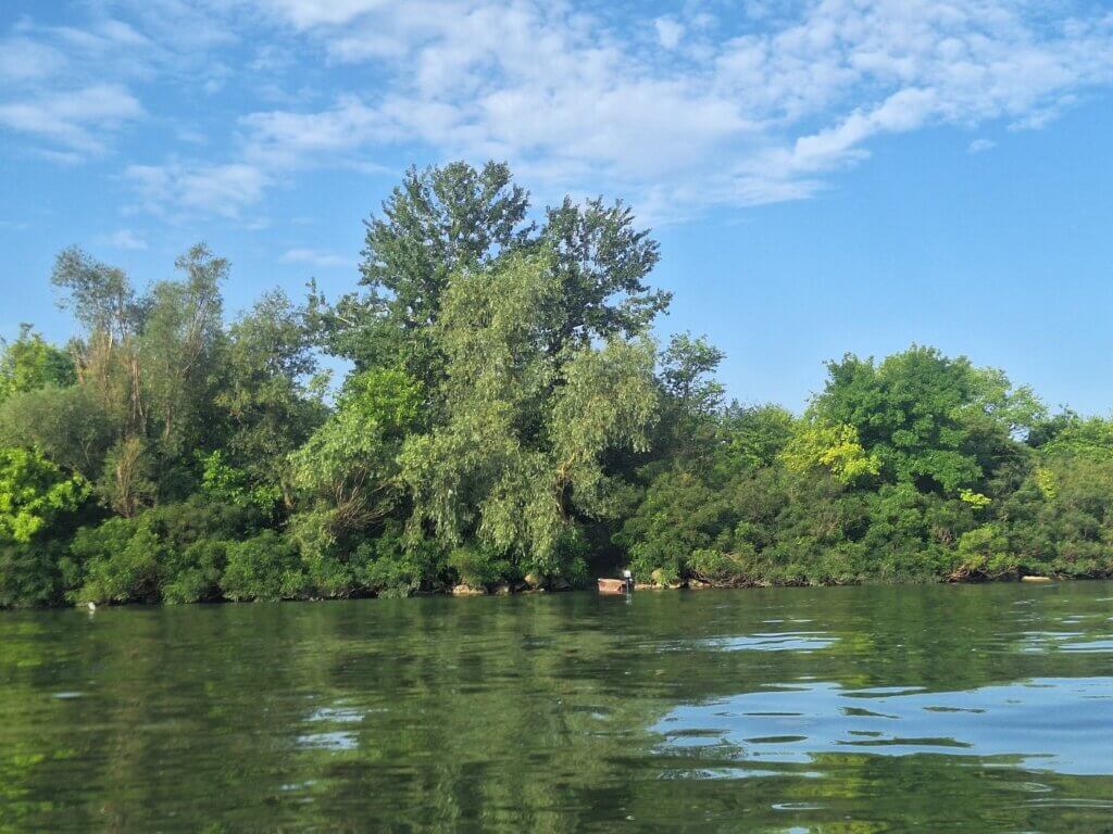 A secret boat passage into the backwaters of Șimian Island
 The tail of Șimian Island
The Most Extreme Danube River Bend
Though our distance from Drobeta-Turnu Severin to Crivina is only 15 kilometers today in a straight line, we have about 35 kilometers to paddle. That’s because there’s one gigantic river bend up ahead. The Danube wraps itself completely around this sort of Serbian panhandle. It didn’t start today; I think this massive turn started in Donji Milanovac (or even Cozla) and will only end after Brza Palanka. Though someone on Google Maps mapped it as “the Easternmost Point of Serbia”, it isn’t. And though this is quite the detour, it used to be even longer, since the old Danube loop beyond the Romanian village of Ostrovu Corbului was cut off and shortened.
I was measuring to a Romanian village called Hinova. It’s a little less than kilometers away from where we were. After that, I can have a protein bar as it’s more than one-third of the way to Crivina. Time to make some speed and cover some distance.
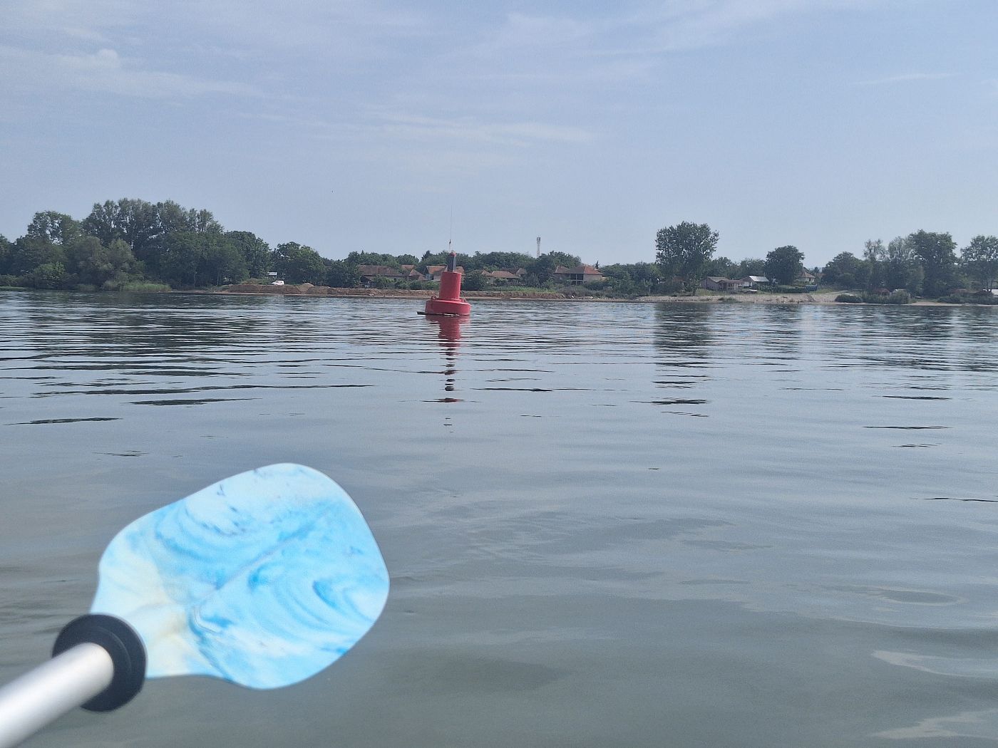
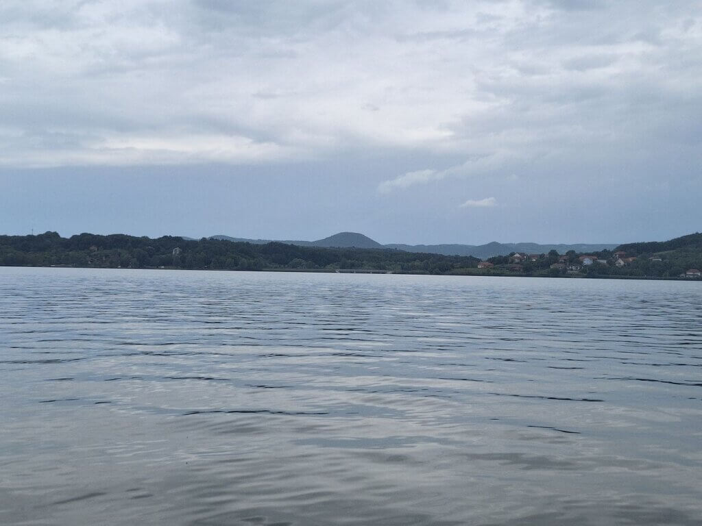
I was just enjoying the surroundings. The glassy Danube water. The Serbian islands to our right that go pretty much unnamed and unnoticed. The singular red buoy we’re aiming for. The little Romanian police boat on the water that I am sure noticed us, but isn’t coming over. And the slight downslope gradient of the water and our whole world.
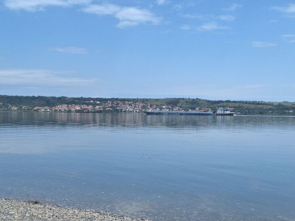
By 9:06 we were parallel to Rtkovo in Serbia. The towns there look pretty decent, though I know they also have their fair share of stray dogs and misery. Somehow, all I feel is that I’m missing Serbia. Perhaps the TID was right and it’s best to just stick to the Serbian side for as long as possible.
 Rtkovo
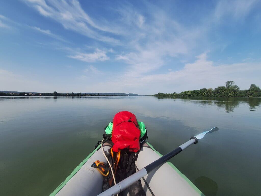
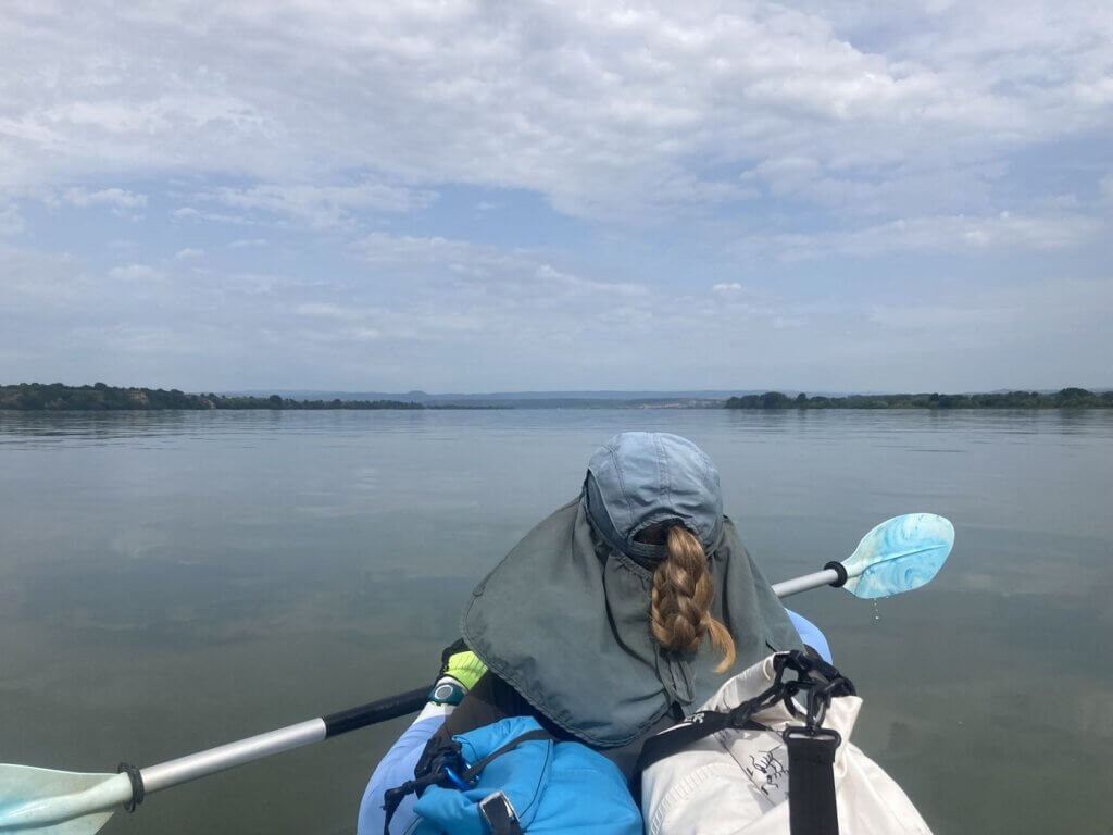
The river bend began its turn to the right. Jonas checked the latest weather forecast and said that the rain and thunder is canceled. We were trying to be in the middle of the river for speed purposes. I tried always aiming a little more for Serbia so that we ‘shortcut’ the turn ever so slightly.
And then the current picked up. Jonas asked me to measure our speed, so I got my OSM map out and let the screen run for a bit while I gauged an average. Always above 7.5 kilometers per hour, sometimes we hit 8.5. Those are wonderful speeds. Let’s enjoy them while they last.
We arrived at the easternmost point of the turn at 9:30. We paddled a little more before I asked for my protein bar at 9:45. These were double the price of the ones from the German DM Drogerie, but it was also white chocolate + cookie dough. Delightful.
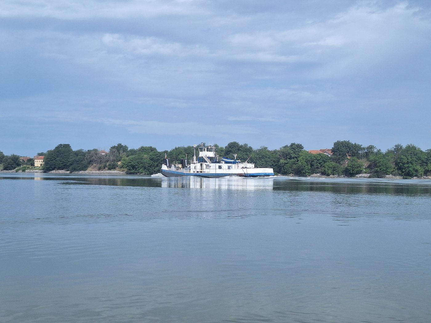
At 10:00, near the village of Korbovo, we were spooked because a pushtow without any barges had snuck up behind us without us noticing. We were paddling closer to the Serbian side, but this Romanian-flagged ship was still squeezing between us and Serbia for some reason. It wasn’t tight, but it was a bit uncomfortable. And unburdened by any barges to push or tow, it was going at a massive speed and left an impressive white-crested wake behind itself.
The plan was to surf it, which we did. We overestimated the danger by paddling away too much back to Romania, but we corrected that afterward.
A Break on a Beach + Vrancea
Now through most of the turn, we had to find a new aim. There was this one prominent round mountain in the distance that looked good, so we agreed to aim for that.
The pushtow that had overtaken us and left us a messy river for a couple of minutes raced over to the left side of the Danube to pass on the correct side of the red buoy. On the right side and further behind it was a Serbian fishing boat doing its thing. Thankfully, no water police.
Though we tried to pass the buoy on the right, the current dragged us to the left. We were hitting speeds like 10km/h here at times. Control over our vessel can sometimes be just an illusion.
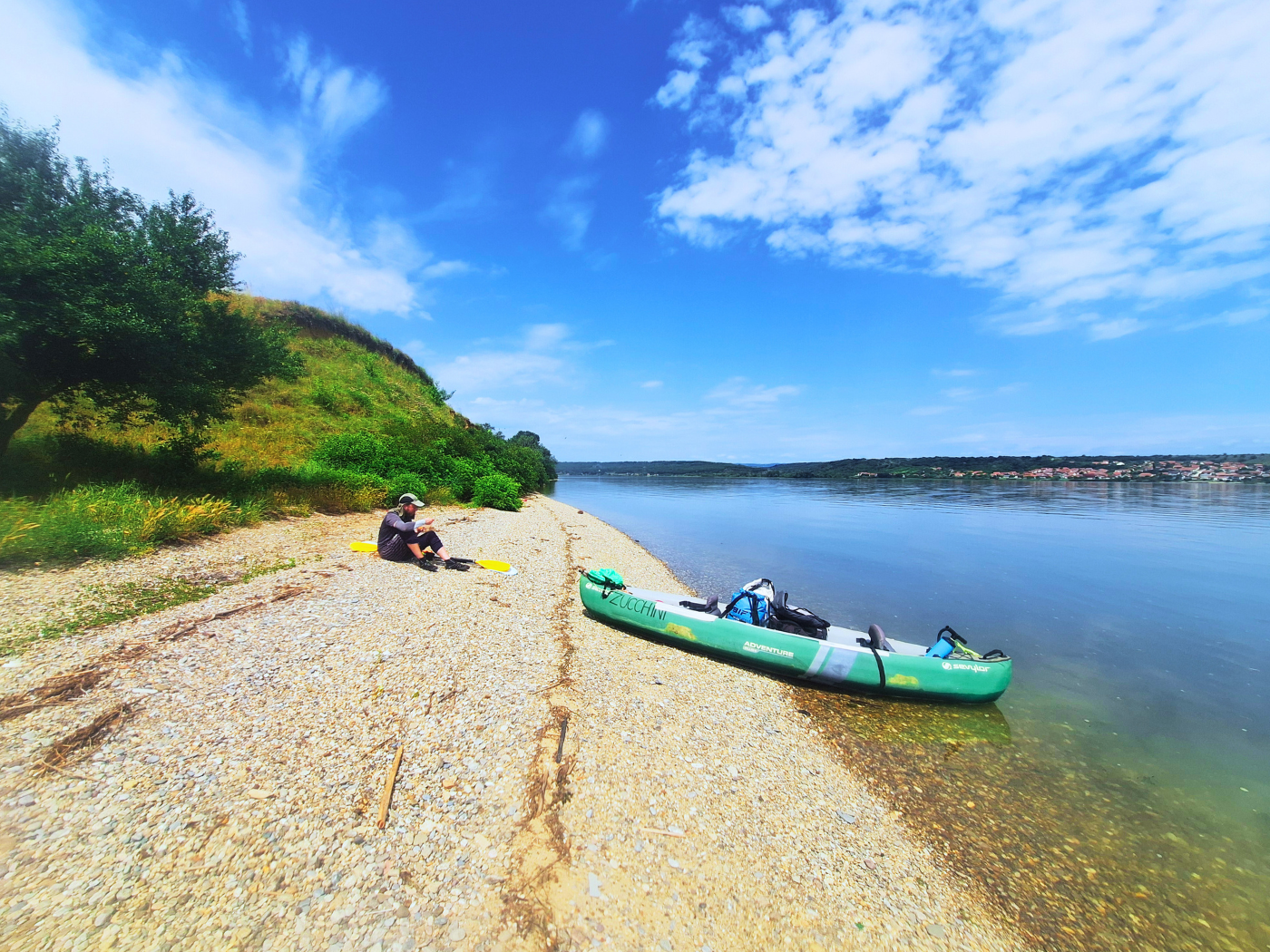
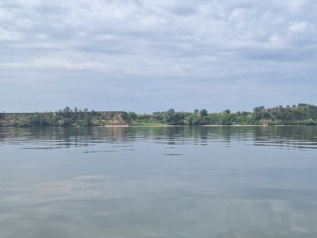
The clouds rolled in and provided us some much-needed relief from the heat. To the left, the Romanian shore became quiet and patterned: small cliff, then a dip, then another small cliff, a dip, and repeat. Below it was one continuous beach and lots of greenery all around. Up the cliff and beyond or line of sight, just farmland. I’m hoping that when we take a break on land, it will be a nice tranquil spot like that.
I measured our route on the OnCourse app for a while, trying to get to one nautical mile mapped. The problem was that I didn’t know how long one nautical mile is in metric off the top of my head. One freedumb mile is 1.6 kilometers, that much I know. So I was following it on my phone for a long time till it hit 1.04 nautical miles and then took a screenshot. I’m still not sure if this app makes any damn sense.
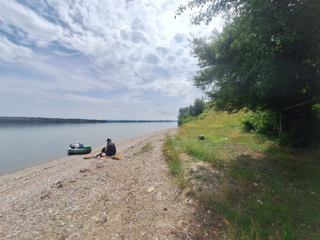
We slowly crossed over to the Romanian side, aiming for that round mountain (probably one mapped as “Velika Čuka” near Podvrška) in the distance. When we got close to the shore, Jonas spotted a cargo ship coming from behind. It was also time for a break on land, so we scouted a spot and tried to be there when the ship would pass us by so we’d have some privacy.
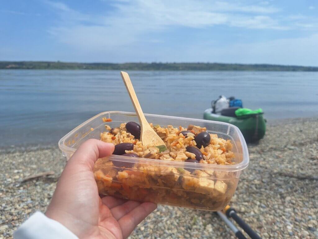
At 11:21, we landed at a lovely spot in one such dip between two cliffs. There were small holes in the cliffs, made by the birds that use them as housing. At the Iron Gate Natural Park visitor center near Orșova I saw a sign about them. It’s the Sand Martin, aka the Riparia Riparia in Latin and the Lăstun de Mal in Romanian. The birds were not amused with our short visit.
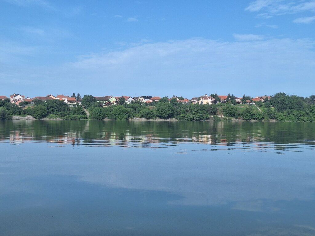
We sat down with our box of tofu fried rice on the beach as the cargo ship passed and its small wake arrived. There were some trees in the shadow, but I was a bit afraid of snakes and/or ticks, so we sat in the sunshine with our hats on. As hoped, it was a beautiful spot across from the Serbian village of Vajuga. Once again, the village looked super decent.
After lunch, we took some more photos at this beautiful spot. That’s when I realized the white silk tape on our boat covers the letters of Zucchini on my side. All in all, it does look a little dumb. But if the tape holds, I think it’s a net-positive.
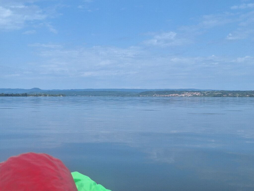
We kayaked away at 11:50. Our 29-minute break felt a lot longer. Back in the boat, it was time to reapply sunscreen and paddle past the village of Vrancea. That one also has online bookable accommodation, but we decided against booking that because we like to frontload the distance before the dam.
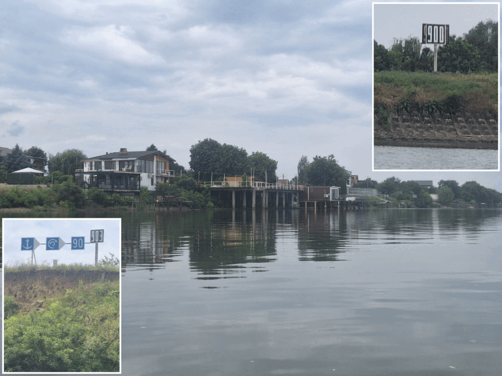
We came past our first readable kilometer sign of the day: 903. We started counting down to 900 as we paddled past the village. There were quite some people still at their (holiday?) homes after the weekend. Either fishing, DIYing, or smoking from their riverside platforms. One lady took photos or videos of us from the river. I wish this footage would somehow get back to us so we also have some photos of the two of us in the boat while kayaking from a third-person perspective.
 Looking back at our old focal point. In the foreground is the Serbian village of Milutinovac
900 kilometers to go to the Black Sea. It was 12:19 when we paddled past that sign, which was a newer kilometer sign pasted over an older rusty one. We were behind Vrancea and about 6 kilometers from Crivina. Let’s finish this.
The Long Paddle to Crivina
I don’t know what it was, but after Vrancea, the current slowed down, the headwind picked up, or we were just getting a bit tired. Or all three. Either way, we slowed down by a lot against our will or knowledge.
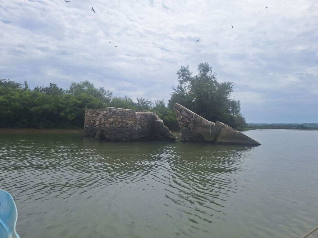
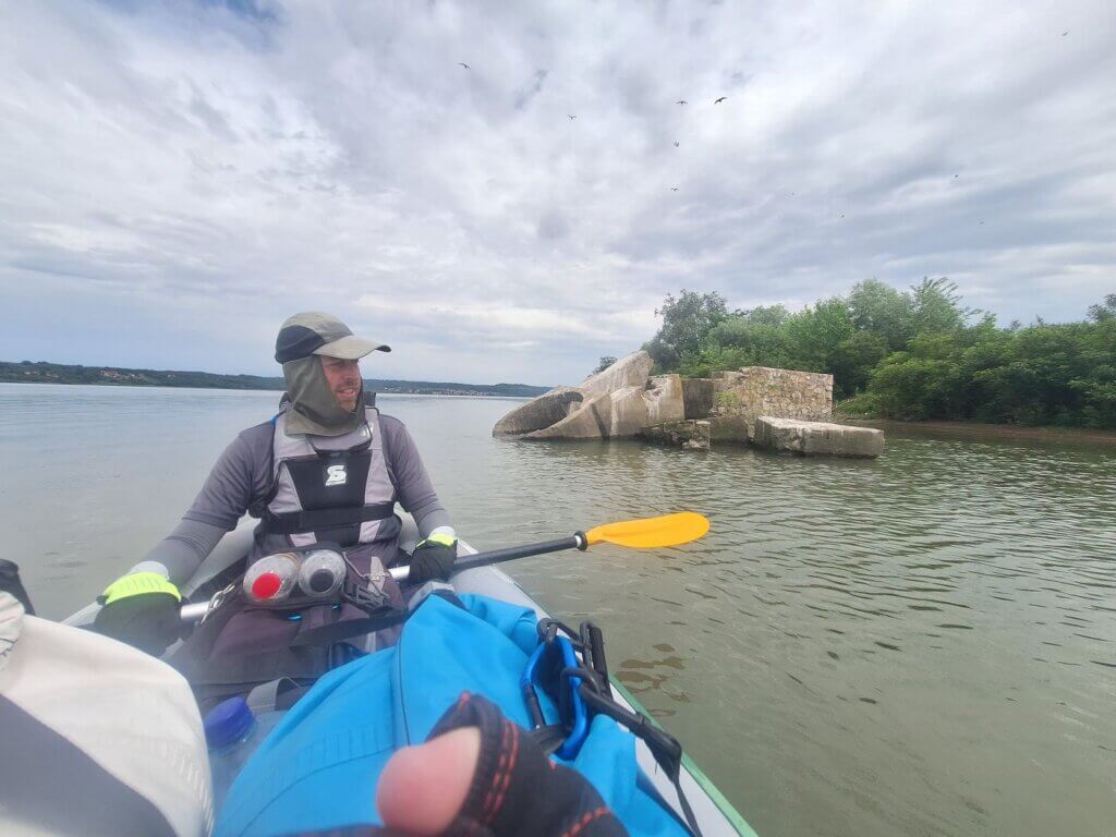
The Romanian shoreline became a bit more natural, i.e. messy. There were patches of land and peninsulas stretching out into the river. We paddled around them, but still, we ended up in kind of shallow waters, judging by the plants. In the distance, we saw a structure in the water. Another sunken castle? Something more modern? It was also the resting place for many gulls, who were not amused when we approached closer to check it out. Perhaps it’s a bunker from the Cold War or WWII. I don’t know, but the concrete with rusty metal sticking out looked modern. The structure is visible on Google Satellite view.
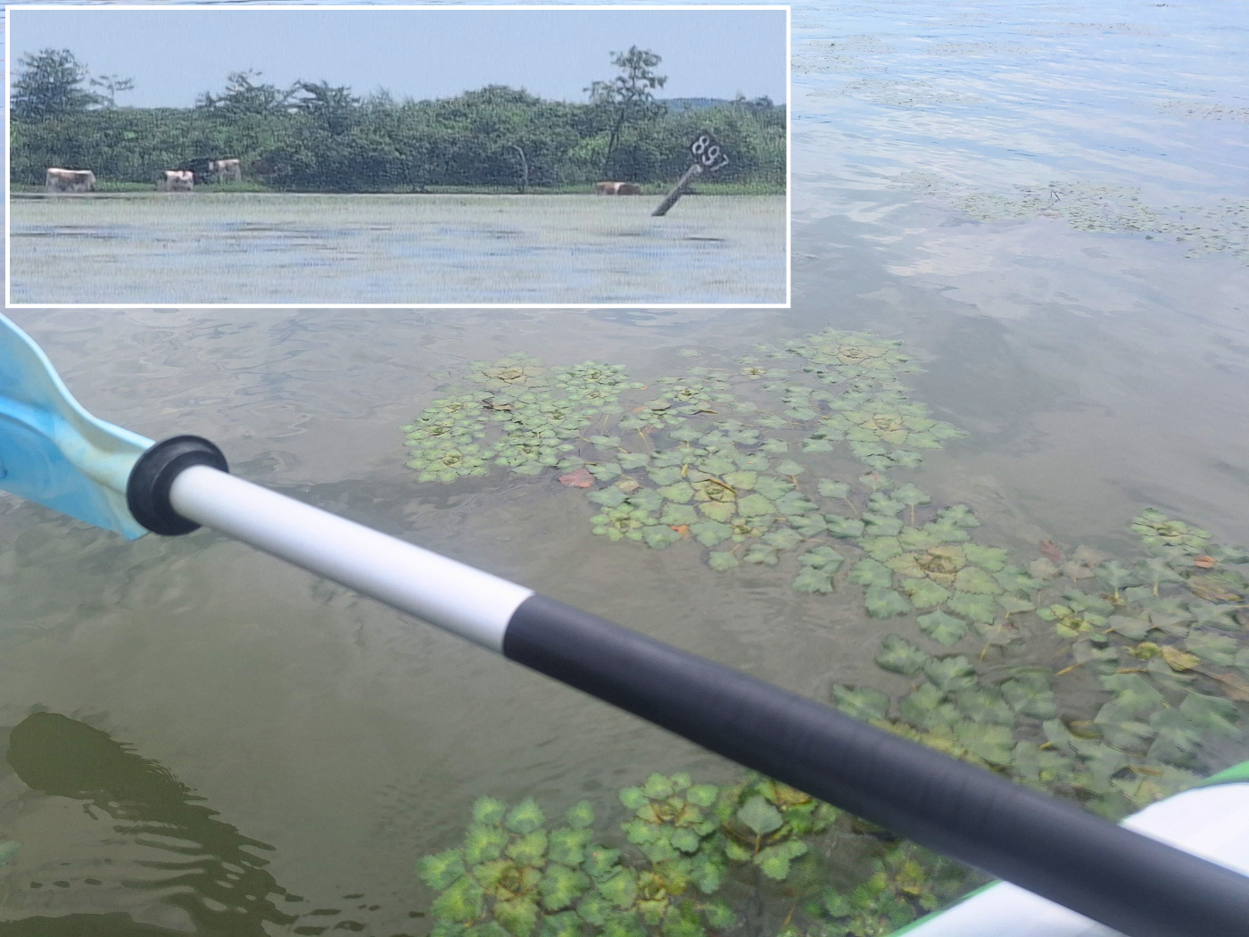
A shallow lagoon full of water plants appeared to our left, alongside the 897 kilometer sign. It was hanging like a small boat had knocked it over and looked drunk. Behind the sign was a herd of cows eating grass on the flooded shores and taking a bath in the Danube. They seemed to have fun.
The last two days, I’ve been following the news about the floods in southern Germany and Austria. The persistent rains have affected the Danube basin and caused the deaths of a few people (at the time of writing, it’s ongoing). We’ve been following the water level alarms in that area of the Danube. It’s kind of a trip down memory lane, as we see place names in the headlines like Deggendorf and Passau. We are kind of hoping that it will come downstream to us and give the Danube a nice little push. Nothing crazy, just some crumbs for two peasantly kayakers. I’m fairly sure my mom will message me soon about the news and tell us to be careful.
Somehow, every time we checked the map, we had only paddled a few hundred meters further. The last few kilometers to Crivina were truly depressing for some reason. But eventually, we saw the village of 604 people.
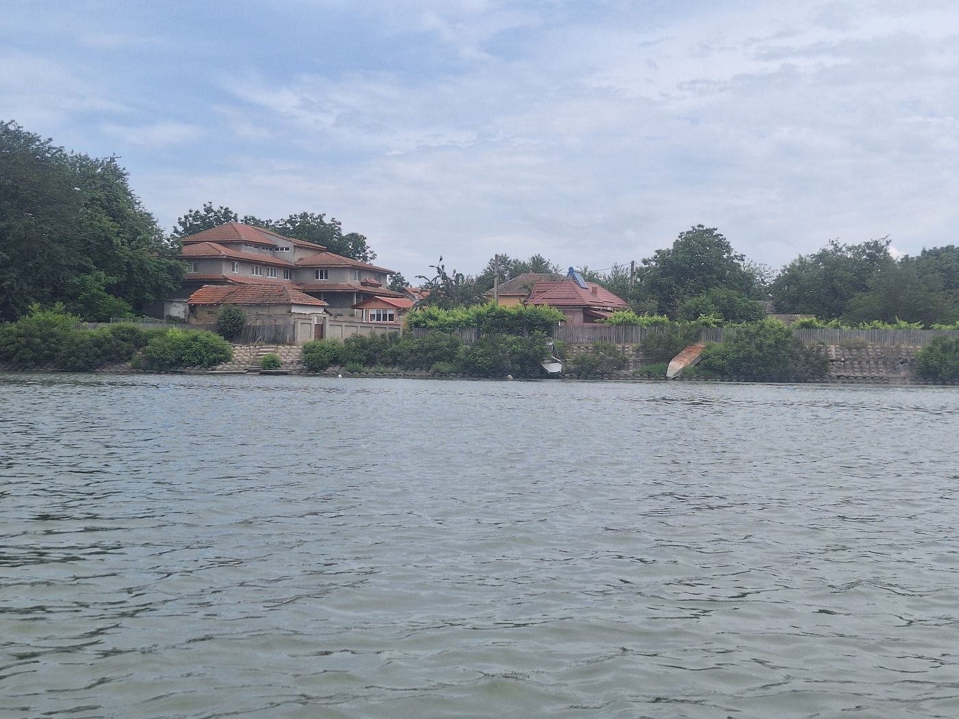
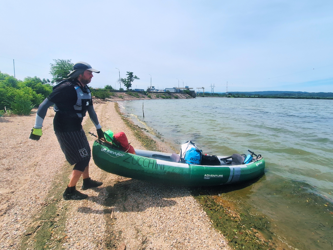
We were staying all the way on the other side of the village, so we kept paddling and approaching the shore while keeping an eye on the map. At our satellite-vetted exit spot, there were some stairs. But the bushes there completely blocked it, so we landed next to it, which was a hole in the concrete embankment. Arrival time in Crivina: 13:34.
Up the embankment was an unpaved road parallel to the river and an asphalted one to the village. There was one dog on each street, that we managed to not trigger until we carried Zucchini up. We’ll have to walk about 500 meters to our guesthouse.
It started raining a little while we flipped Zucchini to let the water out. I voted in favor of just packing everything up as quickly as possible and walking to the guesthouse. If we want to dry Zucchini well, there might be a garden we can use if the sun still comes back today. One of the dogs on the side street was barking at us the entire time we were packing up.
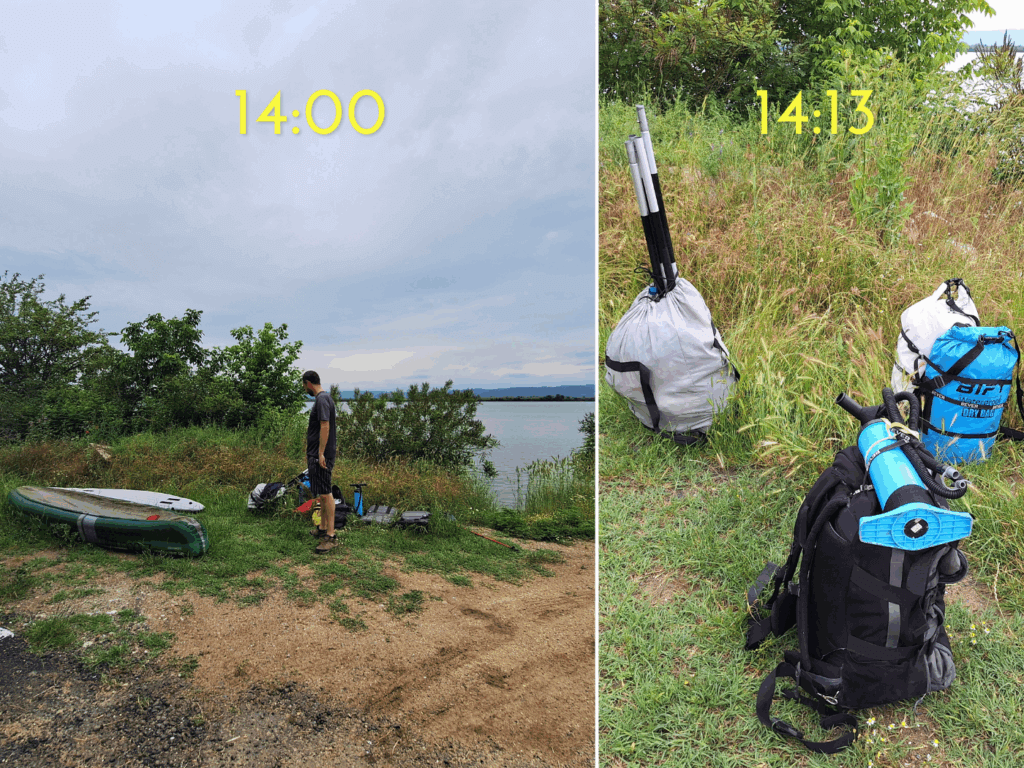
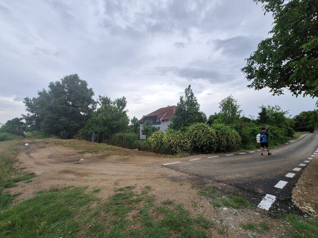
It was mightily hot on shore, so we took off some layers of clothes and packed them up before walking to Laguna Verde guesthouse. One of the street dogs here walked away from us as we approached, but barked at us while next to someone’s property with at least three dogs behind a fence, triggering the entire town. What a douchy dog.
The road through Crivina was a bit uncomfortable to walk on since there was no sidewalk but quite some fast car traffic. At the guesthouse, there was a man sitting outside who let us in. Zucchini went in a storage facility while I went upstairs already with the key. Jonas completed the checkin while I took photos of the accommodation in Romania and started unpacking.
Our Stay in Crivina
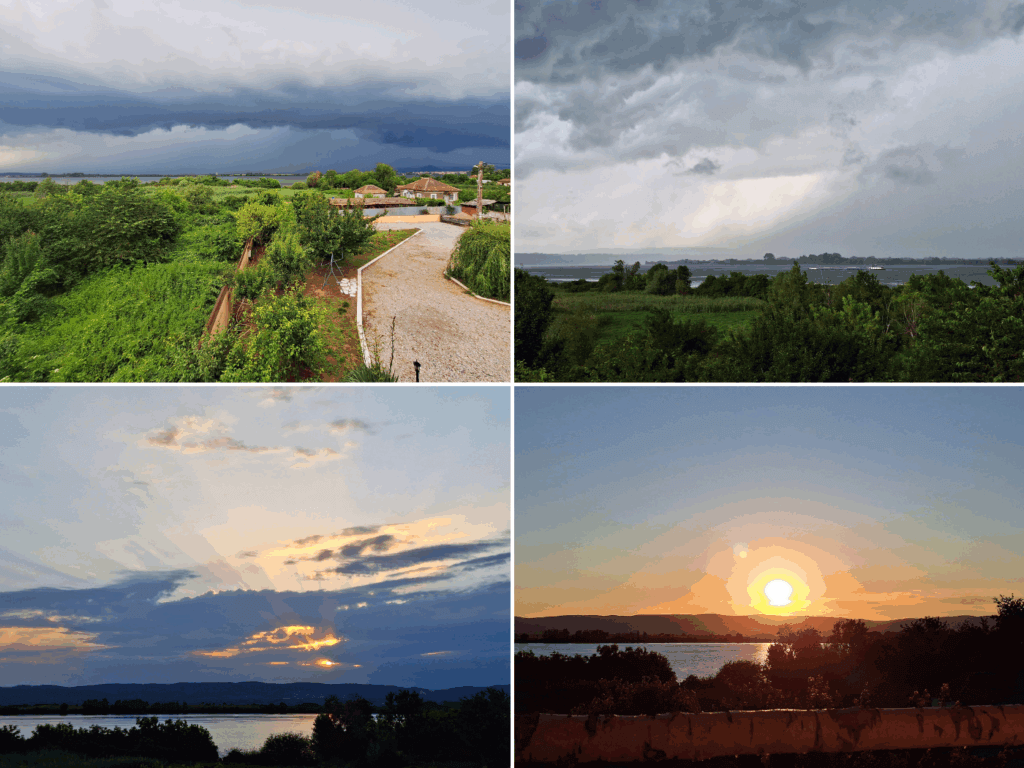 Ominous clouds, rain, thunder, and two sunsets in Crivina
Good read? Please consider supporting my blog


Similar posts:
 Kayak Trip Day 68: Iron Gate II Dam to
  Kayak Trip Day 65: Orșova to Drobeta-Turnu Severin – Iron Gate I Locks Unlocked!
 Kayak Trip Day 67: Crivina to Comoara Istrului – Iron Gate II Dam + Danube Gogoșu Branch
 Kayak Trip Day 72: Oryahovo to Nikopol – Summer Solstice + 80 Kilometers
 Kayak Trip Day 75: Ruse to Tutrakan – New Kayak Sail + 1000 Kilometers Paddled