

 to Travel")


")


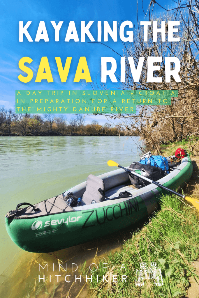
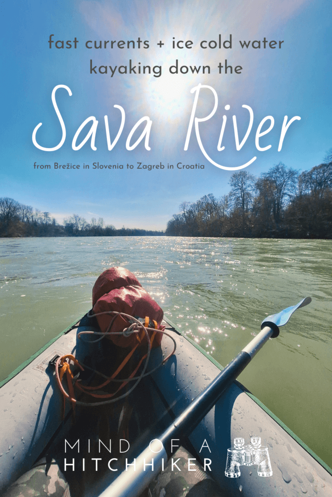
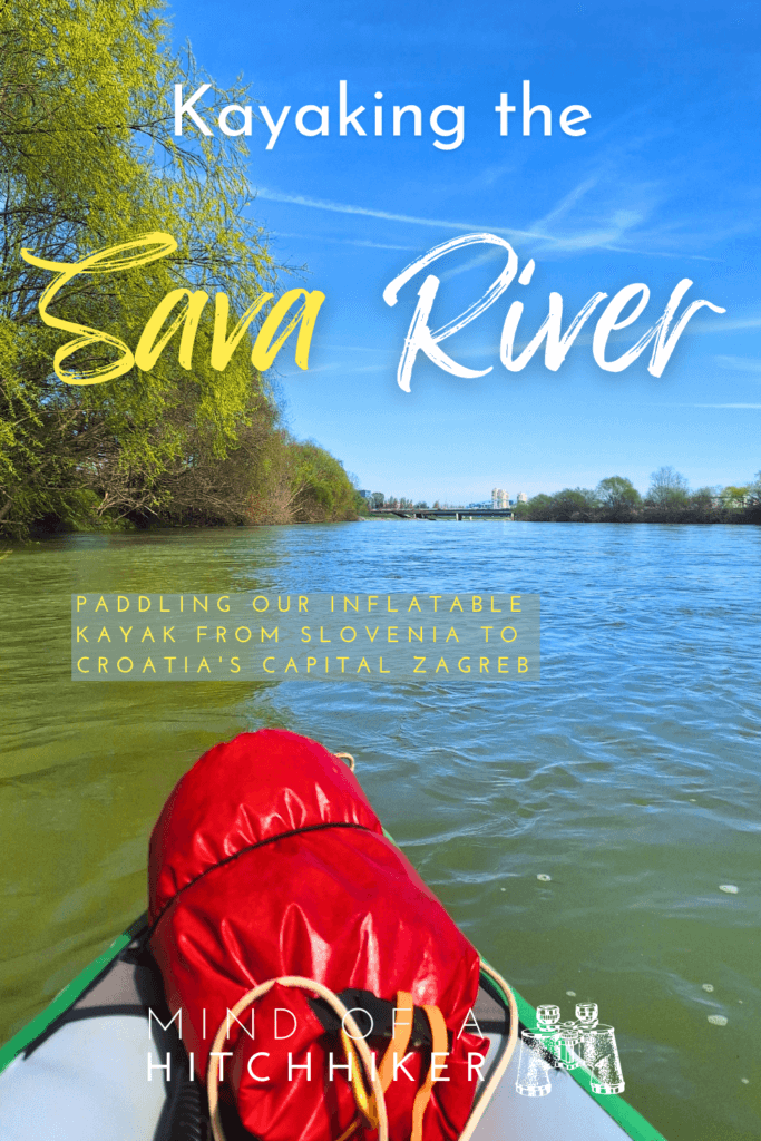
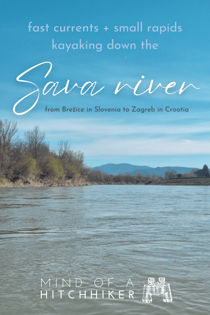
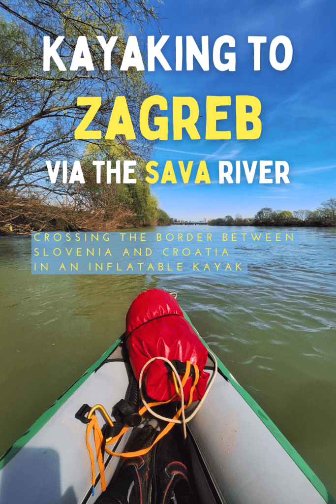
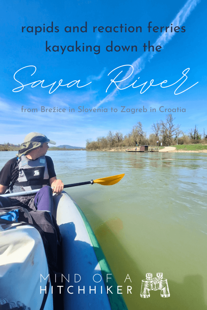
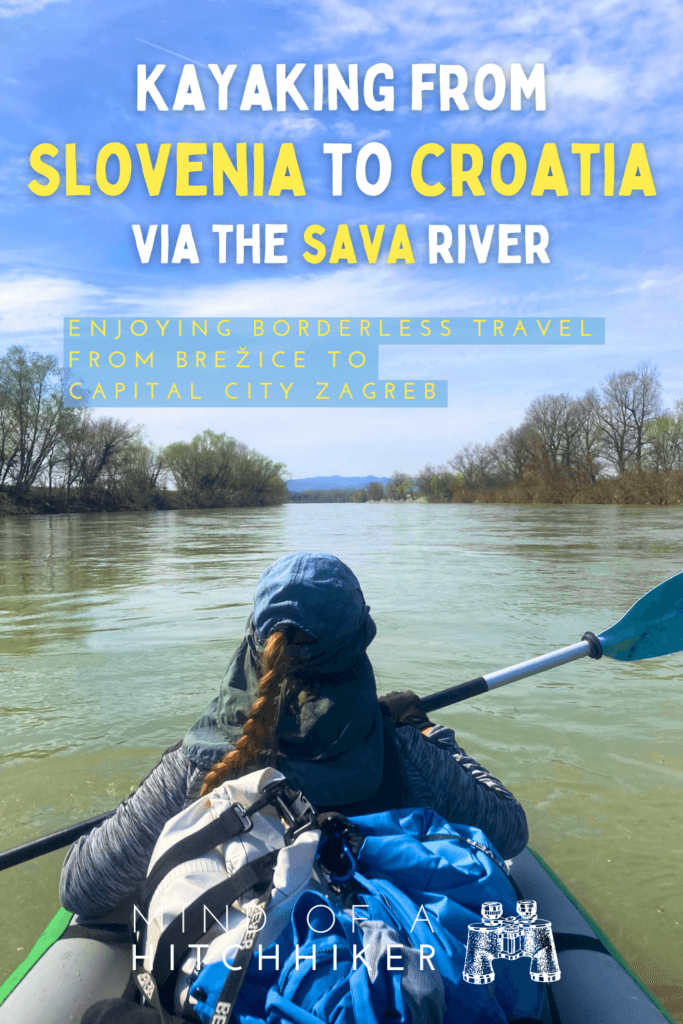
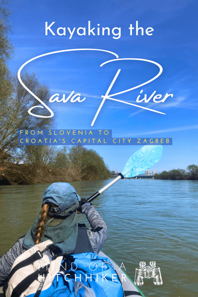
We kayaked down the mighty Sava River from Slovenia to Croatia on Friday the 15th of March, 2024. This was the first time since 2019 that we loaded Zucchini with full luggage—including our laptops in a dry bag. We started at the reaction ferry in Mostec near Brežice in Slovenia. The Sava is fast, so we arrived in Croatia’s capital city Zagreb in no time after 32.5 kilometers.
Contents
- 1 One Day in Brežice: Sava Rapids, Research, Pizza and Beer
- 2 A Terrible Taxi Driver + A Terrible Entry Spot
- 3 A Fast Flow on the Sava
- 4 Crossing the Border from Slovenia to Croatia
- 5 Fishermen, Ferry Man, and a Landing Attempt on the Sava Banks
- 6 Bridges, the Krapina – Sava Confluence, and the Last Rapids
- 7 Landing Attempts, Končar Kayak Club, Entering Zagreb
- 8 Landing Under Savski Most in Zagreb
- 9 Under the Bridge + Tram to the Zagreb Airbnb
- 10 Map of Kayaking the Sava River to Zagreb
- 11 Informative post? Consider buying me a craft beer!
- 12 Feel free to share this article with your friends!
One Day in Brežice: Sava Rapids, Research, Pizza and Beer
Arriving in Brežice
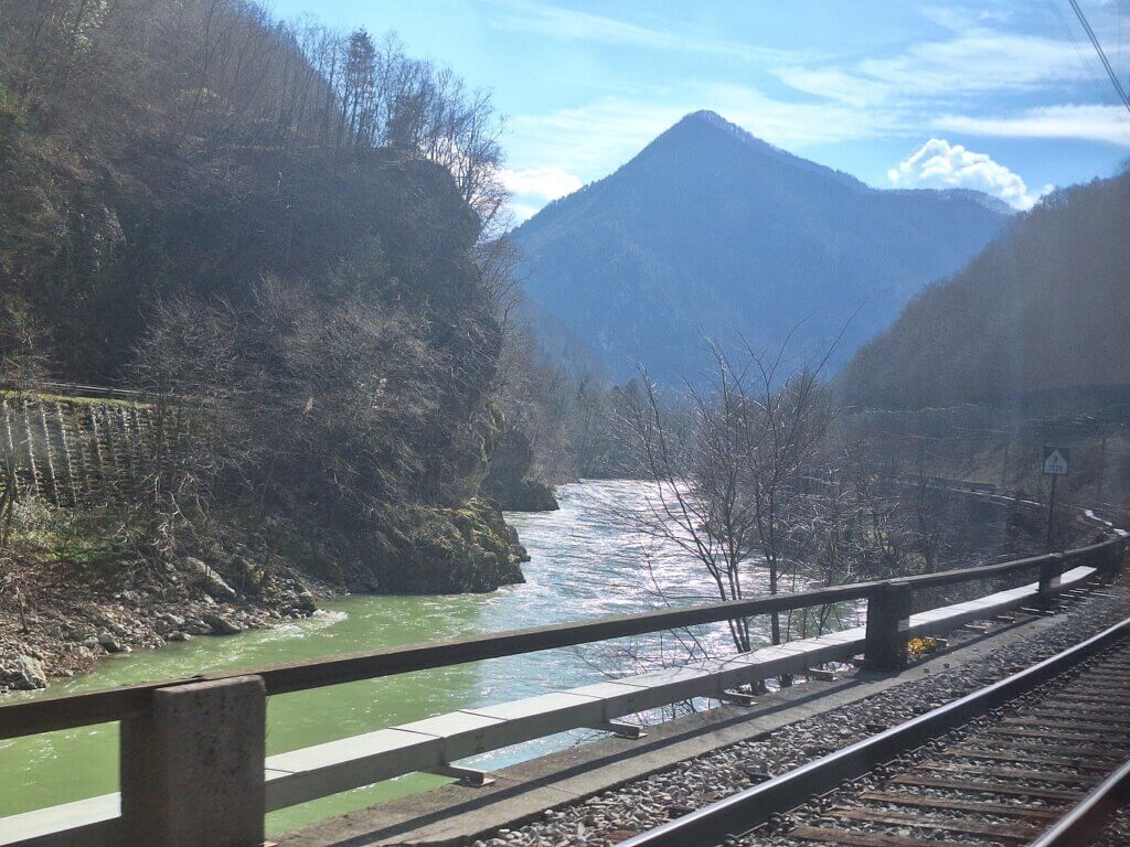
Traveling from Ljubljana to Brežice was not as smooth as hoped; there was some fuckery with the train. This resulted in us hopping into what we thought was the wrong train to Maribor. At Zidani Most, a helpful older man said with no words that we had to follow him. At Zidani Most, we all got out of the train, but then got back in it again. It was apparently the right train, but the wrong train compartment; the train splits up in Zidani Most into one part that goes to Maribor and another to Dobova. We needed the Dobova one as it passes by Brežice.
 Rajhenburg Castle
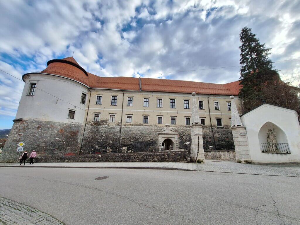 Brežice Castle
Then in Brežice, the bus into the town was quite pricey for the distance. Also at our accommodation in Slovenia’s Brežice, we waited outside for ten minutes before someone opened the door for us.
But once we had dropped our stuff in the room and repacked a small backpack, it was time to do the one thing we came for in Brežice: checking out the Sava Rapids. Can we kayak them with all our luggage? If we do it, where should we drop down the rapids? Is this a stupid idea? Those were the questions I sought to answer.
Research at the Sava Rapids
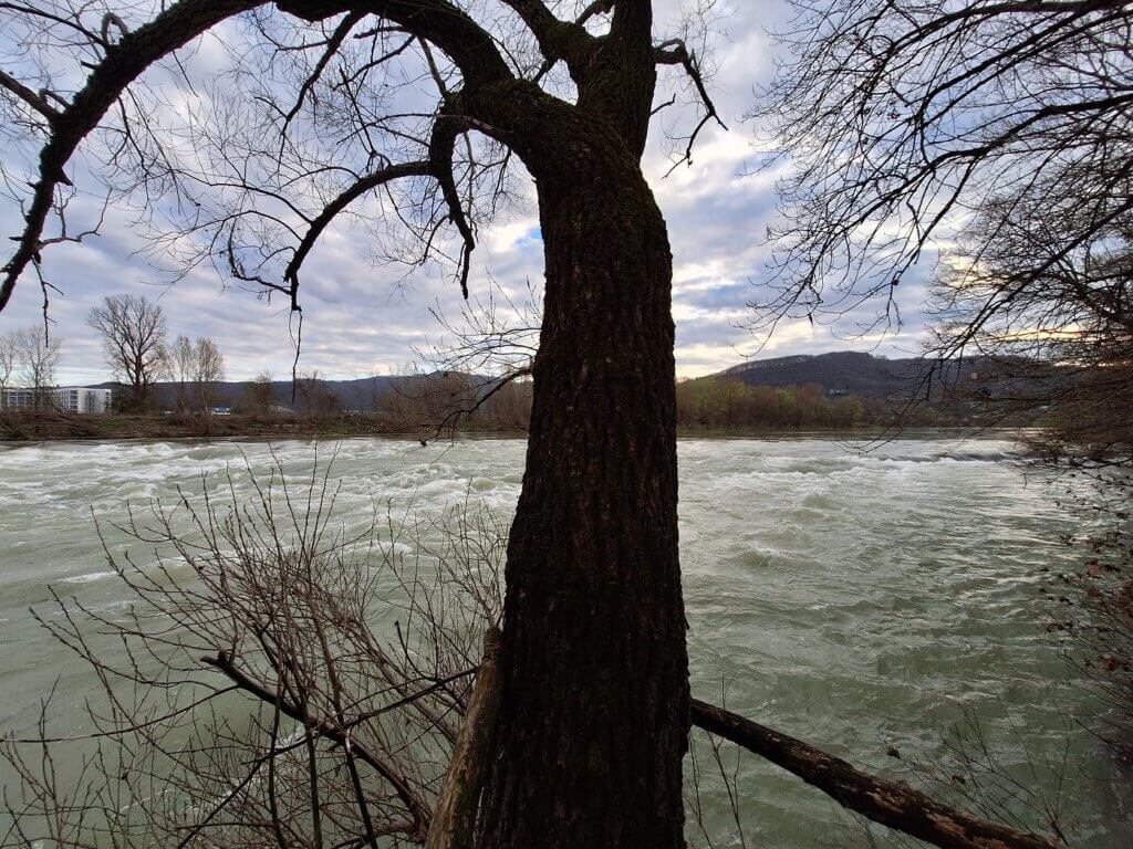
The Sava Rapids viewpoint is about three kilometers from our Hotel Splavar in Brežice. We took a route over the embankment. We could immediately see how much space the Sava receives to flood. There were warning signs at regular intervals to tell us that the water level here can change rapidly. We heard the noise of falling water as we approached closer. In the distance, I saw the Zagreb TV Tower atop Sljeme peak of the Medvenica mountain. That’s where we’re headed tomorrow.
Once at the rapids, we had to bypass a field of what’s presumably young wheat. With the help of GPS, we found the hole in the row of trees that led down to a bench and a very cute and rustic viewpoint. We ate our burek there and discussed what to do.
I said that anywhere we’d go, the drop would probably be too big. I wasn’t comfortable with it. To my surprise, Jonas thought it was quite doable. I argued that from the perspective of the boat, it’s really hard to see where to attack the rapids. As in, we could find the perfect spot to cross from this elevated side view, but in the boat I can’t guarantee we’ll taking the right route. And though Zucchini is a stable genius and doesn’t capsize easily, it’s a risk I’m not willing to take. Without laptops—maybe I’d do it.

 Downstream, the reaction ferry between Čatež ob Savi and Mostec
A last point: there’s quite some water in the river right now. This usually doesn’t change drastically between our viewing of the Sava Rapids and the time we put our boat in the water. Back at the hotel, I compared pictures of the Sava Rapids online with what I saw with my own eyes. The rocks were fully visible in those. The advantage of average or more water in the river is that we don’t scrape the bottom of the boat on the underlying rocks. The disadvantage is that the speed of the river is so great that it can be hard to control the boat. Also, standing waves. They can be terrifying.
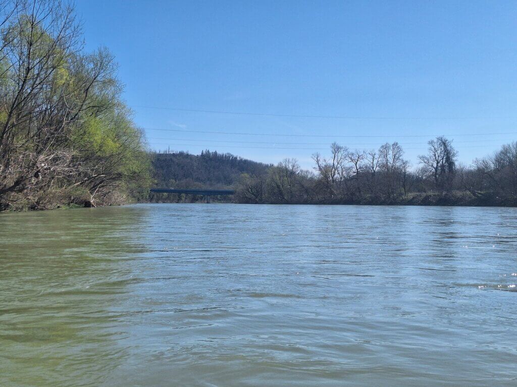
From this viewpoint, we could see the reaction ferry downstream, parked on the left bank. I thought it wasn’t operating yet as it’s only the middle of March. My idea was to use its slipway either on the side it’s moored, or on the opposite side. Most of the Sava embankment we’ve seen here or on the beautiful train ride from Ljubljana was very steep. Immediately downstream of the reaction ferry are a few more rapids, but nothing as big as the ones at the viewpoint.
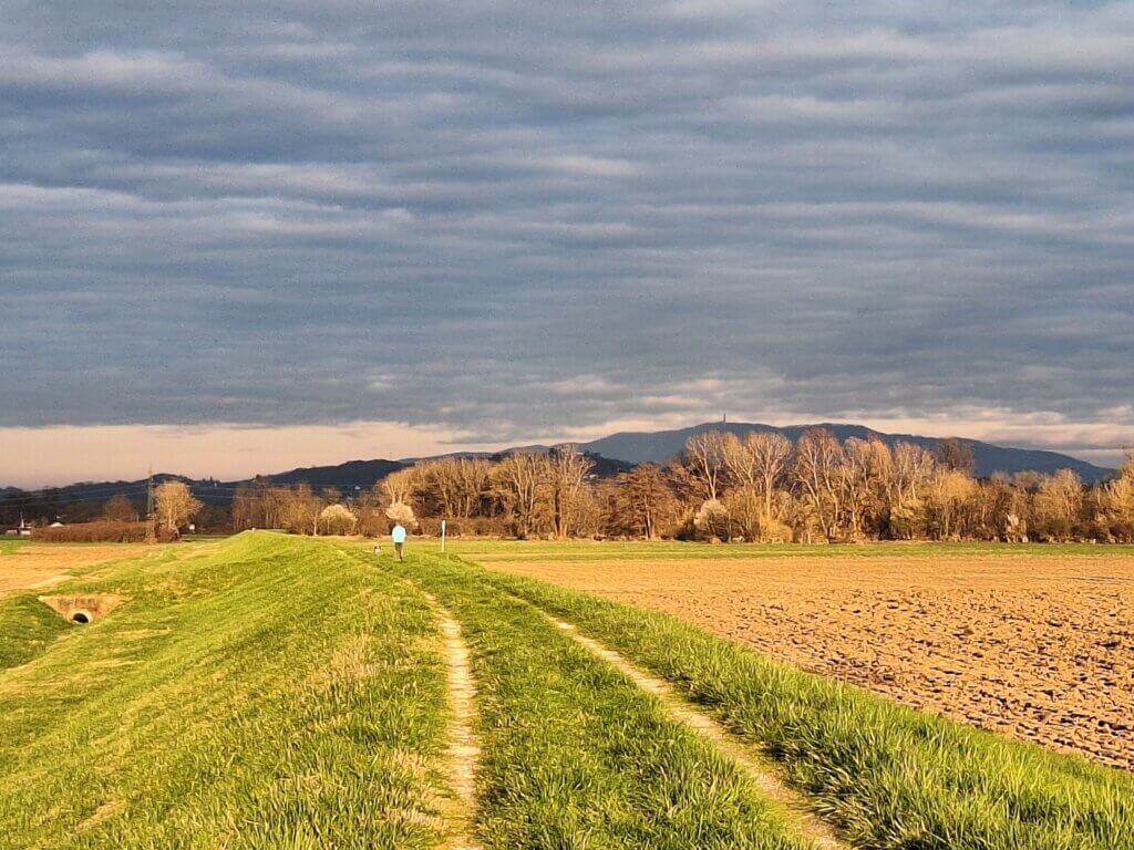
On the way back, we tried to find the entry point into the Sava near the police station and beautiful iron bridge across the Sava and Krka Rivers, but we couldn’t find it and the embankment was very steep. We did, however, see three cats on this six-kilometer walk and had golden hour views of Brežice Castle and the water tower.
 Zagreb TV tower in the distance
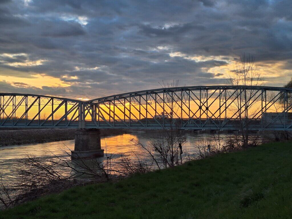 Bridge across the Sava and Krka rivers, hydroelectric dam behind
Satellite Research at the Hotel
We needed to look at all of this online when we were back at the hotel. For an hour, we sat down to look at satellite view, street view, photos from Google Maps reviews, etc. We mapped all the potential rapids and looked at the emails we received from the people of Končar kayak and canoe club in Zagreb (hvala!)
I copied all the potential dangers to my OSM map with notes. I mapped a route from the reaction ferry to two potential exits: one at the Končar kayak club, and one a bit further and closer to Zagreb center. The latter one had my preference because A) it feels more like an epic arrival when you’re in the city and B) it was close to a tram stop with a direct route to our Airbnb in Zagreb. From the kayak club, it would have been a bus ride followed by a tram ride, or we’d get an Uber. From the Savski Most pedestrian and cycling bridge, it’s also possible to get an Uber and it would be much easier.
However, we didn’t see good footage on a potential exit at the Savski Most. It was still a bit of a guess that we could get out there. After the bridge, there would be still a few more options, but none of them close to our favorite tram. We would just have to wing it.
Pizza + Craft Beer in Brežice
After the research, we packed the dry bags a little. Though we had tested fitting our laptops in the dry bag back in Germany, now it was real. It’s a bit of a puzzle always.
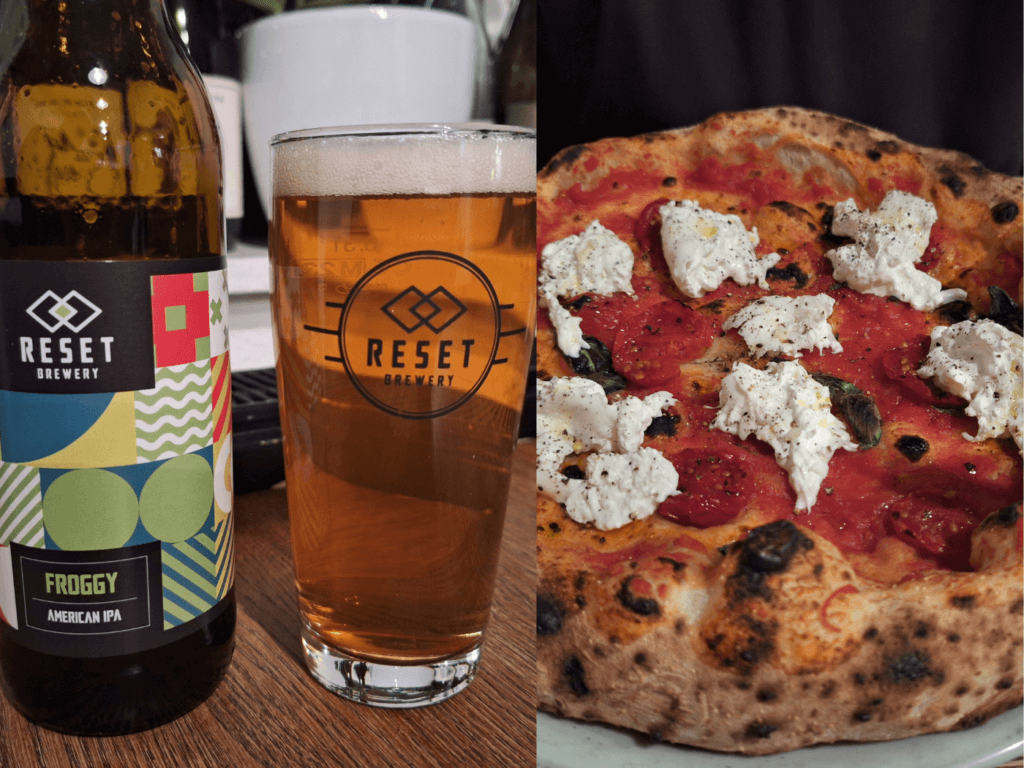
I had a quick nap and then it was time to eat. After that burek, neither of us was very hungry. But there was a pizza place called Huda that came highly recommended by the receptionist. She’d also suggested we’d go to the Reset Brewery to eat and drink beer, but that’s all the way back at the train station. Also, when asked about how much the taxi to Mostec would be, she said “Maximum €10”. We’ll get to that later.
We walked to Huda and ordered a burrata pizza and I had an IPA from the local Reset Brewery. It was all super nice and felt like a very wholesome lesbian-run place. Lots of vegetarian or vegan options as well. We had cannoli for dessert and returned to the hotel round and happy.
Though we only spent one late afternoon and evening in Brežice, we had a pretty good time. Would it have been better to spend two nights here? Probably, but then a hotel would have been insufficient since we’d want to cook for ourselves.
The Next Morning
The following morning, we woke up before our alarms at 7:30 to the powerful light of such spring days. Jonas received a message about a death in the family. Though it wasn’t unexpected, it’s still terrible news.
We took it slow this morning. I offered to take the train to Zagreb instead of paddling, but he was okay and was also really looking forward to kayaking. It definitely helps to keep your mind elsewhere. We decided on the spot that it would be better for us to get in at the ferry slipway on the right bank instead of the left. This would be 5.1 kilometers by taxi instead of 4.3 for the left bank, so it shouldn’t make much of a difference in price.
We got dressed for the river, finalized packing, and called a taxi that was there in ten minutes.
A Terrible Taxi Driver + A Terrible Entry Spot
The taxi arrived and the driver helped us put our luggage in the back. We tried to tell him where we wanted to go, but still had to show the way. We were navigating towards the spa of Brežice called Terme Čatež. I thought it would be closed or quiet this time of year, but there were a lot of people.
Once at the 300-meter path that leads to the ferry slipway, we told him this was the place. I started unloading the luggage while Jonas dealt with paying the man. He charged us €20 for this short ride. I was pissed, Jonas too, but we decided not to pick a fight on a day where we need to save our energy that already started off badly. So maybe find a Slovenian-speaking receptionist to make the call and negotiate the price for you if you find yourself in Brežice.
Once at the slipway, we saw something even worse: the concrete path down was incredibly steep and there was a drop of more than half a meter. How the fuck are we going to get the luggage in Zucchini?

Across the river was the reaction ferry, with the ferry man aboard. The first thing we did was connecting our paddles to show that we’re not interested in a ride across the Sava. Although… the other side looked a bit better to get our boat in the river. Would it be stupid to cross the river and get in on the other side? Will the ferryman also scam us? Will he tell us we can’t use his infrastructure because “mah properdy”-style Americanism?
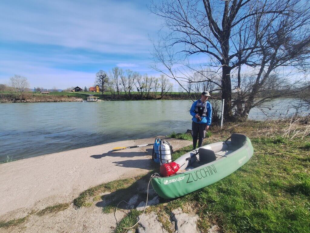
We decided to stick with our decision and inflate Zucchini on the right bank. It took us a little over half an hour to get her up and running with the small luggage in the boat. We carried her down to the right side of the slipway cliff, where there were some shallow rocks that would at least help her not float away. I held her as Jonas carried the luggage to Zucchini and installed the dry bags and CabinMAX backpack with our snacks.
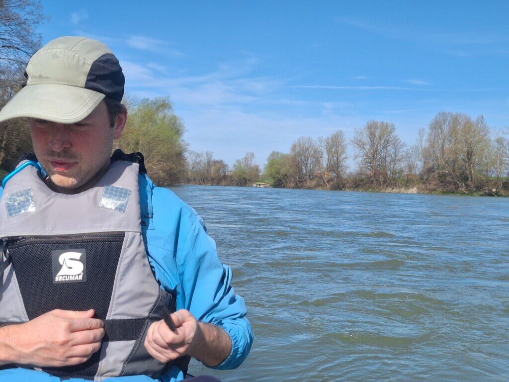
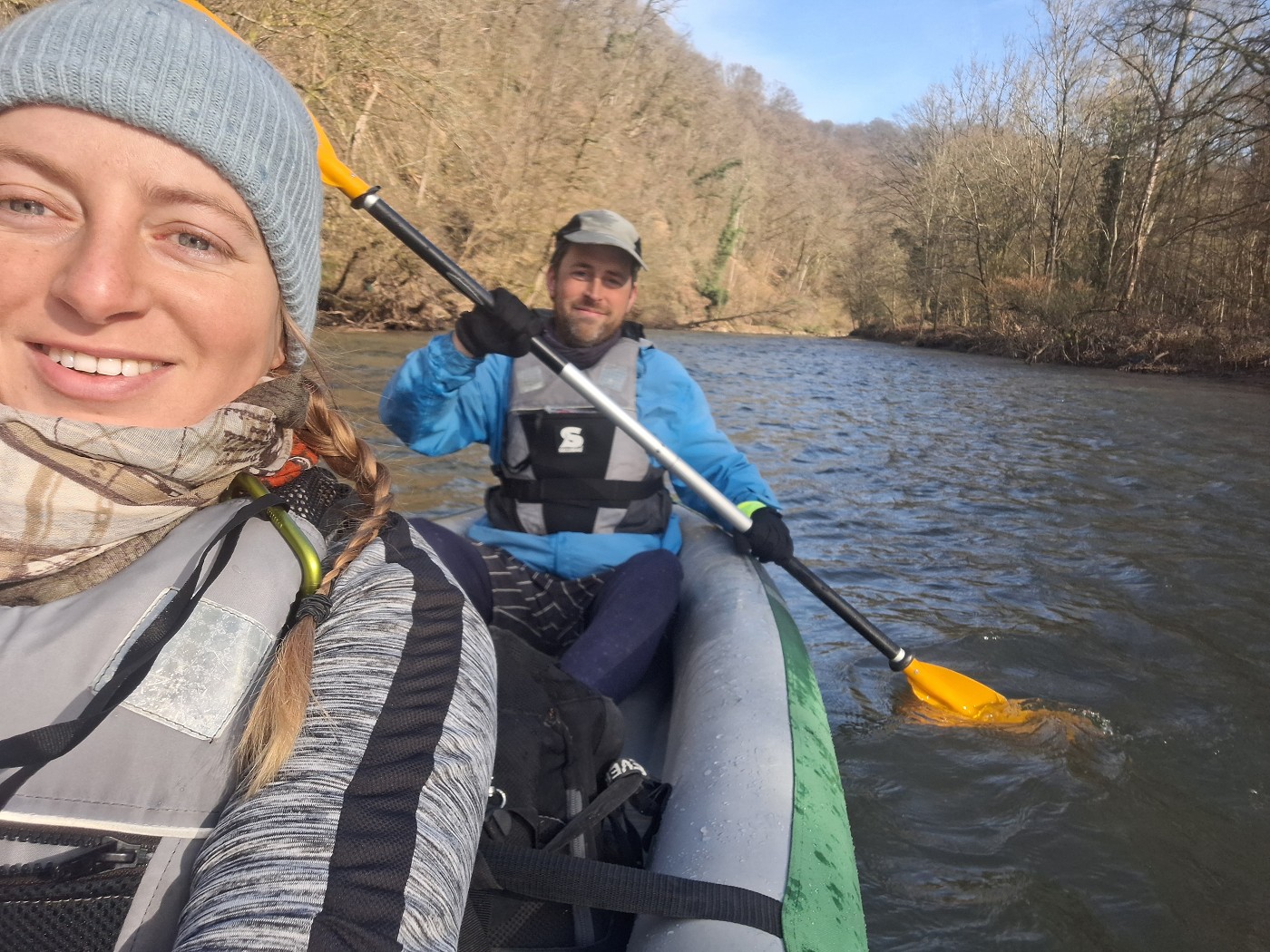
To get in the boat, I had to climb down the ledge onto a slippery-when-wet surface. I hopped in the boat, but we couldn’t move now because we were stuck on the rock that helped us before. I got out, freed Zucchini, and got back in with Jonas following in quick succession. The fast current turned Zucchini’s bow around and we were going.
 First moments on the Sava
A Fast Flow on the Sava
Ah, the mighty Sava River. She originates in northwest Slovenia near the borders with Italy and Austria. One source is a lake called Zelenci Springs where the river goes by the name Sava Dolinka. The second, shorter stream of the Sava – the Sava Bohinjka – originates near the Savica Falls. At their confluence begins the Sava River herself. She flows for 902 kilometers, gaining the powers of – among others – the Ljubljanica and Krka in Slovenia, the Vrbas and Bosna between Bosnia and Herzegovina and Croatia, and the Drina between Bosnia and Herzegovina and Serbia. The Sava’s journey ends when the Danube thanks her for her service and absorbs her in Belgrade, the capital of Serbia.

Yes, in the end it’s always about the Danube for me. Always has been. I was very satisfied with myself when I came up with the idea to paddle the Sava from Brežice to Zagreb. This stretch features no dams to portage around, it crosses a country border, and it suits our three-step plan to get back into kayaking:
- Paddle the fast-flowing Agger into the Sieg and Rhine to see if Zucchini still floats
- Kayak the Ljubljanica from Vrhnika to Ljubljana to build physical and mental strength for slow rivers
- Test our limits with high stakes on the Sava: full luggage, country border, and more than 30 kilometers, moving from place to place
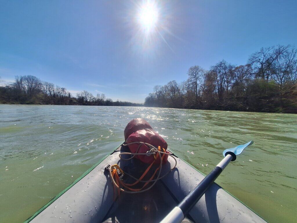
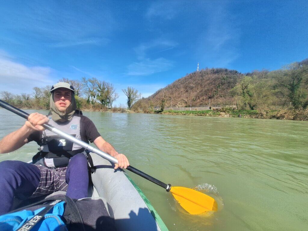
It felt like the plan was coming together quite well. The fast flow of the Sava made us cover several kilometers of river while doing very little. But then I saw some wild rapids before my eyes. I checked my map markers for advice, but didn’t find any. Jonas and I scoured the splashy event horizon for a way through. We chose the path of least resistance, but had to deal with some wild waves of more than half a meter at times. Most of the time, we wobbled over them with relatively small spray. But then, an unexpected wave from the left slammed our port side and poured in over the edge.
 Zucchini is wet
The cold waters of the Sava shocked me. I kept paddling fast until we entered lighter waters. I checked in on Jonas, who was also wet, but okay. Zucchini didn’t capsize. The dry bags are still inside the boat. And we’re still afloat.
I just think we’re carrying five extra liters of water now, whether we like it or not.
Crossing the Border from Slovenia to Croatia
We continued swiftly downstream, getting dried by the sun. Jonas predicted that today would be one of those ‘all seasons in one day’ kind of day. But for now, we’re experiencing summer. Jonas took off his jacket and his sweater.
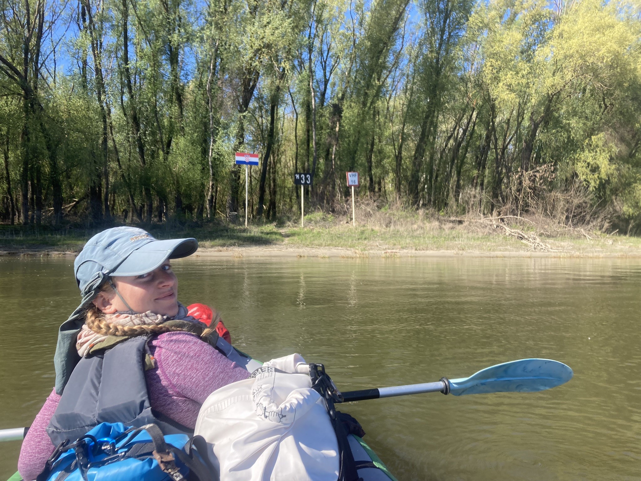
We were approaching the border of Slovenia and Croatia. Here, the Sava doesn’t cross from one country to the next, but has a staggered border with a 3.5-kilometer section where the two banks are under different management. On that stretch, the thalweg – the lowest part of the riverbed – forms the border.
What’s really curious to me is that Google Maps appears to imply that Croatia claims the Sava already after the Slovenian village of Jesenice. This is a section of 2.1 kilometers of potentially disputed land. OSM doesn’t mention it, so what this is founded on is a mystery to me. Here’s a map:
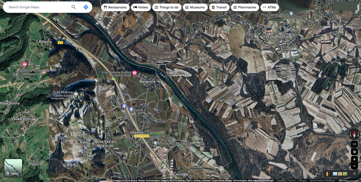
Though Croatia and Slovenia are no strangers to each other regarding border disputes, the good new is that it doesn’t matter! They’re all in Schengen! Croatia only since January 2023, but still, progress!
As we paddled into the border zone, I could only know by looking on my GPS. There’s no trace of a fence. Nothing. The Schengen Area is a wonderful thing. We just floated downstream and had to pay attention to the next bits of rapids. Our satellite research in this area was a bit worse because of a sudden imagery quality change. None of them were as big as the rapids from earlier, though. Online pictures of exposed rocks when the water is low. Better some wild waters than scraping over the rocks, in my opinion.
 Croatia to the left of us...
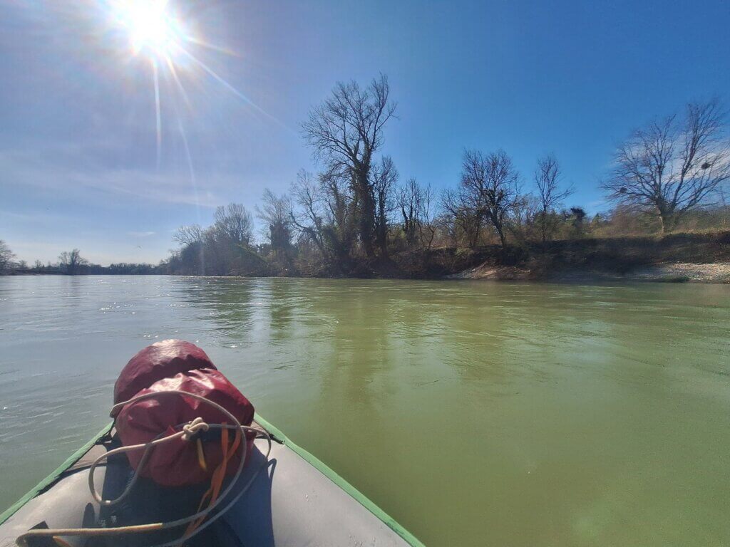 ...Slovenia to the right
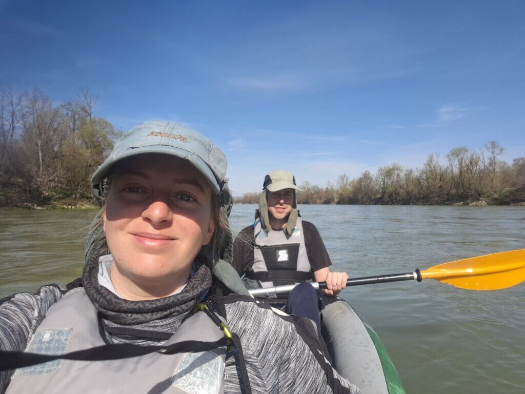 Here I am, stuck in a wet boat with Jonas
In no time, we were past the other point and now fully in Croatia. We still waved at Slovenia, which will be a lot of fond memories, but mostly because of the six cats and wonderful hosts in Ljubljana. We found traveling in Slovenia actually rather tricky and overestimated their preparedness to receive foreigners. This was balanced out by lots of very nice Slovenians who did their best to help us out.
Fishermen, Ferry Man, and a Landing Attempt on the Sava Banks
A long bend to the left introduced us to the first Croatian fishermen along the shores. Ah, something I didn’t miss about kayaking. We paddled to the center of the river to avoid their fishing lines, but they were polite and had apparently reeled them in already. A tractor drove on the right bank and we wanted to not get overtaken by it, so we paddled real fast to stay ahead. In the distance, Zagreb TV Tower once again.


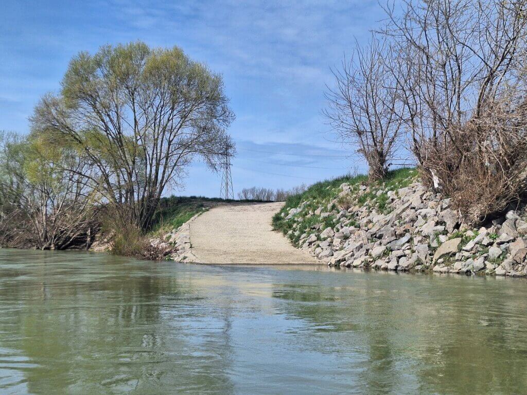
There would have been some good places to get out of the river here. So far, all the embankments of the Sava have been incredibly steep. If we’d try it, we could probably make it work, but I really don’t want to fall into the cold river waters. Not a risk I want to take. But our satellite research showed that at some point there will be shallow pebble embankments we can use for a break.
I checked my watch and saw we’d almost been paddling for one hour. For five minutes, we put in the work to see how much distance we can cover in the first hour. We’d started at 10:32 and at 11:32, we had paddled/floated 11.9 kilometers. That’s a lot of speed!
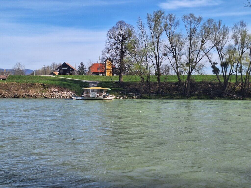
Next, we paddled towards the reaction ferry across the Sava at the town of Medsave. Unlike the first reaction ferry, this one can also take cars, so it’s probably operating nearly year-round. There was a Croatian flag on the ferry and also a small one on the traveller at the cable. He seemed like a friendly ferry man and we actually took the effort to put down our paddles and greet properly. The greeting is still Dobre dan over here. That’s easy.
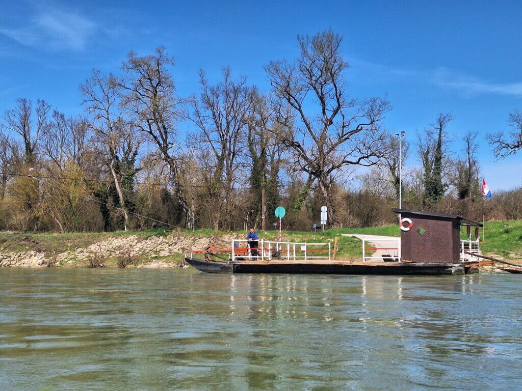 Happy reaction ferry man
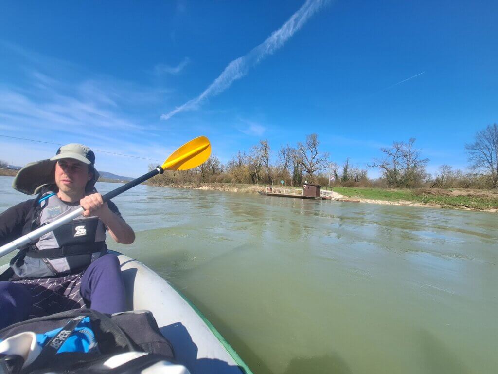
I haven’t been to Croatia since 2015. It’s quite cool to be back and arrive in this fashionable way. I’ve never properly stopped in Zagreb, though; I just hitchhiked through Slavonia a couple of times.
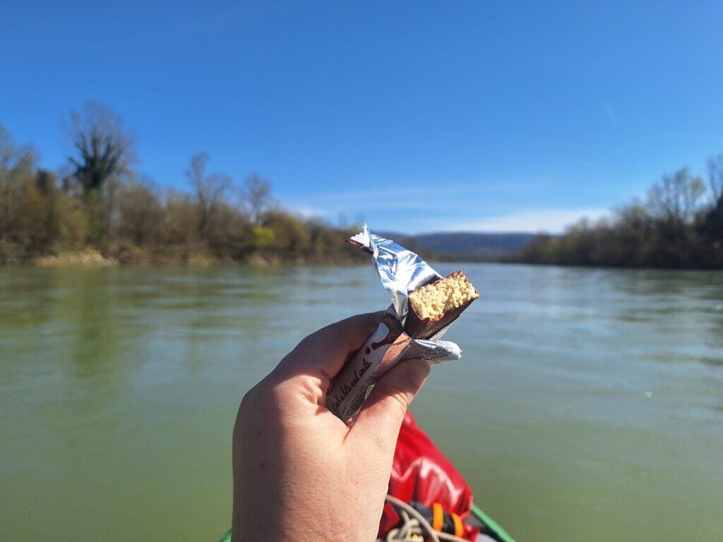
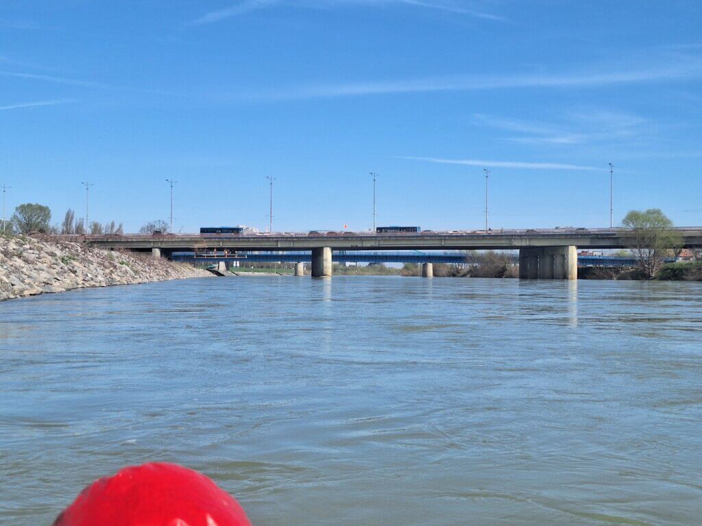
We were coming up on the first bridge for today. It’s a big highway bridge that the Končar kayak club people had told us to go left. This section of the Sava was relatively easy going, so we decided to eat our protein bars. First food of the day.
Bridges, the Krapina – Sava Confluence, and the Last Rapids
Once we had filled our tummies, I spent a good amount of time analyzing the map again. After the highway bridge is the confluence with the Krapina River. Then some more rapids with tips to stay somewhat right if you want to avoid them. Then another bridge where it says go through the middle. It was a lot of information to keep in my head and there were discrepancies between Jonas’ and my info.
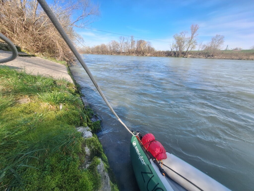
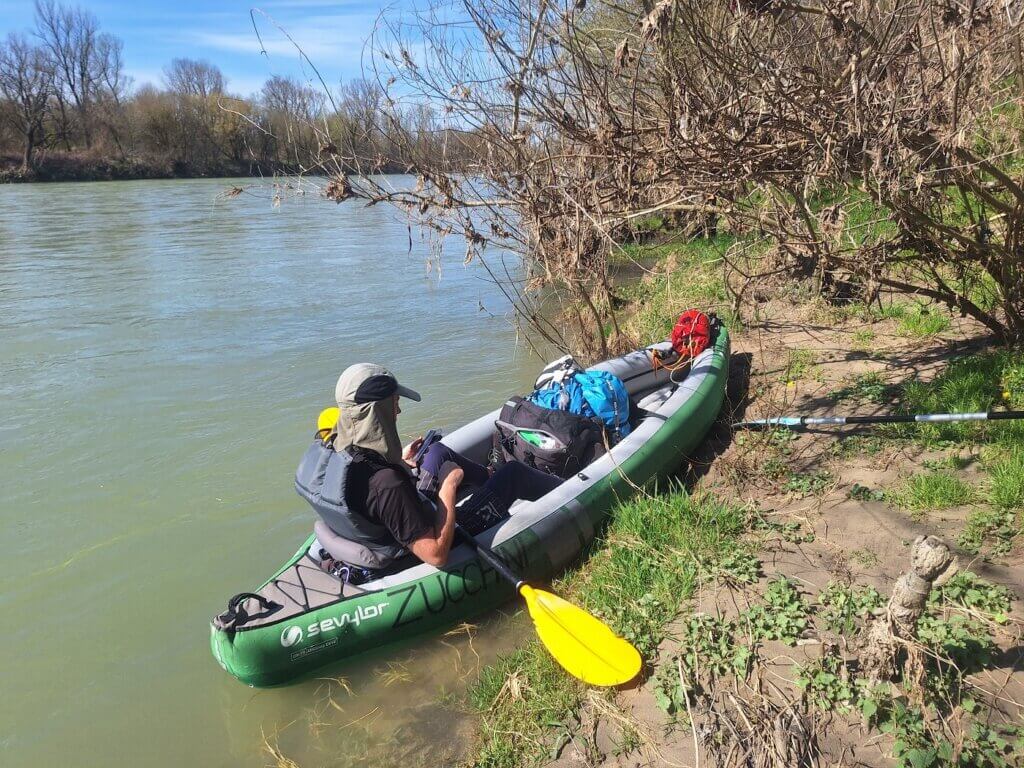
I suggested to try to land somewhere. Mostly to test if we can land or if the Sava currents are too powerful. About one kilometer from the Most Sava highway bridge, we found a rather overgrown spot. We landed the boat with relative ease by decreasing our speed well ahead of time. But now my head was in a tree and getting out wasn’t easy. I grabbed a branch, which was dead and loose and put it in the river. Once I was on firm soil, I passed Jonas my phone so he could analyze the upcoming tricky parts.
After some discussion, we got back into Zucchini to tackle the coming challenges. We paddled to the highway bridge and passed on the left side of the pillar, but not too far to the left. There’s always some wild waters at or after bridges. Immediately afterward, we crossed to the right side to avoid any nonsense from the Krapina confluence. The email had said something about big rapids on the Krapina, but we’re not paddling upstream or anywhere near that river today. We found no challenge in this confluence, except the lots of fishermen such spots attract.
Jonas suggested to land on the right bank to analyze the next rapids, but if we’d been on shore, we wouldn’t be able to see shit as the trees would block the view. The river island became clear to me. The waters on the left of it looked much more wild than on the right, so I suggested we’d improvise and go right of the island. This was a good bet.
Next, we weaved around, between, and through a series of other mild rapids. Just splooshy water and speed, nothing to be concerned about. Most of the standing waves were very easy to avoid. Did we expect the Sava to be this much like the Agger, but wider? No. But I think it’s a lot of fun to paddle a relatively mature river with the attitude of a young one.
At the following bridge (Podsusedski Most), the instructions were unclear. Our email had told us to go through the middle, but in the middle of the river is one of the pillars of the bridge. We chose to go left of the pillar, which was fine.
The Podsusedski Most was also the place where one could leave the Sava to have a break at a restaurant called Suhina. That’s something the kayak club recommended. I didn’t see a suitable landing spot there, though, and I didn’t even look for it because it was at the bottom of the list of priorities.
After these 15 minutes of needing a lot of our energy to spot rapids, we could finally chill a little bit. The Sava kept running and doing our job for us.
Landing Attempts, Končar Kayak Club, Entering Zagreb
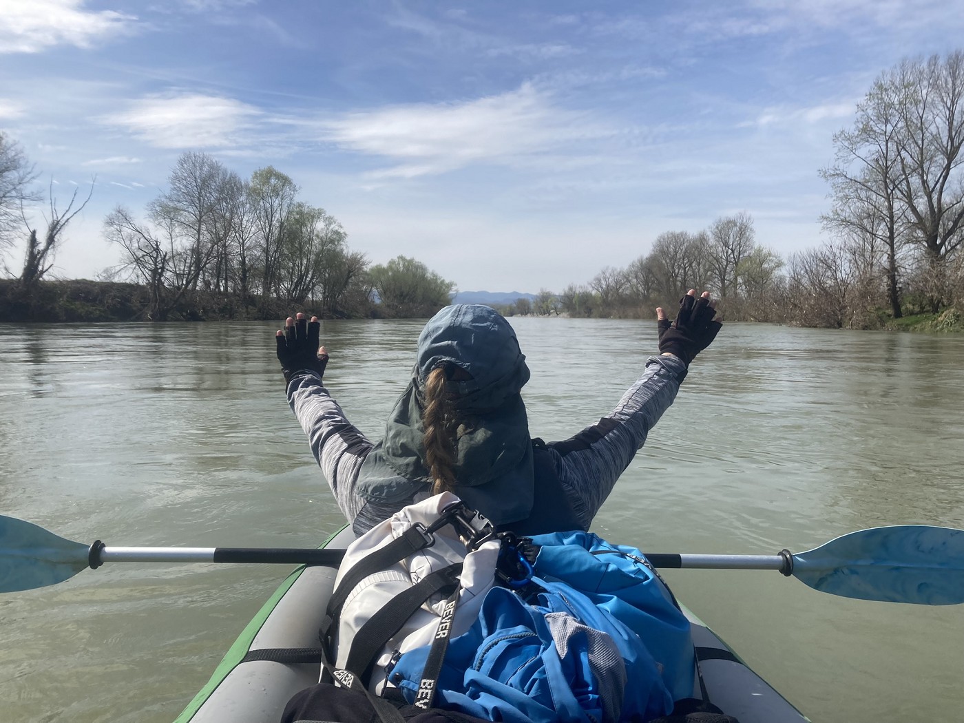
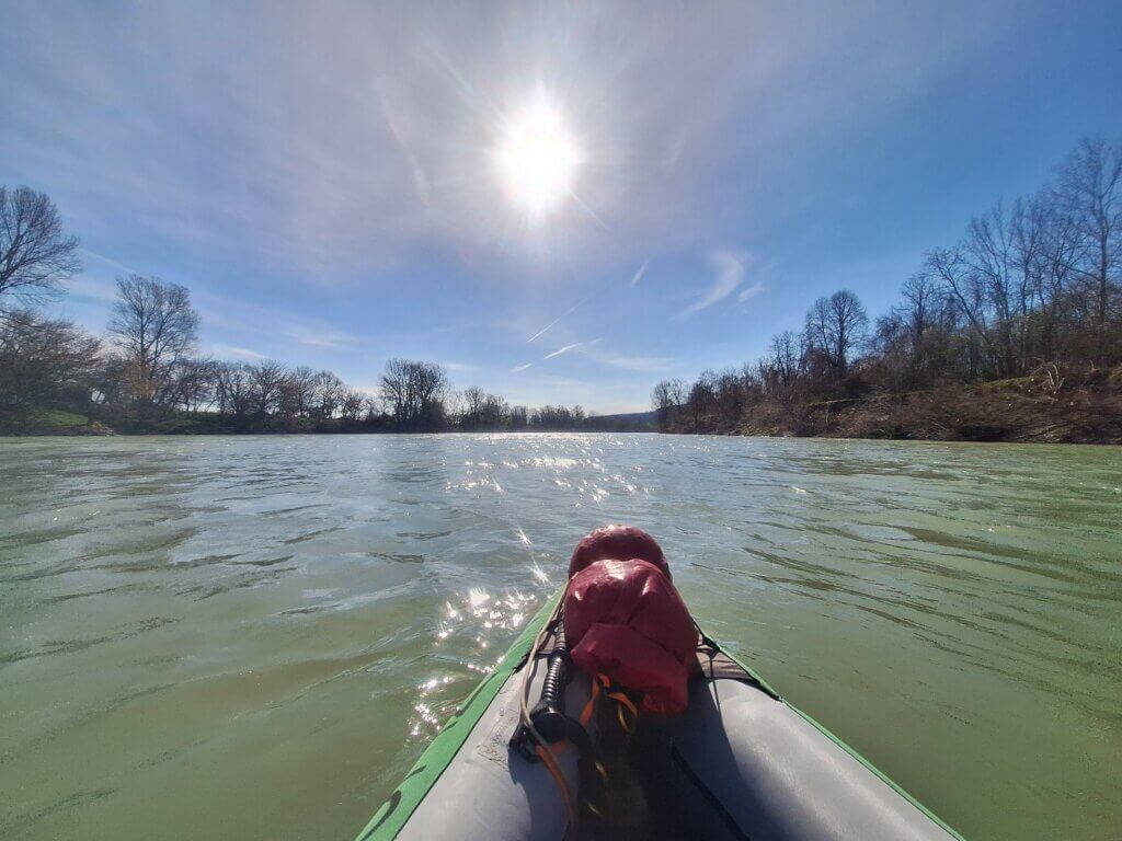
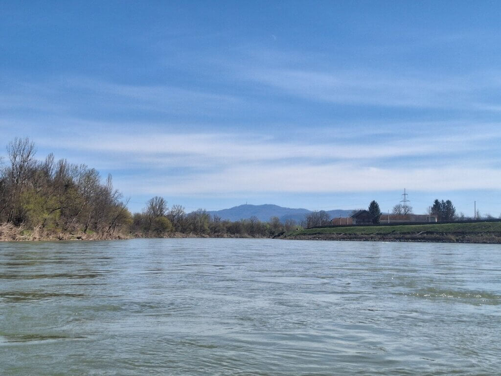
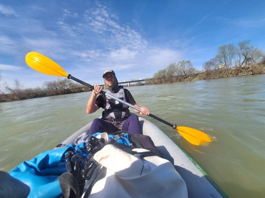
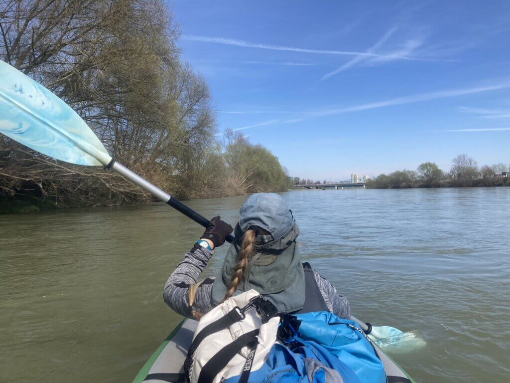
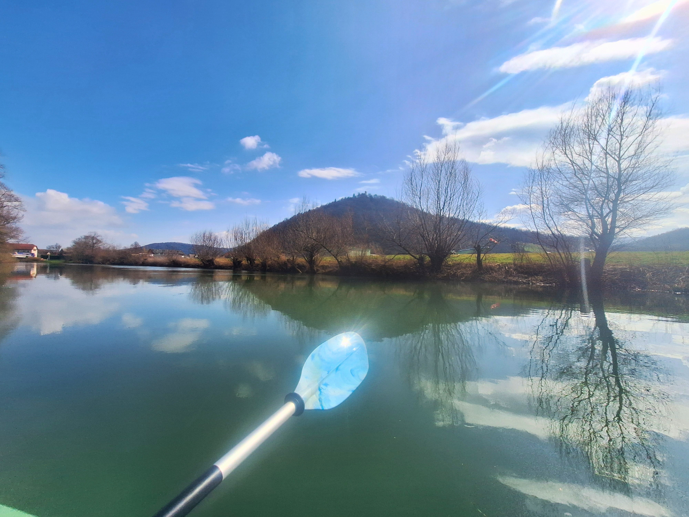
We kept paddling in the noon sunshine under the next highway bridge and onward. Jonas wondered if having bare arms was a bad idea. I asked if he wanted to borrow my sun protective sleevies, but he said no. Now that we were at a manageable speed, we also enjoyed an aimless float, looking back at the mountains in Slovenia where we and the Sava originated (also, see featured photo📸).
 Jonas and Jankomirski Bridge behind him
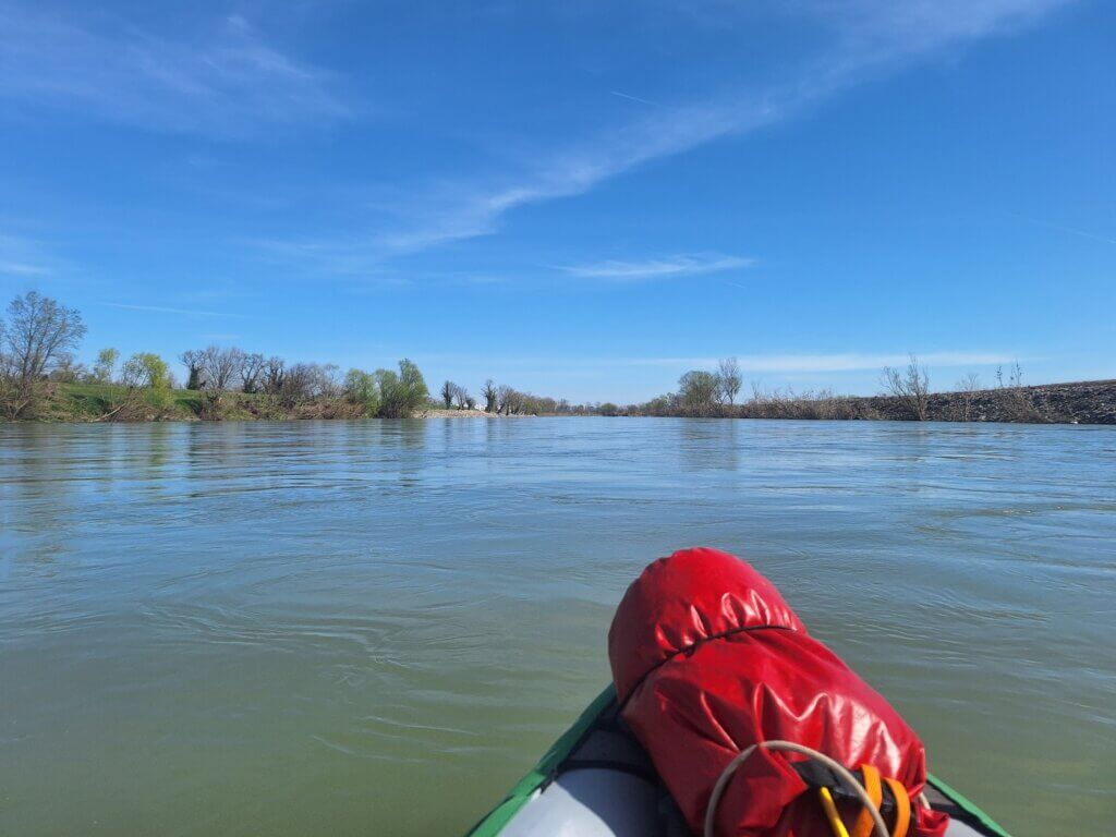 To Zagreb
 Looking back at Slovenia
My worry at this moment was being too fast when coming in for landing. There were no signs of the Sava slowing down anytime soon, but I was still determined to take the exit near the city center and not at the kayak club.
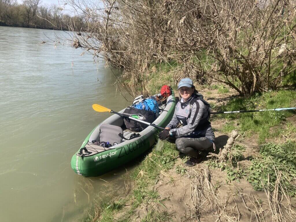
But I wanted to do one more test landing somewhere. We decided on this spot close to the western start of Jarun Lake. Satellite view showed a good landing spot there near a bus stop called Savski nasip Park&Ride. Some 300 meters before the spot, we stopped paddling to not give more speed to ourselves. Sticking to the left, we were quite close to the trees. Above the embankment were the first cyclists and city people walking their dogs.
We turned the boat around and used our paddles to break before coming to a complete standstill in this little nook. It was an elegant landing. Good, the test is done. This gave us a healthy amount of confidence in our skills.

Next, we paddled past some suburbs to the right and the very nice slipway that’s at the Končar kayak club to the left. It was a good slipway, but didn’t tell me anything about the size of the kayak club since it’s on the other side at Lake Jarun. This lake is probably a dead arm of the Sava that has since been landscaped to make it more artificially straight for the rowing club. I would have loved to see this place in Zagreb, but it’s quite far away from where we’re staying.
 Housing blocks of West New Zagreb
In anticipation for our own exit, I cleared some space at my feet for a speedy exit. It’s important to have the boat leash in reach but not tangled around my feet.
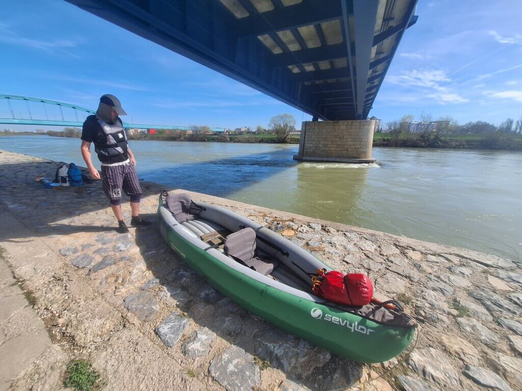
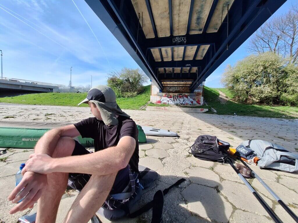
Landing Under Savski Most in Zagreb
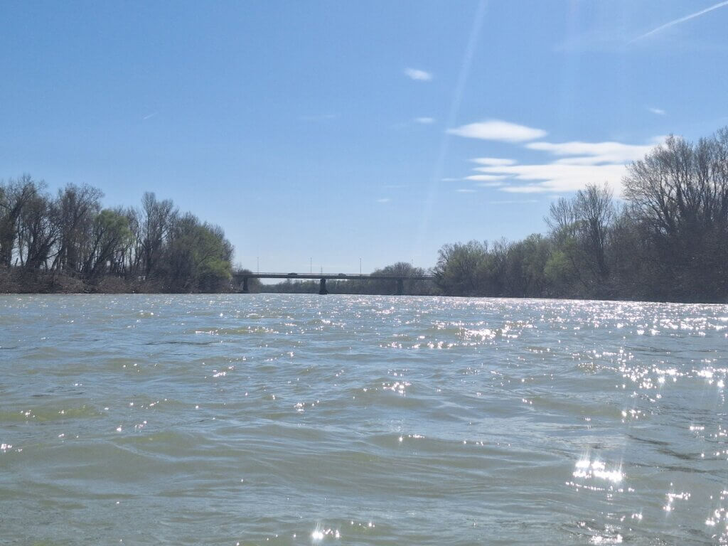
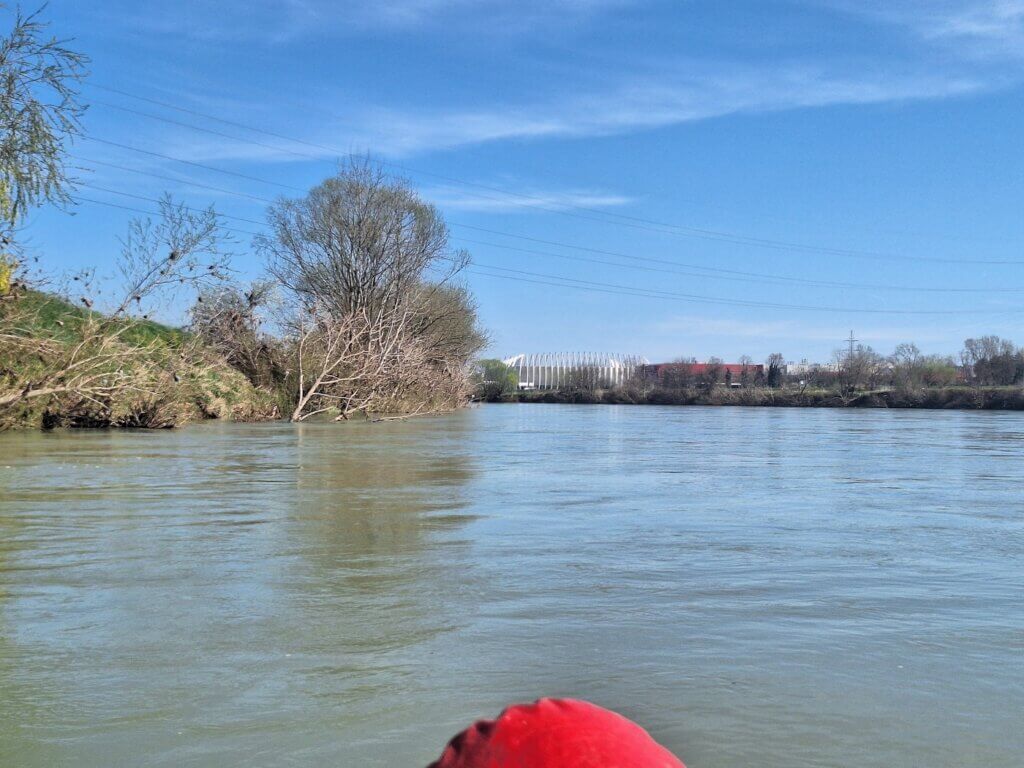
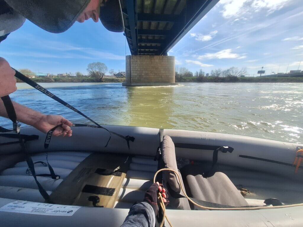
A stadium in the distance followed by the high green arches of the Hendrix Bridge. We still had to pass around one river bend before we had the full view of the two bridges preceding that one: road bridge Jadranski Most and the pedestrian/cycling bridge Savski Most. The latter has our exit point according to satellite. If we overshoot it, there are still a few options to get out, but this place would be the best.
One stream called the Vrapčak joined the Sava last minute. It caused some weird currents. But what was something we could not anticipate is that the Jadranski Most was under maintenance. Below the bridge was scaffolding and about 12 guys with tools doing some bridge fixing stuff. There was also a stick in the water here, which later turned out to be attached to a cable and the scaffolding for some reason.
We were breaking constantly with our paddles as we approached the overhanging construction site, the stick, and the turbulent waters after the bridge. There’s about 100 meters after this first bridge till we need to stick the landing.
All the construction workers were staring down at us as we paddled under and to the side of their workplace. One of them shouted DOBRE DAN, which echoed beautifully under the bridge. I shouted it back, but didn’t get no echoes as we were already popping out the other side.
With a scoop of the paddle, Jonas turned the boat around. We approached as slow as we could. The Savski Most had no gravel beach below it as satellite view had told us, but there were some nice stairs to get out. No way we could have known this from the available info online.
Jonas held onto the stairs first and thought of getting out, but that means that the bow of Zucchini gets caught in the current again and will start turning. I said I need to get out first, which I did with my paddle in one hand and the boat leash in another. I put my paddle down high up and reeled Jonas back in with the boat leash. While sitting down on the stairs, I brought Jonas alongside the stairs and held Zucchini while he hopped out. He took out all the luggage from Zucchini one by one and carried them up the stairs.
Holding the boat in such a strong current doesn’t actually require much strength. It’s more that if I fuck up and let go, we’ll lose our boat forever. Zucchini would drop down the rapids a few kilometers downstream and just float off to Serbia.
Once the last loose items were out of the boat, it was time to bring her on shore. Jonas lifted her onto the stairs till she was at a 45° angle. I lifted up the stern till she was on high ground.
We did it! We kayaked to another European capital city!
 Strong currents around the bridge's pillars
Arrival time: 12:59. Nice. For 3:27 hours of kayaking 32.5 kilometers, that’s 9.4km/h including on-shore breaks/stops. Minus the 22-minute break on shore, it’s 10.5km/h.
Under the Bridge + Tram to the Zagreb Airbnb
We poured the water out of Zucchini and laid her out to dry in the sun. She was a bit overinflated because of the sun and heat, which we solved by letting some air out. We sat down on the seats to eat our sandwiches in the shadow. We both googled for flights to Germany. Jonas had had enough sun and later in the evening I saw he actually had quite a sunburn on his right arm. Next time he’ll have to wear his sleevies.
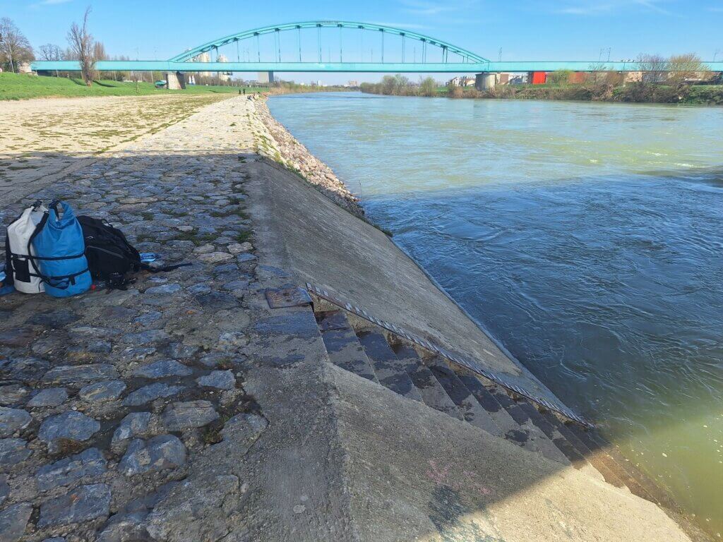
 Closeup of the stairs we used to get out
Drying Zucchini took a long time. We won’t use her until we’re at the Danube in Mohács, so we needed to do a good job. There were lots of people enjoying the riverside or teenagers hanging out under the bridge as one does at that age. The boys of a group of teens climbed up on the maintenance platform that rolls below the bridge like a train. They actually crossed the Sava River by pulling on the cable all the way. Brilliant. Shit like this would be locked away in the Netherlands.
One shitty thing about this landing spot was the amount of broken glass. Also a very common sight beneath bridges. We removed some pieces in our Zucchini folding area to not puncture her. And we put on our proper shoes.
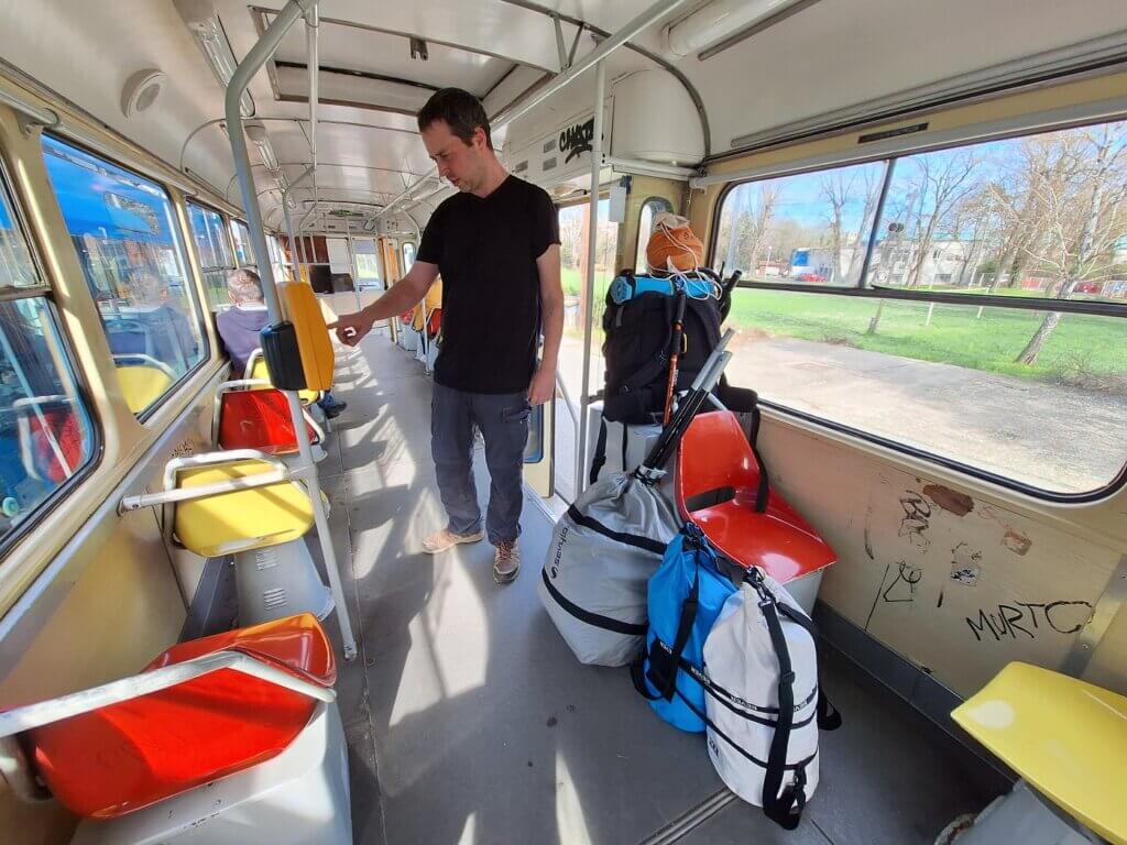
When it was time to pack, we tried a new method: taking out the bottom inflatable part and packing it on the outside of Zucchini. This worked brilliantly and we wondered why we’d never thought about this before. Incredible.
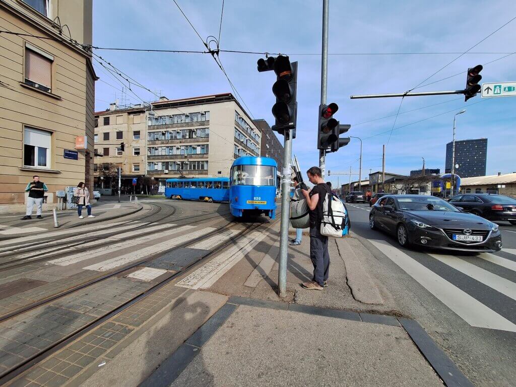
Once packed, we walked up the embankment to the tram stop also called Savski Most. We hopped into the number 4 tram, which was a lovely old model. Jonas tried to make the tram tickets work with an app, but he ended up buying paper tickets at the conductor for a premium. Jonas noticed that the Google Maps navigation aid wasn’t all that great, so we relied on my offline map app for the tram route and stops.
As we rolled towards the center of Zagreb, the feelings of accomplishment slowly got replaced with the endless list of things to do.
We got out at Branimirova. It was a 300-meter walk to the apartment, where we could do a self-check-in.
Once inside, I unpacked while Jonas bought some goodies. In the evening, he booked his flight out of Zagreb to Köln for Monday till Friday. He would not get to stay as long in Zagreb as hoped, but it was important he’d attend the funeral in Germany. Maybe a handful of times in one’s life, it’s important to catch a last-minute flight somewhere and pay the premium. This was one of those cases.
I put Zucchini in the closet for now—she’d passed the third and final test. I’m so excited to get back to the Danube later this month.
Map of Kayaking the Sava River to Zagreb
Zoom in and out on this map and use the menu button top right to find more info about places. For information about the water levels on the Sava, check out this website. If you want to know what kind of items are helpful when self-organizing a kayak trip, check out my kayaking gear list.
Informative post? Consider buying me a craft beer!


Similar posts:
 Kayaking the Agger, Sieg, and Rhine – Zucchini’s Recertification River Trials for the Danube
 Ljubljanica Kayaking: Vrhnika to the Ljubljana Marsh and the Capital’s Iconic Bridges
 Paddling the Morava River – A Day Trip from Bratislava
 Kayak Trip Day 50: Mohács in Hungary to Apatin in Serbia – We Meet Again, Danube
 Accommodation in Slovenia: Ljubljana, the Best Airbnb We’ve Ever Stayed in + Brežice