


")


")

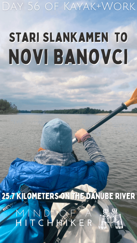
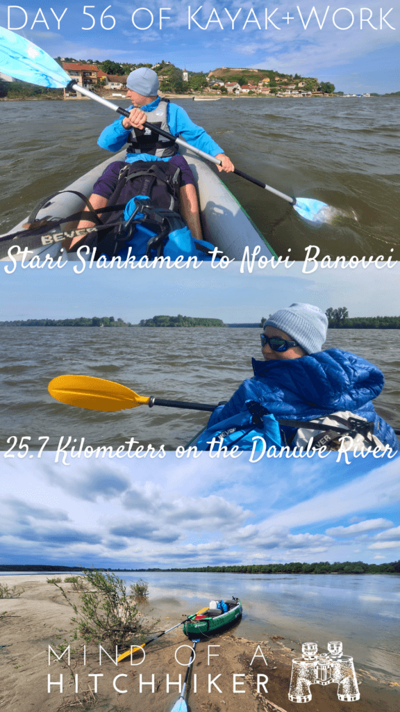
Our 56th kayak day on the Danube was on Sunday, the 21st of April, 2024. We paddled from Stari Slankamen to Novi Banovci in Serbia. It was a shorter distance.
Want to travel the (entire) Danube River in an adventurous way? Join our Facebook group Danube River Source to Sea: Kayak / Canoe / Bike / Hike / Sail to find your community
Contents
Departing Stari Slankamen + Tisza Confluence
We woke up at 7:00, had a coffee and a banana, and a look out the window. The sky was a bit overcast as predicted, but what surprised us was the roughness of the water. We observed it for a bit, stepped out on the balcony to confirm, and checked again with the weather forecast. No significant wind predicted for today. Ehm, thanks, forecast. At least it appeared to come from behind. Perhaps we’re going sailing today!
We walked to the riverside, wearing enough layers of clothing for the (still cold) weather. Perhaps it’s not as bad as the day we left Novi Sad, but it’s still not great. At least the rain has been canceled.
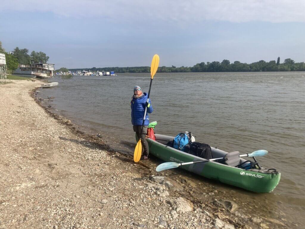
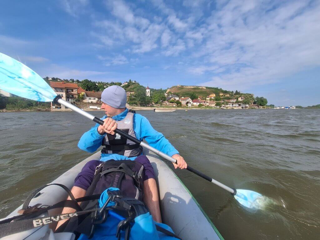
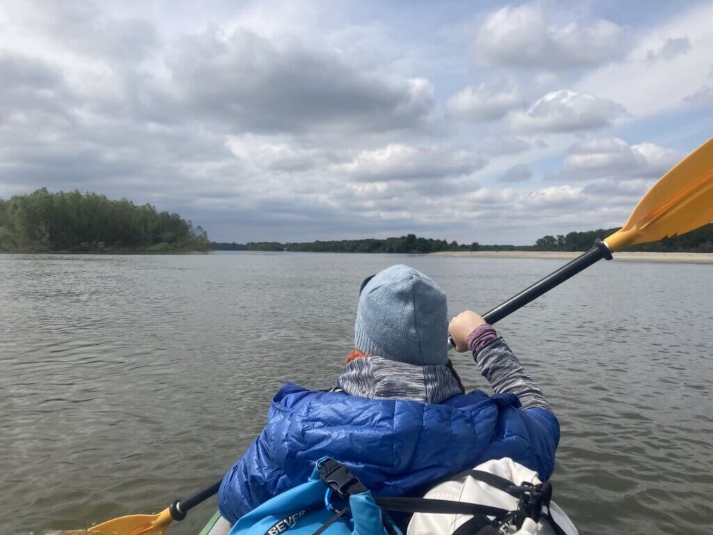
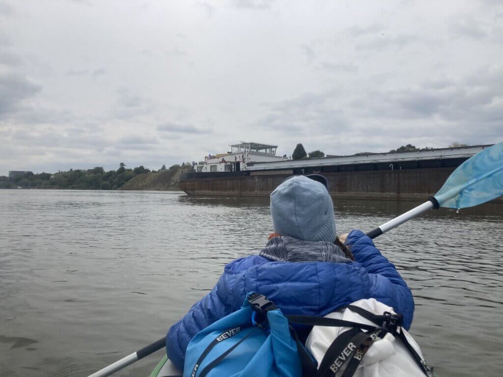
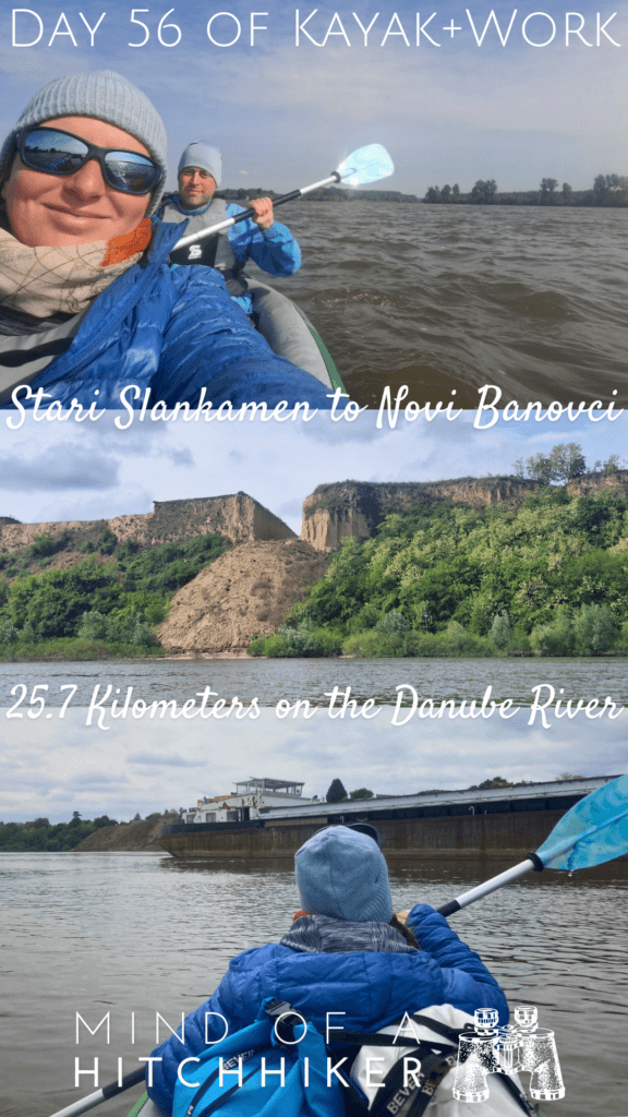
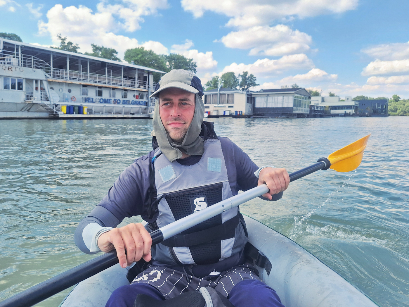
Because today is a short day of under 30 kilometers to Novi Banovci, Jonas felt the chill. He wanted to make some videos for his Facebook to show people what the trip is like. I held the camera while he talked about today. He has such a nice voice. Another change we made is switching paddles. Today, I use the smaller yellow one and Jonas gets my big blue one. More on that later.
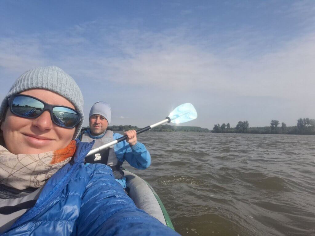
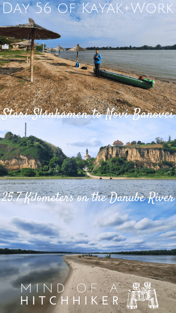
Jonas put the dry bags in Zucchini while I held the boat. The waves from the Danube were splashing hard against portside, making our seats a little wet. We left Stari Slankamen at 9:06. We had a really good time in this small town. Much because of the nice accommodation.
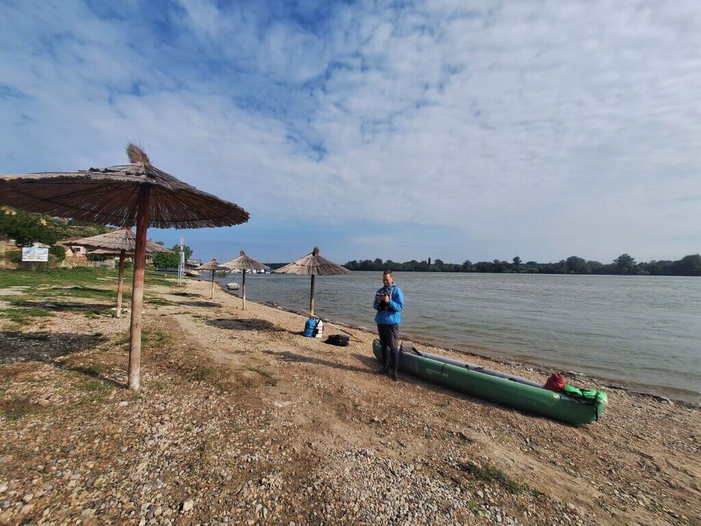
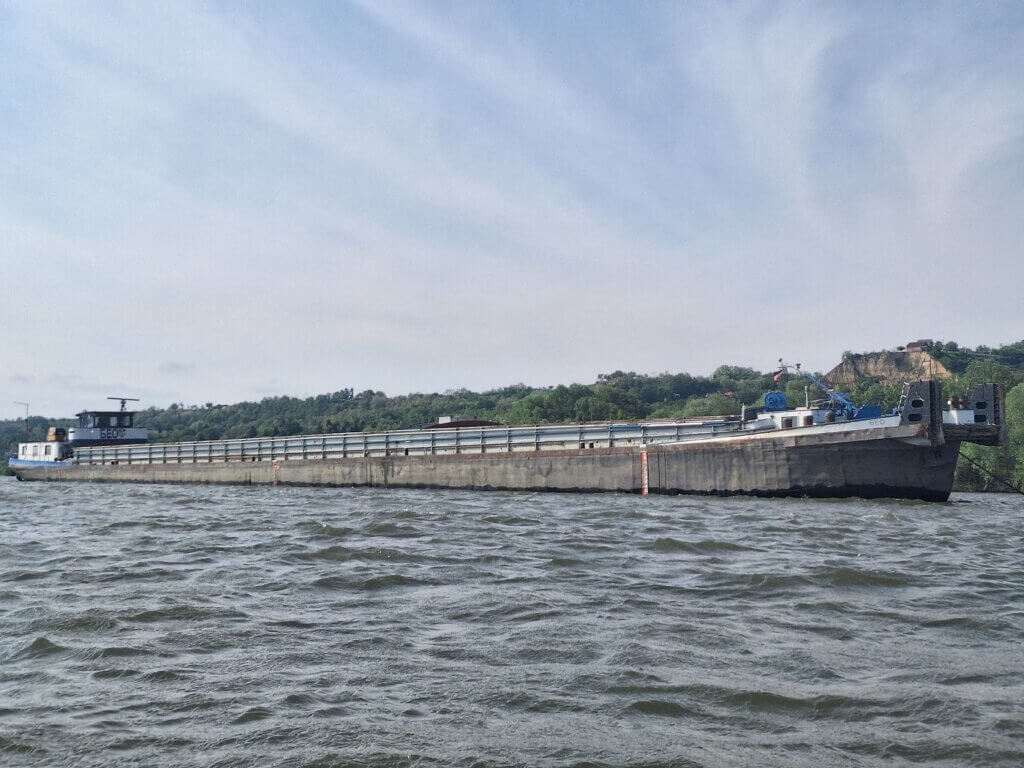
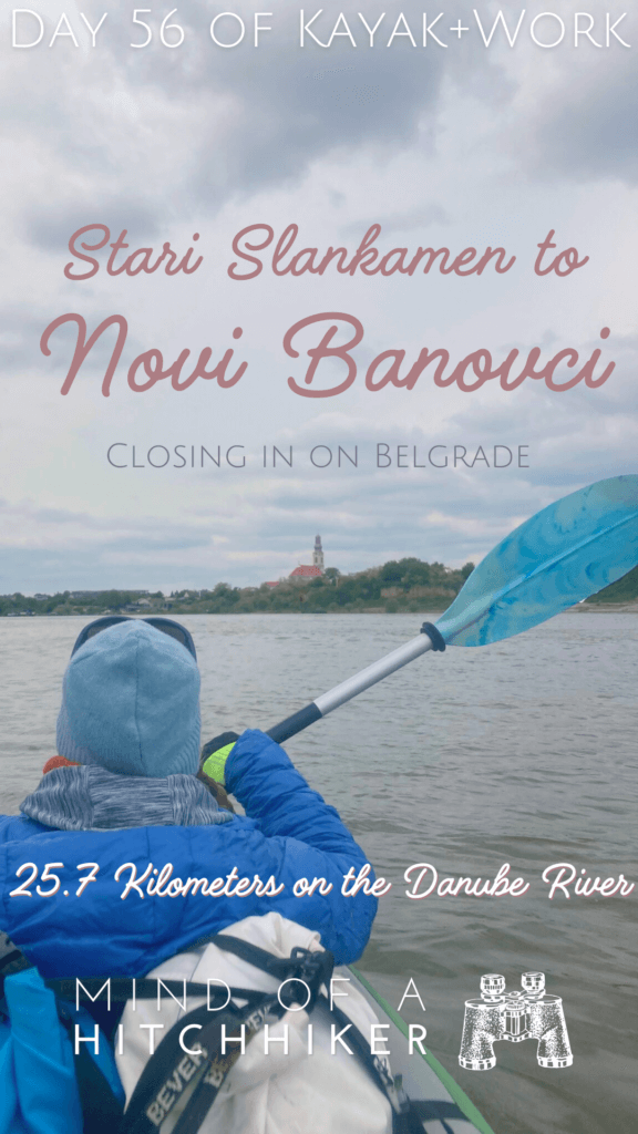
We immediately had to paddle out to dodge a moored motorboat. After that, we were on approach to the confluence of the Tisza and the Danube. There was this empty cargo ship named Beo anchored as well. We had seen it pop out of the Tisza River two days earlier right before sunset. It’s been anchored there ever since. Perhaps the captain lives in Stari Slankamen and can just spend a few days at home? I have clearly no idea how this job works.
Though the wind was great, I didn’t want to deploy the kayak sail until we were past the confluence with the Tisza. We paddled a bit on the wavy waters. The beacon that blinks at night stands on the end tip of the river island, not the Tisza River herself. A double cargo ship was coming from behind at a high speed, passing in front of the confluence just as it became visible. The ship passed fast, so we could look up the Tisza for a few minutes. Then we had to deal with the ship’s wake.
 The mighty Tisza joins the Danube!
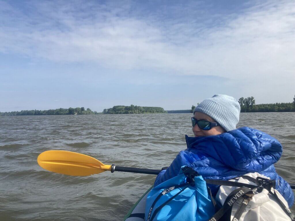
Jonas made another short video for his live updates from our trip. Then it was time for me to deploy the kayak sail. I don’t think the Tisza River added much speed to us. All the tributary rivers in this area of the Danube seem very mature and calm as well. But tomorrow, we’ll meet the Sava River (again) and will have to paddle her upstream for one kilometer. Will that be fun?
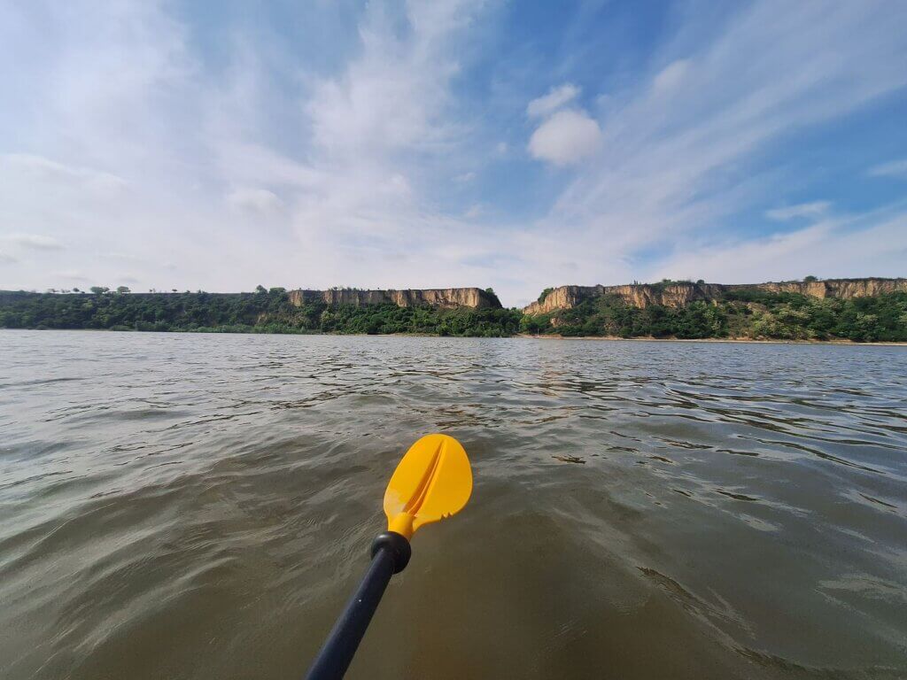
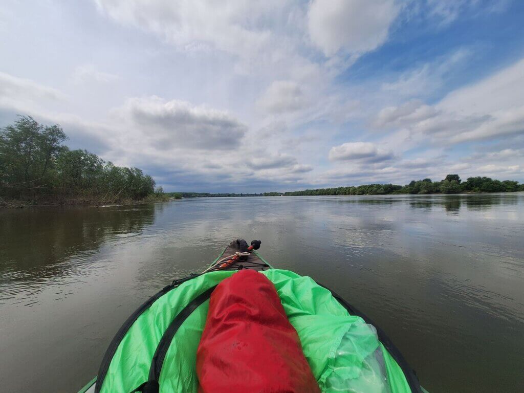
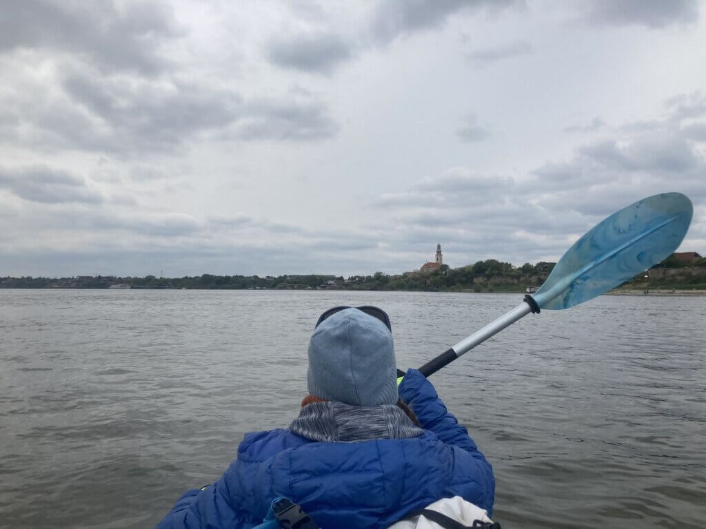
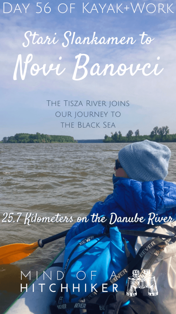
 The Danube up ahead
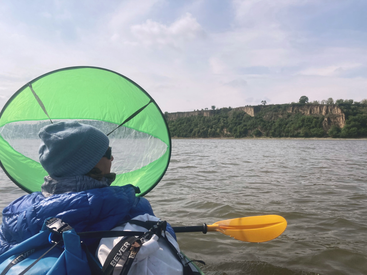
The Loess Cliffs of Surduk + Switching Paddles
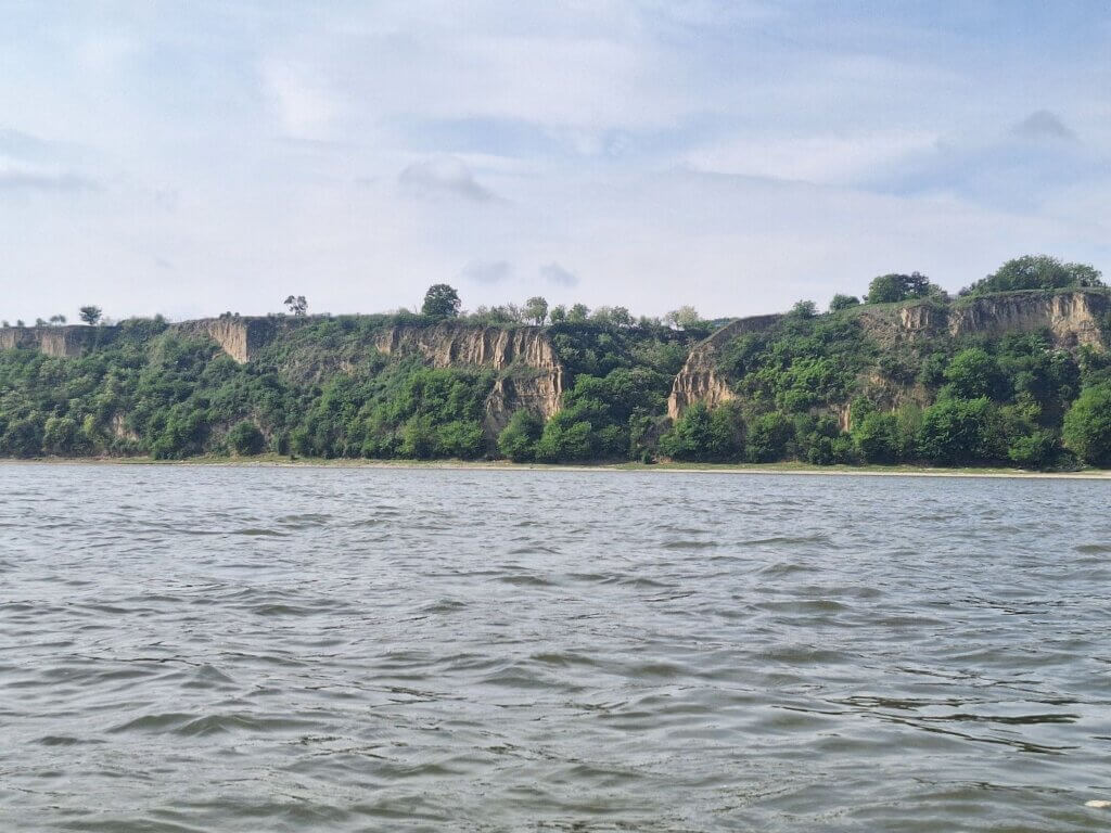
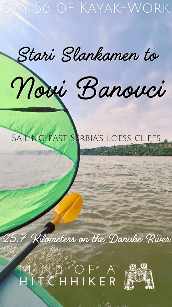
The route between Stari Slankamen and Surduk is fairly straight. This was great for kayak sailing. Jonas took another short narrated video about this from the boat and uploaded it. To our left, the banks of the Danube are low and flat and full of trees. To our right, the cliffs are tall and houses tower above us. There are very few ways down to the river from up there.
Because today is such a short day, we also experimented with switching the paddles. I usually have the blue one, which has a bigger scoop and is a bit longer and heavier. That’s because I – as the front paddler – provide only forward power and have very little control over the direction. Because Jonas sits behind me, it’s important that I don’t scoop water into the boat with every stroke. Whenever I used Jonas’ yellow paddle before, I often made his living space very wet because the paddle is too short for the width of Zucchini.
I’ve wanted to buy a second version of the amazing blue paddle, but we have no idea where it came from. This has been casually simmering in the back of my brain for the last five years, but Jonas seems too adjusted to his small yellow paddle to care for an upgrade. I think it would make a huge difference if he also had a paddle with a bigger scoop and a longer shaft. Perhaps we can then paddle 50 or even 60-kilometer days.
Once I had the sail under control and hooked into my life jacket, I managed to also paddle along with Jonas. The yellow paddle is so light and agile. It somehow feels a bit like a toy. I’m afraid if I put it down that the wind will blow it off the boat.
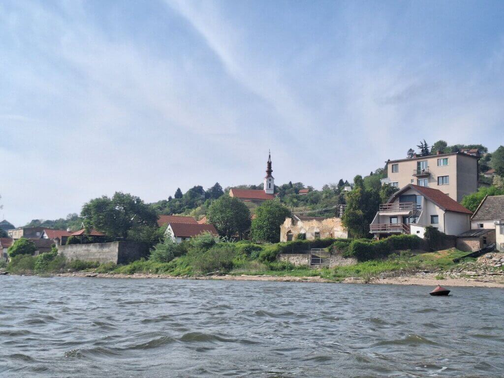
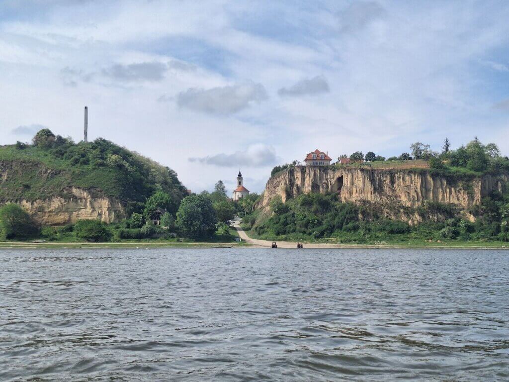
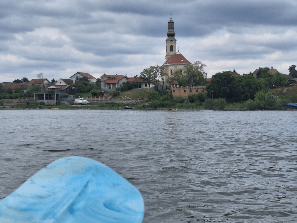
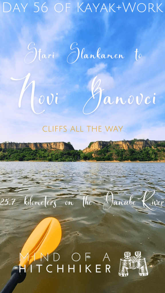
At 10:22, we were below the center of Surduk. That’s the village where our new friend we met in Stari Slankamen lives. There’s a path down from the cliffs and through this cut, you can see the church of Surduk. The name of the town apparently originates from Turkish, meaning “abyss” or “precipice”. An apt name. But I couldn’t find such a translation in today’s Turkish language, even when trying different spellings.
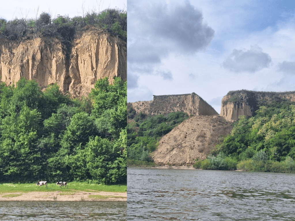 Cows wandering below the cliffs and a bulldozed cliff RIP
1207, 1206, 1205
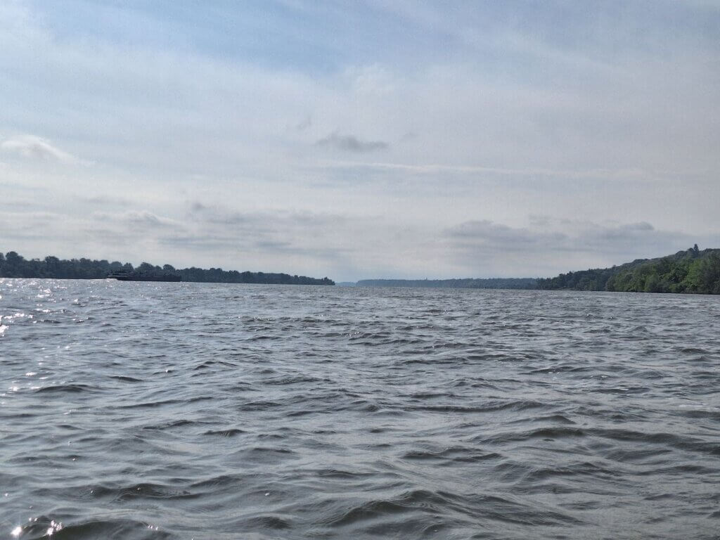
The kilometers were counting down. At the same time, I feel like I know exactly where I am on the river, while not knowing at all. We are before Belgrade, but after Budapest. More specifically, after Stari Slankamen, but before Novi Banovci. It’s over halfway to the Black Sea, but how much over halfway? And does it still mean anything if the river slows down and things become really tough? Are we spending too little time in the villages and cities along the Danube, or too much? What would be exactly right?
A Break on the Islands
After Surduk, it was time for our daily protein bar. I had something with white chocolate and pink berries. It wasn’t that good. Perhaps I should stop experimenting and just get more of the white chocolate crispy rice ones.
We were turning right and entered the river island section. The shipping lane passes all the way on the left, but we had decided to go through the island channels for fun and a little shortcut.
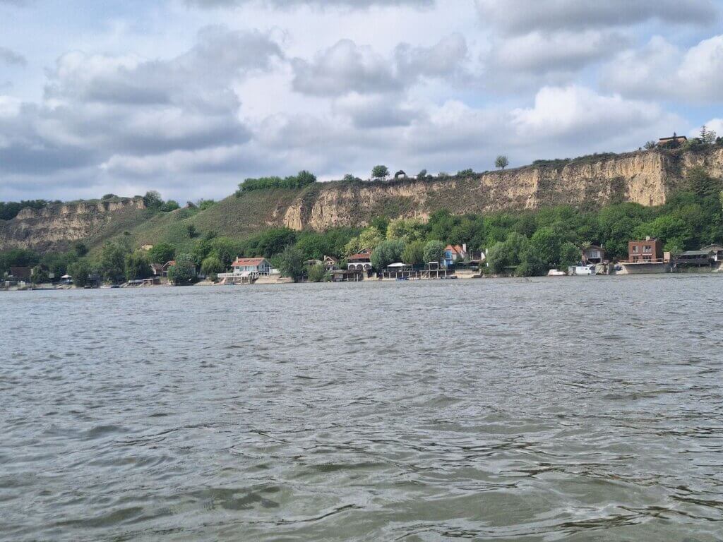
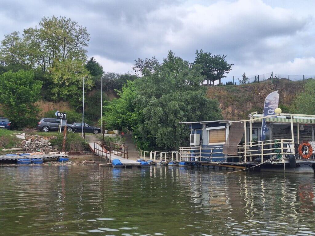
Though Miloš had told us about a marina near Surduk, I hadn’t seen anything like that when paddling past the town. But the next village named Belegiš did have a lot of recreational boating facilities. There was even something that looked like a restaurant on shore. It’s still our hope to one day paddle downstream without bringing our own food, moor at a riverside restaurant, have lunch, then get back into the boat and paddle to our destination of the day. The only time I remember doing that was between Slovakia and Hungary in the Danube Floodplains.
 Belegiš marina
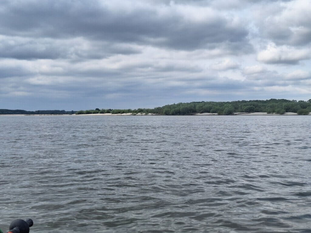
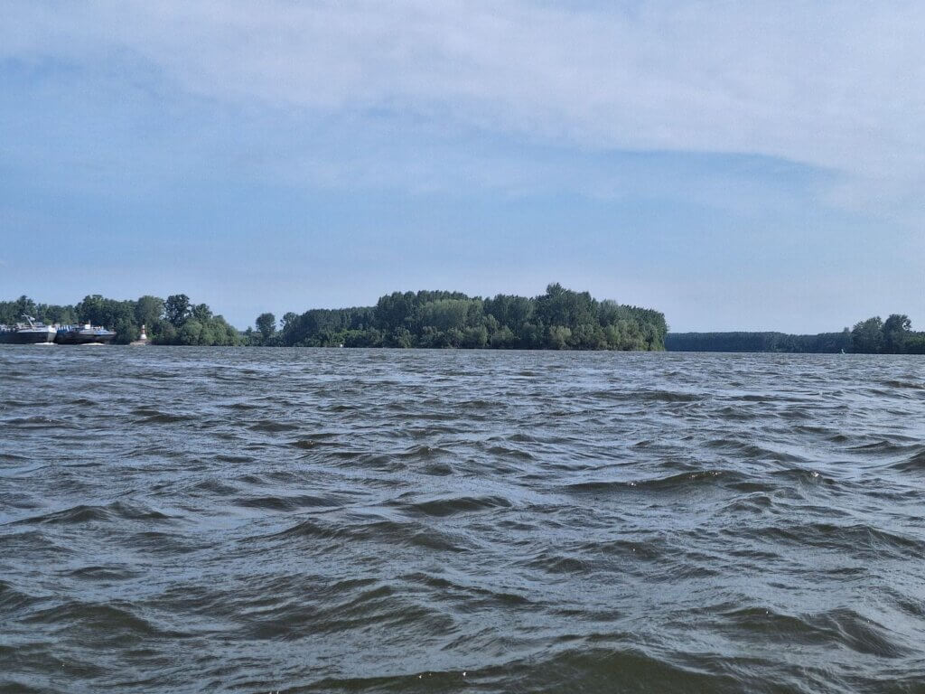
Satellite view, my OSM map, and reality all didn’t agree with the number, size, and location of the river islands. There’s the big one, creatively named Velika Ada on both OSM and Google Maps. That one is in its promised place. But then there is a barren sand bank on satellite view that we can’t decide how to pass around it. Without knowing how old the satellite footage is, we don’t know how much trust to put into it. I think the sand bank has upgraded itself to being full of vegetation now? It would have been easier to go through the shipping lane, navigationally speaking.
We found a way around the overgrown sand bank. There were even some manmade structures on the island that must get flooded at the Danube’s will. There was a nice sandy island to our right that we thought of landing at, but decided not to in the end.
 The current is picking up...
We paddled close to Velika Ada and saw a man and some horses on the island. If there are horses, there will also be dogs. Let’s pass it.
In front of us, there was a small island. We could pass between Velika Ada and that small island, or go right of the island and pass it between the tail of the sandy island and more islands to follow. We chose the latter.
Once getting close to the channel between those two smaller islands, we saw a very strong current. Jonas had just said something about next time not going through such nice natural areas and just sticking to the shipping lane. We paddled against this very strong current for a solid five minutes, moving barely and almost being dragged into the trees of this innocent-looking island. We eventually made it through, but it was tough. Still, I’d rather be here in the backwaters where the big ships can’t come than always taking the easy way.
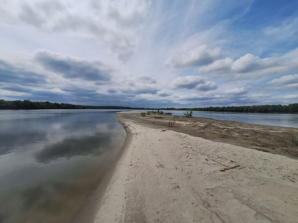
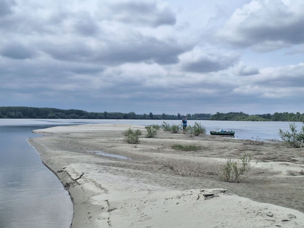
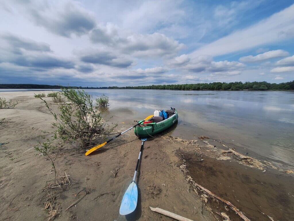
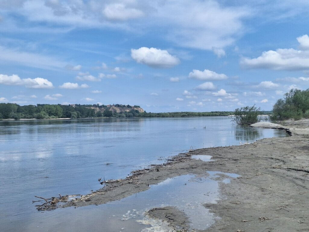
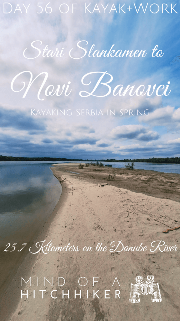
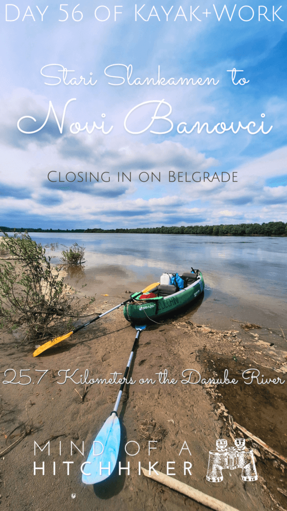
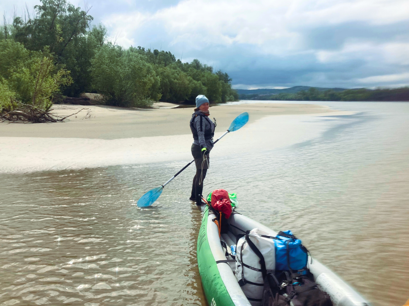
We landed on the sandy tail of this island. There was sparse vegetation, but it was beautiful with the long strips of sand. I picked up a shell, but then saw it was occupied by a snail so I put it down very quickly. On the right bank, there was a cargo ship hidden behind a river island. Very strange to have a cargo ship this close to shore in a small and shallow channel. Has it been abandoned?
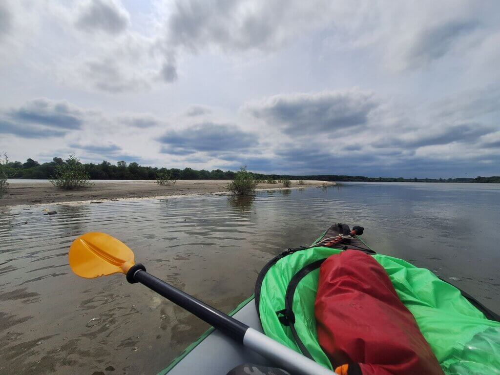 Landing on the river island
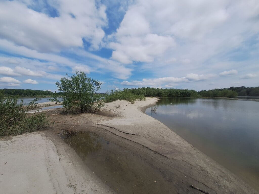
 I loved all the silver hues in this area
I filmed another video where Jonas talks about the kayak trip.
After our break and uploading the video, Jonas asked if I wanted to switch paddles again. There was no hesitation on my side.
 Looking back on Belegiš
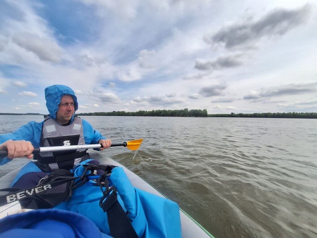 Paddles switched back!
Arriving in Novi Banovci
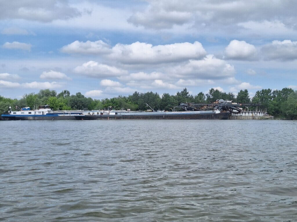
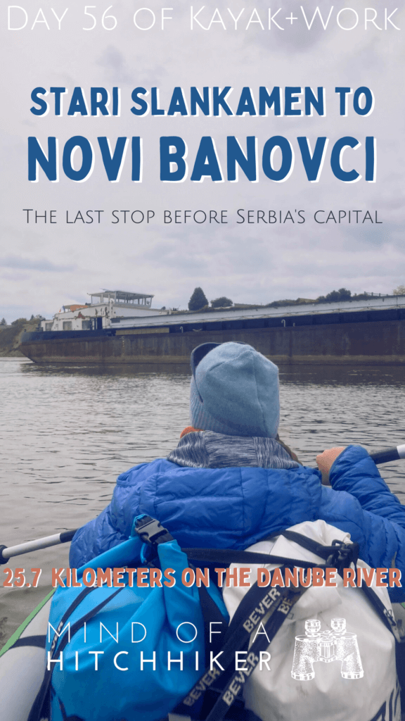
We continued at 11:48. Paddling past that weird river island with the hidden ship, we saw that there were more such ships parked behind it, including a German one. Very strange and I have no explanation. One of the structures on land could have been a conveyor belt to put dirt on the ship, but we’ll never know. Satellite doesn’t have any of these structures or stranded ships.
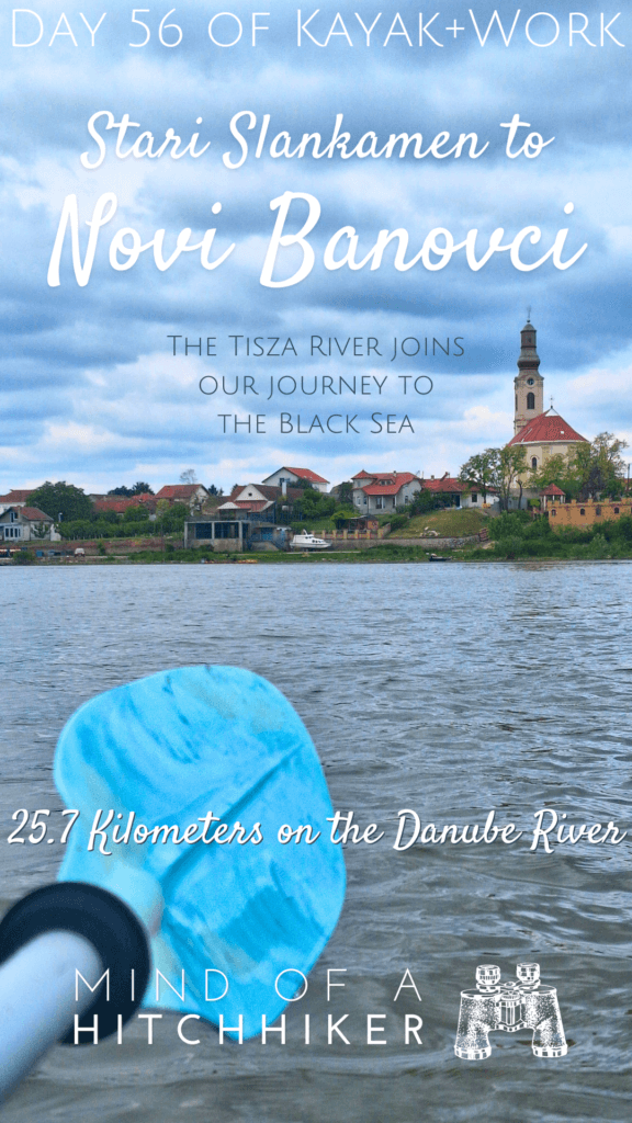
The 1200-kilometer sign was on the main channel, so we missed that one. We were now at 1197 kilometers to the Black Sea. The river turn right had ended and now we had to paddle through a counter turn going left. First southwest, then south. We were on the final approach to Stari and Novi Banovci, where we’ll spend only one night. In the distance, we could already see the church of Novi Banovci.
 First spotting of Stari/Novi Banovci
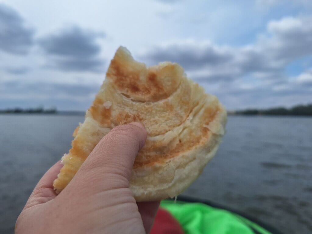
We ate a little cheesy burek in the boat. This one was a frozen version that Jonas had baked in the oven the day before. It was good, but not as good as the bakery versions.
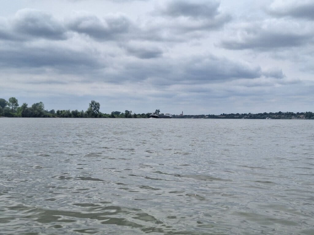
The loess cliffs were back, including what looked like a collapsed house from a landslide. Loess is wonderful, but landslides do happen in cliff form next to a big river. A cargo ship called Rene zoomed upstream.

To our right was a bit of industry. A sand heap with a cargo ship just about to moor there and receive some goods.
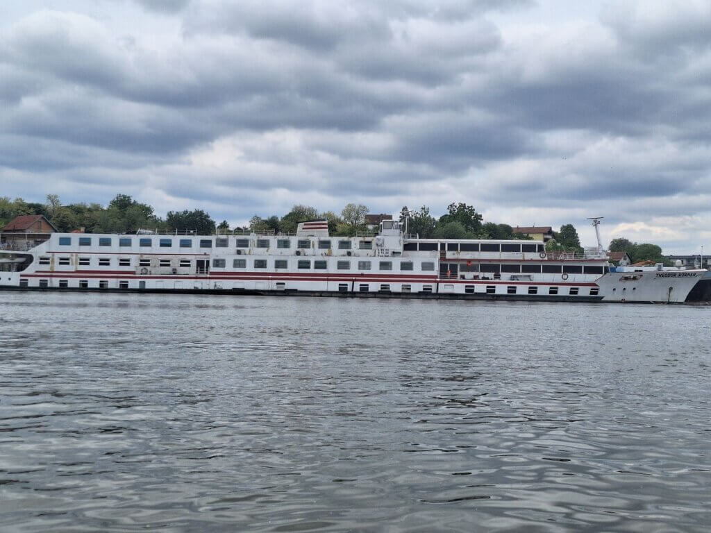
Novi Banovci had much more shipping going on than we had anticipated. There were several cargo ships moored close to our landing spot. One of them looked like a cruise ship, but we weren’t sure if it was moving. What was strange is that all these ships are moored in front of the mouth of the Budovar River, which is mapped as if it is navigable by small boats (edit: it’s not really navigable). This short river originates in the Fruška Gora mountain range.
Upon closer examination, the cruise ship is the MS Theodor Körner. It has seen better days, judging by the peeling paint and shabby exterior. Everything I could find about it online says it used to do bike-boat tours for boomers along the Danube. The most recent trips I could find are already from four years ago. Did the pandemic kill this cruise ship?
As we were about to land, we paddled closer to the cargo ship moored behind the forgotten cruise ship. We passed right behind the Calypso, flying the French flag.
At kilometer 1191, there was a floating restaurant that looked tempting to land at and have a drink, but we were so close to our accommodation now. We kept paddling past fishermen who sometimes had a fire burning on shore. The architecture of the many villas was very strange and random. One looked like a James Bond house, with a slipway and a boat garage under the house and vineyards left and right of it. Also abandoned-looking, just like the next jetty-to-nowhere at the next property. What’s going on with Novi Banovci?
We thought we had found our landing spot. there were like six people chatting and fishing. But Jonas said this is not it yet. We have to go 100 meters further. The people ashore on the concrete landing were friendly, but it’s always best to land when there are no people around.
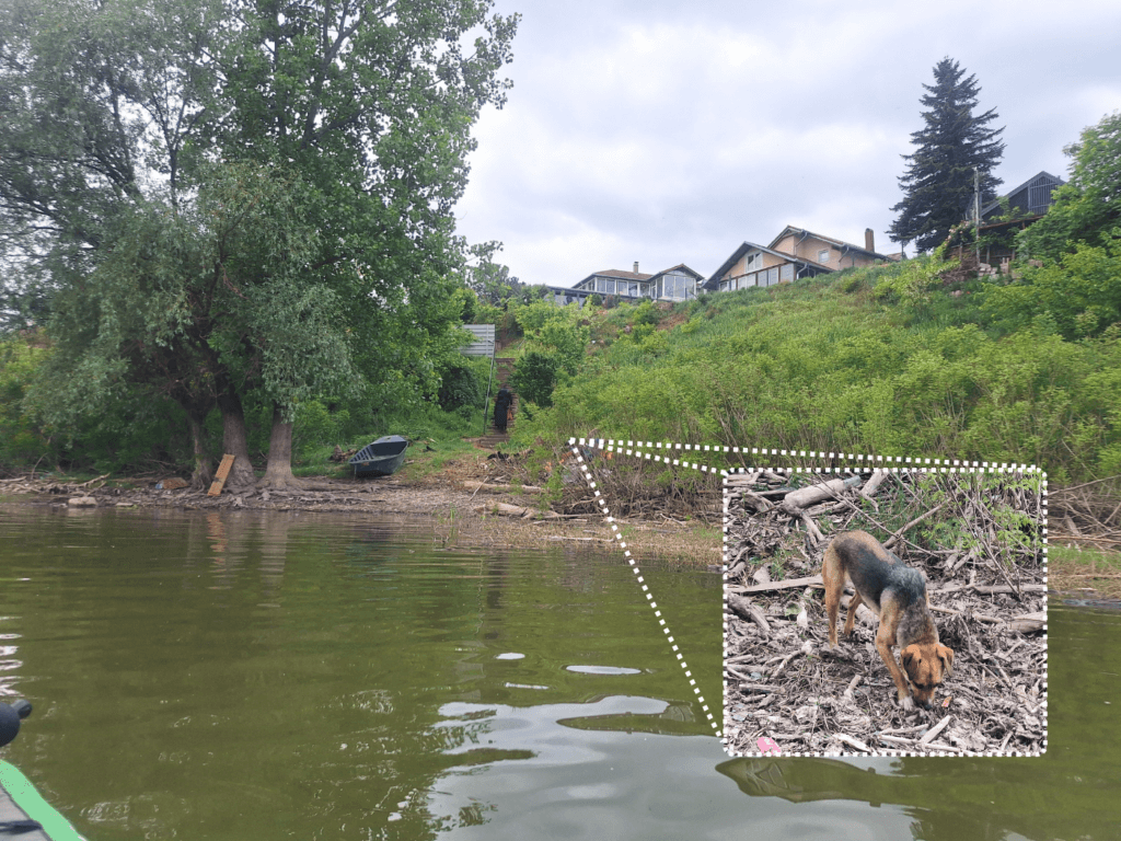
Our actual landing became visible once we were around a tree. There were two stray dogs on shore and the water here was very dirty. I heard the noise of a pipe dumping water in the Danube. But the stairs to the upper embankment and our home for the night were here. It didn’t make sense to paddle back to the concrete place as it’s further from our home and we have no idea how to get up from there. At least these stairs would lead to the street.
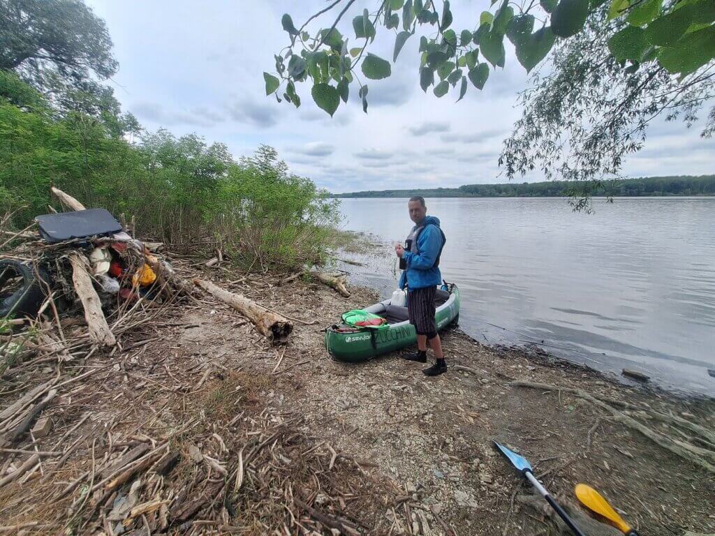
We landed at 13:04. Jonas got out first and waded through the dirty water with something in it that was hard to define. I hopped out of the boat and balanced on a log to get my feet as little wet as possible. It was difficult. There was trash everywhere. There was broken glass on the ground. Not great. Not great at all.
I encouraged Jonas to get changed into land shoes, bring the dry bags up, and check into the accommodation. I wanted to keep the boat inflated and carry her up the stairs. If the accommodation has grass, we can just put Zucchini upside down and keep her inflated for the night. Jonas wasn’t seeing the big picture yet.
We emptied Zucchini, put her on land, and flipped her. I had realized what the uniform white rags were in the water: baby wet wipes, used. Yuck! One of them had gotten stuck on our fin. Jonas used a stick to get it off. We drained the water from Zucchini and then Jonas went up.
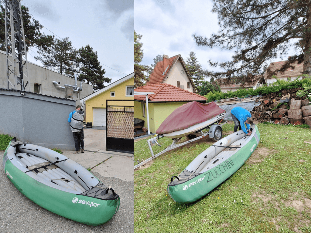
I sat down on the edge of an abandoned metal fishing boat. I dried my feet and then put on my shoes. Then I packed up everything in the duffel bag and the CabinMAX. My idea was to carry Zucchini up and have all the leftover luggage on our backs. It’s like portaging Zucchini during the 2019 trip, minus the dry bags.
When Jonas came back, he agreed to the plan because he had seen a good spot for Zucchini in the garden of the accommodation. I carried the bow of the boat and Jonas the back, but he went first. We only needed one break to walk the 200 meters to the property. I was impressed with how much energy I had left for this.
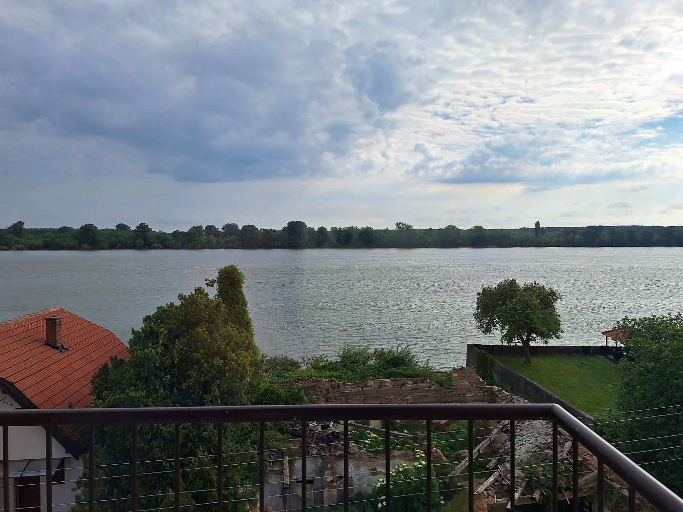
We found a piece of grass, deflated Zucchini a little bit, and flipped her upside down. Then we went into the apartment, where we both took a shower to get the ick off. We hung all damp items to dry. And we had a nice instant coffee on the amazing terrace to warm up and enjoy the stunning view of the Danube. A little while later, a small cat came to visit us and we gave her some snacks.
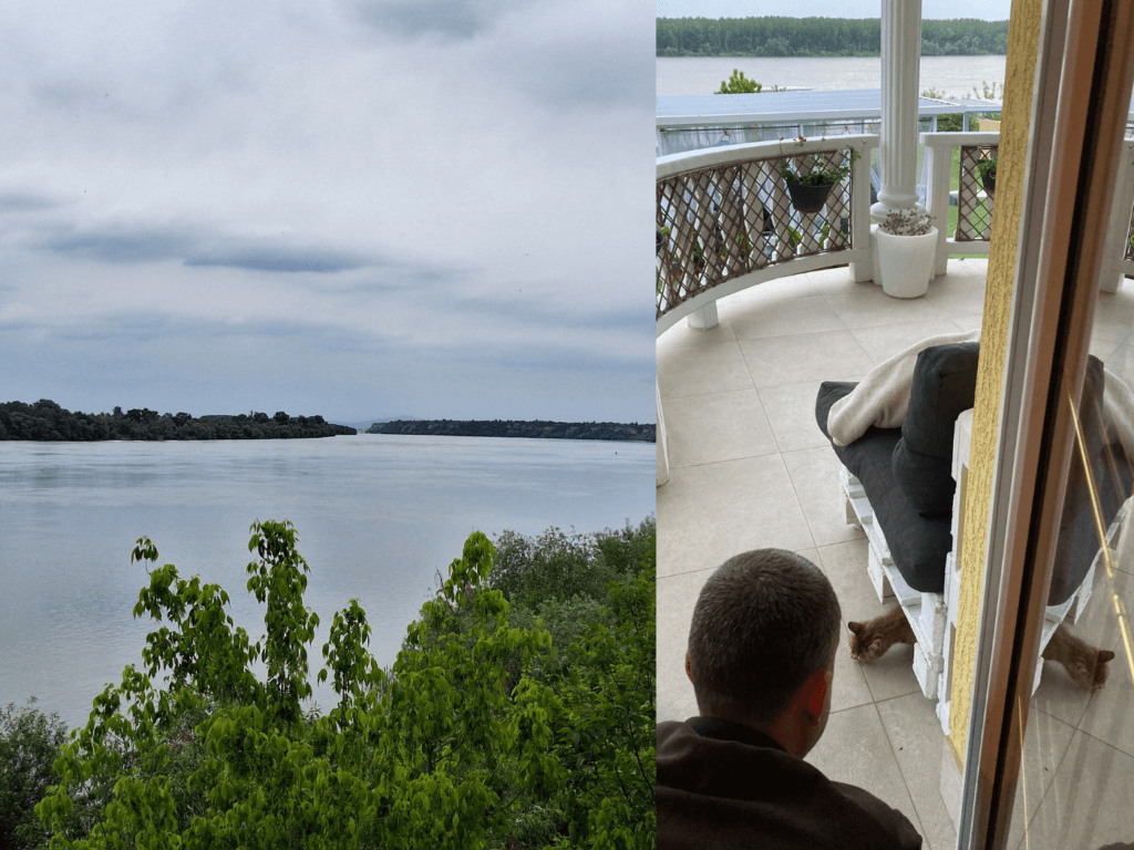 Belgrade less than 25 kilometers away + a sweet, shy catto
The hosts of this amazing property in Novi Banovci are originally from Berlin. Jonas did most of the talking.
One Night in Novi Banovci
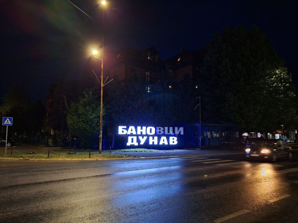
After resting up a little and writing some of this, we walked into Novi Banovci, or Banovci Dunav according to the signs. We went to a supermarket to buy some food for tomorrow and inquired about the menu at a restaurant called La Luna #2.
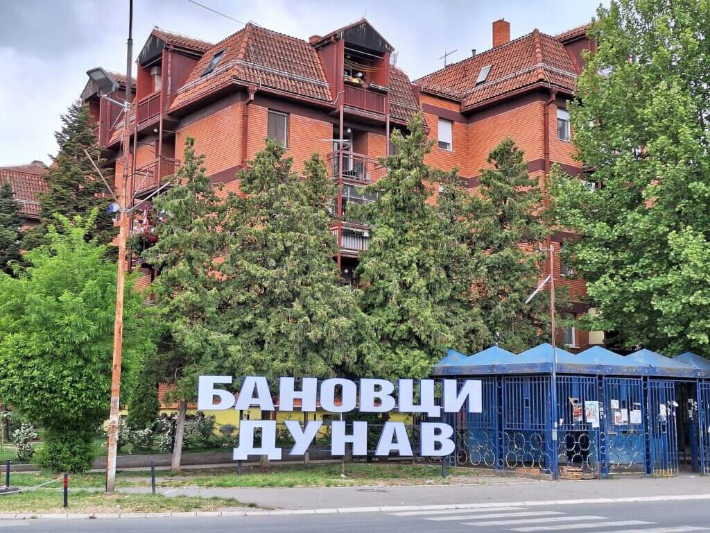
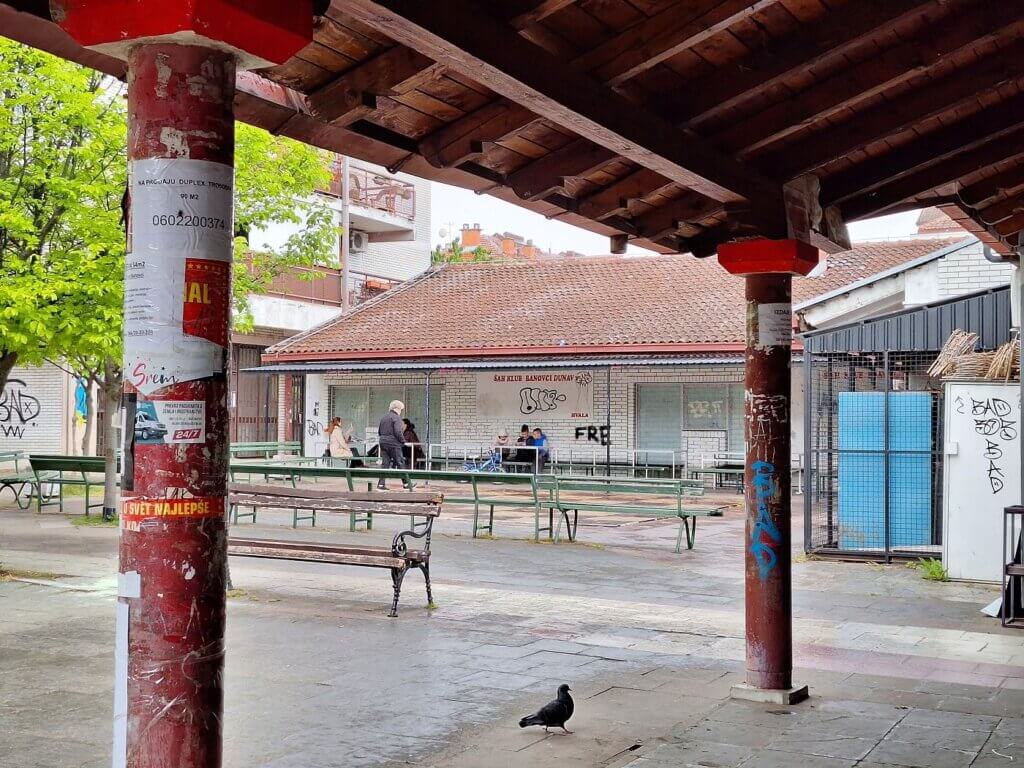
On the way back, we walked past some communal areas of Novi Banovci, including the local chess club. Crossing the road was always a bit of a pain in the ass since the road through town seems to be popular with Belgradian commuters. We are so close to the last capital city on the Danube. This is crazy.
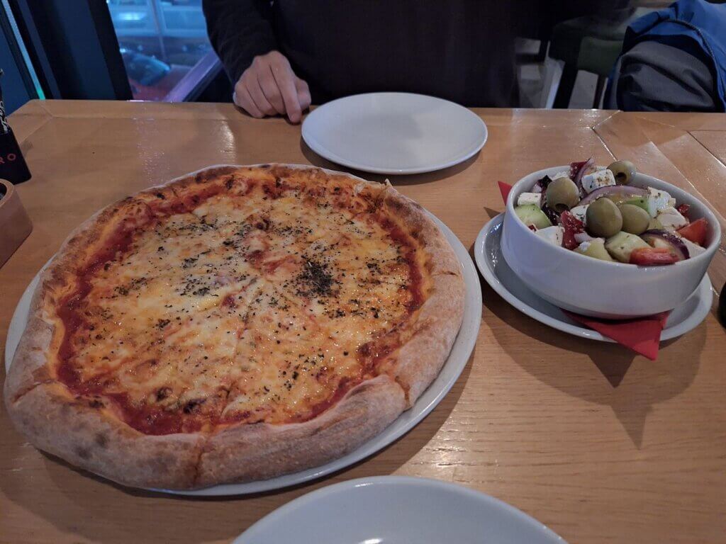
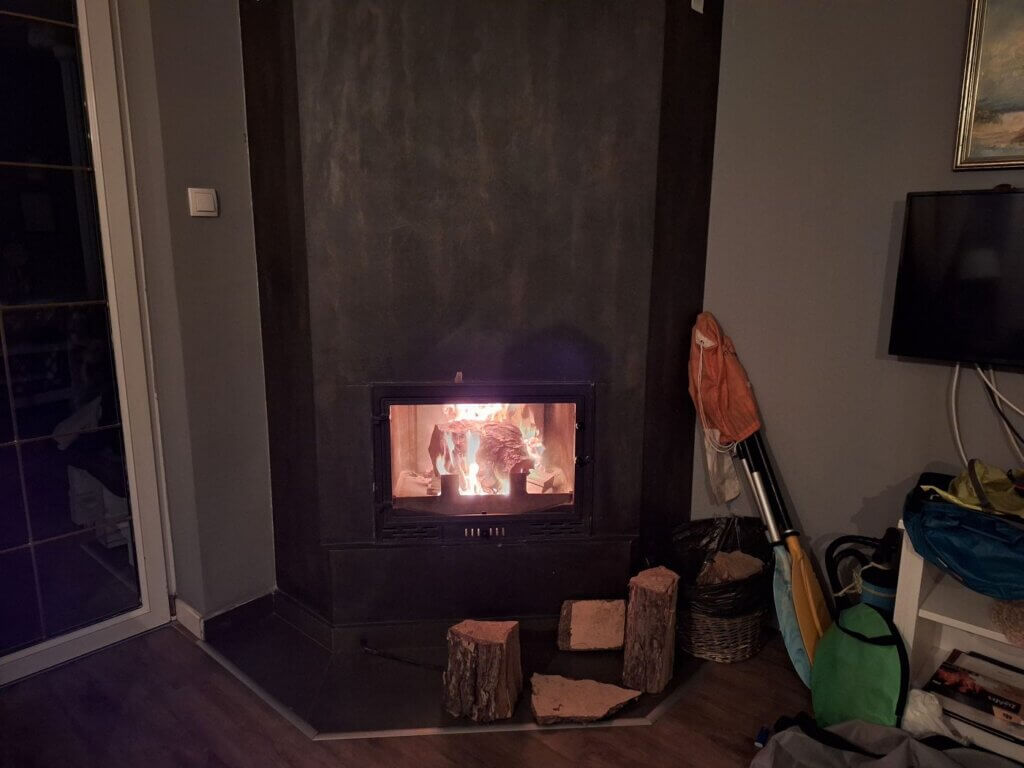
In the evening, we ate our pizza and salad and drank our beer there. Back at home, we checked up on Zucchini, prepped our sandwiches for the next day, and used the fireplace for an extra cozy time while watching some Netflix. Part of me would’ve liked to stay here longer for the nice accommodation and to befriend that cat, but I wouldn’t know what to do with a whole day here.
I’m feeling ambivalent about returning to Belgrade, the city where I sort of lived in 2015, and where shit happened while I was gone. But I’m mostly excited because it’s such a milestone in our trip down the Danube to the Black Sea.
Good read? Consider buying me a pizza!


Donate via PayPal

Similar posts:
 Kayak Trip Day 54: Ilok to Bačka Palanka to Novi Sad – Goodbye Croatia, Hello Serbia
 Kayak Trip Day 55: Novi Sad to Stari Slankamen – Frozen Toes
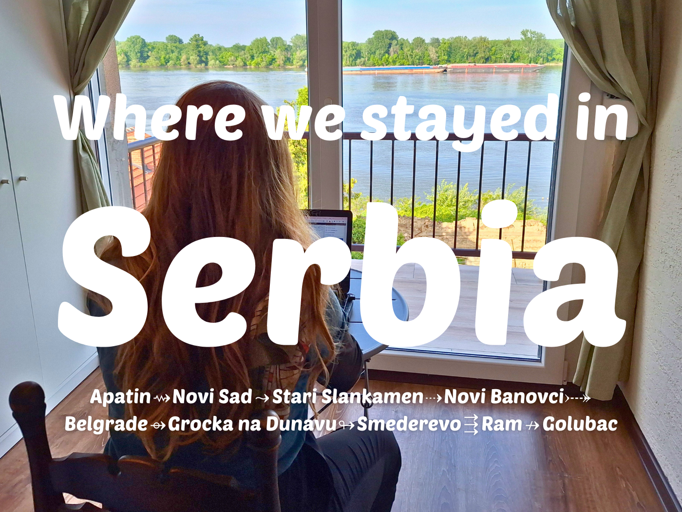 Accommodation in Serbia: From Apatin to Novi Sad, Belgrade, and Golubac
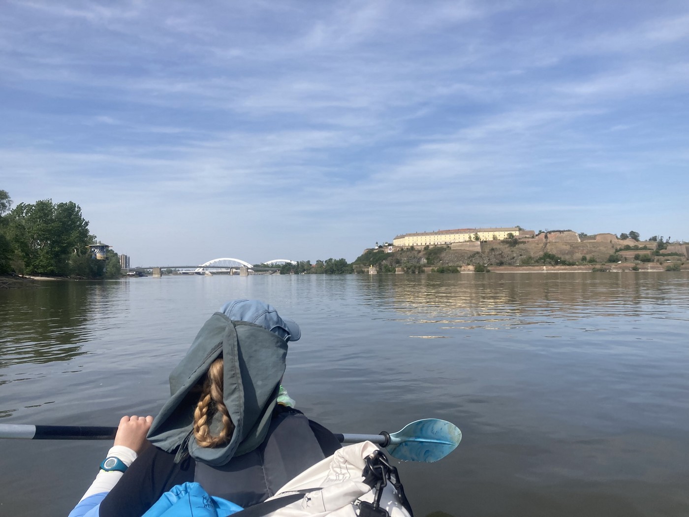
 Kayak Trip Day 57: Novi Banovci to Belgrade – The Last Capital on the Danube
 Kayak Trip Day 36: Čunovo to the Danube Floodplains – Freecamping